Block
From the record
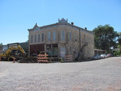
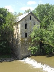
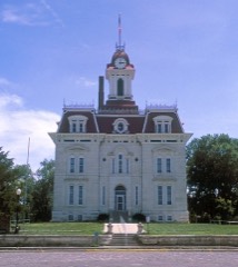
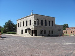
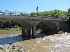
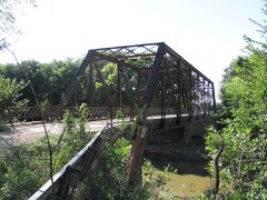
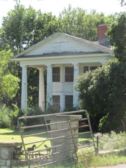
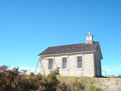
21 National Register listings published here, 2 of them National Historic Landmarks.
Sources: the National Register database, National Park Service
43 topographic sheets cover 15 settlements here, and 21 properties are on the National Register of Historic Places.
21 National Register listings published here, 2 of them National Historic Landmarks.
Sources: the National Register database, National Park Service
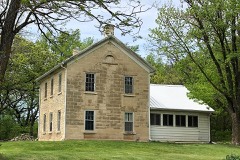
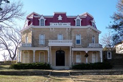
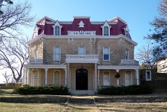
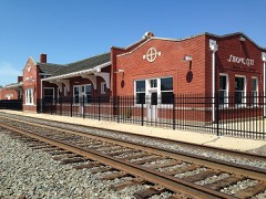
Every property in this county listed on the National Register of Historic Places, with the year it was listed and the federal nomination document.
Every wildfire the federal occurrence database records inside this county: 55 of them, burning about 69,328 acres. None started naturally and 2 were recorded as arson. Each settlement page carries the fires within five miles of it.
| Reported cause | Fires |
|---|---|
| Debris and open burning | 24 |
| Missing data/not specified/undetermined | 20 |
| Equipment and vehicle use | 6 |
| Smoking | 3 |
| Arson/incendiarism | 2 |
The five largest, by the area the report gives. None of them was recorded as arson.
| Date | Cause | Size | Reported by | Name on the report |
|---|---|---|---|---|
| 27 March 2002 | Missing data/not specified/undetermined | 30,000 acres | Chase County | not named |
| 6 April 2011 | Debris and open burning | 5,000 acres | Flint Hills National Wildlife Refuge | V ROAD |
| 11 April 2003 | Missing data/not specified/undetermined | 4,000 acres | Chase County | not named |
| 7 April 2015 | Missing data/not specified/undetermined | 3,500 acres | Tallgrass Prairie National Preserve | NOBODY KNOWS |
| 10 April 2010 | Debris and open burning | 3,490 acres | Tallgrass Prairie National Preserve | TALLGRASS COMPLEX |
| 22 March 1994 | Missing data/not specified/undetermined | 3,000 acres | Chase County | not named |
| 19 April 2018 | Missing data/not specified/undetermined | 3,000 acres | Chase County | 190 AND YY RD |
| 5 April 2018 | Missing data/not specified/undetermined | 2,500 acres | Chase County | NICKEL CREEK |
Every settlement page carries the fires within five miles of it - see the settlement index below.
The NOAA Storm Events Database holds 380 reports for this county, causing 6 deaths, 13 injuries and about $6,527,830 in recorded property damage. Each settlement page carries the reports that name it.
| Kind of event | Reports |
|---|---|
| Hail | 178 |
| Thunderstorm Wind | 120 |
| Tornado | 47 |
| Flash Flood | 13 |
| Flood | 10 |
| Heavy Rain | 10 |
| Lightning | 2 |
The most serious of them, by death, then injury, then recorded damage. The accounts are quoted exactly as the forecast office filed them.
| When | Event | Place named | Harm | What the report says |
|---|---|---|---|---|
| August 2003 | Flash Flood | Gladstone | 6 killed, $250,000 | Torrential rains of 6-8 inches, occurring in about 3 hours, caused flash flooding of Jacob Creek along I-35, the Kansas Turnpike, near milepost 116, 12 miles southwest of Emporia. The exceptionally heavy rains turned what had been a nearly dry creek into a raging river that surged almost due north at a rate of about 4,100 cubic feet per second. The creek overflowed across the northeast bound lanes and against a concrete median separating the northeast bound from the southwest bound lanes. The median consisted of 10 cement barriers, each 20 feet long and weighing 10,000-20,000 pounds. The water pressure built to the point that the median suddenly broke, allowing 6 to 7 feet of water to surge in a mini tsunami-like manner across the rest of the interstate.Seven vehicles were swept off the turnpike. Of these, one was a minivan carrying a family of six. Of the six occupants, five perished. The fatalities comprised of one woman and four children, all four under 10 years of age. The woman's body was found about two miles from the interstate. Of the four children, three were found inside the minivan, while the fourth was found 3/4 mile from the vehicle. The husband had broken out a window and was sucked out of the vehicle in the process. The sixth fatality, a man, resulted when his vehicle had stalled. The concrete barriers were also washed into the creek.The seven vehicles were strewn about in a low-lying area of the Flint Hills. Just east of the minivan, two vehicles were partially submerged and a third was flipped upside down and leaning against a tree. There were no statements as to the whereabouts of the other three vehicles. It was the first time in 50 years that the Kansas Turnpike had flooded at this location.The Arkansas City Traveler, the Chanute Tribune, the Wichita Eagle and the U.S. Geological Survey all contributed greatly to this narrative. |
| May 2003 | Thunderstorm Wind | Matfield Green | 6 hurt, $380,000 | Severe thunderstorm winds derailed 38 cars of a 118-car Burlington Northern Santa Fe freight train. One of the derailed freight cars, a unibody tank car filled with sulphur dioxide, forced the evacuation of an estimated 250 residents. Six firemen and law enforcement officers, exact number of each unknown, were treated at the scene for respiratory ailments. |
| October 2017 | Lightning | Matfield Green | 3 hurt | Three state transportation workers were injured, while working along the Kansas Turnpike, when their vehicle was struck by lightning. One worker was inside the vehicle, while two others were nearby. All three of the employees were taken to the hospital, two were treated and released, while the other was hospitalized in fair condition. |
| May 1950 | Tornado (F3) | not stated | 2 hurt, $250,000 | no account filed |
| April 2023 | Tornado (EF0) | Strong City | 1 hurt, $20,000 | This was the eighth tornado documented by the NWS Wichita damage Survey Team. This tornado mainly produced EF0 damage to mainly trees. There was one minor injury close to the initial touchdown along Highway 50, when a car was thrown 30 yards off the highway. The person was treated and released. |
| April 2023 | Tornado (EF0) | Elmdale | 1 hurt | This is the third tornado which initially caused the loss of roof material on an outbuilding. The tornado crossed U.S. Highway 50, and a semi was blown over resulting in one injury. Several small road signs were taken out. A one to two foot diameter tree was snapped before the tornado lifted. This tornado was rated an EF0. |
| May 1987 | Tornado (F2) | not stated | $2,500,000 | no account filed |
| May 1974 | Tornado (F2) | not stated | $2,500,000 | no account filed |
| May 2009 | Flood | Matfield Green | $100,000 | Three to four inches of rainfall caused flooding across the county. Numerous low water crossings were flooded with portions of the Kansas Turnpike near mile post 101 closed because of high water. |
| May 1998 | Thunderstorm Wind | Elmdale | $100,000 | Widespread tree damage, including several trees that fell onto houses. One car was lifted off a highway but driver was unharmed. |
| April 2009 | Thunderstorm Wind | Wonsevu | $50,000 | A garage picked up and fell on a car. A barn was blown down which inflicted minor damage to a residence. A second residence was also damaged in the area. |
| June 2008 | Tornado (EF0) | Cedar Pt | $50,000 | The tornado caused minor damage to a couple of homesteads. |
| July 2008 | Flash Flood | Cedar Pt | $35,000 | Water was reported over highway 50 between mile marker 311 and 312. Several rural roads in the Cedar Point area were also closed due to high water over them. |
| August 2019 | Thunderstorm Wind | Strong City | $25,000 | Winds estimated around 56 knots/65 mph pulled a 50 foot by 30 foot pole barn from the ground and lifted it. The pole barn landed in a nearby pasture. Posts had been inserted 3 feet deep but did not have concrete support. There was an 8-foot opening to the north and a 15-foot opening to the west. A small lawn tractor that had been parked on the east side of the building was pushed onto its right side. |
| August 2009 | Thunderstorm Wind | Cottonwood Falls | $25,000 | Many large trees were knocked down throughout town. |
| March 1991 | Tornado (F1) | not stated | $25,000 | no account filed |
| May 1990 | Tornado (F0) | not stated | $25,000 | no account filed |
| May 1953 | Tornado (F3) | not stated | $25,000 | no account filed |
| July 2010 | Thunderstorm Wind | Bazaar | $20,000 | A semi-truck was blown over near mile marker 110 on the Kansas Turnpike, roughly 9 miles northeast of Matfield Green. |
| August 2019 | Lightning | Cottonwood Falls | $15,000 | The lightning struck a camper. The camper was subsequently destroyed with only one wall left standing. No injuries were reported. The report was received courtesy of radio station KVOE. This was a delayed report. |
| July 2015 | Thunderstorm Wind | Elmdale | $12,000 | A tractor trailer semi was blown over. |
| September 2014 | Thunderstorm Wind | Matfield Green | $10,000 | Tree limbs of unknown size were blown down on Highway 177 near Matfield Green. The limbs were large enough that a chainsaw was needed to cut them up. |
| September 2014 | Thunderstorm Wind | Matfield Green | $10,000 | A tree fell on the Kansas Turnpike on the south bound side at Mile Marker 101. |
| May 1998 | Thunderstorm Wind | Cedar Pt | $10,000 | Two-foot diameter tree uprooted. Garage damaged. |
| May 1998 | Thunderstorm Wind | Cottonwood Falls | $10,000 | Shed blown down. Tree damage. |
| May 1998 | Thunderstorm Wind | Cottonwood Falls | $10,000 | One-two foot diameter tree limbs broken off and doors blown off barns. |
| June 1998 | Tornado (F0) | Wonsevu | $10,000 | Outbuildings damaged. |
| April 2023 | Tornado (EF1) | Cottonwood Falls | $5,000 | The sixth tornado produced by the supercell tracked across the town of Cottonwood Falls producing EF1 damage, mainly to trees and minor damage to roof structures. |
| July 2008 | Thunderstorm Wind | Cottonwood Falls | $5,000 | Several large trees were blown down from high winds. Winds were estimated to be at least 65 mph. |
| July 2008 | Thunderstorm Wind | Elmdale | $5,000 | Several large trees were blown down from high winds. Winds were estimated at 65 mph. |
| April 2006 | Hail | Cottonwood Falls | $5,000 | The hail broke out windows of historic buildings which are part of the Tallgrass Prairie Preserve. |
| August 2000 | Thunderstorm Wind | Matfield Green | $5,000 | Roof damage and large limbs downed. |
| June 1994 | Thunderstorm Wind | Strong City | $5,000 | no account filed |
| May 1993 | Hail | Saffordville | $5,000 | no account filed |
| March 2017 | Thunderstorm Wind | Cottonwood Falls | $4,000 | Power poles were reported down. |
| April 2011 | Thunderstorm Wind | Elmdale | $4,000 | Power lines were downed along the railroad tracks. Power lines were also flashing in Elmdale. |
| April 1991 | Tornado (F0) | not stated | $2,500 | no account filed |
| April 1991 | Tornado (F0) | not stated | $2,500 | no account filed |
| July 1985 | Tornado (F0) | not stated | $2,500 | no account filed |
| April 1984 | Tornado (F0) | not stated | $2,500 | no account filed |
| April 1964 | Tornado (F2) | not stated | $2,500 | no account filed |
| June 2009 | Thunderstorm Wind | Cottonwood Falls | $2,000 | A 3 to 4 foot diameter tree fell across the road. |
| May 2023 | Thunderstorm Wind | Cottonwood Falls | $1,000 | Power lines were reported down. |
| July 2015 | Flash Flood | Saffordville | $1,000 | One to two feet of water was flowing over US highway 50 near YY road. Rainfall amounts were 2 to 2.5 inches of rain. |
| May 2008 | Thunderstorm Wind | Matfield Green | $500 | A few shingles were blown off a roof. |
| May 1994 | Thunderstorm Wind | Cedar Point | $500 | Tree limbs were blown down. |
| May 2019 | Flood | Strong City | $100 | Highway 177 was closed due to river flooding along the Cottonwood River south of Strong City. |
| October 2018 | Flood | Saffordville | $100 | Water was reported over the county roads in and around Saffordville. |
| August 2010 | Thunderstorm Wind | Cottonwood Falls | $100 | A few 3 to 4-inch diameter tree limbs were downed. |
| June 1978 | Tornado (F0) | not stated | $30 | no account filed |
| April 2026 | Hail | Bazaar | - | This report was relayed via social media. |
| April 2026 | Hail | Cottonwood Falls | - | Report was received courtesy of KSN, and it was supported by law enforcement. |
| May 2025 | Thunderstorm Wind | Cottonwood Falls | - | Sporadic damage reported across the county with trees, tree limbs, and privacy fences knocked down. A metal roof was partially blown off in Cottonwood Falls. |
| May 2024 | Thunderstorm Wind | Matfield Green | - | A cedar tree was blown over. |
| June 2024 | Hail | Strong City | - | Report received via mPing. |
| June 2024 | Thunderstorm Wind | Matfield Green | - | Storm chaser reported an estimated wind gust of 70 mph along Kansas Highway 177. |
| June 2024 | Thunderstorm Wind | Strong City | - | A report via mPing of broken one inch tree limbs. |
| June 2024 | Thunderstorm Wind | Elmdale | - | Recorded from the Kansas State Mesonet. |
| June 2024 | Thunderstorm Wind | Elmdale | - | Recorded from the Kansas State Mesonet in Elmdale. |
| August 2024 | Thunderstorm Wind | Elmdale | - | Measured wind gust of 63 mph from the Kansas State Mesonet near Elmdale. |
The Survey's mineral resources record lists 3 workings inside this county. All of them still produce. Each settlement page carries the workings within five miles of it.
| Commodity | Workings |
|---|---|
| Stone, Crushed/Broken | 3 |
The least common of them first, because a county's hundredth gravel pit says nothing its first ten did not.
| Where | Site | Commodity | Status | Recorded |
|---|---|---|---|---|
| Biggs Quarry | Stone, Crushed/Broken | Producer | ||
| Campbell Quarry | Stone, Crushed/Broken | Producer | ||
| Chase County Quarry | Stone, Crushed/Broken | Producer |
Named settlements recorded in the Geographic Names Information System, each with the topographic sheets covering it. Villages, hamlets and abandoned places alike. Each is shown with the nearest named watercourse or landform and the survey quadrangle it falls on.
Bazaar township · 66845 · On Rock Creek · Cottonwood Falls quadrangle
12 sheets, 1898 to 1985
Cottonwood township · 66843 · On Bruno Creek · Cedar Point quadrangle
14 sheets, 1898 to 1989
Falls township · 66845 · On Spring Creek · Cottonwood Falls quadrangle
12 sheets, 1898 to 1985
Diamond Creek township · 66850 · On Middle Creek · Elmdale quadrangle
13 sheets, 1898 to 1989
Matfield township · 66862 · On Little Cedar Creek · Matfield Green quadrangle
12 sheets, 1898 to 1985
Diamond Creek township · 66850 · On Diamond Creek · Strong City quadrangle
14 sheets, 1898 to 1989
Diamond Creek township · 66869 · On Gannon Creek · Hymer quadrangle
14 sheets, 1898 to 1989
Toledo township · 66869 · On Bull Creek · Saffordville quadrangle
19 sheets, 1888 to 1989
Toledo township · 66801 · On East Buckeye Creek · Plymouth quadrangle
18 sheets, 1888 to 1989