Block
From the record
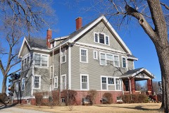
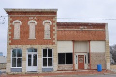
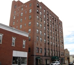
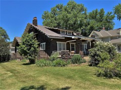
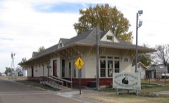
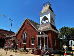
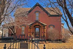
48 National Register listings published here, 1 of them a National Historic Landmark.
Sources: the National Register database, National Park Service
64 topographic sheets cover 26 settlements here, and 48 properties are on the National Register of Historic Places.
48 National Register listings published here, 1 of them a National Historic Landmark.
Sources: the National Register database, National Park Service
Every property in this county listed on the National Register of Historic Places, with the year it was listed and the federal nomination document.
Every wildfire the federal occurrence database records inside this county: 208 of them, burning about 4,673 acres. 1 started naturally and 15 were recorded as arson. Each settlement page carries the fires within five miles of it.
| Reported cause | Fires |
|---|---|
| Debris and open burning | 86 |
| Missing data/not specified/undetermined | 68 |
| Equipment and vehicle use | 15 |
| Arson/incendiarism | 15 |
| Recreation and ceremony | 8 |
| Power generation/transmission/distribution | 4 |
| Misuse of fire by a minor | 4 |
| Other causes | 4 |
| Smoking | 2 |
| Fireworks | 1 |
| Natural | 1 |
The five largest, by the area the report gives. One of them was set deliberately.
| Date | Cause | Size | Reported by | Name on the report |
|---|---|---|---|---|
| 31 July 2006 | Missing data/not specified/undetermined | 640 acres | Kansas Counties | 1700 AND JEEP ROAD |
| 31 March 2010 | Missing data/not specified/undetermined | 375 acres | Kansas Counties | DETROIT |
| 31 March 2010 | Missing data/not specified/undetermined | 350 acres | Kansas Counties | WOLF ROAD |
| 22 February 2009 | Missing data/not specified/undetermined | 325 acres | Kansas Counties | 2300 AND QUIET ROAD |
| 12 March 2015 | Debris and open burning | 320 acres | Kansas Forest Service | 24 |
| 1 March 2017 | Debris and open burning | 200 acres | Dickinson County | 3513 |
| 12 April 2003 | Debris and open burning | 160 acres | Dickinson County | not named |
| 20 March 2016 | Arson/incendiarism | 150 acres | Kansas Forest Service | 4728 |
Every settlement page carries the fires within five miles of it - see the settlement index below.
The NOAA Storm Events Database holds 857 reports for this county, causing 2 deaths, 18 injuries and about $55,884,665 in recorded property damage. Each settlement page carries the reports that name it.
| Kind of event | Reports |
|---|---|
| Hail | 469 |
| Thunderstorm Wind | 277 |
| Tornado | 44 |
| Flash Flood | 37 |
| Lightning | 11 |
| Flood | 10 |
| Funnel Cloud | 7 |
| Heavy Rain | 2 |
The most serious of them, by death, then injury, then recorded damage. The accounts are quoted exactly as the forecast office filed them.
| When | Event | Place named | Harm | What the report says |
|---|---|---|---|---|
| June 2008 | Tornado (EF3) | Enterprise | 1 killed, 3 hurt, $20,200,000 | This is the first segment of a tornado that moved through 2 counties. This tornado continued northeast out of Dickinson County and dissipated shortly after entering Geary County. The tornado first touched down at a farmstead to the north-northwest of the town of Enterprise. A grain bin was destroyed, and some tree damage was observed. Damage was also noted to another farmstead where a grain bin was destroyed, as were a center pivot and several power poles. The tornado then entered Chapman on the southwest side. It was reported that 70 homes were completely destroyed, and 215 damaged. In all, three-quarters of the buildings in town sustained damage. Two churches were demolished. The town's middle school and high school were both severely damaged. Approximately 100 residents were in the locker rooms of the high school seeking shelter from the storm when the tornado struck. Trees across town were twisted and nearly stripped of their leaves and branches. For the most part, the downtown business section received only minor damage. Once outside the town, another farmstead was hit which damaged trees and outbuildings before lifting to the northeast of town. Debris from the town was littered for several miles east of the town. Dozens of individuals sustained minor injuries. Three were critically injured. One death was reported when a tree was blown onto a woman who had just put her daughter into the carseat of her vehicle. Thousands of volunteers took part in the clean-up effort over the next few weeks. |
| June 2005 | Flash Flood | Hope | 1 killed, $300,000 | Six inches of fast flowing water over roads 6 miles south of Hope. One fatality occurred when a 37 year old man was swept away by rapidly flowing water after he exited his truck when the right front tire dropped off a low water bridge. |
| April 1972 | Tornado (F3) | not stated | 6 hurt, $250,000 | no account filed |
| May 2016 | Tornado (EF4) | Solomon | 5 hurt | The long track violent tornado began 1-2 miles NNE of Niles Kansas and destroyed 2 homes in Ottawa county before crossing into Dickinson county north of Solomon. The tornado tracked 2-3 miles north of the city of Abilene following a meandering path approximately east along 2700 avenue in Dickinson county before veering southeast and crossing interstate 70 approx. 2 miles west of the city of Chapman. The tornado then moved ESE and then east along a path around 1 mile south of Chapman destroying 1 farmstead and several other homes in the area. The worst damage was done to a farmstead 1 mile southwest of Chapman along old highway 40 where the home was destroyed and all outbuildings were blown away. The sub floor of the home was removed from a bolted sill plate and the poured concrete foundation was cracked on the south side exposing the rebar where the strongest forces from the lifting structure occurred as it was being removed and blown away likely occurred. Much of the brick facade of the home did remain where it fell around the structure however so the area was not swept clean. Winds approaching 200 mph were likely in this area while a woman home at the time took shelter in the basement and was ok with only superficial injuries. The approximate number of minor injuries was 5 reported to NWS however none required a hospital visit. Photos of the damage are available off of the NWS damage assessment toolkit website at https://apps.dat.noaa.gov/StormDamage/DamageViewer/ . |
| June 1957 | Tornado | not stated | 3 hurt, $2,500 | no account filed |
| September 2015 | Thunderstorm Wind | Holland | 1 hurt | A roof was blown off a farm house at 1600 Eden rd. Minor injuries reported. Power poles were snapped off for 1 mile along 1700 rd which runs east-west and also for one mile along Eden rd which runs north-south. |
| September 1973 | Tornado (F3) | not stated | $25,000,000 | no account filed |
| July 1994 | Thunderstorm Wind | Herington | $5,000,000 | Extremely strong thunderstorm winds caused extensive tree damage, blew the roof off of an implement company and dropped it on several large tractors and combines, and blew an above ground pool full of water off of it's foundation. |
| May 1995 | Hail | Chapman | $750,000 | Large hail driven by high winds caused widespread roof, window and vehicle damage in and around the area. At the three Chapman schools, nearly 100 windows and 10 skylights were knocked out. In addition, widespread roof damage occurred at the schools and other buildings around the town. School was cancelled for at least one day. Many county rural roads were under water and closed from heavy rains. |
| July 1994 | Thunderstorm Wind | Abilene | $500,000 | Strong winds caused tree damage in the area. |
| May 2007 | Flood | Solomon | $400,000 | Solomon River is out of banks. Road between Solomon and Abilene impassable. Smoky Hill river at Enterprise floods. Sandbagging is done in the cities of Abilene, Chapman and Solomon due to flooding along the Solomon and Smoky Hill Rivers. |
| May 2007 | Flood | Solomon | $400,000 | Rain road/State highway 206 closed one mile north of Chapman. Vehicles are stranded in Chapman with sandbagging and some evacuations made. Moderate or greater flooding on the Smoky Hill river through Abilene and Enterprise with widespread lowland flooding that closes some roads. |
| May 2007 | Flash Flood | Solomon | $300,000 | Reports of three feet of water running across roads in the town of Solomon. Also, a report of 1 to 2 feet of water cross highway 40 at Daisy road. |
| July 1992 | Tornado (F1) | not stated | $250,000 | no account filed |
| July 1982 | Tornado (F1) | not stated | $250,000 | no account filed |
| May 2003 | Hail | Upland | $200,000 | Large hail damaged buildings and destroyed some crops near Upland. |
| May 2003 | Hail | Buckeye | $150,000 | Large hail damaged buildings and destroyed some crops in the Buckeye area. |
| May 2007 | Flash Flood | Solomon | $100,000 | Reports of three feet of water running across roads in the town of Solomon. Also, a report of 1 to 2 feet of water cross highway 40 at Daisy road. |
| May 2007 | Flash Flood | Talmage | $100,000 | A bridge in town that was recently built is currently 3 feet under water. On either side of the bridge, water is 15 to 20 feet deep. The town is isolated. Schools are cancelled. |
| August 2006 | Lightning | Abilene | $100,000 | A local newspaper reported a lightning strike at a hardware store, followed by approximately 2.00" of rain, the combination of which caused extensive damage to the building itself, and the goods inside. |
| June 2005 | Flash Flood | Enterprise | $100,000 | Highway 43 in Enterprise closed due to nearly a foot of fast flowing water across road. |
| June 2005 | Flash Flood | Hope | $100,000 | Six inches of fast flowing water across some streets in Hope. |
| June 2005 | Heavy Rain | Hope | $100,000 | Reports of ponded water 6 to 7 inches deep over area roads including highway K-4. |
| May 1995 | Thunderstorm Wind | Abilene | $100,000 | High winds did substantial damage to the Abilene airport. |
| August 2005 | Flash Flood | Herington | $80,000 | Police closing some streets due to deep and fast flowing water. |
| June 2003 | Thunderstorm Wind | Enterprise | $80,000 | Strong winds blew a steel roof off a business onto some power lines. |
| May 1995 | Hail | Abilene | $75,000 | Hail and high winds combined for widespread damage. |
| May 1999 | Tornado (F1) | Abilene | $60,000 | A tornado touched down 4 miles southeast of Abilene and traveled intermittently for 2 and one half miles before dissipating. The tornado struck a farm doing considerable damage to outbuildings. A second funnel aloft was seen at times accompanying the tornado. |
| May 2007 | Flash Flood | Abilene | $50,000 | About 2 inches of water reported flowing across Fair rd. in town. Water over the road was rising and county officials were barricading the road. |
| May 2007 | Flash Flood | Moonlight | $50,000 | Highway 18 is closed 1/4 mile east of the junction with highway 15. A swift water rescue was performed. |
| May 2007 | Flash Flood | Sand Spg | $50,000 | Daisy rd. at highway 40 closed due to high water from recent rain. |
| May 1995 | Thunderstorm Wind | Detroit | $50,000 | High winds and large hail produced widespread damage in the area. |
| September 1997 | Hail | Herington | $50,000 | no account filed |
| July 1996 | Hail | Abilene | $50,000 | no account filed |
| July 1996 | Thunderstorm Wind | Abilene | $40,000 | no account filed |
| July 1996 | Thunderstorm Wind | Abilene | $40,000 | no account filed |
| July 1996 | Thunderstorm Wind | Herington Arpt | $40,000 | no account filed |
| April 2006 | Tornado (F1) | Manchester | $30,000 | This tornado touched down 2.5 mile southwest of Manchester at 3:03pm cst and travelled 2.5 miles before lifting 1 mile west of Manchester at 3:08pm cst. The tornado was originally spotted by law enforcement as well as an off-duty NWS employee. It had a path width of 200 yards and damaged or destroyed several outbuildings and flipped a mobile home on its side. The damage was rated as F1. A supercell thunderstorm spawned this tornado. |
| May 1995 | Hail | Detroit | $30,000 | High winds occurred with the hail and knocked down trees. |
| August 1998 | Lightning | Herington | $30,000 | no account filed |
| May 2010 | Thunderstorm Wind | Hope | $25,000 | The attached garage to a house near Hope, Kansas was completely destroyed. A separate work shop near the house also sustained major damage. An enclosed trailer was tossed in the air and deposited on its side 30 feet away. Many objects throughout the yard were also thrown about 100 yards as a result of 90 to 100 mph winds. |
| September 1999 | Lightning | Abilene | $25,000 | Lightning struck a city dispatch center in Abilene doing about 25 thousand dollars damage. |
| June 1992 | Tornado (F1) | not stated | $25,000 | no account filed |
| June 1992 | Tornado (F1) | not stated | $25,000 | no account filed |
| June 1992 | Tornado (F1) | not stated | $25,000 | no account filed |
| May 1991 | Tornado (F0) | not stated | $25,000 | no account filed |
| June 1964 | Tornado (F3) | not stated | $25,000 | no account filed |
| August 1952 | Tornado (F2) | not stated | $25,000 | no account filed |
| August 1951 | Tornado | not stated | $25,000 | no account filed |
| July 1950 | Tornado (F2) | not stated | $25,000 | no account filed |
| May 2007 | Flash Flood | Abilene | $20,000 | Water moving onto Interstate 70 eastbound from the median to the shoulder of the fast lane at mile marker 275. Water over Highway 40 east of the town of Solomon...road closed. Dickinson County receives a county disaster declaration. |
| November 1998 | Flash Flood | Abilene | $20,000 | no account filed |
| July 1996 | Hail | Abilene | $20,000 | no account filed |
| May 1996 | Flash Flood | Abilene | $20,000 | no account filed |
| July 1996 | Thunderstorm Wind | Manchester | $10,000 | no account filed |
| September 2001 | Tornado (F1) | Abilene | $8,000 | A tornado touched down in the city park and damaged 2 sheds and a concession stand before lifting moments later. |
| May 2005 | Flash Flood | Hope | $6,000 | Numerous reports of fast flowing water over highway 4 with several cars in ditches. |
| September 2001 | Tornado (F1) | Upland | $5,000 | A tornado touched down just south of Upland and moved northeast over mostly open country doing some power line damage. The tornado crossed into Geary county at 4:34 pm. |
| May 1995 | Hail | Elmo | $5,000 | Large hail driven by high winds caused widespread roof, window and vehicle damage in and around the area. At the three Chapman schools, nearly 100 windows and 10 skylights were knocked out. In addition, widespread roof damage occurred at the schools and other buildings around the town. School was cancelled for at least one day. Many county rural roads were under water and closed from heavy rains. |
| May 1995 | Hail | Abilene | $5,000 | no account filed |
The Survey's mineral resources record lists 4 workings inside this county. All of them still produce. Each settlement page carries the workings within five miles of it.
| Commodity | Workings |
|---|---|
| Stone, Crushed/Broken | 3 |
| Sand and Gravel, Construction | 1 |
The least common of them first, because a county's hundredth gravel pit says nothing its first ten did not.
| Where | Site | Commodity | Status | Recorded |
|---|---|---|---|---|
| Wilson Pit & Pekor Dredge | Sand and Gravel, Construction | Producer | ||
| Kansas Falls Quarry & Mill | Stone, Crushed/Broken | Producer | ||
| P.W. Quarry | Stone, Crushed/Broken | Producer | ||
| Woodbine Quarry | Stone, Crushed/Broken | Producer |
Named settlements recorded in the Geographic Names Information System, each with the topographic sheets covering it. Villages, hamlets and abandoned places alike. Each is shown with the nearest named watercourse or landform and the survey quadrangle it falls on.