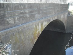
Block
From the record
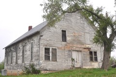
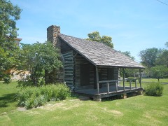
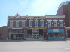
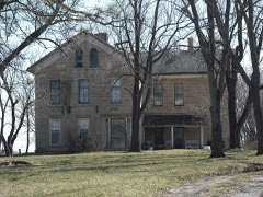
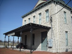
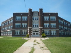
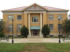
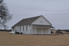
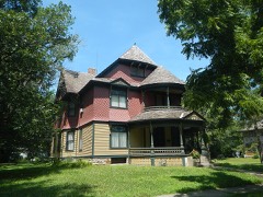
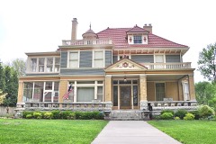
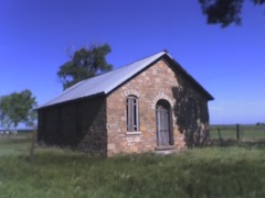
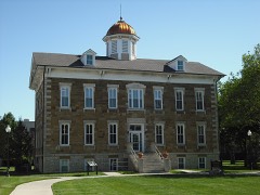
21 National Register listings published here.
Sources: the National Register database, National Park Service
47 topographic sheets cover 19 settlements here, and 21 properties are on the National Register of Historic Places.
21 National Register listings published here.
Sources: the National Register database, National Park Service
Every property in this county listed on the National Register of Historic Places, with the year it was listed and the federal nomination document.
Every wildfire the federal occurrence database records inside this county: 405 of them, burning about 4,866 acres. 2 started naturally and 32 were recorded as arson. Each settlement page carries the fires within five miles of it.
| Reported cause | Fires |
|---|---|
| Debris and open burning | 191 |
| Missing data/not specified/undetermined | 140 |
| Arson/incendiarism | 32 |
| Equipment and vehicle use | 22 |
| Smoking | 5 |
| Power generation/transmission/distribution | 5 |
| Other causes | 4 |
| Natural | 2 |
| Misuse of fire by a minor | 2 |
| Recreation and ceremony | 1 |
| Fireworks | 1 |
The five largest, by the area the report gives. None of them was recorded as arson.
| Date | Cause | Size | Reported by | Name on the report |
|---|---|---|---|---|
| 4 February 2006 | Missing data/not specified/undetermined | 325 acres | Kansas Counties | INDIANA ROAD |
| 26 February 2017 | Debris and open burning | 320 acres | Franklin County | 10 |
| 14 March 2018 | Debris and open burning | 200 acres | Kansas Forest Service | 69 |
| 15 February 2017 | Missing data/not specified/undetermined | 150 acres | Franklin County | 26 |
| 14 March 2018 | Debris and open burning | 150 acres | Kansas Forest Service | 67 |
| 14 March 2018 | Debris and open burning | 140 acres | Kansas Forest Service | 68 |
| 22 March 2018 | Debris and open burning | 130 acres | Kansas Forest Service | 77 |
| 4 March 2017 | Missing data/not specified/undetermined | 120 acres | Franklin County | 43 |
Every settlement page carries the fires within five miles of it - see the settlement index below.
The NOAA Storm Events Database holds 588 reports for this county, causing 3 deaths, 29 injuries and about $14,956,030 in recorded property damage. Each settlement page carries the reports that name it.
| Kind of event | Reports |
|---|---|
| Hail | 250 |
| Thunderstorm Wind | 238 |
| Flash Flood | 46 |
| Tornado | 29 |
| Flood | 10 |
| Funnel Cloud | 7 |
| Lightning | 6 |
| Heavy Rain | 2 |
The most serious of them, by death, then injury, then recorded damage. The accounts are quoted exactly as the forecast office filed them.
| When | Event | Place named | Harm | What the report says |
|---|---|---|---|---|
| May 1957 | Tornado (F5) | not stated | 3 killed, 11 hurt, $2,500,000 | no account filed |
| August 1987 | Thunderstorm Wind | not stated | 10 hurt | no account filed |
| April 2026 | Tornado (EF2) | Ottawa | 3 hurt | NWS storm survey revealed a tornado formed a few miles west of Ottawa and proceeded to move ESE through the southern parts of the city of Ottawa. The tornado turned to the ENE as it exited to the city and moved across interstate 35 doing more damage to structures before it ended near the Marais des Cygness River. The tornado produced EF2 damage with estimated winds of 120-125 mph throughout the southern parts of the city of Ottawa and to other structures to the ENE of the city before it ended. There were 3 non serious injuries reported at a home near the end point of the tornado. |
| August 1954 | Tornado (F1) | not stated | 2 hurt, $25,000 | no account filed |
| June 1999 | Thunderstorm Wind | Ottawa | 1 hurt, $70,000 | Strong winds damaged trees and blew down power lines. Falling tree limbs damaged at least 6 cars. Two churches and several businesses had extensive damage. One person was injured from broken glass. |
| April 1964 | Tornado (F2) | not stated | 1 hurt, $2,500 | no account filed |
| October 1990 | Thunderstorm Wind | not stated | 1 hurt | no account filed |
| June 2014 | Thunderstorm Wind | Wellsville | $3,000,000 | Trees were uprooted. There was damage to the high school roof. Numerous power lines down over a large swath of Wellsville. |
| November 1998 | Flash Flood | Ottawa | $2,500,000 | no account filed |
| August 1998 | Thunderstorm Wind | Ottawa | $1,300,000 | Severe thunderstorms moved north across Franklin county producing numerous reports of damaging winds. Five planes were overturned and a business severely damaged at Ottawa airport. Much crop damage was also reported. |
| June 2007 | Flood | Lane | $1,000,000 | Douglas road next to Pottawatomie creek flooded for 1/4 of a mile. Rain continues producing increasingly widespread flooding through the rest of the month. Record flooding occurs near Lane on Pottawatomie Creek and near Pomona on the Marais des Cygnes river. By late on the 30th, homes are flooded and the fire department is assisting with evacuations. Snakes were seen swimming for shelter and raccoons were trapped in trees. Flooding continues into July. |
| July 2003 | Hail | Ottawa | $1,000,000 | Widespread baseball size hail damaged roofs, buildings, and many car windows in the Ottawa area during an early evening storm. |
| July 2009 | Thunderstorm Wind | Centropolis | $500,000 | The storm moved out of Franklin county and into Franklin county where it did the most damage. Many trees of greater than 36 diameter were snapped or uprooted from the storm. The heaviest damage was incurred at the Ottawa Airport where eyewitness estimates the wind speed ranged from 90 to 100 mph. Two 18 wheel trucks were reported as overturned, as a result of the strong winds as the storm crossed Interstate 35 in Ottawa. A hangar collapsed onto a collection of small aircraft at the Ottawa airport. Approximately half a dozen small aircraft were heavily damage when the structure caved in. A motel was also destroyed when the roof was completely ripped off the top of the structure. Aside from these compromised structures, a vintage DC-3 was blown by the strong winds approximately 1/2 mile from the Ottawa Airport into a near by bean field. An uncountable number of small outbuildings such as grain bins, barns, sheds, garages, and tin shelters were destroyed in the wind. Numerous telephone poles were also snapped as a result of the winds. The length of the damage path was approximately 25.5 miles long by approximately 11 miles wide. |
| August 1998 | Thunderstorm Wind | Princeton | $325,000 | At least 10 homes along with numerous trees and power lines were badly damaged by 60 to 70 mph straight line winds. |
| July 2007 | Flood | Ottawa | $300,000 | Rain ends but flooding continues into the new month. Many roads are flooded. Emergency manager reports that up to 25 homes have been evacuated with 15 homes flooded in Lane. Homes are evacuated on the west and east sides of Ottawa due to approaching floodwaters. Flood gates closed in downtown Ottawa. Highway K68 bridge crossing the Marais des Cygnes west of Ottawa has 5 feet of water over the bridge. An indirect fatality occurred nearly two weeks later (on the 15th) when a motorist was thrown from his vehicle 4 miles east of Pomona after hitting a hole in the road caused by flood waters earlier in the month. A state report said that flood waters destroyed five houses in the county with 20 receiving major damage, 23 had minor damage and 21 were affected by not considered damaged. |
| September 1965 | Tornado | not stated | $250,000 | no account filed |
| June 2005 | Flash Flood | Countywide | $200,000 | At least 6 inches of water flowing over many roads throughout the county. |
| June 2005 | Flash Flood | Ottawa | $150,000 | Vehicles reported stuck in fast flowing water across many streets in Ottawa. Newspaper reported nearly 4 inches of rain just before and during the flash flooding. |
| October 1998 | Flash Flood | Ottawa | $147,000 | no account filed |
| April 2003 | Tornado (F1) | Rantoul | $105,000 | A tornado touched down and moved northeast a little over a quarter mile before dissipating. The tornado damaged or destroyed 6 out buildings at one farm and damaged a barn at another farm nearby. |
| August 2019 | Flash Flood | Ottawa | $100,000 | Photos from KOFO radio station. Numerous buildings in Ottawa surrounded by flood waters. Estimated depth of the water 6 to 12 inches deep. |
| June 2007 | Flash Flood | Ottawa | $100,000 | Highway 59 closed due to high water. |
| May 1995 | Hail | Wellsville | $100,000 | Large hail accompanied by high winds caused widespread damage in and north of Wellsville. This supercell storm had originated in central Kansas and produced extensive and widespread, mainly straightline/ downburst wind damage, as it moved east across the region, finally exiting the state around 2200 CST. |
| May 1995 | Hail | Ottawa | $100,000 | Large hail accompanied by high winds caused widespread damage to roofs, cars and windows. |
| February 1996 | Lightning | Ottawa | $100,000 | no account filed |
| June 2025 | Flood | Ottawa Muni Arpt | $80,000 | CO-OP observer called and said many of the county roads 5 miles northeast of Princeton, KS remain flooded from earlier heavy rainfall. |
| August 2005 | Flash Flood | Ottawa | $80,000 | Up to a foot of water flowing over streets around Ottawa. |
| August 2019 | Flash Flood | Ottawa | $75,000 | Two vehicles inundated by flood waters in Ottawa due to flooding t-storm rains. |
| June 2007 | Flash Flood | Ottawa | $70,000 | Bridge crossing Middle Creek under water 2 miles east of 59 highway on Hamilton road. |
| June 2007 | Flash Flood | Lane | $50,000 | Water covering 4300 block of Allen Terrace. Water completely covers the 600 block of Marshall road. It is impassable. |
| May 2007 | Flood | Ottawa | $50,000 | Moderate or greater flooding along the reach of the Marais Des Cygnes river in the vicinity of Ottawa. The Ottawa flood gates are closed. Flooding of lowland areas and county roads occurred. |
| July 2005 | Flash Flood | Princeton | $50,000 | Clark, Georgia and Butler roads impassable due to fast flowing water. |
| July 2005 | Flash Flood | Richmond | $50,000 | Small streams out of banks and flowing fast over rural roads. |
| July 2005 | Flash Flood | Princeton | $50,000 | Up to three feet of water flowing over county roads west of Princeton with trucks flooded. |
| July 2005 | Flash Flood | Richmond | $50,000 | Over two feet of water flowing across Butler road. |
| July 1994 | Thunderstorm Wind | Ottawa | $50,000 | High winds produced scattered damage to power lines, trees and some buildings across most of the county. |
| March 1993 | Hail | Centropolis | $50,000 | Large hail dented some cars and roofs as it fell briefly in far western and northwest Franklin County. |
| June 2007 | Flash Flood | Pomona | $30,000 | Water rescue occurring at 1200 block of Labette and Florida Roads. Water reported up to the passenger window of pickup truck. |
| June 2007 | Flash Flood | Lane | $30,000 | Fast flowing water crossing the road at Vermont and Douglas. Depth unknown. |
| August 2019 | Flash Flood | Norwood | $25,000 | A water rescue was needed to get people out of a vehicle near Norwood, Kansas. |
| July 2004 | Thunderstorm Wind | Le Loup | $25,000 | Strong winds damaged a 120 foot by 80 foot machine shed, a transformer and some trees. A lean-to was picked up by the wind and carried over an adjacent 25 foot tall building. |
| November 1982 | Tornado (F1) | not stated | $25,000 | no account filed |
| April 1960 | Tornado (F3) | not stated | $25,000 | no account filed |
| May 1958 | Tornado (F2) | not stated | $25,000 | no account filed |
| May 1958 | Tornado (F2) | not stated | $25,000 | no account filed |
| August 1954 | Tornado (F1) | not stated | $25,000 | no account filed |
| June 2007 | Heavy Rain | Rantoul | $20,000 | Locally heavy rain produced lowland and small stream flooding along Middle creek west of Rantoul. Also, a small creek near highway 59 spilled over Rock Creek road. |
| June 1999 | Lightning | Wellsville | $10,000 | An unusual event occurred in Wellsville when lightning that struck a house a few days earlier and ignited a smoldering fire that burst into flames the evening of the 2nd. Considerable damage was done to the house, mainly the attic portion. |
| April 1995 | Hail | Wellsville | $8,000 | Large hail propelled by winds estimated over 70 mph caused damage to a barn and outbuildings. Heavy rains of three to five inches, most of it occurring in about one hour, caused isolated temporary flooding. |
| March 2004 | Flash Flood | Ottawa | $8,000 | no account filed |
| July 1996 | Thunderstorm Wind | Ottawa | $8,000 | no account filed |
| August 2004 | Lightning | Rantoul | $7,000 | Lightning struck a house near Rantoul and ignited a fire. The house suffered substantial fire, smoke, and water damage. |
| June 2001 | Lightning | Ottawa | $7,000 | Lightning struck a storage barn and ignited a fire that damaged the structure and much of its contents. |
| September 2009 | Flash Flood | Williamsburg | $5,000 | Slow moving thunderstorms dumped 3 to 4 inches of rain across the area. Old highway 50 and N Dane Road were flooded and closed with 6 inches of flowing water reported in the town of Williamsburg due to the heavy rains. |
| June 2007 | Flash Flood | Lane | $5,000 | Deputies reported that water was flowing over the road near the intersection of Virginia Road and Hwy 169. Just over three inches of rain was reported to have fallen over the course of the event. |
| July 2000 | Thunderstorm Wind | Wellsville | $5,000 | Strong winds blew tree limbs down on a transformer doing considerable damage. |
| June 1999 | Thunderstorm Wind | Pomona | $5,000 | Strong winds blew the roof off a house. |
| April 1995 | Hail | Ottawa | $5,000 | Large hail propelled by winds estimated over 70 mph caused damage to a barn and outbuildings. Heavy rains of three to five inches, most of it occurring in about one hour, caused isolated temporary flooding. |
| June 1995 | Thunderstorm Wind | Ottawa | $5,000 | Winds tore down trees and limbs and damaged some roofs. |
| June 1994 | Thunderstorm Wind | Ottawa | $5,000 | High winds tore down power lines, tree limbs and caused minor damage to some buildings. |
The Survey's mineral resources record lists 1 working inside this county. It still produces. Each settlement page carries the workings within five miles of it.
| Commodity | Workings |
|---|---|
| Clay | 1 |
The least common of them first, because a county's hundredth gravel pit says nothing its first ten did not.
| Where | Site | Commodity | Status | Recorded |
|---|---|---|---|---|
| Buildex Clay Pit & Plant | Clay | Producer |
Named settlements recorded in the Geographic Names Information System, each with the topographic sheets covering it. Villages, hamlets and abandoned places alike. Each is shown with the nearest named watercourse or landform and the survey quadrangle it falls on.
Centropolis township · 66067 · On Cole Creek · Ottawa North quadrangle
18 sheets, 1885 to 1983
Ottawa city · 66067 · On Wilson Creek · Ottawa North quadrangle
18 sheets, 1885 to 1983
Williamsburg township · 66095 · On Mill Creek · Williamsburg quadrangle
18 sheets, 1885 to 1990