 Block
Ottawa, Kansas
19 topographic sheets cover this place, the earliest surveyed in 1885 and the latest in 1983. It stands in Ottawa City. It lies in ZIP code area 66067. It stands on Wilson Creek. The Survey maps it on the Ottawa South quadrangle. 12,625 people lived here at the 2020 count. It stands 902 feet above sea level.
Research this city
On record in Ottawa
Buildings and businesses the archive holds for this place. Each opens its own page, with the source record it came from.
On the National Register 12 of 14 shown
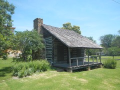 Dietrich Cabinlisted 1972
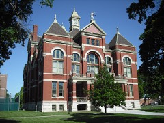 Franklin County Courthouselisted 1972
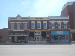 Historic Ottawa Central Business Districtlisted 2008
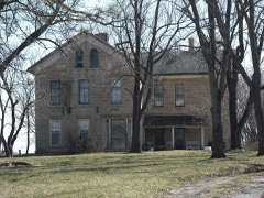 Tauy Jones Houselisted 1972
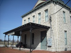 Old Santa Fe Railroad Depotlisted 1973
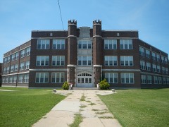 Ottawa High School and Junior High Schoollisted 2000
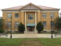 Ottawa Librarylisted 1980
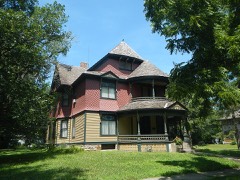 James H. Ransom Houselisted 1974
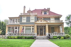 Lyman Reid Houselisted 2017
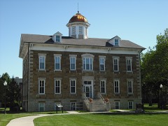 Tauy Jones Halllisted 1982
- Downtown Ottawa Historic Districtlisted 1972
- Eight Mile Creek Warren Truss Bridgelisted 2003
Population over time
2 figuresOttawa fell from 12,649 to 12,625 between 2010 and 2020. These are the recorded population figures Wikidata holds for this place, reached through the Geographic Names Information System number this page is keyed on rather than by name, so they belong to this place and not to another of the same name. Most are census counts, but not all are: an early figure may be a founding or settlement estimate, and an estimate published within five years of a census is left out. The change column is computed, and is left blank where more than 20 years separate a figure from the one before it, because a gap that long is not a change between two counts.
| Year | People | Change |
|---|---|---|
| 2010 | 12,649 | |
| 2020 | 12,625 | -24 (-0%) |
Topographic sheets covering this place
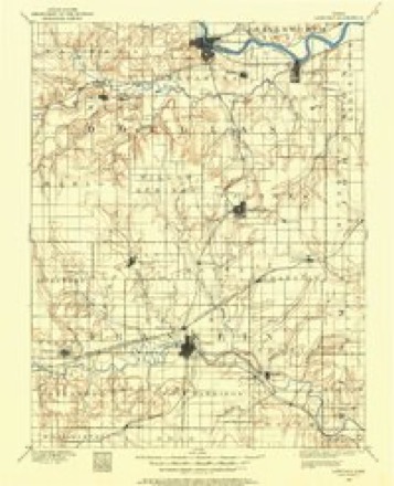
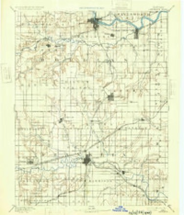
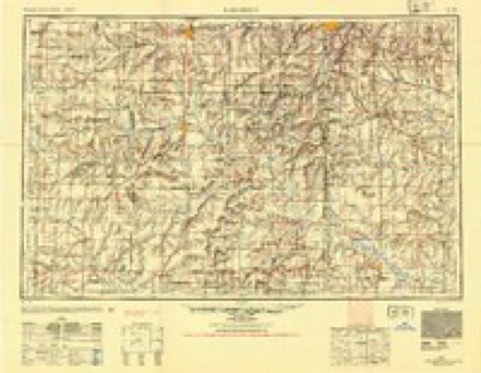
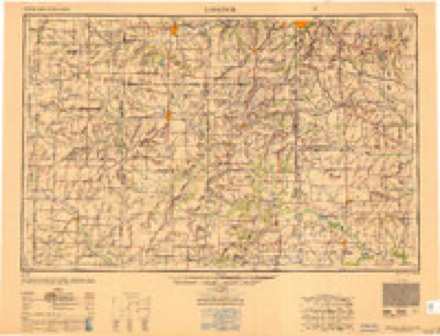
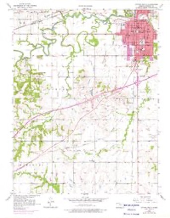
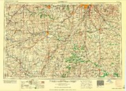
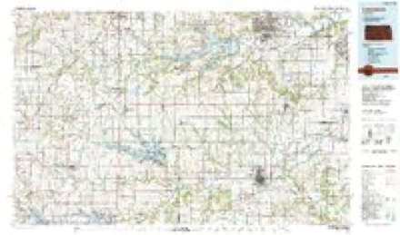
8 surveys from 19 printed sheetsMatched by testing this settlement's coordinate against the published boundary of every sheet in the United States Geological Survey's historical collection. Each opens the scanned sheet at the Survey.
- 1885 USGS Lawrence quadrangle1:125000
- 1889 USGS Lawrence quadrangle1:125000, 6 printings
- 1947 USGS Lawrence quadrangle1:250000
- 1950 USGS Lawrence quadrangle1:250000
- 1956 USGS Lawrence quadrangle1:250000, 4 printings
- 1956 USGS Ottawa South quadrangle1:24000, 4 printings
- 1961 USGS Lawrence quadrangle1:250000
- 1983 USGS Lawrence quadrangle1:100000
Fires near this place
78 since 2015Regional context, not property-specific evidence. The federal wildfire occurrence database lists 78 fires within 5 miles of Ottawa between 2015 and 2020, burning about 311 acres in total. 1 started naturally. 5 were recorded as arson. Distance is straight-line from the map coordinates, so a fire counted here may appear on a neighbouring settlement's page as well.
| Reported cause | Fires |
|---|---|
| Missing data/not specified/undetermined | 39 |
| Debris and open burning | 23 |
| Equipment and vehicle use | 5 |
| Arson/incendiarism | 5 |
| Power generation/transmission/distribution | 4 |
| Fireworks | 1 |
| Natural | 1 |
The most recent of them, most recent first, with the day each was reported and the service that recorded it.
| Date | Cause | Size | Reported by | Name on the report |
|---|---|---|---|---|
| 18 August 2018 | Missing data/not specified/undetermined | under an acre | Kansas Forest Service | 1192 |
| 7 July 2018 | Missing data/not specified/undetermined | under an acre | Kansas Forest Service | 180164 |
| 4 July 2018 | Equipment and vehicle use | under an acre | Kansas Forest Service | 180156 |
| 25 July 2018 | Missing data/not specified/undetermined | under an acre | Kansas Forest Service | 1057 |
| 25 July 2018 | Missing data/not specified/undetermined | under an acre | Kansas Forest Service | 1052 |
| 25 July 2017 | Missing data/not specified/undetermined | 6.0 acres | Franklin County | 2017195 |
| 20 July 2018 | Fireworks | under an acre | Kansas Forest Service | 1035 |
| 20 July 2017 | Debris and open burning | 1.5 acres | Franklin County | 2017190 |
Settlements close enough to share some of these fires:
Storms near this place
60 of 179 shownRegional context, not property-specific evidence. The National Weather Service names Ottawa in 179 storm reports between 1993 and 2026: 75 thunderstorm wind, 73 hail, 18 flash flood, 4 tornado. The reports record 4 injuries. Each account below is quoted exactly as the forecast office filed it, from the NOAA Storm Events Database, and each date opens the federal record of that event.
| When | Event | Place named | Harm | What the report says |
|---|---|---|---|---|
| April 2026 | Tornado (EF2) | Ottawa | 3 hurt | NWS storm survey revealed a tornado formed a few miles west of Ottawa and proceeded to move ESE through the southern parts of the city of Ottawa. The tornado turned to the ENE as it exited to the city and moved across interstate 35 doing more damage to structures before it ended near the Marais des Cygness River. The tornado produced EF2 damage with estimated winds of 120-125 mph throughout the southern parts of the city of Ottawa and to other structures to the ENE of the city before it ended. There were 3 non serious injuries reported at a home near the end point of the tornado. |
| June 1999 | Thunderstorm Wind | Ottawa | 1 hurt, $70,000 | Strong winds damaged trees and blew down power lines. Falling tree limbs damaged at least 6 cars. Two churches and several businesses had extensive damage. One person was injured from broken glass. |
| November 1998 | Flash Flood | Ottawa | $2,500,000 | no account filed |
| August 1998 | Thunderstorm Wind | Ottawa | $1,300,000 | Severe thunderstorms moved north across Franklin county producing numerous reports of damaging winds. Five planes were overturned and a business severely damaged at Ottawa airport. Much crop damage was also reported. |
| July 2003 | Hail | Ottawa | $1,000,000 | Widespread baseball size hail damaged roofs, buildings, and many car windows in the Ottawa area during an early evening storm. |
| July 2007 | Flood | Ottawa | $300,000 | Rain ends but flooding continues into the new month. Many roads are flooded. Emergency manager reports that up to 25 homes have been evacuated with 15 homes flooded in Lane. Homes are evacuated on the west and east sides of Ottawa due to approaching floodwaters. Flood gates closed in downtown Ottawa. Highway K68 bridge crossing the Marais des Cygnes west of Ottawa has 5 feet of water over the bridge. An indirect fatality occurred nearly two weeks later (on the 15th) when a motorist was thrown from his vehicle 4 miles east of Pomona after hitting a hole in the road caused by flood waters earlier in the month. A state report said that flood waters destroyed five houses in the county with 20 receiving major damage, 23 had minor damage and 21 were affected by not considered damaged. |
| June 2005 | Flash Flood | Ottawa | $150,000 | Vehicles reported stuck in fast flowing water across many streets in Ottawa. Newspaper reported nearly 4 inches of rain just before and during the flash flooding. |
| October 1998 | Flash Flood | Ottawa | $147,000 | no account filed |
| August 2019 | Flash Flood | Ottawa | $100,000 | Photos from KOFO radio station. Numerous buildings in Ottawa surrounded by flood waters. Estimated depth of the water 6 to 12 inches deep. |
| June 2007 | Flash Flood | Ottawa | $100,000 | Highway 59 closed due to high water. |
| May 1995 | Hail | Ottawa | $100,000 | Large hail accompanied by high winds caused widespread damage to roofs, cars and windows. |
| February 1996 | Lightning | Ottawa | $100,000 | no account filed |
| August 2005 | Flash Flood | Ottawa | $80,000 | Up to a foot of water flowing over streets around Ottawa. |
| August 2019 | Flash Flood | Ottawa | $75,000 | Two vehicles inundated by flood waters in Ottawa due to flooding t-storm rains. |
| June 2007 | Flash Flood | Ottawa | $70,000 | Bridge crossing Middle Creek under water 2 miles east of 59 highway on Hamilton road. |
| May 2007 | Flood | Ottawa | $50,000 | Moderate or greater flooding along the reach of the Marais Des Cygnes river in the vicinity of Ottawa. The Ottawa flood gates are closed. Flooding of lowland areas and county roads occurred. |
| July 1994 | Thunderstorm Wind | Ottawa | $50,000 | High winds produced scattered damage to power lines, trees and some buildings across most of the county. |
| March 2004 | Flash Flood | Ottawa | $8,000 | no account filed |
| July 1996 | Thunderstorm Wind | Ottawa | $8,000 | no account filed |
| June 2001 | Lightning | Ottawa | $7,000 | Lightning struck a storage barn and ignited a fire that damaged the structure and much of its contents. |
| April 1995 | Hail | Ottawa | $5,000 | Large hail propelled by winds estimated over 70 mph caused damage to a barn and outbuildings. Heavy rains of three to five inches, most of it occurring in about one hour, caused isolated temporary flooding. |
| June 1995 | Thunderstorm Wind | Ottawa | $5,000 | Winds tore down trees and limbs and damaged some roofs. |
| June 1994 | Thunderstorm Wind | Ottawa | $5,000 | High winds tore down power lines, tree limbs and caused minor damage to some buildings. |
| June 1994 | Thunderstorm Wind | Ottawa | $5,000 | High winds, hail, and heavy rain once again caused damage in and around the Ottawa area. |
| June 1998 | Thunderstorm Wind | Ottawa | $3,000 | no account filed |
| July 2012 | Thunderstorm Wind | Ottawa | $2,000 | A 4 inch tree limb was broken and shingles were removed from a home near Ottawa. |
| September 2009 | Flash Flood | Ottawa | $2,000 | Thunderstorms producing heavy rains caused flash flooding in the city of Ottawa. Eisenhower road in Ottawa had one foot of water flowing over the road. 15th street in Ottawa also had one foot of flowing water across the road. |
| September 2009 | Flash Flood | Ottawa | $2,000 | Two Cars were reported to be stalled in high water due a heavy rains from thunderstorms. The high water and stalled cars were at the intersection of 15th and Poplar streets in Ottawa. |
| September 2010 | Thunderstorm Wind | Ottawa | $1,000 | A tree as split in half and numerous large limbs were reported down in and near Ottawa. |
| April 2007 | Lightning | Ottawa | $1,000 | Lightning struck a tree in the yard of a home in Ottawa and peeled bark off two sides of the tree. The bolt traveled into the ground, where it struck a water line, blew the heads off the in-ground sprinkler system in the yard, and traveled along a fence surrounding the yard. The water line also tracked into the home, where all of the basement windows were blown out, and a few appliances were damaged. There were other isolated reports around town of power outages during the storm. |
| April 2026 | Hail | Ottawa | - | Delayed report of 2 inch diameter hail across the street from the Ottawa High School. Photos were sent via email. |
| April 2026 | Thunderstorm Wind | Ottawa | - | Wind gusts were estimated between 60-65 mph. |
| July 2025 | Thunderstorm Wind | Ottawa | - | Estimated 60 mph gust. |
| April 2023 | Hail | Ottawa | - | Quarter sized hail reported. |
| February 2023 | Thunderstorm Wind | Ottawa | - | Measured at awos in Ottawa. |
| May 2023 | Hail | Ottawa | - | Nickel sized hail reported. |
| July 2023 | Thunderstorm Wind | Ottawa | - | Kofo reported that an 18 wheeler truck was blown off of interstate 35. |
| July 2023 | Thunderstorm Wind | Ottawa | - | Kofo reported a tree fell through the roof of a house and power is out all through the town of Ottawa. |
| June 2022 | Thunderstorm Wind | Ottawa | - | Report of 6 to 8 inch diameter tree limbs down. |
| June 2021 | Thunderstorm Wind | Ottawa | - | Video from twitter shows 12 inch diameter tree limbs broken. Tree appeared to be healthy. Time estimated by radar. |
| June 2021 | Thunderstorm Wind | Ottawa | - | Tree limbs down in Ottawa. Delayed report from Sheriff Office. |
| June 2021 | Flash Flood | Ottawa | - | Water over multiple roadways in Ottawa. |
| May 2020 | Thunderstorm Wind | Ottawa | - | Large tree blown over, per social media pictures. Time estimated based on radar. |
| May 2020 | Thunderstorm Wind | Ottawa | - | Public reported power poles and a railroad crossing guard blown down. Time estimated based on radar. |
| May 2019 | Flash Flood | Ottawa | - | Water was running across Highway 59 just south of Ottawa. In addition, multiple roads in Ottawa are impassable. |
| August 2019 | Thunderstorm Wind | Ottawa | - | Social media photos of 6 inch diameter tree limbs down. Time estimated by radar. |
| August 2019 | Thunderstorm Wind | Ottawa | - | Power lines down around city of Ottawa. |
| May 2019 | Thunderstorm Wind | Ottawa | - | Estimated wind gust report. |
| May 2019 | Thunderstorm Wind | Ottawa | - | Estimated wind gust report. |
| May 2019 | Thunderstorm Wind | Ottawa | - | Measured at the Ottawa Mesonet site. 79.9 mph was measured at 10 meters. |
| May 2018 | Thunderstorm Wind | Ottawa | - | Measured wind gust. |
| June 2018 | Thunderstorm Wind | Ottawa | - | Picture received via social media of a large tree on a house. |
| June 2018 | Thunderstorm Wind | Ottawa | - | Power lines were reported down in the city of Ottawa. |
| October 2017 | Thunderstorm Wind | Ottawa | - | Social media report of a 6 inch diameter tree limb down. Dispatch relayed multiple tree limbs and power lines down within the city. Time was estimated by radar. |
| July 2017 | Thunderstorm Wind | Ottawa | - | Numerous small trees and power lines are down throughout the city of Ottawa. |
| August 2016 | Thunderstorm Wind | Ottawa | - | A 4 inch diameter tree limb fell. |
| August 2016 | Thunderstorm Wind | Ottawa | - | A couple of tree were blown over. |
| August 2016 | Thunderstorm Wind | Ottawa | - | A tree fell on a house. No description of the tree was given. |
| July 2016 | Thunderstorm Wind | Ottawa | - | Two trees blown over and landed on a vehicle. |
| July 2015 | Thunderstorm Wind | Ottawa | - | There was an 8 inch diameter tree limb down. |
Nearest settlements
The eight closest, with where each one stands in the county. Distances are straight-line, computed from the Geographic Names Information System coordinates.
| Map | Place | Distance | Sheets |
|---|---|---|---|
| Ottawa Junction | 1.3 miles | 18 | |
| B N Junction | 3.7 miles | 19 | |
| Richter | 5.9 miles | 17 | |
| Imes | 6.5 miles | 17 | |
| Norwood | 6.6 miles | 17 | |
| Peoria | 6.7 miles | 17 | |
| Le Loup | 7.9 miles | 17 | |
| Centropolis | 8.2 miles | 18 |
Elsewhere
Matched on this settlement's Geographic Names Information System number rather than its name, so it cannot be a different place of the same name in another state.
| Wikipedia article on Ottawa | An encyclopaedic summary. Its text is share-alike, so it is linked here rather than copied. |
| Wikidata item Q1913965 | The structured record the population and elevation above come from. Public domain (CC0). |
Provenance
This settlement is recorded in the Geographic Names Information System as feature 479367. The sheet list is computed by point-in-boundary test against the United States Geological Survey's historical topographic inventory. Both are works of the United States government and carry no copyright under 17 U.S.C. 105.
Wildfire. Short, Karen C. 2022. Spatial wildfire occurrence data for the United States, 1992-2020 [FPA_FOD_20221014]. 6th Edition. Fort Collins, CO: Forest Service Research Data Archive. https://doi.org/10.2737/RDS-2013-0009.6 Collected with United States Government funding and usable without additional permissions or fees.
Storms. NOAA National Centers for Environmental Information, Storm Events Database https://www.ncei.noaa.gov/stormevents/ A work of the United States government, no copyright under 17 U.S.C. 105. Narratives are quoted verbatim from the National Weather Service report and are not edited or summarised.