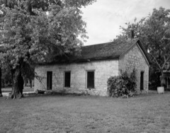
Block
From the record
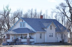
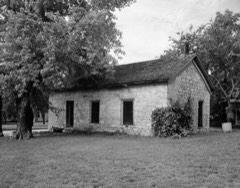
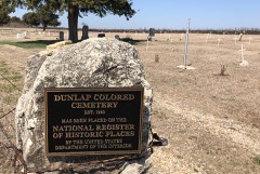
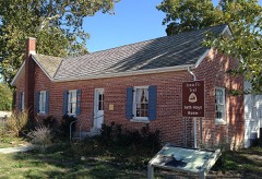
27 National Register listings published here, 1 of them a National Historic Landmark.
Sources: the National Register database, National Park Service
33 topographic sheets cover 14 settlements here, and 27 properties are on the National Register of Historic Places.
27 National Register listings published here, 1 of them a National Historic Landmark.
Sources: the National Register database, National Park Service
Every property in this county listed on the National Register of Historic Places, with the year it was listed and the federal nomination document.
Every wildfire the federal occurrence database records inside this county: 108 of them, burning about 8,531 acres. 2 started naturally and 2 were recorded as arson. Each settlement page carries the fires within five miles of it.
| Reported cause | Fires |
|---|---|
| Missing data/not specified/undetermined | 43 |
| Debris and open burning | 41 |
| Equipment and vehicle use | 12 |
| Recreation and ceremony | 5 |
| Arson/incendiarism | 2 |
| Natural | 2 |
| Power generation/transmission/distribution | 1 |
| Fireworks | 1 |
| Other causes | 1 |
The five largest, by the area the report gives. None of them was recorded as arson.
| Date | Cause | Size | Reported by | Name on the report |
|---|---|---|---|---|
| 18 February 1994 | Missing data/not specified/undetermined | 5,000 acres | Morris County | not named |
| 19 April 2018 | Debris and open burning | 900 acres | Kansas Forest Service | 18 |
| 18 February 2002 | Debris and open burning | 500 acres | Dickinson County | not named |
| 11 March 2015 | Debris and open burning | 400 acres | Kansas Forest Service | 2015009 |
| 8 April 2009 | Missing data/not specified/undetermined | 300 acres | Kansas Counties | Q ROAD FIRE COMPLEX |
| 10 April 2015 | Debris and open burning | 160 acres | Kansas Forest Service | 2015016 |
| 6 March 2020 | Missing data/not specified/undetermined | 120 acres | Kansas Forest Service | not named |
| 16 February 2017 | Missing data/not specified/undetermined | 100 acres | Morris County | 2017007 |
Every settlement page carries the fires within five miles of it - see the settlement index below.
The NOAA Storm Events Database holds 486 reports for this county, causing 1 death, 8 injuries and about $8,267,500 in recorded property damage. Each settlement page carries the reports that name it.
| Kind of event | Reports |
|---|---|
| Hail | 276 |
| Thunderstorm Wind | 127 |
| Tornado | 38 |
| Flash Flood | 32 |
| Flood | 7 |
| Funnel Cloud | 4 |
| Lightning | 1 |
| Heavy Rain | 1 |
The most serious of them, by death, then injury, then recorded damage. The accounts are quoted exactly as the forecast office filed them.
| When | Event | Place named | Harm | What the report says |
|---|---|---|---|---|
| May 1996 | Flash Flood | Council Grove | 1 killed, $30,000 | no account filed |
| June 1969 | Tornado (F2) | not stated | 6 hurt, $250,000 | no account filed |
| June 1995 | Tornado (F2) | not stated | 1 hurt, $12,000 | A tornado struck a pickup throwing the driver into a nearby ditch. The truck was found about one-quarter mile away with the engine about 200 yards from the remains of the nearly destroyed truck chassis. The driver sustained severe injuries and required at least 30 stitches. The driver had barbed wire and clothing wrapped around his legs and body. He crawled to a nearby road where he was able to stand and walk. He was found by a passing motorist and taken to a local hospital where he remained for several days. The tornado also damaged nearby buildings, silos, and farm equipment. The tornado was reportedly moving northwest. |
| August 1986 | Thunderstorm Wind | not stated | 1 hurt | no account filed |
| April 1991 | Tornado (F0) | not stated | $2,500,000 | no account filed |
| March 1990 | Tornado (F2) | not stated | $2,500,000 | no account filed |
| May 1995 | Hail | Council Grove | $500,000 | Large hail produced extensive damage across the county including both property and crop. Many roofs, vehicles and windows were broken or damaged. |
| November 2005 | Tornado (F1) | Delavan | $250,000 | This tornado touched down 1 mile southwest of Delavan and moved north for 15 miles before exiting into Geary county 3 miles west of Skiddy. It produced primarily F0 damage along its path, however, F1 damage occurred on several farmsteads across northwest parts of the county, where several outbuildings were damaged or destroyed. Roofing material from one building was stuck in a fence a mile away to the north. The tornado remained on the ground across the border into southwest Geary county for 5 more miles, making the total path length 20 miles. The parent thunderstorm was a mini-supercell. |
| May 1986 | Tornado (F1) | not stated | $250,000 | no account filed |
| March 1974 | Tornado (F2) | not stated | $250,000 | no account filed |
| March 1974 | Tornado (F2) | not stated | $250,000 | no account filed |
| June 1971 | Tornado (F3) | not stated | $250,000 | no account filed |
| May 1995 | Hail | White City | $200,000 | Hail near the size of softballs did extensive damage to the White City school building. Skylights and windows were blown out with severe damage to the roof and nearby buildings and vehicles. |
| May 1995 | Hail | Parkerville | $130,000 | Large hail driven by high winds caused widespread roof, window and vehicle damage in and around the area. Two of the counties sheriff's cars and one Emergency Medical Transport vehicle received enough hail damage to render them out-of-sevice. |
| August 2005 | Flash Flood | White City | $70,000 | Fast flowing water closed Skiddy road. |
| August 2005 | Flash Flood | Dunlap | $70,000 | Fast flowing water closed Dunlap road. |
| May 2007 | Flash Flood | Helmick | $50,000 | Water over road at 1400 rd and 56 highway. Water over road at various spots west on 56 highway to 2100 road. Estimated two feet of water over V road near 1500 road. |
| May 2007 | Flash Flood | White City | $50,000 | Water reported over the road at K4 and McKenzie in White City. Road was considered impassable by sheriff's dept. |
| May 2007 | Flash Flood | Council Grove | $50,000 | Water reported flowing over sections of road between 500 block and 1200 block. Also on Main Street. |
| May 2007 | Flood | Council Grove | $50,000 | Widespread lowland flooding immediate reach of the gage near Dunlap due to moderate or greater flooding of the Neosho River. |
| May 2007 | Flash Flood | Wilsey | $50,000 | Five inches of water flowing over the road near 1900 road and 56 highway. 1900 road underwater for about a half mile south of this area. |
| August 2005 | Flash Flood | Skiddy | $50,000 | Fast flowing water over roads. |
| August 2005 | Flash Flood | White City | $50,000 | Fast flowing water over K-4 highway. |
| August 2005 | Flash Flood | Council Grove | $50,000 | Fast flowing water over roads with small streams out of banks. Rainfall of five to seven inches produced flash flooding. |
| July 1994 | Thunderstorm Wind | Council Grove | $50,000 | Winds estimated to 80 mph caused widespread and significant damage in Council Grove, nearby Council Grove Reservoir and across much of the county. Trees, power lines, signs, boats, marina and homes were all damaged in various degrees. Power was out in many areas for 12 to 18 hours. |
| May 1995 | Hail | White City | $45,000 | Large hail and high winds combined to damage windows, siding and vehicles. |
| August 2006 | Thunderstorm Wind | White City | $40,000 | Strong winds destroyed the roof and two walls of an old theater. Also, several storage sheds were destroyed. Numerous large branches were broken and trees up to 10 inches in diameter were uprooted. A small metal storage shed was wrapped around a utility pole. Property damage from the wind was widespread. The best indicator of the strength of the wind was the derailment of a railroad train at White City. Six of 58 cars were de-railed with five cars blown on their sides. Fortunately, the train crew was uninjured. |
| May 1998 | Thunderstorm Wind | Council Grove | $30,000 | no account filed |
| May 1999 | Tornado (F1) | Burdick | $27,500 | A tornado moved from Marion county into Morris county and touched down southwest of Burdick and moved northeast 5 miles before lifting. It struck a farm destroying part of the roof on a house and damaging a garage, two cars, a barn and some fenses. |
| May 1995 | Hail | Delavan | $25,000 | no account filed |
| July 1992 | Tornado (F0) | not stated | $25,000 | no account filed |
| June 2005 | Heavy Rain | Council Grove | $20,000 | Ponding of water and small stream flooding along U.S. Highway 177 near Council Grove. |
| June 2004 | Thunderstorm Wind | Council Grove | $20,000 | Strong winds destroyed a metal grain elevator. |
| August 2010 | Thunderstorm Wind | Council Grove Res | $15,000 | Near Council Grove numerous power lines were blown down. Two large trees, 15 and 18 inches respectively, were uprooted, and a grain bin was caved in. |
| August 2006 | Thunderstorm Wind | Latimer | $10,000 | One side of a prefab house was peeled away and a large portion of the roof lost shingles. Some trees were uprooted and some smaller outbuildings were blown over. An old granery building was flattened. A windmill dating from the 1930's was also destroyed. Large round hay bales were blown from a nearby field to near the house. A nearby house suffered tree and property damage. Large pine trees, some over 100 years old, were toppled. A utility pole fell on a propane tank causing a gas leak. A satellite dish was ripped from the roof and windows were blown out of the home. |
| July 1996 | Thunderstorm Wind | Delavan | $10,000 | no account filed |
| June 1998 | Hail | Diamond Spgs | $7,000 | no account filed |
| August 2009 | Thunderstorm Wind | Latimer | $5,000 | The measured wind gust of 80 mph came out of White City. The main structure of the storm moved through Morris county, producing 80 to 90 mph winds. Some structures in White City suffered major damage as a result of the wind storm. Most of these structures were pre-fabricated homes, garages, and a mobile home, which was not tied down. Windows were also broken out of permanent structures from wind and hail being thrown against the sides of the the structures. The major damage swath was about 20 miles wide with the storm track from this event being the mid line of the storm's damage path. In Council Grove, reports were received of 36 to 48 inch trees being snapped by the strong winds. Quarter sized hail was also reported at this location. |
| June 2004 | Thunderstorm Wind | Dwight | $5,000 | Strong winds moved a 400 pound dumpster 15 to 20 feet. A 16 foot car trailer was moved off jack stands. |
| September 2010 | Thunderstorm Wind | Council Grove | $3,000 | A large tree was blown down. a barn was moved three feet from foundation. Large empty fuel barrels rolled away. |
| April 1964 | Tornado | not stated | $2,500 | no account filed |
| May 1953 | Tornado (F1) | not stated | $2,500 | no account filed |
| June 1998 | Hail | Wilsey | $2,000 | no account filed |
| July 1997 | Thunderstorm Wind | White City | $2,000 | no account filed |
| August 2010 | Thunderstorm Wind | Wilsey | $1,000 | A law enforcement officer reported a power line down near Wilsey. |
| June 2009 | Flood | Delavan | $1,000 | The 2800 Road from X Avenue South to Burdick Road is still closed. |
| June 2009 | Flash Flood | White City | $1,000 | Debris and mud flowing over the intersection of highways K4 and K149 from Level Creek. |
| March 2007 | Flash Flood | Council Grove | $1,000 | Six to eight inches of water flowing over Rural Roads K and 500. |
| May 2005 | Flash Flood | Council Grove | $1,000 | Up to 6 inches of rain caused flash flooding with rapid flow over rural roads around Council Grove. |
| October 1997 | Thunderstorm Wind | Burdick | $1,000 | no account filed |
| July 1996 | Thunderstorm Wind | Council Grove | $1,000 | no account filed |
| June 2011 | Thunderstorm Wind | Burdick | $500 | Three to four inch tree limbs were broken. |
| June 2011 | Thunderstorm Wind | Dunlap | $500 | A COOP Observer near Dunlap reported two to three inch diameter tree limbs down. |
| May 2005 | Flash Flood | Dunlap | $500 | Fast flowing water over 4 mile road near Dunlap. |
| July 1996 | Lightning | Council Grove | $500 | no account filed |
| April 2026 | Tornado (EF1) | Dunlap | - | NWS damage survey revealed a small tornado did damage to a single family home and a few outbuildings and cabins on the northeast side of Lake Kahola. The short damage path was discontinuous with portions of the short track having been untouched. The greatest degree of damage occurred to outbuildings that were destroyed and walls were tossed into another cabin. This tornado was rated a EF1 with winds to around 110 mph. |
| May 2025 | Hail | Delavan | - | Quarter size hail east of Herington. |
| August 2025 | Thunderstorm Wind | Latimer | - | Several outbuildings destroyed. |
| September 2025 | Hail | Dunlap | - | Delayed report from southern Morris County. Time estimated from radar. |
| September 2024 | Thunderstorm Wind | Burdick | - | Estimated 60 mph wind gust. |
Named settlements recorded in the Geographic Names Information System, each with the topographic sheets covering it. Villages, hamlets and abandoned places alike. Each is shown with the nearest named watercourse or landform and the survey quadrangle it falls on.
Council Grove city · 66846 · On Elm Creek · Council Grove quadrangle
16 sheets, 1885 to 1985
Township 8 · 66838 · On Sixmile Creek · Diamond Springs quadrangle
15 sheets, 1889 to 1985
Township 2 · 66846 · On Lairds Creek · Council Grove Lake quadrangle
15 sheets, 1889 to 1985
No longer a settlement
The vanished settlements of Morris County: the places named above that are no longer on the map.