 Block
From the record
9 National Register listings published here.
Sources: the National Register database, National Park Service
30 topographic sheets cover 13 settlements here, and 9 properties are on the National Register of Historic Places.
9 National Register listings published here.
Sources: the National Register database, National Park Service
Every property in this county listed on the National Register of Historic Places, with the year it was listed and the federal nomination document.
| Photograph | Property | Type | Listed | Reference |
|---|---|---|---|---|
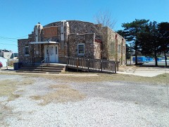 | Earl H. Ellis VFW Post #1362 | building | 2006 | 06000597 |
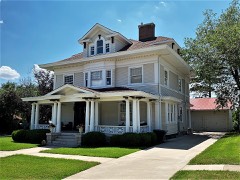 | S. P. Gebhart House | building | 1987 | 87000074 |
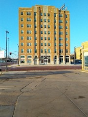 | Hotel Roberts | building | 2015 | 14001122 |
| Norden Bombsight Storage Vaults | structure | 2012 | 12000816 | |
| Parachute Building | building | 2009 | 09000231 | |
| J. R. Rice Barn and Granary | building | 1995 | 95000695 | |
| J.R. Rice Farmstead | building | 2000 | 99001649 | |
| Sawyer City Jail | building | 2022 | 100007924 | |
| Thornton Adobe Barn | building | 2003 | 03001258 |
Every wildfire the federal occurrence database records inside this county: 65 of them, burning about 1,036 acres. 3 started naturally and 1 was recorded as arson. Each settlement page carries the fires within five miles of it.
| Reported cause | Fires |
|---|---|
| Missing data/not specified/undetermined | 21 |
| Debris and open burning | 20 |
| Equipment and vehicle use | 10 |
| Smoking | 5 |
| Fireworks | 5 |
| Natural | 3 |
| Arson/incendiarism | 1 |
The five largest, by the area the report gives. None of them was recorded as arson.
| Date | Cause | Size | Reported by | Name on the report |
|---|---|---|---|---|
| 4 November 2007 | Missing data/not specified/undetermined | 500 acres | Kansas Counties | LUTE'S CRP |
| 1 January 2016 | Debris and open burning | 100 acres | Kansas Forest Service | 1 |
| 19 April 2018 | Debris and open burning | 70 acres | Kansas Forest Service | 10 |
| 8 November 2020 | Smoking | 50 acres | Kansas Forest Service | not named |
| 10 April 2015 | Debris and open burning | 40 acres | Kansas Forest Service | 3 |
| 9 April 2017 | Missing data/not specified/undetermined | 40 acres | Pratt County | 12 |
| 11 April 2017 | Debris and open burning | 35 acres | Pratt County | 13 |
| 19 November 2020 | Equipment and vehicle use | 25 acres | Kansas Forest Service | not named |
Every settlement page carries the fires within five miles of it - see the settlement index below.
The NOAA Storm Events Database holds 1,002 reports for this county, causing 3 deaths, 10 injuries and about $27,931,750 in recorded property damage. Each settlement page carries the reports that name it.
| Kind of event | Reports |
|---|---|
| Hail | 576 |
| Thunderstorm Wind | 290 |
| Tornado | 75 |
| Heavy Rain | 35 |
| Flash Flood | 15 |
| Flood | 5 |
| Lightning | 3 |
| Funnel Cloud | 3 |
The most serious of them, by death, then injury, then recorded damage. The accounts are quoted exactly as the forecast office filed them.
| When | Event | Place named | Harm | What the report says |
|---|---|---|---|---|
| May 2008 | Tornado (EF3) | Sawyer | 2 killed, 2 hurt | This 3/4 mile wide tornado produced EF3 damage and unfortunately claimed two lives. A husband and wife were parked on highway 54 approximately 2 1/4 miles east of Cairo. The tornado picked up their car and carried it approximately 1700 feet NNE into a wheat field (they were not discovered until the next morning at about 9 AM). The female occupant was ejected and was found 30 feet southwest of the wreckage. The male was still strapped in his seat. The car was nearly unrecognizable. ||A second vehicle (3/4 ton truck) was parked 20 yards behind the aforementioned car. It also went airborne briefly but got lodged on the north side ditch. The two male occupants received numerous cuts and bruises but were otherwise unhurt. They both claimed it was extremely cold immediately after crawling out of their vehicle with heavy vapor breath noticed.||This tornado destroyed a home about a mile north and the collapsed east wall trapped a male in the bathtub where he had taken cover. Help was needed in lifting the wall off of him but he claimed he was not hurt. Other homes in the tornadoes path received minor to moderate damage. |
| May 2007 | Tornado (EF3) | Hopewell | 1 killed, 1 hurt | This tornado moved across out of southeast Edwards county at 2148 CST and grew into a large tornado of a little more than a mile wide. A male was killed near Hopewell as a basement wall collapsed on him when his home was demolished. Very little of the home was left visible. |
| May 1965 | Tornado (F3) | not stated | 7 hurt, $250,000 | no account filed |
| May 2002 | Tornado (F2) | Pratt | $20,000,000 | This very large tornado moved southeast across much of Pratt. Damage was rated a STRONG F2. There were 14 homes destroyed, 15 with major damage and 230 with minor damage. Over 50 Pivot sprinklers were damaged or destroyed. Despite the very heavy damage, there were no injuries thanks in part to adequate warnings. |
| October 2018 | Flood | Pratt | $2,500,000 | Heavy rainfall and runoff caused extensive flooding along the Ninnescah river flooding the city park, Memorial lake and the Kansas Department of Wildlife offices and rearing ponds. At the lake, several vehicles, tents and campers were inundated by flood waters. At the fish hatchery at the KDWP offices, many of the ponds were breached washing fingerling fish and brood fish out into the swollen river. |
| August 1996 | Thunderstorm Wind | Cullison | $2,000,000 | no account filed |
| September 1998 | Thunderstorm Wind | Pratt | $850,000 | Microburst occurred...centered about 4 miles north of Pratt. The impact point was 4 miles north of Highway 54 and 1/2 mile east of Highway 281. Area extended 3 miles northwest through southwest with the greatest damage at the Pratt airport. Five buildings had considerable damage...7 with major damage and 18 had minor damage. Debris was carried for miles past the impact point. A John Deere tractor had a 16 foot long 2x4 impaled into the engine compartment. Three sprinkler irrigation systems were destroyed. |
| May 2002 | Tornado (F2) | Hopewell | $500,000 | This tornado moved in from Kiowa county. No injuries due to adequate warning. |
| April 1991 | Tornado (F1) | not stated | $250,000 | no account filed |
| April 1951 | Tornado (F3) | not stated | $250,000 | no account filed |
| May 2013 | Thunderstorm Wind | Byers | $150,000 | Three sprinkler irrigation systems were overturned by the high wind in the vicinity. |
| April 2015 | Thunderstorm Wind | Preston | $100,000 | Several pivot irrigation systems were overturned by the wind. |
| September 1998 | Thunderstorm Wind | Sawyer | $100,000 | Two irrigation sprinklers were overturned. |
| May 1995 | Hail | Pratt | $100,000 | Hail the size of cantaloupes was reported. Unspecified damage was done. |
| August 1996 | Thunderstorm Wind | Coats | $100,000 | no account filed |
| June 2008 | Tornado (EF1) | Preston | $65,000 | This relatively brief tornado was moving at about 60 mph and turned a pivot irrigation sprinkler over. |
| March 2000 | Thunderstorm Wind | Byers | $57,000 | Trailer house moved six inches. Six to eight inch diameter tree limbs broken. Overhead doors of a steel building blown off. Center pivot sprinkler blown over. |
| June 2011 | Thunderstorm Wind | Coats | $55,000 | A pivot irrigation sprinkler was blown over. |
| May 2011 | Thunderstorm Wind | Iuka | $55,000 | A center pivot sprinkler was overturned by an estimated 80 MPH wind. |
| May 2011 | Thunderstorm Wind | Byers | $55,000 | An irrigation sprinkler was overturned. |
| June 2011 | Thunderstorm Wind | Pratt | $55,000 | A pivot irrigation sprinkler was overturned. |
| April 2015 | Thunderstorm Wind | Preston | $50,000 | A pivot irrigation system was overturned and a round hay bale was blown across the road. |
| March 2000 | Thunderstorm Wind | Pratt | $50,000 | Center pivot sprinkler overturned. |
| May 1996 | Hail | Hopewell | $50,000 | no account filed |
| March 1991 | Tornado (F1) | not stated | $25,000 | no account filed |
| June 1974 | Tornado (F2) | not stated | $25,000 | no account filed |
| November 1964 | Tornado (F2) | not stated | $25,000 | no account filed |
| June 1951 | Tornado | not stated | $25,000 | no account filed |
| August 2005 | Thunderstorm Wind | Pratt | $20,000 | A large shed was blown down. |
| June 2004 | Hail | Pratt | $20,000 | Hail covered the ground 2 inches deep. Several houses were damaged with broken windows and damaged siding |
| September 1994 | Hail | Pratt | $20,000 | Hail the size of golf balls broke windows nine miles south of Pratt at 1600 CST. |
| May 1996 | Lightning | Preston | $20,000 | no account filed |
| March 2021 | Thunderstorm Wind | Pratt | $15,000 | There were 24 power poles that were broken by the high wind. |
| August 2006 | Thunderstorm Wind | Pratt | $10,000 | Ten power poles were blown down. |
| April 1996 | Thunderstorm Wind | Preston | $10,000 | no account filed |
| August 2009 | Thunderstorm Wind | Pratt Muni Arpt | $9,000 | Multiple power poles were blown down. |
| June 2000 | Thunderstorm Wind | Pratt | $8,000 | Numerous 6 to 8 inch limbs blown down. One large tree fell on a pickup truck. |
| August 2004 | Thunderstorm Wind | Coats | $7,500 | A roof was blown of a barn by the high wind and 10 power poles were blown down blocking the road. |
| July 2025 | Flash Flood | Pratt | $5,000 | The Emergency Manager reported multiple roads across Pratt flooded. |
| May 1993 | Tornado (F2) | Byers | $5,000 | Tornado developed northwest of Byers and moved to the northeast into Stafford County. The tornado was 1/4 of a mile wide as it crossed the county line into Stafford County. |
| July 1994 | Hail | Pratt | $5,000 | no account filed |
| April 2006 | Thunderstorm Wind | Coats | $4,000 | Six power poles were blown down. |
| June 1997 | Thunderstorm Wind | Pratt | $4,000 | Four inch diameter tree limbs blown down along with power lines. |
| April 1999 | Tornado (F1) | Cairo | $3,500 | Tornado that formed from a low toppped supercell damaged a gas well and destroyed the head house. |
| May 2012 | Thunderstorm Wind | Cullison | $3,000 | There were five power poles blown down by wind estimated to be at least 70 MPH. |
| March 2000 | Thunderstorm Wind | Pratt | $3,000 | Six power poles blown down. |
| May 2001 | Thunderstorm Wind | Pratt | $2,500 | Five power poles broken. |
| May 1965 | Tornado | not stated | $2,500 | no account filed |
| May 1965 | Tornado | not stated | $2,500 | no account filed |
| April 1957 | Tornado | not stated | $2,500 | no account filed |
| February 2000 | Thunderstorm Wind | Byers | $1,500 | Thunderstorm wind damaged a car port, blew a trampoline against a house and blew 14 inch tree limbs down. |
| October 1998 | Thunderstorm Wind | Cairo | $1,500 | Power lines blown down. |
| June 2009 | Thunderstorm Wind | Byers | $1,000 | The strong wind broke three to four inch diameter tree limbs. Power was out in the Byers area. |
| July 2009 | Thunderstorm Wind | Coats | $1,000 | Two power poles were blown down. The report was actually made by the public relayed by the Emergency Manager. |
| November 1998 | Thunderstorm Wind | Pratt | $1,000 | Porch blown off back of home. |
| June 1996 | Thunderstorm Wind | Pratt | $1,000 | no account filed |
| April 1994 | Thunderstorm Wind | Croft | $500 | Large hail of unknown size broke windshield out of car. Harper County 5 N Harper,09,1752CST,,,0,0,0,0,Hail (0.75) |
| May 1964 | Tornado (F2) | not stated | $250 | no account filed |
| April 2026 | Hail | Preston | - | A social media report of 1.5 inch hail. |
| April 2026 | Hail | Waldeck | - | Report from social media showed up to 2 inch hail measured up with a ruler. Time estimated via radar. |
Named settlements recorded in the Geographic Names Information System, each with the topographic sheets covering it. Villages, hamlets and abandoned places alike. Each is shown with the nearest named watercourse or landform and the survey quadrangle it falls on.