 Block
Angelus, Kansas
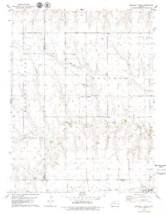
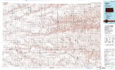
7 topographic sheets cover this place, the earliest surveyed in 1954 and the latest in 1985. It stands in Solomon Township. It lies in ZIP code area 67738. The Survey maps it on the Grinnell North quadrangle.
Topographic sheets covering this place
5 surveys from 7 printed sheetsMatched by testing this settlement's coordinate against the published boundary of every sheet in the United States Geological Survey's historical collection. Each opens the scanned sheet at the Survey.
- 1954 USGS Goodland quadrangle1:250000
- 1956 USGS Goodland quadrangle1:250000
- 1957 USGS Goodland quadrangle1:250000, 2 printings
- 1979 USGS Grinnell North quadrangle1:24000
- 1985 USGS Oakley quadrangle1:100000, 2 printings



Storms near this place
60 of 79 shownRegional context, not property-specific evidence. The National Weather Service names Angelus in 79 storm reports between 1995 and 2025: 41 hail, 25 thunderstorm wind, 10 tornado, 1 funnel cloud. No death or injury is recorded in these reports. Each account below is quoted exactly as the forecast office filed it, from the NOAA Storm Events Database, and each date opens the federal record of that event.
| When | Event | Place named | Harm | What the report says |
|---|---|---|---|---|
| May 2025 | Tornado (EF3) | Angelus | $120,000 | The same supercell which produced Grinnell tornado produced another EF3 tornado in Sheridan County, which led to damage to portions of a homestead. The worst damage was broken bolts and metal brackets of a metal frame that was bolted into concrete. The tornado also removed the roof from a barn nearby, as well as leveling a cinderblock garage and removing/destroying wooden and metal grain bins. The tornado started just northwest of CR 110 S and 40W based on Sentinel satellite data, crossed CR 90 S and 80 S, then lifted just northwest of County Road 406 and CR 20 W intersection based on the same Sentinel data as well. |
| May 2025 | Tornado (EF2) | Angelus | $50,000 | Based on damage and satellite footage, a second corridor of damage occurred northwest of the homestead. The damage tracks of the two tornadoes merge at the end point of this tornado. This tornado twisted a pivot, broke several power poles, and removed tree tops from the west edge of the windbreak. |
| May 2025 | Thunderstorm Wind | Angelus | $10,000 | Part of a irrigation pivot was tipped over. |
| May 2008 | Hail | Angelus | $10,000 | NSSL SHAVE project relayed a half dozen reports of large hail from 4 miles SSE Angelus to east of Angelus. The largest hail was reported at 3.5 inches in diameter with numerous reports at 1.5 to 2.5 inches. |
| June 2006 | Thunderstorm Wind | Angelus | $5,000 | 8 inch diameter tree limb and power lines downed. |
| May 2017 | Thunderstorm Wind | Angelus | $2,000 | A flag pole was snapped in half, two wind chimes were lost and a couple of trees were blown down. |
| June 2006 | Thunderstorm Wind | Angelus | $1,000 | Outside work shed destroyed. |
| May 2025 | Tornado (EF3) | Angelus | - | Continuation of the Gove County tornado that impacted Grinnell. |
| July 2024 | Thunderstorm Wind | Angelus | - | Report of a shed picked up, thrown an unknown distance and destroyed. |
| June 2023 | Hail | Angelus | - | Report of Golf Ball sized hail. |
| June 2023 | Hail | Angelus | - | The hail started out ping pong ball size then decreased to pea size by the end. |
| August 2023 | Hail | Angelus | - | Ping pong to tennis balls sized hail reported at location. Damage done to pickup truck and entire east side of the house. Time is estimated by radar. |
| August 2023 | Hail | Angelus | - | Golf ball sized hail reported at location. |
| August 2023 | Hail | Angelus | - | Report received of golf ball sized hail at location. Hail caused trees to lose most of their leaves. |
| April 2022 | Tornado (EF1) | Angelus | - | Upon further review and information/video gathered, it was determined that a tornado moved across extreme southern Sheridan County. This tornado was confirmed by damage from NWS Storm Survey, tornado chaser video, and a brief/weak tornadic debris signature on NWS Goodland WSR 88D radar imagery. Damage consisted of several large healthy tree limbs snapped, one treat snapped near the base, and a power pole down. Based on the damage, maximum wind speed was determined to be 100 mph. |
| June 2022 | Hail | Angelus | - | Pea to puarter sized hail reported via Social Media. |
| May 2021 | Hail | Angelus | - | Trained spotter reported hail up to 1 inch in size for a 10 minute duration. |
| August 2021 | Hail | Angelus | - | The hail ranged from quarter to golf ball in size. |
| August 2021 | Hail | Angelus | - | The hail ranged for quarter to golf ball in size. |
| September 2021 | Thunderstorm Wind | Angelus | - | A reported 60 mph wind gust occurred as a strong thunderstorm moved over the location. |
| September 2021 | Hail | Angelus | - | A trained spotter observed penny to quarter sized hail as a thunderstorm moved over the location. |
| July 2020 | Hail | Angelus | - | A citizen reported hail between a nickel and quarter in size. |
| April 2019 | Hail | Angelus | - | The hail was nickel size, with some stones a little larger in size. The roads were completely covered with hail. |
| July 2019 | Thunderstorm Wind | Angelus | - | A wind gust to 70 mph was estimated by the public from a severe thunderstorm. |
| June 2018 | Thunderstorm Wind | Angelus | - | An estimated wind gust of 75 MPH was reported. |
| June 2018 | Hail | Angelus | - | The hail ranged from pea to quarter in size, with the hail covering the ground. |
| May 2017 | Hail | Angelus | - | A mix of rain and hail continued through 3 AM CDT. No hail size was given past the time of this report. |
| May 2017 | Thunderstorm Wind | Angelus | - | Public report of an estimated 80 mph wind gust. |
| May 2015 | Tornado (EF0) | Angelus | - | Chaser reported a large tornado on the ground moving north. |
| November 2015 | Tornado (EF1) | Angelus | - | The tornado moved north-northeast out of Gove county into Sheridan county, east of Rd 10W in Sheridan county and the Gove Ee intersection. Law enforcement reported power lines down along K-23 where the tornado crossed the highway 15 miles south of Hoxie. Power poles were also blown down 13 miles south and 1 east of Hoxie. Just east of road 80S/40E intersection 8.5 miles southeast of Hoxie, grain bins and power lines were damaged, and two stock trailers were flipped over. Minor damage was reported to the house there, and a 20'x40' shop was destroyed. Not long after causing this damage the tornado track shifted more to the north. The tornado track ended south of Tasco where damage was done to a home and some outbuildings. |
| October 2011 | Flood | Angelus | - | Observers reported rainfall close to four inches across parts of Sheridan county, with Doppler radar estimating that some areas south and east of Hoxie may have received closer to six or seven inches. Reports from neighboring counties with similar rainfall totals indicated some county roads were washed out and many remained impassible through the day. |
| October 2011 | Flash Flood | Angelus | - | Water over Kansas State Highway 23 just south of Hoxie. Doppler radar estimated a large band of up to seven inches of rain may have occurred south and east of Hoxie. This event transitioned into an areal flood event as lighter rains continued overnight keeping county roads under water. |
| June 2011 | Thunderstorm Wind | Angelus | - | The spotter estimated peak winds near 60 mph. |
| June 2010 | Tornado (EF0) | Angelus | - | A brief tornado developed and remained over open fields with no known damage. |
| May 2008 | Tornado (EF0) | Angelus | - | This tornado moved into southern Sheridan county from Gove county, and remained over open fields until dissipation 9 miles SW of Hoxie. |
| May 2007 | Tornado (EF0) | Angelus | - | Brief tornado, report relayed by Sheridan county sheriff office. Time of original report adjusted slightly based on Doppler radar signature. No known damage...over open fields. |
| July 2005 | Hail | Angelus | - | Dime to quarter size hail covered ground. |
| August 2004 | Hail | Angelus | - | Hail completely covered the ground. |
| August 2004 | Hail | Angelus | - | Hail forced drivers on Interstate 70 to pull off the road. |
| May 2001 | Tornado (F0) | Angelus | - | Tornado destroyed empty grain bin and tore out a mulberry tree. |
| July 2000 | Thunderstorm Wind | Angelus | - | Wind turned over sprinkler system. |
| July 1999 | Thunderstorm Wind | Angelus | - | 3 to 6 inch limbs down. |
| May 1998 | Hail | Angelus | - | Nickel to quarter size hail also reported 6ESE of Angelus at 2124 CST. |
| May 1995 | Hail | Angelus | - | Hail broke windows. |
| July 1995 | Hail | Angelus | - | Thunderstorm winds gusting to 70 mph accompanied the hail. |
| July 1995 | Thunderstorm Wind | Angelus | - | Thunderstorm winds broke one to four inch diameter branches. |
| July 2024 | Hail | Angelus | - | no account filed |
| August 2019 | Hail | Angelus | - | no account filed |
| June 2018 | Hail | Angelus | - | no account filed |
| June 2017 | Hail | Angelus | - | no account filed |
| June 2017 | Hail | Angelus | - | no account filed |
| May 2014 | Thunderstorm Wind | Angelus | - | no account filed |
| September 2012 | Thunderstorm Wind | Angelus | - | no account filed |
| September 2012 | Hail | Angelus | - | no account filed |
| June 2011 | Hail | Angelus | - | no account filed |
| June 2011 | Hail | Angelus | - | no account filed |
| June 2011 | Thunderstorm Wind | Angelus | - | no account filed |
| May 2010 | Hail | Angelus | - | no account filed |
| August 2009 | Hail | Angelus | - | no account filed |
| May 2008 | Thunderstorm Wind | Angelus | - | no account filed |
Nearest settlements
The eight closest, with where each one stands in the county. Distances are straight-line, computed from the Geographic Names Information System coordinates.
Provenance
This settlement is recorded in the Geographic Names Information System as feature 471308. The sheet list is computed by point-in-boundary test against the United States Geological Survey's historical topographic inventory. Both are works of the United States government and carry no copyright under 17 U.S.C. 105.
Storms. NOAA National Centers for Environmental Information, Storm Events Database https://www.ncei.noaa.gov/stormevents/ A work of the United States government, no copyright under 17 U.S.C. 105. Narratives are quoted verbatim from the National Weather Service report and are not edited or summarised.