 Block
Selden, Kansas
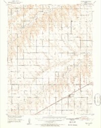
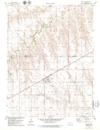
9 topographic sheets cover this place, the earliest surveyed in 1951 and the latest in 1985. It stands in Sheridan Township. It lies in ZIP code area 67757. The Survey maps it on the Selden quadrangle. 184 people lived here at the 2020 count. It stands 2,835 feet above sea level.
Research this city
Population over time
2 figuresSelden fell from 219 to 184 between 2010 and 2020. These are the recorded population figures Wikidata holds for this place, reached through the Geographic Names Information System number this page is keyed on rather than by name, so they belong to this place and not to another of the same name. Most are census counts, but not all are: an early figure may be a founding or settlement estimate, and an estimate published within five years of a census is left out. The change column is computed, and is left blank where more than 20 years separate a figure from the one before it, because a gap that long is not a change between two counts.
| Year | People | Change |
|---|---|---|
| 2010 | 219 | |
| 2020 | 184 | -35 (-16%) |
Topographic sheets covering this place
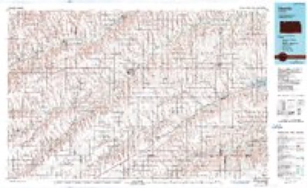
6 surveys from 9 printed sheetsMatched by testing this settlement's coordinate against the published boundary of every sheet in the United States Geological Survey's historical collection. Each opens the scanned sheet at the Survey.
- 1951 USGS Selden quadrangle1:62500, 2 printings
- 1954 USGS Goodland quadrangle1:250000
- 1956 USGS Goodland quadrangle1:250000
- 1957 USGS Goodland quadrangle1:250000, 2 printings
- 1978 USGS Selden quadrangle1:24000
- 1985 USGS Oberlin quadrangle1:100000, 2 printings



Fires near this place
1 since 2018Regional context, not property-specific evidence. The federal wildfire occurrence database lists 1 fire within 5 miles of Selden in 2018, burning about 1 acre in total. None started naturally. None was recorded as arson. Distance is straight-line from the map coordinates, so a fire counted here may appear on a neighbouring settlement's page as well.
| Reported cause | Fires |
|---|---|
| Equipment and vehicle use | 1 |
The most recent of them, most recent first, with the day each was reported and the service that recorded it.
| Date | Cause | Size | Reported by | Name on the report |
|---|---|---|---|---|
| 17 May 2018 | Equipment and vehicle use | 1.0 acres | Kansas Forest Service | 6 |
Storms near this place
60 of 92 shownRegional context, not property-specific evidence. The National Weather Service names Selden in 92 storm reports between 1995 and 2025: 49 hail, 27 thunderstorm wind, 12 tornado, 4 flash flood. No death or injury is recorded in these reports. Each account below is quoted exactly as the forecast office filed it, from the NOAA Storm Events Database, and each date opens the federal record of that event.
| When | Event | Place named | Harm | What the report says |
|---|---|---|---|---|
| April 2008 | Hail | Selden | $670,000 | Follow-up newspaper reports indicated significant window and roof damage in the town of Selden. Emergency manager estimated around 75% of the homes in Selden had some type of window or siding damage on the north side. Most hail was of golf ball size with the largest being softball. The grade school was closed the following day due to roof and water damage. |
| May 2008 | Tornado (EF1) | Selden | $250,000 | This tornado developed SW of Selden in Sheridan county and tracked for 17.5 miles into central Decatur county SW of Oberlin. The tornado damaged outbuildings and trees at a farmstead NW of Selden producing F1 damage. |
| April 2022 | Thunderstorm Wind | Selden | $100,000 | Straight-line winds knocked down several power poles near the intersection of Highway 123, County Road 10 E, and County Road 140 N. |
| June 2024 | Thunderstorm Wind | Selden | $80,000 | Straight-line winds associated with an outflow boundary blew an irrigation pivot onto its side and ripped apart a metal outbuilding storing a tractor at a neighboring property. All damage was laying towards the north to north-northeast. |
| May 2015 | Tornado (EF2) | Selden | $75,000 | Chaser reported a large tornado on the ground moving north from Sheridan into Decatur county. Damage occurred at a farmstead with a large tree damaged, minor roof damage and an antenna blown over near Selden. Another resident reported a barn was destroyed. |
| May 1999 | Hail | Selden | $50,000 | no account filed |
| May 2023 | Flash Flood | Selden | $5,000 | Sheridan County Law Enforcement reported water of an unknown depth flowing over the roads at the location, but deep enough to close the roads temporarily. An estimated three to four inches of rainfall fell over the location. |
| June 2025 | Thunderstorm Wind | Selden | - | PWS site KKSSELDE20 reported gusts between 58 and 61 mph. |
| September 2025 | Hail | Selden | - | Most of the hail was pea size. |
| July 2024 | Thunderstorm Wind | Selden | - | KKSSELDE4 Wunderground station reported the wind gust. |
| June 2024 | Thunderstorm Wind | Selden | - | Reported via Ambient weather station - Home station Selden. |
| June 2024 | Hail | Selden | - | About four or five hail stones the size of golf balls fell in town. |
| May 2023 | Tornado (EFU) | Selden | - | Tornado reported northwest of Selden, KS. Tornado remained over open fields along the Sheridan and Decatur County borders. No damage was reported as a result of this tornado. |
| May 2023 | Hail | Selden | - | Sheridan County Dispatch relayed a report of pea to nickel sized hail that was accumulating to a depth of one to two inches. |
| May 2023 | Thunderstorm Wind | Selden | - | Wind damage to farm outbuildings, irrigation pivots, and street signs. Seems to be an RFD from an intensifying supercell that produced the tornado northwest of Selden, KS. |
| May 2023 | Thunderstorm Wind | Selden | - | Over a duration of ten minutes a thunderstorm produced 59 to 81 mph winds. The strongest gust occurred at 4:37 pm. |
| June 2023 | Hail | Selden | - | Torrential rainfall accompanied the hail. |
| July 2023 | Hail | Selden | - | Law enforcement reports hail up to a quarter size or larger in Selden, KS. Time is radar estimated. |
| July 2023 | Thunderstorm Wind | Selden | - | Mesonet station reported a 60 mph thunderstorm wind gust at location. |
| April 2022 | Thunderstorm Wind | Selden | - | Reported via Weather Underground. Mesonet station KKSSELDE4 reported a 58 mph wind gust as a thunderstorm approached the site over the northwest corner of Sheridan County. |
| April 2022 | Tornado (EF1) | Selden | - | A quasi-linear convective system (QLCS) tornado formed in far northern Sheridan County before crossing into southern Decatur County. Damage consisted of highway signs down and/or twisted, a tree trunk was snapped, a few blown over irrigation pivots, and a railroad crossing gate was destroyed. |
| May 2021 | Thunderstorm Wind | Selden | - | Reported via Weather Underground, mesonet station KKSSELDE4 measured a wind gust of 66 mph. |
| June 2021 | Thunderstorm Wind | Selden | - | Mesonet station reported a 67 mph thunderstorm wind gust at location. |
| August 2021 | Hail | Selden | - | Report received of dime to nickel sized hail at location. Time is radar-estimated. |
| August 2021 | Hail | Selden | - | Report received of quarter sized hail at location. Time is radar-estimated. |
| May 2021 | Tornado (EF1) | Selden | - | A large, multi-vortex tornado moved across northwestern Sheridan County, Kansas, impacting the town of Selden. The tornado started west of town initially and moved slowly to the east, eventually crossing Highway 83. As the tornado crossed the highway, it started to impact structures on the west side of Selden, and eventually moving across the town. In town, damage was widespread and quiet concentrated. At one point, the tornado reached a width of one half mile wide. Damage consisted of thousands of broken tree limbs, hundreds of uprooted and snapped trees, shingles off and pieces of roofing removed from residences and buildings, many farm outbuildings either missing roofing material, walls damaged, and/or the building completely collapsed and removed from its foundation, windows broken out of houses, buildings, and vehicles, snapped power poles, overturned irrigation pivots, overturned semis and rail cars, and several grain silos blown over.||The tornado then proceeded to the east, exiting town and heading towards the Highway 83 and Highway 383 split. There were a few more irrigation pivots overturned, as well as power poles snapped. The tornado appeared to dissipate as it neared the Highway 83 and Highway 383 split due to a lack of any visible damage at that intersection.||The challenge with this survey was there were multiple vortices causing damage. Therefore, there were a few areas of more concentrated high-end EF-1 damage with broad/widespread EF-0 to EF-1 damage.||There was one minor injury with this event. The town tornado sirens were not functioning as a result of a power outage. Therefore, fire fighters jumped into their vehicles to drive through town to warn people of the coming tornado. Powerlines fell upon one of the trucks, striking a fire fighter in the back of the neck. Injury was treated on scene. |
| July 2020 | Thunderstorm Wind | Selden | - | Mesonet station reported a 59 mph thunderstorm wind gust at location. |
| May 2019 | Flash Flood | Selden | - | Dispatch reported Highway 283 in Selden flooded around 425 pm mdt but as of 510 pm mdt the water has receded. |
| June 2018 | Flash Flood | Selden | - | Flooding was reported on the east and west sides of town along Highway 83. The depth in the middle of the highway was six inches, increasing to 12 inches deep on the edge of the highway. Roughly 150 feet of highway was flooded. |
| June 2017 | Hail | Selden | - | Quite a bit of nickel size hail. |
| September 2016 | Thunderstorm Wind | Selden | - | Estimated wind gusts of 60-70 MPH occurred with the storm. |
| September 2016 | Flash Flood | Selden | - | Flash flooding was reported near the intersection of CR 130 N and Highway 23. Law enforcement reported the flash flooding was impacting Highway 23. Radar estimates around two inches of heavy rainfall occurred from the repeated rounds of storm activity over this location. |
| November 2015 | Hail | Selden | - | Quarter size hail is covering the ground. |
| June 2015 | Hail | Selden | - | Nickel to quarter size hail on Highway 83. |
| June 2015 | Tornado (EF0) | Selden | - | A brief tornado was reported west of Selden near Highway 83. |
| July 2014 | Hail | Selden | - | Hail was mostly quarter size but a few stones were as large as half dollars. |
| June 2011 | Hail | Selden | - | Storm chaser encountered hail near the intersection of Highway 9 and 23. |
| June 2011 | Tornado (EF0) | Selden | - | The tornado was brief and remained over open fields with no known damage. |
| August 2009 | Hail | Selden | - | Heavy rain totaling 0.90 inches fell in about a 20 minute period. |
| May 2008 | Tornado (EF0) | Selden | - | Tornado occurred over open country with no known damage. |
| May 2008 | Tornado (EF0) | Selden | - | This brief tornado remained over open country with no known damage. |
| June 2007 | Hail | Selden | - | This report was relayed via the NSSL SHAVE project. |
| June 2007 | Hail | Selden | - | This report was relayed via the NSSL SHAVE project. |
| June 2000 | Tornado (F0) | Selden | - | Brief Touchdown in open field. |
| October 2000 | Tornado (F0) | Selden | - | Tornado moved through extreme northwest corner of Sheridan County. The tornado traveled from Thomas County, then quickly exited into Decatur County. |
| May 2023 | Hail | Selden | - | no account filed |
| May 2023 | Thunderstorm Wind | Selden | - | no account filed |
| May 2023 | Thunderstorm Wind | Selden | - | no account filed |
| May 2023 | Thunderstorm Wind | Selden | - | no account filed |
| May 2023 | Hail | Selden | - | no account filed |
| May 2023 | Hail | Selden | - | no account filed |
| September 2023 | Thunderstorm Wind | Selden | - | no account filed |
| July 2022 | Thunderstorm Wind | Selden | - | no account filed |
| July 2022 | Hail | Selden | - | no account filed |
| July 2020 | Thunderstorm Wind | Selden | - | no account filed |
| June 2017 | Hail | Selden | - | no account filed |
| June 2017 | Thunderstorm Wind | Selden | - | no account filed |
| October 2017 | Hail | Selden | - | no account filed |
| July 2017 | Thunderstorm Wind | Selden | - | no account filed |
| May 2016 | Hail | Selden | - | no account filed |
Nearest settlements
The eight closest, with where each one stands in the county. Distances are straight-line, computed from the Geographic Names Information System coordinates.
Elsewhere
Matched on this settlement's Geographic Names Information System number rather than its name, so it cannot be a different place of the same name in another state.
| Wikipedia article on Selden | An encyclopaedic summary. Its text is share-alike, so it is linked here rather than copied. |
| Wikidata item Q2188667 | The structured record the population and elevation above come from. Public domain (CC0). |
Provenance
This settlement is recorded in the Geographic Names Information System as feature 471107. The sheet list is computed by point-in-boundary test against the United States Geological Survey's historical topographic inventory. Both are works of the United States government and carry no copyright under 17 U.S.C. 105.
Wildfire. Short, Karen C. 2022. Spatial wildfire occurrence data for the United States, 1992-2020 [FPA_FOD_20221014]. 6th Edition. Fort Collins, CO: Forest Service Research Data Archive. https://doi.org/10.2737/RDS-2013-0009.6 Collected with United States Government funding and usable without additional permissions or fees.
Storms. NOAA National Centers for Environmental Information, Storm Events Database https://www.ncei.noaa.gov/stormevents/ A work of the United States government, no copyright under 17 U.S.C. 105. Narratives are quoted verbatim from the National Weather Service report and are not edited or summarised.