 Block
Tasco, Kansas
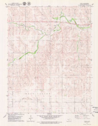
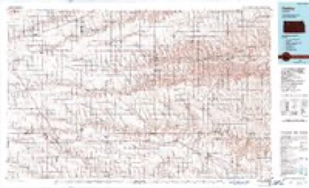
7 topographic sheets cover this place, the earliest surveyed in 1954 and the latest in 1985. It stands in Valley Township. It lies in ZIP code area 67740. It stands on Cortez Creek. The Survey maps it on the Tasco quadrangle. It stands 2,500 feet above sea level.
Topographic sheets covering this place
5 surveys from 7 printed sheetsMatched by testing this settlement's coordinate against the published boundary of every sheet in the United States Geological Survey's historical collection. Each opens the scanned sheet at the Survey.
- 1954 USGS Goodland quadrangle1:250000
- 1956 USGS Goodland quadrangle1:250000
- 1957 USGS Goodland quadrangle1:250000, 2 printings
- 1979 USGS Tasco quadrangle1:24000
- 1985 USGS Oakley quadrangle1:100000, 2 printings



Fires near this place
1 since 2018Regional context, not property-specific evidence. The federal wildfire occurrence database lists 1 fire within 5 miles of Tasco in 2018, burning under an acre in total. None started naturally. None was recorded as arson. Distance is straight-line from the map coordinates, so a fire counted here may appear on a neighbouring settlement's page as well.
| Reported cause | Fires |
|---|---|
| Missing data/not specified/undetermined | 1 |
The most recent of them, most recent first, with the day each was reported and the service that recorded it.
| Date | Cause | Size | Reported by | Name on the report |
|---|---|---|---|---|
| 17 May 2018 | Missing data/not specified/undetermined | under an acre | Kansas Forest Service | 1800013 |
Storms near this place
60 of 88 shownRegional context, not property-specific evidence. The National Weather Service names Tasco in 88 storm reports between 1993 and 2026: 63 hail, 18 thunderstorm wind, 5 tornado, 2 flash flood. No death or injury is recorded in these reports. Each account below is quoted exactly as the forecast office filed it, from the NOAA Storm Events Database, and each date opens the federal record of that event.
| When | Event | Place named | Harm | What the report says |
|---|---|---|---|---|
| May 2008 | Tornado (EF2) | Tasco | $1,000,000 | This tornado moved into southern Sheridan county from Gove county. It initially moved NNE, then straight north on Road 120E then turned back to the NNW before dissipating near Road 50S and 100E in Sheridan county. Approximately five miles of utility poles were broken or heavily damaged from a combination of tornado and rear flank downdraft winds. In addition, several farmsteads suffered damage to the home and outbuildings. A mobile home was blown off its supports and into a nearby home which was destroyed as a result. |
| May 2008 | Hail | Tasco | $100,000 | Over a dozen hail reports received via the NSSL SHAVE project with sizes between 1.0 and 2.5 inches. Extremely heavy rain was also reported. |
| May 2008 | Flash Flood | Tasco | $100,000 | Extremely heavy rainfall occurred in association with several rounds of supercell thunderstorms during the afternoon and early evening hours. County roads were reported impassible in many areas. |
| August 2006 | Thunderstorm Wind | Tasco | $30,000 | Strong wind from thunderstorm outflow pushed a large pole barn off its foundation. Time estimated from nearby severe reports. |
| May 2008 | Thunderstorm Wind | Tasco | $25,000 | A large machine shed was destroyed, apparently by thunderstorm winds, with pieces blown about a half mile from the original location. Nearby, the homeowner's residence suffered minor roof damage. |
| August 1997 | Thunderstorm Wind | Tasco | $10,000 | Wind estimated 70 to 80 mph damaged camper and brought down large tree limbs at Sheridan Lake. At Studley, estimated 70 mph winds brought down tree limbs. |
| June 2014 | Thunderstorm Wind | Tasco | $3,000 | Six to eight inch diameter tree limbs blown down along with .80 of rainfall. Estimated time of report from radar. |
| August 2017 | Thunderstorm Wind | Tasco | $2,000 | The antenna was torn from the house. |
| April 2026 | Hail | Tasco | - | Quite a bit of hail fell, but not enough to measure for a depth. |
| May 2025 | Hail | Tasco | - | A public report of hail up to penny size. |
| July 2024 | Hail | Tasco | - | Public report of dime to quarter sized hail. |
| April 2024 | Hail | Tasco | - | Pea to around quarter sized hail fell over a duration of seven minutes. |
| June 2023 | Thunderstorm Wind | Tasco | - | Measured at a personal weather station. |
| July 2023 | Hail | Tasco | - | The hail ranged from golf ball to lime size. |
| July 2021 | Hail | Tasco | - | Caller reported various sized hail, mostly pea to dime in size with a few quarter sized stones mixed in. |
| October 2021 | Hail | Tasco | - | Pea to nickel sized hail covered half the ground at the location. The spotter also noted the hail was bouncing at least 3 ft off the ground. |
| July 2020 | Thunderstorm Wind | Tasco | - | Report received via social media of a personal weather station recording a peak wind gust of 67 mph. Time is radar estimated. Report also mentioned power lines down on the ground nearby. |
| May 2019 | Hail | Tasco | - | The hail ranged from pea to dime size, lasting for 10 minutes. |
| May 2018 | Tornado (EF0) | Tasco | - | A weak tornado formed south of Tasco near the Gove County line during the development of a thunderstorm. No information was given regarding the path width or duration of the tornado. |
| June 2018 | Thunderstorm Wind | Tasco | - | Estimated the wind gusts to be 65 MPH. |
| June 2017 | Hail | Tasco | - | The time of the report was estimated by radar. Difficult to be sure of time due to many storms around location of report. |
| June 2017 | Hail | Tasco | - | The report was second hand information. |
| August 2017 | Thunderstorm Wind | Tasco | - | Children's swing set was blown over. |
| August 2017 | Hail | Tasco | - | The hail ranged from 0.50-0.75, covering the ground. |
| November 2015 | Thunderstorm Wind | Tasco | - | Power lines blown down across the county road. Radar estimated wind speeds of 74 mph at the time the lines were blown down. |
| October 2013 | Hail | Tasco | - | Strong winds also reported, along with zero visibility. |
| March 2013 | Hail | Tasco | - | The ground is completely covered with hail. |
| May 2013 | Hail | Tasco | - | Some brief gusts were also reported with the hail. No estimate was given for the strength of the gusts. |
| June 2012 | Thunderstorm Wind | Tasco | - | Estimated the wind gusts to be 50 to 60 MPH. |
| July 2009 | Hail | Tasco | - | Most hail was quarter sized. |
| July 2009 | Hail | Tasco | - | Resident also reported 1.71 inches of rain. |
| July 2009 | Hail | Tasco | - | Strong winds and very heavy rainfall was also reported. |
| May 2008 | Tornado (EF0) | Tasco | - | Tornado report relayed from the National Spotter Network. Tornado remained over open countryside with no known damage. |
| June 2007 | Hail | Tasco | - | This report was relayed via the NSSL SHAVE project. |
| June 2007 | Hail | Tasco | - | This report was relayed via the NSSL SHAVE project. |
| June 2007 | Tornado (EF0) | Tasco | - | Tornado developed about 3 SE of Tasco and lasted 18 minutes...dissipating 5 SE of Tasco. Tornado remained over open fields with no known damage.| |
| May 2006 | Hail | Tasco | - | Via NSSL. |
| May 2006 | Hail | Tasco | - | Via NSSL. |
| May 2006 | Hail | Tasco | - | Via NSSL. |
| April 2005 | Flash Flood | Tasco | - | Water over roads near Tasco. |
| June 2005 | Thunderstorm Wind | Tasco | - | A hog shed was moved by winds estimated at 80 mph. Power lines down...no power in much of Tasco. 4-5 inch diameter tree limbs down with one tree limb reportedly piercing a house. |
| August 2004 | Hail | Tasco | - | Some vehicles damaged by hail. |
| July 2002 | Thunderstorm Wind | Tasco | - | Quansit hut pushed off foundation. |
| April 2001 | Thunderstorm Wind | Tasco | - | Occasional gusts exceeding 58 mph persisted nearly 25 minutes. |
| October 1997 | Thunderstorm Wind | Tasco | - | Spotter estimated gust to near 60 mph. |
| May 1995 | Tornado (F2) | Tasco | - | Tornado snapped large trees. |
| April 2024 | Hail | Tasco | - | no account filed |
| July 2023 | Hail | Tasco | - | no account filed |
| July 2023 | Hail | Tasco | - | no account filed |
| October 2021 | Hail | Tasco | - | no account filed |
| September 2019 | Hail | Tasco | - | no account filed |
| May 2017 | Hail | Tasco | - | no account filed |
| June 2017 | Hail | Tasco | - | no account filed |
| June 2017 | Hail | Tasco | - | no account filed |
| June 2017 | Hail | Tasco | - | no account filed |
| October 2017 | Hail | Tasco | - | no account filed |
| October 2017 | Hail | Tasco | - | no account filed |
| November 2015 | Hail | Tasco | - | no account filed |
| August 2013 | Hail | Tasco | - | no account filed |
| August 2013 | Hail | Tasco | - | no account filed |
Nearest settlements
The eight closest, with where each one stands in the county. Distances are straight-line, computed from the Geographic Names Information System coordinates.
Elsewhere
Matched on this settlement's Geographic Names Information System number rather than its name, so it cannot be a different place of the same name in another state.
| Wikipedia article on Tasco | An encyclopaedic summary. Its text is share-alike, so it is linked here rather than copied. |
| Wikidata item Q48849186 | The structured record the population and elevation above come from. Public domain (CC0). |
Provenance
This settlement is recorded in the Geographic Names Information System as feature 471276. The sheet list is computed by point-in-boundary test against the United States Geological Survey's historical topographic inventory. Both are works of the United States government and carry no copyright under 17 U.S.C. 105.
Wildfire. Short, Karen C. 2022. Spatial wildfire occurrence data for the United States, 1992-2020 [FPA_FOD_20221014]. 6th Edition. Fort Collins, CO: Forest Service Research Data Archive. https://doi.org/10.2737/RDS-2013-0009.6 Collected with United States Government funding and usable without additional permissions or fees.
Storms. NOAA National Centers for Environmental Information, Storm Events Database https://www.ncei.noaa.gov/stormevents/ A work of the United States government, no copyright under 17 U.S.C. 105. Narratives are quoted verbatim from the National Weather Service report and are not edited or summarised.