 Block
Ash Grove, Kansas
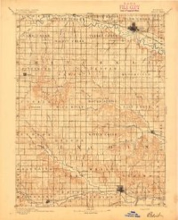
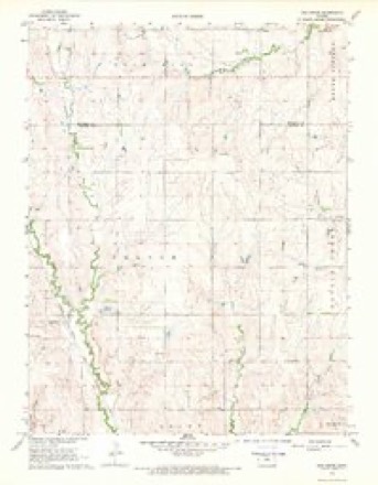
12 topographic sheets cover this place, the earliest surveyed in 1894 and the latest in 1985. It stands in Orange Township. It lies in ZIP code area 67481. The Survey maps it on the Ash Grove quadrangle.
Topographic sheets covering this place
5 surveys from 12 printed sheetsMatched by testing this settlement's coordinate against the published boundary of every sheet in the United States Geological Survey's historical collection. Each opens the scanned sheet at the Survey.
- 1894 USGS Beloit quadrangle1:125000, 3 printings
- 1955 USGS Beloit quadrangle1:250000, 3 printings
- 1959 USGS Beloit quadrangle1:250000, 3 printings
- 1968 USGS Ash Grove quadrangle1:24000
- 1985 USGS Beloit quadrangle1:100000, 2 printings
Storms near this place
60 of 63 shownRegional context, not property-specific evidence. The National Weather Service names Ash Grove in 63 storm reports between 1997 and 2026: 30 thunderstorm wind, 28 hail, 2 flood, 1 tornado. No death or injury is recorded in these reports. Each account below is quoted exactly as the forecast office filed it, from the NOAA Storm Events Database, and each date opens the federal record of that event.
| When | Event | Place named | Harm | What the report says |
|---|---|---|---|---|
| June 2013 | Thunderstorm Wind | Ash Grove | $25,000 | A wind generator was destroyed. |
| June 2013 | Thunderstorm Wind | Ash Grove | $20,000 | One side of a building was torn off. The details as to building type are unknown at this time. |
| June 2013 | Thunderstorm Wind | Ash Grove | $20,000 | A roof was torn off a building. The details as to building type are unknown at this time. |
| June 2011 | Flood | Ash Grove | $10,000 | Very heavy rainfall amounts on the order of 2 to nearly 4 inches from the evening on the 1st into the overnight hours produced widespread flooding across Lincoln county through the evening on the 3rd. In addition to numerous roads being closed countywide due to high water, flooding was fairly widespread along the swollen Salt Creek near Barnard, and the Saline River and Spillman creek near Lincoln and Denmark. Furthermore, the swollen Bullfoot creek produced 5 feet of water in a residence's basement; this is the only known property damage produced by the flooding. The flooding also caused widespread damage to Lincoln County crops, but crop monetary losses are unknown. The Lincoln Sentinel-Republican contributed to this report. |
| June 2013 | Thunderstorm Wind | Ash Grove | $5,000 | The winds downed power lines. The time of occurrence was estimated from radar. |
| August 2023 | Heavy Rain | Ash Grove | - | Rain fall total 24 hours of 1.88 inches. |
| August 2021 | Thunderstorm Wind | Ash Grove | - | A trained spotter measured the gust. |
| August 2021 | Thunderstorm Wind | Ash Grove | - | A trained spotter measured the gust. |
| August 2021 | Thunderstorm Wind | Ash Grove | - | Fifty to sixty mph wind gusts were reported along with dime size hail. |
| August 2021 | Thunderstorm Wind | Ash Grove | - | This was an estimated gust. |
| August 2021 | Thunderstorm Wind | Ash Grove | - | A 58 mph wind gust was reported. |
| May 2018 | Hail | Ash Grove | - | Sent via Twitter. The hail lasted for 10 minutes. |
| September 2018 | Thunderstorm Wind | Ash Grove | - | A sheriffs deputy reported the gust, while responding to a lightning induced fire. |
| June 2017 | Thunderstorm Wind | Ash Grove | - | A large tree was blown down on highway 181 near Quail Drive. |
| May 2017 | Thunderstorm Wind | Ash Grove | - | Reported on Highway 18. |
| May 2017 | Thunderstorm Wind | Ash Grove | - | Reported by a trained spotter. |
| May 2016 | Flood | Ash Grove | - | Several roads were closed across the county. More numerous near Salt Creek around Barnard. |
| July 2016 | Thunderstorm Wind | Ash Grove | - | A trained spotter reported the gust. |
| July 2016 | Thunderstorm Wind | Ash Grove | - | This was reported by a trained storm spotter. |
| June 2013 | Hail | Ash Grove | - | Very strong winds also occurred but no speeds were reported. |
| June 2013 | Thunderstorm Wind | Ash Grove | - | No damage was reported. |
| August 2011 | Thunderstorm Wind | Ash Grove | - | Winds were estimated by the Emergency Manager. |
| June 2011 | Flash Flood | Ash Grove | - | Very heavy rainfall amounts on the order of 2 to nearly 4 inches from the evening on the 1st into the overnight hours produced widespread flooding across Lincoln county. Highway 14 near Interstate 70 was closed due to high water, along with Highway 181. Many other roads across the county were closed due to high water. Unfortunately, any property damage that may have occurred as a result of the flooding is unknown. |
| June 2011 | Thunderstorm Wind | Ash Grove | - | Measured wind gust reported by a trained spotter. |
| June 2011 | Thunderstorm Wind | Ash Grove | - | Measured wind gust reported by the Emergency Manager. |
| September 2010 | Hail | Ash Grove | - | Dime size hail was accompanied by 40 to 50 mph winds. |
| May 2008 | Thunderstorm Wind | Ash Grove | - | Estimated 70 mph winds leveled wheat fields and snapped 10-inch diameter tree limbs. |
| August 2006 | Thunderstorm Wind | Ash Grove | - | Four to six inch tree limbs were blown out of trees. |
| May 1999 | Tornado (F0) | Ash Grove | - | Remaining over open country, the tornado crossed the Lincoln/Mitchell County line, 4 miles northwest of Ash Grove where it lifted just west of Hunter in extreme Southwest Mitchell County. |
| June 1998 | Hail | Ash Grove | - | About 50% of wheat crop damaged. |
| April 2026 | Hail | Ash Grove | - | no account filed |
| April 2026 | Hail | Ash Grove | - | no account filed |
| May 2022 | Hail | Ash Grove | - | no account filed |
| August 2021 | Hail | Ash Grove | - | no account filed |
| August 2021 | Hail | Ash Grove | - | no account filed |
| December 2021 | Thunderstorm Wind | Ash Grove | - | no account filed |
| June 2020 | Hail | Ash Grove | - | no account filed |
| May 2019 | Hail | Ash Grove | - | no account filed |
| May 2018 | Hail | Ash Grove | - | no account filed |
| May 2018 | Hail | Ash Grove | - | no account filed |
| May 2017 | Hail | Ash Grove | - | no account filed |
| April 2017 | Hail | Ash Grove | - | no account filed |
| May 2016 | Hail | Ash Grove | - | no account filed |
| May 2016 | Hail | Ash Grove | - | no account filed |
| September 2014 | Hail | Ash Grove | - | no account filed |
| June 2013 | Hail | Ash Grove | - | no account filed |
| April 2012 | Hail | Ash Grove | - | no account filed |
| May 2011 | Thunderstorm Wind | Ash Grove | - | no account filed |
| April 2010 | Hail | Ash Grove | - | no account filed |
| August 2009 | Hail | Ash Grove | - | no account filed |
| May 2008 | Hail | Ash Grove | - | no account filed |
| May 2006 | Hail | Ash Grove | - | no account filed |
| September 2006 | Thunderstorm Wind | Ash Grove | - | no account filed |
| June 2004 | Hail | Ash Grove | - | no account filed |
| June 2004 | Hail | Ash Grove | - | no account filed |
| July 2004 | Thunderstorm Wind | Ash Grove | - | no account filed |
| May 2003 | Thunderstorm Wind | Ash Grove | - | no account filed |
| May 2002 | Thunderstorm Wind | Ash Grove | - | no account filed |
| August 2002 | Thunderstorm Wind | Ash Grove | - | no account filed |
| May 2001 | Hail | Ash Grove | - | no account filed |
Nearest settlements
The eight closest, with where each one stands in the county. Distances are straight-line, computed from the Geographic Names Information System coordinates.
| Map | Place | Distance | Sheets |
|---|---|---|---|
| Grant | 3.3 miles | 12 | |
| Denmark | 6.4 miles | 12 | |
| Goldenrod | 9.4 miles | 12 | |
| Vesper | 9.9 miles | 12 | |
| Sylvan Grove | 10.6 miles | 12 | |
| Wolf Creek | 10.7 miles | 12 | |
| Lincoln | 14.2 miles | 12 | |
| Barnard | 17.1 miles | 13 |
Provenance
This settlement is recorded in the Geographic Names Information System as feature 472495. The sheet list is computed by point-in-boundary test against the United States Geological Survey's historical topographic inventory. Both are works of the United States government and carry no copyright under 17 U.S.C. 105.
Storms. NOAA National Centers for Environmental Information, Storm Events Database https://www.ncei.noaa.gov/stormevents/ A work of the United States government, no copyright under 17 U.S.C. 105. Narratives are quoted verbatim from the National Weather Service report and are not edited or summarised.