 Block
Bloom, Kansas
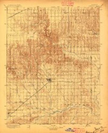
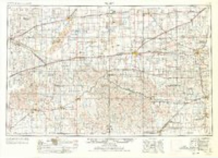
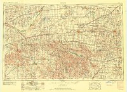
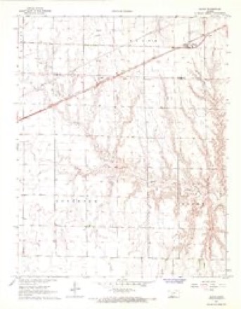
11 topographic sheets cover this place, the earliest surveyed in 1896 and the latest in 1985. It stands in Bloom Township. It lies in ZIP code area 67865. The Survey maps it on the Bloom quadrangle. It stands 2,582 feet above sea level.
Topographic sheets covering this place
5 surveys from 11 printed sheetsMatched by testing this settlement's coordinate against the published boundary of every sheet in the United States Geological Survey's historical collection. Each opens the scanned sheet at the Survey.
- 1896 USGS Ashland quadrangle1:125000, 3 printings
- 1955 USGS Pratt quadrangle1:250000, 3 printings
- 1959 USGS Pratt quadrangle1:250000, 2 printings
- 1967 USGS Bloom quadrangle1:24000
- 1985 USGS Protection quadrangle1:100000, 2 printings
Fires near this place
1 since 2017Regional context, not property-specific evidence. The federal wildfire occurrence database lists 1 fire within 5 miles of Bloom in 2017, burning about 3 acres in total. None started naturally. None was recorded as arson. Distance is straight-line from the map coordinates, so a fire counted here may appear on a neighbouring settlement's page as well.
| Reported cause | Fires |
|---|---|
| Equipment and vehicle use | 1 |
The most recent of them, most recent first, with the day each was reported and the service that recorded it.
| Date | Cause | Size | Reported by | Name on the report |
|---|---|---|---|---|
| 2 March 2017 | Equipment and vehicle use | 3.0 acres | Ford County | 1170080 |
Storms near this place
60 of 130 shownRegional context, not property-specific evidence. The National Weather Service names Bloom in 130 storm reports between 1993 and 2025: 62 hail, 37 thunderstorm wind, 14 tornado, 11 heavy rain. The reports record 1 injury. Each account below is quoted exactly as the forecast office filed it, from the NOAA Storm Events Database, and each date opens the federal record of that event.
| When | Event | Place named | Harm | What the report says |
|---|---|---|---|---|
| May 2016 | Tornado (EF3) | Bloom | 1 hurt | Family took shelter in an underground unit and was able to survive. The modular home was completely destroyed. Two vehicles were thrown about 150 yards. Another truck was carried, rolled, thrown with the bed located 1200 yards from the original location. The two occupants in the home destroyed were in a reinforced concrete bunker but one received minor injuries when a piece of pipe was driven into the wall breaking out concrete. The steal rebar prevented the chunk of pipe from penetrating into the individual. Visually at one point this tornado appeared to be strong enough to cause EF4 damage. |
| August 2022 | Thunderstorm Wind | Bloom | $500,000 | Several large grain bins were destroyed and there was a stretch of power poles broken over by the high wind. |
| May 2019 | Tornado (EF3) | Bloom | $500,000 | The tornado moved out of Clark County at 1952 LST. One farm that received EF3 damage was unoccupied at the time as the residents left their safe spot (basement) and drove 1 1/2 miles east. They left the basement, that did not have any debris in it, on the advice of a storm chaser that was following the tornado. They (Grandparents and three grand children) were very fortunate that they were not injured, if not worse. |
| February 2007 | Tornado (EF1) | Bloom | $225,000 | The second tornado to form started 6.3 miles northwest of Fowler at 1011 PM and traveled a total of 17 miles dissipating at 1040 PM 7 miles southwest of the Dodge City Post Office. It did EF1 damage to five pivot irrigation sprinklers, trees and some outbuildings...in addition to moving a 3000 gallon tank about 1/2 of a mile. |
| May 2008 | Tornado (EF1) | Bloom | $145,000 | EF1 damage was done to two pivot irrigation sprinklers and a grain bin. |
| July 2009 | Thunderstorm Wind | Bloom | $60,000 | A pivot irrigation sprinkler was overturned by the high wind. |
| September 2009 | Flood | Bloom | $25,000 | Rainfall of 5 to 8 inches in about 4 hours produced widespread farmland flooding. Some county roads were submerged after water flowed out of the fields. |
| September 2025 | Hail | Bloom | - | A public report of 1 inch hail. |
| September 2025 | Thunderstorm Wind | Bloom | - | A public report of 57 mph. |
| June 2025 | Thunderstorm Wind | Bloom | - | Mesonet station recorded a 58 mph wind gust. |
| August 2025 | Thunderstorm Wind | Bloom | - | A report of blown down tree branches. |
| July 2025 | Thunderstorm Wind | Bloom | - | The report was received from KKSBLOOM2 weather station. |
| September 2025 | Hail | Bloom | - | A social media report of 1.75 inch hail. |
| July 2023 | Thunderstorm Wind | Bloom | - | Strong winds. |
| April 2022 | Heavy Rain | Bloom | - | There was some minor flooding as the 1.56 of rain fell in 50 minutes. |
| April 2022 | Thunderstorm Wind | Bloom | - | Singles were blown off the roof. |
| June 2022 | Tornado (EF0) | Bloom | - | This was a small and brief landspout. |
| August 2021 | Hail | Bloom | - | The hail lasted about 10 minutes. |
| August 2021 | Hail | Bloom | - | There was severe roof and siding damage at this location. There was a circle of corn 1 mile west of this location that was completely destroyed by the wind driven hail. There were also power lines downed by the high wind. |
| August 2021 | Thunderstorm Wind | Bloom | - | Power lines were blown down. There was also baseball sized hail at this location causing severe roof and siding damage. |
| July 2020 | Thunderstorm Wind | Bloom | - | Winds were estimated to be at least 60 MPH. |
| May 2017 | Funnel Cloud | Bloom | - | The funnel cloud was visible for several minutes. |
| May 2017 | Tornado (EF0) | Bloom | - | This landspout moved almost due west. |
| May 2016 | Tornado (EF0) | Bloom | - | This was a brief and intermittent tornado under a second meso-cyclone that was east/northeast of the first tornado in southern Ford county. |
| June 2016 | Thunderstorm Wind | Bloom | - | Tree branches of up to 10 inches in diameter were blown down by the high wind. |
| July 2016 | Heavy Rain | Bloom | - | Rainfall of 3.06 inches was observed at a location 3 mile west of Bloom. |
| July 2016 | Thunderstorm Wind | Bloom | - | Several very large tree limbs were broken. |
| June 2014 | Thunderstorm Wind | Bloom | - | Winds were estimated to be between 65 and 70 MPH. |
| June 2013 | Hail | Bloom | - | The hail was mostly pea sized. |
| August 2013 | Flash Flood | Bloom | - | Ditches were overflowing onto highway 283 near wildfire road. |
| August 2013 | Heavy Rain | Bloom | - | Rainfall of 6.75 inches was reported. This caused widespread flooding across this part of the county. Many roads were washed out. |
| August 2013 | Heavy Rain | Bloom | - | Rainfall of 4.75 inches was reported. |
| August 2013 | Heavy Rain | Bloom | - | Rainfall of 3.50 inches was reported. |
| August 2012 | Thunderstorm Wind | Bloom | - | Trees were uprooted and a roof was torn off a building near 118 and Wrangler roads. |
| August 2012 | Thunderstorm Wind | Bloom | - | Numerous limbs of 8 to 9 inches in diameter were blown down. A vehicle was damaged by the falling debris. |
| August 2012 | Thunderstorm Wind | Bloom | - | Winds blew a 20 foot Featerlite stock trailer over, tipped over grain carts and uprooted a large tree. |
| August 2012 | Thunderstorm Wind | Bloom | - | Several campers were blown over in Bloom and at least 2 semi trailers were blown over on highway 54 east of Bloom. |
| August 2012 | Thunderstorm Wind | Bloom | - | The top half of a barn was blown off and trees were uprooted. |
| August 2012 | Thunderstorm Wind | Bloom | - | Winds were estimated at 75 MPH. |
| August 2012 | Thunderstorm Wind | Bloom | - | A 24 foot stock trailer and 500 bushel grain cart blown over. |
| June 2012 | Hail | Bloom | - | The hail ranged from penny to quarter sized. |
| May 2009 | Thunderstorm Wind | Bloom | - | This wind was estimated by the resident at this location. |
| September 2009 | Hail | Bloom | - | Most of the hail was dime sized. |
| September 2009 | Hail | Bloom | - | Thunderstorm winds of 60 mph accompanied the hail. |
| September 2009 | Thunderstorm Wind | Bloom | - | Nickel sized hail was also observed. |
| September 2009 | Heavy Rain | Bloom | - | Rainfall of 5.10 inches was measured at this location. Other unofficial amounts of up to 8 inches were reported in the vicinity. |
| May 2007 | Flood | Bloom | - | Water was over 118th road 1 mile north of Bloom rest stop...approximately six inches deep. |
| May 2007 | Heavy Rain | Bloom | - | Rainfall of 3.90 inches fell in 12 hours. Rainfall of 8.90 inches fell during the 48 hour period and at one point 2 inches fell in 30 minutes. |
| May 2006 | Heavy Rain | Bloom | - | 3.45" of rain fell overnight |
| May 2006 | Heavy Rain | Bloom | - | 3.90" of rain fell overnight. |
| May 2006 | Heavy Rain | Bloom | - | 3.40" of rain fell overnight. |
| May 2006 | Heavy Rain | Bloom | - | 4.00" of rain fell overnight. |
| May 2006 | Hail | Bloom | - | This was third hail at this location during the night/early morning. Also, nearly 4 inches of rain fell. |
| October 2006 | Tornado (F0) | Bloom | - | This was another small tornado that was ongoing at the same time as another tornado located 7 miles WNW of Bloom. |
| October 2006 | Tornado (F0) | Bloom | - | This tornado was ongoing at the same time as another that was crossing highway 283 west of this location. |
| October 2006 | Tornado (F0) | Bloom | - | This multiple vortex tornado had a debris cloud a mile wide. Other than tumble weeds, no structures were impacted. |
| October 2006 | Tornado (F0) | Bloom | - | This was a brief spinup.| |
| October 2006 | Tornado (F0) | Bloom | - | This was another separate spinup. |
| October 2006 | Tornado (F0) | Bloom | - | There were two on the ground at the same time. The other was across highway 283. There was a tremendous amount of dirt and tumble weeds in the air with this tornado that did not strike any structures. |
| June 2005 | Hail | Bloom | - | Ford county reported 60,000 acres of crop damage with 30 to 70 percent loss from hail and high wind. |
Nearest settlements
The eight closest, with where each one stands in the county. Distances are straight-line, computed from the Geographic Names Information System coordinates.
| Map | Place | Distance | Sheets |
|---|---|---|---|
| Kingsdown | 7.8 miles | 13 | |
| Ford | 12.8 miles | 14 | |
| Bucklin | 14.5 miles | 13 | |
| Wilroads | 14.9 miles | 14 | |
| Wilroads Gardens | 16.5 miles | 14 | |
| Fort Dodge | 17.1 miles | 14 | |
| Happy Homes Park | 18.4 miles | 14 | |
| South Dodge | 18.8 miles | 14 |
Elsewhere
Matched on this settlement's Geographic Names Information System number rather than its name, so it cannot be a different place of the same name in another state.
| Wikipedia article on Bloom | An encyclopaedic summary. Its text is share-alike, so it is linked here rather than copied. |
| Wikidata item Q4928138 | The structured record the population and elevation above come from. Public domain (CC0). |
Provenance
This settlement is recorded in the Geographic Names Information System as feature 470693. The sheet list is computed by point-in-boundary test against the United States Geological Survey's historical topographic inventory. Both are works of the United States government and carry no copyright under 17 U.S.C. 105.
Wildfire. Short, Karen C. 2022. Spatial wildfire occurrence data for the United States, 1992-2020 [FPA_FOD_20221014]. 6th Edition. Fort Collins, CO: Forest Service Research Data Archive. https://doi.org/10.2737/RDS-2013-0009.6 Collected with United States Government funding and usable without additional permissions or fees.
Storms. NOAA National Centers for Environmental Information, Storm Events Database https://www.ncei.noaa.gov/stormevents/ A work of the United States government, no copyright under 17 U.S.C. 105. Narratives are quoted verbatim from the National Weather Service report and are not edited or summarised.