 Block
Monument, Kansas
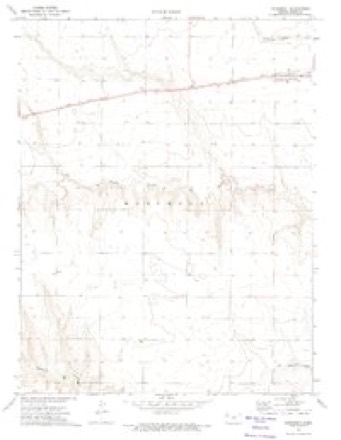
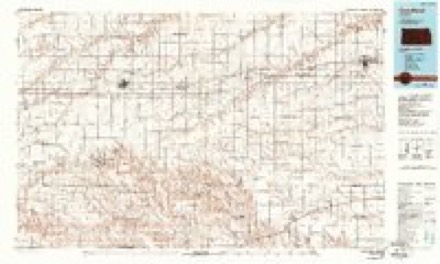
7 topographic sheets cover this place, the earliest surveyed in 1954 and the latest in 1985. It stands in Monument Township. It lies in ZIP code area 67747. The Survey maps it on the Monument quadrangle. 56 people lived here at the 2020 count. It stands 3,176 feet above sea level.
Topographic sheets covering this place
5 surveys from 7 printed sheetsMatched by testing this settlement's coordinate against the published boundary of every sheet in the United States Geological Survey's historical collection. Each opens the scanned sheet at the Survey.
- 1954 USGS Goodland quadrangle1:250000
- 1956 USGS Goodland quadrangle1:250000
- 1957 USGS Goodland quadrangle1:250000, 2 printings
- 1972 USGS Monument quadrangle1:24000
- 1985 USGS Goodland quadrangle1:100000, 2 printings



Fires near this place
3 since 2006Regional context, not property-specific evidence. The federal wildfire occurrence database lists 3 fires within 5 miles of Monument between 2006 and 2017, burning about 35 acres in total. None started naturally. None was recorded as arson. Distance is straight-line from the map coordinates, so a fire counted here may appear on a neighbouring settlement's page as well.
| Reported cause | Fires |
|---|---|
| Missing data/not specified/undetermined | 2 |
| Equipment and vehicle use | 1 |
The most recent of them, most recent first, with the day each was reported and the service that recorded it.
| Date | Cause | Size | Reported by | Name on the report |
|---|---|---|---|---|
| 30 July 2017 | Missing data/not specified/undetermined | under an acre | Logan County | 17017 |
| 22 May 2006 | Equipment and vehicle use | 35 acres | Logan County | not named |
| 6 March 2017 | Missing data/not specified/undetermined | under an acre | Logan County | 0W17002 |
Settlements close enough to share some of these fires:
Storms near this place
60 of 91 shownRegional context, not property-specific evidence. The National Weather Service names Monument in 91 storm reports between 1993 and 2025: 58 hail, 22 thunderstorm wind, 8 flash flood, 2 flood. No death or injury is recorded in these reports. Each account below is quoted exactly as the forecast office filed it, from the NOAA Storm Events Database, and each date opens the federal record of that event.
| When | Event | Place named | Harm | What the report says |
|---|---|---|---|---|
| July 1996 | Hail | Monument | $150,000 | no account filed |
| May 2017 | Thunderstorm Wind | Monument | $50,000 | An irrigation pivot was flipped over north of CR Ceder Crest between CR 380 and CR 390. |
| September 2014 | Thunderstorm Wind | Monument | $36,000 | A metal building, a 20 by 10 foot storage shed and a carport were destroyed at a residence southeast of Monument. Time of report estimated from Doppler radar. A 7 x 20 foot trailer was moved approximately 100 feet. |
| August 2011 | Thunderstorm Wind | Monument | $26,000 | A power pole was snapped one half mile south of monument. A grain bin was also blown down. Time estimated from radar. |
| August 2011 | Thunderstorm Wind | Monument | $25,000 | A semi-truck was blown over, with no injuries reported. |
| May 2017 | Thunderstorm Wind | Monument | $9,000 | About six power poles were blown down beginning at the CR Cedar Crest/CR 350 intersection and on south. Some of the poles were on the road. |
| May 2011 | Thunderstorm Wind | Monument | $8,000 | Eight power poles were reported broken near Monument with all poles laying to the east. |
| September 2009 | Flood | Monument | $5,000 | Runoff from heavy rainfall the previous evening resulted in lingering flooding through the morning of September 8. KDOT reported water remaining over US Highway 40 between Monument and Oakley the following morning. |
| October 2017 | Flash Flood | Monument | $4,000 | Logan County Road Department reported the road had been washed away from the culverts on CR Zest between CR 380 and CR 390. |
| September 2009 | Thunderstorm Wind | Monument | $2,500 | Five power poles were blown over by thunderstorm winds. |
| October 2017 | Flash Flood | Monument | $2,000 | Logan County road department reported the road was washed away around a 6'x8' box culvert on CR Seneca between CR 380 and CR 390 where Plum Creek crosses under CR Seneca. |
| October 2017 | Flash Flood | Monument | $2,000 | Logan County Road Department reported the road was closed due to flood waters cutting a deep ditch in CR 390 where Plum Creek flows under the road between CR Seneca and CR Rawhide. |
| August 2010 | Thunderstorm Wind | Monument | $2,000 | A small portion of the roof of an old church was damaged. Four-inch diameter tree limbs were blown down in town. |
| March 2025 | Thunderstorm Wind | Monument | - | Mesonet station UP841 west of Monument recorded a 60 MPH gust. Multiple gusts over the following minutes were around 55-58 MPH with another 58 MPH gust occurring at 13 minutes after the hour. |
| April 2025 | Hail | Monument | - | Nickel sized hail reported 5 miles west of Oakley on Highway 40. |
| April 2025 | Hail | Monument | - | Report of golf ball sized hail at the junction between Highway 40 and Highway 25. |
| April 2025 | Hail | Monument | - | Report of pea to nickel size hail. |
| April 2025 | Thunderstorm Wind | Monument | - | Windows were blown out of the garage. |
| June 2023 | Hail | Monument | - | Trained spotter report with photo via social media of hail up to 2 inches in diameter. |
| June 2023 | Thunderstorm Wind | Monument | - | Measured 2 miles west of Monument. |
| July 2023 | Thunderstorm Wind | Monument | - | Gusts of 66 and 64 mph were measured over 5 minutes at the UP841 Mesonet. |
| October 2023 | Hail | Monument | - | Report of hail with a few up to the size of golf balls. Mostly smaller hail around quarter size fell over the location. |
| October 2023 | Hail | Monument | - | Hail up to half dollar in size reported. |
| October 2023 | Hail | Monument | - | Hail up to quarters in size reported. Most hail was smaller in size. |
| July 2022 | Hail | Monument | - | Dime to golf ball sized hail reported. |
| July 2022 | Hail | Monument | - | Accumulating pea to penny sized hail observed over a period of three minutes. |
| May 2021 | Thunderstorm Wind | Monument | - | As a linear cluster of storms approached the town of Monument, estimated outflow wind gusts of 60 mph produced blowing dust with zero visibility. |
| May 2017 | Flash Flood | Monument | - | Three to four inches of heavy rain fell causing flood waters to run over CR 380 a half mile south of Highway 40. |
| May 2017 | Thunderstorm Wind | Monument | - | Terrible straight-line winds broke many tree limbs. Estimated time of the report from radar. |
| June 2017 | Hail | Monument | - | Quite a bit of the hail was quarter to ping-pong size. The hail has been falling for 15 minutes so far, with the hail beginning to get smaller. |
| May 2016 | Hail | Monument | - | The hail was atleast quarter size. |
| September 2016 | Hail | Monument | - | Second round of quarter size hail. |
| May 2016 | Hail | Monument | - | The hail stones ranged from ping-pong to golf ball in size. |
| June 2014 | Flash Flood | Monument | - | Extremely heavy rainfall, estimated by Doppler radar at 5-7 inches, resulted in highway and low land flooding with 18-24 inches of water flowing over roads west of Oakley. |
| April 2014 | Hail | Monument | - | A lot of pea sized hail was also reported. |
| July 2013 | Hail | Monument | - | Hail was reported to be quarter to ping pong ball size which resulted in severe damage to the corn crop in the vicinity. Cost estimates of crop damage are unknown at this time. Damage was reported near Road Zest and Road 400. |
| July 2013 | Hail | Monument | - | The hail ranged from pea to nickel size. |
| October 2011 | Flood | Monument | - | County road closed 4 miles south of Monument due to persistent heavy rainfall overnight. In addition, water was reported over numerous county roads in eastern Logan county. |
| September 2009 | Flash Flood | Monument | - | Six to eight inches of water was running across US Highway 40 between mile markers 62 and 64 west of Oakley. |
| June 2003 | Hail | Monument | - | 1/4-1/2 inch diameter hail covering the ground. |
| July 2001 | Flash Flood | Monument | - | Locally very heavy rains caused water of significant depth to run over highway 40 and highway 83. Also, many county roads were flooded. |
| June 2000 | Thunderstorm Wind | Monument | - | Small Hail accompanied the strong Winds. |
| July 2000 | Thunderstorm Wind | Monument | - | Straight Line Winds hit Monument and downed power lines and tree limbs. In addition, there was damage to vehicles and smaller structures, including part of a tin roof from a farm building. Power was out until the next day. |
| July 2000 | Flash Flood | Monument | - | Flash Flood mainly contained to low lying areas. Water was also reported running over Highway 46. |
| June 1998 | Hail | Monument | - | Also, tree limbs down. |
| May 1995 | Hail | Monument | - | Three-quarters inch hail also reported 4 SW Monument at 1219 CST. |
| June 1994 | Tornado (F1) | Monument | - | Tornado moved into Logan County from Thomas County. |
| June 1994 | Thunderstorm Wind | Monument | - | Ham radio spotter measured 70 mph winds. |
| July 1994 | Hail | Monument | - | Spotter also reported rotating wall cloud. |
| May 1993 | Hail | Monument | - | Hail damaged 140 acres of wheat. |
| May 2023 | Hail | Monument | - | no account filed |
| June 2018 | Thunderstorm Wind | Monument | - | no account filed |
| May 2017 | Hail | Monument | - | no account filed |
| June 2017 | Hail | Monument | - | no account filed |
| May 2016 | Hail | Monument | - | no account filed |
| September 2016 | Hail | Monument | - | no account filed |
| May 2016 | Hail | Monument | - | no account filed |
| May 2012 | Hail | Monument | - | no account filed |
| August 2011 | Hail | Monument | - | no account filed |
| May 2011 | Hail | Monument | - | no account filed |
Nearest settlements
The eight closest, with where each one stands in the county. Distances are straight-line, computed from the Geographic Names Information System coordinates.
| Map | Place | Distance | Sheets |
|---|---|---|---|
| Page City | 7.4 miles | 7 | |
| Oakley | 7.9 miles | 7 | |
| Winona | 12.9 miles | 7 | |
| Russell Springs | 16.1 miles | 8 | |
| McAllaster | 21.5 miles | 8 | |
| Elkader | 22.9 miles | 9 |
Elsewhere
Matched on this settlement's Geographic Names Information System number rather than its name, so it cannot be a different place of the same name in another state.
| Wikipedia article on Monument | An encyclopaedic summary. Its text is share-alike, so it is linked here rather than copied. |
| Wikidata item Q6906784 | The structured record the population and elevation above come from. Public domain (CC0). |
Provenance
This settlement is recorded in the Geographic Names Information System as feature 471338. The sheet list is computed by point-in-boundary test against the United States Geological Survey's historical topographic inventory. Both are works of the United States government and carry no copyright under 17 U.S.C. 105.
Wildfire. Short, Karen C. 2022. Spatial wildfire occurrence data for the United States, 1992-2020 [FPA_FOD_20221014]. 6th Edition. Fort Collins, CO: Forest Service Research Data Archive. https://doi.org/10.2737/RDS-2013-0009.6 Collected with United States Government funding and usable without additional permissions or fees.
Storms. NOAA National Centers for Environmental Information, Storm Events Database https://www.ncei.noaa.gov/stormevents/ A work of the United States government, no copyright under 17 U.S.C. 105. Narratives are quoted verbatim from the National Weather Service report and are not edited or summarised.