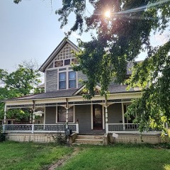
| April 2012 | Tornado (EF3) | Haysville | 38 hurt, $500,000,000 | Significant damage to homes, many of them had a number missing outer walls. Seven homes were missing two to four walls, one home was completely destroyed. The trees associated with house completely stripped to nothing, this was also the case at many other locations along the path. ||A mobile home park to south had seventy five percent of the homes uninhabitable. Approximately twenty five percent were reduced to rubble. ||Significant damage was also noted at McConnell AFB. Many of the hangars sustained damage. One hangar in particular that was owned by Spirit Aerosystems sustained a considerable amount of damage.||Several apartments and businesses also had damage like roofs being torn off and windows blown out. |
| April 2015 | Thunderstorm Wind | Haysville | 1 hurt | One person was injured when they were blown off their porch at a mobile home park. |
| May 2010 | Lightning | Haysville | $20,000 | Lightning struck a house causing a small fire. |
| July 2009 | Thunderstorm Wind | Haysville | $20,000 | Building A at Campus High School sustained roof damage due to winds around 65 mph. Fences surrounding the school's tennis courts were also damaged, and numerous tree limbs were downed surrounding the school. The Haysville Sun-Times contributed to this narrative. |
| August 2003 | Thunderstorm Wind | Haysville | $15,000 | Unspecified number of power poles and power lines downed at 71st St S./Hoover Rd intersection. (Reported by KFDI). |
| May 2002 | Thunderstorm Wind | Haysville | $10,000 | Ten inch diameter tree blown onto house. Power lines downed. |
| April 2009 | Thunderstorm Wind | Haysville | $5,000 | A few power poles were blown down. |
| May 2006 | Thunderstorm Wind | Haysville | $3,000 | Large elm trees uprooted. Relayed via KSNW Television. |
| May 2012 | Hail | Haysville | $1,000 | Occurred with very heavy rains. Some minor damage to a few cars parked at Genesis Health Club in Northeast Wichita. |
| September 2009 | Thunderstorm Wind | Haysville | $1,000 | Some tree limbs were downed and shingles were blown off a roof. |
| June 2022 | Thunderstorm Wind | Haysville | $500 | A picture on social media of a large tree branch down. |
| September 2010 | Thunderstorm Wind | Haysville | $500 | A directional sign was blown over and blocked the road. |
| October 1993 | Thunderstorm Wind | Haysville | $500 | no account filed |
| May 2014 | Hail | Haysville | $200 | The trained spotter reported small tree limbs down as well. |
| May 2019 | Flood | Haysville | $100 | Water was reported over the road near the 6500 block of Meridian. |
| May 2019 | Flood | Haysville | $100 | Water was reported over the road. |
| May 2019 | Flood | Haysville | $100 | Lots of standing water was reported south of Haysville. |
| May 2019 | Flood | Haysville | $100 | Street flooding was reported in town. |
| September 2016 | Flood | Haysville | $100 | Street flooding reported in Haysville, Kansas on south Kessler Road. |
| June 2024 | Thunderstorm Wind | Haysville | - | Public report via mPing. Three inch diameter tree limbs broken. Power poles broken. |
| May 2022 | Thunderstorm Wind | Haysville | - | A trained spotter reported the gust. |
| May 2022 | Thunderstorm Wind | Haysville | - | Small tree limbs were blown out of trees and some shingle damage was reported. |
| May 2022 | Hail | Haysville | - | Most of the hail was quarter size, however, a few the size of a ping pong ball were reported. |
| June 2022 | Hail | Haysville | - | Reported from Mping. |
| March 2021 | Hail | Haysville | - | This report is courtesy KSN TV. |
| June 2021 | Hail | Haysville | - | Report received via mPing. |
| May 2019 | Hail | Haysville | - | KWCH relayed a report of nickel to quarter-sized hail occurring at NW 47th and West St. |
| August 2018 | Thunderstorm Wind | Haysville | - | The public reported the wind gusts. |
| April 2016 | Hail | Haysville | - | The hail occurred near the Ridge Rd./NW 55th St. Intersection. |
| April 2016 | Flash Flood | Haysville | - | The E. 71st St. S./S. Broadway Intersection was flooded. |
| September 2016 | Thunderstorm Wind | Haysville | - | Picture on twitter reported a four inch diameter tree top came down on a house. |
| September 2016 | Hail | Haysville | - | Hail ranged in size from pea to quarter size hail. |
| August 2016 | Heavy Rain | Haysville | - | Considerable rain fell across far southeast Sedgwick county. Amounts varied from 4 to 8 inches across the area over a three hour period. |
| August 2016 | Flash Flood | Haysville | - | Several reports of water rescues occurred across the community. |
| May 2014 | Hail | Haysville | - | The hail was pea to nickel sized. The hail occurred on Summey Street near 63rd Street and Seneca. |
| June 2013 | Thunderstorm Wind | Haysville | - | Gusts ranging from 65-70 mph were reported by a trained spotter. |
| April 2011 | Thunderstorm Wind | Haysville | - | Penny size hail also fell with the strong winds. |
| June 2010 | Thunderstorm Wind | Haysville | - | The severe winds lasted for almost 10 minutes. |
| September 2010 | Tornado (EF0) | Haysville | - | A storm chaser also reported and had video confirming touchdown at this location. Rotation was very weak and over an open field. |
| September 2010 | Tornado (EF0) | Haysville | - | Trained spotter was at West 103rd and Ridge Road looking to the northeast and reported a weak tornado on the ground in an open field. |
| August 2009 | Hail | Haysville | - | The report was relayed by Kake-TV. |
| May 2009 | Hail | Haysville | - | Hail ranged in size from nickel size to dime size. |
| June 2008 | Hail | Haysville | - | The hail ranged in size from one inch to one and three quarters inches. The hail was reported a half mile north of 71st and Senaca. |
| May 2004 | Hail | Haysville | - | Occurred at 79th St. S/Broadway intersection. |
| June 2000 | Thunderstorm Wind | Haysville | - | Winds at least 52kts blew limbs off trees. |
| May 1995 | Thunderstorm Wind | Haysville | - | Window on the south side of a building was blown out and the roof taken off. The roof blew over the house to the north and then slammed into a second house. Numerous trees and power poles were blown down. |
| October 1994 | Thunderstorm Wind | Haysville | - | A weather spotter estimated 65 mph winds in Haysville. |
| July 2025 | Hail | Haysville | - | no account filed |
| August 2017 | Hail | Haysville | - | no account filed |
| June 2014 | Hail | Haysville | - | no account filed |
| April 2011 | Hail | Haysville | - | no account filed |
| May 2010 | Hail | Haysville | - | no account filed |
| September 2010 | Hail | Haysville | - | no account filed |
| April 2009 | Thunderstorm Wind | Haysville | - | no account filed |
| February 2008 | Hail | Haysville | - | no account filed |
| June 2008 | Thunderstorm Wind | Haysville | - | no account filed |
| May 2004 | Hail | Haysville | - | no account filed |
| May 2004 | Hail | Haysville | - | no account filed |
| June 2004 | Hail | Haysville | - | no account filed |
| May 2002 | Thunderstorm Wind | Haysville | - | no account filed |
 Block