 Block
From the record
10 National Register listings published here.
Sources: the National Register database, National Park Service
80 topographic sheets and 6 fire insurance atlases across 1 place.
10 National Register listings published here.
Sources: the National Register database, National Park Service
Taken for the Office of War Information and the Farm Security Administration, who photographed the country between 1935 and 1944. Works of United States government photographers, with no known restriction on use. Each opens its catalogue record.
Every property in this county listed on the National Register of Historic Places, with the year it was listed and the federal nomination document.
| Photograph | Property | Type | Listed | Reference |
|---|---|---|---|---|
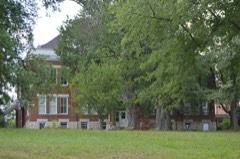 | Sue Bennett Memorial School Building | building | 1979 | 79001017 |
 | Federal Building-Courthouse | building | 1974 | 74000889 |
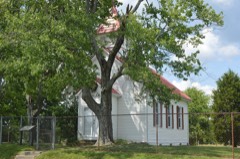 | First Evangelical Reformed Church | building | 1980 | 80001648 |
| London Downtown Historic District | district | 2011 | 11000793 | |
 | London Tuberculosis Hospital | building | 2016 | 16000503 |
 | Pennington Infirmary | building | 1987 | 87000900 |
 | Poynter Building | building | 1985 | 85001745 |
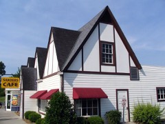 | Harland Sanders Cafe | building | 1990 | 90001169 |
| Wildcat Battlefield Site | site | 1979 | 79001018 | |
| Wildcat Mountain Battlefield (Boundary Increase) | site | 2006 | 06000808 |
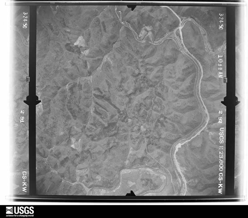
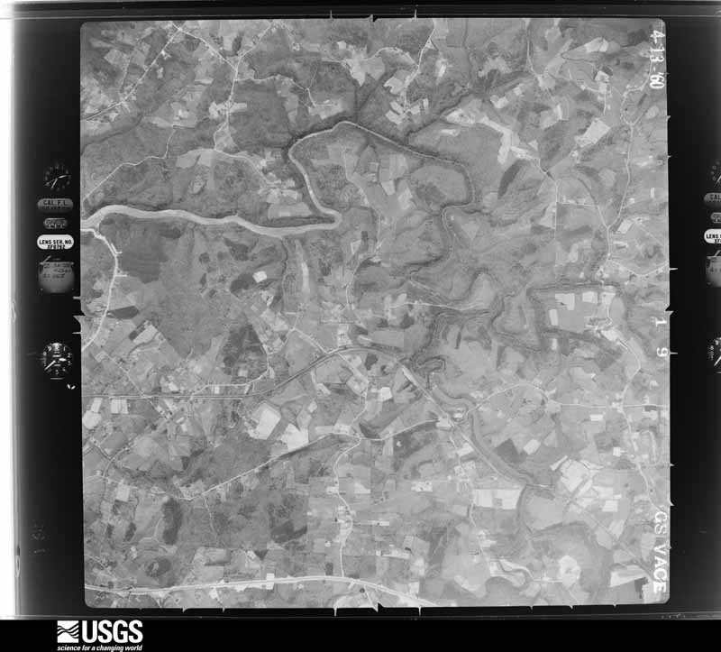
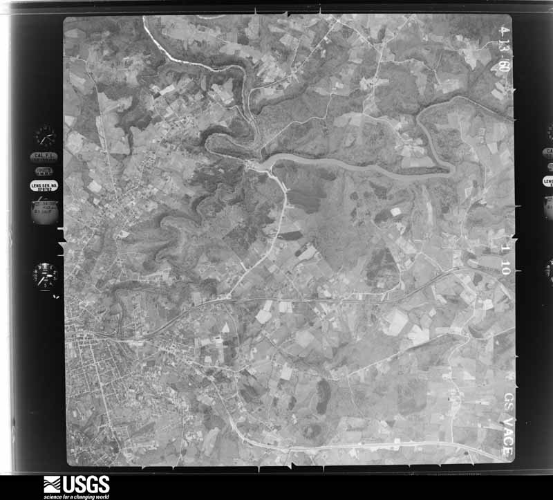
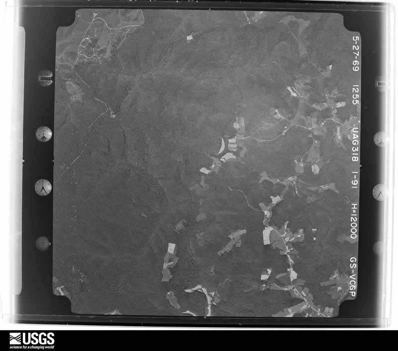
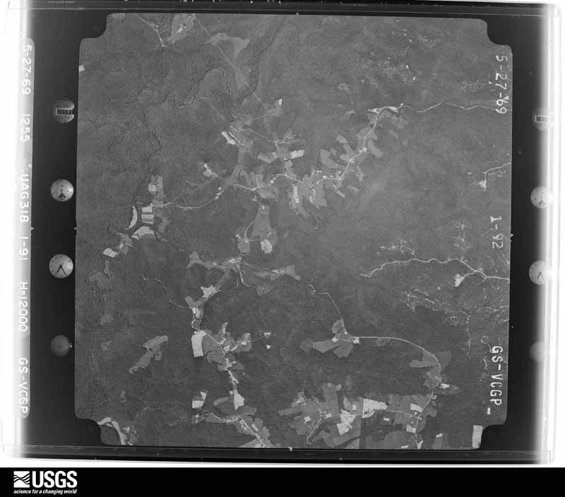
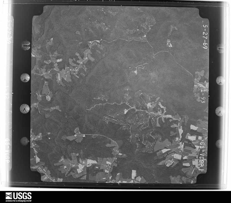
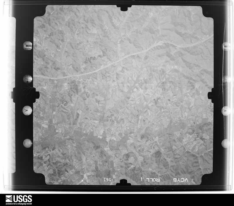
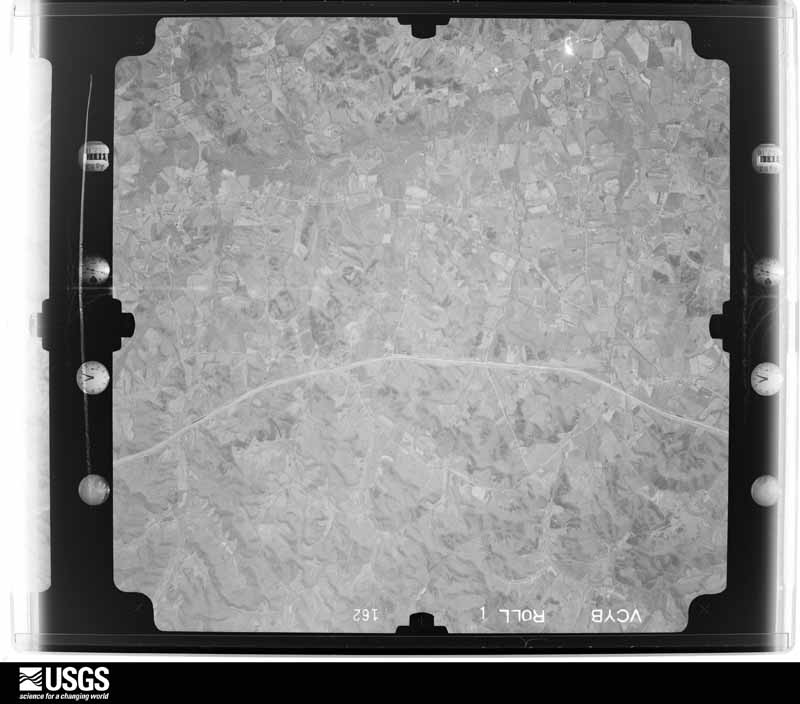
Flown by the U.S. Geological Survey between 1937 and 1989, the Aerial Photo Single Frames collection is the definitive mid-century view of the land: fields, roads and rivers as the camera saw them. The Survey holds 757 frames inside the rectangle that bounds this county; the 28 frames below were taken over the county itself, chosen across the decades of flights (at most four a year from that rectangle), so one flight cannot crowd out the rest. The full set is free to browse and download at EarthExplorer under the dataset Aerial Photo Single Frames.




















The thermometers that kept this county's weather, and the gages that measured the flow of its streams, as the federal records hold them. The extremes below are measured values from those records, not estimates.
Who lived here in 1950, one enumeration district at a time, as the Census Bureau described each district. Each row opens its official National Archives result, with Population Schedules and ED Maps available there.
Every wildfire the federal occurrence database records inside this county: 449 of them, burning about 6,045 acres. 8 started naturally and 122 were recorded as arson. Each settlement page carries the fires within five miles of it.
| Reported cause | Fires |
|---|---|
| Debris and open burning | 144 |
| Arson/incendiarism | 122 |
| Missing data/not specified/undetermined | 87 |
| Recreation and ceremony | 60 |
| Equipment and vehicle use | 10 |
| Natural | 8 |
| Smoking | 8 |
| Railroad operations and maintenance | 5 |
| Misuse of fire by a minor | 3 |
| Fireworks | 1 |
| Power generation/transmission/distribution | 1 |
The five largest, by the area the report gives. Four of them were set deliberately.
| Date | Cause | Size | Reported by | Name on the report |
|---|---|---|---|---|
| 10 April 2017 | Missing data/not specified/undetermined | 309 acres | Daniel Boone National Forest | LICK BRANCH |
| 31 October 2000 | Arson/incendiarism | 269 acres | Daniel Boone National Forest | SOUTH FORK |
| 8 March 2002 | Debris and open burning | 150 acres | Kentucky Division of Forestry | not named |
| 23 March 2004 | Missing data/not specified/undetermined | 150 acres | Kentucky Division of Forestry | not named |
| 14 September 1999 | Railroad operations and maintenance | 146 acres | Kentucky Division of Forestry | not named |
| 22 April 2008 | Arson/incendiarism | 143 acres | Daniel Boone National Forest | STORM BRANCH |
| 2 May 2007 | Arson/incendiarism | 120 acres | Daniel Boone National Forest | POISON HONEY |
| 2 November 2000 | Arson/incendiarism | 112 acres | Kentucky Division of Forestry | not named |
Every settlement page carries the fires within five miles of it - see the settlement index below.
The NOAA Storm Events Database holds 590 reports for this county, causing 24 deaths, 108 injuries and about $67,911,740 in recorded property damage. Each settlement page carries the reports that name it.
| Kind of event | Reports |
|---|---|
| Thunderstorm Wind | 343 |
| Hail | 129 |
| Flash Flood | 59 |
| Tornado | 19 |
| Flood | 18 |
| Funnel Cloud | 10 |
| Lightning | 6 |
| Heavy Rain | 6 |
The most serious of them, by death, then injury, then recorded damage. The accounts are quoted exactly as the forecast office filed them.
| When | Event | Place named | Harm | What the report says |
|---|---|---|---|---|
| May 2025 | Tornado (EF4) | Goodwater | 17 killed | NWS survey teams dispatched on Saturday morning to Russell and |Pulaski Counties, where they were able to confirm a touchdown |along KY-619, about 2.5 miles northeast of Jamestown. Upon |touchdown it caused damage to a garage, two antenna towers, and |several trees. Sporadic damage east of KY-619 seems to suggest |that the tornado may have briefly lifted for a few hundred yards |after its initial touchdown point, before touching back down in a |grove of trees between KY-619 and John Streat Road. EF-1 damage |was observed in this area, with winds estimated between 95 and 100|mph. The tornado caused roofing damage to a house along John |Streat Road as it continued east, also producing a swath of |uprooted trees as it crossed a finger of Lake Cumberland. The |tornado gradually intensified as it crossed Parks Ridge and |continued through the community of Eli and points eastward. The|damage in this area was consistent with high-end EF-1 and EF-2 |winds, between 100 and 130 mph. ||The tornado then continued across the Pulaski County line, where |it caused considerable damage near the Faubush and Nancy |communities, before making it's way to the south side of Somerset.|Here it strengthened as it came down a steep hillside into the |city. Some residences and numerous businesses were affected, with |survey results showing high end EF-2 damage along Parkers Mill |Way and S Hwy 27. On the eastern edge of the city it affected the |South Kentucky RECC, causing catastrophic damage to all buildings,|as well as surrounding businesses. Damage in this region shows a|likely strengthening to low-end EF-3 winds.||The damage path continued on eastward towards the Daniel Boone |National Forest, where additional EF-3 damage was incurred. This|includes the lifting, twisting, and throwing of a high tension |power pole eastward several hundred yards downwind in a nearby |field off of Rush Branch Road, and destroying multiple residences.|High-resolution satellite imagery shows the tornado plowing |through the Daniel Boone Forest, with complete destruction of |trees through the middle of the path. It also reveals a path width|of nearly a mile wide during this time, including the strongest |inflow into the storm. This was also confirmed by the survey crew |on Monday. ||The tornado then exited the forest and moved towards the south|side of London between 11:35 and 11:45 EDT. It is at this point |that it started impacting large residential areas as it set sites |on the London-Corbin Airport. Two teams surveyed the damage in |southern London for several days. The survey results showed that |the tornado continued to strengthen just west of the I-75 |corridor, as it started towards the Sunshine Hills subdivision. It|was here that some of the heaviest damage occurred, with the |tornado taking a direct path through the subdivision. Many homes |were wiped clean from their foundations, with vehicles thrown and |trees debarked with only stubs of the largest limbs left. It is in|this subdivision where the majority of casualties occurred. |Survey teams and subject- matter experts all looked at the damage |that had occurred in this location and agreed that the tornado had|increased again to around 170mph based on the damage, making it |an EF-4 rated tornado. ||After the tornado passed over I-75 around 11:45 EDT, it headed |for the airport, continuing to cause high end EF-3 damage to both |the airport and residential communities adjacent to the west along|the center of it's path. After exiting the airport, it caused |extensive damage at Levi Jackson Park, the Laurel County |Fairgrounds, Crooked Creek Golf Course, and neighboring |subdivisions. The tornado began to lose considerable strength |after this point, with generally EF-0 damage reported as it |neared East Laurel Road (Hwy-80) and Mt. Salem Rd (KY-488). The |tornado appears to have lifted just east of KY-488, based on NWS |ground surveys, satellite, and aerial video. NWS survey teams |followed the circulation path eastward through Clay and Leslie, |but were unable to find any reports that the tornado touched back |down in these counties. ||By the time it lifted, just a few minutes before midnight, the |tornado had carved out a damage path of just shy of 60 miles over|the course of 3 counties. One death was reported in Russell and |another in Pulaski County. Sadly, 17 lives were lost in Laurel |County. |
| March 2012 | Tornado (EF2) | Hazel Patch | 6 killed, 40 hurt, $5,000,000 | A storm damage survey team from the National Weather Service Forecast Office in Jackson, Kentucky confirmed that an EF-2 tornado moved across portions of Laurel County on March 2, 2012. The tornado touched down southwest of Wood Creek Lake at 704 pm EST, and tracked northeast crossing I-75 and Highway 490 before lifting just south of the Victory community. Winds were estimated to have reached 125 mph. This tornado damaged or destroyed several residences. Five fatalities occurred on March 2nd with another person dieing on March 23rd from injuries they received as their mobile home was impacted by the tornado on March 2nd. All fatalities occurred in mobile homes. |
| May 1995 | Thunderstorm Wind | Holly Bay | 1 killed | A downed tree lands on 23-year-old Lexington man killing him at the Holly Bay Camp Ground. |
| April 1974 | Tornado (F2) | not stated | 22 hurt, $2,500,000 | no account filed |
| October 1977 | Tornado (F2) | not stated | 16 hurt, $250,000 | no account filed |
| June 2001 | Tornado (F2) | London | 10 hurt, $17,140,000 | A strong F2 tornado with wind estimates between 135 and 155 miles per hour ripped through downtown London during the evening hours. The Carnaby Square shopping center was hard hit. The tornado was reported by eye witnesses to have been nearly stationary in the parking lot for nearly 4 minutes. During this time several automobiles including a large moving van were overtured. A 20 by 30 foot chunk of 4 inch thick blacktop from the parking lot was torn up and thrown approximately 100 feet. Merchandise from one of the stores was later found 25 miles to the east. The tornado lifted before crossing U.S. Highway 25. The tornado touched down again along Bellinger Street between 6:15 and 6:20 pm where several homes received major damage. One duplex lost its entire roof as a mother and her two sons took shelter on the second floor. A mobile home used for storage was demolished. One block over on Morgan Street several brick and framed homes lost their entire roofs. A framed home placed on a block foundation was blown 15 feet away from the foundation. The storm lifted as if approached the Rolling Acres Subdivision. Witnesses reported seeing two funnel clouds at this time as the storm continued moving east. Damage was confined to large trees and some shingle damage on roofs of homes. The storm again dropped a tornado as it approached a ball park just northwest of the intersection of Kentucky Highway 192 and 80. Three of the four teams in the park took refuge in the concession stand and the fourth team remained in the dugout where parents covered the children while laying on the ground. One mid sized truck was tossed from the parking lot approximately 150 feet. Fencing from both ball diamonds was blown away. The last major damage occurred at a mobile home sales lot near the intersection of Kentucky Highway 192 and the Daniel Boone Parkway. Eight mobile homes weighing 8 to 12 tons were totaled.Emergency management officials reported that there were 10 minor injuries with the most serious being a broken arm. Eighteen residences were destroyed, 21 received major damage while 84 received minor damage. Twenty-six businesses suffered major damage. One church received major damage with another receiving minor damage. Thirty vehicles were destroyed and three 18 wheel tractor trailers were overturned. |
| May 1984 | Tornado (F2) | not stated | 8 hurt, $2,500,000 | no account filed |
| March 2016 | Thunderstorm Wind | (Loz)Mcgee Fld Londo | 3 hurt | A swath of thunderstorm wind damage was observed east of London. An NWS storm survey revealed that mobile home damage off of Sasser School Road near Highway 229 was caused by approximately 60 mph winds that hit the trailer perpendicular and lifted the roof off. A few injuries were reported. Just to the east over the ridge along Highway 80 near Bush Elementary School, there was more substantial damage in a narrow path. Several large pine trees up to 2.5 feet in diameter were snapped with several others uprooted. Three homes were damaged in this area when trees fell on their roofs and another home was damaged when a sturdy built carport was uplifted by the winds. Estimated wind gusts of 90 mph are indicative of this degree of damage. No evidence of rotation was found amid any of the surveyed damage. |
| June 1973 | Tornado (F3) | not stated | 2 hurt, $250,000 | no account filed |
| August 2001 | Thunderstorm Wind | Tuttle | 2 hurt, $5,000 | Strong winds blew a large limb out of a tree which struck two women, only minor injuries resulted. The thunderstorm also brought trees down on Tuttle, Green Valley, and Westerfield roads. The winds also blew a barn off of its foundation. |
| July 2013 | Thunderstorm Wind | Keavy | 2 hurt | A tree was blown down onto a moving car on Rachael Road with two non-life threatening injuries reported. |
| March 1997 | Lightning | Lily | 1 hurt, $1,000 | no account filed |
| July 2012 | Thunderstorm Wind | Hare | 1 hurt | A tree fell on a man on Hawk Creek Rd. |
| July 2002 | Lightning | London | 1 hurt | One woman was struck by lightning. |
| May 2002 | Hail | Countywide | $30,000,000 | During the evening of May 1st, a severe thunderstorm moving southeast dumped a large swath of hail ranging in size from pennies to softballs across a large portion of Laurel County. Numerous homes and vehicles were damaged, especially in the town of London. |
| May 1995 | Tornado (F2) | East Bernstat | $5,000,000 | A tornado touched down north of London. Buildings were damaged and trees were down. Sloan Furniture was destroyed. |
| April 1974 | Tornado (F3) | not stated | $2,500,000 | no account filed |
| June 1990 | Tornado (F1) | not stated | $250,000 | no account filed |
| April 1980 | Tornado (F1) | not stated | $250,000 | no account filed |
| June 1954 | Tornado (F2) | not stated | $250,000 | no account filed |
| May 2024 | Lightning | London | $200,000 | Video showed lightning striking a business in downtown London and starting a fire. The structure was reported a total loss. |
| April 2007 | Tornado (EF1) | London | $150,000 | An EF1 tornado with a path length of 1.8 miles and a path width of 50 yards destroyed a pole barn, uprooted large hardwood trees, pushed a well tied down mobile home off its foundation and blew a roof off of a store. |
| May 2024 | Thunderstorm Wind | London | $80,000 | A tree fell onto a residence on Camelot Place in the city of London. |
| June 2019 | Thunderstorm Wind | Oakley | $80,000 | Dispatch reported trees down north of London, at the intersection of Dollie Miller Road and Kentucky Highway 1376, as well as on McWhorter Road. A tree blew onto a mobile home in East Bernstadt, destroying it. |
| November 2007 | Tornado (EF1) | Bernstadt | $75,000 | Tornado touchdown occurred 1.8 miles east-northeast of Bernstadt around 428 pm EST, with the tornado dissipating 1 mile southwest of Pittsburg around 433 pm EST. The path length was almost 2 miles and the width was 200 yards at its maximum. The tornado was rated EF1, with estimated peak winds of 94 to 99 mph. Several homes along the tornados path sustained broken windows from flying debris and shingle and gutter damage along the tornados path. A tree fell on one home. Intermittent tree damage was observed along the tornados path. One barn collapsed and several outbuildings were also damaged, with one building being blown off its foundation. A manufactured home was shifted of its foundation at the touchdown site. |
| May 2002 | Tornado (F0) | North Corbin | $55,000 | A brief tornado touched down just northeast of the highway 25 and 25E interchange near Corbin and concluded to the northeast of Campground Road. Eleven home received minor damage, as well as two barns and one out building. A cluster of trees were also blown down. |
| March 2012 | Thunderstorm Wind | East Bernstadt | $50,000 | Multiple mobile homes were damaged on Little County Road. |
| July 2008 | Thunderstorm Wind | London | $50,000 | Numerous trees were blown down by thunderstorm wind gusts, mainly in the eastern and southeastern sections of the county. |
| April 2008 | Flash Flood | Pittsburg | $50,000 | Pittsburgh School Road was closed due to flood waters. Four to 5 inches of water were running across Slate Lick Road. Several homes were evacuated due to flood waters. |
| April 2007 | Thunderstorm Wind | London | $50,000 | Stuctural damage, with trees and power lines down. Damage was in western, southern, and eastern portions of county. |
| August 2003 | Flash Flood | London | $50,000 | Flowing water moved cars on Seven School Road. There was one and a half feet of water flowing across Mill Street, between Fifth and Seventh Streets. One foot of water was in a basement and around a home on Valley Lane off of Highway 1006. |
| February 2003 | Flash Flood | Dortha | $50,000 | Water was over Kentucky Highway 312 at the intersection of Interstate 75. Water also covered roads at Lily and Fariston. |
| April 2022 | Thunderstorm Wind | East Bernstadt | $40,000 | NWS Storm Survey and Emergency Manager report that the steeple at the First Baptist Church in East Bernstadt was blown off the roof. A peak wind gust of 60 to 65 mph was estimated due to the exposure of the steeple, and the lack of any other damage in the vicinity. |
| July 2012 | Thunderstorm Wind | London | $40,000 | The roof was blown off a tobacco house and a greenhouse was damaged in London. |
| April 2022 | Thunderstorm Wind | Bernstadt | $35,000 | Straight-line winds, funneling through a valley and up onto an exposed ridge, led to the collapse of 2 barn structures and damage to a third barn in the 2000 block of Hawk Creek Road. |
| April 2007 | Thunderstorm Wind | London | $35,000 | Barn totally demolished, houses slightly damaged. |
| May 2025 | Thunderstorm Wind | London | $30,000 | A report came in of a roof being peeled off a business, falling onto multiple adjacent vehicles which sustained unspecified damage. |
| April 2011 | Thunderstorm Wind | London | $30,000 | A part of a building was blown off. |
| June 2007 | Thunderstorm Wind | Victory | $30,000 | Trailer blown off its foundation. One tree down. |
| April 1998 | Flash Flood | Countywide | $30,000 | no account filed |
| April 2022 | Thunderstorm Wind | Hazel Patch | $25,000 | Straight-line winds lifted a partially constructed cabin/home off it's exposed block pillars along the west side (1434) of F Hubbard Road. |
| February 2011 | Thunderstorm Wind | Corbin London Arpt | $25,000 | Wind damage occurred to a house and a building on the Sweet Hollow Golf course. A mobile home was also damaged when a tree fell on it. |
| June 2009 | Thunderstorm Wind | Tuttle | $25,000 | Trees were blown down. A wind gust of 70 mph was estimated to have occurred. |
| April 1982 | Tornado (F1) | not stated | $25,000 | no account filed |
| May 2024 | Flash Flood | Dortha | $20,000 | A car was reportedly swept away by flood waters at the 600 block of Rita Lane in Lily. The occupant had to be rescued from their vehicle. Time of event is based on time of report at 2:10 AM EDT. |
| May 2024 | Thunderstorm Wind | London | $20,000 | The Laurel County EM reported damage to at least one building at the Flea Land flea market in London. Photos shared showed the roof missing off one building. |
| February 2021 | Flood | (Loz)Mcgee Fld Londo | $20,000 | The Finley Fun Center in London has flood water surrounding the building with people inside. The Fire Dept. is on the scene. |
| April 2011 | Thunderstorm Wind | Lily | $20,000 | Power lines and trees were blown down on Van Zant Road in Lily. |
| April 2011 | Thunderstorm Wind | Hare | $20,000 | There were numerous trees and power lines down near Hawk Creek. |
| February 2009 | Thunderstorm Wind | Greenmount | $20,000 | Trees were blown down on homes and power poles were also blown down. This report was received from someone at the London Sentinel Echo newspaper office. |
| January 2008 | Thunderstorm Wind | East Bernstadt | $20,000 | A television tower was blown over by winds estimated at 69 mph. |
| January 2008 | Thunderstorm Wind | East Bernstadt | $20,000 | A television tower was blown over by wind gusts estimated at 63 mph. |
| September 2003 | Flash Flood | London | $20,000 | The following roads were closed due to flash flooding: East Fourth Street at Tobacco Road, Tobacco Road from Green Street to Roosevelt Street, Middleground Way, Commercial Drive, and Spring Street. Water was reported to be as high as the fender wells on cars. One home was flooded along with several businesses. |
| May 2002 | Flash Flood | London | $20,000 | Flash flooding resulted in a road being damaged in London. Several roads were closed due to flowing water, and high waters caused a trailer to flood. |
| February 2021 | Flood | Maplesville | $15,000 | Flooding was ongoing across Sally's Branch Road. Local broadcast media posted a video on Facebook of a water rescue now occurring on this road. |
| May 2011 | Thunderstorm Wind | Greenmount | $15,000 | The roof of a barn was blown off and carried a long distance before being dropped. Tow trees were also blown down near the Glenmount cemetary in Greenmount. |
| April 2011 | Thunderstorm Wind | London | $15,000 | There were trees and power lines down on Parker road. There was a possible funnel cloud in the area. |
| April 2011 | Thunderstorm Wind | London | $15,000 | There were power lines and trees down on County Farm Road 1 mile west of London. |
| August 2009 | Thunderstorm Wind | Keavy | $15,000 | Multiple trees down around Keavy with water rising along roads. |
| June 2008 | Thunderstorm Wind | London | $15,000 | Several 1 foot diameter trees were blown down along Good Branch Road and across a driveway. Branches were also torn off several trees. |
The Survey's mineral resources record lists 3 workings inside this county. None of them still produces: all are closed or unrecorded. Each settlement page carries the workings within five miles of it.
| Commodity | Workings |
|---|---|
| Zinc | 1 |
| Lead, Silver | 1 |
| Silica | 1 |
| Stone, Crushed/Broken | 1 |
The least common of them first, because a county's hundredth gravel pit says nothing its first ten did not.
| Where | Site | Commodity | Status | Recorded |
|---|---|---|---|---|
| Bryant Prospect | Zinc, Lead, Silver | Prospect | ||
| Highway 80 Sandstone Pit | Silica | Prospect | ||
| Laurel County Quarry | Stone, Crushed/Broken | Past Producer |
Named settlements recorded in the Geographic Names Information System, each with the topographic sheets covering it. Villages, hamlets and abandoned places alike. Each is shown with the nearest named watercourse or landform and the survey quadrangle it falls on. The 1 place that was also surveyed for fire insurance comes first, with the number of atlases and photographs held for them.
London census division · 40741 · London quadrangle
15 sheets, 1893 to 1982
Fire insurance: 6 atlases
East Bernstadt census division · 40741 · On Watkins Branch · London quadrangle
15 sheets, 1893 to 1982
Colony census division · 40741 · On Billy Branch · Bernstadt quadrangle
16 sheets, 1893 to 1982
Camp Ground census division · 40744 · On Calloway Creek · Lily quadrangle
14 sheets, 1893 to 1982
Camp Ground census division · 40744 · On Blackwater Creek · Blackwater quadrangle
13 sheets, 1891 to 1979
Greenmount-Langnau census division · 40729 · On White Oak Creek · Parrot quadrangle
14 sheets, 1893 to 1982
Greenmount-Langnau census division · 40741 · Portersburg quadrangle
13 sheets, 1891 to 1979
East Bernstadt census division · 40729 · On South Fork Rockcastle River · Parrot quadrangle
14 sheets, 1893 to 1982
North Corbin census division · 40701 · On Little Laurel River · Corbin quadrangle
17 sheets, 1890 to 1981
Camp Ground census division · 40740 · On Camp Branch · Blackwater quadrangle
13 sheets, 1891 to 1979
East Bernstadt census division · 40729 · On Little Hazel Patch Creek · London quadrangle
15 sheets, 1893 to 1982
No longer a settlement
Greenmount-Langnau census division · 40741 · On Little Raccoon Creek · London quadrangle
15 sheets, 1893 to 1982
East Bernstadt census division · 40729 · Near Begley Hollow · Bernstadt quadrangle
16 sheets, 1893 to 1982
Keavy census division · 40744 · On Buck Branch · London SW quadrangle
14 sheets, 1893 to 1982
North Corbin census division · 40701 · On Robinson Creek · Corbin quadrangle
17 sheets, 1890 to 1981
East Bernstadt census division · 40729 · On Parker Branch · Livingston quadrangle
15 sheets, 1893 to 1982
Greenmount-Langnau census division · 40741 · On Nineva Creek · Portersburg quadrangle
13 sheets, 1891 to 1979
Bush census division · 40744 · Blackwater quadrangle
13 sheets, 1891 to 1979
Bush census division · 40741 · On Blackwater Creek · Blackwater quadrangle
13 sheets, 1891 to 1979
North Corbin census division · 40744 · On Robinson Creek · Lily quadrangle
14 sheets, 1893 to 1982
Greenmount-Langnau census division · 40741 · On Dixon Branch · London quadrangle
13 sheets, 1891 to 1979
East Bernstadt census division · 40729 · Near Margaret Hollow · Livingston quadrangle
15 sheets, 1893 to 1982
North Corbin census division · 40701 · On Horse Creek · Corbin quadrangle
17 sheets, 1890 to 1981
East Bernstadt census division · 40729 · On Patton Branch · London quadrangle
15 sheets, 1893 to 1982
London census division · 40741 · On Pittman Branch · London quadrangle
15 sheets, 1893 to 1982
Camp Ground census division · 40744 · On Bennets Branch · Blackwater quadrangle
13 sheets, 1891 to 1979
London census division · 40744 · On Cloyd Branch · Lily quadrangle
14 sheets, 1893 to 1982
East Bernstadt census division · 40729 · Near Margaret Hollow · Livingston quadrangle
15 sheets, 1893 to 1982
East Bernstadt census division · 40729 · On Patton Branch · London quadrangle
15 sheets, 1893 to 1982
No longer a settlement
Camp Ground census division · 40744 · On Camp Branch · Blackwater quadrangle
13 sheets, 1891 to 1979
The vanished settlements of Laurel County: the places named above that are no longer on the map.
15 topographic sheets and 6 fire insurance atlases, 1895 to 1941