 Block
From the record
27 National Register listings published here.
Sources: the National Register database, National Park Service
45 topographic sheets cover 20 settlements here, and 27 properties are on the National Register of Historic Places.
27 National Register listings published here.
Sources: the National Register database, National Park Service
Every property in this county listed on the National Register of Historic Places, with the year it was listed and the federal nomination document.
| Photograph | Property | Type | Listed | Reference |
|---|---|---|---|---|
 | Bates House | building | 1984 | 84002026 |
| Callis General Store and Post Office | building | 1983 | 83002878 | |
 | Coleman, House | building | 1983 | 83002880 |
 | William L. Coleman House | building | 1983 | 83002879 |
 | Ginn's Furniture Store | building | 1983 | 83002881 |
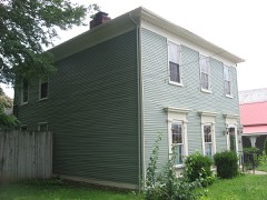 | Hancock House | building | 1984 | 84002029 |
| House Tm-B-7 | building | 1984 | 84002033 | |
 | House Tm-M-27 | building | 1984 | 84002035 |
 | House Tm-M-28 | building | 1984 | 84002036 |
 | House at Moffett Cemetery Road | building | 1983 | 83002882 |
 | House on KY 1492 | building | 1984 | 84002031 |
| Humphrey Place | building | 1983 | 83002883 | |
 | W. W. Logan House | building | 1984 | 84002052 |
 | Milton Masonic Lodge and County General Store | building | 1983 | 83002884 |
| Moreland School | building | 1984 | 84002053 | |
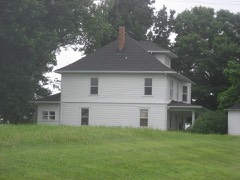 | Neal House | building | 1984 | 84002054 |
| Old Kentucky Tavern | building | 1983 | 83002885 | |
| Page | building | 1984 | 84002056 | |
| Page-Bell House | building | 1983 | 83002886 | |
 | Peak House | building | 1984 | 84002057 |
| Preston House | building | 1983 | 83002887 | |
| Rowlett House | building | 1984 | 84002058 | |
| Rowlett's Grocery | building | 1983 | 83002888 | |
| Third Street Historic District | district | 1984 | 84002059 | |
| Trimble County Jail | building | 1984 | 84002061 | |
| Trout House | building | 1983 | 83002889 | |
 | Yeager General Store | building | 1983 | 83004528 |
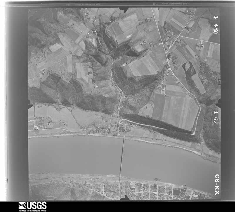
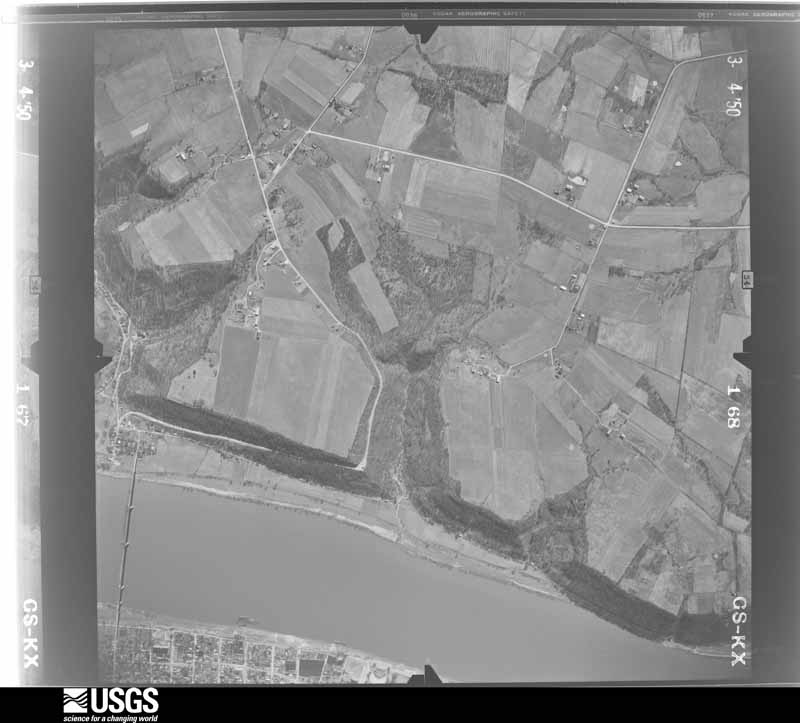
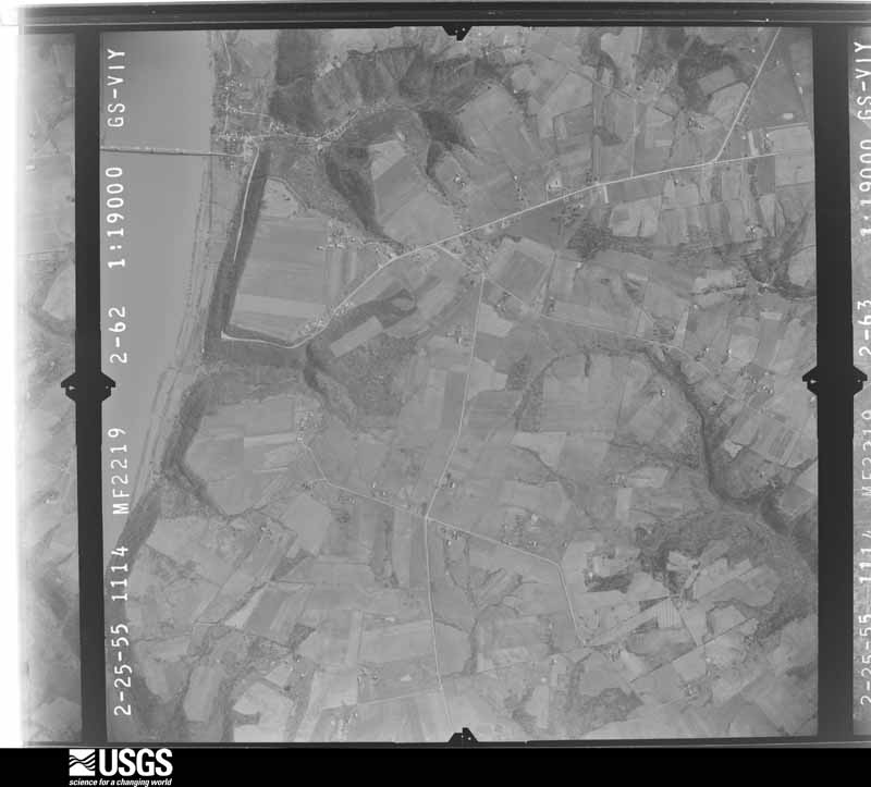
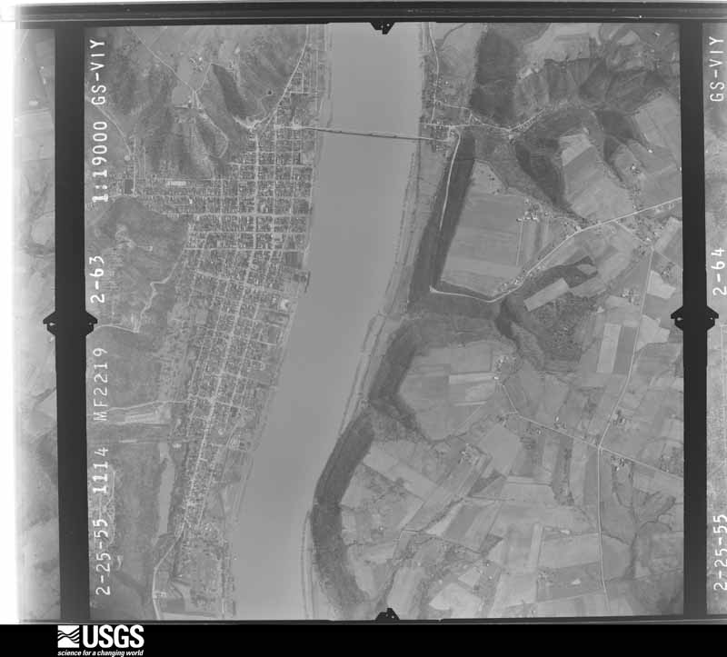
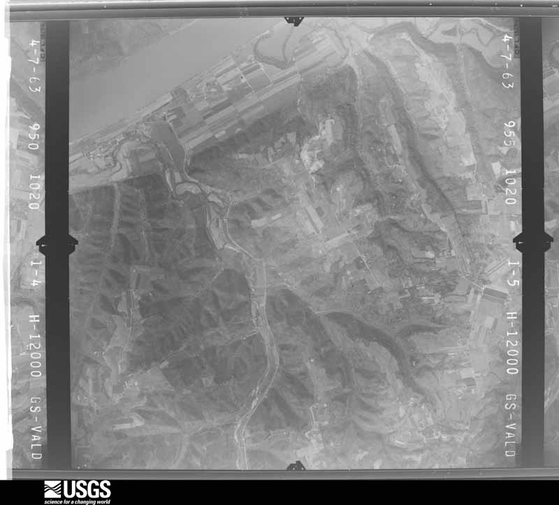
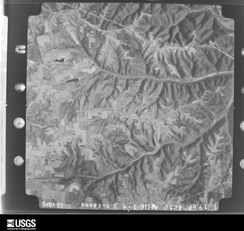
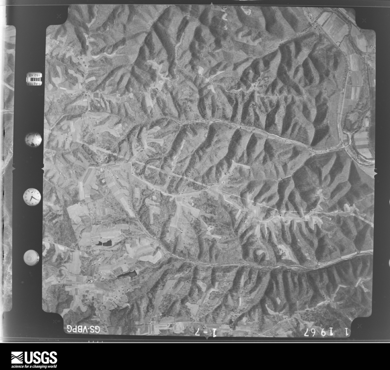
Flown by the U.S. Geological Survey between 1937 and 1989, the Aerial Photo Single Frames collection is the definitive mid-century view of the land: fields, roads and rivers as the camera saw them. The Survey holds 715 frames inside the rectangle that bounds this county; the 32 frames below were taken over the county itself, chosen across the decades of flights (at most four a year from that rectangle), so one flight cannot crowd out the rest. The full set is free to browse and download at EarthExplorer under the dataset Aerial Photo Single Frames.

























The thermometers that kept this county's weather, as the federal records hold them.
Who lived here in 1950, one enumeration district at a time, as the Census Bureau described each district. Each row opens its official National Archives result, with Population Schedules and ED Maps available there.
Every wildfire the federal occurrence database records inside this county: 7 of them, burning about 406 acres. None started naturally and 1 was recorded as arson. Each settlement page carries the fires within five miles of it.
| Reported cause | Fires |
|---|---|
| Recreation and ceremony | 4 |
| Debris and open burning | 2 |
| Arson/incendiarism | 1 |
The five largest, by the area the report gives. One of them was set deliberately.
| Date | Cause | Size | Reported by | Name on the report |
|---|---|---|---|---|
| 3 October 2004 | Arson/incendiarism | 354 acres | Big Oaks National Wildlife Refuge | TARGET |
| 15 March 2014 | Recreation and ceremony | 18 acres | Kentucky Division of Forestry | BUCK CREEK |
| 21 October 2010 | Recreation and ceremony | 15 acres | Kentucky Division of Forestry | HOMETOWN |
| 8 March 2002 | Recreation and ceremony | 13 acres | Kentucky Division of Forestry | not named |
| 9 April 2001 | Debris and open burning | 3.0 acres | Kentucky Division of Forestry | not named |
| 22 March 2001 | Debris and open burning | 1.5 acres | Kentucky Division of Forestry | not named |
| 26 March 2008 | Recreation and ceremony | 1.0 acres | Kentucky Division of Forestry | not named |
Every settlement page carries the fires within five miles of it - see the settlement index below.
The NOAA Storm Events Database holds 152 reports for this county, causing no deaths, 6 injuries and about $4,625,550 in recorded property damage. Each settlement page carries the reports that name it.
| Kind of event | Reports |
|---|---|
| Thunderstorm Wind | 87 |
| Flash Flood | 27 |
| Hail | 21 |
| Tornado | 10 |
| Flood | 6 |
| Heavy Rain | 1 |
The most serious of them, by death, then injury, then recorded damage. The accounts are quoted exactly as the forecast office filed them.
| When | Event | Place named | Harm | What the report says |
|---|---|---|---|---|
| August 2007 | Thunderstorm Wind | Milton | 2 hurt, $10,000 | Thunderstorm winds blew a tree on to a barn. Two people inside the barn were injured. |
| March 2024 | Tornado (EF2) | Milton | 2 hurt | The National Weather Service in Louisville, KY in coordination with the National Weather Service in Wilmington, OH conducted a 2 day storm damage assessment survey. The survey found a 18.6 mile long EF-2 tornado with peak winds of 115 mph occurred on the afternoon of March 14, 2024. The tornado was on the ground for 26 minutes as it touched down 1 mile north of Hanover, IN, and lifted just east of Carrollton, KY. The tornado crossed the Ohio River three times as it started in Jefferson County, IN, crossed the Ohio River into Trimble County, KY, entered Carroll County, KY, crossed the Ohio River back into Jefferson County, IN, crossed into Switzerland County, IN, and crossed the Ohio River for the last time before entering Carroll County, KY. The tornado was 500 yards wide at its maximum.||The tornado crossed the Ohio River between River Bottom Road on the Indiana side and Coopers Bottom Road on the Kentucky side, just south of the Clifty Creek Power Plant. After the tornado crossed the river, the next observed damage was along Race Track Road. There was extensive tree damage, consisting of uprooted, topped, and twisted trees facing in all directions. Two greenhouses had the plastic roofing material thrown several hundred yards. Three well-built barns next to the greenhouses sustained no damage, nor did the farmhouse. NWS drone photography showed distinct tree damage and greenhouse debris. The tornado was 80 to 85 mph, EF0, with a|width of around 200 yards.||The tornado then started moving more to the northeast and damaged roof panels on some older barns at the end of Detmer Lane. The tornado was 85 mph, EF0, with a width of 250 yards.||At this point, the tornado came down the large hill overlooking Milton and widened significantly, moving parallel to the sharpest curve on US 421. Half of the tornado was over the Ohio River and the other half was just north of US 421 mainly along Coopers|Bottom Road. There was a plethora of tree damage all the way to the Milton-Madison Bridge. The tornado was 90 mph, EF1, with a width of around 400 yards. Some of the most dramatic tornado video shows the tornado partially over the Ohio River, sucking up water and throwing it in all directions.||EF-0 and EF-1 damage continued as the southern half of the funnel entered Milton, doing roof and structural damage to numerous homes and businesses. In addition, numerous hardwood trees were either snapped or uprooted. Just east of downtown Milton, a large brick home under renovation had a large section of its back wall blown|out, with estimated winds of 105 mph, which was a bit stronger than points to the west. Noted strengthening occurred over the next mile eastward as more concentrated medium to high end EF-1 damage was noted. Evidence that the center of the tornado was still out over water at this point was strong, given that the downed trees were facing toward the river in almost all instances from Milton eastward until Paradise Point along Highway 36 about 1 mile east of downtown Milton.||The center of the tornado finally came on shore at Paradise Point and was immediately at low-end EF-2 strength as several large campers and a motorhome were demolished. One tri-axle camper weighing well over 10,000 pounds was rolled and thrown over 100 yards to the ESE, with debris scattered much farther downstream. Just across Highway 36, a well-built single family residence sustained major roof damage as half of the structure was removed by the tornado. This was also rated at EF-2 strength with winds of 115 mph. Just east of that house, a semi trailer was rolled, a large barn was completely collapsed and shifted, and nearly every tree was snapped in a grove. This was a notable uptick in intensity from areas to the west as snapped trees were more sporadic in those areas. This was more justification for the increase to EF-2. It was at this point that a clear northern portion of the tornado track became evident as downed trees along Highway 36 were laying in a SE direction, pointing inward toward the center of the circulation. It was unclear just how wide the tornado was as it crossed through Milton, since half of the funnel was out over water, however the tornado was around 500 yards wide (roughly a third of a mile) by the time it reached the Trimble/Carroll county line at North Spillman Lane. EF-1/EF-2 intensity remained here as a large span of telephone polls were snapped. |
| June 1990 | Tornado (F3) | not stated | 1 hurt, $2,500,000 | no account filed |
| June 1984 | Tornado (F1) | not stated | 1 hurt, $2,500 | no account filed |
| March 2012 | Tornado (EF3) | Leeport | $500,000 | The tornado first touched down about 5 miles south of Milton just southwest of the intersection of Routes 421 and 1226. After damaging several trees just west of Route 421, this narrow funnel rapidly increased in intensity as it crossed Route 421 and struck Milton Firestation number 2. The station was heavily damaged with the collapse of rigid frames. A two ton concession trailer was moved 30 yards, while a pickup truck was moved 60 yards. Damage to the fire station and a pumper exceeded 300 thousand dollars. Damage to the station indicated 140 mph winds and a tornado with EF-3 intensity. After extensively damaging many trees along Route 1226, the tornado weakened to an EF-1 at 871 Palmyra Road. ||At this point witnesses described one vortex lifting while another descended from its parent wall cloud. Rapidly strengthening to an EF-3, it destroyed several homes on Culls Road. One of these homes had collapsed exterior walls. The tornado knocked over a large truss tower connected with an major electrical transmission line. The tornado weakened and damaged several trees with estimated 80 to 90 mph winds as it moved east into Carroll County. |
| January 2008 | Thunderstorm Wind | Milton | $300,000 | Thunderstorm winds damaged homes, barns, and farm equipment. Power lines were also downed. |
| March 2017 | Thunderstorm Wind | Abbott | $250,000 | The Trimble County Emergency Manager reported that almost every house on Smith Lane was damaged. The severe thunderstorm winds resulted in most locations without power in the county. There were also many other buildings, mobile homes, and greenhouses damaged due to the thunderstorms. |
| March 2017 | Thunderstorm Wind | Wises Lndg | $250,000 | A NWS Storm Survey found an intermittent swath of straight line winds occurred from just east of Wises Landing in Trimble County east to the intersection of US 421 and Highway 316. There were two areas of more intense damage where 70-80 mph winds occurred. The first was along Gills Ridge Road where 2 large barns sustained serious roof damage and were shifted slightly. The second was along Smith Lane where several outbuildings were completely destroyed, and debris was scattered 200 to 250 yards downwind. Several homes sustained shingle and siding damage. Numerous large trees were also snapped and uprooted. Damage in this area was consistent with wind speeds between 65 and 80 mph. |
| February 2008 | Thunderstorm Wind | Milton | $100,000 | Thunderstorm winds blew a tree on to a trailer destroyed on Pike Road. Power lines were downed on Pyles Road. |
| May 1996 | Flash Flood | Countywide | $100,000 | no account filed |
| July 2004 | Thunderstorm Wind | Bedford | $80,000 | A barn was blown down. |
| July 2015 | Flash Flood | Trout | $75,000 | A trained spotter reported that mobile homes were washed downstream Corn Creek where Joyce Mill Rd and Highway 625 intersect. Several inches of rain fell in the area on top of very saturated ground. |
| March 2012 | Tornado (EF2) | Trout | $75,000 | The massive EF-4 that crossed southern Indiana finally lifted in Trimble County after a solid path length of 49 miles. This tornado crossed the Ohio River as an EF-1 with a 200 yard wide path length. It damaged a home and two barns on Roger's Road. The barns were overturned with several trees damaged in a manner consistent with 105 mph winds. The tornado then crossed a heavily wooded area near the intersection of Routes 625 and 1838 and damaged some garage shingles. At this point, a second satellite vortex developed just to the south of the main circulation. It totally destroyed a barn on Rodgers Road and extensively damaged another. It severely damaged a rugged forested area before merging with the path of the original tornado near the confluence of Corn Creek Road, Highway 625, and Joyce Mill Road. At this point, the tornado was rated an EF2 with 115 mph estimated winds. Three mobile homes near the intersection of Route 625 and Joyce Mill Road were destroyed along with extensive damage to power lines and poles. Farther east, trees were damaged near Rawlett Lane. Before lifting, the twister brought EF-1 damage to two homes and a mobile home on New Hope Ridge Road. It lifted around 2 miles west of Highway 421. |
| May 2010 | Flash Flood | Bedford | $75,000 | Multiple roads across the county were closed due to flash flooding. A total of three to four inches of rain fell across Trimble county from May 1-2. |
| March 2012 | Tornado (EF0) | Abbott | $50,000 | An EF-1 tornado touched down on Willard Wilson Road in southern Trimble County. It descended from a supercell storm that earlier brought an EF-1 tornado to Clark County Indiana. This cyclic supercell tracked just to the south of, and 15 minutes behind, another supercell that produced the EF-4 tornado across southern Indiana. Shortly after touching down, the tornado destroyed a barn and a single-wide mobile home. Farther along Willard Wilson Road, another barn had collapsed. A 400 pound four-wheeler was moved 30 feet. Another home had shingle damage. The strongest winds, estimated near 100 mph, developed near High Grove Road. A concentrated grove of trees were destroyed along with downed power lines and a gutter ripped off a house. Finally, the twister downed some power lines and hardwood trees along Carmon Creek Road. It lifted just northwest of the intersection of State Highway 421 and Interstate 71. |
| August 2016 | Thunderstorm Wind | Milton | $30,000 | The local fire department reported that a tree fell down onto a pickup and a house. |
| February 2009 | Thunderstorm Wind | Bedford | $30,000 | A mobile home was blown over on New Hope Road with one person trapped inside. The person was rescued without injuries. Numerous trees and power lines were also reported down across the county. |
| July 2015 | Flash Flood | Hisle | $25,000 | The Trimble County emergency manager reported several cars and a large truck were washed away along Hardy Creek Rd near Hardy Creek. |
| May 2012 | Tornado (EF0) | Mt Pleasant | $25,000 | A weak tornado touched down along Mount Pleasant Road to the northwest of Bedford. It snapped the tops off of several trees along a very narrow path. Witnessed by the occupants of a mobile home, it toppled a tree in their yard, crushing a pickup truck. After traveling just under 2 miles the twister lifted near the intersection of Mount Pleasant Road and State Highway 421. |
| September 1992 | Tornado (F1) | not stated | $25,000 | no account filed |
| November 1973 | Tornado (F1) | not stated | $25,000 | no account filed |
| June 2019 | Thunderstorm Wind | Hisle | $20,000 | Multiple trees and power lines were down at New Hope Road and Highway 421. |
| May 2012 | Thunderstorm Wind | Leeport | $15,000 | A storm survey associated with an EF-0 tornado just northwest of Bedford uncovered outflow wind damage 4.5 miles north-northeast of where the west-to-east-tracking tornado had lifted. Winds estimated at 75 mph tore the well constructed roof off of a barn. |
| June 2008 | Flash Flood | Milton | $15,000 | Roads closed for several hours due to rock and mud slides caused by heavy rain. Water also over roadway and in some structures. |
| June 2014 | Thunderstorm Wind | Milton | $10,000 | Winds estimated at 65 mph broke a flag pole, damaged a few signs and felled several trees around Milton. |
| May 2005 | Flash Flood | Countywide | $10,000 | Several roads in the county were closed due to streams and creeks flowing out of their banks. Some vehicles were trapped by high water, but no injuries were reported. |
| May 1996 | Thunderstorm Wind | Milton | $10,000 | no account filed |
| March 2019 | Thunderstorm Wind | Milton | $5,000 | Barn damage was reported. |
| October 2010 | Tornado (EF0) | Milton | $5,000 | A NWS storm survey confirmed an EF-0 tornado from 2.2 miles SW of Milton to 1.1 miles SW of Milton. The path length was 1.1 miles with a maximum path width of 20 yards. Maximum sustained winds were 70 mph. In addition to tree and fence damage, a front porch roof was destroyed on one home, along with other roof and garage damage. |
| October 2007 | Thunderstorm Wind | Wises Lndg | $5,000 | Thunderstorm winds damaged a carport and a chimney at one home, and blew a tree on to another house on the Oldham County line. Minor damage was also sustained to metal sections of nearby outbuildings. |
| August 2007 | Thunderstorm Wind | Milton | $2,000 | A tree was blown on to a passing car on Milton Hill. |
| July 2012 | Thunderstorm Wind | Monitor | $1,000 | A spotter reported that a portion of a roof was removed from a garage along Culls Ridge Road near Bedford. |
| June 1994 | Thunderstorm Wind | not stated | $50 | One tree was knocked down in Milton. |
| April 2026 | Thunderstorm Wind | Bedford | - | Trees fell down and a barn was damaged. |
| February 2024 | Thunderstorm Wind | Wises Lndg | - | An old barn collapsed, and an outbuilding was damaged along Morton Ridge Road. |
| February 2024 | Thunderstorm Wind | Bedford | - | A portion of the community center's roof was blown off the building. |
| June 2024 | Thunderstorm Wind | Milton | - | Trees fell across Coopers Bottom Road. |
| June 2024 | Thunderstorm Wind | Leeport | - | Trees fell on power lines at Garriott Road and Garriott Court. |
| June 2024 | Thunderstorm Wind | Leeport | - | There were trees down at Highway 421 and Milton Bedford Pike. |
| August 2024 | Thunderstorm Wind | Milton | - | A user on social media sent several pictures of a large tree that snapped and fell onto a truck and house. |
| March 2023 | Thunderstorm Wind | Monitor | - | A 40 by 60 foot barn was destroyed by wind gusts. |
| March 2023 | Hail | Milton | - | Quarter-sized hail fell in Milton. |
| August 2022 | Thunderstorm Wind | Milton | - | Trees were down across Kentucky 36. |
| September 2022 | Flash Flood | Monitor | - | Connector Road was closed due to water rises along Hardy Creek and the Little Kentucky River. Five other roads experienced minor flooding across Trimble County. |
| June 2021 | Flash Flood | Monitor | - | US 42, near Ruby Drive, flooded and had debris in the roadway. |
| June 2019 | Thunderstorm Wind | Milton | - | Multiple trees were reported down in Milton. |
| June 2019 | Thunderstorm Wind | Monitor | - | Ten to fifteen trees were reported down along 42 between Connector Road and Highway 36. |
| February 2018 | Flood | Milton | - | The public reported flooding across access road to Hanover Beach community due to flooding. |
| February 2018 | Flash Flood | Abbott | - | Department of Highways reported high water over the road in several places on Kentucky Highway 3175 and Sulphur Bedford Road. |
| May 2018 | Thunderstorm Wind | Hisle | - | Trees reported down on Highway 421, both north and south of Bedford. |
| February 2018 | Flood | Milton | - | The Trimble County emergency manager reported numerous road closures in the Milton area due to high water. |
| July 2018 | Flash Flood | Bedford | - | There was water over parts of Highway 421 and other rural roads southeast of Bedford. |
| February 2018 | Flood | Monitor | - | Kentucky Highway 2871 flooded due to high water. |
| May 2017 | Thunderstorm Wind | Bedford | - | Trained spotters trees down across the area. |
| March 2017 | Thunderstorm Wind | Milton | - | A NWS Storm Survey team concluded that straight line winds occurred intermittently just south of the Ohio River from 2 miles west of Milton to 2.5 miles east of Milton. A mobile home park was damaged with multiple hardwood trees snapped, and a few un-anchored mobile homes slid off their piers. Winds were estimated between 70 and 75 mph at this location. Further east of Milton, the damage was more significant with large outbuildings either heavily damaged or destroyed. Large hardwood trees were snapped and uprooted. Debris was scattered 200 to 300 yards downwind. Maximum winds there were estimated to be 80 to 90 mph. |
| July 2017 | Thunderstorm Wind | Milton | - | The public reported several trees down in the area due to severe thunderstorm winds. |
| July 2017 | Thunderstorm Wind | Milton | - | Local fire department reported multiple trees down on Milton Hill. |
| March 2016 | Hail | Bedford | - | The Trimble County Emergency Manager reported hail 1.25 inches in diameter. |
| April 2016 | Thunderstorm Wind | Hisle | - | Local law enforcement reported trees down on Highway 421 north of Bedford. |
| September 2016 | Thunderstorm Wind | Hisle | - | Trees were reported down on US Highway 421 at the bottom of Bedford Hill. This resulted in one lane of the roadway blocked. |
Named settlements recorded in the Geographic Names Information System, each with the topographic sheets covering it. Villages, hamlets and abandoned places alike. Each is shown with the nearest named watercourse or landform and the survey quadrangle it falls on.
Bedford census division · 40006 · Bedford quadrangle
8 sheets, 1953 to 1990
No longer a settlement
Bedford census division · 40006 · On Demeree Branch · Bedford quadrangle
8 sheets, 1953 to 1990
No longer a settlement
Bedford census division · 40006 · Near New Hope Ridge · Madison East quadrangle
11 sheets, 1953 to 1990
Bedford census division · 40011 · On Carmon Creek · Bedford quadrangle
8 sheets, 1953 to 1990
Bedford census division · 40006 · On Corn Creek · Bethlehem quadrangle
15 sheets, 1939 to 1990
No longer a settlement
Bedford census division · Near Morton Ridge · Bedford quadrangle
8 sheets, 1953 to 1990
No longer a settlement
Milton census division · 40045 · On Tiber Creek · Madison East quadrangle
11 sheets, 1953 to 1990
Bedford census division · 40006 · Near Kings Ridge · Madison East quadrangle
11 sheets, 1953 to 1990
Bedford census division · 40006 · Near Wentworth Ridge · Bethlehem quadrangle
15 sheets, 1939 to 1990
Bedford census division · 40006 · Near Fishers Ridge · Madison East quadrangle
11 sheets, 1953 to 1990
No longer a settlement
Milton census division · 40006 · Near Leeport Ridge · Madison East quadrangle
11 sheets, 1953 to 1990
No longer a settlement
Bedford census division · 40006 · Near Wentworth Ridge · Bedford quadrangle
8 sheets, 1953 to 1990
No longer a settlement
Bedford census division · 40011 · On Carrs Creek · Campbellsburg quadrangle
7 sheets, 1952 to 1990
Bedford census division · 40006 · Near Fishers Ridge · Madison East quadrangle
11 sheets, 1953 to 1990
No longer a settlement
Bedford census division · 41008 · Near Nilly Hollow · Carrollton quadrangle
12 sheets, 1943 to 1990
No longer a settlement
Milton census division · 40006 · On Pryors Fork · Madison West quadrangle
17 sheets, 1939 to 1990
Bedford census division · 40006 · Near Morton Ridge · Bedford quadrangle
8 sheets, 1953 to 1990
Bedford census division · 40006 · On Schoolhouse Branch · Bethlehem quadrangle
15 sheets, 1939 to 1990
The vanished settlements of Trimble County: the places named above that are no longer on the map.
The complete index, with nothing left out. Each of these is a separate record with its own page: a federal survey report, or the case file that argued a property on to the National Register. Both are public domain and reproduced word for word.
The vanished settlements of Trimble County, the places these records name that are no longer on the map.