 Block
Milton, Kentucky
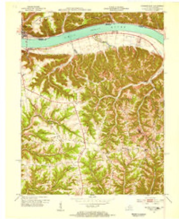
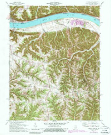
11 topographic sheets cover this place, the earliest surveyed in 1953 and the latest in 1990. It stands in the Milton census division. It lies in ZIP code area 40045. It stands on Tiber Creek. The Survey maps it on the Madison East quadrangle. 590 people lived here at the 2020 count. It stands 459 feet above sea level.
Research this city
On record in Milton
Buildings and businesses the archive holds for this place. Each opens its own page, with the source record it came from.
On the National Register 12 of 15 shown
 Ginn's Furniture Storelisted 1983
 House at Moffett Cemetery Roadlisted 1983
 House on KY 1492listed 1984
 House Tm-M-27listed 1984
 House Tm-M-28listed 1984
 Milton Masonic Lodge and County General Storelisted 1983
 Neal Houselisted 1984
- Moreland Schoollisted 1984
- Pagelisted 1984
- Page-Bell Houselisted 1983
- Preston Houselisted 1983
- Rowlett Houselisted 1984
Every listing in Trimble County
Surveyed buildings and structures 1 record
- US 421 Milton-Madison Bridge (KY-NBI No.: 112B00001N), US 421 spanning the Ohio River between Milton, KY & Madison, IN, Miltonfederal building survey, 1 photograph
Population over time
3 figuresMilton grew from 525 to 590 between 2000 and 2020. These are the recorded population figures Wikidata holds for this place, reached through the Geographic Names Information System number this page is keyed on rather than by name, so they belong to this place and not to another of the same name. Most are census counts, but not all are: an early figure may be a founding or settlement estimate, and an estimate published within five years of a census is left out. The change column is computed, and is left blank where more than 20 years separate a figure from the one before it, because a gap that long is not a change between two counts.
| Year | People | Change |
|---|---|---|
| 2000 | 525 | |
| 2010 | 574 | +49 (+9%) |
| 2020 | 590 | +16 (+3%) |
Topographic sheets covering this place
6 surveys from 11 printed sheetsMatched by testing this settlement's coordinate against the published boundary of every sheet in the United States Geological Survey's historical collection. Each opens the scanned sheet at the Survey.
- 1953 USGS Madison East quadrangle1:24000, 2 printings
- 1956 USGS Louisville quadrangle1:250000, 2 printings
- 1964 USGS Louisville quadrangle1:250000
- 1971 USGS Madison East quadrangle1:24000, 4 printings
- 1986 USGS Madison quadrangle1:100000
- 1990 USGS Madison quadrangle1:100000


Fires near this place
12 since 2002Regional context, not property-specific evidence. The federal wildfire occurrence database lists 12 fires within 5 miles of Milton between 2002 and 2010, burning about 20 acres in total. None started naturally. 2 were recorded as arson. Distance is straight-line from the map coordinates, so a fire counted here may appear on a neighbouring settlement's page as well.
| Reported cause | Fires |
|---|---|
| Recreation and ceremony | 3 |
| Missing data/not specified/undetermined | 3 |
| Debris and open burning | 2 |
| Arson/incendiarism | 2 |
| Equipment and vehicle use | 2 |
The most recent of them, most recent first, with the day each was reported and the service that recorded it.
| Date | Cause | Size | Reported by | Name on the report |
|---|---|---|---|---|
| 25 September 2004 | Arson/incendiarism | 1.0 acres | Indiana State Fire Marshal's Office | not named |
| 15 September 2010 | Missing data/not specified/undetermined | 10 acres | Big Oaks National Wildlife Refuge | HANOVER HILL |
| 2 July 2002 | Debris and open burning | 1.0 acres | Indiana State Fire Marshal's Office | not named |
| 15 July 2002 | Equipment and vehicle use | 1.0 acres | Indiana State Fire Marshal's Office | not named |
| 26 March 2008 | Recreation and ceremony | 1.0 acres | Kentucky Division of Forestry | not named |
| 25 March 2007 | Missing data/not specified/undetermined | 1.0 acres | Indiana State Fire Marshal's Office | not named |
| 24 March 2007 | Recreation and ceremony | 1.0 acres | Indiana State Fire Marshal's Office | not named |
| 24 March 2004 | Recreation and ceremony | under an acre | Indiana State Fire Marshal's Office | not named |
Settlements close enough to share some of these fires:
Mines and quarries near this place
1 within 5 milesRegional context, not property-specific evidence. The federal mineral resources record lists 1 working within 5 miles of Milton: 1 producer. All of them still produce. What was taken out: Stone. Distance is straight-line from the map coordinates, so a quarry counted here may appear on a neighbouring settlement's page as well.
| Where | Site | Commodity | Status | Recorded |
|---|---|---|---|---|
| Jefferson Co. Hwy. Dept. | Stone | Producer |
Storms near this place
46 since 1996Regional context, not property-specific evidence. The National Weather Service names Milton in 46 storm reports between 1996 and 2024: 31 thunderstorm wind, 8 hail, 3 flood, 2 flash flood. The reports record 4 injuries. Each account below is quoted exactly as the forecast office filed it, from the NOAA Storm Events Database, and each date opens the federal record of that event.
| When | Event | Place named | Harm | What the report says |
|---|---|---|---|---|
| August 2007 | Thunderstorm Wind | Milton | 2 hurt, $10,000 | Thunderstorm winds blew a tree on to a barn. Two people inside the barn were injured. |
| March 2024 | Tornado (EF2) | Milton | 2 hurt | The National Weather Service in Louisville, KY in coordination with the National Weather Service in Wilmington, OH conducted a 2 day storm damage assessment survey. The survey found a 18.6 mile long EF-2 tornado with peak winds of 115 mph occurred on the afternoon of March 14, 2024. The tornado was on the ground for 26 minutes as it touched down 1 mile north of Hanover, IN, and lifted just east of Carrollton, KY. The tornado crossed the Ohio River three times as it started in Jefferson County, IN, crossed the Ohio River into Trimble County, KY, entered Carroll County, KY, crossed the Ohio River back into Jefferson County, IN, crossed into Switzerland County, IN, and crossed the Ohio River for the last time before entering Carroll County, KY. The tornado was 500 yards wide at its maximum.||The tornado crossed the Ohio River between River Bottom Road on the Indiana side and Coopers Bottom Road on the Kentucky side, just south of the Clifty Creek Power Plant. After the tornado crossed the river, the next observed damage was along Race Track Road. There was extensive tree damage, consisting of uprooted, topped, and twisted trees facing in all directions. Two greenhouses had the plastic roofing material thrown several hundred yards. Three well-built barns next to the greenhouses sustained no damage, nor did the farmhouse. NWS drone photography showed distinct tree damage and greenhouse debris. The tornado was 80 to 85 mph, EF0, with a|width of around 200 yards.||The tornado then started moving more to the northeast and damaged roof panels on some older barns at the end of Detmer Lane. The tornado was 85 mph, EF0, with a width of 250 yards.||At this point, the tornado came down the large hill overlooking Milton and widened significantly, moving parallel to the sharpest curve on US 421. Half of the tornado was over the Ohio River and the other half was just north of US 421 mainly along Coopers|Bottom Road. There was a plethora of tree damage all the way to the Milton-Madison Bridge. The tornado was 90 mph, EF1, with a width of around 400 yards. Some of the most dramatic tornado video shows the tornado partially over the Ohio River, sucking up water and throwing it in all directions.||EF-0 and EF-1 damage continued as the southern half of the funnel entered Milton, doing roof and structural damage to numerous homes and businesses. In addition, numerous hardwood trees were either snapped or uprooted. Just east of downtown Milton, a large brick home under renovation had a large section of its back wall blown|out, with estimated winds of 105 mph, which was a bit stronger than points to the west. Noted strengthening occurred over the next mile eastward as more concentrated medium to high end EF-1 damage was noted. Evidence that the center of the tornado was still out over water at this point was strong, given that the downed trees were facing toward the river in almost all instances from Milton eastward until Paradise Point along Highway 36 about 1 mile east of downtown Milton.||The center of the tornado finally came on shore at Paradise Point and was immediately at low-end EF-2 strength as several large campers and a motorhome were demolished. One tri-axle camper weighing well over 10,000 pounds was rolled and thrown over 100 yards to the ESE, with debris scattered much farther downstream. Just across Highway 36, a well-built single family residence sustained major roof damage as half of the structure was removed by the tornado. This was also rated at EF-2 strength with winds of 115 mph. Just east of that house, a semi trailer was rolled, a large barn was completely collapsed and shifted, and nearly every tree was snapped in a grove. This was a notable uptick in intensity from areas to the west as snapped trees were more sporadic in those areas. This was more justification for the increase to EF-2. It was at this point that a clear northern portion of the tornado track became evident as downed trees along Highway 36 were laying in a SE direction, pointing inward toward the center of the circulation. It was unclear just how wide the tornado was as it crossed through Milton, since half of the funnel was out over water, however the tornado was around 500 yards wide (roughly a third of a mile) by the time it reached the Trimble/Carroll county line at North Spillman Lane. EF-1/EF-2 intensity remained here as a large span of telephone polls were snapped. |
| January 2008 | Thunderstorm Wind | Milton | $300,000 | Thunderstorm winds damaged homes, barns, and farm equipment. Power lines were also downed. |
| February 2008 | Thunderstorm Wind | Milton | $100,000 | Thunderstorm winds blew a tree on to a trailer destroyed on Pike Road. Power lines were downed on Pyles Road. |
| August 2016 | Thunderstorm Wind | Milton | $30,000 | The local fire department reported that a tree fell down onto a pickup and a house. |
| June 2008 | Flash Flood | Milton | $15,000 | Roads closed for several hours due to rock and mud slides caused by heavy rain. Water also over roadway and in some structures. |
| June 2014 | Thunderstorm Wind | Milton | $10,000 | Winds estimated at 65 mph broke a flag pole, damaged a few signs and felled several trees around Milton. |
| May 1996 | Thunderstorm Wind | Milton | $10,000 | no account filed |
| March 2019 | Thunderstorm Wind | Milton | $5,000 | Barn damage was reported. |
| October 2010 | Tornado (EF0) | Milton | $5,000 | A NWS storm survey confirmed an EF-0 tornado from 2.2 miles SW of Milton to 1.1 miles SW of Milton. The path length was 1.1 miles with a maximum path width of 20 yards. Maximum sustained winds were 70 mph. In addition to tree and fence damage, a front porch roof was destroyed on one home, along with other roof and garage damage. |
| August 2007 | Thunderstorm Wind | Milton | $2,000 | A tree was blown on to a passing car on Milton Hill. |
| June 2024 | Thunderstorm Wind | Milton | - | Trees fell across Coopers Bottom Road. |
| August 2024 | Thunderstorm Wind | Milton | - | A user on social media sent several pictures of a large tree that snapped and fell onto a truck and house. |
| March 2023 | Hail | Milton | - | Quarter-sized hail fell in Milton. |
| August 2022 | Thunderstorm Wind | Milton | - | Trees were down across Kentucky 36. |
| June 2019 | Thunderstorm Wind | Milton | - | Multiple trees were reported down in Milton. |
| February 2018 | Flood | Milton | - | The public reported flooding across access road to Hanover Beach community due to flooding. |
| February 2018 | Flood | Milton | - | The Trimble County emergency manager reported numerous road closures in the Milton area due to high water. |
| March 2017 | Thunderstorm Wind | Milton | - | A NWS Storm Survey team concluded that straight line winds occurred intermittently just south of the Ohio River from 2 miles west of Milton to 2.5 miles east of Milton. A mobile home park was damaged with multiple hardwood trees snapped, and a few un-anchored mobile homes slid off their piers. Winds were estimated between 70 and 75 mph at this location. Further east of Milton, the damage was more significant with large outbuildings either heavily damaged or destroyed. Large hardwood trees were snapped and uprooted. Debris was scattered 200 to 300 yards downwind. Maximum winds there were estimated to be 80 to 90 mph. |
| July 2017 | Thunderstorm Wind | Milton | - | The public reported several trees down in the area due to severe thunderstorm winds. |
| July 2017 | Thunderstorm Wind | Milton | - | Local fire department reported multiple trees down on Milton Hill. |
| July 2016 | Thunderstorm Wind | Milton | - | Local officials reported trees down in the area. |
| July 2014 | Thunderstorm Wind | Milton | - | The local fire department reported trees snapped and uprooted. A large tree fell and blocked State Highway 421 at Milton Hill. |
| July 2012 | Thunderstorm Wind | Milton | - | Several trees were downed along County Road 625 just south of Milton. |
| July 2012 | Thunderstorm Wind | Milton | - | A tree was downed across Race Track Road near Milton. |
| July 2012 | Thunderstorm Wind | Milton | - | A couple of trees were downed near Milton, blocking Highway 421. |
| July 2009 | Thunderstorm Wind | Milton | - | Trees were downed. |
| February 2008 | Thunderstorm Wind | Milton | - | Thunderstorm winds downed trees and power lines. |
| March 2008 | Flash Flood | Milton | - | Highways 625 and 2870 were closed due to high water. Heavy rains caused a mudslide that closed a section of Coopers Bottom Road near the Ohio River. |
| June 2008 | Hail | Milton | - | Penny size hail reported in Milton. |
| April 2008 | Flood | Milton | - | Three roads in the county were closed due to high water. |
| July 2008 | Thunderstorm Wind | Milton | - | Trees were downed near the bridge to Madison Indiana. |
| August 2007 | Thunderstorm Wind | Milton | - | Trees and power lines were downed. |
| October 2007 | Thunderstorm Wind | Milton | - | Trees and power lines were downed. A trained spotter estimated at 70 mph wind gust. |
| July 1998 | Thunderstorm Wind | Milton | - | Numerous trees down in the Cutshaw Lane area. |
| July 2018 | Hail | Milton | - | no account filed |
| August 2007 | Hail | Milton | - | no account filed |
| June 2006 | Thunderstorm Wind | Milton | - | no account filed |
| June 1998 | Thunderstorm Wind | Milton | - | no account filed |
| May 1998 | Hail | Milton | - | no account filed |
| May 1998 | Thunderstorm Wind | Milton | - | no account filed |
| May 1998 | Hail | Milton | - | no account filed |
| May 1998 | Thunderstorm Wind | Milton | - | no account filed |
| March 1997 | Hail | Milton | - | no account filed |
| May 1996 | Hail | Milton | - | no account filed |
| May 1996 | Thunderstorm Wind | Milton | - | no account filed |
Nearest settlements
The eight closest, with where each one stands in the county. Distances are straight-line, computed from the Geographic Names Information System coordinates.
| Map | Place | Distance | Sheets |
|---|---|---|---|
| North Mount Tabor (historical) | 4.9 miles | 11 | |
| Callis Grove | 5.9 miles | 11 | |
| Mount Tabor (historical) | 6.1 miles | 11 | |
| Trout | 6.2 miles | 17 | |
| South Mount Tabor (historical) | 6.5 miles | 11 | |
| Monitor | 7.2 miles | 11 | |
| Mount Pleasant | 7.7 miles | 15 | |
| Poplar Ridge (historical) | 7.9 miles | 8 |
Elsewhere
Matched on this settlement's Geographic Names Information System number rather than its name, so it cannot be a different place of the same name in another state.
| Wikipedia article on Milton | An encyclopaedic summary. Its text is share-alike, so it is linked here rather than copied. |
| Wikidata item Q2556835 | The structured record the population and elevation above come from. Public domain (CC0). |
Provenance
This settlement is recorded in the Geographic Names Information System as feature 498397. The sheet list is computed by point-in-boundary test against the United States Geological Survey's historical topographic inventory. Both are works of the United States government and carry no copyright under 17 U.S.C. 105.
Wildfire. Short, Karen C. 2022. Spatial wildfire occurrence data for the United States, 1992-2020 [FPA_FOD_20221014]. 6th Edition. Fort Collins, CO: Forest Service Research Data Archive. https://doi.org/10.2737/RDS-2013-0009.6 Collected with United States Government funding and usable without additional permissions or fees.
Mines and quarries. USGS Mineral Resources Data System (MRDS) https://mrdata.usgs.gov/mrds/ A work of the United States government, no copyright under 17 U.S.C. 105.
Storms. NOAA National Centers for Environmental Information, Storm Events Database https://www.ncei.noaa.gov/stormevents/ A work of the United States government, no copyright under 17 U.S.C. 105. Narratives are quoted verbatim from the National Weather Service report and are not edited or summarised.