 Block
Baskett, Kentucky
14 topographic sheets cover this place, the earliest surveyed in 1905 and the latest in 1991. It stands in the Spottsville census division. It lies in ZIP code area 42420. It stands on Race Creek. The Survey maps it on the Spottsville quadrangle. It stands 400 feet above sea level.
Topographic sheets covering this place
8 surveys from 14 printed sheetsMatched by testing this settlement's coordinate against the published boundary of every sheet in the United States Geological Survey's historical collection. Each opens the scanned sheet at the Survey.
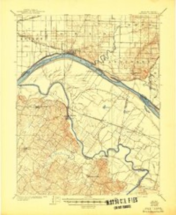
- 1905 USGS Newburg quadrangle1:62500, 3 printings
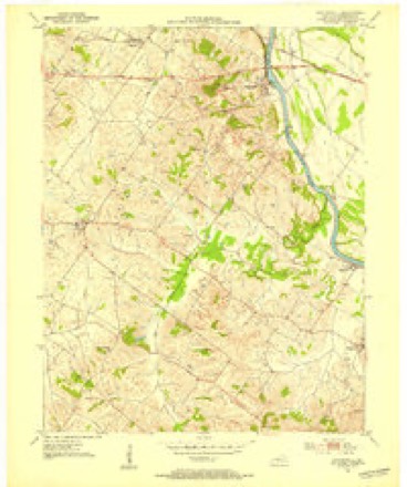
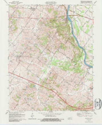
- 1951 USGS Spottsville quadrangle1:24000
- 1954 USGS Evansville quadrangle1:250000
- 1957 USGS Evansville quadrangle1:250000, 3 printings
- 1961 USGS Evansville quadrangle1:250000, 2 printings
- 1971 USGS Spottsville quadrangle1:24000, 2 printings
- 1986 USGS Evansville quadrangle1:100000
- 1991 USGS Evansville quadrangle1:100000
Fires near this place
8 since 1999Regional context, not property-specific evidence. The federal wildfire occurrence database lists 8 fires within 5 miles of Baskett between 1999 and 2017, burning about 106 acres in total. None started naturally. None was recorded as arson. Distance is straight-line from the map coordinates, so a fire counted here may appear on a neighbouring settlement's page as well.
| Reported cause | Fires |
|---|---|
| Missing data/not specified/undetermined | 3 |
| Debris and open burning | 2 |
| Recreation and ceremony | 2 |
| Equipment and vehicle use | 1 |
The most recent of them, most recent first, with the day each was reported and the service that recorded it.
| Date | Cause | Size | Reported by | Name on the report |
|---|---|---|---|---|
| 28 August 1999 | Equipment and vehicle use | 45 acres | Kentucky Division of Forestry | not named |
| 17 May 2007 | Recreation and ceremony | 1.0 acres | Kentucky Division of Forestry | not named |
| 6 April 2013 | Recreation and ceremony | 3.1 acres | Kentucky Division of Forestry | REED FIRE |
| 21 April 2003 | Missing data/not specified/undetermined | 50 acres | Kentucky Division of Forestry | not named |
| 10 March 2017 | Debris and open burning | 3.0 acres | Kentucky Division of Forestry | HATCHETT MILL ROAD |
| 15 February 2017 | Debris and open burning | 2.0 acres | Kentucky Division of Forestry | HWY 1078 |
| 31 October 2010 | Missing data/not specified/undetermined | 1.0 acres | Kentucky Division of Forestry | HALLOWEEN FIRE |
| 24 October 2010 | Missing data/not specified/undetermined | 1.0 acres | Kentucky Division of Forestry | MIDNIGHT FIRE |
Settlements close enough to share some of these fires:
Storms near this place
12 since 2008Regional context, not property-specific evidence. The National Weather Service names Baskett in 12 storm reports between 2008 and 2025: 7 flood, 3 thunderstorm wind, 1 lightning, 1 funnel cloud. The reports record 1 death. Each account below is quoted exactly as the forecast office filed it, from the NOAA Storm Events Database, and each date opens the federal record of that event.
| When | Event | Place named | Harm | What the report says |
|---|---|---|---|---|
| March 2013 | Flood | Baskett | 1 killed, $20,000 | Minor flooding occurred along the Ohio River in Henderson County. Some low-lying fields were underwater. A few river access roads were underwater. At the end of a secondary road near the confluence of the Green and Ohio Rivers, a 70-year-old man drowned after driving into floodwaters. The man was discovered by a sheriff's deputy on March 24 while on routine patrol. The water was close to chest deep when the deputy located him. It appeared the victim's truck had stalled in the water and that he attempted to walk out. The victim did not have a phone in his possession. County dispatch was notified of his stalled truck on March 22, but nobody was found during a search by rescue squad personnel. |
| May 2011 | Flood | Baskett | $6,000,000 | Flooding continued on the Ohio River from April. At the Evansville, Indiana river gage, the river crested at 46.78 feet on May 5. This was the 8th highest crest on record, and less than a foot below the 1997 flood. Due to Ohio River flooding, a horse-racing track was surrounded by floodwater. A preliminary estimate of the number of flooded homes ranges from 100 to 200. Near the confluence of the Green and Ohio Rivers, a number of homes were enveloped by water near Spottsville. At least 80 county roads and a much smaller number of state roads were closed by flooding. U.S. Highway 60 was closed from Spottsville to the Daviess County line. A Red Cross shelter was opened for a very small number of evacuees, mostly from the Reed and Beals communities. The National Guard was activated. There was considerable flooding of low-lying agricultural land, forcing farmers to delay planting. |
| August 2022 | Thunderstorm Wind | Baskett | $15,000 | Trees were blown down in the vicinity of U.S. Highway 60 near Baskett, Spottsville, and Reed. |
| November 2011 | Lightning | Baskett | $10,000 | Lightning struck a vacant house on U.S. Highway 60, starting a fire. The fire was mainly confined to the outside walls of the house. |
| July 2021 | Thunderstorm Wind | Baskett | $2,000 | A few trees were blown down at a farm, along with gutter damage and flattened sweet corn. |
| July 2025 | Flood | Baskett | - | Heavy rainfall resulted in ditches overflowing north of Henderson. A driveway was flooded with half a foot of water. Peak hourly rainfall rates reached approximately 1-1.5. |
| March 2020 | Thunderstorm Wind | Baskett | - | The Kentucky mesonet site in Henderson County measured a gust to 90 mph as the center of a tornado passed about one kilometer northwest of the site. The pressure at the mesonet site dropped a few millibars as the tornado passed. |
| January 2016 | Flood | Baskett | - | Minor flooding continued into the first few days of January on the Ohio River in the Henderson area. Parts of Audubon State Park were flooded, along with a couple bottomland roads and woodlands near the Green River confluence. |
| December 2015 | Flood | Baskett | - | Minor flooding occurred on the Ohio River in the Henderson area. Parts of Audubon State Park were flooded, along with a couple bottomland roads and woodlands near the Green River confluence. The flooding continued into early January. |
| June 2011 | Funnel Cloud | Baskett | - | The general public reported a funnel cloud along U.S. Highway 60 between Spottsville and the Daviess County line. |
| March 2008 | Flood | Baskett | - | Minor flooding of the Ohio River occurred. At the Evansville, IN gage, the river crested at 43.65 feet on March 23. Flood stage there is 42 feet. Low-lying fields near the river were flooded. |
| April 2018 | Flood | Baskett | - | no account filed |
Nearest settlements
The eight closest, with where each one stands in the county. Distances are straight-line, computed from the Geographic Names Information System coordinates.
| Map | Place | Distance | Sheets |
|---|---|---|---|
| Spottsville | 2.7 miles | 14 | |
| Beals | 3.2 miles | 14 | |
| Zion | 4.0 miles | 14 | |
| Graham Hill | 4.9 miles | 18 | |
| Reed | 5.9 miles | 14 | |
| Scuffletown | 6.0 miles | 17 | |
| Bluff City | 6.5 miles | 14 | |
| Henderson | 7.2 miles | 18 |
Elsewhere
Matched on this settlement's Geographic Names Information System number rather than its name, so it cannot be a different place of the same name in another state.
| Wikipedia article on Baskett | An encyclopaedic summary. Its text is share-alike, so it is linked here rather than copied. |
| Wikidata item Q4867767 | The structured record the population and elevation above come from. Public domain (CC0). |
Provenance
This settlement is recorded in the Geographic Names Information System as feature 486457. The sheet list is computed by point-in-boundary test against the United States Geological Survey's historical topographic inventory. Both are works of the United States government and carry no copyright under 17 U.S.C. 105.
Wildfire. Short, Karen C. 2022. Spatial wildfire occurrence data for the United States, 1992-2020 [FPA_FOD_20221014]. 6th Edition. Fort Collins, CO: Forest Service Research Data Archive. https://doi.org/10.2737/RDS-2013-0009.6 Collected with United States Government funding and usable without additional permissions or fees.
Storms. NOAA National Centers for Environmental Information, Storm Events Database https://www.ncei.noaa.gov/stormevents/ A work of the United States government, no copyright under 17 U.S.C. 105. Narratives are quoted verbatim from the National Weather Service report and are not edited or summarised.