 Block
Henderson, Kentucky
18 topographic sheets cover this place, the earliest surveyed in 1914 and the latest in 1991. It stands in the Henderson census division. It lies in ZIP code area 42420. It stands on Sugar Creek. The Survey maps it on the Henderson quadrangle. 27,981 people lived here at the 2020 count. It stands 407 feet above sea level.
Research this city
On record in Henderson
Buildings and businesses the archive holds for this place. Each opens its own page, with the source record it came from.
On the National Register 12 of 22 shown
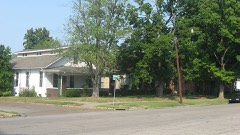 Alves Historic Districtlisted 1989
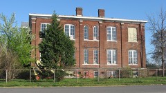 Audubon Schoollisted 1998
 John James Audubon State Parklisted 1988
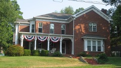 Barret Houselisted 1978
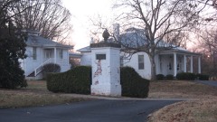 Delano-Alves Houselisted 1993
 Geibel Houselisted 1998
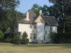 J. Hawkins Hart Houselisted 2011
 Henderson Armorylisted 2002
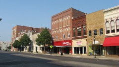 Henderson Commercial Districtlisted 1989
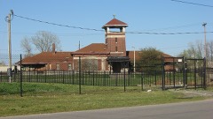 Henderson, Louisville and Nashville Railroad Depotlisted 1980
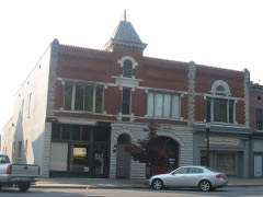 Klee Funeral Parlorlisted 1989
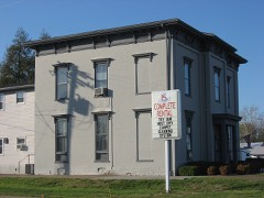 John E. McCallister Houselisted 1982
Every listing in Henderson County
Surveyed buildings and structures 4 records
- Beulah & Eva Lockett House, Elm & Jefferson Streets, Hendersonfederal building survey, 10 photographs
- Governor Lazarus Powell House, Hendersonfederal building survey, 8 photographs
- Henderson County Court House, First & Main Streets, Hendersonfederal building survey, 10 photographs
- St. Paul's Episcopal Church, Third & Main Streets, Hendersonfederal building survey, 9 photographs
Population over time
2 figuresHenderson fell from 28,757 to 27,981 between 2010 and 2020. These are the recorded population figures Wikidata holds for this place, reached through the Geographic Names Information System number this page is keyed on rather than by name, so they belong to this place and not to another of the same name. Most are census counts, but not all are: an early figure may be a founding or settlement estimate, and an estimate published within five years of a census is left out. The change column is computed, and is left blank where more than 20 years separate a figure from the one before it, because a gap that long is not a change between two counts.
| Year | People | Change |
|---|---|---|
| 2010 | 28,757 | |
| 2020 | 27,981 | -776 (-3%) |
Topographic sheets covering this place
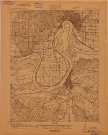
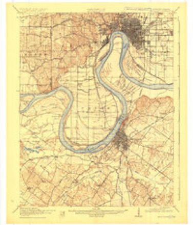
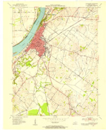
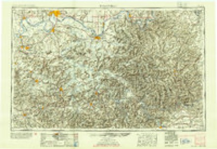
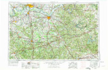
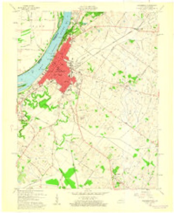
10 surveys from 18 printed sheetsMatched by testing this settlement's coordinate against the published boundary of every sheet in the United States Geological Survey's historical collection. Each opens the scanned sheet at the Survey.
- 1914 USGS Henderson quadrangle1:48000
- 1916 USGS Henderson quadrangle1:62500, 3 printings
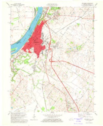
- 1952 USGS Henderson quadrangle1:24000
- 1954 USGS Evansville quadrangle1:250000
- 1957 USGS Evansville quadrangle1:250000, 3 printings
- 1959 USGS Henderson quadrangle1:24000
- 1961 USGS Evansville quadrangle1:250000, 2 printings
- 1971 USGS Henderson quadrangle1:24000, 4 printings
- 1986 USGS Evansville quadrangle1:100000
- 1991 USGS Evansville quadrangle1:100000
What the histories say of this town
25,773 words1 chapter about Henderson from the published histories of the county, public domain and reproduced complete.
| Chapter | From | Length |
|---|---|---|
| History | History of Henderson County, Kentucky (1887) | 25,773 words in 2 parts |
Photographs
8 of 22 photographs shown, 1916 to 2020Taken for the Office of War Information and the Farm Security Administration, who photographed the country between 1935 and 1944. Works of United States government photographers, with no known restriction on use. Each opens its catalogue record.

Hine, Lewis Wickes, 1916. Library of Congress

Hine, Lewis Wickes, 1916. Library of Congress
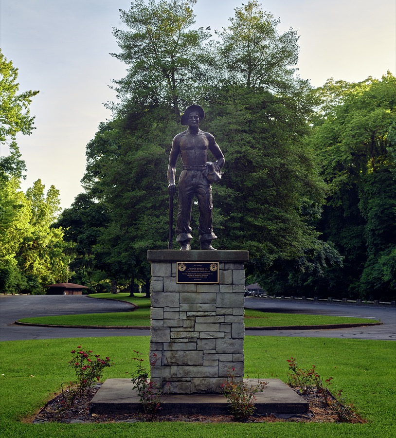
Highsmith, Carol M, 2020. Library of Congress

Hine, Lewis Wickes, 1916. Library of Congress

Hine, Lewis Wickes, 1916. Library of Congress

Highsmith, Carol M, 2020. Library of Congress

Hine, Lewis Wickes, 1916. Library of Congress

Hine, Lewis Wickes, 1916. Library of Congress
Every photograph of Henderson County
Fires near this place
2 since 1998Regional context, not property-specific evidence. The federal wildfire occurrence database lists 2 fires within 5 miles of Henderson between 1998 and 2010, burning about 3 acres in total. None started naturally. None was recorded as arson. Distance is straight-line from the map coordinates, so a fire counted here may appear on a neighbouring settlement's page as well.
| Reported cause | Fires |
|---|---|
| Debris and open burning | 1 |
| Missing data/not specified/undetermined | 1 |
The most recent of them, most recent first, with the day each was reported and the service that recorded it.
| Date | Cause | Size | Reported by | Name on the report |
|---|---|---|---|---|
| 28 March 1998 | Debris and open burning | 2.0 acres | Kentucky Division of Forestry | not named |
| 24 October 2010 | Missing data/not specified/undetermined | 1.0 acres | Kentucky Division of Forestry | MIDNIGHT FIRE |
Settlements close enough to share some of these fires:
Mines and quarries near this place
2 within 5 milesRegional context, not property-specific evidence. The federal mineral resources record lists 2 workings within 5 miles of Henderson: 2 producers. All of them still produce. What was taken out: Sand and Gravel, Construction. Distance is straight-line from the map coordinates, so a quarry counted here may appear on a neighbouring settlement's page as well.
| Where | Site | Commodity | Status | Recorded |
|---|---|---|---|---|
| Henderson County Sand Company | Sand and Gravel, Construction | Producer | ||
| Henderson Plant | Sand and Gravel, Construction | Producer |
Storms near this place
60 of 137 shownRegional context, not property-specific evidence. The National Weather Service names Henderson in 137 storm reports between 1995 and 2025: 50 thunderstorm wind, 35 hail, 20 flash flood, 15 flood. The reports record 1 death and 12 injuries. Each account below is quoted exactly as the forecast office filed it, from the NOAA Storm Events Database, and each date opens the federal record of that event.
| When | Event | Place named | Harm | What the report says |
|---|---|---|---|---|
| March 2015 | Flood | Henderson | 1 killed, $20,000 | Minor flooding occurred on the Ohio River. Numerous secondary roads in low-lying bottomlands were underwater. One motorist died after driving down a flooded road in a remote area adjacent to Audubon State Park. The body of the 55-year-old man was found in the water near his truck about 17 days after he went missing. A few state roads were closed near the river, including Highways 268, 811, and 136. |
| November 2005 | Tornado (F3) | Henderson | 8 hurt, $7,000,000 | The tornado that would cause mass casualties in the Evansville, Indiana area crossed the Ohio River a second time. This second crossing was from Vanderburgh County, Indiana into Henderson County. The tornado then crossed the river a third time less than a mile west of the U.S. Highway 41 twin bridges. The river does not form the state line at the third crossing. From the bridges, extensive tree damage was visible along both sides of the Ohio River. Almost immediately after crossing the river, the tornado slammed into a horse racing facility named Ellis Park. There was extensive damage to grandstands and housing facilities for jockeys. A few race horses were killed. This facility was the first major facility to be impacted by the tornado. All of the Henderson County tornado injuries were at Ellis Park. The tornado then crossed back into Vanderburgh County, Indiana after striking Ellis Park. |
| June 2018 | Thunderstorm Wind | Henderson | 2 hurt, $20,000 | Six to ten trees were down along U.S. Highway 41A. One of the trees fell on a car, causing injuries. |
| May 1998 | Flash Flood | Henderson | 1 hurt, $50,000 | About 2.2 inches of rain fell in 45 minutes during a thunderstorm. There were about a dozen reports of motorists stranded in floodwaters. One motorist was injured while submerged in floodwaters on U.S. Route 41. Part of U.S. 60 was under water near Starlight Drive-In. Henderson Police reported most of the city was flooded, and there was three feet of water in front of the police station. |
| March 1997 | Flash Flood | Henderson | 1 hurt, $40,000 | no account filed |
| July 2025 | Flash Flood | Henderson | $100,000 | Torrential rainfall rates of 1.5'' in an hour resulted in flash flooding in Henderson. Numerous vehicles were stuck in floodwaters including on North Green St and Ingram St, between 7th and 1st Street. Portions of Alvesia St were also closed due to floodwaters. |
| June 2020 | Flash Flood | Henderson | $100,000 | Flash flooding of roads became rather widespread. Some roads were impassable. Water rescues were conducted from vehicles that were stranded in floodwaters. Rainfall amounts were heaviest in southeast parts of the county, where close to 8 inches fell in a 48-hour period. Much of that rain fell early on the 28th. A trained spotter just east of Corydon measured 7.85 inches during the daytime hours on the 28th. |
| October 2014 | Thunderstorm Wind | Henderson | $100,000 | At the Henderson County High School, there was considerable damage at the athletic complex behind the school. A small building housing a baseball conditioning room lost about 20 feet of metal roofing, and an outside wall was displaced about three feet. A few small trees were blown down. Power poles were down across Highway 351. A radio tower south of the athletic fields was blown down. |
| June 2010 | Thunderstorm Wind | Henderson | $60,000 | Multiple trained spotters estimated wind speeds of 60 mph in the Henderson area. Small trees were snapped in the city of Henderson. A wind gust to 55 mph was measured at the Henderson City-County Airport. Six power poles and some trees were down on U.S. Highway 60 near Baskett, and sections of a fence were tossed into a nearby field. |
| November 2019 | Flash Flood | Henderson | $50,000 | Numerous water rescues were occurring around Henderson County, including the city of Henderson. |
| April 1996 | Flash Flood | Henderson | $50,000 | no account filed |
| July 2014 | Thunderstorm Wind | Henderson | $40,000 | Roof damage occurred to two homes in northeast Henderson County. A two-foot diameter tree was down on one home. The roof was peeled off part of a second home. Numerous smaller trees and power lines were damaged. |
| January 2008 | Thunderstorm Wind | Henderson | $40,000 | At Ellis Park, the roof was torn off the equipment building. Two barns were damaged or destroyed. Trees and power lines were blown down. Power lines and a few trees were blown down in Henderson. |
| June 1998 | Thunderstorm Wind | Henderson | $35,000 | Numerous trees were blown down in and east of Henderson. Trees fell on vehicles at several locations in the city. East of the city, roads were blocked by downed limbs. |
| June 2018 | Thunderstorm Wind | Henderson | $30,000 | Widespread tree and power line damage was reported. |
| October 2013 | Thunderstorm Wind | Henderson | $30,000 | Two trees were blown down, blocking roads in northern sections of the city. Downed power lines and power outages were also reported in northern sections of the city. |
| April 2005 | Thunderstorm Wind | Henderson | $30,000 | Several trees and power lines were blown down. One tree landed on a police cruiser, damaging the windshield and hood. A tree landed on a house on Kentucky Highway 266. Some trees fell on Kentucky Highway 351 and on Old U.S. 60 East. |
| April 2002 | Flash Flood | Henderson | $30,000 | Torrential downpours, producing close to 3 inches of rain, flooded numerous streets and forced authorities to block off some places. Police estimated 60 percent of the city was flooded, including First through Ninth Streets. Water entered homes in the Eighth and Ninth Street areas. A number of vehicles became stranded in high water. Outside the city, U.S. Highway 60 near Kentucky 1078 and Kentucky 351 was under water. |
| July 2010 | Thunderstorm Wind | Henderson | $25,000 | Several boats were overturned at a boat ramp on the Ohio River. |
| March 2006 | Thunderstorm Wind | Henderson | $20,000 | A wind gust to 63 MPH was measured on the U.S. Highway 41 twin bridges over the Ohio River. In Henderson, two utility poles were knocked down, and a business sign was blown away. Outside the city, the roof was blown off a residence, and four trees were blown down. |
| May 1998 | Thunderstorm Wind | Henderson | $15,000 | Thunderstorm winds blew down trees and toppled telephone poles. A carport buckled in at a home on 8th Street. |
| March 2020 | Thunderstorm Wind | Henderson | $10,000 | A radio communications tower was blown down. |
| March 2019 | Flash Flood | Henderson | $10,000 | Water rescues were conducted on Highway 1539 a few miles east of Henderson. The creek flooding may have been aggravated by backwater from the Ohio River, which was near flood stage. Around two inches of rain fell during the predawn hours, causing flash flooding of creeks. |
| October 2019 | Thunderstorm Wind | Henderson | $10,000 | Large tree limbs were down. There was some shingle damage to homes. |
| May 2011 | Thunderstorm Wind | Henderson | $10,000 | A large tree fell across a mobile home. Tree limbs were blown down. |
| July 2000 | Lightning | Henderson | $10,000 | Lightning struck a maple tree in a residential area, sending large limbs falling across a fence and swimming pool. Lightning struck an electrical transformer in the same area, causing a power outage to 30 or 40 residents. |
| June 1998 | Thunderstorm Wind | Henderson | $10,000 | Trees fell on vehicles at several locations. |
| May 1995 | Thunderstorm Wind | Henderson | $10,000 | Several trees and large limbs were blown down in Henderson. |
| August 2024 | Thunderstorm Wind | Henderson | $8,000 | Several trees were downed in Henderson as a line of thunderstorms moved across the city. |
| May 2018 | Thunderstorm Wind | Henderson | $8,000 | At least a half dozen trees were down, and power outages were reported. |
| September 2000 | Thunderstorm Wind | Henderson | $8,000 | Trees and power lines were blown down in Henderson. A tree fell across the southbound lanes of South Green Street, partially blocking traffic for an hour. A power pole was blown over in the same area. |
| August 1996 | Flood | Henderson | $8,000 | no account filed |
| June 2000 | Thunderstorm Wind | Henderson | $7,000 | A few trees were blown down. Wind gusts to 55 MPH were measured at a school. |
| May 2016 | Thunderstorm Wind | Henderson | $6,000 | A tree and power poles were down. |
| June 1999 | Thunderstorm Wind | Henderson | $6,000 | Numerous trees and power lines were down. |
| July 2024 | Thunderstorm Wind | Henderson | $5,000 | A garage roof partially collapsed along Green River Rd as a thunderstorm moved southeastward through northern Henderson County. |
| July 2016 | Thunderstorm Wind | Henderson | $5,000 | Large tree limbs were blown down. |
| May 2006 | Thunderstorm Wind | Henderson | $5,000 | In Spottsville, minor damage to shingles and siding was reported, and tree limbs were down. On U.S. Highway 60 near Audubon State Park, power lines and trees were down. |
| May 2006 | Thunderstorm Wind | Henderson | $5,000 | Trees and power lines were blown down. |
| June 1997 | Thunderstorm Wind | Henderson | $5,000 | Several trees and a power line were down in and around Henderson. |
| May 1995 | Hail | Henderson | $5,000 | no account filed |
| May 2019 | Thunderstorm Wind | Henderson | $4,000 | A large tree was blown onto a house. |
| July 1997 | Thunderstorm Wind | Henderson | $4,000 | Power lines were down across the county. |
| March 2020 | Thunderstorm Wind | Henderson | $3,000 | Just southeast of Audubon State Park, a few trees were downed. Video showed some power flashes. Nearby, the northbound side of U.S. Highway 41 was closed near the Ohio River bridges. This wind occurred in association with the storm that produced tornadoes in Henderson County and Warrick County, Indiana. |
| March 2019 | Thunderstorm Wind | Henderson | $3,000 | A few trees were down around town. |
| July 2025 | Thunderstorm Wind | Henderson | $2,000 | Power lines were downed by thunderstorm winds onto S. Green St. Further north, a 50mph gust was recorded near the intersection of US-60 and US-41. |
| August 2022 | Thunderstorm Wind | Henderson | $2,000 | At least a couple of large trees were uprooted in the Ohio River bottoms area northeast of Henderson. |
| October 2010 | Thunderstorm Wind | Henderson | $2,000 | Two trees were blown down in the city. |
| September 2006 | Flash Flood | Henderson | $2,000 | Water covered numerous roads and approached several residences. Some roads were closed. At least one vehicle was abandoned at a flooded intersection. In the Spottsville area, school buses were rerouted around flooded areas. Flooded roads included U.S. Highway 41 North in Henderson and U.S. Highway 60 East near Baskett. Traffic was backed up on U.S. Highway 41 heading into Henderson due to high water. Water entered the basement of one house. Lines of thunderstorms moved across the city during the mid and late afternoon hours as a cold front stalled just west of the area. |
| June 2024 | Thunderstorm Wind | Henderson | $1,000 | Wind gust measured on the south side of Henderson at US 41 and the Audubon Parkway. |
| April 2002 | Lightning | Henderson | $1,000 | Lightning struck a church, blowing a hole in the roof and starting a small fire. |
| October 2025 | Flood | Henderson | - | Torrential rainfall during the morning resulted in flooding of roads in Henderson County including part of Hwy 41. Over 4.5in of rainfall were observed in multiple locations: 4.74in at Robards, 4.71in at Coryden, and 4.52in at Henderson. |
| July 2025 | Flash Flood | Henderson | - | Flash flooding was observed on US-60 at 4th St and 12th St with traffic rerouted. Rainfall rates in the area were estimated by radar at around an inch over 45 minutes. |
| March 2024 | Hail | Henderson | - | Hail of three-quarters of an inch was reported via mPING. |
| May 2024 | Hail | Henderson | - | Broadcast media relayed a report of hail estimated to be dime to nickel size in Henderson from a storm tracking to the ENE. |
| May 2024 | Hail | Henderson | - | Hail measured to nickel size fell from a thunderstorm moving northeastward through Henderson. |
| March 2023 | Flash Flood | Henderson | - | Flooding was curb deep in the city of Henderson on Green River Road among other streets. Four miles south-southeast of Henderson, water was covering part of the roadway on U.S. Highway 41 South at Smith Staples Road. |
| August 2023 | Flash Flood | Henderson | - | There was flooding of city streets in parts of Henderson. |
| September 2022 | Flash Flood | Henderson | - | Flash flooding was reported along Highway 41 in the retail area on the east side of Henderson. |
| June 2021 | Flood | Henderson | - | A few city streets were closed by flooding around Henderson. |
Nearest settlements
The eight closest, with where each one stands in the county. Distances are straight-line, computed from the Geographic Names Information System coordinates.
| Map | Place | Distance | Sheets |
|---|---|---|---|
| Weaverton | 1.5 miles | 18 | |
| Finley Addition | 2.9 miles | 18 | |
| Graham Hill | 3.3 miles | 18 | |
| Rankin | 3.8 miles | 18 | |
| Wilson | 5.3 miles | 17 | |
| Geneva | 5.7 miles | 17 | |
| Zion | 5.8 miles | 14 | |
| Anthoston | 6.0 miles | 18 |
Elsewhere
Matched on this settlement's Geographic Names Information System number rather than its name, so it cannot be a different place of the same name in another state.
| Wikipedia article on Henderson | An encyclopaedic summary. Its text is share-alike, so it is linked here rather than copied. |
| Wikidata item Q734134 | The structured record the population and elevation above come from. Public domain (CC0). |
Provenance
This settlement is recorded in the Geographic Names Information System as feature 494023. The sheet list is computed by point-in-boundary test against the United States Geological Survey's historical topographic inventory. Both are works of the United States government and carry no copyright under 17 U.S.C. 105.
Wildfire. Short, Karen C. 2022. Spatial wildfire occurrence data for the United States, 1992-2020 [FPA_FOD_20221014]. 6th Edition. Fort Collins, CO: Forest Service Research Data Archive. https://doi.org/10.2737/RDS-2013-0009.6 Collected with United States Government funding and usable without additional permissions or fees.
Mines and quarries. USGS Mineral Resources Data System (MRDS) https://mrdata.usgs.gov/mrds/ A work of the United States government, no copyright under 17 U.S.C. 105.
Storms. NOAA National Centers for Environmental Information, Storm Events Database https://www.ncei.noaa.gov/stormevents/ A work of the United States government, no copyright under 17 U.S.C. 105. Narratives are quoted verbatim from the National Weather Service report and are not edited or summarised.