BlockBefore

Henderson County, Kentucky

68 topographic sheets and 11 fire insurance atlases across 2 places.

Research this county

From the record

22 National Register listings published here · the county-history sources tell 1 story and name 1 person · people the book names include Murder Of James E. Rankin (Henderson, 1887) (machine-read).

Sources: the county history on the Internet Archive · the National Register database, National Park Service

Kentucky within the United States
Henderson County within Kentucky

What the record shows

  • 2 places in this county were surveyed for fire insurance: Henderson, Corydon, between 1885 and 1956.
  • 11 fire insurance atlases survive for the county. Topographic coverage is national; fire insurance survey reached only incorporated places with something worth insuring.
  • 447 topographic sheet readings cover the county's settlements.
  • 22 properties here are on the National Register of Historic Places: 15 buildings, 6 districts and 1 site.
  • 2 of the 22 listings were added during the 1970s.
  • The Geographic Names Information System records 29 populated places in this county; 29 are covered by at least one topographic sheet.

What happened here

1 accounts

Among them: Murder Of Lemuel Cheaney By Charles C. Carr. These passages come from the identified county-history source books. Each inset names its own source and opens the exact section it comes from.

From History of Henderson County, Kentucky, published 1887 - Henderson

Murder Of Lemuel Cheaney By Charles C. Carr

1818. On the fourteenth day of December, 1818, Charles C. Carr, or Stephen Grimes, shot and killed Lemuel Cheane}', while riding through the silent, solemn woods, near Colonel Elias Powell's meadow farm. It is not known to this day which one of the two did the shooting, although Carr was hung and Grimes cleared.

Read the rest of this passage

Photographs

22 photographs, 1916 to 2020

Taken for the Office of War Information and the Farm Security Administration, who photographed the country between 1935 and 1944. Works of United States government photographers, with no known restriction on use. Each opens its catalogue record.

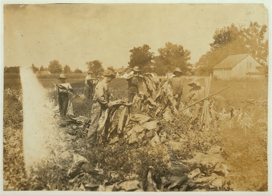
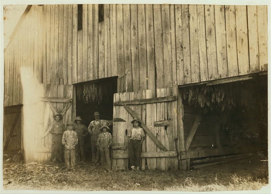
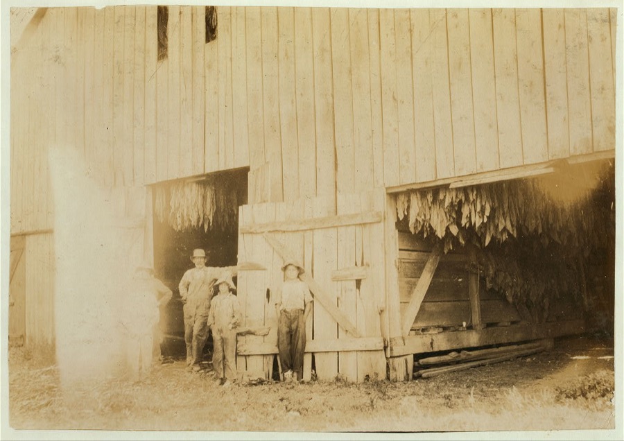
Group gathering tobacco on farm of Daniel Barrett, Spottsville, Ky., Star Route. He is a renter. Boys all belong to other families and will go to Bluff City School, Div. 3, Henderson Co., when work is over. School opened 2 weeks ago, and the boys expect to be out several weeks more. 10-year old boy, Edward Goldsberry carries and drops the sticks. 11-year old Aubrey Hazeland is piling the tobacco (in front). 13-year old Dolph Hazeland piling (behind Aubrey), and 14-year old Willie Goldsberry is spiking the tobacco. Location: Henderson County--Spottsville, Kentucky
Hine, Lewis Wickes, 1916. Library of Congress
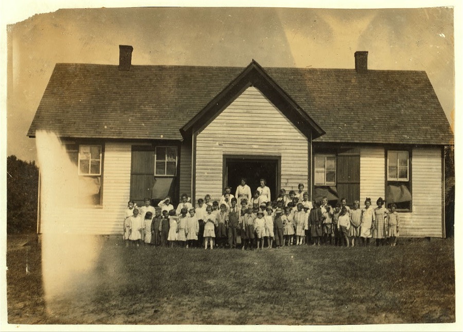
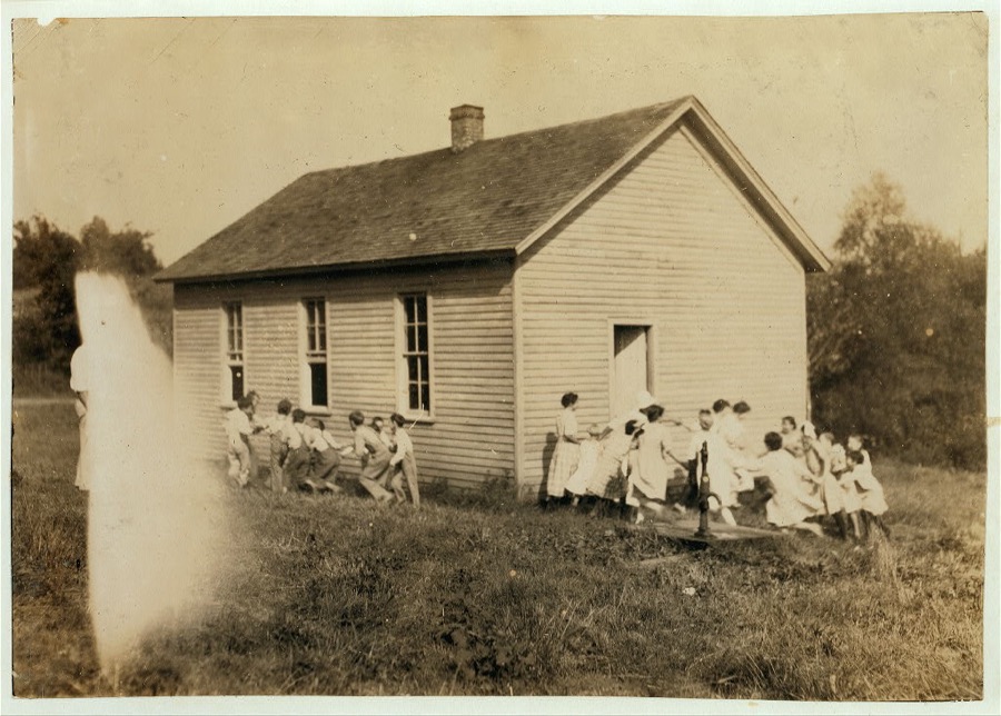
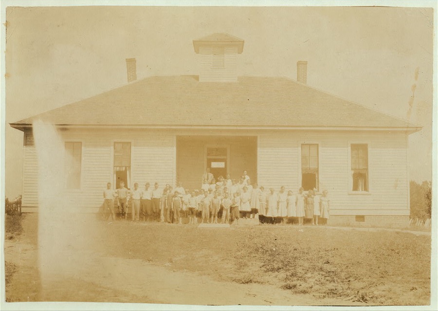
Anthoston School which opened September 5th. 54 present out of an enrollment of 62; Census 84. Work is interfering. See photo of school 2 weeks before it opened.  Location: Henderson County, Kentucky
Anthoston School which opened September 5th. 54 present out of an enrollment of 62; Census 84. Work is interfering. See photo of school 2 weeks before it opened. Location: Henderson County, Kentucky
Hine, Lewis Wickes, 1916. Library of Congress
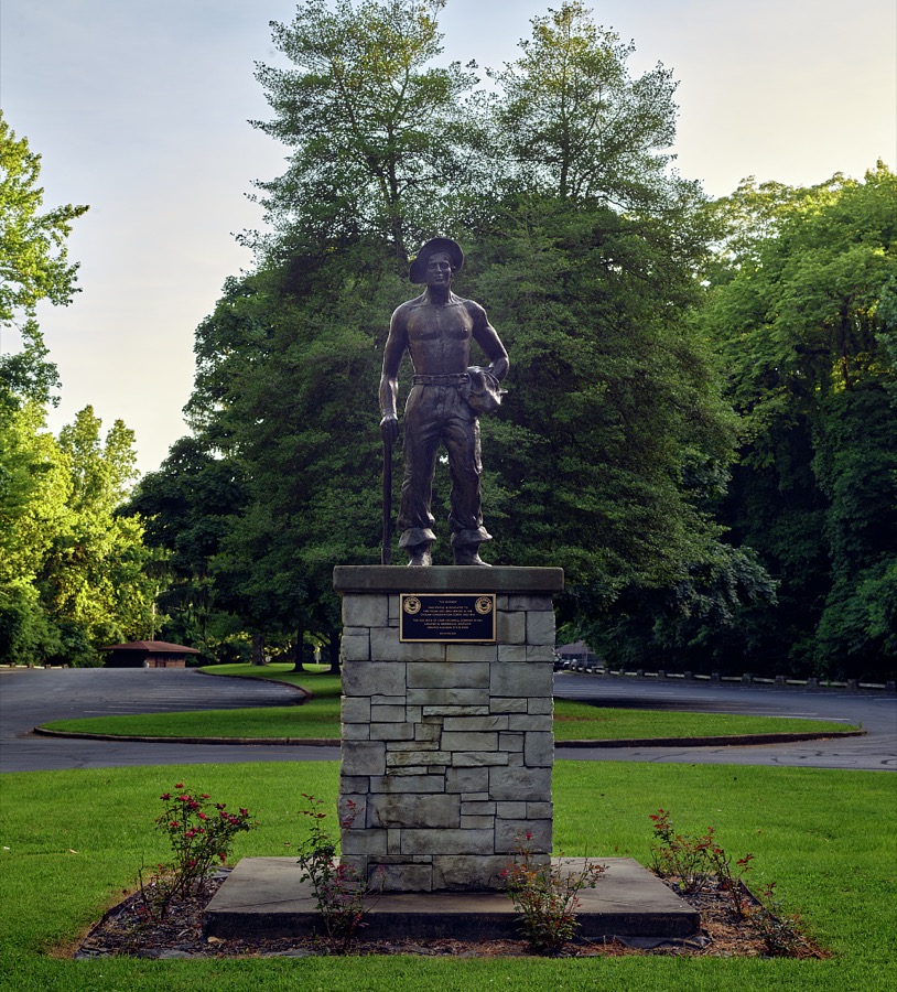
A statue titled, simply, "The Worker," in Henderson, Kentucky's, Audubon State Park, honors those who served in the Civilian Conservation Corps in the throes of the Great Depression, from 1933 to 1942
Highsmith, Carol M, 2020. Library of Congress
Boy 16 and brother 20. Family of A. W. Galloway, Hebbardsville, Route 1. Boys go to Keats (or Bethel) School.  Location: Henderson County--[Hebbardsville], Kentucky
Boy 16 and brother 20. Family of A. W. Galloway, Hebbardsville, Route 1. Boys go to Keats (or Bethel) School. Location: Henderson County--[Hebbardsville], Kentucky
Hine, Lewis Wickes, 1916. Library of Congress
Rock Spring School which opened September 5th. Census 49, Enrollment of 28, attendance 25. Expect an enrollment of 35. Tobacco is chief cause of absence.  Location: Henderson County, Kentucky
Rock Spring School which opened September 5th. Census 49, Enrollment of 28, attendance 25. Expect an enrollment of 35. Tobacco is chief cause of absence. Location: Henderson County, Kentucky
Hine, Lewis Wickes, 1916. Library of Congress
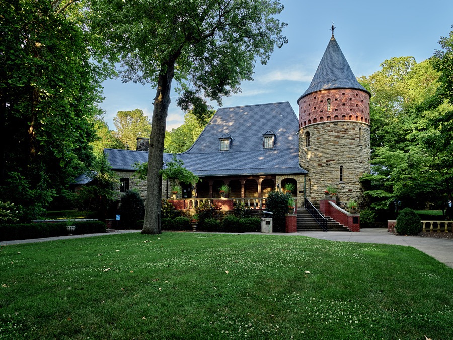
The house and museum at the John James Audubon State Park, whose grounds and art gallery interpretsthe lives and work of the famed ornithologist, naturalist and artist and his family in Henderson, Kentucky
Highsmith, Carol M, 2020. Library of Congress
Utopia School opened September 5th. Census 58, enrollment 24, attendance 18; more after tobacco work is over.  Location: Henderson County, Kentucky
Utopia School opened September 5th. Census 58, enrollment 24, attendance 18; more after tobacco work is over. Location: Henderson County, Kentucky
Hine, Lewis Wickes, 1916. Library of Congress
Pruett School which opened September 5th. 61 pupils in District and only 28 present. Expect an enrollment of 50. Only 1 boy of 11; the rest are 9 years and younger. Many out for work.  Location: Henderson County--Hebbardsville [vicinity], Kentucky
Pruett School which opened September 5th. 61 pupils in District and only 28 present. Expect an enrollment of 50. Only 1 boy of 11; the rest are 9 years and younger. Many out for work. Location: Henderson County--Hebbardsville [vicinity], Kentucky
Hine, Lewis Wickes, 1916. Library of Congress
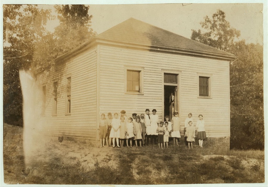
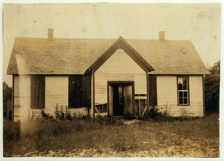
Anthoston School. A most dilapidated shack; unlocked, open to the weather, windows broken out and furniture knocked about. Opens September 6th.  Location: Henderson County, Kentucky
Anthoston School. A most dilapidated shack; unlocked, open to the weather, windows broken out and furniture knocked about. Opens September 6th. Location: Henderson County, Kentucky
Hine, Lewis Wickes, 1916. Library of Congress
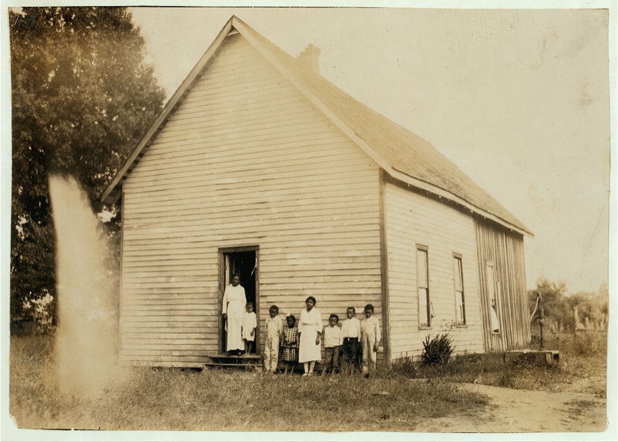
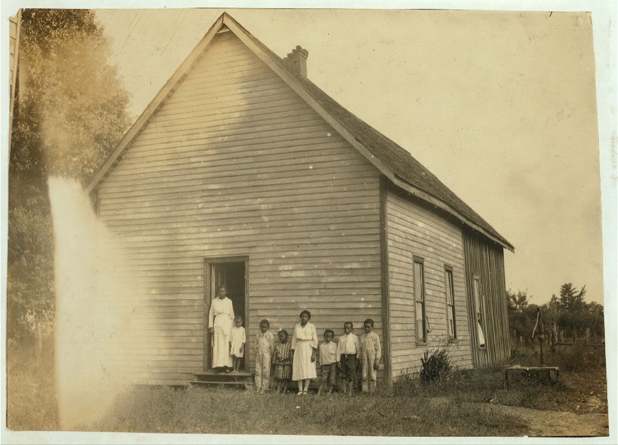
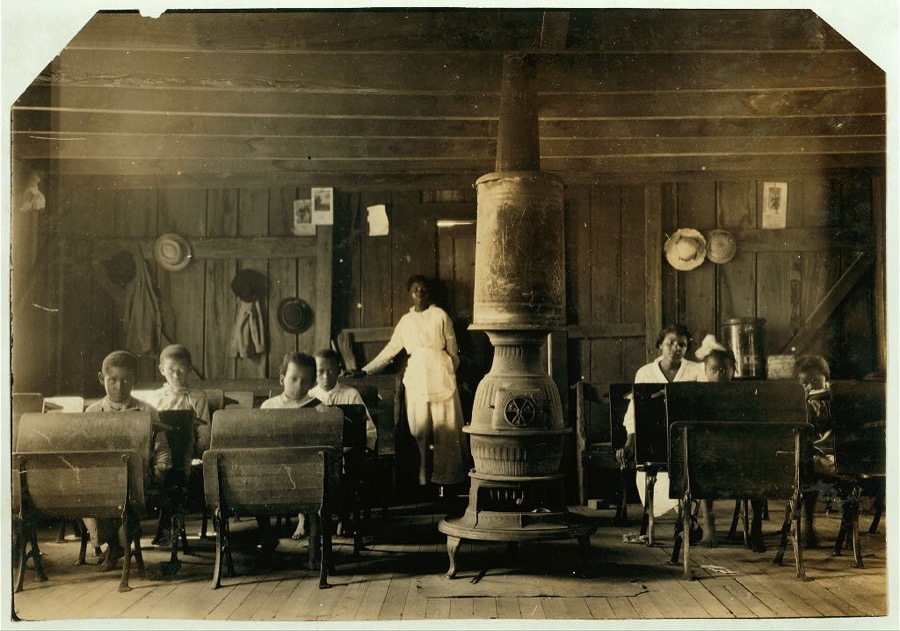
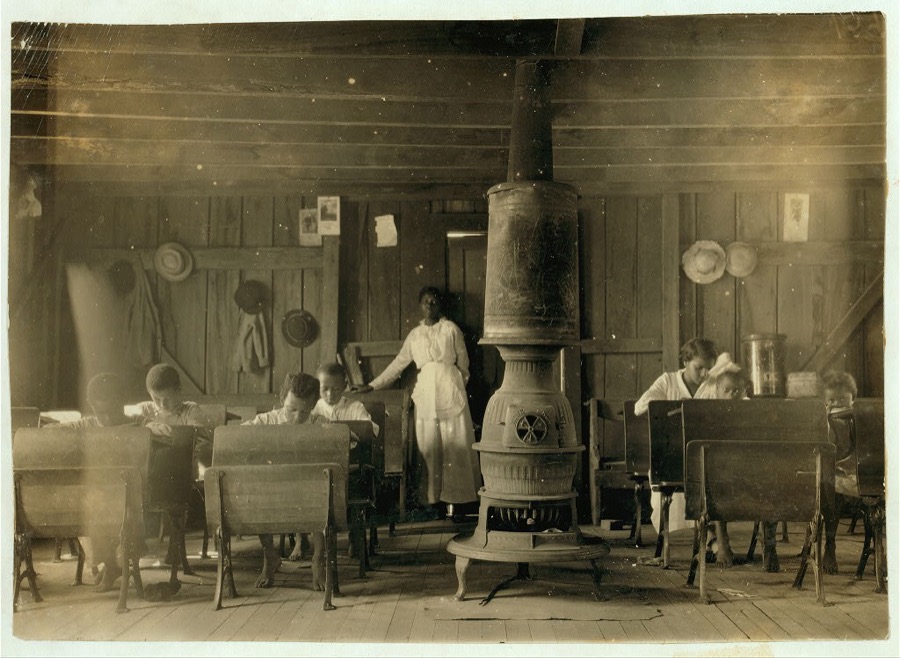
Colored School at Anthoston. Census 27, enrollment 12, attendance 7. Teacher expects 19 to be enrolled after work is over. "Tobacco keeps them out and they are short of hands." Ages of those present: 13 years = 1, 10 years = 2, 8 years = 2, 7 years = 1, 5 years = 1.  Location: Henderson County, Kentucky
Colored School at Anthoston. Census 27, enrollment 12, attendance 7. Teacher expects 19 to be enrolled after work is over. "Tobacco keeps them out and they are short of hands." Ages of those present: 13 years = 1, 10 years = 2, 8 years = 2, 7 years = 1, 5 years = 1. Location: Henderson County, Kentucky
Hine, Lewis Wickes, 1916. Library of Congress
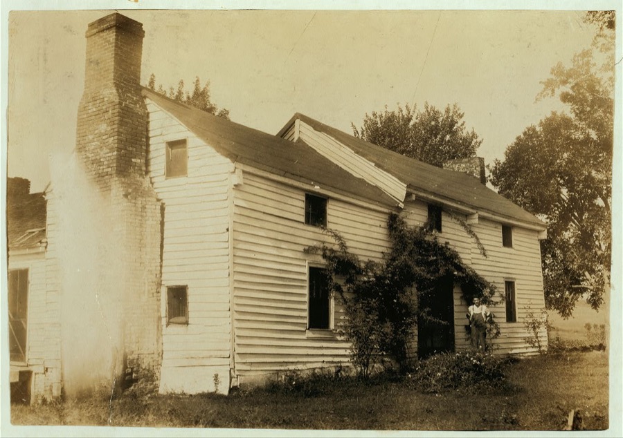
Home of Wyatt Pruett (in doorway). His father is a prosperous farmer but the boy stays out of school to work. Will go to Pruett School.  Location: Henderson County--Hebbardsville [vicinity], Kentucky
Home of Wyatt Pruett (in doorway). His father is a prosperous farmer but the boy stays out of school to work. Will go to Pruett School. Location: Henderson County--Hebbardsville [vicinity], Kentucky
Hine, Lewis Wickes, 1916. Library of Congress
Colored School at Anthoston. Census 27, enrollment 12, Attendance 7. Teacher expects 19 to be enrolled after work is over. "Tobacco keeps them out and they are short of hands." Ages of those present: 13 years = 1, 10 years = 2, 8 years = 2, 7 years = 1, 5 years = 1.  Location: Henderson County, Kentucky
Colored School at Anthoston. Census 27, enrollment 12, Attendance 7. Teacher expects 19 to be enrolled after work is over. "Tobacco keeps them out and they are short of hands." Ages of those present: 13 years = 1, 10 years = 2, 8 years = 2, 7 years = 1, 5 years = 1. Location: Henderson County, Kentucky
Hine, Lewis Wickes, 1916. Library of Congress
Colored School at Anthoston. Census 27, enrollment 12, attendance 7. Teacher expects 19 to be enrolled after work is over. "Tobacco keeps them out and they are short of hands." Ages of those present: 13 years = 1, 10 years = 2, 8 years = 2, 7 years = 1, 5 years = 1.  Location: Henderson County, Kentucky
Colored School at Anthoston. Census 27, enrollment 12, attendance 7. Teacher expects 19 to be enrolled after work is over. "Tobacco keeps them out and they are short of hands." Ages of those present: 13 years = 1, 10 years = 2, 8 years = 2, 7 years = 1, 5 years = 1. Location: Henderson County, Kentucky
Hine, Lewis Wickes, 1916. Library of Congress
One of several "splash pad" fountains, with a long and complex railroad bridge over the Ohio River in the distance, in the town of Henderson, Kentucky
Highsmith, Carol M, 2020. Library of Congress
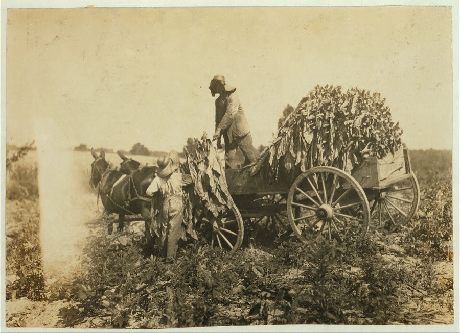
Barn of Daniel Barrett and group shown in photos 4464-5-6.  Location: Henderson County--Spottsville, Kentucky
Barn of Daniel Barrett and group shown in photos 4464-5-6. Location: Henderson County--Spottsville, Kentucky
Hine, Lewis Wickes, 1916. Library of Congress
Barn of Daniel Barrett and group shown in photos 4464-5-6. Location: Henderson County--Spottsville, Kentucky
Hine, Lewis Wickes, 1916. Library of Congress
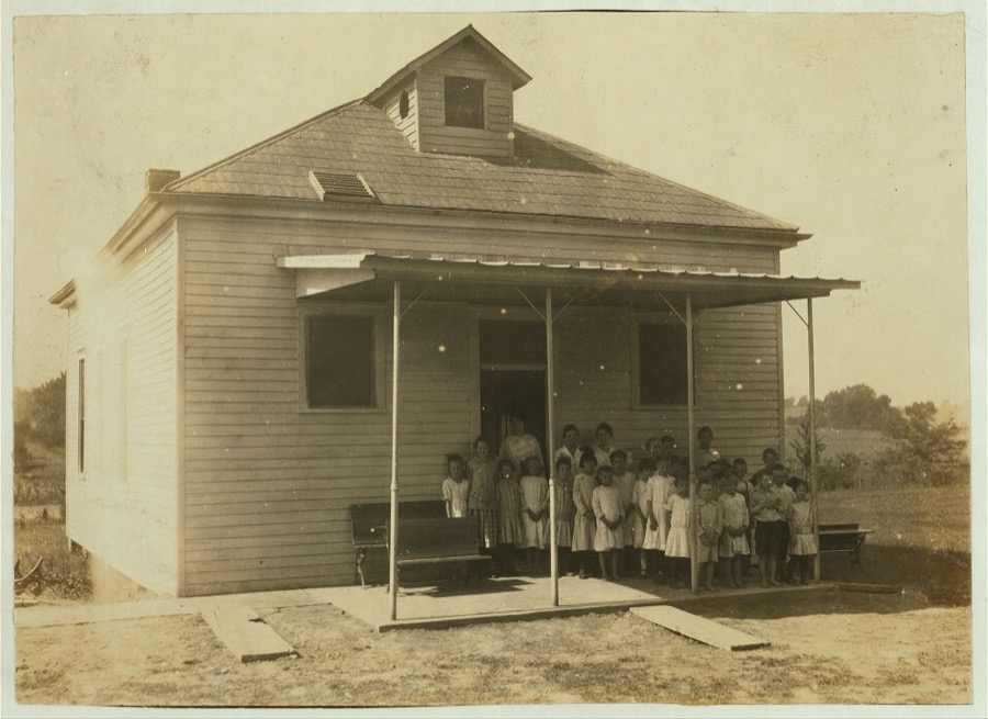
Hebbardsville School. Principal is new and said "Only a few absent." School opened September 5th.  Location: Henderson County, Kentucky
Hebbardsville School. Principal is new and said "Only a few absent." School opened September 5th. Location: Henderson County, Kentucky
Hine, Lewis Wickes, 1916. Library of Congress
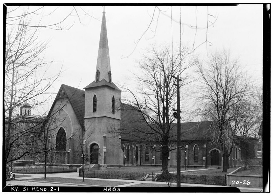
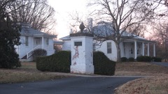
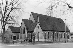
St. Paul's Episcopal Church, Third & Main Streets, Henderson, Henderson County, KY
Photographer not recorded. Library of Congress
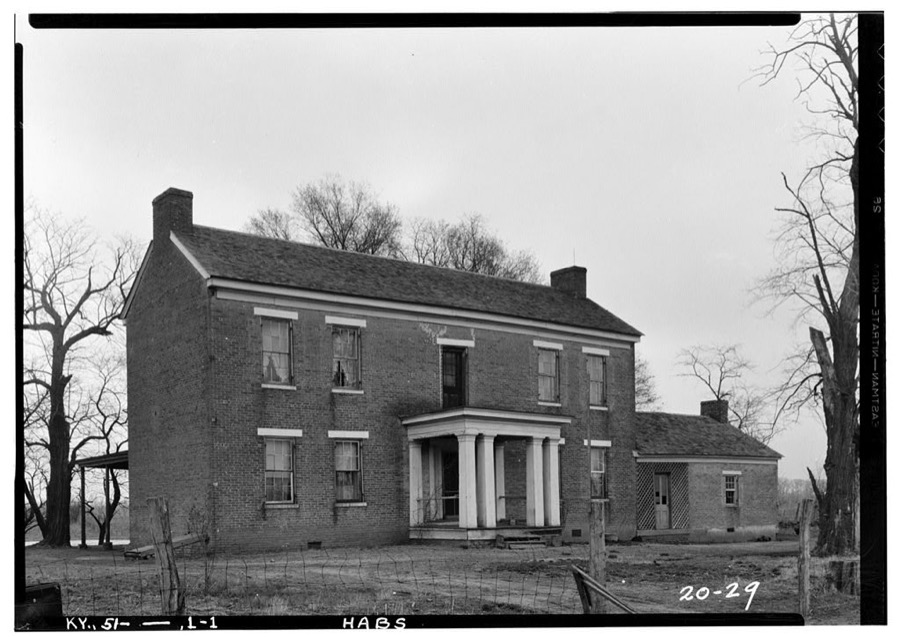
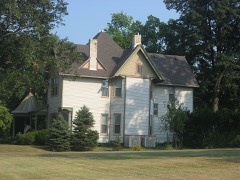
Indian Valley, Geneva, Henderson County, KY
Photographer not recorded. Library of Congress
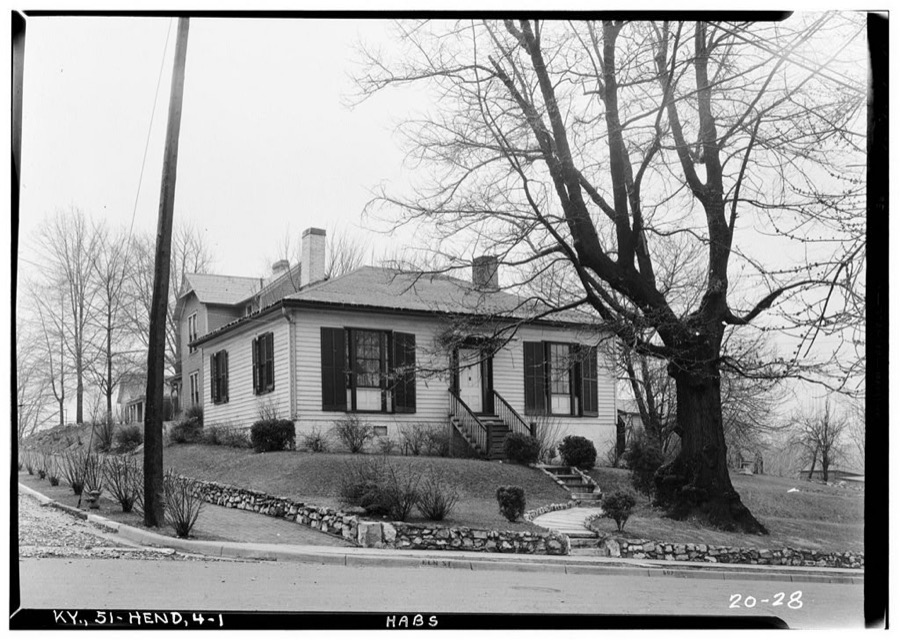
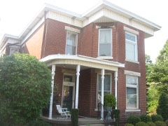
Beulah & Eva Lockett House, Elm & Jefferson Streets, Henderson, Henderson County, KY
Photographer not recorded. Library of Congress
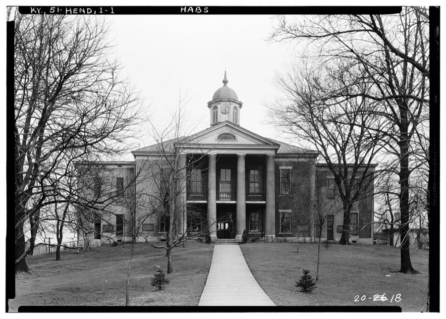
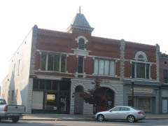
Henderson County Court House, First & Main Streets, Henderson, Henderson County, KY
Photographer not recorded. Library of Congress

Places on the National Register

22

Every property in this county listed on the National Register of Historic Places, with the year it was listed and the federal nomination document.

Photograph PropertyType ListedReference
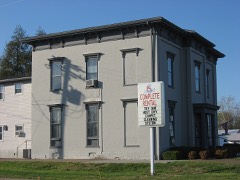
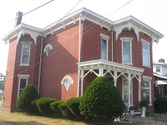
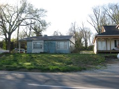
Alves Historic Districtdistrict198989001151
Audubon Schoolbuilding199898001497
John James Audubon State Parkdistrict198887002220
Barret Housebuilding197878001340
Barret-Keach Farmsite200100001596
Delano-Alves Housebuilding199393000044
E. L. Ehlen Livery and Sale Stablebuilding198989002007
Geibel Housebuilding199898001491
J. Hawkins Hart Housebuilding201111000005
Henderson Armorybuilding200202000928
Henderson Commercial Districtdistrict198989001975
Henderson Cotton Mill Workers Housing Districtdistrict199898001495
Henderson, Louisville and Nashville Railroad Depotbuilding198080001549
Klee Funeral Parlorbuilding198989002006
John E. McCallister Housebuilding198282002701
North Main Street Historic Districtdistrict199090000297
John O'Byrne Housebuilding199090000485
Prichett Housebuilding199898001490
William Soaper Farmbuilding200100001595
South Main and South Elm Streets Historic Districtdistrict199292000500
St. Paul's Episcopal Churchbuilding197878001341
Stewart Housebuilding199898001496

Photographs from libraries nationwide

2 of 5 shown

Selected from the Digital Public Library of America's 5 image records catalogued for this county. Every one shown here carries a public-domain status or a licence that permits reuse on a site that carries advertising; non-commercial, share-alike and restricted images are excluded. The selection is spread across the county's towns (at most eight per town), so no single institution's bulk upload crowds out the rest. Each opens the holding library's record, and the complete set at the Digital Public Library of America is one click away.

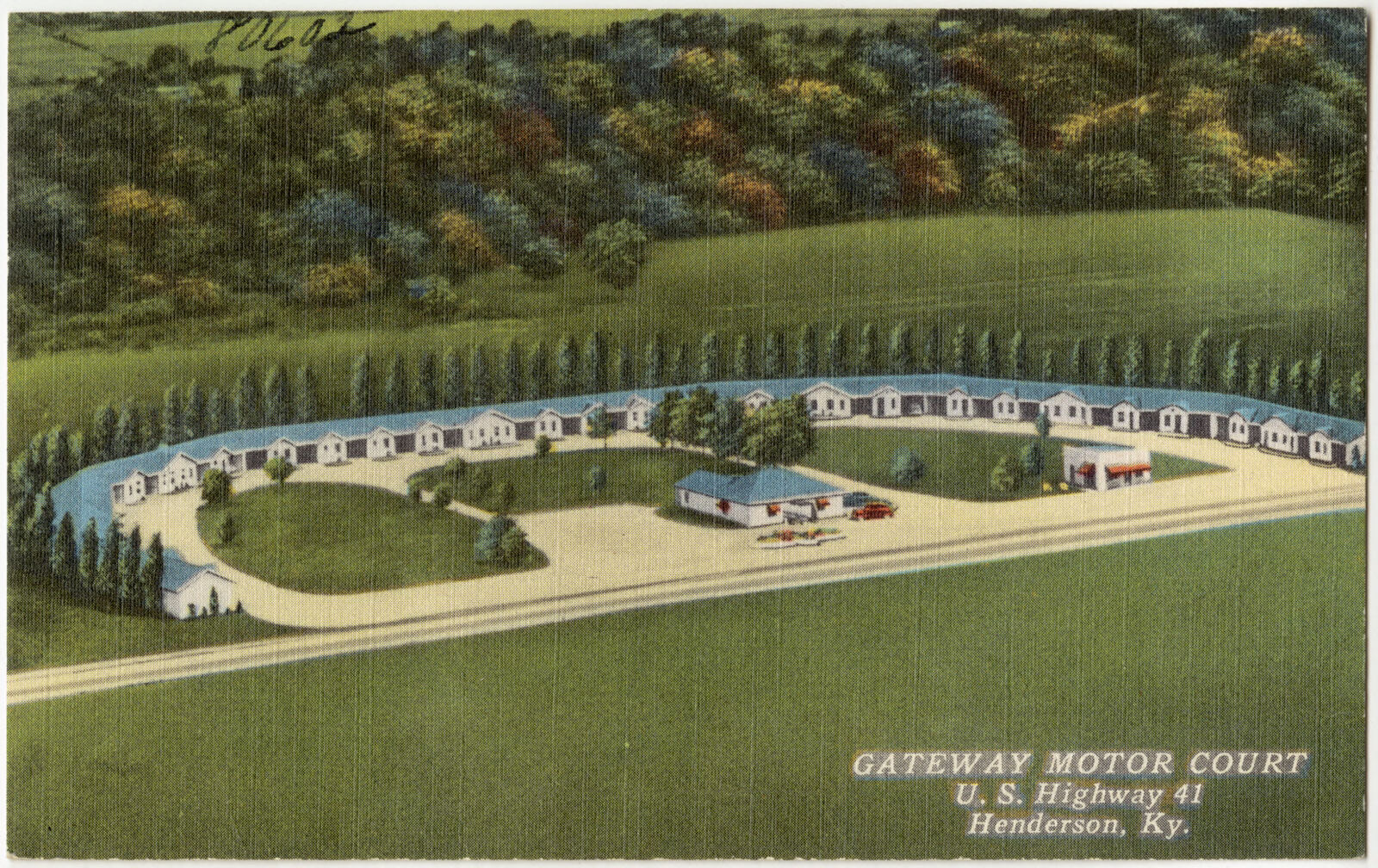
Gateway Motor Court, U. S. Highway 41, Henderson, Ky., Boston Public Library - undated
Gateway Motor Court, U. S. Highway 41, Henderson, Ky.. Boston Public Library, via the Digital Public Library of America.
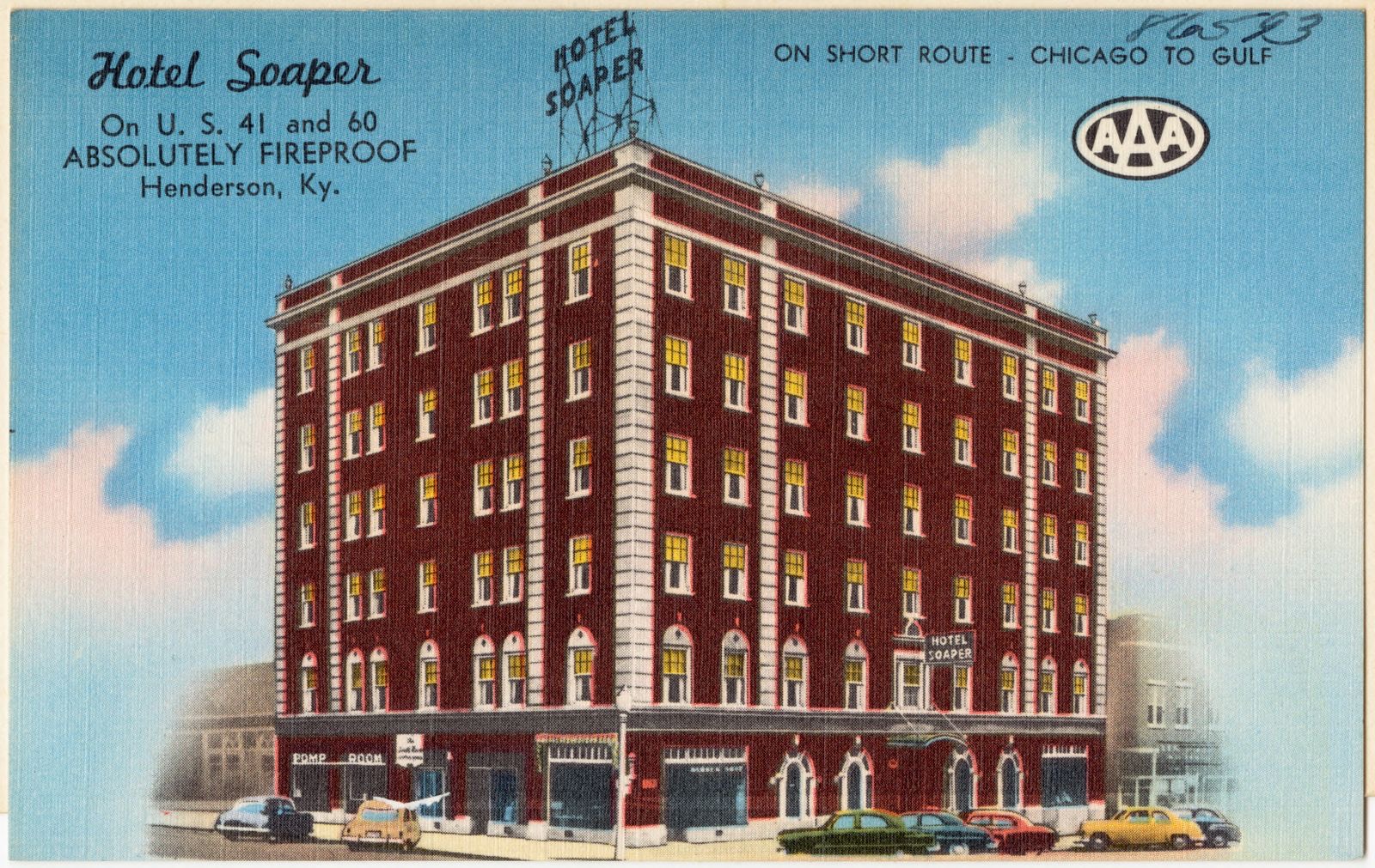
Hotel Soaper, on U. S. 41 and 60, absolutely fireproof, Henderson, Ky., Boston Public Library - undated
Hotel Soaper, on U. S. 41 and 60, absolutely fireproof, Henderson, Ky.. Boston Public Library, via the Digital Public Library of America.

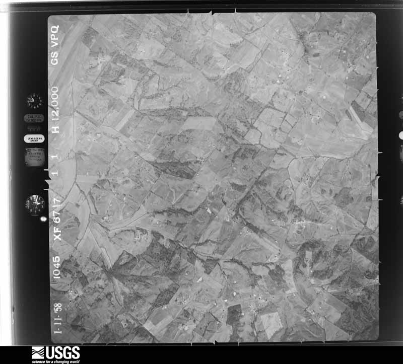
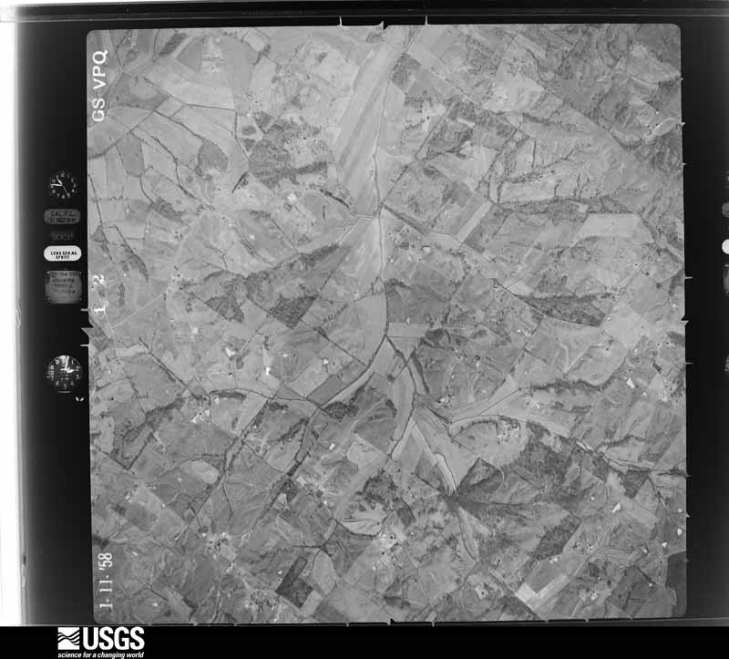
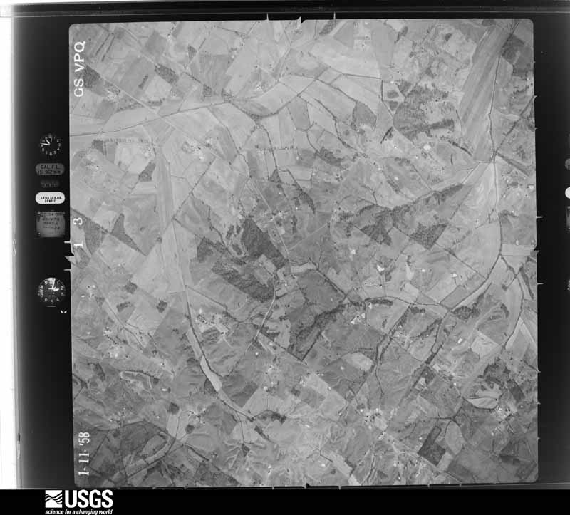
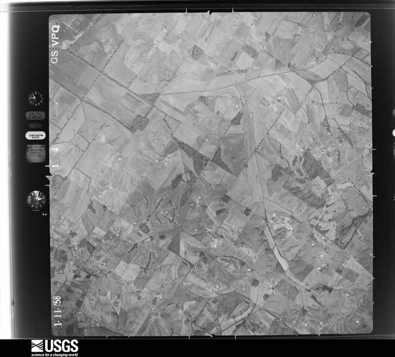
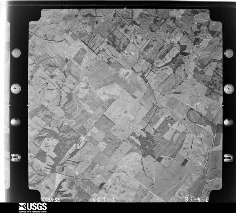
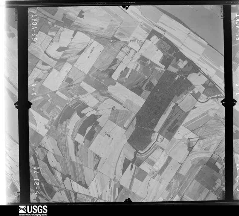
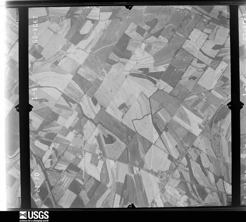
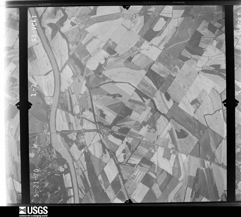
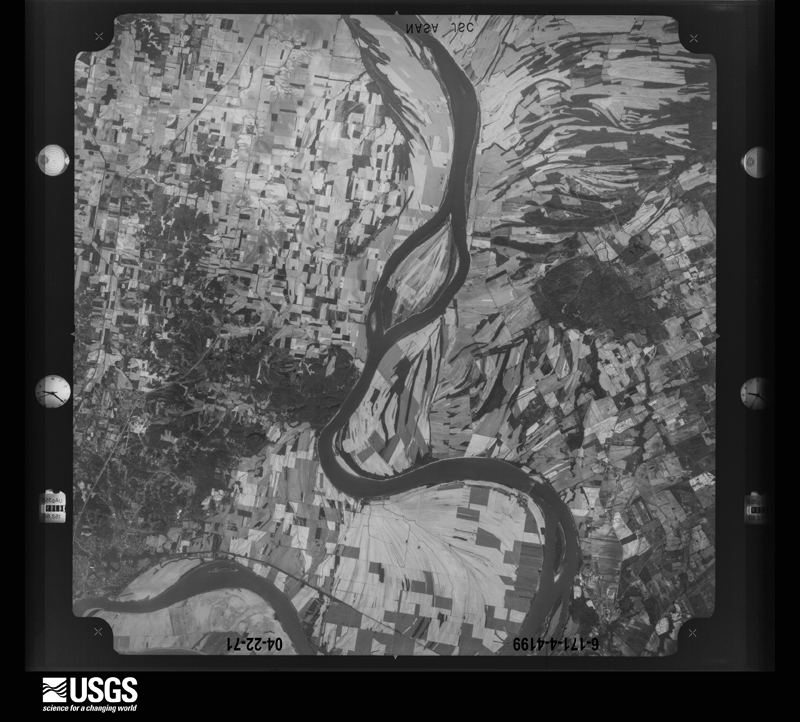
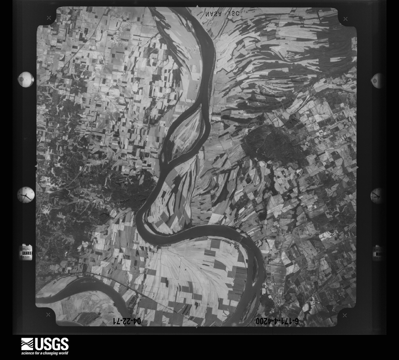
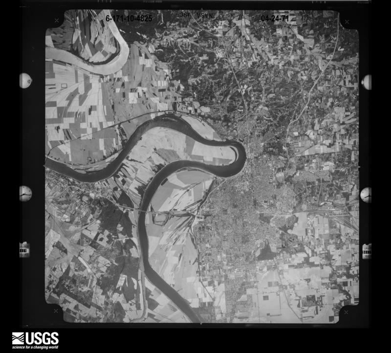
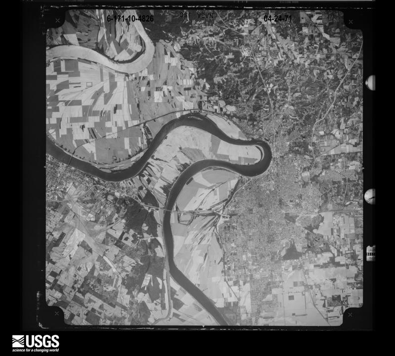
The county from the air

40 shown

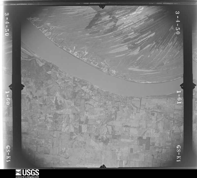
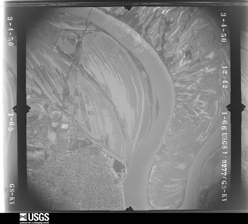
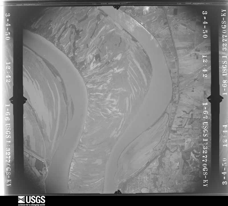
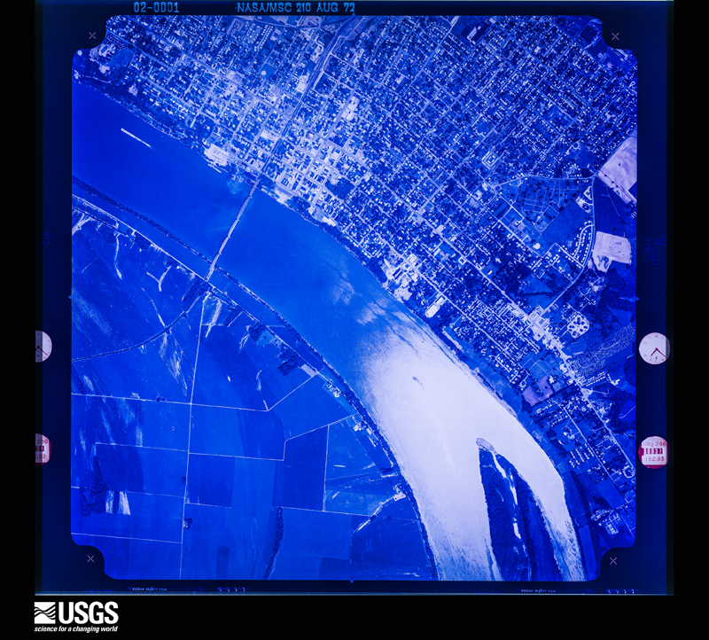
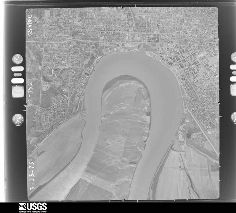
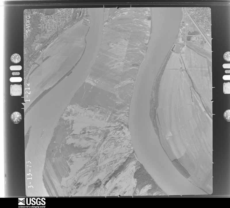
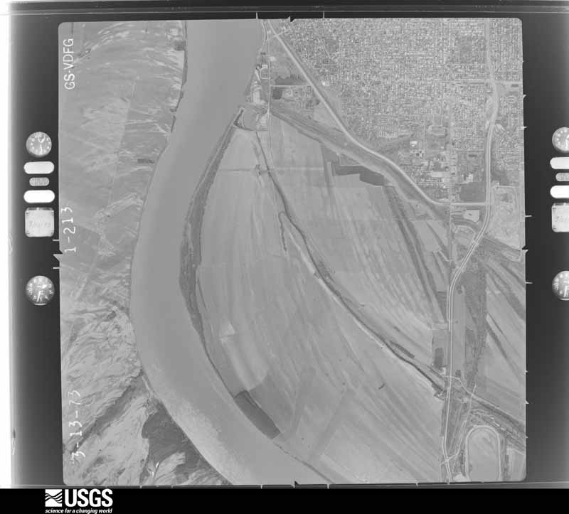
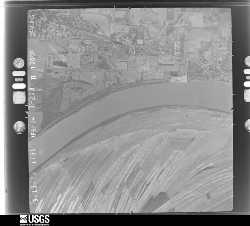
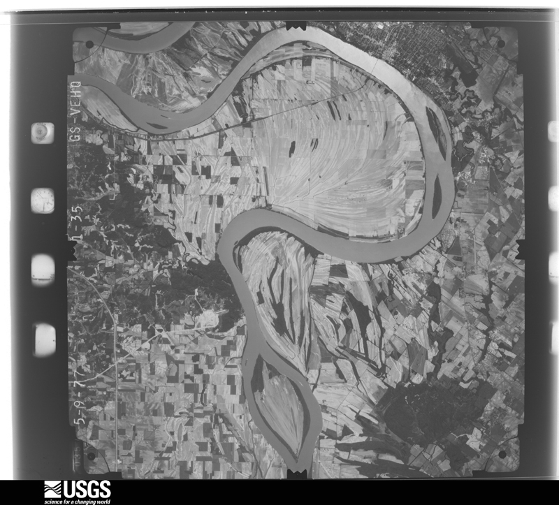
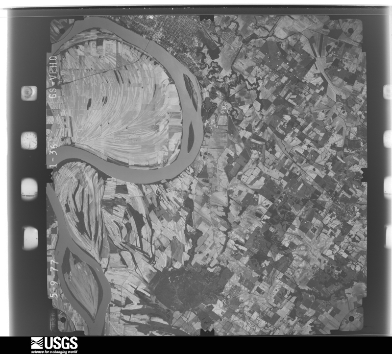
Flown by the U.S. Geological Survey between 1937 and 1989, the Aerial Photo Single Frames collection is the definitive mid-century view of the land: fields, roads and rivers as the camera saw them. The Survey holds 1,385 frames inside the rectangle that bounds this county; the 40 frames below were taken over the county itself, chosen across the decades of flights (at most four a year from that rectangle), so one flight cannot crowd out the rest. The full set is free to browse and download at EarthExplorer under the dataset Aerial Photo Single Frames.

U.S. Geological Survey aerial photograph, 1950-04-01, scale 1:32770
1950-04-01, scale 1:32770. U.S. Geological Survey aerial photograph.
U.S. Geological Survey aerial photograph, 1950-04-01, scale 1:32770
1950-04-01, scale 1:32770. U.S. Geological Survey aerial photograph.
U.S. Geological Survey aerial photograph, 1950-04-01, scale 1:32770
1950-04-01, scale 1:32770. U.S. Geological Survey aerial photograph.
U.S. Geological Survey aerial photograph, 1950-04-01, scale 1:32770
1950-04-01, scale 1:32770. U.S. Geological Survey aerial photograph.
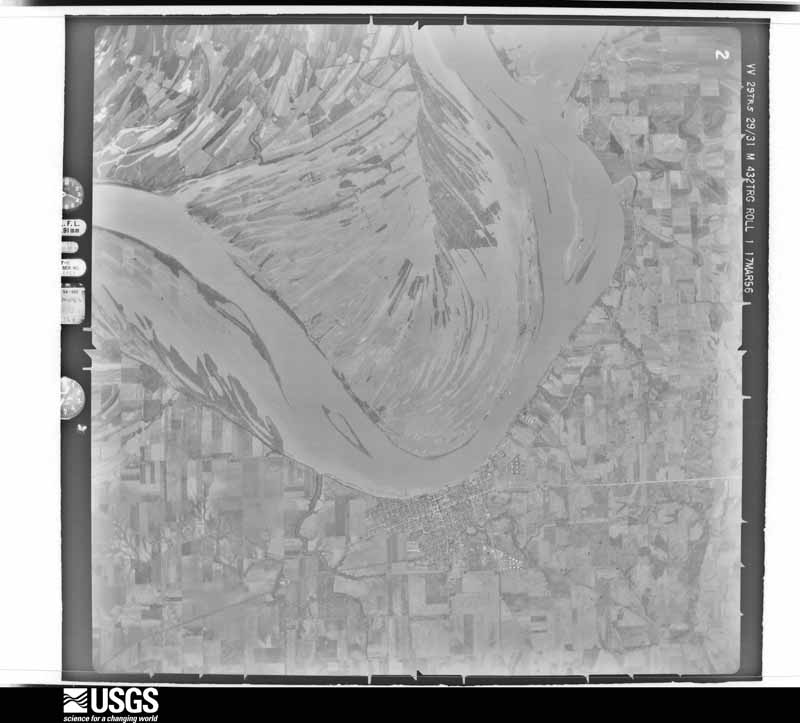
U.S. Geological Survey aerial photograph, 1956-03-17, scale 1:60000
1956-03-17, scale 1:60000. U.S. Geological Survey aerial photograph.
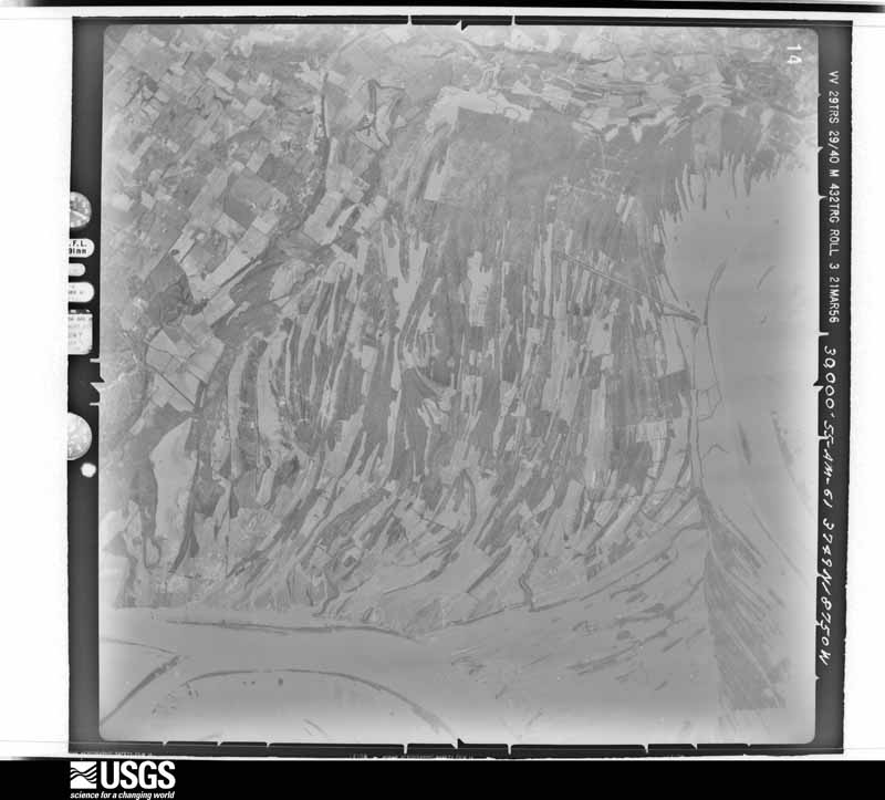
U.S. Geological Survey aerial photograph, 1956-03-21, scale 1:60000
1956-03-21, scale 1:60000. U.S. Geological Survey aerial photograph.
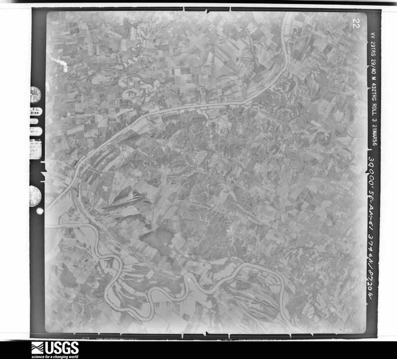
U.S. Geological Survey aerial photograph, 1956-03-21, scale 1:60000
1956-03-21, scale 1:60000. U.S. Geological Survey aerial photograph.
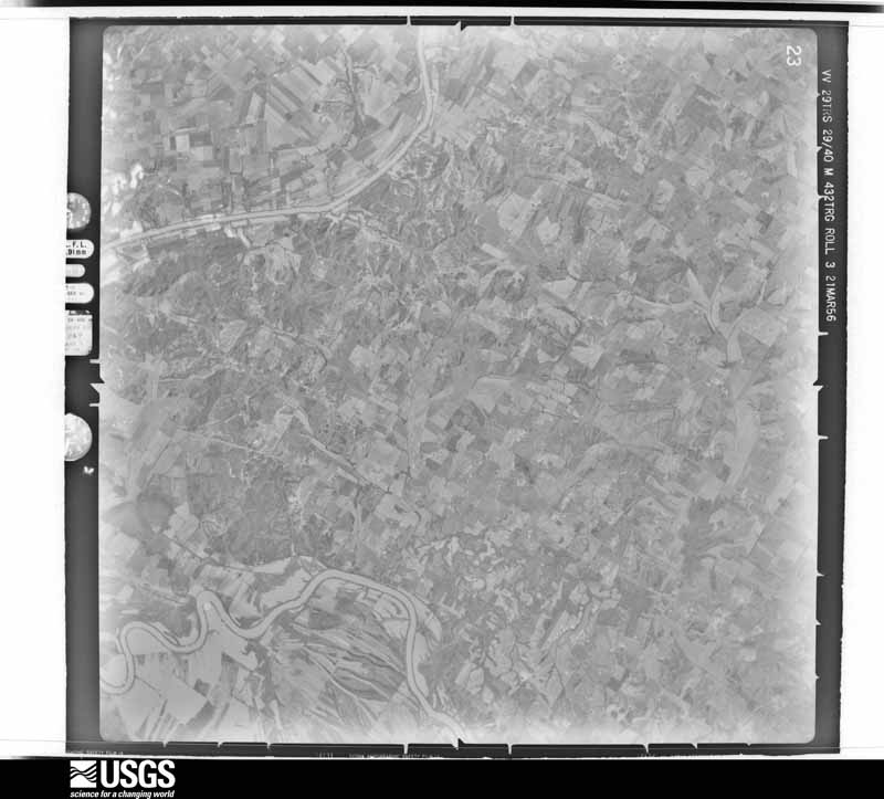
U.S. Geological Survey aerial photograph, 1956-03-21, scale 1:60000
1956-03-21, scale 1:60000. U.S. Geological Survey aerial photograph.
U.S. Geological Survey aerial photograph, 1958-01-11, scale 1:24000
1958-01-11, scale 1:24000. U.S. Geological Survey aerial photograph.
U.S. Geological Survey aerial photograph, 1958-01-11, scale 1:24000
1958-01-11, scale 1:24000. U.S. Geological Survey aerial photograph.
U.S. Geological Survey aerial photograph, 1958-01-11, scale 1:24000
1958-01-11, scale 1:24000. U.S. Geological Survey aerial photograph.
U.S. Geological Survey aerial photograph, 1958-01-11, scale 1:24000
1958-01-11, scale 1:24000. U.S. Geological Survey aerial photograph.
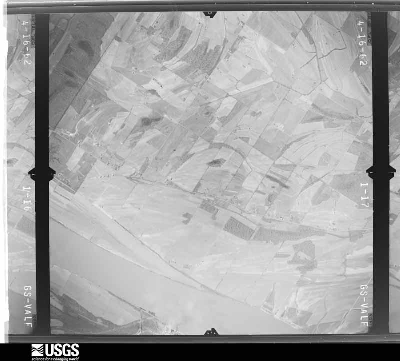
U.S. Geological Survey aerial photograph, 1962-04-16, scale 1:24000
1962-04-16, scale 1:24000. U.S. Geological Survey aerial photograph.
U.S. Geological Survey aerial photograph, 1962-04-16, scale 1:24000
1962-04-16, scale 1:24000. U.S. Geological Survey aerial photograph.
U.S. Geological Survey aerial photograph, 1962-04-16, scale 1:24000
1962-04-16, scale 1:24000. U.S. Geological Survey aerial photograph.
U.S. Geological Survey aerial photograph, 1962-04-16, scale 1:24000
1962-04-16, scale 1:24000. U.S. Geological Survey aerial photograph.
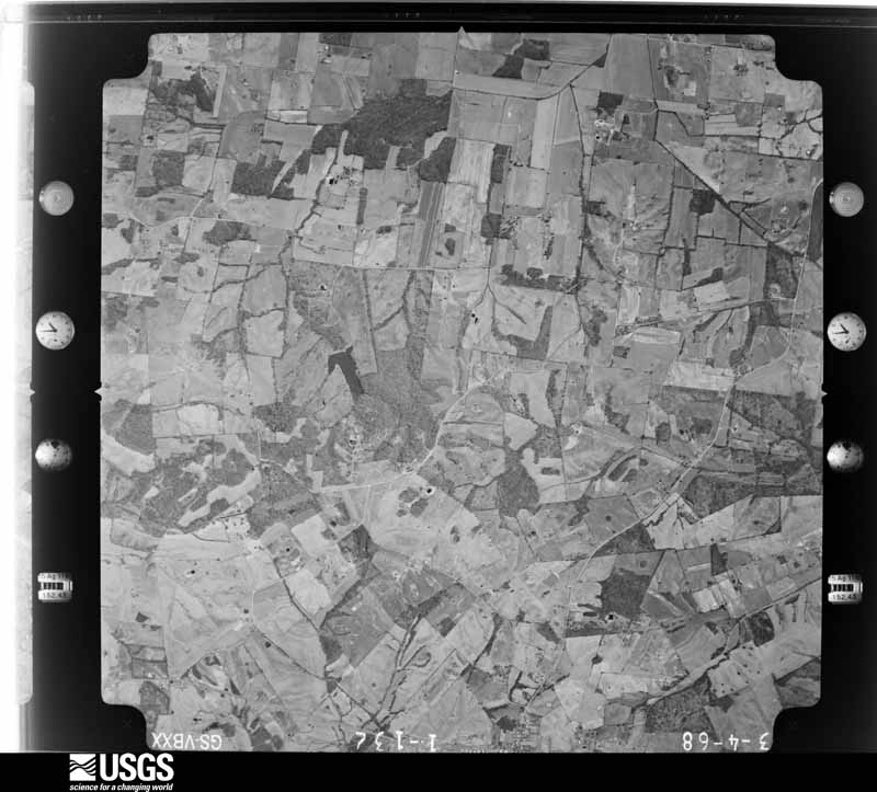
U.S. Geological Survey aerial photograph, 1968-03-04, scale 1:24000
1968-03-04, scale 1:24000. U.S. Geological Survey aerial photograph.
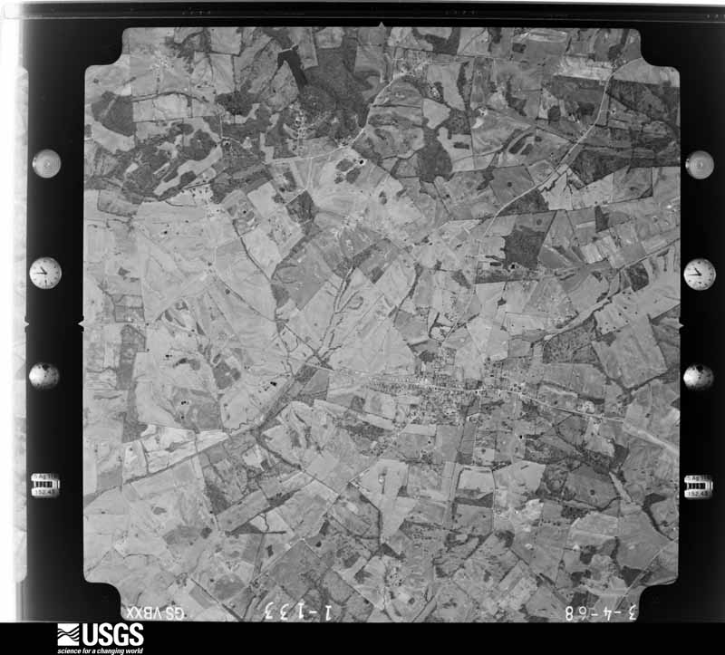
U.S. Geological Survey aerial photograph, 1968-03-04, scale 1:24000
1968-03-04, scale 1:24000. U.S. Geological Survey aerial photograph.
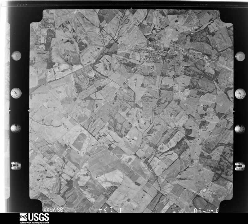
U.S. Geological Survey aerial photograph, 1968-03-04, scale 1:24000
1968-03-04, scale 1:24000. U.S. Geological Survey aerial photograph.
U.S. Geological Survey aerial photograph, 1968-03-04, scale 1:24000
1968-03-04, scale 1:24000. U.S. Geological Survey aerial photograph.
U.S. Geological Survey aerial photograph, 1970-05-21, scale 1:24000
1970-05-21, scale 1:24000. U.S. Geological Survey aerial photograph.
U.S. Geological Survey aerial photograph, 1970-05-21, scale 1:24000
1970-05-21, scale 1:24000. U.S. Geological Survey aerial photograph.
U.S. Geological Survey aerial photograph, 1970-05-21, scale 1:24000
1970-05-21, scale 1:24000. U.S. Geological Survey aerial photograph.
U.S. Geological Survey aerial photograph, 1970-05-21, scale 1:24000
1970-05-21, scale 1:24000. U.S. Geological Survey aerial photograph.
U.S. Geological Survey aerial photograph, 1971-04-22, scale 1:100799
1971-04-22, scale 1:100799. U.S. Geological Survey aerial photograph.
U.S. Geological Survey aerial photograph, 1971-04-22, scale 1:101397
1971-04-22, scale 1:101397. U.S. Geological Survey aerial photograph.
U.S. Geological Survey aerial photograph, 1971-04-24, scale 1:100253
1971-04-24, scale 1:100253. U.S. Geological Survey aerial photograph.
U.S. Geological Survey aerial photograph, 1971-04-24, scale 1:98653
1971-04-24, scale 1:98653. U.S. Geological Survey aerial photograph.
U.S. Geological Survey aerial photograph, 1972-08-10, scale 1:20077
1972-08-10, scale 1:20077. U.S. Geological Survey aerial photograph.
U.S. Geological Survey aerial photograph, 1972-08-10, scale 1:20077
1972-08-10, scale 1:20077. U.S. Geological Survey aerial photograph.
U.S. Geological Survey aerial photograph, 1972-08-10, scale 1:20077
1972-08-10, scale 1:20077. U.S. Geological Survey aerial photograph.
U.S. Geological Survey aerial photograph, 1972-08-10, scale 1:20077
1972-08-10, scale 1:20077. U.S. Geological Survey aerial photograph.
U.S. Geological Survey aerial photograph, 1973-03-01, scale 1:24000
1973-03-01, scale 1:24000. U.S. Geological Survey aerial photograph.
U.S. Geological Survey aerial photograph, 1973-03-01, scale 1:24000
1973-03-01, scale 1:24000. U.S. Geological Survey aerial photograph.
U.S. Geological Survey aerial photograph, 1973-03-01, scale 1:24000
1973-03-01, scale 1:24000. U.S. Geological Survey aerial photograph.
U.S. Geological Survey aerial photograph, 1973-03-01, scale 1:24000
1973-03-01, scale 1:24000. U.S. Geological Survey aerial photograph.
U.S. Geological Survey aerial photograph, 1977-05-01, scale 1:80000
1977-05-01, scale 1:80000. U.S. Geological Survey aerial photograph.
U.S. Geological Survey aerial photograph, 1977-05-01, scale 1:80000
1977-05-01, scale 1:80000. U.S. Geological Survey aerial photograph.
U.S. Geological Survey aerial photograph, 1977-05-01, scale 1:80000
1977-05-01, scale 1:80000. U.S. Geological Survey aerial photograph.
U.S. Geological Survey aerial photograph, 1977-05-01, scale 1:80000
1977-05-01, scale 1:80000. U.S. Geological Survey aerial photograph.

Weather records

10 stations, 2 gages

The thermometers that kept this county's weather, and the gages that measured the flow of its streams, as the federal records hold them. The extremes below are measured values from those records, not estimates.

The 1950 census, district by district

48 districts

Who lived here in 1950, one enumeration district at a time, as the Census Bureau described each district. Each row opens its official National Archives result, with Population Schedules and ED Maps available there.

  • 51-1Magisterial District 1, Point, including all islands in this Magisterial District
  • 51-2Magisterial District 2, Spottsville: Magisterial District 2, Spottsville - That part north of U.S. Hwy. 60
  • 51-3Magisterial District 2, Spottsville - That part south of U.S. Hwy. 60, west of Zion - Baskett Rd. and south of State Hwy. 54
  • 51-4Magisterial District 2, Spottsville - That part south of U.S. Hwy. 60, east of Zion -Baskett Rd. and north of State Hwy. 54
  • 51-5Magisterial District 3, Hebbardsville and Niagara: Magisterial District 3, Hebbardsville and Niagara - That part north of State Hwy. 54 and northwest of Robards - Hebbardsville Rd.
  • 51-6Magisterial District 3, Hebbardsville and Niagara - That part southeast of Robards - Hebbardsville Rd. and south of State Hwy. 54
  • 51-7Henderson city, comprising parts of Magisterial Districts 4, Upper Henderson, and 5, Lower Henderson: Henderson city - That part of Ward 1 in Magisterial District 4, Upper Henderson Bounded by City limits; City limits; 5th; Illinois Central Railroad spur
  • 51-8Henderson city - That part of Ward 1 in Magisterial District 4, Upper Henderson Bounded by Illinois Cental Railroad spur; 7th; N. Adams
  • 51-9Henderson city - That part of Ward 1 in Magisterial District 4, Upper Henderson Bounded by City limits; Illinois Central Railroad spur, N. Adams, 7th, Illinois Central Railroad spur; 5th; N. Green
  • 51-10Henderson city - That part of Ward 1 in Magisterial District 4, Upper Henderson Bounded by 12th; N. Green; 5th; Riverside Driveway
  • 51-11Henderson city - That part of Ward 1 in Magisterial District 4, Upper Henderson Bounded by City limits; City limits, N. Green; 12th; N. Elm, Old Ellisville Rd.
  • 51-12Henderson city - That part of Ward 1 in Magisterial District 4, Upper Henderson Bounded by City limits; City limits, Old Ellisville Rd., N. Elm, 12th, Riverside Driveway; Ward line; City limits
  • 51-13Henderson city - That part of Ward 2 in Magisterial District 4, Upper Henderson Bounded by City limits; City limits; Magisterial District line; Canoe Creek
  • 51-14Henderson city - That part of Ward 2 in Magisterial District 4, Upper Henderson Bounded by 5th, City limits; Canoe Creek; Magisterial District line; Illinois Central Railroad
  • 51-15Henderson city - That part of Ward 2 in Magisterial District 4, Upper Henderson Bounded by 5th; Illinois Central Railroad; 1st; N. Adams
  • 51-16Henderson city - That part of Ward 2 in Magisterial District 4, Upper Henderson Bounded by 5th; N. Adams; 1st; N. Elm
  • 51-17Henderson city - That part of Ward 2 in Magisterial District 4, Upper Henderson, excluding Soaper Hotel Bounded by Ohio River, 5th; N. Elm; 1st, Magisterial District line; City limits
  • 51-18Soaper Hotel (In Henderson city, Ward 2, Magisterial District 4)
  • 51-19Henderson city - That part of Ward 2 in Magisterial District 5, Lower Henderson Bounded by Magisterial District line; City limits; Ward line; McKinley Ave.
  • 51-20Henderson city - That part of Ward 2 in Magisterial District 5, Lower Henderson Bounded by 1st, Magisterial District line; McKinley Ave.; Ward line, Center; N. Julia
  • 51-21Henderson city - That part of Ward 2 in Magisterial District 5, Lower Henderson Bounded by Magisterial District line, 1st; N. Julia; Center, Ward line; City limits
  • 51-22Henderson city - That part of ward 3 in Magisterial District 5, Lower Henderson Bounded by Ward line; City limits; Clay; Louisiana and Nashville Railroad
  • 51-23Henderson city - That part of Ward 3 in Magisterial District 5, Lower Henderson Bounded by Center; Louisiana and Nashville Railroad; Clay; Mill, Fowell, Meadow
  • 51-24Henderson city - That part of Ward 3 in Magisterial District 5, Lower Henderson Bounded by Center; Meadow, Powell, Mill; Clay; S. Julia
  • 51-25Henderson city - That part of Ward 3 in Magisterial District 5, Lower Henderson Bounded by Center; S. Julia; Clay; S. Alvasia
  • 51-26Henderson city - That part of Ward 3 in Magisterial District 5, Lower Henderson Bounded by Center; S. Alvasia; Clay; S. Green
  • 51-27Henderson city - That part of Ward 3 in Magisterial District 5, Lower Henderson Bounded by Ward line, Center; S. Green; Clay, Ward line; City limits
  • 51-28Henderson city - That part of Ward 4 in Magisterial District 5, Lower Henderson Bounded by Clay; Atkinson; O' Byrne, Mill, O' Byrne, Dixon; S. Alves
  • 51-29Henderson city - That part of Ward 4 in Magisterial District 5, Lower Henderson Bounded by Ward line, Clay, S. Green, Clay; S. Alves; Belt Line Railroad, Towles, Ohio River; City limits
  • 51-30Henderson city - That part of Ward 4 in Magisterial District 5, Lower Henderson Bounded by Dixon, O'Byrne, S. Mill, O'Byrne, Atkinson, Clay; City limits; Pringle, Atkinson, Bailey, Vine; S. Alves
  • 51-31Henderson city - That part of Ward 4 in Magisterial District 5, Lower Henderson Bounded by Bailey, Vine; Atkinson; Pringle; Madison, S. Alvasia
  • 51-32Henderson city - That part of Ward 4 in Magisterial District 5, Lower Henderson Bounded by Vine, S. Alvasia, Madison, Pringle; City limits; City limits; S. Alvasia, Cherry, S. Alves
  • 51-33Henderson city - That part of Ward 4, in Magisterial District 5, Lower Henderson Bounded by Belt Line Railroad; S. Alves, Cherry, S. Alvasia, City limits; City limits; S. Green
  • 51-34Henderson city - That part of Ward 4, in Magisterial District 5, Lower Henderson Bounded by Ohio River, Towles, Belt Line Railroad; S. Green; City limits; City limits
  • 51-35Magisterial District 4, Upper Henderson - That part outside Henderson city: (Remainder of Magisterial District 4, Upper Henderson, is in Henderson city)
  • 51-36Magisterial District 5, Lower Henderson, outside Henderson city: Magisterial District 5, Lower Henderson - That part including Henderson Island, outside Henderson city and excluding Ohio River Ordnance Works (part)
  • 51-37Ohio River Ordnance Works - That part in Magisterial District 5, Lower Henderson (Remainder of Ohio River Ordnance Works is in Magisterial District 8, Walnut Bottom (Remainder of Magisterial District 5, Lower Henderson, is in Henderson city)
  • 51-38Magisterial District 6, Robards: Magisterial District 6, Robards - That part east of State Hwy. 283 and Louisiana and Nashville Railroad
  • 51-39Magisterial District 6, Robards - That part west of State Hwy. 283 and east of Louisiana and Nashville Railroad
  • 51-40Magisterial District 6, Robards - That part west of Louisiana and Nashville Railroad
  • 51-41Magisterial District 7, Corydon: Corydon city
  • 51-42Magisterial District 7, Corydon - That part east of U.S. Hwy. 41
  • 51-43Magisterial District 7, Corydon - That part west of U.S. Hwy. 41 and east of State Hwy. 145 and Illinois Central Railroad, outside Corydon city
  • 51-44Magisterial District 7, Corydon - That part west of Illinois Central Railroad and State Hwy. 145, outside Corydon city and excluding Camp Breckinridge (part)
  • 51-45Camp Breckenridge - That part in Magisterial District 7, Corydon (Remainder of Camp Breckenridge is in Magisterial District 1, Webster County and Magisterial District 1, Morganfield, Union County)
  • 51-46Magisterial District 8, Walnut Bottom: Magisterial District 8, Walnut Bottom - That part northeast of Smith Mills - Corydon Rd., State Hwy. 136, and State Hwy. 136 extended to north county line, including Diamond Island and any other islands in this enumeration district, and excluding Ohio River Ordnance Works (part)
  • 51-47Ohio River Ordnance Works - That part in Magisterial District 8, Walnut Bottom (Remainder of Ohio River Ordnance Works is in Magisterial District 5, Lower Henderson)
  • 51-48Magisterial District 8, Walnut Bottom - That part southwest of Corydon - Smith Mills Rd., State Hwy. 136 and State Hwy. 136 extended

Wildfire, 1998 to 2017

31 fires

Every wildfire the federal occurrence database records inside this county: 31 of them, burning about 434 acres. None started naturally and 1 was recorded as arson. Each settlement page carries the fires within five miles of it.

Reported cause Fires
Recreation and ceremony9
Missing data/not specified/undetermined9
Debris and open burning6
Railroad operations and maintenance5
Equipment and vehicle use1
Arson/incendiarism1

The five largest, by the area the report gives. None of them was recorded as arson.

DateCause SizeReported by Name on the report
15 March 2014Recreation and ceremony75 acresKentucky Division of ForestryROBERTS RD.
9 September 2013Recreation and ceremony65 acresKentucky Division of ForestryKLONDIKE RD.
21 April 2003Missing data/not specified/undetermined50 acresKentucky Division of Forestrynot named
11 March 2014Recreation and ceremony47 acresKentucky Division of ForestryWINDING TRAIL
28 August 1999Equipment and vehicle use45 acresKentucky Division of Forestrynot named
4 May 2015Debris and open burning25 acresKentucky Division of ForestryKLONDIKE FIRE
23 October 2010Missing data/not specified/undetermined25 acresKentucky Division of ForestryPOWERLINE FIRE
10 November 2011Railroad operations and maintenance20 acresKentucky Division of ForestryFENCEROW

Every settlement page carries the fires within five miles of it - see the settlement index below.

Storms, 1955 to 2025

60 of 374 shown

The NOAA Storm Events Database holds 374 reports for this county, causing 2 deaths, 27 injuries and about $40,817,750 in recorded property damage. Each settlement page carries the reports that name it.

Kind of event Reports
Thunderstorm Wind150
Hail82
Flood57
Flash Flood31
Tornado28
Heavy Rain15
Funnel Cloud8
Lightning3

The most serious of them, by death, then injury, then recorded damage. The accounts are quoted exactly as the forecast office filed them.

WhenEvent Place namedHarm What the report says
March 2015FloodHenderson1 killed, $20,000Minor flooding occurred on the Ohio River. Numerous secondary roads in low-lying bottomlands were underwater. One motorist died after driving down a flooded road in a remote area adjacent to Audubon State Park. The body of the 55-year-old man was found in the water near his truck about 17 days after he went missing. A few state roads were closed near the river, including Highways 268, 811, and 136.
March 2013FloodBaskett1 killed, $20,000Minor flooding occurred along the Ohio River in Henderson County. Some low-lying fields were underwater. A few river access roads were underwater. At the end of a secondary road near the confluence of the Green and Ohio Rivers, a 70-year-old man drowned after driving into floodwaters. The man was discovered by a sheriff's deputy on March 24 while on routine patrol. The water was close to chest deep when the deputy located him. It appeared the victim's truck had stalled in the water and that he attempted to walk out. The victim did not have a phone in his possession. County dispatch was notified of his stalled truck on March 22, but nobody was found during a search by rescue squad personnel.
November 2005Tornado (F3)Henderson8 hurt, $7,000,000The tornado that would cause mass casualties in the Evansville, Indiana area crossed the Ohio River a second time. This second crossing was from Vanderburgh County, Indiana into Henderson County. The tornado then crossed the river a third time less than a mile west of the U.S. Highway 41 twin bridges. The river does not form the state line at the third crossing. From the bridges, extensive tree damage was visible along both sides of the Ohio River. Almost immediately after crossing the river, the tornado slammed into a horse racing facility named Ellis Park. There was extensive damage to grandstands and housing facilities for jockeys. A few race horses were killed. This facility was the first major facility to be impacted by the tornado. All of the Henderson County tornado injuries were at Ellis Park. The tornado then crossed back into Vanderburgh County, Indiana after striking Ellis Park.
April 1979Tornado (F2)not stated5 hurtno account filed
May 1982Tornado (F2)not stated4 hurt, $2,500,000no account filed
March 2009Tornado (EF3)Kings Mills2 hurt, $500,000This tornado crossed into Henderson County from Union County. The tornado was near its maximum intensity of 140 mph near the county line. A Ford Ranger pickup truck was hurled about one quarter mile. Several other vehicles were overturned. Six homes were destroyed, ten received major damage, and sixty homes and buildings received minor damage. Much of the damage occurred in and near Corydon, especially along U.S. Highway 60. The hardest-hit buildings lost most walls and the roof. At least one grain bin was flattened. Hundreds of trees were snapped or uprooted. The average path width was about 300 yards. The tornado was photographed by an emergency management official. Due to the rain-wrapped nature of the tornado and the distance the photo was taken from, the tornado was not easily identifiable in the photo. The photographer was near where the tornado lifted or dissipated, less than a mile from the Henderson County airport. However, the tornado was still some distance away at the time of the photo.
February 2012Tornado (EF1)White City2 hurt, $80,000This tornado occurred on the north bank of the Ohio River. Three river cabins were partially destroyed, and one cabin was completely destroyed. The cabins were poorly constructed. Six to seven telephone poles were blown over. Peak winds were estimated near 90 mph. The average path width was 100 yards.
June 2018Thunderstorm WindHenderson2 hurt, $20,000Six to ten trees were down along U.S. Highway 41A. One of the trees fell on a car, causing injuries.
April 2015Thunderstorm WindSmith Mills1 hurt, $210,000Destructive thunderstorm winds swept across a 16-mile swath of Henderson County that crossed directly through the Corydon area. Two mobile homes were destroyed. Two other mobile homes received major damage. At least a dozen houses sustained minor damage, primarily loss of shingles and fascia. Approximately a dozen barns, sheds, or garages received roof or siding damage. Dozens of trees were uprooted. About ten power poles were snapped or blown down. Transformers were damaged at a power substation. One person received minor injuries. An elderly woman was transported to the hospital after her mobile home was flipped over and destroyed. The damage area was up to 1.25 miles wide. Peak winds were estimated near 100 mph.
July 2006Thunderstorm WindCountywide1 hurt, $100,000Widespread damage resulted from wind gusts around 70 MPH. Semi trucks were overturned in the Henderson area. An overturned semi closed the southbound lanes of the Pennyrile Parkway near exit 79 in Henderson. The driver of an overturned semi was hospitalized in stable condition. Numerous trees were down across the county, including dozens of them in Henderson. Some trees blocked roads and train tracks. About 27 county roads were blocked by fallen trees. At least one third of Henderson residents were without power, some for two to three days. A spokesperson for the utility company serving the region reported this was the most significant power loss in her five years with the company. Power lines were brought down along U.S. Highway 60 a few miles south of Henderson. A few homes near Spottsville received major damage from falling trees. A fence was blown down in Henderson.
May 1998Flash FloodHenderson1 hurt, $50,000About 2.2 inches of rain fell in 45 minutes during a thunderstorm. There were about a dozen reports of motorists stranded in floodwaters. One motorist was injured while submerged in floodwaters on U.S. Route 41. Part of U.S. 60 was under water near Starlight Drive-In. Henderson Police reported most of the city was flooded, and there was three feet of water in front of the police station.
March 1997Flash FloodHenderson1 hurt, $40,000no account filed
November 2005Flash FloodCountywide$17,500,000Widespread flash flooding inundated numerous homes and businesses. County officials estimated 3.5 million dollars in damage occurred to homes, and 14 million dollars in damage to commercial and government property. Many roads were closed or under several feet of water. Numerous people were evacuated and removed from subdivisions in the city of Henderson, including the Cooper Park and Lakeland neighborhoods. Water was up to the window sills on some homes. An industrial area was flooded by Canoe Creek, with three to four feet of water in at least two manufacturing plants. A portion of the Eastgate Shopping Center was submerged, closing several businesses. Throughout the county, a number of water rescues were conducted for people stranded in flooded vehicles. Flooding shut down U.S. Highway 41 South within the Henderson city limits. About 100 county-maintained roads were flooded, and two bridges were washed out. More than 15 miles of state-maintained roads were closed. Schools were closed. 6.80 inches of rain was measured by a spotter from overnight thunderstorms in Spottsville. In Henderson, a spotter reported 5.6 inches, with 1.69 inches falling in one hour. In Zion, the unofficial total for the morning storms was 5.8 inches.
May 2011FloodBaskett$6,000,000Flooding continued on the Ohio River from April. At the Evansville, Indiana river gage, the river crested at 46.78 feet on May 5. This was the 8th highest crest on record, and less than a foot below the 1997 flood. Due to Ohio River flooding, a horse-racing track was surrounded by floodwater. A preliminary estimate of the number of flooded homes ranges from 100 to 200. Near the confluence of the Green and Ohio Rivers, a number of homes were enveloped by water near Spottsville. At least 80 county roads and a much smaller number of state roads were closed by flooding. U.S. Highway 60 was closed from Spottsville to the Daviess County line. A Red Cross shelter was opened for a very small number of evacuees, mostly from the Reed and Beals communities. The National Guard was activated. There was considerable flooding of low-lying agricultural land, forcing farmers to delay planting.
May 2011FloodAlzey$3,000,000no account filed
March 2020Tornado (EF2)Corydon$500,000The tornado began in Corydon, passed across the southern outskirts of Henderson, and ended a mile or so west of Spottsville. The tornado did roof, siding, and fascia damage to dozens of homes along the path. At least a dozen barns or outbuildings sustained roof or structural damage. One large barn was completely destroyed, with debris scattered hundreds of yards from its foundation. The tornado moved northeast across the intersection of the Audubon Parkway and Highway 41 on the south side of Henderson. A Kentucky state road maintenance facility at that intersection sustained damage. A salt dome was destroyed, and a radio tower was blown down. Hundreds of trees were snapped or uprooted. Peak winds were estimated near 115 mph.
May 2003Tornado (F1)Corydon$350,000The tornado entered the southwest corner of the county from Union County. Most of the significant damage occurred near Robards, where three mobile homes were destroyed. Several large barns were destroyed. An empty grain silo was damaged. Upwards of 100 trees were down. The damage ended along U.S. Highway 41 near the Pennyrile Parkway at a truck stop. Peak winds were estimated near 110 MPH.
March 2008FloodSmith Mills$300,000Creeks and low-lying areas experienced major flooding. Voluntary evacuations were in effect for several neighborhoods in Henderson that were flooded. At least one family was evacuated from their flooded home by boat. Several animals were rescued from the flooded area. A Henderson church was flooded. Flooding of Canoe Creek was responsible for many of the problems. Near Audubon State Park, a mudslide pushed several trees toward U.S. Highway 41 on the north side of Henderson. Elsewhere in the county, U.S. Highway 60 was closed at the Union County line.
November 2013Tornado (EF2)Kings Mills$250,000The tornado entered Henderson County just north of U.S. Highway 60 near the community of Kings Mill. The tornado passed through the center of Corydon just before lifting on the east side of town. The most intense damage in Henderson County was in Corydon, where the roof was blown off a house and some other houses sustained considerable roof damage. Peak winds at this location were estimated near 120 mph. The other damage in Henderson County was rated EF-0 or EF-1.
July 2025Flash FloodHenderson$100,000Torrential rainfall rates of 1.5'' in an hour resulted in flash flooding in Henderson. Numerous vehicles were stuck in floodwaters including on North Green St and Ingram St, between 7th and 1st Street. Portions of Alvesia St were also closed due to floodwaters.
June 2020Flash FloodHenderson$100,000Flash flooding of roads became rather widespread. Some roads were impassable. Water rescues were conducted from vehicles that were stranded in floodwaters. Rainfall amounts were heaviest in southeast parts of the county, where close to 8 inches fell in a 48-hour period. Much of that rain fell early on the 28th. A trained spotter just east of Corydon measured 7.85 inches during the daytime hours on the 28th.
October 2014Thunderstorm WindHenderson$100,000At the Henderson County High School, there was considerable damage at the athletic complex behind the school. A small building housing a baseball conditioning room lost about 20 feet of metal roofing, and an outside wall was displaced about three feet. A few small trees were blown down. Power poles were down across Highway 351. A radio tower south of the athletic fields was blown down.
July 2012Thunderstorm WindSmith Mills$100,000A number of structures were damaged. Several homes and a closed store sustained roof damage. Many tree limbs were blown down. Temporary structures such as car ports were damaged. All roads were open and most power was restored by the next morning. The damage appeared to be caused by a microburst.
November 2005Tornado (F3)Smith Mills$100,000The tornado first touched down in northwest Henderson County and moved rapidly east-northeast across Ohio River bottomland. This fertile bottomland, used primarily for farming, was sparsely populated. A well-defined swath of snapped and uprooted trees was visible by air. An isolated farm house a few miles northeast of Smith Mills was destroyed. A pickup truck at the house was thrown into a field and destroyed. Due to the winding course of the Ohio River, which forms much of the Kentucky/Indiana border, the tornado crossed the river three times. The first crossing was into a peninsular section of Vanderburgh County, Indiana.
May 2004Thunderstorm WindCountywide$90,000no account filed
April 2011Tornado (EF2)Tunnel Hill$80,000This tornado crossed from Webster County near the town of Poole into Henderson County. A barn and garage was destroyed southwest of Robards. Dozens of trees were snapped or uprooted. Peak winds were estimated near 125 mph. The average path width was 150 yards.
September 2006FloodCountywide$80,000Excessive rainfall from the previous 24 hours resulted in continued flooding. Major flooding of Canoe Creek prompted some road closures and evacuations. Canoe Creek rose 2.5 feet over the bridge on Kentucky Highway 136. Flooding was reported on the Audubon Parkway near the toll booth, though the road was not closed. U.S. Highway 41 was closed at Lakeland subdivision. Rescue workers patrolled one neighborhood by boat, but only about six residents were evacuated. At least one business and one home were damaged by flooding. About 20 inches of floodwater caused some damage at the city public works building. Around the county, numerous buildings were threatened by floodwaters. Sandbag levees were built around some of the threatened buildings. A church sanctuary and classrooms were flooded. Although this was an unusually severe flood event, this flooding was not as severe as the November, 2005 flood.
June 2010Thunderstorm WindHenderson$60,000Multiple trained spotters estimated wind speeds of 60 mph in the Henderson area. Small trees were snapped in the city of Henderson. A wind gust to 55 mph was measured at the Henderson City-County Airport. Six power poles and some trees were down on U.S. Highway 60 near Baskett, and sections of a fence were tossed into a nearby field.
November 2019Flash FloodHenderson$50,000Numerous water rescues were occurring around Henderson County, including the city of Henderson.
March 2012Tornado (EF0)Rock Spgs$50,000The tornado touched down about 7 miles south of Henderson along Highway 1299 and ended just east of the Pennyrile Parkway near Niagara Elementary School, about 9 miles southeast of Henderson. A small shed was destroyed and several barns lost parts of their roofs. A house lost a few shingles and several trees were blown down.
September 2011Thunderstorm WindZion$50,000Near Zion, a microburst containing estimated winds near 85 mph occurred along Highway 351. One pole barn was destroyed, and one garage was damaged. The house sustained damage to porch columns, and two windows were broken. Several large trees were downed or uprooted. The damage area was about one-half mile long and one-quarter mile wide. At Spottsville, a trained spotter estimated wind gusts were near 65 mph. Emergency managers reported many trees and limbs down at unspecified locations across the county, causing roadway blockages and some spotty power outages.
May 2007Thunderstorm WindCorydon$50,000Numerous trees were blown down across the county. Two houses were damaged by falling trees, including one in Reed and another in Corydon. About ten streets were blocked by downed trees around the county.
September 1993Thunderstorm WindRobards$50,000Thunderstorm wind blew numerous large trees onto a house and a truck in Robards. A tobacco barn filled with tobacco was destroyed 1 mile northeast of Robards. The same storm blew several large trees down, including Kentucky's largest sugar maple, in Spottsville where one home lost half of its roof.
September 1993Thunderstorm WindSpottsville$50,000Thunderstorm wind blew numerous large trees onto a house and a truck in Robards. A tobacco barn filled with tobacco was destroyed 1 mile northeast of Robards. The same storm blew several large trees down, including Kentucky's largest sugar maple, in Spottsville where one home lost half of its roof.
May 2004Thunderstorm WindCountywide$50,000no account filed
April 1996Flash FloodHenderson$50,000no account filed
May 2004Tornado (F1)Spottsville$45,000A double wide mobile home was shoved 10 feet off its base. A 12-by-16 foot wooden shed was destroyed, killing 26 baby chicks. Several trees on the property were blown down. Peak winds were estimated around 110 MPH.
August 2014Tornado (EF1)Niagara$40,000This tornado was photographed by a sheriff's deputy and confirmed by a National Weather Service damage survey. Peak winds were estimated near 90 mph. There was minor roof and siding damage to three homes and a mobile home. Numerous large tree limbs were broken, and a couple of trees were uprooted. A large tree was down across a roadway. The path of the suction vortex was clearly evident in aerial photos of a cornfield. The tornado crossed Interstate 69, also known as the Pennyrile Parkway.
July 2014Thunderstorm WindHenderson$40,000Roof damage occurred to two homes in northeast Henderson County. A two-foot diameter tree was down on one home. The roof was peeled off part of a second home. Numerous smaller trees and power lines were damaged.
January 2008Thunderstorm WindHenderson$40,000At Ellis Park, the roof was torn off the equipment building. Two barns were damaged or destroyed. Trees and power lines were blown down. Power lines and a few trees were blown down in Henderson.
July 2004Thunderstorm WindCountywide$40,000Numerous trees and power lines were down throughout the county. A tree fell on a house in the Corydon area, resulting in considerable damage to the house. A large tree fell on a van. Kentucky 1078-North was blocked by a fallen tree, causing a minor accident.
June 1998Thunderstorm WindHenderson$35,000Numerous trees were blown down in and east of Henderson. Trees fell on vehicles at several locations in the city. East of the city, roads were blocked by downed limbs.
July 2023Thunderstorm WindRobards$30,000A microburst occurred on U.S. Highway 41 in the Robards area, then spread westward a short distance on Highway 416. Three trees were down on houses, and one tree was down on a car.
March 2018FloodScuffletown$30,000Moderate flooding occurred along the Ohio River. The river crested very early in March. Tributary creeks flooded extensively due to backwater flooding from the Ohio River. Countywide, numerous county roads and some state roads were closed. U.S. Highway 60 was closed near the Spottsville bridge and the Daviess County line.
June 2018Thunderstorm WindHenderson$30,000Widespread tree and power line damage was reported.
October 2013Thunderstorm WindHenderson$30,000Two trees were blown down, blocking roads in northern sections of the city. Downed power lines and power outages were also reported in northern sections of the city.
April 2005Thunderstorm WindHenderson$30,000Several trees and power lines were blown down. One tree landed on a police cruiser, damaging the windshield and hood. A tree landed on a house on Kentucky Highway 266. Some trees fell on Kentucky Highway 351 and on Old U.S. 60 East.
April 2002Flash FloodHenderson$30,000Torrential downpours, producing close to 3 inches of rain, flooded numerous streets and forced authorities to block off some places. Police estimated 60 percent of the city was flooded, including First through Ninth Streets. Water entered homes in the Eighth and Ninth Street areas. A number of vehicles became stranded in high water. Outside the city, U.S. Highway 60 near Kentucky 1078 and Kentucky 351 was under water.
July 2013Thunderstorm WindCorydon$25,000Several trees were reported down in the community of Corydon. A large tree and power lines were down in the community of Smith Mills.
July 2010Thunderstorm WindHenderson$25,000Several boats were overturned at a boat ramp on the Ohio River.
May 2004Thunderstorm WindSmith Mills$25,000An exterior wall of a convenience store was blown down. The wall was part of the storage area of an older part of the building. Numerous tree limbs and several trees were down, including some across roads.
May 1989Tornado (F1)not stated$25,000no account filed
June 1973Tornado (F1)not stated$25,000no account filed
December 1971Tornado (F2)not stated$25,000no account filed
July 1966Tornado (F1)not stated$25,000no account filed
April 1956Tornado (F3)not stated$25,000no account filed
March 2023Tornado (EF1)Smith Mills$20,000An EF-1 tornado passed just to the west of the Smith Mills community in Henderson County. The tornado developed along JJ Utley Road. Traveling north-northeast along Greenlick Baptist Church Road, the tornado destroyed a farm outbuilding. The tornado crossed Kentucky Highway 359 just south of Smith Mills where several trees suffered extensive large limb damage. Continuing north-northeast, the tornado passed through a cemetery along Grandpa Jones Road where several large trees were snapped. The tornado diminished as it reached Kentucky Highway 136 just west of Smith Mills. Peak winds were estimated near 95 mph.
March 2023Thunderstorm WindSpottsville$20,000A house suffered major roof shingle loss on Highway 351 just east of Zion. Further down the road on route 351, a large barn lost part of its roof.
April 2015Tornado (EF0)Dixie$20,000At least a half dozen trees were uprooted. A carport and a recreational vehicle were damaged by falling trees. There was partial shingle loss to one home, and gutter damage to another. The community of Dixie is an unincorporated community approximately four miles south-southeast of Corydon at the intersection of Kentucky Highways 145 and 1557. Peak winds were estimated near 85 mph.
March 2006Thunderstorm WindHenderson$20,000A wind gust to 63 MPH was measured on the U.S. Highway 41 twin bridges over the Ohio River. In Henderson, two utility poles were knocked down, and a business sign was blown away. Outside the city, the roof was blown off a residence, and four trees were blown down.

Mines and quarries

3 recorded

The Survey's mineral resources record lists 3 workings inside this county. All of them still produce. Each settlement page carries the workings within five miles of it.

Commodity Workings
Sand and Gravel, Construction2
Aluminum, Contained or Metal1

The least common of them first, because a county's hundredth gravel pit says nothing its first ten did not.

Where SiteCommodity StatusRecorded
(Facility) Sebree SmelterAluminum, Contained or MetalPlant
Henderson County Sand CompanySand and Gravel, ConstructionProducer
Henderson PlantSand and Gravel, ConstructionProducer

Town by town, in the county's histories

25,773 words

The part of each published history that is about one town: 1 chapter, each reproduced complete.

TownChapter FromLength
HendersonHistoryHistory of Henderson County, Kentucky (1887)25,773 words in 2 parts

The county's history books

323,357 words

One book written about this county, cut here where the book itself is cut, at its printed chapters: 22 chapters in all. Every chapter is public domain, machine-read from the scan and reproduced complete. A chapter already given under one of the county's towns is not repeated in this list.

History of Henderson County, Kentucky (1887)

The people it describes

1 named

Everyone History of Henderson County, Kentucky stops to write about, with the section that describes them. Among them are the men who founded the place and governed the Territory. Each name opens the passage itself, in the words of 1887.

Every populated place in the county

29

Named settlements recorded in the Geographic Names Information System, each with the topographic sheets covering it. Villages, hamlets and abandoned places alike. Each is shown with the nearest named watercourse or landform and the survey quadrangle it falls on. The 2 places that were also surveyed for fire insurance come first, with the number of atlases and photographs held for them.

Recorded here

Henderson, Kentucky

18 topographic sheets and 9 fire insurance atlases, 1885 to 1956

Corydon, Kentucky

14 topographic sheets and 2 fire insurance atlases, 1927

Everything this county holds

The complete index, with nothing left out. Each of these is a separate record with its own page: a federal survey report, or the case file that argued a property on to the National Register. Both are public domain and reproduced word for word.

Surveyed structures

5 structures

Provenance

  • Topographic sheets. USGS Historical Topographic Map Collection, county index, measured from the bulk metadata.
  • Fire insurance maps. Library of Congress Sanborn collection, faceted to this county.
  • Photographs. Each place queried individually against the Library of Congress Prints and Photographs search.
  • Wildfire. Short, Karen C. 2022. Spatial wildfire occurrence data for the United States, 1992-2020 [FPA_FOD_20221014]. 6th Edition. Fort Collins, CO: Forest Service Research Data Archive. https://doi.org/10.2737/RDS-2013-0009.6 Collected with United States Government funding and usable without additional permissions or fees.
  • Mines and quarries. USGS Mineral Resources Data System (MRDS) https://mrdata.usgs.gov/mrds/ A work of the United States government, no copyright under 17 U.S.C. 105.
  • Storms. NOAA National Centers for Environmental Information, Storm Events Database https://www.ncei.noaa.gov/stormevents/ A work of the United States government, no copyright under 17 U.S.C. 105. Narratives are quoted verbatim from the National Weather Service report and are not edited or summarised.