 Block
Bethel, Kentucky
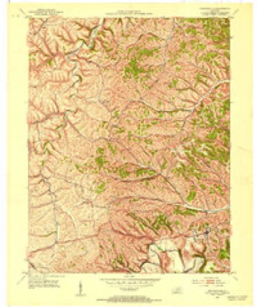
9 topographic sheets cover this place, the earliest surveyed in 1952 and the latest in 1982. It stands in the Sharpsburg census division. It lies in ZIP code area 40374. It stands on Maux Branch. The Survey maps it on the Owingsville quadrangle.
Topographic sheets covering this place
4 surveys from 9 printed sheetsMatched by testing this settlement's coordinate against the published boundary of every sheet in the United States Geological Survey's historical collection. Each opens the scanned sheet at the Survey.
- 1952 USGS Owingsville quadrangle1:24000, 4 printings
- 1957 USGS Huntington quadrangle1:250000, 3 printings
- 1960 USGS Huntington quadrangle1:250000
- 1982 USGS Morehead quadrangle1:100000
Fires near this place
5 since 2001Regional context, not property-specific evidence. The federal wildfire occurrence database lists 5 fires within 5 miles of Bethel between 2001 and 2017, burning about 62 acres in total. None started naturally. 1 was recorded as arson. Distance is straight-line from the map coordinates, so a fire counted here may appear on a neighbouring settlement's page as well.
| Reported cause | Fires |
|---|---|
| Recreation and ceremony | 2 |
| Arson/incendiarism | 1 |
| Railroad operations and maintenance | 1 |
| Debris and open burning | 1 |
The most recent of them, most recent first, with the day each was reported and the service that recorded it.
| Date | Cause | Size | Reported by | Name on the report |
|---|---|---|---|---|
| 25 April 2001 | Arson/incendiarism | 5.0 acres | Kentucky Division of Forestry | not named |
| 20 April 2016 | Recreation and ceremony | 5.0 acres | Kentucky Division of Forestry | NORTH CONVICT RD |
| 18 November 2017 | Debris and open burning | 15 acres | Kentucky Division of Forestry | KISER BRANCH |
| 22 October 2008 | Railroad operations and maintenance | 12 acres | Kentucky Division of Forestry | not named |
| 11 October 2010 | Recreation and ceremony | 25 acres | Kentucky Division of Forestry | PISGAH ROAD |
Settlements close enough to share some of these fires:
Storms near this place
20 since 2000Regional context, not property-specific evidence. The National Weather Service names Bethel in 20 storm reports between 2000 and 2024: 13 thunderstorm wind, 3 hail, 3 flash flood, 1 flood. No death or injury is recorded in these reports. Each account below is quoted exactly as the forecast office filed it, from the NOAA Storm Events Database, and each date opens the federal record of that event.
| When | Event | Place named | Harm | What the report says |
|---|---|---|---|---|
| April 2024 | Thunderstorm Wind | Bethel | $60,000 | The survey team was sent to a property that sustained substantial damage off Chandler road just NE of the Bethel community. Two houses set on the property next to one another. The first was an old farmhouse that was being lived in but no longer maintained. The house directly beside it was a new Amish house. When winds hit the older house, sitting to the west, it lifted off the roof structure and threw it to the ESE, hitting the roof and chimney of the new house. This caused the chimney to collapse and fall, leading to significant damage to the side of the house and porches. Thankfully no one was injured in this incident. In addition, several other nearby outbuildings sustained damage, as did the siding on the houses, but all other structures on the property were fine. |
| February 2008 | Thunderstorm Wind | Bethel | $40,000 | Numerous trees were blown down county wide. The greatest amount of damage occurred in the southwestern portion of the county, where at least 20 to 30 trees were blown down. |
| April 2024 | Thunderstorm Wind | Bethel | $30,000 | A small subdivision along Country Lane in Bethel sustained damage due to straight line winds. Several houses had Bradford Pear Trees and rotted hardwood trees that blew down to the east. Several homes also sustained shingle and minor roof damage on the west facing side. In addition, a small timber frame that was being built (likely a shed) collapsed. |
| April 2024 | Thunderstorm Wind | Bethel | $15,000 | A barn sustained wind damage along Market Lane, near KY-11, between Sharpsburg and Bethel. The barn was already structurally unsound, but the additional winds collapsed the barn, throwing pieces of the roofing and wood sides across KY-11 about 100+ yards to the east. |
| April 2024 | Thunderstorm Wind | Bethel | $15,000 | A small concrete blocked building housing an auction company lost its tin roof, thrown eastward. The building was located near the intersection of KY-36 and KY-11 between Sharpsburg and Bethel. |
| April 2024 | Thunderstorm Wind | Bethel | $10,000 | Two barns set beside each other at the start of Chandler Road, near Shiloh Road, one an open air newer barn on the NW side, and the other a large old wooden white barn just to the SE. Wind hit the open air barn and caused it to collapse, though no notable damage appears to be sustained to the white barn next to it. |
| June 2011 | Thunderstorm Wind | Bethel | $10,000 | Trees and a cable t.v. line were blown down in Bethel. |
| April 2024 | Thunderstorm Wind | Bethel | $5,000 | Plastic greenhouse covers were pulled off at an Amish house along Shields Road near Reynoldsville. |
| May 2011 | Hail | Bethel | $2,000 | Golf ball size hail dented a car a mile west northwest of Bethel. |
| December 2019 | Flood | Bethel | $1,000 | Dispatch relayed a report of water over Little Flat-Ledford Road near Bethel. |
| June 2011 | Thunderstorm Wind | Bethel | $1,000 | A tree was blown down and onto a road in Bethel. |
| August 2019 | Flash Flood | Bethel | $500 | Local Emergency Management reported a bridge washed out on Sanderson Road southeast of Bethel. |
| July 2023 | Thunderstorm Wind | Bethel | - | A tree was reportedly blown down blocking Rooster Run Road southeast of the community of Bethel. |
| June 2019 | Thunderstorm Wind | Bethel | - | Emergency Management and local media relayed reports of trees down near Bethel on Bethel Ridge Road to north of Bethel along Little Flat Ledford Road. |
| September 2018 | Flash Flood | Bethel | - | Local Emergency Management observed flowing water over Convict Road south of Bethel, forcing the closure of the road. |
| March 2013 | Flash Flood | Bethel | - | Highway 1105 was closed due to flash flooding between mile markers 2 and 4 near Flat Creek. |
| July 2012 | Thunderstorm Wind | Bethel | - | Trees were blown down in Bethel. |
| July 2012 | Thunderstorm Wind | Bethel | - | Trees were blown down in Bethel. |
| May 2011 | Hail | Bethel | - | no account filed |
| July 2000 | Hail | Bethel | - | no account filed |
Nearest settlements
The eight closest, with where each one stands in the county. Distances are straight-line, computed from the Geographic Names Information System coordinates.
| Map | Place | Distance | Sheets |
|---|---|---|---|
| Bald Eagle (historical) | 3.2 miles | 9 | |
| South Sherburne (historical) | 4.1 miles | 6 | |
| East Fork (historical) | 4.3 miles | 9 | |
| Sharpsburg | 4.4 miles | 6 | |
| Reynoldsville | 4.5 miles | 9 | |
| Pittsburgh (historical) | 5.7 miles | 9 | |
| White Oak | 5.8 miles | 9 | |
| Fairview (historical) | 6.1 miles | 6 |
Provenance
This settlement is recorded in the Geographic Names Information System as feature 486946. The sheet list is computed by point-in-boundary test against the United States Geological Survey's historical topographic inventory. Both are works of the United States government and carry no copyright under 17 U.S.C. 105.
Wildfire. Short, Karen C. 2022. Spatial wildfire occurrence data for the United States, 1992-2020 [FPA_FOD_20221014]. 6th Edition. Fort Collins, CO: Forest Service Research Data Archive. https://doi.org/10.2737/RDS-2013-0009.6 Collected with United States Government funding and usable without additional permissions or fees.
Storms. NOAA National Centers for Environmental Information, Storm Events Database https://www.ncei.noaa.gov/stormevents/ A work of the United States government, no copyright under 17 U.S.C. 105. Narratives are quoted verbatim from the National Weather Service report and are not edited or summarised.