 Block
Reynoldsville, Kentucky
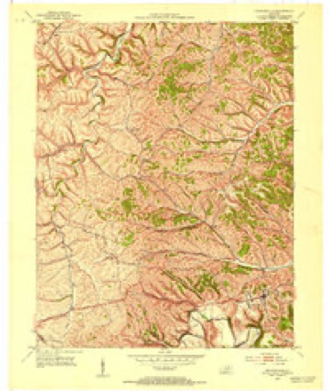
9 topographic sheets cover this place, the earliest surveyed in 1952 and the latest in 1982. It stands in the Owingsville census division. It lies in ZIP code area 40360. It stands on North Prong Prickly Ash Creek. The Survey maps it on the Owingsville quadrangle.
Topographic sheets covering this place
4 surveys from 9 printed sheetsMatched by testing this settlement's coordinate against the published boundary of every sheet in the United States Geological Survey's historical collection. Each opens the scanned sheet at the Survey.
- 1952 USGS Owingsville quadrangle1:24000, 4 printings
- 1957 USGS Huntington quadrangle1:250000, 3 printings
- 1960 USGS Huntington quadrangle1:250000
- 1982 USGS Morehead quadrangle1:100000
Fires near this place
5 since 2001Regional context, not property-specific evidence. The federal wildfire occurrence database lists 5 fires within 5 miles of Reynoldsville between 2001 and 2017, burning about 24 acres in total. None started naturally. 2 were recorded as arson. Distance is straight-line from the map coordinates, so a fire counted here may appear on a neighbouring settlement's page as well.
| Reported cause | Fires |
|---|---|
| Arson/incendiarism | 2 |
| Recreation and ceremony | 2 |
| Railroad operations and maintenance | 1 |
The most recent of them, most recent first, with the day each was reported and the service that recorded it.
| Date | Cause | Size | Reported by | Name on the report |
|---|---|---|---|---|
| 25 April 2001 | Arson/incendiarism | 5.0 acres | Kentucky Division of Forestry | not named |
| 20 April 2016 | Recreation and ceremony | 5.0 acres | Kentucky Division of Forestry | NORTH CONVICT RD |
| 28 November 2017 | Arson/incendiarism | 1.0 acres | Kentucky Division of Forestry | STEPSTONE RD |
| 22 October 2008 | Railroad operations and maintenance | 12 acres | Kentucky Division of Forestry | not named |
| 13 October 2008 | Recreation and ceremony | 1.0 acres | Kentucky Division of Forestry | not named |
Settlements close enough to share some of these fires:
Storms near this place
33 since 2005Regional context, not property-specific evidence. The National Weather Service names Reynoldsville in 33 storm reports between 2005 and 2024: 25 thunderstorm wind, 5 flash flood, 1 hail, 1 flood. No death or injury is recorded in these reports. Each account below is quoted exactly as the forecast office filed it, from the NOAA Storm Events Database, and each date opens the federal record of that event.
| When | Event | Place named | Harm | What the report says |
|---|---|---|---|---|
| April 2024 | Tornado (EF0) | Reynoldsville | $40,000 | Straight line winds pushed through Mount Pleasant Road from west to east, resulting in damage to structures on both the north and south side of this mobile home. However, the mobile home, which set in the middle of the damage, showed signs of rotation as the system moved through, indicative of a quick spin-up tornado. All damage that was viewed downstream by the survey team seemed to be more in line with straight-line winds as well, so this was likely a very quick spin-up. There was a lack of structures behind this mobile home, and a lack of damage across the street to the east of this home. It matched up well with one of the tighter circulations that went through the area. The mobile home itself was hit from the backside, lifting off the roof on the back half of the house. Siding was torn off on all sides. The front of the house's roofline was a bit rotted, but lost it's flashing. Insulation and mud was plastered along the front side. Meanwhile, more mud and insulation was plastered all through the inside of the house as well. |
| October 2022 | Thunderstorm Wind | Reynoldsville | $40,000 | Multiple barns and farm structures (corn crib bin and chicken coop) were damaged or destroyed due to thunderstorm winds. NWS Storm Survey results noted that the small buildings were light and not well anchored down, that the metal pole barn was open on the ends, and that the stick-built barn was old and also had a door open - allowing winds to get inside. All damage was laying uniformly towards the ENE. |
| April 2024 | Thunderstorm Wind | Reynoldsville | $25,000 | Farm sustained heavy wind damage along W Hwy-60. An open air barn collapsed. Metal roof from the barn was thrown southward and eastward about 200-300 yards across fields. Multiple Bradford Pear trees were also broken, and several other sheds were damaged. |
| April 2024 | Thunderstorm Wind | Reynoldsville | $25,000 | House sustained damage along Mt. Pleasant Road just north of Reynoldsville. The house was located on the northside of a spin-up tornado. Two sheds behind the house collapsed and were thrown ENE, with contents and metal roofing littering the yard and across the street to the east. The southeast corner of the house also was missing roofing material off the porch, and the south-side of the porch was ripped off. Owners also reported that some of the windows bowed in, likely due to the nearby tornado. |
| October 2022 | Thunderstorm Wind | Reynoldsville | $25,000 | Thunderstorm winds led to the destruction of 2 barns on a private property. The barns were old, and were not anchored down to the ground. One barn was moved off its foundation by about 15 feet and collapsed. The other lost roofing material and had multiple north-facing wall panels blown off. |
| September 2021 | Flash Flood | Reynoldsville | $25,000 | Water over White Oak Road just northwest of Owingsville has caused damage to the pavement along several portions of the road. |
| April 2024 | Thunderstorm Wind | Reynoldsville | $15,000 | An older barn collapsed due to strong winds. It's was located in an exposed and elevated landscape. |
| April 2024 | Thunderstorm Wind | Reynoldsville | $10,000 | Roofing was peeled off of west side of the barn, along with multiple large tree limbs snapped on the property along Flat Creek Road. Another barn behind this one also sustained roof damage. |
| October 2022 | Thunderstorm Wind | Reynoldsville | $10,000 | A barn was moved off its foundation and lost its roof. According to the NWS Storm Survey Steam, the cement block footers showed no indication of anchors to the barn and the wood looked dry rotted. Remainders of the barn were through 1/8 mile in a uniform direction to the ENE. |
| October 2022 | Thunderstorm Wind | Reynoldsville | $10,000 | A peg construction barn collapsed with most debris uniformly laying towards the ENE and NE. The roof was dislodged and tossed 150 feet to the east of the barn, but the framing of the roof seemed to be rotted. The cement footers that the bar was sitting on showed no indication of being anchored to the barn - rather the weight of the barn was holding it up. |
| October 2022 | Thunderstorm Wind | Reynoldsville | $10,000 | A partial barn collapse. The walls of the barn did look to be anchored with a piece of rebarb sticking out of the concrete footers, and into a hole at the bottom of the 6x6 inch barn posts/vertical beams. No other anchoring clips were used, so wind was able to lift post off the anchor. The NWS Storm Survey Team also noted that most of the wood was dry rotted. |
| July 2013 | Thunderstorm Wind | Reynoldsville | $10,000 | Several trees and tree limbs were downed in a 2 mile area along Highway 60 and Bob-o-Link Drive. One large tree was uprooted and fell onto a car and house. |
| October 2022 | Thunderstorm Wind | Reynoldsville | $9,000 | An open air barn had its roof peeled off and thrown into the field east of the barn. The NWS Storm Survey Team noted that the wood of the barn was dry rotted and weathered. |
| October 2022 | Thunderstorm Wind | Reynoldsville | $7,500 | An older barn lost a large section of the roofing, causing one side to collapse. The roof sections were intact and traveled about 30 feet eastward, away from the barn. A large tree branch was also snapped in the same location. |
| October 2011 | Thunderstorm Wind | Reynoldsville | $3,000 | Three trees were blown down on Highway 36W between mile markers 8 and 9 in Reynoldsville. |
| May 2018 | Flash Flood | Reynoldsville | $1,000 | County Emergency Management reported several roadways containing at least half a foot of flowing water near Flat Creek and west of Owingsville, leading to a vehicle becoming stranded on U.S. Highway 60 near the Montgomery County line. |
| August 2015 | Flash Flood | Reynoldsville | $1,000 | An estimated two feet of flowing water was present on a curve on Hwy US60 near Flat Creek. There were a couple of swift water rescues that needed to be performed involving vehicles getting stuck in flood waters. |
| July 2005 | Thunderstorm Wind | Reynoldsville | $1,000 | Trained spotter reported trees and power lines blown down. |
| April 2024 | Thunderstorm Wind | Reynoldsville | - | Multiple trees were snapped and twisted along the tree line down Tower Road in the community of White Oak. Most of the trees were laying to the N or NW. Utility crews were also working at the end of Tower Road, though there were no signs of visible damage here. |
| July 2023 | Thunderstorm Wind | Reynoldsville | - | The Bath County emergency manager reported numerous tree blown down in the county. |
| October 2022 | Thunderstorm Wind | Reynoldsville | - | Trees were reported down along White Oak Road off of Highway 36. |
| October 2022 | Thunderstorm Wind | Reynoldsville | - | Multiple large tree limbs between 5 and 7 inches in diameter were downed due to thunderstorm winds. Trees did not appear to be rotted, and were all laying uniformly towards the east. |
| October 2022 | Thunderstorm Wind | Reynoldsville | - | A rotten oak tree was snapped. |
| October 2022 | Thunderstorm Wind | Reynoldsville | - | A tree was reported down along Flat Creek Road near the community of Flat Creek, WNW of Owingsville. |
| October 2022 | Thunderstorm Wind | Reynoldsville | - | Several locust trees were snapped along Wonderful Lane. However the NWS Storm Survey team noted that most of them had rotted trunks. All trees were uniformly laying to the east. |
| April 2020 | Thunderstorm Wind | Reynoldsville | - | Dispatch reported a tree blown down across one lane of U.S. Highway 60 in Flat Creek. |
| August 2019 | Flash Flood | Reynoldsville | - | Local Emergency Management observed nearly a foot of swiftly flowing water over Flat Creek Road north of U.S. Highway 60. |
| September 2018 | Flood | Reynoldsville | - | Water of an unknown depth was observed flowing across Flat Creek Road southeast of Sharpsburg. |
| June 2017 | Flash Flood | Reynoldsville | - | Emergency management reported multiple instances of flash flooding across the county. The first of which included a car being stranded north of Bethel as flood waters engulfed both sides of the road. Portions of Kentucky Highway 36 west of Owingsville were impassable, while water entered homes on Pendleton Branch Road and Old State Road. Rainfall amounts generally ranged from 2 to 3 inches. |
| May 2015 | Thunderstorm Wind | Reynoldsville | - | A tree was blown down and onto US 60 near Owingsville. |
| October 2014 | Thunderstorm Wind | Reynoldsville | - | Several large limbs were blown down. |
| July 2012 | Thunderstorm Wind | Reynoldsville | - | A tree was blown down on 1944 near White Oak Church. |
| July 2005 | Hail | Reynoldsville | - | no account filed |
Nearest settlements
The eight closest, with where each one stands in the county. Distances are straight-line, computed from the Geographic Names Information System coordinates.
| Map | Place | Distance | Sheets |
|---|---|---|---|
| Bald Eagle (historical) | 1.7 miles | 9 | |
| Upper Prickly Ash (historical) | 2.1 miles | 9 | |
| Harpers (historical) | 2.3 miles | 9 | |
| Pittsburgh (historical) | 2.6 miles | 9 | |
| White Oak | 2.8 miles | 9 | |
| East Fork (historical) | 4.0 miles | 9 | |
| Bethel | 4.5 miles | 9 | |
| Owingsville | 4.5 miles | 9 |
Provenance
This settlement is recorded in the Geographic Names Information System as feature 508927. The sheet list is computed by point-in-boundary test against the United States Geological Survey's historical topographic inventory. Both are works of the United States government and carry no copyright under 17 U.S.C. 105.
Wildfire. Short, Karen C. 2022. Spatial wildfire occurrence data for the United States, 1992-2020 [FPA_FOD_20221014]. 6th Edition. Fort Collins, CO: Forest Service Research Data Archive. https://doi.org/10.2737/RDS-2013-0009.6 Collected with United States Government funding and usable without additional permissions or fees.
Storms. NOAA National Centers for Environmental Information, Storm Events Database https://www.ncei.noaa.gov/stormevents/ A work of the United States government, no copyright under 17 U.S.C. 105. Narratives are quoted verbatim from the National Weather Service report and are not edited or summarised.