 Block
Clay City, Kentucky
12 topographic sheets cover this place, the earliest surveyed in 1892 and the latest in 1982. It stands in the Clay City census division. It lies in ZIP code area 40312. It stands on Fife Lick Creek. The Survey maps it on the Clay City quadrangle. 1,193 people lived here at the 2020 count. It stands 620 feet above sea level.
Research this city
On record in Clay City
Buildings and businesses the archive holds for this place. Each opens its own page, with the source record it came from.
On the National Register 1 record
 Clay City National Bank Buildinglisted 1976
Population over time
2 figuresClay City grew from 1,077 to 1,193 between 2010 and 2020. These are the recorded population figures Wikidata holds for this place, reached through the Geographic Names Information System number this page is keyed on rather than by name, so they belong to this place and not to another of the same name. Most are census counts, but not all are: an early figure may be a founding or settlement estimate, and an estimate published within five years of a census is left out. The change column is computed, and is left blank where more than 20 years separate a figure from the one before it, because a gap that long is not a change between two counts.
| Year | People | Change |
|---|---|---|
| 2010 | 1,077 | |
| 2020 | 1,193 | +116 (+11%) |
Topographic sheets covering this place
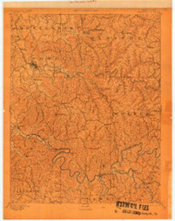
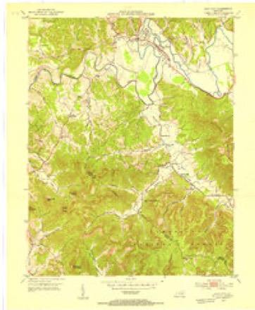
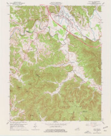
6 surveys from 12 printed sheetsMatched by testing this settlement's coordinate against the published boundary of every sheet in the United States Geological Survey's historical collection. Each opens the scanned sheet at the Survey.
- 1892 USGS Beattyville quadrangle1:125000, 6 printings
- 1952 USGS Clay City quadrangle1:24000
- 1957 USGS Jenkins quadrangle1:250000
- 1960 USGS Jenkins quadrangle1:250000
- 1966 USGS Clay City quadrangle1:24000, 2 printings
- 1982 USGS Irvine quadrangle1:100000
Fires near this place
79 since 1998Regional context, not property-specific evidence. The federal wildfire occurrence database lists 79 fires within 5 miles of Clay City between 1998 and 2020, burning about 734 acres in total. None started naturally. 7 were recorded as arson. Distance is straight-line from the map coordinates, so a fire counted here may appear on a neighbouring settlement's page as well.
| Reported cause | Fires |
|---|---|
| Missing data/not specified/undetermined | 26 |
| Debris and open burning | 24 |
| Recreation and ceremony | 18 |
| Arson/incendiarism | 7 |
| Railroad operations and maintenance | 1 |
| Misuse of fire by a minor | 1 |
| Equipment and vehicle use | 1 |
| Smoking | 1 |
The most recent of them, most recent first, with the day each was reported and the service that recorded it.
| Date | Cause | Size | Reported by | Name on the report |
|---|---|---|---|---|
| 29 September 2008 | Missing data/not specified/undetermined | 2.0 acres | Kentucky Division of Forestry | not named |
| 26 September 1999 | Debris and open burning | 2.0 acres | Kentucky Division of Forestry | not named |
| 25 September 2019 | Arson/incendiarism | 1.0 acres | Kentucky Division of Forestry | CHARLIE LANE |
| 24 September 1998 | Debris and open burning | 1.0 acres | Kentucky Division of Forestry | not named |
| 18 September 1999 | Recreation and ceremony | 1.0 acres | Kentucky Division of Forestry | not named |
| 14 September 2008 | Recreation and ceremony | 1.0 acres | Kentucky Division of Forestry | not named |
| 3 August 2002 | Debris and open burning | 21 acres | Kentucky Division of Forestry | not named |
| 17 June 2007 | Recreation and ceremony | 10 acres | Kentucky Division of Forestry | not named |
Settlements close enough to share some of these fires:
Mines and quarries near this place
2 within 5 milesRegional context, not property-specific evidence. The federal mineral resources record lists 2 workings within 5 miles of Clay City: 2 producers. All of them still produce. What was taken out: Clay, Stone, Crushed/Broken. Distance is straight-line from the map coordinates, so a quarry counted here may appear on a neighbouring settlement's page as well.
| Where | Site | Commodity | Status | Recorded |
|---|---|---|---|---|
| 213 Quarry | Stone, Crushed/Broken | Producer | ||
| Drake 01 | Clay | Producer |
Storms near this place
60 of 69 shownRegional context, not property-specific evidence. The National Weather Service names Clay City in 69 storm reports between 1995 and 2026: 33 thunderstorm wind, 14 hail, 11 flash flood, 5 flood. The reports record 1 injury. Each account below is quoted exactly as the forecast office filed it, from the NOAA Storm Events Database, and each date opens the federal record of that event.
| When | Event | Place named | Harm | What the report says |
|---|---|---|---|---|
| April 2014 | Lightning | Clay City | 1 hurt | A county employee was struck by lightning. The person was taken to a hospital but there were no details available on specific injuries. |
| March 1997 | Flash Flood | Clay City | $200,000 | no account filed |
| April 2008 | Flash Flood | Clay City | $55,000 | Adams Ridge Road was washed out by flood waters. |
| August 2009 | Flash Flood | Clay City | $50,000 | The Powell County emergency manager say that Stanton is experiencing severe flash flooding. A rescue was underway in the city limits on Stanton Road. A daycare center was evacuated due to flooding and many businesses were flooded. Debris was seen flowing across many roads within Stanton city limits. |
| February 2008 | Thunderstorm Wind | Clay City | $35,000 | Numerous trees and power lines were blown down county wide. |
| December 2019 | Flood | Clay City | $11,000 | The Kentucky Transportation Cabinet reported standing water over Kentucky Highways 2026, 1184, and 613 between Bowen and Clay City. |
| May 2008 | Thunderstorm Wind | Clay City | $10,000 | Numerous tree branches were torn off along Spout Springs Road. Branches were 2 to 5 inches in diameter. One tree was also blown down on Highway 2001. |
| June 2007 | Thunderstorm Wind | Clay City | $10,000 | Several trees down. |
| August 2010 | Thunderstorm Wind | Clay City | $7,000 | Dispatch reported that a tree fell on a vehicle on Main St, injuring two of the passengers. |
| June 1998 | Thunderstorm Wind | Clay City | $5,000 | Trees downed. One tree fell onto house. |
| May 1998 | Thunderstorm Wind | Clay City | $3,000 | Power lines were downed. |
| March 1997 | Thunderstorm Wind | Clay City | $3,000 | no account filed |
| January 2008 | Thunderstorm Wind | Clay City | $2,500 | A thunderstorm wind gust estimated at 60 mph occurred near Stanton in Powell county. One small tree and two large limbs blown down in Stanton. |
| February 2012 | Thunderstorm Wind | Clay City | $2,000 | Large tree limbs were blown down on Snow Creek. |
| March 2008 | Thunderstorm Wind | Clay City | $2,000 | Two trees were blown down on Highway 11. |
| July 2007 | Thunderstorm Wind | Clay City | $2,000 | Two trees down on old Winchester Road. One tree down on Pecks Creek Road and another on Oak Ridge Drive. |
| July 2023 | Thunderstorm Wind | Clay City | $1,000 | A phone line was blown down by strong thunderstorm wind gusts near Clay City. |
| March 2015 | Flood | Clay City | $1,000 | Adams Ridge on Brush Branch had to be closed due to flooding. |
| May 2008 | Thunderstorm Wind | Clay City | $1,000 | A 5 inch diameter tree limb was blown down by thunderstorm wind gusts. |
| July 2008 | Thunderstorm Wind | Clay City | $1,000 | A tree was blown down on Route 1057 near Big Hardwicks Creek Road. |
| July 2008 | Thunderstorm Wind | Clay City | $1,000 | Three trees were blown down on Little Hardwicks Creek Road. |
| May 2006 | Thunderstorm Wind | Clay City | $1,000 | Tree blown down on a power line. |
| March 2026 | Thunderstorm Wind | Clay City | - | Powell County dispatch reported a tree blown down along the road near the intersection of Pompeii Road and Woody Ware Road. |
| August 2023 | Thunderstorm Wind | Clay City | - | A tree was blown down near the intersection of Woody Ware and Pompeii roads. |
| January 2022 | Heavy Rain | Clay City | - | The cooperative observer located 2 miles west of Stanton measured 3.14 inches of rainfall in a 48-hour period ending at 8am on January 2, 2022. |
| June 2022 | Thunderstorm Wind | Clay City | - | A tree was blown down on Beech Fork Road near Clay City. |
| July 2021 | Heavy Rain | Clay City | - | A 24-hour rainfall total of 3.25 inches was reported off Beech Fork Road just east-northeast of Clay City. |
| December 2021 | Thunderstorm Wind | Clay City | - | A tree was downed and over Paint Creek Road in the 2500 block north of Stanton. |
| February 2019 | Flood | Clay City | - | Local media reported flooding between Stanton and Clay City along Kentucky Highway 2026. |
| March 2017 | Thunderstorm Wind | Clay City | - | A tree was blown down in the Heartbreak Ridge area. |
| February 2012 | Hail | Clay City | - | Quarter size hail was reported in Clay City. |
| March 2012 | Hail | Clay City | - | Hail, ranging from dime to half dollar size, covered the ground approximately 2.5 miles north on Route 11 heading towards Mount Sterling. |
| April 2011 | Hail | Clay City | - | The hail was the size of half dollars. |
| May 2010 | Heavy Rain | Clay City | - | A volunteer weather observer reported that 3.58 inches of rain had fallen in Clay City since 8 am. |
| May 2010 | Flash Flood | Clay City | - | The Beech Fork Reservoir between Clay City and Stanton was in danger of breach. Water was overflowing the dam according to the Beech Fork Water Commission. |
| January 2009 | Flood | Clay City | - | Numerous roads were flooded due to the ice and debris in the Red River causing it to overflow its banks. Roads closures included Pompeii, Adams Ridge, Rosslyn, Bowen and Maple Street. These roads were all in the Clay City and Stanton areas. |
| August 2009 | Flash Flood | Clay City | - | Portions of Highway 15 has over 6 inches of water flowing across it. Debris was also flowing across the road. |
| April 2009 | Funnel Cloud | Clay City | - | A funnel cloud was reported by state police in Clay City and West Bend. |
| February 2008 | Flood | Clay City | - | Highway 2026 near beach fork was flooded. Flooding was also reported in the Bowen Community on Highway 15. |
| February 2008 | Thunderstorm Wind | Clay City | - | Thunderstomr winds were estimated at 65 mph by a National Weather Service employee. |
| January 2006 | Flash Flood | Clay City | - | Twelve inches of water flowing across several areas of Highway 82, Hardwick Road, and Adams Ridge Road. |
| April 2005 | Thunderstorm Wind | Clay City | - | Trees down on Happy Top Road near Clay City. |
| June 2005 | Thunderstorm Wind | Clay City | - | Trees down in Clay City. |
| May 2005 | Thunderstorm Wind | Clay City | - | Large tree limbs down in Clay City. |
| August 2005 | Thunderstorm Wind | Clay City | - | One tree down at Snow Creek. |
| August 2005 | Thunderstorm Wind | Clay City | - | One tree down on Highway 82. |
| May 2004 | Tornado (F0) | Clay City | - | A storm survey confirmed that an F0 tornado, with a wind of 60 to 70 miles per hour, touched down in Clay City near Highway 15. The tornado had a width of about 50 feet and touched down very briefly. The tornado was embedded in a large area of straight-line, downburst wind. |
| July 2001 | Thunderstorm Wind | Clay City | - | Trees were blown down. |
| July 2001 | Thunderstorm Wind | Clay City | - | Thunderstorm winds brought several trees down in the area. |
| August 2001 | Flash Flood | Clay City | - | Two feet of flowing water between mile marker 12 and 16 on the Mountain Parkway. Portion of the Parkway was closed at Exit 16 due to high water. Kentucky Highways 15 and 11 were also closed due to flowing water. One house and 2 mobile homes were surrounded by water, no damage was reported. |
| October 2001 | Thunderstorm Wind | Clay City | - | Trees were blown down. |
| July 2000 | Thunderstorm Wind | Clay City | - | One tree and several large limbs down. |
| December 2000 | Flash Flood | Clay City | - | Harwicks Creek and Frames Branch reported out of their banks at Adams Ridge near Clay City. Several homes cut off by floodwaters. |
| January 1999 | Flash Flood | Clay City | - | Water blocked roads in and around the Clay City area. |
| June 1998 | Thunderstorm Wind | Clay City | - | Trees downed. |
| July 1997 | Thunderstorm Wind | Clay City | - | Trees were downed. |
| June 1995 | Hail | Clay City | - | Public reports golf ball-size hail. |
| March 2012 | Hail | Clay City | - | no account filed |
| May 2008 | Hail | Clay City | - | no account filed |
| June 2008 | Hail | Clay City | - | no account filed |
Newspapers printed here
4,201 digitised pages1 paper published in this town, digitised by the Library of Congress and free to read: 1,004 issues, 4,201 pages. Every page is searchable, so a name or a street can be looked for directly in what the town printed about itself at the time.
| Newspaper | Published |
|---|---|
| The Clay City Times | 1901 to Current |
What the paper printed
11,105 wordsFront pages of the local paper, read from the Library of Congress scans: 6 issues spread across its run from 1901 to 1922, 11,105 words in total. Each is reproduced on its own page, exactly as the recogniser returned it.
These pages read less well than anything else here, and the number is worth stating: about three words in four come through cleanly, against nine in ten for the building records. An 1896 broadsheet sets eight-point type in seven columns on microfilm, which is the hardest thing in this archive to read by machine. We tested our own recognisers against the Library's and they were not better, so the Library's text is what appears, with the wholly unreadable columns removed. Read it as a guide to what the paper covered, and follow the link to the scan before quoting anything.
| Issue | Paper | Length |
|---|---|---|
| 1901-11-28 | The Clay City Times | 1,809 words |
| 1901-12-12 | The Clay City Times | 2,008 words |
| 1901-12-26 | The Clay City Times | 2,066 words |
| 1902-04-24 | The Clay City Times | 1,348 words |
| 1902-05-08 | The Clay City Times | 1,635 words |
| 1922-12-28 | The Clay City Times | 2,239 words |
Nearest settlements
The eight closest, with where each one stands in the county. Distances are straight-line, computed from the Geographic Names Information System coordinates.
| Map | Place | Distance | Sheets |
|---|---|---|---|
| Piggville (historical) | 0.7 miles | 12 | |
| Waltersville | 0.9 miles | 12 | |
| Powell Valley | 1.6 miles | 12 | |
| Old Clay City Road (historical) | 2.0 miles | 12 | |
| Black Creek (historical) | 2.2 miles | 12 | |
| Virden | 2.5 miles | 12 | |
| Paint Creek (historical) | 2.6 miles | 12 | |
| Happy Top (historical) | 3.0 miles | 12 |
Elsewhere
Matched on this settlement's Geographic Names Information System number rather than its name, so it cannot be a different place of the same name in another state.
| Wikipedia article on Clay City | An encyclopaedic summary. Its text is share-alike, so it is linked here rather than copied. |
| Wikidata item Q2020113 | The structured record the population and elevation above come from. Public domain (CC0). |
Provenance
This settlement is recorded in the Geographic Names Information System as feature 511380. The sheet list is computed by point-in-boundary test against the United States Geological Survey's historical topographic inventory. Both are works of the United States government and carry no copyright under 17 U.S.C. 105.
Wildfire. Short, Karen C. 2022. Spatial wildfire occurrence data for the United States, 1992-2020 [FPA_FOD_20221014]. 6th Edition. Fort Collins, CO: Forest Service Research Data Archive. https://doi.org/10.2737/RDS-2013-0009.6 Collected with United States Government funding and usable without additional permissions or fees.
Mines and quarries. USGS Mineral Resources Data System (MRDS) https://mrdata.usgs.gov/mrds/ A work of the United States government, no copyright under 17 U.S.C. 105.
Storms. NOAA National Centers for Environmental Information, Storm Events Database https://www.ncei.noaa.gov/stormevents/ A work of the United States government, no copyright under 17 U.S.C. 105. Narratives are quoted verbatim from the National Weather Service report and are not edited or summarised.