 Block
Waltersville, Kentucky
12 topographic sheets cover this place, the earliest surveyed in 1892 and the latest in 1982. It stands in the Clay City census division. It lies in ZIP code area 40312. It stands on Skinner Branch. The Survey maps it on the Clay City quadrangle.
On record in Waltersville
Buildings and businesses the archive holds for this place. Each opens its own page, with the source record it came from.
On the National Register within a mile 1 record
The National Register names another town for these. They stand within one mile of this settlement's coordinate.
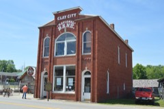 Clay City National Bank Buildinglisted 1976 · 0.8 miles away
Topographic sheets covering this place
6 surveys from 12 printed sheetsMatched by testing this settlement's coordinate against the published boundary of every sheet in the United States Geological Survey's historical collection. Each opens the scanned sheet at the Survey.
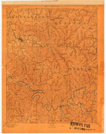
- 1892 USGS Beattyville quadrangle1:125000, 6 printings
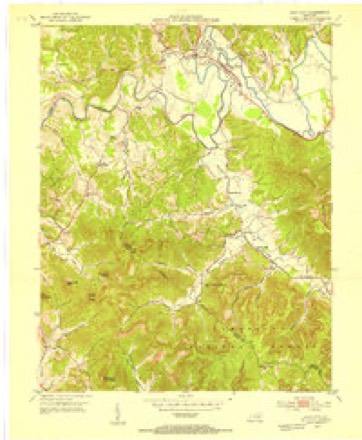
- 1952 USGS Clay City quadrangle1:24000
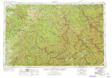
- 1957 USGS Jenkins quadrangle1:250000
- 1960 USGS Jenkins quadrangle1:250000
- 1966 USGS Clay City quadrangle1:24000, 2 printings
- 1982 USGS Irvine quadrangle1:100000
Fires near this place
75 since 1998Regional context, not property-specific evidence. The federal wildfire occurrence database lists 75 fires within 5 miles of Waltersville between 1998 and 2020, burning about 612 acres in total. None started naturally. 6 were recorded as arson. Distance is straight-line from the map coordinates, so a fire counted here may appear on a neighbouring settlement's page as well.
| Reported cause | Fires |
|---|---|
| Missing data/not specified/undetermined | 28 |
| Debris and open burning | 23 |
| Recreation and ceremony | 16 |
| Arson/incendiarism | 6 |
| Equipment and vehicle use | 1 |
| Smoking | 1 |
The most recent of them, most recent first, with the day each was reported and the service that recorded it.
| Date | Cause | Size | Reported by | Name on the report |
|---|---|---|---|---|
| 29 September 2008 | Missing data/not specified/undetermined | 2.0 acres | Kentucky Division of Forestry | not named |
| 26 September 1999 | Debris and open burning | 2.0 acres | Kentucky Division of Forestry | not named |
| 25 September 2019 | Arson/incendiarism | 1.0 acres | Kentucky Division of Forestry | CHARLIE LANE |
| 24 September 1998 | Debris and open burning | 1.0 acres | Kentucky Division of Forestry | not named |
| 18 September 1999 | Recreation and ceremony | 1.0 acres | Kentucky Division of Forestry | not named |
| 3 August 2002 | Debris and open burning | 21 acres | Kentucky Division of Forestry | not named |
| 2 July 2012 | Missing data/not specified/undetermined | 1.0 acres | Kentucky Division of Forestry | COPPERAS C |
| 17 June 2007 | Recreation and ceremony | 10 acres | Kentucky Division of Forestry | not named |
Settlements close enough to share some of these fires:
Mines and quarries near this place
2 within 5 milesRegional context, not property-specific evidence. The federal mineral resources record lists 2 workings within 5 miles of Waltersville: 2 producers. All of them still produce. What was taken out: Clay, Stone, Crushed/Broken. Distance is straight-line from the map coordinates, so a quarry counted here may appear on a neighbouring settlement's page as well.
| Where | Site | Commodity | Status | Recorded |
|---|---|---|---|---|
| 213 Quarry | Stone, Crushed/Broken | Producer | ||
| Drake 01 | Clay | Producer |
Storms near this place
35 since 2008Regional context, not property-specific evidence. The National Weather Service names Waltersville in 35 storm reports between 2008 and 2025: 13 flash flood, 10 thunderstorm wind, 7 flood, 3 hail. No death or injury is recorded in these reports. Each account below is quoted exactly as the forecast office filed it, from the NOAA Storm Events Database, and each date opens the federal record of that event.
| When | Event | Place named | Harm | What the report says |
|---|---|---|---|---|
| May 2020 | Thunderstorm Wind | Waltersville | $5,000 | Dispatch relayed a report of a tree downed on Irvine Road near the intersection with Snow Creek Road west of Clay City. A vehicle struck this tree, but no injuries were sustained. |
| January 2020 | Thunderstorm Wind | Waltersville | $2,000 | Dispatch and Emergency Management relayed reports of the roof blown off of a home on Stokley Loop in Clay City, while another home on Ashley Hollow Road sustained roof damage. The latter home also had multiple trees blown down around it while having a meter pulled off of it. |
| May 2017 | Lightning | Waltersville | $1,000 | Lightning struck a tree, causing the tree to fall onto a nearby home. The event occurred near the intersection of Hwy 11 and Hwy 15 in Clay City. |
| April 2015 | Flash Flood | Waltersville | $1,000 | A vehicle became stranded due to flash flooding on Adams Ridge Road. The drive had to be rescued. |
| July 2015 | Flash Flood | Waltersville | $1,000 | Water entered homes on Black Creek Rd. A family was trapped on Brush Creek due to a tree blocking the road. A number of water rescues had to be performed including a swift water rescue on Brush Creek Road due to rapidly rising flood waters. One person was trapped on Pilot Knob due to flooding. |
| July 2015 | Flash Flood | Waltersville | $1,000 | Severe flash flooding occurred in Clay City and in the surrounding areas. The Mountain Parkway at exit 16 had to be closed due to flash flooding. A car was washed off the road at this location. A ten foot section of Poplar Bluff Road was washed out and an old church on Beech Fork Road was moved about 40 feet from its foundation by flood waters. A single wide house trailer was washed down Brushy Creek and wedged under a private bridge. |
| April 2015 | Flood | Waltersville | $1,000 | Adams Ridge Rd was under water. |
| December 2015 | Flood | Waltersville | $1,000 | Minor flooding occurred along Adams Ridge Road and Hardwicks Creek Road in Clay City. |
| June 2013 | Thunderstorm Wind | Waltersville | $1,000 | Several trees were downed, including one 8-inch diameter tree that fell across the roof of a porch onto a nearby house. Several roads were also blocked due to downed trees. |
| September 2016 | Flash Flood | Waltersville | $10 | Dispatch relayed a report from a citizen of flood waters across Adams Ridge Road just off of Highway 15 in Clay City, making the roadway impassable. |
| May 2025 | Thunderstorm Wind | Waltersville | - | A tree was blown down at the Powell-Estill County line, on the Powell side. |
| August 2023 | Thunderstorm Wind | Waltersville | - | A tree was blown down near 100 Wells Street in Clay City. |
| August 2022 | Flash Flood | Waltersville | - | High water was reported over the road on Adams Ridge Road. |
| February 2021 | Flash Flood | Waltersville | - | Adams Ridge Road was reported to have water flowing across the road making it impassable. An alternate route was being used for people traveling the road. |
| July 2021 | Flood | Waltersville | - | Adams Ridge Road was closed due to high water from Brush Creek. |
| July 2021 | Heavy Rain | Waltersville | - | The cooperative observer at Clay City measured 4.10 inches of rainfall in a 24-hour period ending at 8 am EDT. An additional 0.94 inches of rain fell during the previous 24 hours, bringing the 48-hour and storm total amount to 5.04 inches. |
| February 2019 | Flood | Waltersville | - | Dispatch reported water over Adams Ridge Road outside of Clay City, making the road impassable. |
| September 2018 | Flash Flood | Waltersville | - | Water was observed rushing across Adams Ridges Road from Brush Creek just west of Clay City. |
| August 2018 | Flash Flood | Waltersville | - | Dispatch reported that a portion of Adams Ridge Road west of Clay City was closed due to flowing water over the highway. |
| April 2017 | Thunderstorm Wind | Waltersville | - | Emergency Management reported multiple trees down on Highway 82 southwest of Clay City to near Furnace. |
| June 2017 | Flash Flood | Waltersville | - | Dispatch reported water over Black Creek Road near and north of Clay City where over 2 inches of rain fell. |
| July 2016 | Thunderstorm Wind | Waltersville | - | Dispatch reported a tree down on Adams Ridge Road in Clay City. |
| April 2014 | Flood | Waltersville | - | Old Clay City Road is closed due to high water. |
| January 2013 | Thunderstorm Wind | Waltersville | - | Trees down on Winchester Road. |
| July 2012 | Thunderstorm Wind | Waltersville | - | Trees were blown down on Woody Ware Rd in Clay City. |
| July 2012 | Thunderstorm Wind | Waltersville | - | Trees were blown down between the 8000 and 9000 blocks of Winchester Rd. |
| April 2011 | Hail | Waltersville | - | The hail was the size of quarters. |
| May 2010 | Flash Flood | Waltersville | - | A swift water rescue was performed for a couple of motorists on Hardwicks Creek Road near Clay City. |
| May 2010 | Flood | Waltersville | - | A 100 foot stretch of Main St in Clay City was covered by flood water from the Red River and was closed. Stretches of Pompeii Road, KY Hwy 11, 11th St, and Hardwood St in Clay City were also closed due to flooding. |
| May 2010 | Flash Flood | Waltersville | - | Motorists had to be rescued from a vehicle along Adams Ridge Road in Clay City. Winchester Road at the Powell and Clark county line was closed due to flooding. |
| May 2010 | Flash Flood | Waltersville | - | Main Street in Clay City was closed at the Dairy Queen due to flooding. |
| May 2010 | Flash Flood | Waltersville | - | Three to four feet of water was flowing over Hardwicks Creek Road in Vaughns Mill. |
| February 2008 | Flood | Waltersville | - | Pompeii road was closed due to flood waters. |
| May 2017 | Hail | Waltersville | - | no account filed |
| May 2017 | Hail | Waltersville | - | no account filed |
Nearest settlements
The eight closest, with where each one stands in the county. Distances are straight-line, computed from the Geographic Names Information System coordinates.
| Map | Place | Distance | Sheets |
|---|---|---|---|
| Powell Valley | 0.7 miles | 12 | |
| Clay City | 0.9 miles | 12 | |
| Piggville (historical) | 1.5 miles | 12 | |
| Virden | 1.6 miles | 12 | |
| Black Creek (historical) | 1.8 miles | 12 | |
| Happy Top (historical) | 2.8 miles | 12 | |
| Old Clay City Road (historical) | 2.9 miles | 12 | |
| Lone Oak (historical) | 3.1 miles | 12 |
Provenance
This settlement is recorded in the Geographic Names Information System as feature 516219. The sheet list is computed by point-in-boundary test against the United States Geological Survey's historical topographic inventory. Both are works of the United States government and carry no copyright under 17 U.S.C. 105.
Wildfire. Short, Karen C. 2022. Spatial wildfire occurrence data for the United States, 1992-2020 [FPA_FOD_20221014]. 6th Edition. Fort Collins, CO: Forest Service Research Data Archive. https://doi.org/10.2737/RDS-2013-0009.6 Collected with United States Government funding and usable without additional permissions or fees.
Mines and quarries. USGS Mineral Resources Data System (MRDS) https://mrdata.usgs.gov/mrds/ A work of the United States government, no copyright under 17 U.S.C. 105.
Storms. NOAA National Centers for Environmental Information, Storm Events Database https://www.ncei.noaa.gov/stormevents/ A work of the United States government, no copyright under 17 U.S.C. 105. Narratives are quoted verbatim from the National Weather Service report and are not edited or summarised.