 Block
Elkton, Kentucky
7 topographic sheets cover this place, the earliest surveyed in 1951 and the latest in 1980. It stands in the Elkton census division. It lies in ZIP code area 42220. The Survey maps it on the Elkton quadrangle. 2,056 people lived here at the 2020 count. It stands 623 feet above sea level.
Research this city
On record in Elkton
Buildings and businesses the archive holds for this place. Each opens its own page, with the source record it came from.
On the National Register 7 records
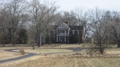 Edwards Halllisted 1974
 Elkton Commercial Historic Districtlisted 1989
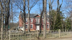 John Gray Springhouselisted 1987
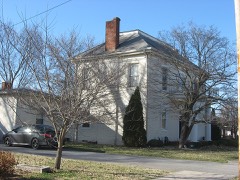 McReynolds Houselisted 1976
 Milliken Memorial Community Houselisted 1990
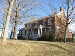 W. L. Reeves Houselisted 1984
 Todd County Courthouselisted 1975
Population over time
2 figuresElkton fell from 2,062 to 2,056 between 2010 and 2020. These are the recorded population figures Wikidata holds for this place, reached through the Geographic Names Information System number this page is keyed on rather than by name, so they belong to this place and not to another of the same name. Most are census counts, but not all are: an early figure may be a founding or settlement estimate, and an estimate published within five years of a census is left out. The change column is computed, and is left blank where more than 20 years separate a figure from the one before it, because a gap that long is not a change between two counts.
| Year | People | Change |
|---|---|---|
| 2010 | 2,062 | |
| 2020 | 2,056 | -6 (-0%) |
Topographic sheets covering this place
4 surveys from 7 printed sheetsMatched by testing this settlement's coordinate against the published boundary of every sheet in the United States Geological Survey's historical collection. Each opens the scanned sheet at the Survey.
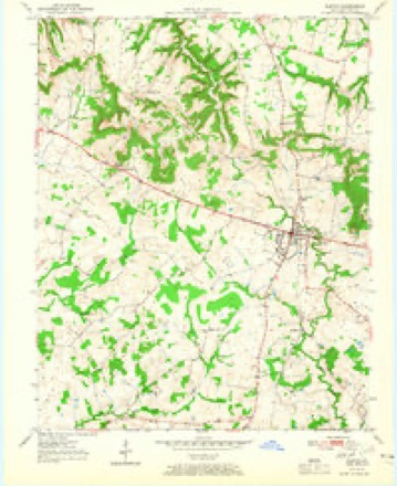
- 1951 USGS Elkton quadrangle1:24000, 3 printings
- 1956 USGS Nashville quadrangle1:250000, 2 printings
- 1959 USGS Nashville quadrangle1:250000
- 1980 USGS Hopkinsville quadrangle1:100000
Photographs
1 photograph, 2020Taken for the Office of War Information and the Farm Security Administration, who photographed the country between 1935 and 1944. Works of United States government photographers, with no known restriction on use. Each opens its catalogue record.

Highsmith, Carol M, 2020. Library of Congress
Fires near this place
1 since 2000Regional context, not property-specific evidence. The federal wildfire occurrence database lists 1 fire within 5 miles of Elkton in 2000, burning under an acre in total. None started naturally. None was recorded as arson. Distance is straight-line from the map coordinates, so a fire counted here may appear on a neighbouring settlement's page as well.
| Reported cause | Fires |
|---|---|
| Missing data/not specified/undetermined | 1 |
The most recent of them, most recent first, with the day each was reported and the service that recorded it.
| Date | Cause | Size | Reported by | Name on the report |
|---|---|---|---|---|
| 2 November 2000 | Missing data/not specified/undetermined | under an acre | Kentucky Division of Forestry | not named |
Settlements close enough to share some of these fires:
Mines and quarries near this place
1 within 5 milesRegional context, not property-specific evidence. The federal mineral resources record lists 1 working within 5 miles of Elkton: 1 producer. All of them still produce. What was taken out: Stone, Crushed/Broken. Distance is straight-line from the map coordinates, so a quarry counted here may appear on a neighbouring settlement's page as well.
| Where | Site | Commodity | Status | Recorded |
|---|---|---|---|---|
| Todd Quarry | Stone, Crushed/Broken | Producer |
Storms near this place
60 of 67 shownRegional context, not property-specific evidence. The National Weather Service names Elkton in 67 storm reports between 1995 and 2023: 28 thunderstorm wind, 14 hail, 9 flash flood, 6 flood. The reports record 1 injury. Each account below is quoted exactly as the forecast office filed it, from the NOAA Storm Events Database, and each date opens the federal record of that event.
| When | Event | Place named | Harm | What the report says |
|---|---|---|---|---|
| September 2023 | Lightning | Elkton | 1 hurt, $25,000 | A house was struck by lightning, starting a damaging fire. While firefighters were battling the fire, another lightning strike occurred about 300 feet away. A firefighter who was next to a fire truck was thrown backward when the lightning struck. The firefighter was shocked and thrown to the ground, causing minor injuries that required treatment at a local hospital. |
| July 2016 | Flash Flood | Elkton | $600,000 | Several residents in Elkton were rescued from their homes because of flash flooding of Elk Fork Creek. Seventeen houses were evacuated. Two bridges were closed. Other roads both in and outside the city of Elkton were closed by flooding. A state of emergency was declared for Todd County. |
| February 2021 | Flash Flood | Elkton | $500,000 | Major flash flooding occurred in Todd County. Initially, a small creek along Stokes Chapel Road near Elkton was out of its banks and flooding the road. The flash flooding became more widespread and intense as the day wore on. Evacuations were underway on a few streets in Elkton. North Main Street was closed coming into Elkton. Elk Fork Road was also closed. A total of 15 residences and 3 businesses were impacted in Elkton, mainly on Water Street, North Main, East Main, West Main, and Washington St. About six people were evacuated from three residences on Water Street and East Main Street. At the peak of the flooding, water was over Highways 181 around Elkton and Guthrie, Highway 475, Highway 106, Highway 104 at Old Trenton, Highway 102 near Allensville, and at least ten county roads. A few roads were temporarily closed until they could be repaired. |
| December 2021 | Thunderstorm Wind | Elkton | $200,000 | The long-track tornado that ended in western Todd County transitioned to a damaging wind event near Elkton. On the west side of Elkton, a barn roof was damaged, several house roofs were damaged, and dozens of trees were snapped or uprooted. The most intense damage was observed on the northeast side of Elkton, where steel poles for electrical transmission lines were broken or bent. Peak winds there were estimated near 115 mph. Elsewhere northeast of Elkton, a barn was destroyed. Most of the other damage consisted of roof damage to barns and outbuildings, mostly minor. Numerous trees were blown down. |
| March 1997 | Flash Flood | Elkton | $200,000 | no account filed |
| May 2005 | Tornado (F1) | Elkton | $150,000 | The tornado skipped along the ground from Christian County into Todd County. This second touchdown occurred about a mile east of the Christian County touchdown. Along U.S. Highway 68 just inside Todd County, a garage and a small building were unroofed. Building debris was blown through a truck window. A piece of wood was impaled into a portable plastic tank. Numerous trees were blown down. This touchdown was about 1/8 mile long and 100 yards wide. Peak winds were estimated near 80 MPH. |
| June 2015 | Thunderstorm Wind | Elkton | $120,000 | Destructive thunderstorm winds estimated up to 95 mph snapped or uprooted dozens of large trees. A mobile home had major damage to walls on one end. At least a half dozen homes had mainly minor shingle and siding damage. One barn was leveled, with at least ten others receiving some loss of roof and siding. Most of the damage occurred along and near Highways 106, 171, and a couple of rural county roads. The path length was six miles, and the path width was about two miles. |
| June 2014 | Thunderstorm Wind | Elkton | $80,000 | The broad area of scattered wind damage extended southward across a wide swath of southern Todd County. The main area of damage in southern Todd County was across the western half of the county, along and west of Highway 181. Two large machine sheds were partially unroofed. The damage consisted mostly of downed tree limbs averaging 3 to 6 inches in diameter. There were occasional uprooted trees, generally small in size. Tin roofing and wall panels were peeled off a few barns and outbuildings. Peak winds in the south part of the county were estimated near 90 mph. |
| April 2011 | Thunderstorm Wind | Elkton | $80,000 | Power poles were down along a one-half mile stretch of U.S. Highway 68. One house was heavily damaged by a falling tree. About half of Todd County was without power through early the next morning. |
| May 1995 | Hail | Elkton | $75,000 | no account filed |
| March 2007 | Tornado (EF1) | Elkton | $35,000 | This small tornado occurred in a neighborhood on the northwest side of Elkton. The roof was blown off a single wide mobile home. A metal roof was partially torn off a storage building. Half of the roof was blown off a site-built home. A chain link fence and a few trees were damaged. A pine tree was stripped of limbs. There was an eyewitness to the event. The tornado was rated an EF (Enhanced Fujita) 1 with peak winds of 88 MPH. |
| August 1999 | Thunderstorm Wind | Elkton | $30,000 | A trailer was overturned, trees were down, and a few barns were partially unroofed. |
| October 2014 | Flash Flood | Elkton | $20,000 | Along Kentucky Highway 475, there were several spots along the road with water up to four feet deep. Three water rescues were conducted for people stranded in vehicles, including an eight-month pregnant woman. Water was reported within three inches of a seat top. Flooding was also reported along a couple of other back roads. |
| July 2016 | Thunderstorm Wind | Elkton | $10,000 | Northeast of Elkton, trees were blown down and a swingset was destroyed. |
| May 2015 | Thunderstorm Wind | Elkton | $10,000 | Smaller trees were split due to high wind. A large tree was down on a home, causing some minor damage to the home. |
| June 2009 | Lightning | Elkton | $10,000 | Lightning struck the 911 dispatch center, knocking out the dispatch consoles and phone lines. Lightning was blamed for a nearby garage fire that occurred about the same time. |
| May 1995 | Thunderstorm Wind | Elkton | $10,000 | Several trees and power lines were blown down in Elkton. |
| January 2023 | Thunderstorm Wind | Elkton | $6,000 | Trees were down on Highway 181 north of Elkton. |
| August 2009 | Thunderstorm Wind | Elkton | $6,000 | Two large trees and a few power lines were blown down. One tree blocked Highway 181. A trained spotter estimated wind gusts near 60 mph. |
| December 2018 | Thunderstorm Wind | Elkton | $5,000 | Some trees were blown down. |
| January 2002 | Thunderstorm Wind | Elkton | $4,000 | Large tree limbs were blown down, and shingles were blown off several houses. A television antenna was blown down, knocking a hole in a roof. |
| June 2020 | Thunderstorm Wind | Elkton | $3,000 | A wind gust to 65 mph was measured at the Kentucky mesonet site in Todd County. A nearby carport structure was blown over. |
| May 1999 | Thunderstorm Wind | Elkton | $3,000 | Some trees were down in the Elkton area, along with power outages. |
| July 2016 | Thunderstorm Wind | Elkton | $2,000 | Two trees were blown down in the city. |
| October 2019 | Thunderstorm Wind | Elkton | $1,000 | The wind gust was measured by a Kentucky mesonet station. |
| November 2007 | Thunderstorm Wind | Elkton | $1,000 | A large tree was blown down, along with some large tree limbs. |
| January 2021 | Flood | Elkton | - | Water was over the road and rising on Business Loop 68 in Elkton. |
| March 2020 | Flash Flood | Elkton | - | Kentucky Highway 848 was closed by floodwaters between Trenton and Pinchem. A secondary road was closed by floodwaters just northwest of Elkton. |
| November 2019 | Flood | Elkton | - | Flooding was reported on Stokes Chapel Road northwest of Elkton, as well as Main Street and Pond River Road around Elkton. |
| May 2018 | Funnel Cloud | Elkton | - | A trained spotter on U.S. Highway 68 near Elkton reported a funnel cloud. |
| March 2017 | Thunderstorm Wind | Elkton | - | A wind gust to 59 mph was measured at a Kentucky mesonet site. |
| May 2017 | Hail | Elkton | - | Nickel-size hail occurred on Highway 475. |
| July 2017 | Thunderstorm Wind | Elkton | - | Winds gusted to 62 mph at a Kentucky mesonet site. |
| July 2016 | Flood | Elkton | - | Several streets were flooded, including Route 102. |
| April 2012 | Thunderstorm Wind | Elkton | - | Several large tree limbs were broken along with 1 large uprooted tree. |
| April 2010 | Heavy Rain | Elkton | - | Heavy rain produced standing water along many roadways countywide. |
| January 2008 | Flood | Elkton | - | The north folk of Elk Creek was out of its banks. |
| December 2007 | Flood | Elkton | - | The north fork of the Elk Creek River was out of its banks. |
| May 2005 | Heavy Rain | Elkton | - | Many roads across the county were reported to be under water. The flooding was due to heavy rainfall from successive thunderstorms. Rainfall was anywhere from 2 to 4 inches during the evening. At the courthouse in Elkton, a total of 2.40 inches was measured in two hours. Street flooding occurred. |
| May 2005 | Thunderstorm Wind | Elkton | - | Wind gusts were estimated near 65 MPH. Some tree damage was reported. |
| May 2005 | Thunderstorm Wind | Elkton | - | Numerous trees were blown down in the northern part of the county. From Elkton north, about six trees were blown down across roads. |
| July 2003 | Heavy Rain | Elkton | - | Water was reported over the road at the intersection of Highways 181 and 171. |
| July 2002 | Thunderstorm Wind | Elkton | - | Large tree limbs were down on Highway 181. |
| May 2001 | Thunderstorm Wind | Elkton | - | Trees and limbs were down, mainly across southern parts of the county. A house trailer was damaged by a falling tree. |
| May 1999 | Flash Flood | Elkton | - | Flooding was reported between Elkton and Guthrie. Emergency management officials reported road closings were imminent if very much additional rain fell. |
| April 1998 | Hail | Elkton | - | Reported on Highway 181. |
| May 2014 | Hail | Elkton | - | no account filed |
| February 2012 | Hail | Elkton | - | no account filed |
| April 2011 | Funnel Cloud | Elkton | - | no account filed |
| April 2011 | Hail | Elkton | - | no account filed |
| April 2009 | Thunderstorm Wind | Elkton | - | no account filed |
| March 2009 | Hail | Elkton | - | no account filed |
| May 2008 | Thunderstorm Wind | Elkton | - | no account filed |
| November 2007 | Hail | Elkton | - | no account filed |
| April 2006 | Hail | Elkton | - | no account filed |
| May 2005 | Hail | Elkton | - | no account filed |
| May 2005 | Funnel Cloud | Elkton | - | no account filed |
| May 2003 | Thunderstorm Wind | Elkton | - | no account filed |
| May 2001 | Hail | Elkton | - | no account filed |
| October 2001 | Hail | Elkton | - | no account filed |
Nearest settlements
The eight closest, with where each one stands in the county. Distances are straight-line, computed from the Geographic Names Information System coordinates.
| Map | Place | Distance | Sheets |
|---|---|---|---|
| Bradshaw | 2.1 miles | 7 | |
| Wilhelmina | 2.3 miles | 7 | |
| Tress Shop | 3.6 miles | 7 | |
| Pennick (historical) | 3.7 miles | 8 | |
| Zion | 4.0 miles | 7 | |
| Daysville | 4.7 miles | 8 | |
| Hermon | 4.7 miles | 7 | |
| Bells Chapel (historical) | 5.2 miles | 8 |
Elsewhere
Matched on this settlement's Geographic Names Information System number rather than its name, so it cannot be a different place of the same name in another state.
| Wikipedia article on Elkton | An encyclopaedic summary. Its text is share-alike, so it is linked here rather than copied. |
| Wikidata item Q2094560 | The structured record the population and elevation above come from. Public domain (CC0). |
Provenance
This settlement is recorded in the Geographic Names Information System as feature 491697. The sheet list is computed by point-in-boundary test against the United States Geological Survey's historical topographic inventory. Both are works of the United States government and carry no copyright under 17 U.S.C. 105.
Wildfire. Short, Karen C. 2022. Spatial wildfire occurrence data for the United States, 1992-2020 [FPA_FOD_20221014]. 6th Edition. Fort Collins, CO: Forest Service Research Data Archive. https://doi.org/10.2737/RDS-2013-0009.6 Collected with United States Government funding and usable without additional permissions or fees.
Mines and quarries. USGS Mineral Resources Data System (MRDS) https://mrdata.usgs.gov/mrds/ A work of the United States government, no copyright under 17 U.S.C. 105.
Storms. NOAA National Centers for Environmental Information, Storm Events Database https://www.ncei.noaa.gov/stormevents/ A work of the United States government, no copyright under 17 U.S.C. 105. Narratives are quoted verbatim from the National Weather Service report and are not edited or summarised.