 Block
Zion, Kentucky
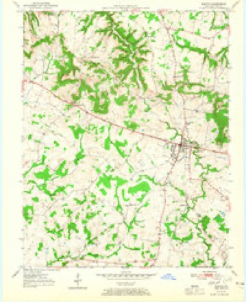
7 topographic sheets cover this place, the earliest surveyed in 1951 and the latest in 1980. It stands in the Guthrie census division. It lies in ZIP code area 42234. The Survey maps it on the Elkton quadrangle.
Topographic sheets covering this place
4 surveys from 7 printed sheetsMatched by testing this settlement's coordinate against the published boundary of every sheet in the United States Geological Survey's historical collection. Each opens the scanned sheet at the Survey.
- 1951 USGS Elkton quadrangle1:24000, 3 printings
- 1956 USGS Nashville quadrangle1:250000, 2 printings
- 1959 USGS Nashville quadrangle1:250000
- 1980 USGS Hopkinsville quadrangle1:100000
Mines and quarries near this place
1 within 5 milesRegional context, not property-specific evidence. The federal mineral resources record lists 1 working within 5 miles of Zion: 1 producer. All of them still produce. What was taken out: Stone, Crushed/Broken. Distance is straight-line from the map coordinates, so a quarry counted here may appear on a neighbouring settlement's page as well.
| Where | Site | Commodity | Status | Recorded |
|---|---|---|---|---|
| Todd Quarry | Stone, Crushed/Broken | Producer |
Storms near this place
8 since 2010Regional context, not property-specific evidence. The National Weather Service names Zion in 8 storm reports between 2010 and 2025: 4 thunderstorm wind, 3 tornado, 1 flash flood. No death or injury is recorded in these reports. Each account below is quoted exactly as the forecast office filed it, from the NOAA Storm Events Database, and each date opens the federal record of that event.
| When | Event | Place named | Harm | What the report says |
|---|---|---|---|---|
| December 2023 | Tornado (EF2) | South Zion | $750,000 | This tornado first touched down on Fort Campbell just north of the Sabre Airfield in Montgomery County, TN. The tornado tracked northeastward through northern Clarksville, entering into Todd County 5 miles west of Guthrie. As the tornado continued into southeastern Todd County, sparsely populated areas were affected initially. Hwys 41, 79, and 848 were blocked by debris or power lines and Hwy 181 was blocked by a train due to debris getting caught under the train. Trees were damaged, along with broken glass at a residence on the Dixie-Beeline Highway and destruction of an outbuilding on Old Railroad Lane. Large sections of a roof were removed from a home on Snardon Mill Rd. Much of the damage occurred on the south side of Allensville, where several homes had heavily damaged roofs, along with more trees, power poles, and outbuildings damaged or destroyed. The tornado continued into Logan County, KY, crossing over on the south side of Allensville. EF-2 damage indicators occurred repeatedly along the track throughout Todd County, suggesting a fairly consistent intensity for this segment. In total, hundreds of trees were snapped or uprooted and several power poles were broken. At least a dozen outbuildings were destroyed, including barns, sheds, workshops, and garages. Over a dozen homes suffered minor to major damage to roofs, siding, and gutters. Several homes had parts of roofs removed. |
| April 2010 | Thunderstorm Wind | South Zion | $75,000 | The microburst damage extended from along the Christian/Todd county border northeastward across southern Todd County. Many dozens of trees were uprooted or broken, blocking a few roads. A barn was levelled. Several other barns received moderate to major damage. A few homes suffered minor damage, such as partial loss of shingles and porch damage. Near Trenton, a falling tree destroyed a garage and cars inside. |
| May 2015 | Flash Flood | North Zion | $20,000 | Flash flooding occurred in Elkton. The parking lot of an auto dealership was flooded with several inches of water. Elk Fork was out of its banks and running across Highway 181 in Elkton. Dozens of roads were covered by water, including two main streets in Elkton. At least three roadways were temporarily closed, including Highway 475 west of town. A church was flooded in Elkton. The Kentucky mesonet site between Elkton and Trenton measured 1.73 inches during the afternoon. |
| May 2024 | Thunderstorm Wind | North Zion | $10,000 | A thunderstorm line after midnight brought down power lines onto Old Trenton Rd. |
| December 2021 | Tornado (EF0) | North Zion | $10,000 | Several sheds experienced roof damage and/or wall collapse. The tornado tracked along a nearly five-mile path between Trenton and Allensville, ending at Highway 102. Peak winds were estimated near 85 mph. |
| June 2019 | Tornado (EF0) | South Zion | $5,000 | The tornado started along Hammacksville Road south of Trenton. It tracked through cornfields, with strong convergence noted within the downed corn. It also uprooted and broke several large limbs off of some trees. There is drone footage of the tornado track and eyewitness reports/pictures of the tornado. Maximum winds were estimated near 85 mph. |
| May 2017 | Thunderstorm Wind | North Zion | $3,000 | A couple of trees were down on Highway 181 south of Elkton. Another tree was down on Highway 104 near the Tennessee state line. |
| May 2025 | Thunderstorm Wind | North Zion | - | Max wind gust from Kentucky Mesonet station ZION (5SW Elkton) over the five minute period. |
Nearest settlements
The eight closest, with where each one stands in the county. Distances are straight-line, computed from the Geographic Names Information System coordinates.
| Map | Place | Distance | Sheets |
|---|---|---|---|
| Hermon | 0.8 miles | 7 | |
| Bradshaw | 2.1 miles | 7 | |
| Pennick (historical) | 3.2 miles | 8 | |
| Pinchem | 3.8 miles | 7 | |
| Anderson | 4.0 miles | 7 | |
| Elkton | 4.0 miles | 7 | |
| Bells Chapel (historical) | 5.3 miles | 8 | |
| Trenton | 5.3 miles | 9 |
Provenance
This settlement is recorded in the Geographic Names Information System as feature 509428. The sheet list is computed by point-in-boundary test against the United States Geological Survey's historical topographic inventory. Both are works of the United States government and carry no copyright under 17 U.S.C. 105.
Mines and quarries. USGS Mineral Resources Data System (MRDS) https://mrdata.usgs.gov/mrds/ A work of the United States government, no copyright under 17 U.S.C. 105.
Storms. NOAA National Centers for Environmental Information, Storm Events Database https://www.ncei.noaa.gov/stormevents/ A work of the United States government, no copyright under 17 U.S.C. 105. Narratives are quoted verbatim from the National Weather Service report and are not edited or summarised.