 Block
Frankfort, Kentucky
17 topographic sheets cover this place, the earliest surveyed in 1922 and the latest in 1996. It stands in the Frankfort census division. It lies in ZIP code area 40601. It lies near Fort Hill. The Survey maps it on the Frankfort East quadrangle. 28,602 people lived here at the 2020 count. It stands 509 feet above sea level.
Research this city
On record in Frankfort
Buildings and businesses the archive holds for this place. Each opens its own page, with the source record it came from.
On the National Register 12 of 45 shown
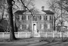 Liberty HallNational Historic Landmark · listed 1971
 Old StatehouseNational Historic Landmark · listed 1971
 George T. Stagg DistilleryNational Historic Landmark · listed 2001
 George F. Berry Houselisted 2002
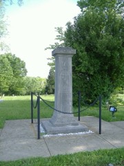 Colored Soldiers Monument in Frankfortlisted 1997
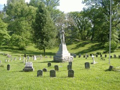 Confederate Monument in Frankfortlisted 1997
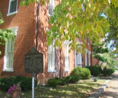 Corner in Celebrities Historic Districtlisted 1971
 Frankfort Cemetery and Chapellisted 1974
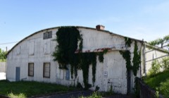 Frankfort Storage Building-Armorylisted 2002
 Glen Willislisted 1972
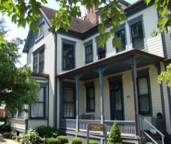 Gooch Houselisted 1980
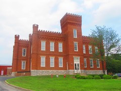 Jackson Hall, Kentucky State Universitylisted 1973
Every listing in Franklin County
Surveyed buildings and structures 12 records
- 100-104 Broadway (Commercial), Frankfortfederal building survey, 4 photographs
- 116 East Main Street (House), Frankfortfederal building survey, 5 photographs
- 402-404 High Street (House), Frankfortfederal building survey, 5 photographs
- 406-408 High Street (House), Frankfortfederal building survey, 10 photographs
- 410 High Street (House), Frankfortfederal building survey, 2 photographs
- 412 High Street (House), Frankfortfederal building survey, 8 photographs
- Church of the Good Shepherd, Frankfortfederal building survey, 1 photograph
- Liberty Hall, Main & Wilkinson Streets, Frankfortfederal building survey, 36 photographs
- Old State House, Broadway, bounded by Madison, Clinton & Lewis Streets, Frankfortfederal building survey, 24 photographs
- Orlando Brown House, 202 Wilkinson Street, Frankfortfederal building survey, 1 photograph
- Red Bridge, Spanning North Benson Creek, Frankfortfederal building survey, 13 photographs
- Reverend Jessie R. Ziegler House, 509 Shelby Street, Frankfortfederal building survey, 14 photographs
Population over time
2 figuresFrankfort grew from 25,527 to 28,602 between 2010 and 2020. These are the recorded population figures Wikidata holds for this place, reached through the Geographic Names Information System number this page is keyed on rather than by name, so they belong to this place and not to another of the same name. Most are census counts, but not all are: an early figure may be a founding or settlement estimate, and an estimate published within five years of a census is left out. The change column is computed, and is left blank where more than 20 years separate a figure from the one before it, because a gap that long is not a change between two counts.
| Year | People | Change |
|---|---|---|
| 2010 | 25,527 | |
| 2020 | 28,602 | +3,075 (+12%) |
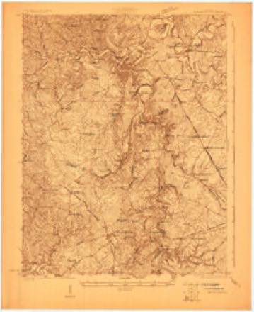
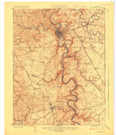
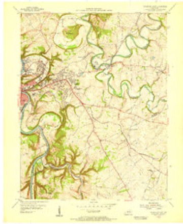
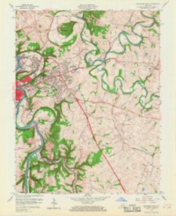
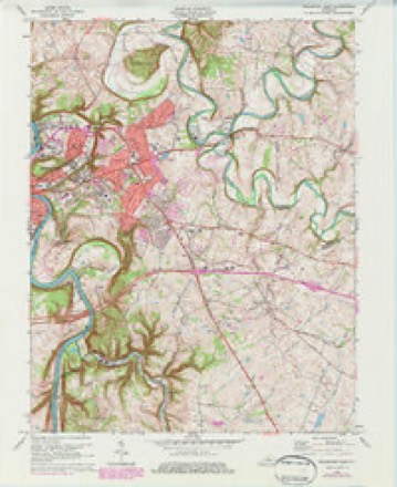
Topographic sheets covering this place
9 surveys from 17 printed sheetsMatched by testing this settlement's coordinate against the published boundary of every sheet in the United States Geological Survey's historical collection. Each opens the scanned sheet at the Survey.
- 1922 USGS Frankfort quadrangle1:48000
- 1924 USGS Frankfort quadrangle1:62500, 2 printings
- 1953 USGS Frankfort East quadrangle1:24000
- 1956 USGS Louisville quadrangle1:250000, 2 printings
- 1959 USGS Frankfort East quadrangle1:24000, 2 printings
- 1964 USGS Louisville quadrangle1:250000
- 1970 USGS Frankfort East quadrangle1:24000, 6 printings
- 1986 USGS Lexington quadrangle1:100000
- 1996 USGS Frankfort East quadrangle1:24000


What the histories say of this town
38,843 words1 chapter about Frankfort from the published histories of the county, public domain and reproduced complete.
| Chapter | From | Length |
|---|---|---|
| History | A History of the First Presbyterian Church, Frankfort, Kentucky, Together with the Churches in Franklin County, in Connection with the Presbyterian Church in the United States of America (1901) | 38,843 words in 3 parts |
Photographs
8 of 29 photographs shown, 1940 to 2020Taken for the Office of War Information and the Farm Security Administration, who photographed the country between 1935 and 1944. Works of United States government photographers, with no known restriction on use. Each opens its catalogue record.

Highsmith, Carol M, 2020. Library of Congress
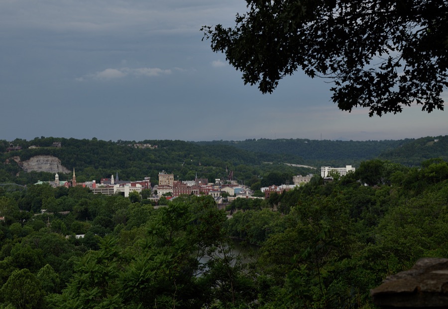
Highsmith, Carol M, 2020. Library of Congress
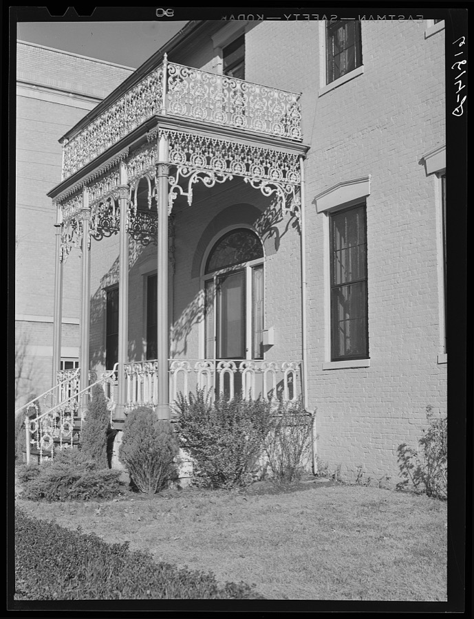
Vachon, John, 1940. Library of Congress
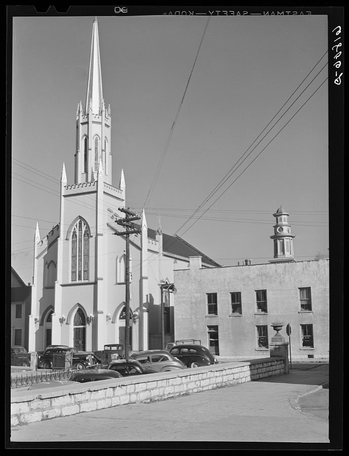
Vachon, John, 1940. Library of Congress

Highsmith, Carol M, 2020. Library of Congress
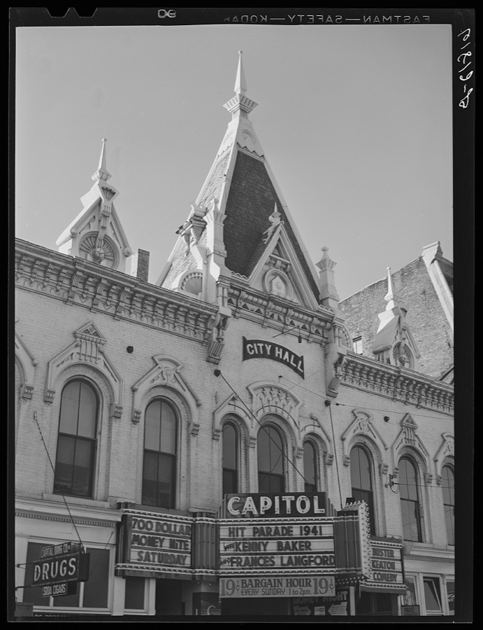
Vachon, John, 1940. Library of Congress

Highsmith, Carol M, 2020. Library of Congress

Highsmith, Carol M, 2020. Library of Congress
Every photograph of Franklin County
Fires near this place
1 since 2019Regional context, not property-specific evidence. The federal wildfire occurrence database lists 1 fire within 5 miles of Frankfort in 2019, burning about 3 acres in total. 1 started naturally. None was recorded as arson. Distance is straight-line from the map coordinates, so a fire counted here may appear on a neighbouring settlement's page as well.
| Reported cause | Fires |
|---|---|
| Natural | 1 |
The most recent of them, most recent first, with the day each was reported and the service that recorded it.
| Date | Cause | Size | Reported by | Name on the report |
|---|---|---|---|---|
| 3 July 2019 | Natural | 3.0 acres | Kentucky Division of Forestry | JIM BEAM |
Settlements close enough to share some of these fires:
Mines and quarries near this place
4 within 5 milesRegional context, not property-specific evidence. The federal mineral resources record lists 4 workings within 5 miles of Frankfort: 2 prospects, 1 producer, 1 past producer. 1 still produces. What was taken out: Stone, Crushed/Broken, Clay. Distance is straight-line from the map coordinates, so a quarry counted here may appear on a neighbouring settlement's page as well.
| Where | Site | Commodity | Status | Recorded |
|---|---|---|---|---|
| Branch Junction Clay | Clay | Prospect | ||
| Franklin County Mine | Stone, Crushed/Broken | Past Producer | ||
| Glenns Creek | Stone, Crushed/Broken | Producer | ||
| Thorn Hill Clay Bed | Clay | Prospect |
Storms near this place
60 of 84 shownRegional context, not property-specific evidence. The National Weather Service names Frankfort in 84 storm reports between 1994 and 2025: 50 thunderstorm wind, 21 hail, 9 flash flood, 2 flood. The reports record 2 deaths and 1 injury. Each account below is quoted exactly as the forecast office filed it, from the NOAA Storm Events Database, and each date opens the federal record of that event.
| When | Event | Place named | Harm | What the report says |
|---|---|---|---|---|
| April 2025 | Flash Flood | Frankfort | 1 killed | A 9 year old boy was on his way to the school bus stop when he was swept away by water. His body was located approximated 2 hours later about half of a mile downstream. |
| September 2006 | Flash Flood | Frankfort | 1 killed | Several roads were closed due to high water. A female drowned in her vehicle which was found in a creek in the Avenstoke Road area. |
| August 2003 | Lightning | Frankfort | 1 hurt | A Franklin County firefighter was struck by lightning inside the Owenton Road Fire Station. |
| May 1995 | Thunderstorm Wind | Frankfort | $5,000,000 | Twelve small aircraft destroyed by Capital City Airport, reported by Department of Emergency Service, relayed by TV36. |
| May 2010 | Flood | Frankfort | $1,000,000 | The Kentucky River at Frankfort crested at 42.8 feet around 7 PM EST on May 4. Flood stage at Frankfort is 31 feet. Major flooding occurs at this level with basements of homes and businessed in downtown Frankfort flooded. The Bellepoint area was cut off by high water. |
| May 1995 | Thunderstorm Wind | Frankfort | $500,000 | Power lines down and damage to Lowe's Hardware store. |
| April 2007 | Thunderstorm Wind | Frankfort | $50,000 | Numerous trees and power lines were downed across the city of Frankfort. The exterior wall of an apartment building collapsed. |
| May 1995 | Thunderstorm Wind | Frankfort | $50,000 | Trees and power lines down. House damaged along U.S. 60 in Western Frankfort reported by city police. |
| June 2014 | Thunderstorm Wind | Frankfort | $30,000 | Local law enforcement reported that a tree fell across a house in east Frankfort. Several people sent pictures via social media of trees down in the Silver Lake neighborhood just east of Frankfort. A spotter with a weather station recorded a wind gust of 55 mph. |
| September 2016 | Thunderstorm Wind | Frankfort | $20,000 | Officials reported a tree down on the Dollar General store. |
| June 2017 | Thunderstorm Wind | Frankfort | $15,000 | Local broadcast media reported trees and power poles snapped. |
| December 2013 | Thunderstorm Wind | Frankfort | $10,000 | Many reports arrived concerning downed trees, power lines and blown transformers south of Wilkinson Road and north of east Main Street in Frankfort. |
| April 2006 | Thunderstorm Wind | Frankfort | $10,000 | There was unspecified damage to a barn due to thunderstorm winds. Large hail also fell, but the size was not reported. |
| May 2010 | Flash Flood | Frankfort | $5,000 | A couple of county roads were temporarily obstructed by debris and rocks from water flowing over the roads. |
| July 1994 | Thunderstorm Wind | Frankfort | $500 | Numerous power lines were downed by high winds on King's Daughters Drive. |
| June 2025 | Thunderstorm Wind | Frankfort | - | A tree was blown down by strong thunderstorm winds along Wilkinson Boulevard near the Capital Plaza Hotel. |
| August 2022 | Flash Flood | Frankfort | - | Wilkinson Boulevard at Reilly Road and 1250 Lewis Ferry Road were closed due to flooding. |
| November 2022 | Hail | Frankfort | - | Quarter sized hail was observed in downtown Frankfort. |
| July 2020 | Thunderstorm Wind | Frankfort | - | There was a report of a tree down. |
| July 2020 | Thunderstorm Wind | Frankfort | - | A transformer was sparking due to a tree down on Reilly Road. |
| March 2019 | Thunderstorm Wind | Frankfort | - | A few trees were snapped near Alumni Stadium at Kentucky State University. |
| June 2018 | Thunderstorm Wind | Frankfort | - | Trees were reported down on Versailles Road. |
| November 2018 | Flood | Frankfort | - | Rolling Acres Drive was closed due to flooding. |
| April 2017 | Thunderstorm Wind | Frankfort | - | Trees were reported down in the area. |
| June 2017 | Flash Flood | Frankfort | - | Meadowbrook Road covered by 6 to 8 inches of high flowing water. |
| April 2016 | Hail | Frankfort | - | One inch diameter hail was reported by the public via social media. |
| July 2015 | Thunderstorm Wind | Frankfort | - | A Franklin County law enforcement official reported that winds from a complex of thunderstorms had gusts around 50 knots. |
| June 2013 | Thunderstorm Wind | Frankfort | - | The Franklin County emergency manager reported several trees down in Frankfort. |
| December 2013 | Thunderstorm Wind | Frankfort | - | The ASOS site at the Frankfort airport measured a wind gust of 59 mph. |
| July 2012 | Thunderstorm Wind | Frankfort | - | A large tree fell on a house near Nole Avenue. Local emergency management relayed multiple reports of trees and power lines down across Frankfort. Several roads become briefly impassable in the Thornhill neighborhood. |
| September 2012 | Thunderstorm Wind | Frankfort | - | In Frankfort, a tree was downed at the intersection of Clinton and Ann Streets. |
| April 2011 | Thunderstorm Wind | Frankfort | - | Capital Ave. was closed by a downed tree. |
| April 2011 | Thunderstorm Wind | Frankfort | - | Trees were down on roadways throughout the city. A sign was blown into a window at a business in the 800 block of Louisville Rd. |
| April 2011 | Thunderstorm Wind | Frankfort | - | Multiple trees were downed countywide. Power outages were reported both east and west of Frankfort. |
| March 2011 | Hail | Frankfort | - | A spotter reported nickel size hail near the Boone National Guard Center. |
| October 2010 | Thunderstorm Wind | Frankfort | - | A NWS employee reported estimated winds of 60 mph as well as a roll cloud. |
| August 2009 | Flash Flood | Frankfort | - | Numerous roads were flooded in the county. They included Camp Pleasant Road and Seeder Road in the Peaks Mill area. there was a high water rescue on Oklahnd Branch road. |
| June 2008 | Hail | Frankfort | - | Estimated hail size by Emergency Manager. |
| July 2008 | Thunderstorm Wind | Frankfort | - | Trees and power lines were reported down across the county. |
| January 2008 | Thunderstorm Wind | Frankfort | - | Thunderstorm winds downed trees on Grand Avenue. |
| July 2006 | Flash Flood | Frankfort | - | U.S. Highway 421 in southeast Franklin County was flooded in spots. |
| August 2006 | Thunderstorm Wind | Frankfort | - | Trees were downed. |
| May 2004 | Flash Flood | Frankfort | - | Some streets were flooded in the city. |
| May 2004 | Thunderstorm Wind | Frankfort | - | Numerous trees were downed. |
| May 2004 | Thunderstorm Wind | Frankfort | - | Numerous trees were downed. |
| June 2004 | Thunderstorm Wind | Frankfort | - | Trees and power lines were downed. |
| May 2004 | Flash Flood | Frankfort | - | Flag Fork Road off Highway 421 was washed out. |
| July 2004 | Thunderstorm Wind | Frankfort | - | Several large trees were blown down. |
| June 2004 | Thunderstorm Wind | Frankfort | - | Trees were downed and blocking highway 421. |
| July 2004 | Thunderstorm Wind | Frankfort | - | Trees were down along Highway 460. |
| May 1995 | Tornado | Frankfort | - | Tornado touchdown along Route 421 reported by county dispatch. |
| June 1995 | Thunderstorm Wind | Frankfort | - | Power lines blown down. |
| March 2012 | Hail | Frankfort | - | no account filed |
| April 2011 | Hail | Frankfort | - | no account filed |
| July 2011 | Hail | Frankfort | - | no account filed |
| May 2010 | Hail | Frankfort | - | no account filed |
| April 2009 | Hail | Frankfort | - | no account filed |
| February 2009 | Thunderstorm Wind | Frankfort | - | no account filed |
| June 2009 | Hail | Frankfort | - | no account filed |
| April 2007 | Thunderstorm Wind | Frankfort | - | no account filed |
Newspapers printed here
6,420 digitised pages3 papers published in this town, digitised by the Library of Congress and free to read: 926 issues, 6,420 pages. Every page is searchable, so a name or a street can be looked for directly in what the town printed about itself at the time.
| Newspaper | Published |
|---|---|
| The Weekly Roundabout | 1877 to 1882 |
| The Frankfort Roundabout | 1882 to 1908 |
| Frankfort Weekly News and Roundabout | 1908 to 19?? |
What the paper printed
27,405 wordsFront pages of the local paper, read from the Library of Congress scans: 12 issues spread across its run from 1879 to 1908, 27,405 words in total. Each is reproduced on its own page, exactly as the recogniser returned it.
These pages read less well than anything else here, and the number is worth stating: about three words in four come through cleanly, against nine in ten for the building records. An 1896 broadsheet sets eight-point type in seven columns on microfilm, which is the hardest thing in this archive to read by machine. We tested our own recognisers against the Library's and they were not better, so the Library's text is what appears, with the wholly unreadable columns removed. Read it as a guide to what the paper covered, and follow the link to the scan before quoting anything.
| Issue | Paper | Length |
|---|---|---|
| 1879-01-11 | The Weekly Roundabout | 951 words |
| 1879-10-04 | The Weekly Roundabout | 543 words |
| 1879-12-20 | The Weekly Roundabout | 532 words |
| 1882-10-14 | The Frankfort Roundabout | 1,823 words |
| 1882-11-18 | The Frankfort Roundabout | 1,803 words |
| 1882-12-16 | The Frankfort Roundabout | 1,301 words |
| 1887-01-15 | The Frankfort Roundabout | 1,466 words |
| 1908-03-28 | Frankfort Weekly News and Roundabout | 3,770 words |
| 1908-05-09 | Frankfort Weekly News and Roundabout | 3,420 words |
| 1908-06-13 | Frankfort Weekly News and Roundabout | 3,989 words |
| 1908-07-25 | Frankfort Weekly News and Roundabout | 4,020 words |
| 1908-09-05 | Frankfort Weekly News and Roundabout | 3,787 words |
Nearest settlements
The eight closest, with where each one stands in the county. Distances are straight-line, computed from the Geographic Names Information System coordinates.
| Map | Place | Distance | Sheets |
|---|---|---|---|
| Choateville | 1.8 miles | 16 | |
| Kennebec | 2.1 miles | 16 | |
| Glore (historical) | 2.2 miles | 16 | |
| Big Eddy | 2.3 miles | 17 | |
| Indian Hills | 2.5 miles | 17 | |
| Bon Air Hills | 2.6 miles | 17 | |
| Fox Gap (historical) | 3.2 miles | 16 | |
| Jett | 3.5 miles | 17 |
Elsewhere
Matched on this settlement's Geographic Names Information System number rather than its name, so it cannot be a different place of the same name in another state.
| Wikipedia article on Frankfort | An encyclopaedic summary. Its text is share-alike, so it is linked here rather than copied. |
| Wikidata item Q28603 | The structured record the population and elevation above come from. Public domain (CC0). |
Provenance
This settlement is recorded in the Geographic Names Information System as feature 517517. The sheet list is computed by point-in-boundary test against the United States Geological Survey's historical topographic inventory. Both are works of the United States government and carry no copyright under 17 U.S.C. 105.
Wildfire. Short, Karen C. 2022. Spatial wildfire occurrence data for the United States, 1992-2020 [FPA_FOD_20221014]. 6th Edition. Fort Collins, CO: Forest Service Research Data Archive. https://doi.org/10.2737/RDS-2013-0009.6 Collected with United States Government funding and usable without additional permissions or fees.
Mines and quarries. USGS Mineral Resources Data System (MRDS) https://mrdata.usgs.gov/mrds/ A work of the United States government, no copyright under 17 U.S.C. 105.
Storms. NOAA National Centers for Environmental Information, Storm Events Database https://www.ncei.noaa.gov/stormevents/ A work of the United States government, no copyright under 17 U.S.C. 105. Narratives are quoted verbatim from the National Weather Service report and are not edited or summarised.