 Block
Gracey, Kentucky
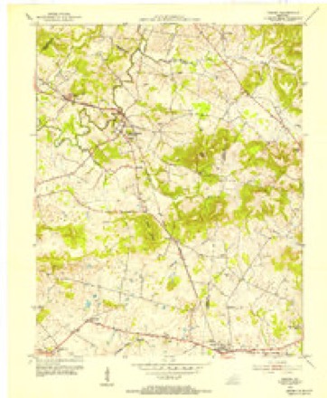
6 topographic sheets cover this place, the earliest surveyed in 1953 and the latest in 1980. It stands in the Hopkinsville census division. It lies in ZIP code area 42232. The Survey maps it on the Gracey quadrangle. 117 people lived here at the 2020 count. It stands 509 feet above sea level.
Population over time
2 figuresGracey fell from 138 to 117 between 2010 and 2020. These are the recorded population figures Wikidata holds for this place, reached through the Geographic Names Information System number this page is keyed on rather than by name, so they belong to this place and not to another of the same name. Most are census counts, but not all are: an early figure may be a founding or settlement estimate, and an estimate published within five years of a census is left out. The change column is computed, and is left blank where more than 20 years separate a figure from the one before it, because a gap that long is not a change between two counts.
| Year | People | Change |
|---|---|---|
| 2010 | 138 | |
| 2020 | 117 | -21 (-15%) |
Topographic sheets covering this place
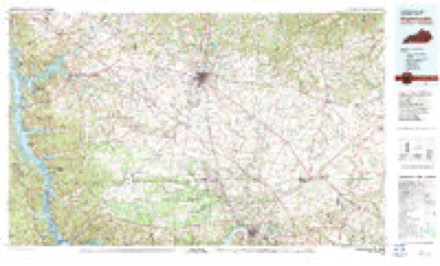
5 surveys from 6 printed sheetsMatched by testing this settlement's coordinate against the published boundary of every sheet in the United States Geological Survey's historical collection. Each opens the scanned sheet at the Survey.
- 1953 USGS Gracey quadrangle1:24000
- 1956 USGS Nashville quadrangle1:250000, 2 printings
- 1959 USGS Nashville quadrangle1:250000
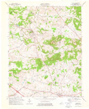
- 1974 USGS Gracey quadrangle1:24000
- 1980 USGS Hopkinsville quadrangle1:100000
Fires near this place
5 since 2007Regional context, not property-specific evidence. The federal wildfire occurrence database lists 5 fires within 5 miles of Gracey between 2007 and 2010, burning about 234 acres in total. None started naturally. None was recorded as arson. Distance is straight-line from the map coordinates, so a fire counted here may appear on a neighbouring settlement's page as well.
| Reported cause | Fires |
|---|---|
| Railroad operations and maintenance | 4 |
| Recreation and ceremony | 1 |
The most recent of them, most recent first, with the day each was reported and the service that recorded it.
| Date | Cause | Size | Reported by | Name on the report |
|---|---|---|---|---|
| 23 September 2008 | Railroad operations and maintenance | 153 acres | Kentucky Division of Forestry | LONG |
| 21 September 2010 | Recreation and ceremony | 45 acres | Kentucky Division of Forestry | QUAIL |
| 8 August 2007 | Railroad operations and maintenance | 1.0 acres | Kentucky Division of Forestry | not named |
| 24 August 2007 | Railroad operations and maintenance | 10 acres | Kentucky Division of Forestry | not named |
| 9 October 2010 | Railroad operations and maintenance | 25 acres | Kentucky Division of Forestry | I-24 FIRE |
Settlements close enough to share some of these fires:
Storms near this place
35 since 1997Regional context, not property-specific evidence. The National Weather Service names Gracey in 35 storm reports between 1997 and 2025: 17 thunderstorm wind, 6 hail, 4 heavy rain, 3 funnel cloud. The reports record 22 injuries. Each account below is quoted exactly as the forecast office filed it, from the NOAA Storm Events Database, and each date opens the federal record of that event.
| When | Event | Place named | Harm | What the report says |
|---|---|---|---|---|
| April 2006 | Tornado (F3) | Gracey | 22 hurt, $35,000,000 | The tornado formed from a long-track supercell that originated in southeast Missouri near Poplar Bluff. The tornado began less than two miles from the Trigg County line with an east-southeast movement, then curved slightly left before crossing Highway 91. The tornado moved east-northeast across central Christian County, passing less than four miles north of downtown Hopkinsville, before crossing into Todd County less than a mile north of Pilot Rock. Near the beginning of the damage path, a church was levelled. Across the county, 91 homes were destroyed, and another 171 homes sustained varying degrees of damage. Several people were pulled from the debris of their homes during a door-to-door search that lasted into the next morning. Of the 22 people directly injured by the tornado, 17 were checked in at the local hospital, and five were transferred to regional hospitals. Another ten or so people received injuries not directly inflicted by the tornado, such as driving into fallen trees. None of the injuries, which consisted mostly of cuts, bruises, and fractures, were considered life-threatening. Numerous garages, barns, and outbuildings were destroyed. Some vehicles were damaged or destroyed. Hundreds of trees were downed, snapped, or uprooted. Power was out to most of the city of Hopkinsville for about six hours as a result of downed steel towers that carry primary transmission lines. Peak winds were estimated near 185 MPH. The average path width was 500 yards. It should be noted that the initial tornado reformed or reorganized about 7 miles northeast of Hopkinsville, leaving a break in the tornado path less than a mile long. Downburst wind damage occurred both north and south of the area where the tornado reorganized, resulting in a two-mile wide swath of damage along Highway 107. The webcam at the local hospital captured the tornado as it passed north of downtown Hopkinsville. |
| February 2011 | Tornado (EF2) | Gracey | $600,000 | Several barns were levelled, and several grain bins were destroyed. A grain bin was carried over two-thirds of a mile. One of the destroyed barns was 20 by 150 feet. There were some homes with primarily roof damage or loss of shingles. Windows were blown out. Dozens of trees were uprooted or snapped. At least ten power poles were snapped, and debris and electrical lines were across roads. State Route 91 was closed for an extended period of time. The tornado lifted as it crossed Highway 109 just a couple of miles northwest of Hopkinsville. Peak winds were estimated near 115 mph. The average path width was 225 yards. |
| April 1997 | Thunderstorm Wind | Gracey | $80,000 | no account filed |
| April 2011 | Thunderstorm Wind | Gracey | $50,000 | A wind gust to 55 knots was measured by automated observing equipment at Fort Campbell. A seven-mile stretch of Kentucky Highway 117 was closed due to multiple trees and power lines across it. |
| June 2021 | Thunderstorm Wind | Gracey | $30,000 | Trees were down on a vehicle and on power lines. |
| May 2011 | Thunderstorm Wind | Gracey | $30,000 | Trees were down, blocking roadways. Very large tree limbs fell on a house. Power outages were reported. |
| July 2016 | Flash Flood | Gracey | $10,000 | Flash flooding was reported throughout the county. Several roads were flooded. At least one road was closed due to a washout. A countywide state of emergency was declared by county government officials. |
| March 2006 | Thunderstorm Wind | Gracey | $10,000 | A wind gust to 68 MPH was measured at the Hopkinsville Midtown Medical Center, where some trees were down. Numerous trees and power lines were down in Gracey. |
| January 1999 | Thunderstorm Wind | Gracey | $10,000 | A carport roof was blown off. |
| April 2022 | Thunderstorm Wind | Gracey | $7,000 | A wind gust to 72 mph was measured. The roof was peeled back on a mobile home in the immediate area. |
| August 2000 | Thunderstorm Wind | Gracey | $5,000 | Numerous large trees and power lines were down. A rural road was impassable by vehicle. Several mainly small farm buildings received roof damage. |
| June 2016 | Thunderstorm Wind | Gracey | $1,000 | Wind gusts to near 65 mph were estimated by the public. At least one tree was blown down. |
| March 2025 | Hail | Gracey | - | Hail up to the size of quarters fell southeast of Gracey. |
| May 2025 | Thunderstorm Wind | Gracey | - | Measured wind gust at Gracey as a line of storms moved eastward into Christian County. |
| March 2022 | Thunderstorm Wind | Gracey | - | The wind gust was measured on Highway 68 on the Trigg County line. |
| March 2021 | Thunderstorm Wind | Gracey | - | Two separate spotters measured a wind gust to 61 mph on Highway 68/80 near the Trigg County line. |
| March 2017 | Thunderstorm Wind | Gracey | - | Scattered wind gusts around 60 mph were reported north and west of Hopkinsville. A wind gust to 60 mph was measured by a trained spotter along U.S. Highway 68 near the Trigg County line. At the Kentucky mesonet site six miles north of Hopkinsville, a wind gust to 61 mph was measured. |
| November 2017 | Thunderstorm Wind | Gracey | - | A wind gust to 59 mph was measured. |
| April 2015 | Heavy Rain | Gracey | - | A storm-total rainfall of 2.56 inches was reported within the past 24 hours. |
| August 2015 | Heavy Rain | Gracey | - | A trained spotter reported minor street flooding. Within a three-hour period, the spotter measured 2.65 inches of rain. |
| July 2013 | Thunderstorm Wind | Gracey | - | Small and medium-size tree limbs were blown down by a wind gust measured at 59 mph. |
| June 2013 | Flood | Gracey | - | Some street flooding and flooding of fields was reported in Gracey. |
| February 2012 | Thunderstorm Wind | Gracey | - | A trained spotter estimated a wind gust to 70 mph. |
| February 2012 | Heavy Rain | Gracey | - | Near Gracey, flooded ditches were overflowing onto roads. A few miles northwest of Hopkinsville, water was over Highway 109. Radar indicated nearly two inches of rain had fallen. |
| February 2012 | Funnel Cloud | Gracey | - | The funnel cloud was reported by a trained spotter north of the intersection of U.S. Highway 68 and Highway 3186. |
| March 2012 | Heavy Rain | Gracey | - | Total rainfall of 3.83 inches was recorded. |
| April 2011 | Flash Flood | Gracey | - | Three to four feet of water was across the main street in Gracey. The road was impassable. |
| September 2009 | Funnel Cloud | Gracey | - | An off-duty meteorologist spotted a cold air funnel cloud while travelling on Interstate 24 west of Hopkinsville. |
| April 2006 | Hail | Gracey | - | Quarter size hail covered the ground at Gracey. West and northwest of Hopkinsville, hail was from nickel to quarter size. The largest reported hail was golf ball size about three miles west of Hopkinsville. |
| August 2005 | Thunderstorm Wind | Gracey | - | Trees were blown down in parts of Christian County, including the Gracey and Hopkinsville areas. |
| May 2000 | Funnel Cloud | Gracey | - | A funnel cloud moved southeast from the Trigg County line across western Christian County. The funnel cloud was observed from Gracey to Herndon in Christian County. The most significant feature of this storm was flash-flood producing rain. |
| January 1999 | Hail | Gracey | - | Dime size hail occurred in western Christian County. |
| May 2015 | Hail | Gracey | - | no account filed |
| February 2012 | Hail | Gracey | - | no account filed |
| April 2007 | Hail | Gracey | - | no account filed |
Nearest settlements
The eight closest, with where each one stands in the county. Distances are straight-line, computed from the Geographic Names Information System coordinates.
| Map | Place | Distance | Sheets |
|---|---|---|---|
| Julien | 3.1 miles | 8 | |
| Belleview (historical) | 3.9 miles | 9 | |
| Sinking Fork | 5.1 miles | 8 | |
| Walnut Grove | 5.2 miles | 9 | |
| Merrittstown | 5.3 miles | 9 | |
| Newstead | 5.7 miles | 8 | |
| Canton Pike | 6.7 miles | 9 | |
| Church Hill | 7.1 miles | 9 |
Elsewhere
Matched on this settlement's Geographic Names Information System number rather than its name, so it cannot be a different place of the same name in another state.
| Wikipedia article on Gracey | An encyclopaedic summary. Its text is share-alike, so it is linked here rather than copied. |
| Wikidata item Q5591486 | The structured record the population and elevation above come from. Public domain (CC0). |
Provenance
This settlement is recorded in the Geographic Names Information System as feature 493072. The sheet list is computed by point-in-boundary test against the United States Geological Survey's historical topographic inventory. Both are works of the United States government and carry no copyright under 17 U.S.C. 105.
Wildfire. Short, Karen C. 2022. Spatial wildfire occurrence data for the United States, 1992-2020 [FPA_FOD_20221014]. 6th Edition. Fort Collins, CO: Forest Service Research Data Archive. https://doi.org/10.2737/RDS-2013-0009.6 Collected with United States Government funding and usable without additional permissions or fees.
Storms. NOAA National Centers for Environmental Information, Storm Events Database https://www.ncei.noaa.gov/stormevents/ A work of the United States government, no copyright under 17 U.S.C. 105. Narratives are quoted verbatim from the National Weather Service report and are not edited or summarised.