 Block
Hodgenville, Kentucky
8 topographic sheets cover this place, the earliest surveyed in 1953 and the latest in 1981. It stands in the Hodgenville census division. It lies in ZIP code area 42748. It stands on McDougal Creek. The Survey maps it on the Hodgenville quadrangle. 3,235 people lived here at the 2020 count. It stands 728 feet above sea level.
Research this city
On record in Hodgenville
Buildings and businesses the archive holds for this place. Each opens its own page, with the source record it came from.
On the National Register 12 of 25 shown
 Abraham Lincoln Birthplace National Historic Sitelisted 1966
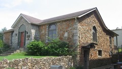 Hodgenville Women's Clublisted 1991
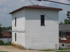 Larue County Jaillisted 1991
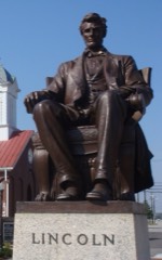 Abraham Lincoln Statuelisted 1991
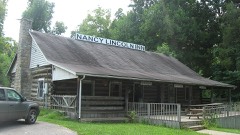 Nancy Lincoln Innlisted 1991
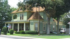 William Miller Houselisted 1991
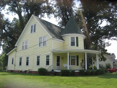 Saunders-Boyd Houselisted 1991
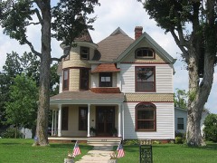 David H. Smith Houselisted 1991
- Aaron Atherton Houselisted 1991
- Dorsey Beeler Houselisted 1991
- Brown Houselisted 1991
- Walter Burch Houselisted 1991
Surveyed buildings and structures 3 records
- Abraham Lincoln Birthplace, Hodgenvillefederal building survey, 3 photographs
- Abraham Lincoln Birthplace, Visitor Center, Hodgenvillefederal building survey, 1 photograph
- Creel Cabin, Hodgenvillefederal building survey, 3 photographs
Population over time
2 figuresHodgenville grew from 3,206 to 3,235 between 2010 and 2020. These are the recorded population figures Wikidata holds for this place, reached through the Geographic Names Information System number this page is keyed on rather than by name, so they belong to this place and not to another of the same name. Most are census counts, but not all are: an early figure may be a founding or settlement estimate, and an estimate published within five years of a census is left out. The change column is computed, and is left blank where more than 20 years separate a figure from the one before it, because a gap that long is not a change between two counts.
| Year | People | Change |
|---|---|---|
| 2010 | 3,206 | |
| 2020 | 3,235 | +29 (+1%) |
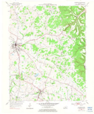
Topographic sheets covering this place
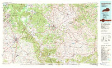
4 surveys from 8 printed sheetsMatched by testing this settlement's coordinate against the published boundary of every sheet in the United States Geological Survey's historical collection. Each opens the scanned sheet at the Survey.
- 1953 USGS Hodgenville quadrangle1:24000, 3 printings
- 1957 USGS Winchester quadrangle1:250000, 3 printings
- 1960 USGS Winchester quadrangle1:250000
- 1981 USGS Elizabethtown quadrangle1:100000


Photographs
8 of 12 photographs shown, 2020Taken for the Office of War Information and the Farm Security Administration, who photographed the country between 1935 and 1944. Works of United States government photographers, with no known restriction on use. Each opens its catalogue record.

Highsmith, Carol M, 2020. Library of Congress
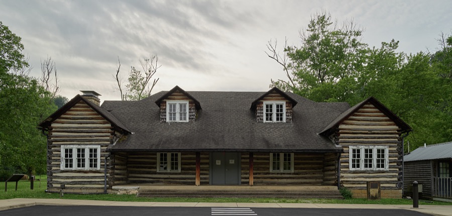
Highsmith, Carol M, 2020. Library of Congress

Highsmith, Carol M, 2020. Library of Congress
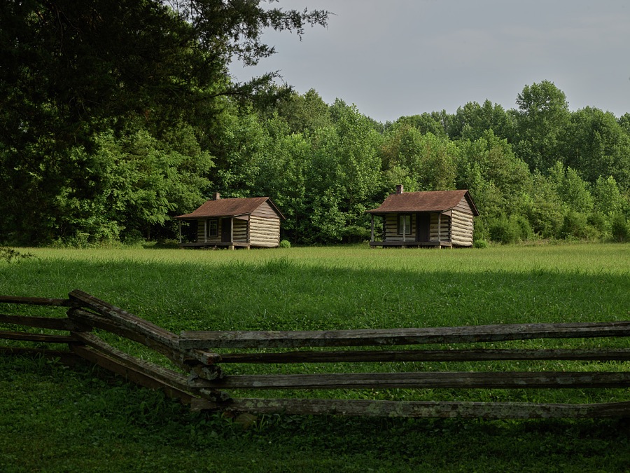
Highsmith, Carol M, 2020. Library of Congress
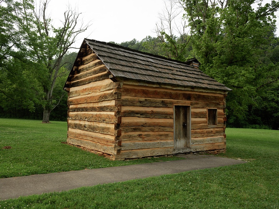
Highsmith, Carol M, 2020. Library of Congress
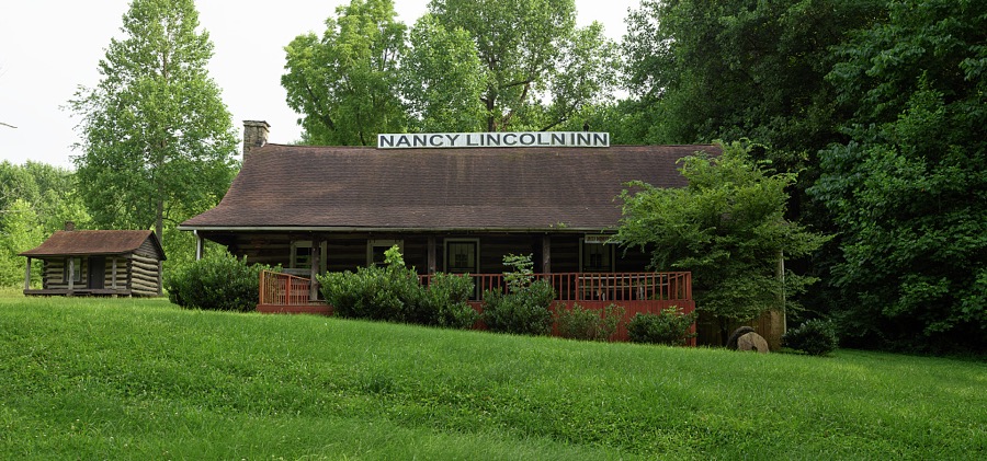
Highsmith, Carol M, 2020. Library of Congress
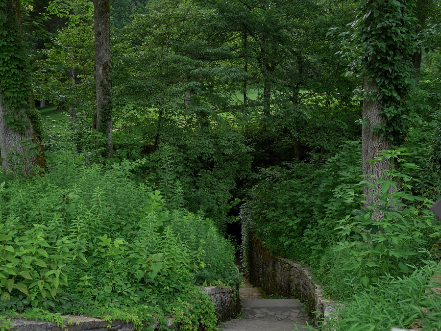
Highsmith, Carol M, 2020. Library of Congress
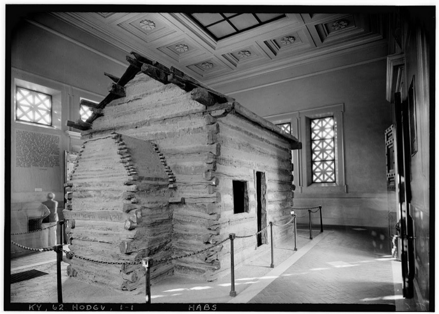
Photographer not recorded. Library of Congress
Every photograph of Larue County
Fires near this place
8 since 1998Regional context, not property-specific evidence. The federal wildfire occurrence database lists 8 fires within 5 miles of Hodgenville between 1998 and 2014, burning about 79 acres in total. None started naturally. None was recorded as arson. Distance is straight-line from the map coordinates, so a fire counted here may appear on a neighbouring settlement's page as well.
| Reported cause | Fires |
|---|---|
| Debris and open burning | 4 |
| Recreation and ceremony | 2 |
| Missing data/not specified/undetermined | 1 |
| Railroad operations and maintenance | 1 |
The most recent of them, most recent first, with the day each was reported and the service that recorded it.
| Date | Cause | Size | Reported by | Name on the report |
|---|---|---|---|---|
| 1 April 2000 | Debris and open burning | 2.0 acres | Kentucky Division of Forestry | not named |
| 4 March 2009 | Debris and open burning | 4.0 acres | Kentucky Division of Forestry | not named |
| 28 March 1998 | Debris and open burning | 1.0 acres | Kentucky Division of Forestry | not named |
| 22 March 2014 | Recreation and ceremony | 1.0 acres | Kentucky Division of Forestry | CANTRELL |
| 28 February 2004 | Missing data/not specified/undetermined | 4.0 acres | Kentucky Division of Forestry | not named |
| 22 February 2014 | Recreation and ceremony | 40 acres | Kentucky Division of Forestry | STILES FORD ROAD |
| 22 February 2014 | Railroad operations and maintenance | 26 acres | Kentucky Division of Forestry | BROWN ROAD |
| 7 October 2010 | Debris and open burning | 1.0 acres | Kentucky Division of Forestry | CATLETT FIRE |
Settlements close enough to share some of these fires:
Storms near this place
52 since 1996Regional context, not property-specific evidence. The National Weather Service names Hodgenville in 52 storm reports between 1996 and 2024: 33 thunderstorm wind, 11 hail, 4 flash flood, 2 flood. No death or injury is recorded in these reports. Each account below is quoted exactly as the forecast office filed it, from the NOAA Storm Events Database, and each date opens the federal record of that event.
| When | Event | Place named | Harm | What the report says |
|---|---|---|---|---|
| February 2012 | Tornado (EF2) | Hodgenville | $200,000 | A tornado touched down near Kyle Street around 2 miles west of Hodgenville. It began as a very narrow 80 yard tornado that did minor roof and shingle damage. It uprooted some cedar trees and damaged some fencing. This tornado then crossed Tanner Road and briefly lifted just west of downtown Hodgenville after staying on the ground for just less than one mile. The tornado then touched down again on the east side of Main Street near the State Farm Insurance Company and Citizen's Union Bank. At this point the tornado strengthened to an EF-2. Two cars were rotated and one was flipped onto the other in the State Farm parking lot. On Wobegone Way, the tornado widened to 200 yards and significantly damaged 3 homes, removing the roof and collapsing the exterior walls of one. After entering a wooded area near Miami Court, it narrowed and became more elevated. It damaged many roofs with the heaviest damage occurring to a day care center. As the tornado crossed State Highway 210, it uprooted numerous trees and damaged several additional buildings. It finally lifted around 80 yards east of Highway 210. The length of this second touchdown was 0.8 miles. |
| May 2014 | Thunderstorm Wind | Hodgenville | $100,000 | A storm survey confirmed widespread straight line wind damage in Hodgenville. A compact but fast moving bow echo that earlier damaged Radcliff brought a measured wind gust of 68 mph to a Kentucky Mesonet site just west of Hodgenville. Numerous soft and hardwood trees had either toppled or had had branches stripped and thrown in a southeasterly direction. A concentrated area of damage consistent with 70 mph winds was surveyed just east of downtown Hodgenville. Awnings and some roof siding were stripped from several buildings. Widespread tree damage was noted near the Red Hill Cemetery. The cemetery's large flag pole was bent at a nearly 45 degree angle. Hail up to half dollar size fell for an estimated 20 minutes. |
| May 1997 | Thunderstorm Wind | Hodgenville | $40,000 | no account filed |
| February 2012 | Tornado (EF2) | Hodgenville | $20,000 | Based upon several witnesses interviewed by a NWS Damage Survey Team, who reported seeing two different tornadoes near the Miami Court and Wobegona Way area, this tornado was determined to have developed just before an earlier one lifted to its northeast. It touched down just south of Miami Court and moved east through a wooded area. Initially, this second tornado damaged only some treetops along a path 50 yards wide. After crossing State Highway 210, it widened to 100 yards and increased in strength, damaging a working garage and two homes off of Highway 916. One well constructed home had significant damage to its exterior walls. A dumpster was thrown 75 yards and snapped a tree along its path. The tornado was rated an EF-2 at this location. |
| July 2012 | Thunderstorm Wind | Hodgenville | $10,000 | The public reported the some siding and a portion of a roof were stripped from a home in Hodgenville. Numerous trees and power lines were downed in Hodgenville and across the rest of the county. |
| May 2024 | Thunderstorm Wind | Hodgenville | - | Trees were blown down by strong winds across LaRue County. |
| September 2024 | Thunderstorm Wind | Hodgenville | - | Power poles and lines were damaged by strong winds in Hodgenville. |
| September 2024 | Thunderstorm Wind | Hodgenville | - | A few trees were downed in Hodgenville. |
| July 2024 | Thunderstorm Wind | Hodgenville | - | Trees were downed by strong winds on Cox Lane in Hodgenville. |
| July 2024 | Thunderstorm Wind | Hodgenville | - | Strong winds caused roof damage to a house on Shawnee Drive in Hodgenville. |
| June 2023 | Thunderstorm Wind | Hodgenville | - | A video showed scattered tree damage around a house in Hodgenville. |
| June 2023 | Thunderstorm Wind | Hodgenville | - | The National Weather Service conducted a storm assessment survey with Larue County Emergency Management for the storms on Sunday evening June 25. There was a concentrated area of straight line winds of 70 mph around Hodgenville. Trees were topped and snapped and a few shallower trees were uprooted. All of the damage was facing from the west northwest to the east southeast. There was no indication of tornadic rotation. |
| July 2020 | Hail | Hodgenville | - | A picture of quarter size hail posted on social media. |
| February 2019 | Flash Flood | Hodgenville | - | Phillips Lane in Hodgenville and Highway 222 were underwater. |
| April 2018 | Thunderstorm Wind | Hodgenville | - | NWS Employee reported trees down across Highway 210 in Hodgenville. |
| April 2017 | Thunderstorm Wind | Hodgenville | - | Trees down at Lincoln Parkway and Campbellsville Road. |
| March 2015 | Flood | Hodgenville | - | Up to 10 inches of water flowed over State Highway 222 near Hodgenville. |
| July 2015 | Thunderstorm Wind | Hodgenville | - | A law enforcement official reported trees down in the area from severe thunderstorm winds. |
| July 2015 | Flash Flood | Hodgenville | - | A law enforcement official reported that Lincoln Highway had high water over it in places. |
| July 2015 | Flash Flood | Hodgenville | - | A law enforcement official reported that West Main street was closed due to high water. |
| July 2015 | Thunderstorm Wind | Hodgenville | - | A LaRue County law enforcement official reported a large tree limb fell on Bardstown Road north of Hodgenville. |
| July 2015 | Thunderstorm Wind | Hodgenville | - | A trained spotter reported several trees down across the city. |
| December 2015 | Hail | Hodgenville | - | The public reported that hail up to 3/4 inch in diameter fell. |
| December 2015 | Thunderstorm Wind | Hodgenville | - | LaRue County law enforcement officials reported a few trees down in Hodgenville because of severe thunderstorm winds. |
| May 2013 | Hail | Hodgenville | - | A spotter reported golf-ball sized hail in Hodgenville. |
| May 2013 | Hail | Hodgenville | - | A National Weather service employee reported one inch hail in Hodgenville. A spotter also reported hail at around this same time 2 miles northwest of Hodgenville. |
| April 2013 | Hail | Hodgenville | - | A spotter located 6 miles west-southwest of Hodgenville reported one inch hail. |
| July 2012 | Thunderstorm Wind | Hodgenville | - | The local emergency dispatch reported several trees downed in Hodgenville. |
| July 2012 | Thunderstorm Wind | Hodgenville | - | Two trees were downed near Hodgenville. One fell along Herbert Howell Road and another fell along Charlie Ragland Road. |
| April 2011 | Flood | Hodgenville | - | A few roads in the county were closed due to flood waters. |
| April 2010 | Thunderstorm Wind | Hodgenville | - | Multiple reports of power lines down were reported throughout the county. |
| February 2009 | Thunderstorm Wind | Hodgenville | - | Trees were reported downed near Hodgenville. |
| May 2009 | Flash Flood | Hodgenville | - | Sections of HWY 222 were closed due to high water between Hodgenville and Glendale. |
| October 2007 | Thunderstorm Wind | Hodgenville | - | Over a dozen trees were downed in and around Hodgenville. |
| May 2004 | Thunderstorm Wind | Hodgenville | - | Numerous trees were downed. Some falling trees knocked down power lines and caused outages. |
| July 2004 | Thunderstorm Wind | Hodgenville | - | Several trees were blown down. |
| July 1997 | Thunderstorm Wind | Hodgenville | - | Ham radio operater reported trees down between Hodgenville and Tonieville. |
| July 2020 | Hail | Hodgenville | - | no account filed |
| June 2007 | Hail | Hodgenville | - | no account filed |
| June 2007 | Hail | Hodgenville | - | no account filed |
| March 2006 | Thunderstorm Wind | Hodgenville | - | no account filed |
| March 2006 | Thunderstorm Wind | Hodgenville | - | no account filed |
| April 2006 | Hail | Hodgenville | - | no account filed |
| May 2006 | Hail | Hodgenville | - | no account filed |
| May 2004 | Thunderstorm Wind | Hodgenville | - | no account filed |
| March 2002 | Hail | Hodgenville | - | no account filed |
| June 2001 | Thunderstorm Wind | Hodgenville | - | no account filed |
| September 2000 | Thunderstorm Wind | Hodgenville | - | no account filed |
| May 1998 | Thunderstorm Wind | Hodgenville | - | no account filed |
| May 1998 | Thunderstorm Wind | Hodgenville | - | no account filed |
| May 1998 | Thunderstorm Wind | Hodgenville | - | no account filed |
| November 1996 | Thunderstorm Wind | Hodgenville | - | no account filed |
Nearest settlements
The eight closest, with where each one stands in the county. Distances are straight-line, computed from the Geographic Names Information System coordinates.
| Map | Place | Distance | Sheets |
|---|---|---|---|
| Mathers Mill | 2.8 miles | 15 | |
| Boundary Oak | 3.0 miles | 8 | |
| Tonieville | 3.9 miles | 15 | |
| Leafdale | 4.1 miles | 8 | |
| White City (historical) | 4.1 miles | 8 | |
| Carter (historical) | 4.2 miles | 18 | |
| Buffalo | 4.8 miles | 8 | |
| Tanner | 5.0 miles | 15 |
Elsewhere
Matched on this settlement's Geographic Names Information System number rather than its name, so it cannot be a different place of the same name in another state.
| Wikipedia article on Hodgenville | An encyclopaedic summary. Its text is share-alike, so it is linked here rather than copied. |
| Wikidata item Q547313 | The structured record the population and elevation above come from. Public domain (CC0). |
Provenance
This settlement is recorded in the Geographic Names Information System as feature 494334. The sheet list is computed by point-in-boundary test against the United States Geological Survey's historical topographic inventory. Both are works of the United States government and carry no copyright under 17 U.S.C. 105.
Wildfire. Short, Karen C. 2022. Spatial wildfire occurrence data for the United States, 1992-2020 [FPA_FOD_20221014]. 6th Edition. Fort Collins, CO: Forest Service Research Data Archive. https://doi.org/10.2737/RDS-2013-0009.6 Collected with United States Government funding and usable without additional permissions or fees.
Storms. NOAA National Centers for Environmental Information, Storm Events Database https://www.ncei.noaa.gov/stormevents/ A work of the United States government, no copyright under 17 U.S.C. 105. Narratives are quoted verbatim from the National Weather Service report and are not edited or summarised.