 Block
Lexington, Kentucky
19 topographic sheets cover this place, the earliest surveyed in 1892 and the latest in 1991. It stands in the Lexington-Fayette Southeast census division. It lies in ZIP code area 40517. The Survey maps it on the Coletown quadrangle. 322,570 people lived here at the 2020 count.
Research this city
On record in Lexington
Buildings and businesses the archive holds for this place. Each opens its own page, with the source record it came from.
On the National Register 12 of 166 shown
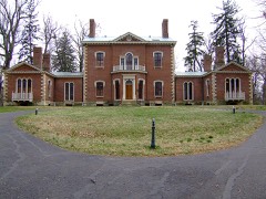 AshlandNational Historic Landmark · listed 1966
 Keeneland-Keeneland RacetrackNational Historic Landmark · listed 1986
 Old Morrison, Transylvania CollegeNational Historic Landmark · listed 1966
 African Cemetery No. 2listed 2004
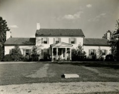 Allen, James Houselisted 1982
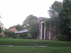 Ashland Park Historic Districtlisted 1986
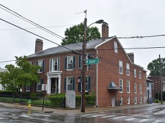 Abraham Barton Houselisted 1977
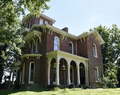 T. D. Basye Houselisted 1987
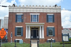 James Burnie Beck Houselisted 1982
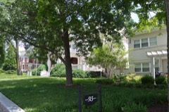 Bell Court Neighborhood Historic Districtlisted 1980
 Bell Placelisted 1978
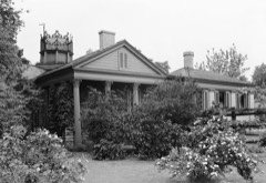 Botherumlisted 1973
Every listing in Fayette County
Surveyed buildings and structures 12 of 25 shown
- 535 West Short Street (Old Doorway), (moved from 655 Price Avenue), Lexingtonfederal building survey, 1 photograph
- Ashland, Gardener's Cottage, Richmond Road, 2 miles Southeast of Lexington, Lexingtonfederal building survey, 1 photograph
- Ashland, Ice Houses, Richmond Road, 2 miles Southeast of Lexington, Lexingtonfederal building survey, 1 photograph
- Ashland, Privy & Wash House, Richmond Road, 2 miles Southeast of Lexington, Lexingtonfederal building survey, 1 photograph
- Ashland, Richmond Road, 2 miles Southeast of Lexington, Lexingtonfederal building survey, 8 photographs
- Ashland, Smokehouse, Richmond Road, 2 miles Southeast of Lexington, Lexingtonfederal building survey, 1 photograph
- Bodley House, 200 North Market Street, Lexingtonfederal building survey, 3 photographs
- Botherum, 341 Madison Place, Lexingtonfederal building survey, 4 photographs
- Bryan Station, Bryan Station Pike, Lexingtonfederal building survey, 1 photograph
- Cadentown Rosenwald School, Caden Lane, Lexingtonfederal building survey, 14 photographs
- Hopemont, 201 North Mill Street, Lexingtonfederal building survey, 8 photographs
- Ingelside, Gibson Avenue, Lexingtonfederal building survey, 6 photographs
Population over time
4 figuresLexington grew from 108,000 to 322,570 between 1970 and 2020. These are the recorded population figures Wikidata holds for this place, reached through the Geographic Names Information System number this page is keyed on rather than by name, so they belong to this place and not to another of the same name. Most are census counts, but not all are: an early figure may be a founding or settlement estimate, and an estimate published within five years of a census is left out. The change column is computed, and is left blank where more than 20 years separate a figure from the one before it, because a gap that long is not a change between two counts.
| Year | People | Change |
|---|---|---|
| 1970 | 108,000 | |
| 1984 | 210,000 | +102,000 (+94%) |
| 2010 | 295,803 | |
| 2020 | 322,570 | +26,767 (+9%) |
Topographic sheets covering this place
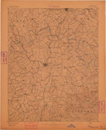
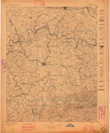
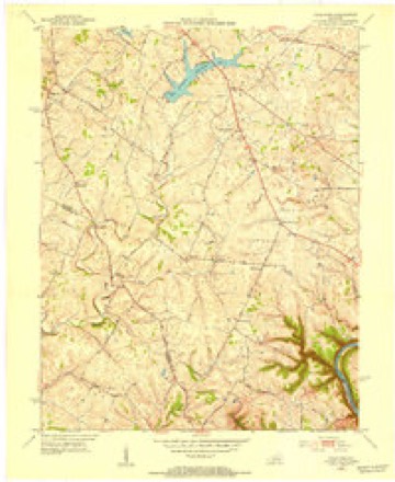
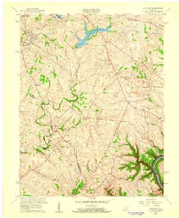
9 surveys from 19 printed sheetsMatched by testing this settlement's coordinate against the published boundary of every sheet in the United States Geological Survey's historical collection. Each opens the scanned sheet at the Survey.
- 1892 USGS Richmond quadrangle1:125000
- 1897 USGS Richmond quadrangle1:125000, 5 printings
- 1952 USGS Coletown quadrangle1:24000
- 1957 USGS Winchester quadrangle1:250000, 3 printings
- 1959 USGS Coletown quadrangle1:24000
- 1960 USGS Winchester quadrangle1:250000
- 1965 USGS Coletown quadrangle1:24000, 5 printings
- 1986 USGS Harrodsburg quadrangle1:100000
- 1991 USGS Harrodsburg quadrangle1:100000


What the histories say of this town
116,944 words1 chapter about Lexington from the published histories of the county, public domain and reproduced complete.
| Chapter | From | Length |
|---|---|---|
| History | History of Lexington, Kentucky : Its Early Annals and Recent Progress, Including Biographical Sketches and Personal Reminiscences of the Pioneer Settlers, Notices of Prominent Citizens, Etc., Etc. (1872) | 116,944 words in 8 parts |
Photographs
8 of 31 photographs shown, 1940 to 2020Taken for the Office of War Information and the Farm Security Administration, who photographed the country between 1935 and 1944. Works of United States government photographers, with no known restriction on use. Each opens its catalogue record.

Wolcott, Marion Post, 1940. Library of Congress

Highsmith, Carol M, 2020. Library of Congress

Highsmith, Carol M, 2020. Library of Congress
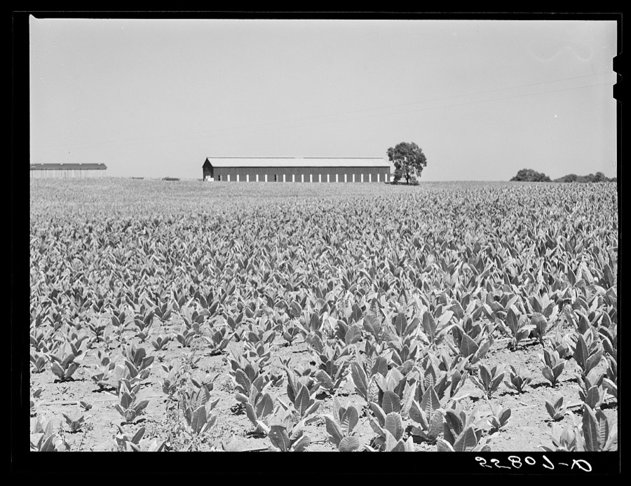
Wolcott, Marion Post, 1940. Library of Congress
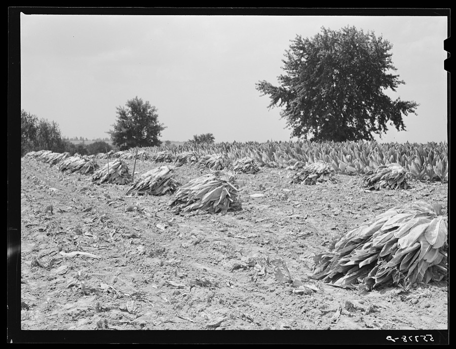
Wolcott, Marion Post, 1940. Library of Congress
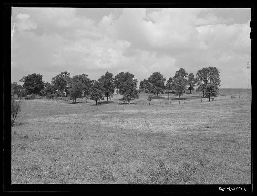
Wolcott, Marion Post, 1940. Library of Congress
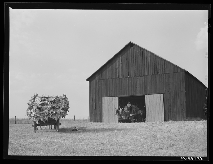
Wolcott, Marion Post, 1940. Library of Congress
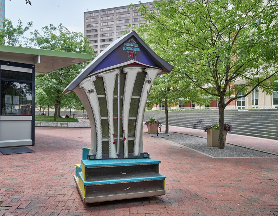
Highsmith, Carol M, 2020. Library of Congress
Every photograph of Fayette County
Fires near this place
1 since 2014Regional context, not property-specific evidence. The federal wildfire occurrence database lists 1 fire within 5 miles of Lexington in 2014, burning about 3 acres in total. None started naturally. None was recorded as arson. Distance is straight-line from the map coordinates, so a fire counted here may appear on a neighbouring settlement's page as well.
| Reported cause | Fires |
|---|---|
| Recreation and ceremony | 1 |
The most recent of them, most recent first, with the day each was reported and the service that recorded it.
| Date | Cause | Size | Reported by | Name on the report |
|---|---|---|---|---|
| 27 March 2014 | Recreation and ceremony | 3.0 acres | Kentucky Division of Forestry | NEELY |
Settlements close enough to share some of these fires:
Mines and quarries near this place
2 within 5 milesRegional context, not property-specific evidence. The federal mineral resources record lists 2 workings within 5 miles of Lexington: 2 producers. All of them still produce. What was taken out: Stone, Crushed/Broken, Tungsten. Distance is straight-line from the map coordinates, so a quarry counted here may appear on a neighbouring settlement's page as well.
| Where | Site | Commodity | Status | Recorded |
|---|---|---|---|---|
| Lexington Underground No. 1 | Stone, Crushed/Broken | Producer | ||
| Semicon Assoc./ Lexington, Ky. | Tungsten | Producer |
Storms near this place
60 of 190 shownRegional context, not property-specific evidence. The National Weather Service names Lexington in 190 storm reports between 1994 and 2026: 123 thunderstorm wind, 36 hail, 22 flash flood, 7 lightning. The reports record 4 deaths and 5 injuries. Each account below is quoted exactly as the forecast office filed it, from the NOAA Storm Events Database, and each date opens the federal record of that event.
| When | Event | Place named | Harm | What the report says |
|---|---|---|---|---|
| September 2006 | Flash Flood | Lexington | 2 killed | Two women were knocked down and swept away by rapidly flowing water, after trying to cross a flooded intersection. Sixty intersections in town were covered by high water, some with water depths up to three or four feet. Interstate 75 at mile marker 115 was flooded. Interstate 64 at mile marker 81 also had high water. |
| May 2006 | Lightning | Lexington | 1 killed | A woman was struck by lightning while placing yard waste in a container near her home. The time is estimated. |
| August 2000 | Thunderstorm Wind | Lexington | 1 killed | A was killed in Lexington when a tree was blown on to the vehicle he was driving. |
| June 2007 | Lightning | Lexington | 2 hurt | no account filed |
| October 2018 | Lightning | Lexington | 1 hurt | The emergency manager reported that a person received minor injuries from a lightning strike. The individual was evaluated and released from medical care. |
| May 2004 | Lightning | Lexington | 1 hurt | A man was struck by lightning while working in a detached garage. He was treated and released from a local hospital. |
| May 1996 | Lightning | Lexington | 1 hurt | no account filed |
| February 2008 | Thunderstorm Wind | Lexington | $250,000 | A concentrated area of straight line winds in downtown Lexington showed evidence of wind speeds up to 75 mph. Winds knocked down two brick walls of a new tire store. A nearby restaurant had windows blown out. Aluminum siding was blown in at a loading dock. A business had roof material blown off on to another nearby building. The orientation of the wind damage all indicated west to east straight line winds. |
| February 2008 | Thunderstorm Wind | Lexington | $100,000 | A house was destroyed when thunderstorm winds uprooted a large tree, and blew it on to the house. |
| July 2019 | Flood | Lexington | $60,000 | The headwaters area of Cane Run flooded and backed near WLEX studios. There were also reports of cars under water on New Circle, Winchester Road, and North Broadway. |
| July 2007 | Thunderstorm Wind | Lexington | $50,000 | A department store on Nicholasville Road received unspecified damage. |
| July 2004 | Thunderstorm Wind | Lexington | $50,000 | The roof on a tobacco warehouse was peeled back. |
| July 1994 | Thunderstorm Wind | Lexington | $50,000 | Numerous trees fell onto power lines. This caused for scattered power outages throughout the city. |
| July 2004 | Thunderstorm Wind | Lexington | $30,000 | The roof was blown off a barn. |
| July 2018 | Thunderstorm Wind | Lexington | $25,000 | A tree blew onto a house at Rose and Maxwell. |
| July 2018 | Thunderstorm Wind | Lexington | $25,000 | A tree blew onto a home in Venice Park. |
| November 2017 | Thunderstorm Wind | Lexington | $20,000 | Broadcast media reported a power pole down and a large tree on a vehicle. |
| May 2010 | Lightning | Lexington | $20,000 | Multiple power outages were reported in the area due to lightning. |
| July 2007 | Thunderstorm Wind | Lexington | $20,000 | A microburst downed approximately 100 trees on the east side of Lexington, mainly in and near Lakeside Golf Course and Jacobson Park. Some vehicle and roof damage resulted from the falling trees in residential areas. |
| July 2016 | Thunderstorm Wind | Lexington | $15,000 | Local media reported power lines and trees down on Elam Park. |
| July 2014 | Thunderstorm Wind | Lexington | $15,000 | The Lexington media reported that a brick building was destroyed in the Park Avenue neighborhood of Lexington. Several trees were downed nearby. |
| May 2020 | Flash Flood | Lexington | $10,000 | A car was partially submerged at Fontaine Road and Catalpa Road. |
| May 2018 | Lightning | Lexington | $10,000 | The fire department reported that four apartment units were damaged due to a lightning strike. |
| August 2014 | Thunderstorm Wind | Lexington | $10,000 | The Lexington media reported that a tree fell on a house several miles west of downtown. |
| June 2013 | Flash Flood | Lexington | $10,000 | Local Television media reported a water rescue at Elm Tree Road and East 2nd Street. For the entire day, the Lexington Airport measured 2.75 inches of rain. Most of this fell during the mid-evening hours. |
| June 2013 | Thunderstorm Wind | Lexington | $10,000 | A spotter reported damage to a barn's roof. Nearby, at the same time, local media relayed a report of downed power lines with a fallen power pole blocking the intersection of Newtown Pike and Citation Blvd. |
| June 2012 | Thunderstorm Wind | Lexington | $10,000 | The Lexington media reported several trees were downed across Fayette County. The largest tree had a diameter of 14 inches. This damage resulted from a gust front associated with a line of storms that moved across southern Ohio. In Lexington, one tree fell across two cars, bring extensive damage to both. According to the local Fayette County electrical utility company, several hundred homes across the county lost power. |
| July 2012 | Thunderstorm Wind | Lexington | $10,000 | A spotter reported several large trees down near the intersection of Jack's Creek Pike and Spears Road, which is just southeast of Lexington. Winds also damaged the roof of a barn in the same area. |
| February 2009 | Thunderstorm Wind | Lexington | $10,000 | A photographer stand was blown over in Commonwealth Stadium and trees and power lines were down, especially across the south side of town. Roof damage was also reported to a home on Winchester road. |
| May 2006 | Thunderstorm Wind | Lexington | $10,000 | Roof damage was reported and power lines were downed in the New Town Pike area. |
| June 2005 | Thunderstorm Wind | Lexington | $10,000 | A large plexiglass window was blown in at the Fayette Mall. No injuries were reported. |
| August 2003 | Flash Flood | Lexington | $10,000 | Heavy rains caused area creeks and small streams to flow out of their banks. Roadways, underpasses, and low lying areas were flooded. Several vehicles were stranded in water on Nicholasville and Richmond Roads in Lexington. |
| November 2000 | Thunderstorm Wind | Lexington | $7,000 | no account filed |
| July 2015 | Flash Flood | Lexington | $5,000 | A Fayette County law enforcement official reported that a minor high water rescue took place after several inches of rain flooded streets in the area. |
| May 2006 | Thunderstorm Wind | Lexington | $5,000 | A tree was downed on a house on Third Street on the north side of Lexington. |
| August 2006 | Thunderstorm Wind | Lexington | $5,000 | Siding was blown off a house on the southeast side of the city. |
| August 2017 | Thunderstorm Wind | Lexington | $4,000 | Trees and electrical wires reported down at Clays Mill Road and Blue Ash Road. |
| June 2007 | Thunderstorm Wind | Lexington | $2,000 | A large tree was blown on to a car on Leestown Road near the Woodford County line. |
| July 2007 | Thunderstorm Wind | Lexington | $2,000 | Thunderstorm winds damaged a garage door. |
| June 2015 | Thunderstorm Wind | Lexington | $1,000 | A law enforcement official reported two trees down along with an electrical line in the Lexington metro. |
| June 1995 | Thunderstorm Wind | Lexington | $500 | Siding was tore off a house on Patchen Drive. |
| May 2025 | Thunderstorm Wind | Lexington | - | A tree was uprooted, pulling up a section of asphalt in a parking lot. The tree fell onto a van. |
| June 2025 | Thunderstorm Wind | Lexington | - | A tree was blown down on the roadway near the intersection of Mason Headley Road and Versailles Road. |
| February 2024 | Thunderstorm Wind | Lexington | - | Power lines were down on 4th Street. |
| February 2024 | Thunderstorm Wind | Lexington | - | A utility pole fell down across North Broadway. |
| August 2024 | Thunderstorm Wind | Lexington | - | A large tree limb fell down on a vehicle in Woodland Park. |
| July 2023 | Thunderstorm Wind | Lexington | - | There was a tree down in a yard. |
| August 2023 | Thunderstorm Wind | Lexington | - | There were multiple reports of power lines down in Lexington. |
| May 2022 | Thunderstorm Wind | Lexington | - | A large tree was blown down, causing damage to a vehicle and power lines near the University of Kentucky campus. |
| April 2022 | Thunderstorm Wind | Lexington | - | Trees were down on Cooper Drive near Colony Boulevard. |
| July 2022 | Thunderstorm Wind | Lexington | - | A tree and power lines were down on Hamilton Park. |
| November 2022 | Hail | Lexington | - | Quarter sized hail was observed near the Henry Clay Estate in Lexington. |
| November 2022 | Hail | Lexington | - | Quarter sized hail was observed in several locations across downtown Lexington. |
| July 2021 | Flash Flood | Lexington | - | High water was over Winchester Road near Midland Avenue. |
| June 2021 | Thunderstorm Wind | Lexington | - | A tree fell on power lines. |
| May 2020 | Flash Flood | Lexington | - | Winchester Road and Walton Avenue were briefly closed due to flooding. |
| July 2020 | Thunderstorm Wind | Lexington | - | A tree blew down on power lines and a parked vehicle on Whitney Avenue. |
| July 2019 | Thunderstorm Wind | Lexington | - | There were trees blocking the road near the intersection of Georgetown and Price. |
| June 2019 | Thunderstorm Wind | Lexington | - | A large tree was reported down on Linden Walk. |
| May 2018 | Flash Flood | Lexington | - | Broadcast media reported that water was flowing over the road near Chinoe Road and Cochran Road. |
Newspapers printed here
19,631 digitised pages9 papers published in this town, digitised by the Library of Congress and free to read: 4,639 issues, 19,631 pages. Every page is searchable, so a name or a street can be looked for directly in what the town printed about itself at the time.
| Newspaper | Published |
|---|---|
| Kentucky Gazette and General Advertiser | 1803 to 1809 |
| The Kentucke Gazette | 1787 to 1789 |
| Lexington Weekly News | 1912 to 19?? |
| The Lexington Record | 1890 to 1??? |
| Blue-Grass Blade | 188? to 19?? |
| The Lexington Standard | 1892 to 1912 |
| The Kentucky Gazette | 1789 to 1803 |
| Kentucky Gazette | 1809 to 1848 |
| The Kentucky Gazette | 1866 to 1907 |
What the paper printed
55,272 wordsFront pages of the local paper, read from the Library of Congress scans: 20 issues spread across its run from 1787 to 1912, 55,272 words in total. Each is reproduced on its own page, exactly as the recogniser returned it.
These pages read less well than anything else here, and the number is worth stating: about three words in four come through cleanly, against nine in ten for the building records. An 1896 broadsheet sets eight-point type in seven columns on microfilm, which is the hardest thing in this archive to read by machine. We tested our own recognisers against the Library's and they were not better, so the Library's text is what appears, with the wholly unreadable columns removed. Read it as a guide to what the paper covered, and follow the link to the scan before quoting anything.
| Issue | Paper | Length |
|---|---|---|
| 1789-08-01 | The Kentucky Gazette | 1,025 words |
| 1789-10-03 | The Kentucky Gazette | 520 words |
| 1809-05-16 | Kentucky Gazette | 3,595 words |
| 1809-07-18 | Kentucky Gazette | 1,844 words |
| 1809-09-12 | Kentucky Gazette | 3,835 words |
| 1809-11-14 | Kentucky Gazette | 3,936 words |
| 1787-09-22 | The Kentucke Gazette | 2,524 words |
| 1900-01-27 | The Lexington Standard | 1,085 words |
| 1866-08-25 | The Kentucky Gazette | 2,742 words |
| 1866-10-10 | The Kentucky Gazette | 8,488 words |
| 1866-11-21 | The Kentucky Gazette | 4,289 words |
| 1803-03-08 | Kentucky Gazette and General Advertiser | 730 words |
| 1803-05-24 | Kentucky Gazette and General Advertiser | 2,767 words |
| 1803-08-16 | Kentucky Gazette and General Advertiser | 1,825 words |
| 1803-11-01 | Kentucky Gazette and General Advertiser | 2,024 words |
| 1912-03-15 | Lexington Weekly News | 3,706 words |
| 1912-08-17 | Lexington Weekly News | 2,758 words |
| 1890-11-01 | The Lexington Record | 1,714 words |
| 1891-05-01 | The Lexington Record | 1,347 words |
| 1910-08-21 | Blue-Grass Blade | 4,518 words |
Nearest settlements
The eight closest, with where each one stands in the county. Distances are straight-line, computed from the Geographic Names Information System coordinates.
| Map | Place | Distance | Sheets |
|---|---|---|---|
| Gainesway | 0.3 miles | 19 | |
| Southeastern Hills | 0.6 miles | 19 | |
| Jonestown | 1.3 miles | 19 | |
| Lakeview Acres | 1.4 miles | 16 | |
| Lansdowne | 1.5 miles | 15 | |
| Hinda Heights | 1.8 miles | 15 | |
| Shadeland | 1.9 miles | 16 | |
| Baralto | 2.1 miles | 15 |
Elsewhere
Matched on this settlement's Geographic Names Information System number rather than its name, so it cannot be a different place of the same name in another state.
| Wikipedia article on Lexington | An encyclopaedic summary. Its text is share-alike, so it is linked here rather than copied. |
| Wikidata item Q49241 | The structured record the population and elevation above come from. Public domain (CC0). |
Provenance
This settlement is recorded in the Geographic Names Information System as feature 496343. The sheet list is computed by point-in-boundary test against the United States Geological Survey's historical topographic inventory. Both are works of the United States government and carry no copyright under 17 U.S.C. 105.
Wildfire. Short, Karen C. 2022. Spatial wildfire occurrence data for the United States, 1992-2020 [FPA_FOD_20221014]. 6th Edition. Fort Collins, CO: Forest Service Research Data Archive. https://doi.org/10.2737/RDS-2013-0009.6 Collected with United States Government funding and usable without additional permissions or fees.
Mines and quarries. USGS Mineral Resources Data System (MRDS) https://mrdata.usgs.gov/mrds/ A work of the United States government, no copyright under 17 U.S.C. 105.
Storms. NOAA National Centers for Environmental Information, Storm Events Database https://www.ncei.noaa.gov/stormevents/ A work of the United States government, no copyright under 17 U.S.C. 105. Narratives are quoted verbatim from the National Weather Service report and are not edited or summarised.