 Block
Louisa, Kentucky
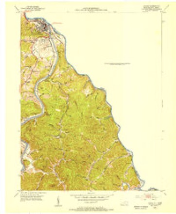
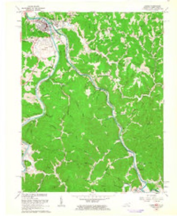
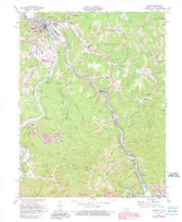
24 topographic sheets cover this place, the earliest surveyed in 1903 and the latest in 1982. It stands in the Louisa census division. It lies in ZIP code area 41230. It stands on Levisa Fork. The Survey maps it on the Louisa quadrangle. 2,679 people lived here at the 2020 count. It stands 584 feet above sea level.
Research this city
On record in Louisa
Buildings and businesses the archive holds for this place. Each opens its own page, with the source record it came from.
On the National Register 9 records
 Atkins-Carter Houselisted 1988
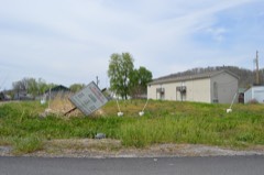 Big Sandy Milling Companylisted 1988
 First United Methodist Churchlisted 1984
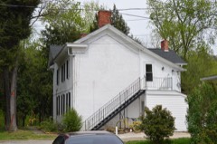 Capt. Freese Houselisted 1988
 Louisa Commercial Historic Districtlisted 1988
 Louisa United Methodist Churchlisted 1988
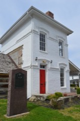 Fred M. Vinson Birthplacelisted 1974
- Garred House, Chapel, and Burial Vaultlisted 1975
- Louisa Residential Historic Districtlisted 1988
Population over time
2 figuresLouisa grew from 2,467 to 2,679 between 2010 and 2020. These are the recorded population figures Wikidata holds for this place, reached through the Geographic Names Information System number this page is keyed on rather than by name, so they belong to this place and not to another of the same name. Most are census counts, but not all are: an early figure may be a founding or settlement estimate, and an estimate published within five years of a census is left out. The change column is computed, and is left blank where more than 20 years separate a figure from the one before it, because a gap that long is not a change between two counts.
| Year | People | Change |
|---|---|---|
| 2010 | 2,467 | |
| 2020 | 2,679 | +212 (+9%) |
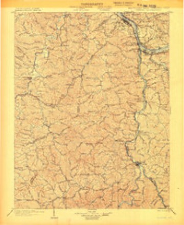
Topographic sheets covering this place
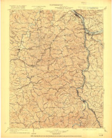
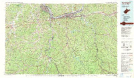
11 surveys from 24 printed sheetsMatched by testing this settlement's coordinate against the published boundary of every sheet in the United States Geological Survey's historical collection. Each opens the scanned sheet at the Survey.
- 1903 USGS Kenova quadrangle1:125000, 5 printings
- 1904 USGS Kenova quadrangle1:125000
- 1911 USGS Louisa quadrangle1:48000
- 1913 USGS Louisa quadrangle1:62500, 3 printings
- 1939 USGS Louisa quadrangle1:62500, 3 printings
- 1953 USGS Louisa quadrangle1:24000
- 1957 USGS Huntington quadrangle1:250000, 3 printings
- 1960 USGS Huntington quadrangle1:250000
- 1962 USGS Louisa quadrangle1:24000
- 1971 USGS Louisa quadrangle1:24000, 4 printings
- 1982 USGS Huntington quadrangle1:100000
Fires near this place
204 since 1992Regional context, not property-specific evidence. The federal wildfire occurrence database lists 204 fires within 5 miles of Louisa between 1992 and 2020, burning about 2,326 acres in total. 1 started naturally. 106 were recorded as arson. Distance is straight-line from the map coordinates, so a fire counted here may appear on a neighbouring settlement's page as well.
| Reported cause | Fires |
|---|---|
| Arson/incendiarism | 106 |
| Debris and open burning | 59 |
| Recreation and ceremony | 15 |
| Missing data/not specified/undetermined | 14 |
| Equipment and vehicle use | 6 |
| Other causes | 2 |
| Misuse of fire by a minor | 1 |
| Natural | 1 |
The most recent of them, most recent first, with the day each was reported and the service that recorded it.
| Date | Cause | Size | Reported by | Name on the report |
|---|---|---|---|---|
| 8 September 2002 | Arson/incendiarism | 1.0 acres | West Virginia Division of Forestry | TUG RIVER RD. |
| 7 September 2002 | Debris and open burning | under an acre | West Virginia Division of Forestry | SPRUCE BRANCH |
| 12 September 2002 | Debris and open burning | 3.0 acres | Kentucky Division of Forestry | not named |
| 11 September 2002 | Recreation and ceremony | 1.0 acres | Kentucky Division of Forestry | not named |
| 28 August 2007 | Recreation and ceremony | 1.0 acres | Kentucky Division of Forestry | not named |
| 17 August 2007 | Arson/incendiarism | under an acre | West Virginia Division of Forestry | not named |
| 4 May 2018 | Debris and open burning | under an acre | West Virginia Division of Forestry | PADDLE CREEK |
| 4 May 2001 | Natural | 5.0 acres | Kentucky Division of Forestry | not named |
Settlements close enough to share some of these fires:
Storms near this place
47 since 1995Regional context, not property-specific evidence. The National Weather Service names Louisa in 47 storm reports between 1995 and 2026: 26 thunderstorm wind, 14 hail, 3 flash flood, 3 flood. The reports record 5 injuries. Each account below is quoted exactly as the forecast office filed it, from the NOAA Storm Events Database, and each date opens the federal record of that event.
| When | Event | Place named | Harm | What the report says |
|---|---|---|---|---|
| July 2016 | Tornado (EF2) | Louisa | 5 hurt, $500,000 | The tornado did extensive damage to the Louisa Walmart and the Brown Food Service Warehouse. Cars and shipping containers were overturned and moved up to 30 yards in the Walmart parking lot. Structural damage to the Walmart and the Brown Food Service warehouse occurred. Numerous trees were snapped and uprooted. The tornado crossed the Tug Fork into West Virginia before dissipating.||Maximum wind gusts were estimated at 120 mph. There were 5 minor injuries at the Walmart. |
| March 2012 | Hail | Louisa | $325,000 | no account filed |
| May 2011 | Thunderstorm Wind | Louisa | $200,000 | Several trees were blown down throughout the community. Extensive power outages and scattered damage to structures occurred. The damage also crossed the river to Fort Gay in West Virginia. |
| March 2012 | Hail | Louisa | $200,000 | no account filed |
| July 2010 | Thunderstorm Wind | Louisa | $100,000 | Several trees were blown down in the city. Roads were blocked and power lines were knocked down. Electricity was interrupted for most of the town. |
| June 2014 | Thunderstorm Wind | Louisa | $75,000 | Trees were blown down, blocking roads. Roof damage occurred to a few homes. One mobile home had damage from a fallen tree. |
| July 2015 | Thunderstorm Wind | Louisa | $50,000 | Several trees were blown down. A few trees fell on power lines. |
| July 2000 | Flash Flood | Louisa | $40,000 | Streams and culverts flooded streets when 1 to 2 inches of rain fell in less than 2 hours on saturated ground. A few vehicles were submerged. |
| July 2015 | Thunderstorm Wind | Louisa | $20,000 | Several trees were blown down around town, with 1 tree damaging a house. |
| June 2012 | Thunderstorm Wind | Louisa | $20,000 | Large trees were blown down. |
| June 2016 | Thunderstorm Wind | Louisa | $15,000 | Wind caused roof damage to a building in Louisa. Their metal roof was partially torn from rafters. |
| May 2015 | Thunderstorm Wind | Louisa | $10,000 | A gust of 50 mph was measured. A few trees were blown down. One tree fell on a mobile home. A small section of a corrugated metal roof and overhang to a thrift shop was torn off. |
| May 1996 | Thunderstorm Wind | Louisa | $10,000 | no account filed |
| February 2016 | Flash Flood | Louisa | $5,000 | Streams, such as Lick and Greenbrier Creeks, overflowed and closed roads. A few road examples included Route 32, Greenbrier Road, and Old Lick Road. |
| April 2011 | Thunderstorm Wind | Louisa | $5,000 | Trees were blown down. |
| August 2010 | Flash Flood | Louisa | $5,000 | Roads were flooded by overflowing small streams and by poor drainage. No dwellings were flooded. |
| June 1998 | Thunderstorm Wind | Louisa | $5,000 | Trees were blown down, damaging a few outbuildings. |
| June 1995 | Thunderstorm Wind | Louisa | $5,000 | State Police reported trees blown down and across roads in the four counties. In Greenup, a power pole was snapped by the wind causing traffic lights to dangle on Route 23. |
| May 1997 | Hail | Louisa | $5,000 | no account filed |
| April 1996 | Thunderstorm Wind | Louisa | $5,000 | no account filed |
| June 2020 | Thunderstorm Wind | Louisa | $3,000 | In Fort Gay, two trees were downed onto Highway 1690. Another two trees were downed onto Highway 2037. |
| June 1996 | Thunderstorm Wind | Louisa | $3,000 | no account filed |
| December 2019 | Flood | Louisa | $2,000 | Old Lick Creek road was closed due to flooding along Lick Creek and Clayton Branch. |
| July 2012 | Thunderstorm Wind | Louisa | $2,000 | Large branches were blown down. |
| April 2011 | Thunderstorm Wind | Louisa | $2,000 | Trees were blown down. |
| August 2000 | Thunderstorm Wind | Louisa | $2,000 | Several trees and large branches fell across roads. |
| March 2026 | Thunderstorm Wind | Louisa | $1,500 | A tree and power line were blown down along Harley Drive south of Louisa. |
| May 2025 | Thunderstorm Wind | Louisa | $1,500 | In Louisa, nearly 100 homes were without power due to downed trees and power lines around the area. |
| February 2003 | Thunderstorm Wind | Louisa | $1,000 | Trees fell across Route 32. |
| April 2026 | Thunderstorm Wind | Louisa | $500 | One downed tree was observed on Town Hill Road. |
| February 2022 | Flood | Louisa | $500 | High water was observed along Old Lick Creek Road. |
| January 2025 | Flood | Louisa | $150 | A low dip in Old Lick Creek Road south of Louisa was underwater throughout the day. |
| May 2004 | Thunderstorm Wind | Louisa | - | Trees were blown into power lines. |
| July 2003 | Thunderstorm Wind | Louisa | - | A few trees and large branches fell in town. |
| June 2015 | Hail | Louisa | - | no account filed |
| February 2012 | Hail | Louisa | - | no account filed |
| April 2011 | Hail | Louisa | - | no account filed |
| May 2011 | Hail | Louisa | - | no account filed |
| June 2011 | Hail | Louisa | - | no account filed |
| May 2010 | Hail | Louisa | - | no account filed |
| February 2008 | Thunderstorm Wind | Louisa | - | no account filed |
| June 2008 | Hail | Louisa | - | no account filed |
| July 2005 | Hail | Louisa | - | no account filed |
| July 2005 | Hail | Louisa | - | no account filed |
| July 1999 | Hail | Louisa | - | no account filed |
| June 1998 | Hail | Louisa | - | no account filed |
| May 1996 | Thunderstorm Wind | Louisa | - | no account filed |
Newspapers printed here
9,533 digitised pages1 paper published in this town, digitised by the Library of Congress and free to read: 1,488 issues, 9,533 pages. Every page is searchable, so a name or a street can be looked for directly in what the town printed about itself at the time.
| Newspaper | Published |
|---|---|
| The Big Sandy News | 1885 to 1929 |
What the paper printed
14,123 wordsFront pages of the local paper, read from the Library of Congress scans: 4 issues spread across its run from 1885 to 1922, 14,123 words in total. Each is reproduced on its own page, exactly as the recogniser returned it.
These pages read less well than anything else here, and the number is worth stating: about three words in four come through cleanly, against nine in ten for the building records. An 1896 broadsheet sets eight-point type in seven columns on microfilm, which is the hardest thing in this archive to read by machine. We tested our own recognisers against the Library's and they were not better, so the Library's text is what appears, with the wholly unreadable columns removed. Read it as a guide to what the paper covered, and follow the link to the scan before quoting anything.
| Issue | Paper | Length |
|---|---|---|
| 1885-08-27 | The Big Sandy News | 3,162 words |
| 1885-10-01 | The Big Sandy News | 1,809 words |
| 1887-11-24 | The Big Sandy News | 7,567 words |
| 1922-12-29 | The Big Sandy News | 1,585 words |
Nearest settlements
The eight closest, with where each one stands in the county. Distances are straight-line, computed from the Geographic Names Information System coordinates.
| Map | Place | Distance | Sheets |
|---|---|---|---|
| Smoky Valley (historical) | 1.7 miles | 24 | |
| Holt | 2.0 miles | 24 | |
| Walbridge | 2.5 miles | 24 | |
| Five Forks | 3.0 miles | 24 | |
| Potters (historical) | 3.6 miles | 24 | |
| Deephole (historical) | 4.0 miles | 23 | |
| Greenwood (historical) | 4.3 miles | 25 | |
| Fullers | 4.4 miles | 24 |
Elsewhere
Matched on this settlement's Geographic Names Information System number rather than its name, so it cannot be a different place of the same name in another state.
| Wikipedia article on Louisa | An encyclopaedic summary. Its text is share-alike, so it is linked here rather than copied. |
| Wikidata item Q2576196 | The structured record the population and elevation above come from. Public domain (CC0). |
Provenance
This settlement is recorded in the Geographic Names Information System as feature 497204. The sheet list is computed by point-in-boundary test against the United States Geological Survey's historical topographic inventory. Both are works of the United States government and carry no copyright under 17 U.S.C. 105.
Wildfire. Short, Karen C. 2022. Spatial wildfire occurrence data for the United States, 1992-2020 [FPA_FOD_20221014]. 6th Edition. Fort Collins, CO: Forest Service Research Data Archive. https://doi.org/10.2737/RDS-2013-0009.6 Collected with United States Government funding and usable without additional permissions or fees.
Storms. NOAA National Centers for Environmental Information, Storm Events Database https://www.ncei.noaa.gov/stormevents/ A work of the United States government, no copyright under 17 U.S.C. 105. Narratives are quoted verbatim from the National Weather Service report and are not edited or summarised.