 Block
Ragland, Kentucky
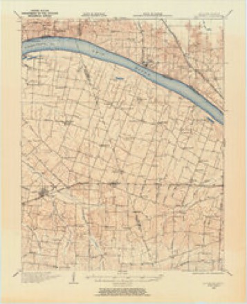
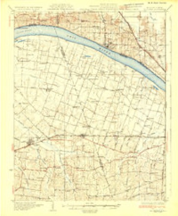
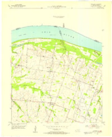
17 topographic sheets cover this place, the earliest surveyed in 1928 and the latest in 1987. It stands in the Grahamville-Heath census division. It lies in ZIP code area 42053. The Survey maps it on the Bandana quadrangle.
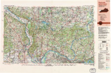
Topographic sheets covering this place
13 surveys from 17 printed sheetsMatched by testing this settlement's coordinate against the published boundary of every sheet in the United States Geological Survey's historical collection. Each opens the scanned sheet at the Survey.
- 1928 USGS La Center quadrangle1:62500
- 1932 USGS La Center quadrangle1:62500
- 1949 USGS Paducah quadrangle1:250000, 2 printings
- 1950 USGS Paducah quadrangle1:250000
- 1954 USGS Bandana quadrangle1:24000
- 1954 USGS Paducah quadrangle1:250000, 2 printings
- 1961 USGS Paducah quadrangle1:250000, 2 printings
- 1964 USGS Paducah quadrangle1:250000, 2 printings
- 1966 USGS Bandana quadrangle1:24000
- 1982 USGS Bandana quadrangle1:24000
- 1984 USGS Paducah quadrangle1:100000
- 1986 USGS Paducah quadrangle1:100000
- 1987 USGS Paducah quadrangle1:250000
Fires near this place
10 since 1999Regional context, not property-specific evidence. The federal wildfire occurrence database lists 10 fires within 5 miles of Ragland between 1999 and 2012, burning about 22 acres in total. None started naturally. 1 was recorded as arson. Distance is straight-line from the map coordinates, so a fire counted here may appear on a neighbouring settlement's page as well.
| Reported cause | Fires |
|---|---|
| Missing data/not specified/undetermined | 5 |
| Recreation and ceremony | 2 |
| Debris and open burning | 1 |
| Smoking | 1 |
| Arson/incendiarism | 1 |
The most recent of them, most recent first, with the day each was reported and the service that recorded it.
| Date | Cause | Size | Reported by | Name on the report |
|---|---|---|---|---|
| 7 September 2008 | Arson/incendiarism | under an acre | Illinois Division of Forestry Resources | 49 |
| 22 August 2012 | Missing data/not specified/undetermined | under an acre | Illinois Division of Forestry Resources | JOPPA |
| 6 March 2010 | Recreation and ceremony | 1.0 acres | Kentucky Division of Forestry | not named |
| 6 March 2007 | Missing data/not specified/undetermined | 3.0 acres | Kentucky Division of Forestry | not named |
| 23 March 2011 | Missing data/not specified/undetermined | 1.0 acres | Illinois Division of Forestry Resources | WEAVER |
| 1 December 1999 | Debris and open burning | 4.0 acres | Kentucky Division of Forestry | not named |
| 6 November 1999 | Missing data/not specified/undetermined | 2.0 acres | Kentucky Division of Forestry | not named |
| 23 November 2008 | Smoking | 5.0 acres | Kentucky Division of Forestry | not named |
Settlements close enough to share some of these fires:
Mines and quarries near this place
2 within 5 milesRegional context, not property-specific evidence. The federal mineral resources record lists 2 workings within 5 miles of Ragland: 1 producer, 1 past producer. 1 still produces. What was taken out: Calcium, Sand and Gravel, Construction. Distance is straight-line from the map coordinates, so a quarry counted here may appear on a neighbouring settlement's page as well.
| Where | Site | Commodity | Status | Recorded |
|---|---|---|---|---|
| Delta Materials, Inc. Dredge | Sand and Gravel, Construction | Past Producer | ||
| Joppa Cement Plant | Calcium | Producer |
Storms near this place
15 since 1996Regional context, not property-specific evidence. The National Weather Service names Ragland in 15 storm reports between 1996 and 2023: 7 flood, 3 tornado, 2 flash flood, 2 hail. The reports record 1 death and 5 injuries. Each account below is quoted exactly as the forecast office filed it, from the NOAA Storm Events Database, and each date opens the federal record of that event.
| When | Event | Place named | Harm | What the report says |
|---|---|---|---|---|
| March 2019 | Flood | Ragland | 1 killed | A prolonged major river flood that peaked in February subsided in March. Information on the February crest height and the total property damage estimate is contained in the February report. The flood damaged about 50 homes in McCracken County. Levee and flood wall gates were installed in the Paducah area. This action along with heavy rainfall in west Kentucky and backwater from the Ohio and Tennessee Rivers caused widespread flooding in the southeast part of McCracken County. Smaller rivers and creeks such as the Clarks River had nowhere to drain and kept rising with each successive round of heavy rain. One fatality occurred due to a vehicle that drove into Clarks River floodwaters. A male, age 59, drove around a barricade and into floodwaters off Highway 787 near the Marshall County line. His girlfriend escaped the vehicle, but he did not. His body was recovered and CPR was administered but to no avail. Countywide, a damage assessment indicated 35 residences sustained minor damage and 15 sustained major damage. Numerous roads were closed around the county, especially in the flood plain west of Paducah and the Clarks River basin in eastern McCracken County. Some of the largest state roads that were closed included Highway 131 south of Reidland, Highway 305 in West Paducah, and Highway 284 between Reidland and Paducah. A Red Cross shelter was opened in Paducah. The City of Paducah declared a state of emergency and installed most of the floodgates in the floodwall. The city's convention center was inaccessible for over a week due to its location outside the floodwall. A makeshift barrier was installed around the convention center to prevent flooding. |
| February 2012 | Tornado (EF2) | Ragland | 5 hurt, $150,000 | The tornado continued into McCracken County from Ballard County. Six to eight residences were heavily damaged or destroyed. The residences were a mix of mobile homes and houses. The steeple was blown off a church. Numerous barns and sheds were destroyed or damaged, with debris carried several hundred yards and deposited in trees. There were several injuries, including one serious injury. Two semi-trailers were flipped on their side. A few stationary vehicles were moved 50 to 75 yards. The tornado exited the county when it crossed the Ohio River into Massac County, IL. |
| February 2019 | Flood | Ragland | $1,000,000 | A prolonged major river flood damaged about 50 homes in McCracken County. At Paducah, the Ohio River crested at 53.27 feet on the 25th. This was tied with the 1950 flood for the second worst flood since the Flood of 1937. Since 1937, only the flood crest of 2011 was higher. The flood crest reached 60.60 feet in the winter of 1937. Levee and flood wall gates were installed in the Paducah area. This action along with heavy rainfall in west Kentucky and backwater from the Ohio and Tennessee Rivers caused widespread flooding in the southeast part of McCracken County. Smaller rivers and creeks such as the Clarks River had nowhere to drain and kept rising with each successive round of heavy rain. A damage assessment indicated 35 residences sustained minor damage and 15 sustained major damage. Numerous roads were closed around the county, especially in the flood plain west of Paducah and the Clarks River basin in eastern McCracken County. Some of the largest state roads that were closed included Highway 131 south of Reidland, Highway 305 in West Paducah, and Highway 284 between Reidland and Paducah. A Red Cross shelter was opened in Paducah. The City of Paducah declared a state of emergency and installed most of the floodgates in the floodwall. The city's convention center was inaccessible for over a week due to its location outside the floodwall. A makeshift barrier was installed around the convention center to prevent flooding. |
| March 2018 | Flood | Ragland | $150,000 | Moderate flooding continued on the Ohio River from late February. At the Paducah river gage, the river crested at 51.43 feet on the 2nd. Flood stage is 39 feet. This crest was just several inches lower than the Flood of March, 1997. A number of homes were evacuated in the county, including an area along Highway 1420 west of Paducah. This area is affected by backwater flooding of Massac Creek, which prompted the closure of Highways 1420 and 305. Numerous other roads were flooded and closed, mainly county roads. The floodgates were installed in the floodwall protecting the city of Paducah. Parks, roads, and boat ramps that were not protected by the floodwall were inundated. |
| July 2016 | Tornado (EF1) | Ragland | $40,000 | The tornado entered McCracken County from Ballard County along Highway 358. Damage in McCracken County consisted mostly of snapped and uprooted trees, including some large mature trees. At least ten trees were blown down in the McCracken County portion of the path. A few homes sustained minor roof and siding damage along the path. A barn roof was blown off. Peak winds were estimated near 105 mph. |
| January 2023 | Tornado (EF1) | Ragland | - | The tornado crossed from Ballard County into the extreme northwest corner of McCracken County. There was no observed damage in McCracken County. The tornado was over dormant farmland before crossing the Ohio River into Massac County, Illinois. |
| August 2016 | Flash Flood | Ragland | - | Water was over Highway 358 in many places between West Paducah and the Ballard County line. Water was over portions of several other roads, including Highway 1564 near the Ballard County line. |
| March 2015 | Flood | Ragland | - | Moderate flooding occurred on the Ohio River. At the Paducah river gage, the river crested at 45.54 feet on the 17th. Flood stage is 39 feet. Mainly bottomland and surrounding low-lying areas were flooded. Floodwaters crept into some backyards along Highway 1420 west of the city. The riverfront park in downtown Paducah was partially flooded but remained open to traffic. Backwater from the Ohio River affected the lower part of the Clarks River in eastern McCracken County. This backwater caused flooding of Kentucky Highway 1255. |
| February 2020 | Flood | Ragland | - | no account filed |
| January 2019 | Flood | Ragland | - | no account filed |
| February 2018 | Flood | Ragland | - | no account filed |
| May 2003 | Thunderstorm Wind | Ragland | - | no account filed |
| May 2002 | Hail | Ragland | - | no account filed |
| September 2001 | Hail | Ragland | - | no account filed |
| July 1996 | Flash Flood | Ragland | - | no account filed |
Nearest settlements
The eight closest, with where each one stands in the county. Distances are straight-line, computed from the Geographic Names Information System coordinates.
| Map | Place | Distance | Sheets |
|---|---|---|---|
| Crawford Lake | 1.5 miles | 17 | |
| Lee (historical) | 1.5 miles | 17 | |
| Rossington | 3.4 miles | 19 | |
| Woodville | 4.7 miles | 16 | |
| Cimota City | 5.2 miles | 16 | |
| Bayou Church (historical) | 6.0 miles | 16 | |
| Grahamville | 6.9 miles | 16 | |
| Heath | 7.4 miles | 16 |
Provenance
This settlement is recorded in the Geographic Names Information System as feature 501525. The sheet list is computed by point-in-boundary test against the United States Geological Survey's historical topographic inventory. Both are works of the United States government and carry no copyright under 17 U.S.C. 105.
Wildfire. Short, Karen C. 2022. Spatial wildfire occurrence data for the United States, 1992-2020 [FPA_FOD_20221014]. 6th Edition. Fort Collins, CO: Forest Service Research Data Archive. https://doi.org/10.2737/RDS-2013-0009.6 Collected with United States Government funding and usable without additional permissions or fees.
Mines and quarries. USGS Mineral Resources Data System (MRDS) https://mrdata.usgs.gov/mrds/ A work of the United States government, no copyright under 17 U.S.C. 105.
Storms. NOAA National Centers for Environmental Information, Storm Events Database https://www.ncei.noaa.gov/stormevents/ A work of the United States government, no copyright under 17 U.S.C. 105. Narratives are quoted verbatim from the National Weather Service report and are not edited or summarised.