 Block
Richmond, Kentucky
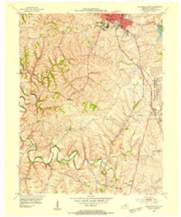
17 topographic sheets cover this place, the earliest surveyed in 1892 and the latest in 1997. It stands in the Richmond census division. It lies in ZIP code area 40475. The Survey maps it on the Richmond South quadrangle. 34,585 people lived here at the 2020 count. It stands 948 feet above sea level.
Research this city
On record in Richmond
Buildings and businesses the archive holds for this place. Each opens its own page, with the source record it came from.
On the National Register 12 of 49 shown
 Fort Boonesborough Townsite Historic DistrictNational Historic Landmark · listed 1994
 Arlingtonlisted 1983
 Blair Parklisted 1983
 Blythewoodlisted 1989
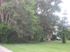 Judge Daniel Breck Houselisted 1976
 Bronston Placelisted 1983
 Burnawoodlisted 1984
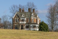 Brutus and Pattie Field Clay Houselisted 1990
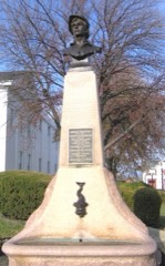 Downtown Richmond Historic Districtlisted 1976
 Elmwoodlisted 2012
 William Holloway Houselisted 1983
 Irvintonlisted 1975
Every listing in Madison County
Surveyed buildings and structures 5 records
- Castlewood, U.S. Route 25, Richmondfederal building survey, 20 photographs
- Whitehall, Clay Lane, Richmondfederal building survey, 12 photographs
- Whitehall, Log Cabin, Clay Lane, Richmondfederal building survey, 1 photograph
- Whitehall, Stone Outbuilding, Clay Lane, Richmondfederal building survey, 1 photograph
- Woodlawn, Richmondfederal building survey, 1 photograph
Population over time
2 figuresRichmond grew from 31,364 to 34,585 between 2010 and 2020. These are the recorded population figures Wikidata holds for this place, reached through the Geographic Names Information System number this page is keyed on rather than by name, so they belong to this place and not to another of the same name. Most are census counts, but not all are: an early figure may be a founding or settlement estimate, and an estimate published within five years of a census is left out. The change column is computed, and is left blank where more than 20 years separate a figure from the one before it, because a gap that long is not a change between two counts.
| Year | People | Change |
|---|---|---|
| 2010 | 31,364 | |
| 2020 | 34,585 | +3,221 (+10%) |
Topographic sheets covering this place
9 surveys from 17 printed sheetsMatched by testing this settlement's coordinate against the published boundary of every sheet in the United States Geological Survey's historical collection. Each opens the scanned sheet at the Survey.
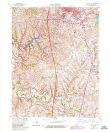
- 1892 USGS Richmond quadrangle1:125000
- 1897 USGS Richmond quadrangle1:125000, 5 printings
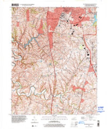
- 1953 USGS Richmond South quadrangle1:24000
- 1957 USGS Winchester quadrangle1:250000, 3 printings
- 1960 USGS Winchester quadrangle1:250000
- 1965 USGS Richmond South quadrangle1:24000, 3 printings
- 1986 USGS Harrodsburg quadrangle1:100000
- 1991 USGS Harrodsburg quadrangle1:100000
- 1997 USGS Richmond South quadrangle1:24000





Photographs
6 photographs, 2020Taken for the Office of War Information and the Farm Security Administration, who photographed the country between 1935 and 1944. Works of United States government photographers, with no known restriction on use. Each opens its catalogue record.

Highsmith, Carol M, 2020. Library of Congress
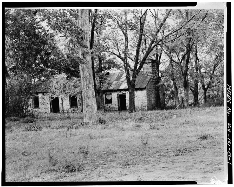
Photographer not recorded. Library of Congress
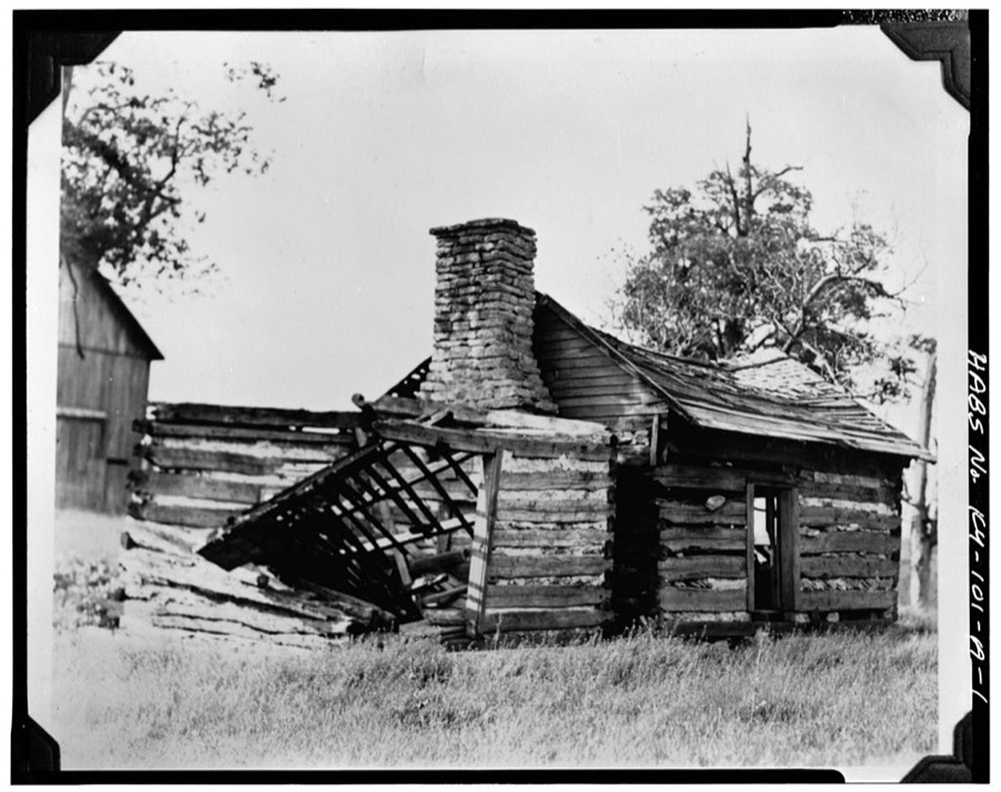
Photographer not recorded. Library of Congress
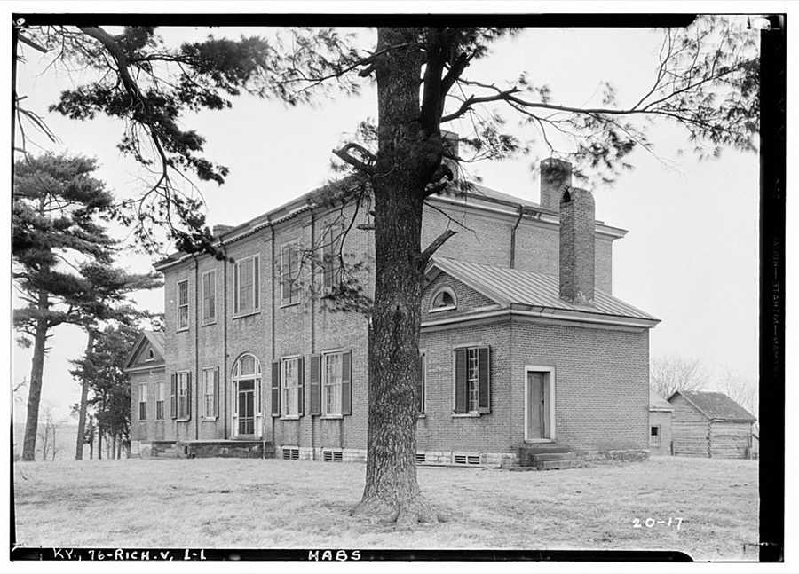
Photographer not recorded. Library of Congress
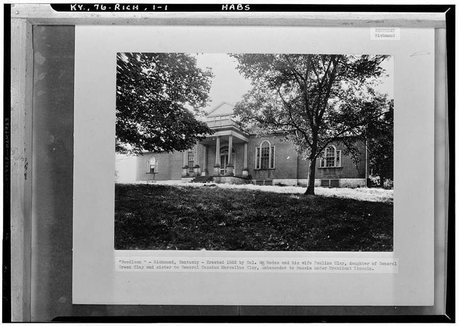
Photographer not recorded. Library of Congress
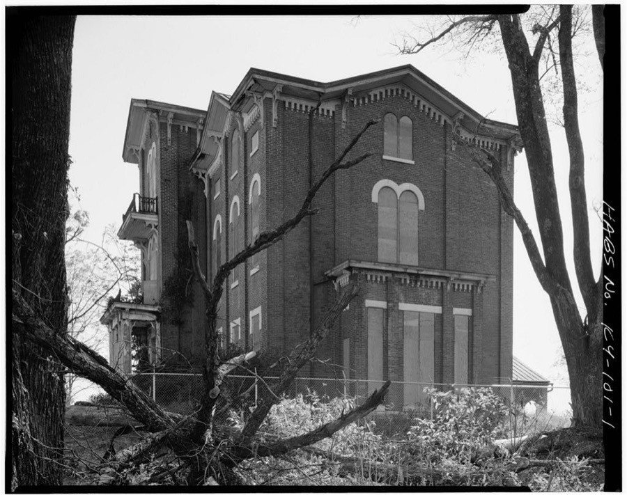
Photographer not recorded. Library of Congress
Fires near this place
2 since 2007Regional context, not property-specific evidence. The federal wildfire occurrence database lists 2 fires within 5 miles of Richmond between 2007 and 2008, burning about 6 acres in total. None started naturally. None was recorded as arson. Distance is straight-line from the map coordinates, so a fire counted here may appear on a neighbouring settlement's page as well.
| Reported cause | Fires |
|---|---|
| Debris and open burning | 1 |
| Recreation and ceremony | 1 |
The most recent of them, most recent first, with the day each was reported and the service that recorded it.
| Date | Cause | Size | Reported by | Name on the report |
|---|---|---|---|---|
| 13 August 2008 | Recreation and ceremony | 5.0 acres | Kentucky Division of Forestry | not named |
| 11 November 2007 | Debris and open burning | 1.0 acres | Kentucky Division of Forestry | not named |
Settlements close enough to share some of these fires:
Storms near this place
60 of 115 shownRegional context, not property-specific evidence. The National Weather Service names Richmond in 115 storm reports between 1996 and 2025: 61 thunderstorm wind, 29 hail, 19 flash flood, 5 flood. The reports record 1 death and 5 injuries. Each account below is quoted exactly as the forecast office filed it, from the NOAA Storm Events Database, and each date opens the federal record of that event.
| When | Event | Place named | Harm | What the report says |
|---|---|---|---|---|
| February 2000 | Flash Flood | Richmond | 1 killed, $10,000 | A 15 year old boy died after the car in which he was riding was overtaken by flood waters. |
| June 2016 | Lightning | Richmond | 4 hurt | Employees working at the Cabinet for Health and Family Services were shocked when lightning stuck the building. Lightning also sparked a garage fire on Hume Branch Road near Waco. |
| April 2002 | Thunderstorm Wind | Richmond | 1 hurt, $25,000 | Many trees were downed. A tree fell on a mobile home, injuring an occupant. Another tree fell on a vehicle. A utility pole was blown down. An ATM machine was damaged by wind. |
| March 2017 | Thunderstorm Wind | Richmond | $100,000 | A storm survey conducted by NWS Jackson concluded that 2 areas of straight line wind damage occurred near Richmond, Kentucky. The most significant damage occurred just south of Richmond where peak winds reached an estimated 80 mph as a mobile home park was damaged. An anchored mobile home was damaged and slid off its foundation. The second area of straight line winds was just north of Richmond and yielded maximum estimated winds of 65 mph. |
| March 2017 | Thunderstorm Wind | Richmond | $70,000 | The Madison County emergency manager reported several mobile homes damaged due to severe thunderstorm winds. |
| May 2010 | Flash Flood | Richmond | $50,000 | The fire department responded to flooded homes and mobile homes where people were trapped due to rising water. Evacuations also took place. |
| December 2007 | Flash Flood | Richmond | $50,000 | Numerous roads in Richmond were under water due to heavy rains. Some roads were covered by as much as four feet of water. Some buildings were flooded. |
| June 2008 | Thunderstorm Wind | Richmond | $20,000 | Tree fell on cars on Ellis Court in Richmond. |
| May 2018 | Thunderstorm Wind | Richmond | $15,000 | There was a tree on a power line on Gibson Lane in Richmond. |
| July 2014 | Thunderstorm Wind | Richmond | $10,000 | A tree fell and damaged a truck near the Eastern Kentucky University Campus. |
| August 2012 | Flash Flood | Richmond | $10,000 | The Madison County emergency manager reported a water rescue just west of downtown Richmond within an area that commonly experiences flooding. Several other low water crossings east of Richmond were briefly closed by high water. |
| January 2008 | Thunderstorm Wind | Richmond | $10,000 | Thunderstorm winds downed blew a tree and power lines on car on Woodland Avenue. A carport was blown down on Highway 169. Winds downed another tree near White Station. |
| January 2005 | Thunderstorm Wind | Richmond | $10,000 | Trees and fences were blown down. |
| May 2015 | Thunderstorm Wind | Richmond | $5,000 | An amateur radio operator reported trees down in Richmond, one of which fell onto a car on Sunset Avenue. |
| June 2013 | Flash Flood | Richmond | $5,000 | A spotter reported around one half foot of water flowing down Madison Hills and 3rd Street in Richmond. |
| April 2005 | Hail | Richmond | $5,000 | Vehicles were dented at the Kentucky State Police Post. |
| December 2005 | Thunderstorm Wind | Richmond | $5,000 | Part of a garage roof was blown off. |
| May 2015 | Thunderstorm Wind | Richmond | $3,000 | A fire department official reported to the NWS trees down on a house on Crescent Hills Drive. |
| October 2001 | Thunderstorm Wind | Richmond | $2,000 | no account filed |
| September 2012 | Flood | Richmond | $1,000 | The Richmond Fire Department reported two cars stalled and several briefly impassable flooded roads downtown. |
| May 2025 | Thunderstorm Wind | Richmond | - | A tree was blown down along Hampton Way in Richmond. |
| August 2024 | Thunderstorm Wind | Richmond | - | Dispatch reported trees down across Madison County. |
| January 2023 | Thunderstorm Wind | Richmond | - | Trees were blown down, roof and gutter damage occurred, and a car was flipped on its side along Lakeridge Drive in Richmond. |
| January 2023 | Thunderstorm Wind | Richmond | - | Trees were downed and limbs were blown across Main Street near Pin Oak Drive in Richmond. |
| June 2023 | Hail | Richmond | - | Tennis ball sized hail was observed northwest of Richmond. |
| June 2023 | Hail | Richmond | - | Ping pong ball sized hail was observed just north of Richmond. |
| June 2023 | Thunderstorm Wind | Richmond | - | The National Weather Service conducted a storm survey for the macroburst damage received near Richmond in Madison county, Kentucky. Damage was first observed along US Highway 25 where some isolated tree snaps occurred. Plenty of tree damage continued to Hunter Lane and extensive property damage occurred to a home where roof damage and damage to outbuildings occurred.||The storm continued along Four Mile Road where damage to a barn roof occurred with more trees uprooted and snapped. Damage continued to become more sporadic along Greens Crossing Road where lots of tree damage and barn outbuildings had roof damage. Richmond Speedway also received roof damage to the restrooms and grandstand seating. The most concentrated damage occurred along Forest and Kennedy Lanes where several residents received damage with very extensive tree damage, including a mixture of uprooted and snapped hardwood trees. Several barn outbuildings also received considerable roof damage. Observable damage continued with trees down along Whitt Road and Speedwell Road and some barn roof damage. Barn outbuildings and tree damage continued toward Brassfield Road before the main extensive damage ended. A majority of the damage was observed in a southerly direction, although some damage varied between the easterly and southwesterly directions. This damage pattern coincides with a macroburst style severe straight line wind downburst from the parent thunderstorm that moved across Madison County. Damage was widespread and appeared to even fan out in many areas, which is also consistent with a straight line wind event. Most damage was consistently in the 90-100 mph range with a max wind speed of 110 in some locations. |
| February 2022 | Thunderstorm Wind | Richmond | - | A building near 3rd Street and Chestnut was damaged in Richmond. There was also sporadic tree damage in the county as well. |
| April 2022 | Thunderstorm Wind | Richmond | - | A tree was down blocking Sara Leigh Drive. |
| January 2020 | Thunderstorm Wind | Richmond | - | Eastern Kentucky University reported several trees were blown down on campus. |
| June 2020 | Thunderstorm Wind | Richmond | - | Trees were down along Highway 388 in Madison. |
| February 2019 | Flood | Richmond | - | Standing water was reported near Altamont and Race Streets in Richmond. |
| December 2019 | Flood | Richmond | - | Madison County Dispatch reported that a section of Tates Creek Road was closed due to standing water in many spots. Several other roads in the county were closed because of water issues. |
| June 2018 | Flood | Richmond | - | A trained spotter reported that streets were starting to flood in Richmond. There was very heavy precipitation and around 40 mph winds. |
| May 2018 | Thunderstorm Wind | Richmond | - | There was a tree on a power line on Gibson Lane in richmond. |
| May 2018 | Hail | Richmond | - | Hail was reported at Farmington Court in Richmond. |
| March 2017 | Thunderstorm Wind | Richmond | - | The public reported trees snapped in half, and roof damage to structures. |
| June 2017 | Thunderstorm Wind | Richmond | - | State officials reported trees down west of Richmond. |
| June 2017 | Thunderstorm Wind | Richmond | - | Local media reported numerous trees down across Madison County. |
| May 2016 | Hail | Richmond | - | Quarter size hail fell on the Richmond Bypass. |
| May 2016 | Thunderstorm Wind | Richmond | - | The Madison County emergency manager reported numerous trees down across multiple locations in Richmond, including one tree that was blocking a driveway. |
| July 2016 | Flash Flood | Richmond | - | The public reported street flooding in the area due to excessive heavy rain. |
| May 2015 | Thunderstorm Wind | Richmond | - | An amateur radio operator reported trees and power lines down along Hunter Lane. |
| July 2015 | Thunderstorm Wind | Richmond | - | The Madison County emergency manager reported a tree down on High Street. |
| July 2015 | Thunderstorm Wind | Richmond | - | The Madison County emergency manager reported that severe thunderstorm winds brought down power lines across North 1st Street in Richmond. |
| June 2014 | Thunderstorm Wind | Richmond | - | Richmond law enforcement reported trees down near the intersections of Mt. Vernon Road and Liberty Avenue, Highway 421 and Battlefield Road, and near the Waco Baptist Church. |
| August 2014 | Flood | Richmond | - | Richmond law enforcement reported water across the Richmond Bypass, associated with Interstate 75. The road was still passable. |
| July 2014 | Thunderstorm Wind | Richmond | - | A tree was downed just north of Richmond. |
| May 2014 | Thunderstorm Wind | Richmond | - | A bowing segment brought widespread power outages throughout the county. Several trees were downed in Richmond. |
| February 2014 | Thunderstorm Wind | Richmond | - | The Madison County emergency management reported that debris covered a portion of Dayview Road in Richmond. |
| April 2013 | Flash Flood | Richmond | - | Tate's Creek overflowed, briefly closing a portion of Tate's Creek Road. |
| November 2013 | Thunderstorm Wind | Richmond | - | The Waco fire department reported trees down on Goggins Lane and Redhouse Road. Downed trees also blocked Tates Creek Road, Four Mile Road and Summit Street. Nearby, a Kentucky mesonet site measured a 48 mph wind gust. In Richmond, a weather station located at Hummel Planetarium measured a 56 mph wind gust. |
| August 2013 | Thunderstorm Wind | Richmond | - | A thunderstorm toppled a tree in Richmond. |
| March 2012 | Flash Flood | Richmond | - | Flash flooding closed two roads just to the south of Richmond. State Highway 25 was briefly closed near the Okonite Factory. Also, the intersection of Cal East and Mills Station Roads was briefly closed. |
| March 2012 | Thunderstorm Wind | Richmond | - | The County Emergency Manager reported a roof off both a house and a barn at 880 Duncannon Lane. |
| July 2012 | Hail | Richmond | - | Local media reported quarter sized hail just north of Richmond. |
| April 2011 | Thunderstorm Wind | Richmond | - | A tree was blown down. |
| June 2010 | Thunderstorm Wind | Richmond | - | A tree was blown down on Fairview Rd. |
| February 2009 | Thunderstorm Wind | Richmond | - | Two tractor trailers were blown over on Interstate 75 - one at the 77 mile marker (southbound) and the other at the 91 mile marker (northbound). Trees and power lines were also reported downed across the county. |
| May 2009 | Thunderstorm Wind | Richmond | - | A rail car was blown over in Richmond. |
Newspapers printed here
13,521 digitised pages7 papers published in this town, digitised by the Library of Congress and free to read: 2,489 issues, 13,521 pages. Every page is searchable, so a name or a street can be looked for directly in what the town printed about itself at the time.
| Newspaper | Published |
|---|---|
| The Climax | 1887 to 1897 |
| The Richmond Climax | 1897 to 1914 |
| The Madisonian | 1913 to 1914 |
| The Climax-Madisonian | 1914 to 1917 |
| The Richmond Climax | 1917 to 191? |
| The Kentucky Register | 190? to 1917 |
| Richmond Daily Register | 1917 to 1978 |
What the paper printed
78,968 wordsFront pages of the local paper, read from the Library of Congress scans: 25 issues spread across its run from 1887 to 1922, 78,968 words in total. Each is reproduced on its own page, exactly as the recogniser returned it.
These pages read less well than anything else here, and the number is worth stating: about three words in four come through cleanly, against nine in ten for the building records. An 1896 broadsheet sets eight-point type in seven columns on microfilm, which is the hardest thing in this archive to read by machine. We tested our own recognisers against the Library's and they were not better, so the Library's text is what appears, with the wholly unreadable columns removed. Read it as a guide to what the paper covered, and follow the link to the scan before quoting anything.
| Issue | Paper | Length |
|---|---|---|
| 1887-06-22 | The Climax | 2,560 words |
| 1887-08-03 | The Climax | 2,546 words |
| 1887-09-14 | The Climax | 2,678 words |
| 1887-10-26 | The Climax | 1,462 words |
| 1887-12-07 | The Climax | 2,601 words |
| 1897-06-30 | The Richmond Climax | 4,449 words |
| 1897-08-25 | The Richmond Climax | 5,242 words |
| 1897-10-27 | The Richmond Climax | 4,043 words |
| 1914-09-30 | The Richmond Climax | 3,200 words |
| 1913-03-11 | The Madisonian | 3,987 words |
| 1913-05-27 | The Madisonian | 4,163 words |
| 1913-08-05 | The Madisonian | 3,979 words |
| 1913-10-15 | The Madisonian | 643 words |
| 1914-09-29 | The Madisonian | 5,077 words |
| 1914-10-14 | The Climax-Madisonian | 2,758 words |
| 1914-10-28 | The Climax-Madisonian | 820 words |
| 1914-12-16 | The Climax-Madisonian | 4,991 words |
| 1917-04-18 | The Climax-Madisonian | 5,016 words |
| 1917-10-31 | The Richmond Climax | 4,490 words |
| 1916-10-27 | The Kentucky Register | 1,248 words |
| 1917-04-13 | The Kentucky Register | 6,025 words |
| 1918-01-18 | Richmond Daily Register | 3,088 words |
| 1918-11-08 | Richmond Daily Register | 730 words |
| 1918-11-11 | Richmond Daily Register | 321 words |
| 1922-12-22 | Richmond Daily Register | 2,851 words |
Nearest settlements
The eight closest, with where each one stands in the county. Distances are straight-line, computed from the Geographic Names Information System coordinates.
| Map | Place | Distance | Sheets |
|---|---|---|---|
| Rosedale (historical) | 0.6 miles | 16 | |
| Arlington | 1.1 miles | 16 | |
| Hillcrest | 1.4 miles | 16 | |
| Reeds Crossing | 3.9 miles | 15 | |
| Caleast | 4.4 miles | 17 | |
| Terrill | 4.7 miles | 17 | |
| Million | 5.4 miles | 15 | |
| Peytontown | 5.7 miles | 17 |
Elsewhere
Matched on this settlement's Geographic Names Information System number rather than its name, so it cannot be a different place of the same name in another state.
| Wikipedia article on Richmond | An encyclopaedic summary. Its text is share-alike, so it is linked here rather than copied. |
| Wikidata item Q757390 | The structured record the population and elevation above come from. Public domain (CC0). |
Provenance
This settlement is recorded in the Geographic Names Information System as feature 501827. The sheet list is computed by point-in-boundary test against the United States Geological Survey's historical topographic inventory. Both are works of the United States government and carry no copyright under 17 U.S.C. 105.
Wildfire. Short, Karen C. 2022. Spatial wildfire occurrence data for the United States, 1992-2020 [FPA_FOD_20221014]. 6th Edition. Fort Collins, CO: Forest Service Research Data Archive. https://doi.org/10.2737/RDS-2013-0009.6 Collected with United States Government funding and usable without additional permissions or fees.
Storms. NOAA National Centers for Environmental Information, Storm Events Database https://www.ncei.noaa.gov/stormevents/ A work of the United States government, no copyright under 17 U.S.C. 105. Narratives are quoted verbatim from the National Weather Service report and are not edited or summarised.