 Block
Scottsville, Kentucky
11 topographic sheets cover this place, the earliest surveyed in 1926 and the latest in 1985. It stands in the Scottsville census division. It lies in ZIP code area 42164. It stands on Jacks Hollowk Branch. The Survey maps it on the Scottsville quadrangle. 4,299 people lived here at the 2020 count. It stands 761 feet above sea level.
Research this city
On record in Scottsville
Buildings and businesses the archive holds for this place. Each opens its own page, with the source record it came from.
On the National Register 11 records
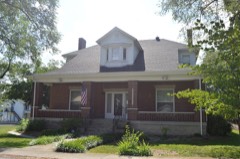 Dr. Pellie G. Graves Houselisted 2001
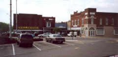 Scottsville Downtown Commercial Historic Districtlisted 2001
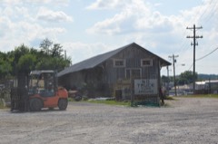 Scottsville Freight Depotlisted 2001
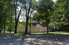 Tabernacle, Thelisted 2001
 J.L. and Son Turner Buildinglisted 2001
- Allen County Poor Farmlisted 1991
- Dumont Hilllisted 2003
- Halcomb, Dr. Francis Joseph (F.J.) Jr., Houselisted 2018
- Edward and Julia Satterfield Houselisted 2005
- Scottsville Public Springlisted 2001
- Andrew M. Whitney House and Barnlisted 1994
Population over time
2 figuresScottsville grew from 4,226 to 4,299 between 2010 and 2020. These are the recorded population figures Wikidata holds for this place, reached through the Geographic Names Information System number this page is keyed on rather than by name, so they belong to this place and not to another of the same name. Most are census counts, but not all are: an early figure may be a founding or settlement estimate, and an estimate published within five years of a census is left out. The change column is computed, and is left blank where more than 20 years separate a figure from the one before it, because a gap that long is not a change between two counts.
| Year | People | Change |
|---|---|---|
| 2010 | 4,226 | |
| 2020 | 4,299 | +73 (+2%) |
Topographic sheets covering this place
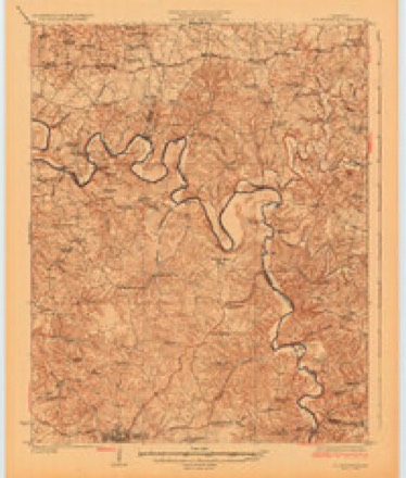
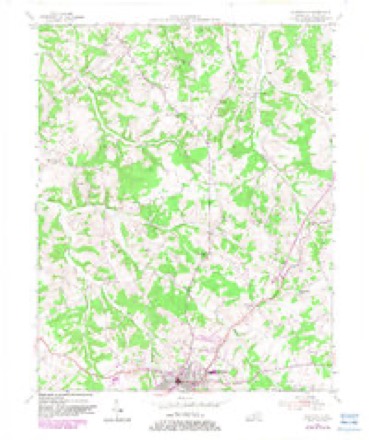
5 surveys from 11 printed sheetsMatched by testing this settlement's coordinate against the published boundary of every sheet in the United States Geological Survey's historical collection. Each opens the scanned sheet at the Survey.
- 1926 USGS Scottsville quadrangle1:62500
- 1954 USGS Scottsville quadrangle1:24000, 4 printings
- 1956 USGS Nashville quadrangle1:250000, 2 printings
- 1959 USGS Nashville quadrangle1:250000
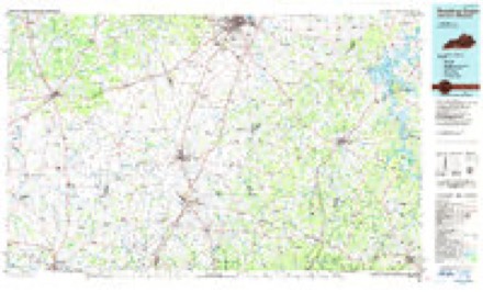
- 1985 USGS Bowling Green quadrangle1:100000, 3 printings
Mines and quarries near this place
1 within 5 milesRegional context, not property-specific evidence. The federal mineral resources record lists 1 working within 5 miles of Scottsville: 1 producer. All of them still produce. What was taken out: Stone, Crushed/Broken. Distance is straight-line from the map coordinates, so a quarry counted here may appear on a neighbouring settlement's page as well.
| Where | Site | Commodity | Status | Recorded |
|---|---|---|---|---|
| Allen County Quarry | Stone, Crushed/Broken | Producer |
Storms near this place
60 of 96 shownRegional context, not property-specific evidence. The National Weather Service names Scottsville in 96 storm reports between 1993 and 2025: 61 thunderstorm wind, 19 hail, 12 flash flood, 2 flood. The reports record 1 death. Each account below is quoted exactly as the forecast office filed it, from the NOAA Storm Events Database, and each date opens the federal record of that event.
| When | Event | Place named | Harm | What the report says |
|---|---|---|---|---|
| June 2019 | Thunderstorm Wind | Scottsville | 1 killed, $25,000 | Thunderstorm winds blew a tree onto a truck on Washington School Road northeast of Scottsville, killing the driver. |
| January 2008 | Thunderstorm Wind | Scottsville | $150,000 | Thunderstorm winds caused structural damage to homes in the vicinity of Highway 98 and Brownsford Road. |
| November 2002 | Tornado (F1) | Scottsville | $65,000 | Near New Roe, KY, a large mobile home was lifted into the air,twisted, and tumbled down a hill. The home did have substantial tie downs which were ripped from the ground. One of the tie downs was bent into a "U" shape. Debris was blown across New Roe Road, about a quarter mile away. Other tree damage and minor structural damage was noted downwind from the mobile home site. |
| May 2002 | Thunderstorm Wind | Scottsville | $50,000 | A radio station antenna was blown down, trees were downed, and windows were blown out. |
| July 2016 | Thunderstorm Wind | Scottsville | $35,000 | Local law enforcement reported multiple trees and power lines down throughout the county. Many roads were closed due to high water. |
| July 2009 | Tornado (EF1) | Scottsville | $25,000 | This short-lived tornado was on the ground for about a mile and a half. Along its path, the tornado did considerable damage to a a stand of substantially sized hardwood trees, some up to four feet in diameter. There was also damage to two barns and one home, where residents witnessed the tornado. |
| July 2004 | Thunderstorm Wind | Scottsville | $25,000 | A mobile home was blown about three feet off its foundation. Bales of hay were blown over. |
| August 2020 | Thunderstorm Wind | Scottsville | $10,000 | A tree fell on an unoccupied car at the intersection of Old Hartsville Road and Stovall Road. |
| July 2015 | Flash Flood | Scottsville | $5,000 | A trained spotter reported that a water rescue took place on Old Glascow Road as a result of intense rain rates and excessive rainfall amounts that flooded the road. |
| March 2006 | Thunderstorm Wind | Scottsville | $5,000 | Trees were downed on Old Hartsville Road. There was unspecified structural damage to a garage on Stovall Road. |
| April 1993 | Hail | Scottsville | $50 | no account filed |
| February 2025 | Flash Flood | Scottsville | - | Numerous roads were impassable across Allen County due to flash flooding. |
| April 2025 | Thunderstorm Wind | Scottsville | - | There were multiple trees and power poles down near the 400 block of Brownsford Road. |
| September 2025 | Thunderstorm Wind | Scottsville | - | A tree was down on a power line, resulting in a power outage. |
| May 2024 | Thunderstorm Wind | Scottsville | - | Several trees were downed across the south side of Scottsville. |
| September 2024 | Thunderstorm Wind | Scottsville | - | A few trees were blown down in downtown Scottsville. |
| July 2023 | Thunderstorm Wind | Scottsville | - | Trees and power lines were downed in Scottsville by strong thunderstorm winds. A few vehicles were damaged by the falling trees. |
| February 2022 | Thunderstorm Wind | Scottsville | - | A small building blew down, and a car was displaced about 40 feet. |
| July 2022 | Thunderstorm Wind | Scottsville | - | A tree fell near Old Glasgow Road, just off of Highway 98. |
| August 2020 | Thunderstorm Wind | Scottsville | - | A large tree fell on a power line and was burning. |
| August 2020 | Thunderstorm Wind | Scottsville | - | Trees blew down on side streets, including Walker Way and Lone Oak Drive, around Highway 100. |
| August 2020 | Thunderstorm Wind | Scottsville | - | A tree blew down in Southwest Park Subdivision. |
| June 2018 | Thunderstorm Wind | Scottsville | - | Trees were reported down in Scottsville. |
| May 2018 | Thunderstorm Wind | Scottsville | - | There were trees down across Maysville Road. |
| May 2017 | Flash Flood | Scottsville | - | Nearly 5 inches of rain was observed by the Kentucky Mesonet station near Scottsville. There were numerous reports of flooding. |
| May 2017 | Flash Flood | Scottsville | - | The Allen County COOP Observer reported flash flooding in Scottsville. There were many roads closed due to high water. |
| May 2017 | Flash Flood | Scottsville | - | The Allen County Emergency Manager reported numerous roads closed throughout the county due to flash flooding. |
| May 2017 | Flash Flood | Scottsville | - | Over 4 inches of rain fell in a short period which resulted in numerous reports of flooding. |
| April 2017 | Thunderstorm Wind | Scottsville | - | State officials reported trees down on Smiths Grove Road. |
| July 2016 | Thunderstorm Wind | Scottsville | - | Trees were reported down on Durham Springs Road. |
| July 2016 | Thunderstorm Wind | Scottsville | - | State officials reported trees down on Dover Church Road. |
| June 2015 | Thunderstorm Wind | Scottsville | - | A law enforcement official reported numerous trees down east of Scottsville toward Holland. |
| July 2015 | Thunderstorm Wind | Scottsville | - | An Allen County law enforcement official reported two trees down in the area. |
| April 2015 | Thunderstorm Wind | Scottsville | - | A tree was uprooted and fell on the front porch of a residence near E. Maple and 3rd St. |
| July 2015 | Flash Flood | Scottsville | - | An Allen County law enforcement official reported that several streets across town were were flooding and becoming impassable as a result of intense rain rates and excessive amounts of rainfall. |
| July 2015 | Flash Flood | Scottsville | - | A public report was received of flooding and high water at the Green Valley Apartments in Scottsville. |
| July 2015 | Flash Flood | Scottsville | - | A trained spotter reported that because of high water and flash flooding, Old Hartsville Road was closed. |
| July 2013 | Flood | Scottsville | - | Holland Road east of Scottsville was impassable due to high water. |
| January 2012 | Thunderstorm Wind | Scottsville | - | Local law enforcement reported scattered trees down county-wide. |
| July 2012 | Thunderstorm Wind | Scottsville | - | Local law enforcement reported that several trees were downed in Scottsville. |
| July 2012 | Thunderstorm Wind | Scottsville | - | The county road crew reported several trees down blocking local roads. Two trees fell across State Highways 2160 and 100 in Scottsville. Another tree fell across State Highway 482 at the 8 mile marker. |
| March 2011 | Hail | Scottsville | - | A spotter reported quarter sized hail. The spotter also relayed several reports of trees down, including one that had fallen on a moving vehicle on Old Hartsville Rd. |
| March 2011 | Thunderstorm Wind | Scottsville | - | A spotter relayed several reports of trees down, including one that had fallen on a moving vehicle on Old Hartsville Rd. |
| June 2011 | Thunderstorm Wind | Scottsville | - | Law enforcement reported numerous trees and power lines down across Scottsville and the surrounding area. |
| June 2011 | Thunderstorm Wind | Scottsville | - | Gusty winds knocked down 2 trees just north of Scottsville. |
| April 2010 | Thunderstorm Wind | Scottsville | - | A few trees were reported down and large limbs were broken. |
| February 2009 | Thunderstorm Wind | Scottsville | - | Several large limbs were downed by thunderstorm wind gusts. |
| May 2009 | Flash Flood | Scottsville | - | Water was reported over numerous roads with some roads closed. |
| June 2009 | Thunderstorm Wind | Scottsville | - | Trees were downed in Scottsville. |
| June 2009 | Thunderstorm Wind | Scottsville | - | Trees, telephone and power lines were downed across the county. A shed was blown over with power outages in parts of the county. |
| June 2009 | Thunderstorm Wind | Scottsville | - | Trees were downed in Scottsville. |
| June 2009 | Thunderstorm Wind | Scottsville | - | Trees were downed and lightning struck a power pole and knocked a traffic light into an intersection in Scottsville. |
| June 2009 | Thunderstorm Wind | Scottsville | - | Trees were downed in Scottsville. |
| July 2008 | Hail | Scottsville | - | Trees down in multiple locations in SW and Central Allen County. |
| July 2008 | Thunderstorm Wind | Scottsville | - | Trees were downed in multiple locations across Allen County. |
| April 2007 | Thunderstorm Wind | Scottsville | - | Several trees were downed. |
| June 2007 | Flash Flood | Scottsville | - | Some roads in downtown Scottsville were closed due to the West Bays Fork flowing out of its banks. |
| July 2006 | Thunderstorm Wind | Scottsville | - | Trees were downed. |
| May 2004 | Thunderstorm Wind | Scottsville | - | Numerous trees and power lines were downed. |
| May 2003 | Thunderstorm Wind | Scottsville | - | Trees were downed. |
Newspapers printed here
3,833 digitised pages3 papers published in this town, digitised by the Library of Congress and free to read: 824 issues, 3,833 pages. Every page is searchable, so a name or a street can be looked for directly in what the town printed about itself at the time.
| Newspaper | Published |
|---|---|
| The Citizen=times | 1918 to Current |
| The Citizen | 1908 to 1918 |
| The Allen County Times | 1890 to 1918 |
What the paper printed
31,813 wordsFront pages of the local paper, read from the Library of Congress scans: 12 issues spread across its run from 1911 to 1928, 31,813 words in total. Each is reproduced on its own page, exactly as the recogniser returned it.
These pages read less well than anything else here, and the number is worth stating: about three words in four come through cleanly, against nine in ten for the building records. An 1896 broadsheet sets eight-point type in seven columns on microfilm, which is the hardest thing in this archive to read by machine. We tested our own recognisers against the Library's and they were not better, so the Library's text is what appears, with the wholly unreadable columns removed. Read it as a guide to what the paper covered, and follow the link to the scan before quoting anything.
| Issue | Paper | Length |
|---|---|---|
| 1919-02-20 | The Citizen=times | 3,461 words |
| 1919-05-01 | The Citizen=times | 2,979 words |
| 1919-07-10 | The Citizen=times | 3,178 words |
| 1919-09-18 | The Citizen=times | 1,201 words |
| 1928-12-27 | The Citizen=times | 2,837 words |
| 1911-08-03 | The Citizen | 1,364 words |
| 1917-07-26 | The Citizen | 2,772 words |
| 1917-08-09 | The Citizen | 2,018 words |
| 1917-08-16 | The Citizen | 3,528 words |
| 1917-11-23 | The Allen County Times | 3,140 words |
| 1917-12-07 | The Allen County Times | 3,548 words |
| 1918-08-16 | The Allen County Times | 1,787 words |
Nearest settlements
The eight closest, with where each one stands in the county. Distances are straight-line, computed from the Geographic Names Information System coordinates.
| Map | Place | Distance | Sheets |
|---|---|---|---|
| White Plains (historical) | 1.7 miles | 12 | |
| Rodemer | 3.1 miles | 12 | |
| Petroleum | 5.0 miles | 12 | |
| West Fork | 5.2 miles | 13 | |
| Oak Forest | 5.5 miles | 10 | |
| Red Hill | 5.8 miles | 12 | |
| Halifax | 5.9 miles | 11 | |
| Chapel Hill | 5.9 miles | 12 |
Elsewhere
Matched on this settlement's Geographic Names Information System number rather than its name, so it cannot be a different place of the same name in another state.
| Wikipedia article on Scottsville | An encyclopaedic summary. Its text is share-alike, so it is linked here rather than copied. |
| Wikidata item Q765866 | The structured record the population and elevation above come from. Public domain (CC0). |
Provenance
This settlement is recorded in the Geographic Names Information System as feature 503118. The sheet list is computed by point-in-boundary test against the United States Geological Survey's historical topographic inventory. Both are works of the United States government and carry no copyright under 17 U.S.C. 105.
Mines and quarries. USGS Mineral Resources Data System (MRDS) https://mrdata.usgs.gov/mrds/ A work of the United States government, no copyright under 17 U.S.C. 105.
Storms. NOAA National Centers for Environmental Information, Storm Events Database https://www.ncei.noaa.gov/stormevents/ A work of the United States government, no copyright under 17 U.S.C. 105. Narratives are quoted verbatim from the National Weather Service report and are not edited or summarised.