 Block
From the record
12 National Register listings published here.
Sources: the National Register database, National Park Service
44 topographic sheets and 5 fire insurance atlases across 1 place.
12 National Register listings published here.
Sources: the National Register database, National Park Service
Every property in this county listed on the National Register of Historic Places, with the year it was listed and the federal nomination document.
| Photograph | Property | Type | Listed | Reference |
|---|---|---|---|---|
| Allen County Poor Farm | building | 1991 | 91001662 | |
| Big Spring School-Oliver Farmstead | district | 2004 | 03000712 | |
| Dumont Hill | site | 2003 | 03001227 | |
 | Dr. Pellie G. Graves House | building | 2001 | 01000798 |
| Halcomb, Dr. Francis Joseph (F.J.) Jr., House | building | 2018 | 100002152 | |
| Edward and Julia Satterfield House | building | 2005 | 05001304 | |
 | Scottsville Downtown Commercial Historic District | district | 2001 | 01000797 |
 | Scottsville Freight Depot | building | 2001 | 01000799 |
| Scottsville Public Spring | site | 2001 | 01000801 | |
 | Tabernacle, The | building | 2001 | 01000800 |
 | J.L. and Son Turner Building | building | 2001 | 01001253 |
| Andrew M. Whitney House and Barn | building | 1994 | 94000250 |
Sampled issues, machine-read from the Library of Congress scan and published page by page, so every headline and column is searchable text.
Scottsville, Ky., 1918 to Current. Machine-read from the Library of Congress scan.
Scottsville, Ky., 1908 to 1918. Machine-read from the Library of Congress scan.
Scottsville, Ky., 1890 to 1918. Machine-read from the Library of Congress scan.
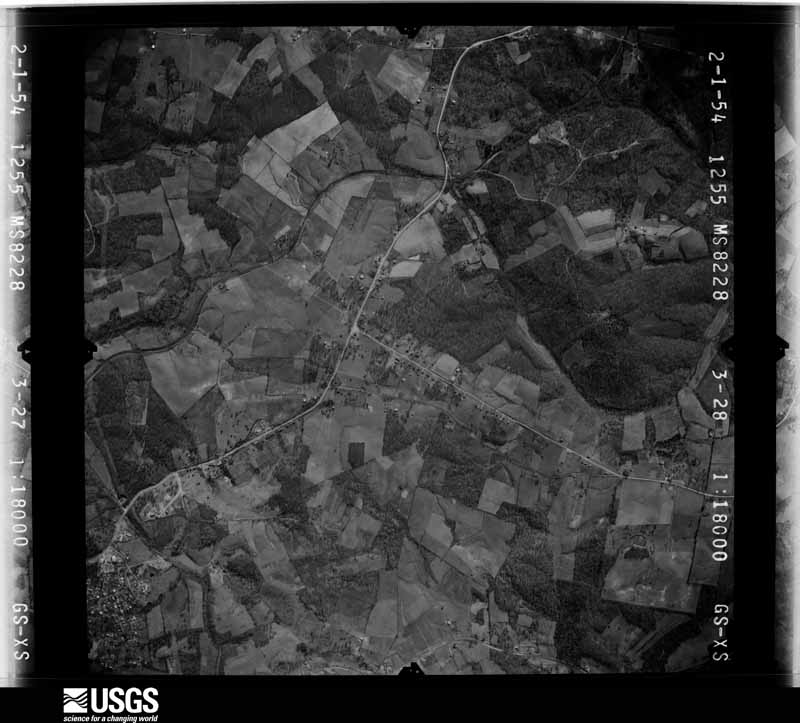
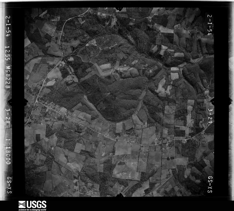
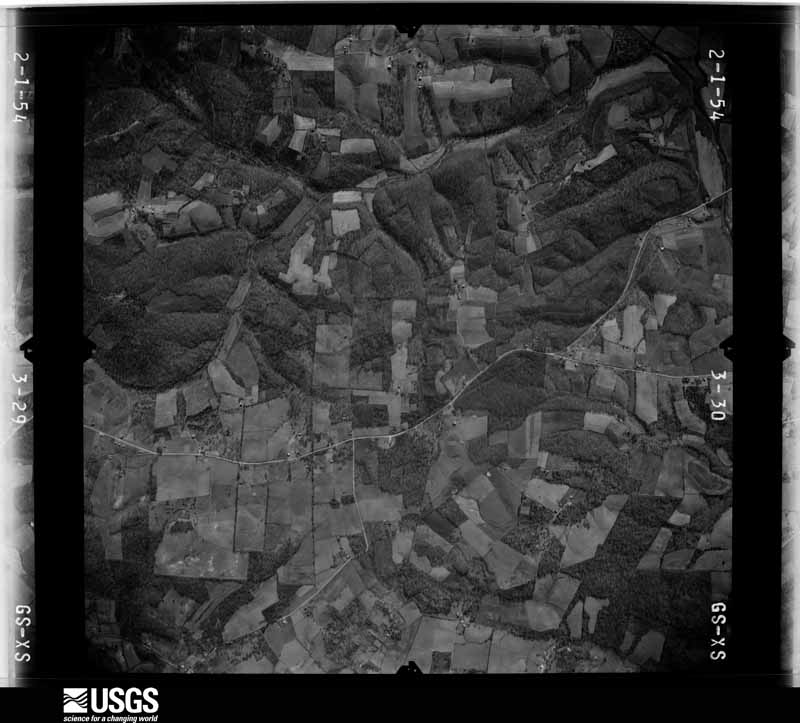
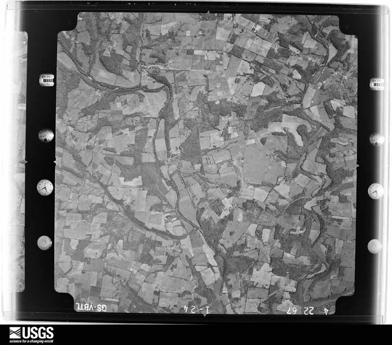
Flown by the U.S. Geological Survey between 1937 and 1989, the Aerial Photo Single Frames collection is the definitive mid-century view of the land: fields, roads and rivers as the camera saw them. The Survey holds 562 frames inside the rectangle that bounds this county; the 17 frames below were taken over the county itself, chosen across the decades of flights (at most four a year from that rectangle), so one flight cannot crowd out the rest. The full set is free to browse and download at EarthExplorer under the dataset Aerial Photo Single Frames.




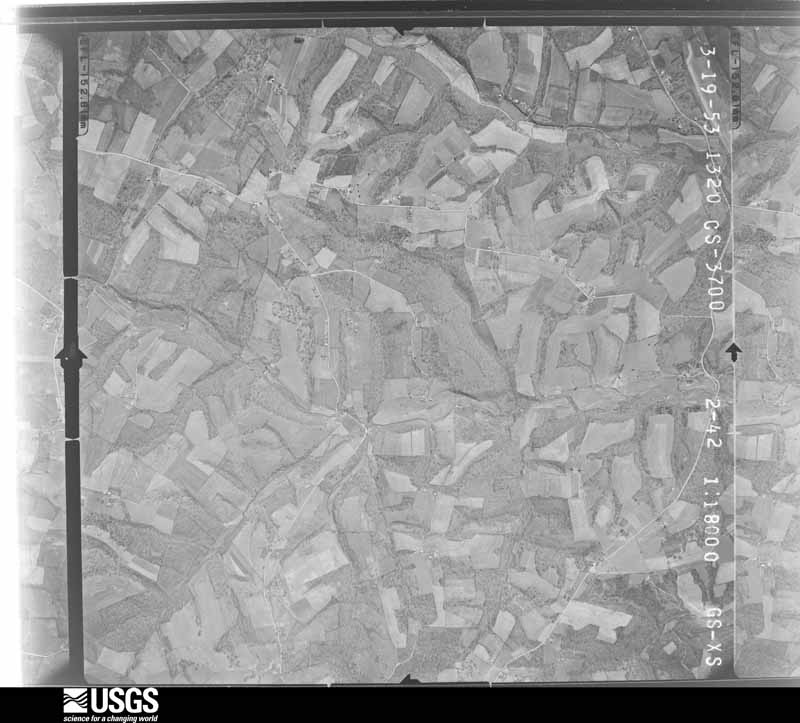
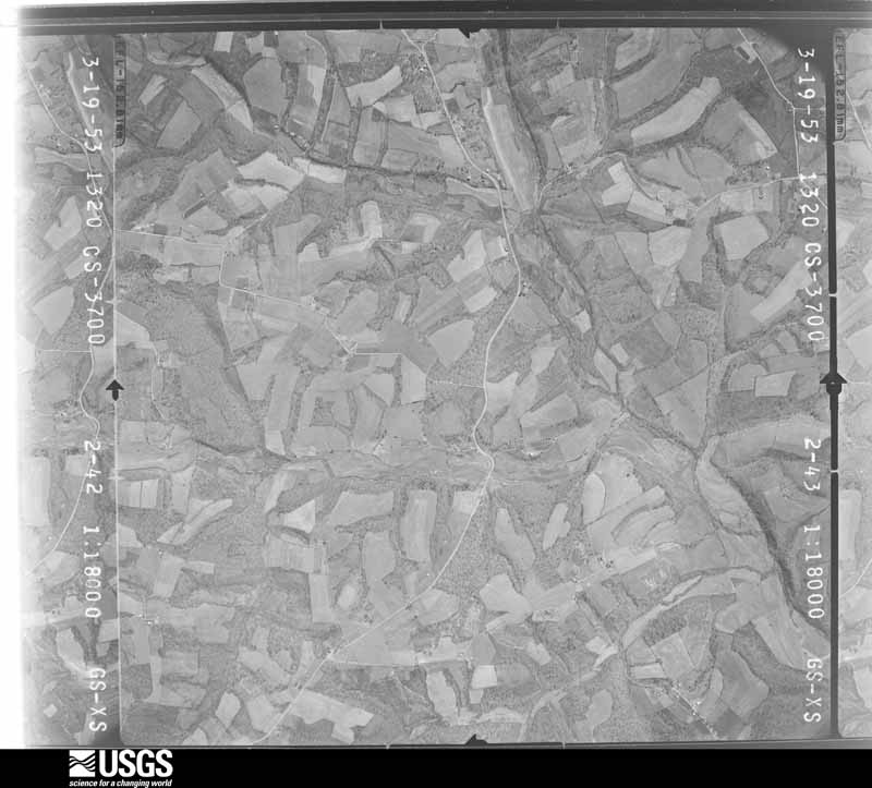

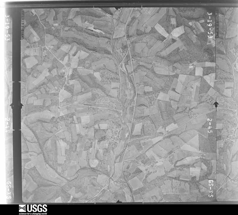
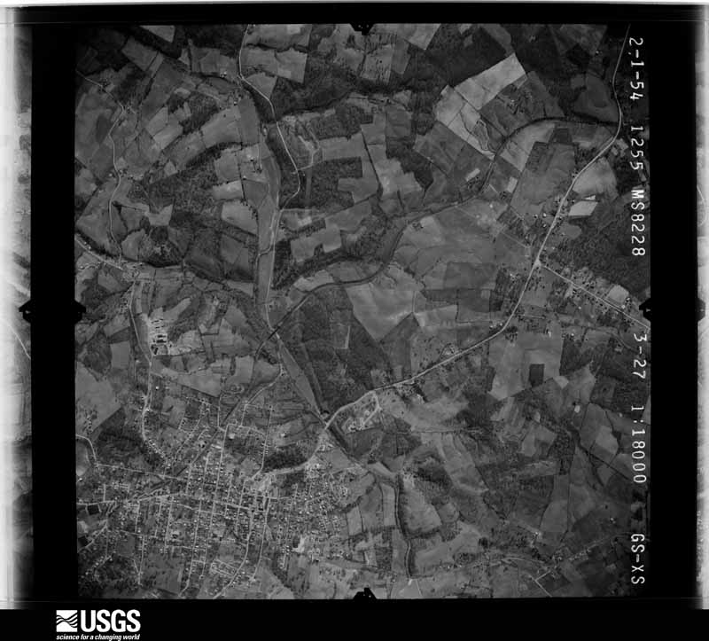




The thermometers that kept this county's weather, and the gages that measured the flow of its streams, as the federal records hold them. The extremes below are measured values from those records, not estimates.
Who lived here in 1950, one enumeration district at a time, as the Census Bureau described each district. Each row opens its official National Archives result, with Population Schedules and ED Maps available there.
Every wildfire the federal occurrence database records inside this county: 11 of them, burning about 102 acres. None started naturally and none was recorded as arson. Each settlement page carries the fires within five miles of it.
| Reported cause | Fires |
|---|---|
| Recreation and ceremony | 5 |
| Debris and open burning | 3 |
| Missing data/not specified/undetermined | 2 |
| Smoking | 1 |
The five largest, by the area the report gives. None of them was recorded as arson.
| Date | Cause | Size | Reported by | Name on the report |
|---|---|---|---|---|
| 9 February 2018 | Debris and open burning | 50 acres | Kentucky Division of Forestry | BROOKS RD. |
| 23 October 2010 | Debris and open burning | 34 acres | Kentucky Division of Forestry | LONG HOLLOW FIRE |
| 3 April 2007 | Debris and open burning | 8.0 acres | Kentucky Division of Forestry | not named |
| 27 February 2006 | Missing data/not specified/undetermined | 3.5 acres | Kentucky Division of Forestry | not named |
| 24 February 2002 | Recreation and ceremony | 2.0 acres | Kentucky Division of Forestry | not named |
| 24 October 1999 | Smoking | 1.0 acres | Kentucky Division of Forestry | not named |
| 24 February 2002 | Recreation and ceremony | 1.0 acres | Kentucky Division of Forestry | not named |
| 27 March 2007 | Recreation and ceremony | 1.0 acres | Kentucky Division of Forestry | not named |
Every settlement page carries the fires within five miles of it - see the settlement index below.
The NOAA Storm Events Database holds 234 reports for this county, causing 7 deaths, 12 injuries and about $2,576,050 in recorded property damage. Each settlement page carries the reports that name it.
| Kind of event | Reports |
|---|---|
| Thunderstorm Wind | 148 |
| Hail | 36 |
| Flash Flood | 30 |
| Flood | 10 |
| Tornado | 9 |
| Heavy Rain | 1 |
The most serious of them, by death, then injury, then recorded damage. The accounts are quoted exactly as the forecast office filed them.
| When | Event | Place named | Harm | What the report says |
|---|---|---|---|---|
| February 2008 | Tornado (EF3) | Amos | 4 killed, 11 hurt, $1,250,000 | The tornado destroyed 12 homes and mobile homes, mainly in the Amos community and in the Tracy Lane area. Many other homes and buildings were damaged. Four people were killed in the Tracy Lane area, and eleven others were injured in southeast Allen County. The tornado continued through rural and wooded sections of eastern Allen County, and crossed into Monroe County, Kentucky near the town of Fountain Run. |
| June 2019 | Thunderstorm Wind | Scottsville | 1 killed, $25,000 | Thunderstorm winds blew a tree onto a truck on Washington School Road northeast of Scottsville, killing the driver. |
| May 2010 | Flash Flood | Forest Spgs | 1 killed, $15,000 | Heavy rains caused flash flood on Snake Creek Road near Maple Grove Church Road. One person died when he reportedly got out of a vehicle that was overcome by flood waters and was swept away. M34VE. |
| May 2024 | Flash Flood | Forest Spgs | 1 killed | A 56 year old male attempted to cross the Blankenship Road bridge over Trammel Creek in southern Allen County. His vehicle was swept away and his body was found in the flood waters later on May 9th. |
| May 2010 | Flash Flood | Maynard | 1 hurt, $15,000 | Heavy rains continued to send flash flood waters over many roads in the county. A 72-year old male sustained a broken arm when flood waters washed his pickup off of KY Highway 482 near a bridge on Pleasant Ridge Church Road by the raging flood waters of Drakes Creek. A daring ladder truck rescue of the man from his truck - which was wedged into a fence by the flood waters - was captured on film by the editor of the local newspaper. |
| June 2019 | Tornado (EF1) | Amos | $300,000 | The National Weather Service conducted a storm damage survey across southeast Allen County to assess damage from the storms on Friday Evening, June 21. There was a significant amount of straight line wind damage across southern Allen County. Most of this damage had wind speeds between 60-65 mph all facing east southeast direction. There were two significant areas of straight line wind damage. There was a barn north of Amos on Highway 99. The second was two large barns just north of Hayesville, TN. ||Interspersed among the straight line wind damage was a tornado which first touched down a half mile east of Amos. A family farm had numerous trees twisted, snapped, and uprooted. Several barns sustained severe structural damage to the roofs. A dozen or so portions of two by fours were impaled into the ground in multiple directions. ||Further southeast on Highland Church Road numerous trees were uprooted and snapped with trees facing from the north northeast to the southeast direction. There was clear evidence that the tornado went to the Tennessee state line in Macon County as we could see trees snapped and uprooted on the state line which correlates well with the NWS Nashville storm survey across the Macon County line. ||At 2592 Highland Church Road (Highland General Baptist Church) there was significant brick damage on the west, south, and east sides of the church due to open vents. The survey crew zig zagged across roads south of Scottsville to Highway 31 but only found sporadic straight line tree and barn damage all facing a southeasterly direction. ||The very last concentrated area of damage the team found was at 444 Old Buck Creek Road were there was numerous softwood tree damage at the residence with power poles down across the road. |
| May 1989 | Tornado (F1) | not stated | $250,000 | no account filed |
| January 2008 | Thunderstorm Wind | Scottsville | $150,000 | Thunderstorm winds caused structural damage to homes in the vicinity of Highway 98 and Brownsford Road. |
| January 2008 | Thunderstorm Wind | Cedar Spgs | $80,000 | Thunderstorm winds destroyed a home near the Barren County line. |
| April 2008 | Flood | Halifax | $75,000 | Numerous roads were closed due to high water, including two state highways. On Scottsville Road, the roof of a building collapsed due to the weight of ponded water. |
| November 2002 | Tornado (F1) | Scottsville | $65,000 | Near New Roe, KY, a large mobile home was lifted into the air,twisted, and tumbled down a hill. The home did have substantial tie downs which were ripped from the ground. One of the tie downs was bent into a "U" shape. Debris was blown across New Roe Road, about a quarter mile away. Other tree damage and minor structural damage was noted downwind from the mobile home site. |
| June 2019 | Tornado (EF1) | Mt Aerial | $50,000 | The National Weather Service in conjunction with Allen County EMA conducted a storm survey across the western half of Allen County. There was significant straight line wind damage across much of the county facing an easterly and southeasterly direction. Interspersed with the straight line wind damage was at least one tornado across western Allen County north of and paralleling KY 585.||The tornado touched down near the Horseshoe Ford Road and Horseshoe Bend Road intersection. There were numerous large hardwood trees split, twisted, and uprooted facing from northerly to southeasterly. Horseshoe Bend Road was closed due to trees down across the road and from flooding. Winds in this area were estimated to be between 90 and 95 mph. Further east along Mayhew Road a large, well-built barn|was uplifted and removed from its foundation with several cedar and maple trees twisted and snapped. Across a farmer's field, corn was flattened and twisted in multiple directions. Large, heavy fuel tanks were rolled in two different directions on Mayhew Road. Several barns and outbuilding had roof damage as well.||At the Mayhew and Pope Road intersection there was extensive softwood and hardwood tree damage, especially around the Harmony|Missionary Baptist Church at 5226 Pope Road. Residents said there was a major pressure change with the tornado.||There were indications there may have been more than one tornado as tree positions would go from a tornadic circulation of northeasterly to southeasterly direction and then to all straight line wind damage in an easterly wind direction, then back to a tornadic circulation in multiple directions. Radar supports this ground analysis with mesovortices along the leading edge of the potent squall line. The width of the individual circulations varied between 75 and 125 yards with widespread straight line wind damage all around. Most of the wind damage was between 85 and 95 mph.||More tree and power line damage was along KY 585 near Shores Road. The tornado dissipated halfway between the intersection of KY 585 and Shores Road and the intersection of Shirk Road and Grider Drive.||The survey crew traveled all along southern Allen County south of Scottsville and found straight line winds facing east and southeasterly directions. |
| May 2002 | Thunderstorm Wind | Scottsville | $50,000 | A radio station antenna was blown down, trees were downed, and windows were blown out. |
| July 2016 | Thunderstorm Wind | Scottsville | $35,000 | Local law enforcement reported multiple trees and power lines down throughout the county. Many roads were closed due to high water. |
| July 2016 | Thunderstorm Wind | Pope | $30,000 | State officials reported trees down on Pope Road. Other trees down across the county resulted in power lines down as well. |
| April 2012 | Flash Flood | Adolphus | $30,000 | Allen County emergency management reported flash flooding near the intersection of Stafford Hollow Road and Andrew Jackson Highway. Several feet of water entered one home, making it uninhabitable. Several other homes were damaged. |
| July 2009 | Tornado (EF1) | Scottsville | $25,000 | This short-lived tornado was on the ground for about a mile and a half. Along its path, the tornado did considerable damage to a a stand of substantially sized hardwood trees, some up to four feet in diameter. There was also damage to two barns and one home, where residents witnessed the tornado. |
| July 2004 | Thunderstorm Wind | Scottsville | $25,000 | A mobile home was blown about three feet off its foundation. Bales of hay were blown over. |
| January 2013 | Thunderstorm Wind | Halifax | $15,000 | A barn along Ray Williams road two miles west of Settle was completely destroyed. |
| January 2013 | Thunderstorm Wind | Settle | $15,000 | Three homes had roof damage near Settle. Fifteen trees were also downed. |
| August 2020 | Thunderstorm Wind | Scottsville | $10,000 | A tree fell on an unoccupied car at the intersection of Old Hartsville Road and Stovall Road. |
| April 2017 | Thunderstorm Wind | Holland | $10,000 | Severe thunderstorm winds tore portions of a roof off a barn and tossed it onto nearby road. |
| January 2012 | Tornado (EF2) | Clare | $10,000 | A long tracked EF-2 tornado that started in Simpson County continued for another 5 and a quarter miles in Allen County. The twister entered Allen County where Highway 100 crosses Sulfur Fork Creek and uprooted many trees as it crossed over a rural area for several miles. Before lifting, the tornado damaged some homes along Walker Chapel Road about one half mile south of Highway 100. |
| May 1995 | Thunderstorm Wind | Scotsville | $10,000 | Several trees were blown down in Scotsville. |
| April 1998 | Tornado (F0) | Meador | $10,000 | no account filed |
| July 2015 | Flash Flood | Scottsville | $5,000 | A trained spotter reported that a water rescue took place on Old Glascow Road as a result of intense rain rates and excessive rainfall amounts that flooded the road. |
| January 2013 | Thunderstorm Wind | Oak Forest | $5,000 | An Allen County official reported that several barns had roof damage along Pitchford Ridge Road. |
| January 2013 | Thunderstorm Wind | Adolphus | $5,000 | Estimated 60 mph winds near Adolphus tore a portion of a barn's roof off. |
| March 2006 | Thunderstorm Wind | Scottsville | $5,000 | Trees were downed on Old Hartsville Road. There was unspecified structural damage to a garage on Stovall Road. |
| August 2004 | Thunderstorm Wind | Red Hill | $5,000 | Thunderstorm winds blew the underpinning out of a mobile home. An outbuilding was destroyed. A few trees were blown down, and some patio furniture was tossed around. |
| May 2003 | Thunderstorm Wind | Alonzo | $1,000 | A chicken coop was blown away. trees and power lines were downed. |
| April 1993 | Hail | Scottsville | $50 | no account filed |
| April 2026 | Thunderstorm Wind | Mt Zion | - | A tree was blocking the road at the intersection of Akersville Road and Ridge Top Road. |
| May 2025 | Flash Flood | Meador | - | Meader-Port Oliver Road was impassable due to flowing water over the roadway. |
| February 2025 | Flash Flood | Scottsville | - | Numerous roads were impassable across Allen County due to flash flooding. |
| April 2025 | Thunderstorm Wind | Scottsville | - | There were multiple trees and power poles down near the 400 block of Brownsford Road. |
| April 2025 | Thunderstorm Wind | Petroleum | - | There were multiple trees down near the 3900 block of Old Gallatin Road. |
| December 2025 | Thunderstorm Wind | Halifax | - | Multiple reports of trees down in Allen County. Tree damage was observed along Halifax Road, Alonzo Long Hollow Road, Franklin Road, and Smiths Grove Road. |
| September 2025 | Thunderstorm Wind | Scottsville | - | A tree was down on a power line, resulting in a power outage. |
| May 2024 | Flash Flood | Petroleum | - | Two water rescues had to be performed, and numerous roads were closed across Allen County due to flash flooding. |
| May 2024 | Thunderstorm Wind | Holland | - | Trained spotter estimated 60 mph wind gusts in southeastern Allen County. |
| May 2024 | Thunderstorm Wind | Scottsville | - | Several trees were downed across the south side of Scottsville. |
| September 2024 | Thunderstorm Wind | Cedar Spgs | - | Trees were blown down on J W York Road. |
| September 2024 | Thunderstorm Wind | Scottsville | - | A few trees were blown down in downtown Scottsville. |
| September 2024 | Thunderstorm Wind | Cedar Spgs | - | Trees were blown down along Old Glasgow Road. |
| March 2023 | Thunderstorm Wind | Allen Spgs | - | Dispatch reported a tree and power line down on Allen Springs Road. |
| June 2023 | Thunderstorm Wind | Holland | - | There was a tree down in a yard. |
| June 2023 | Hail | Halfway | - | Quarter sized hail observed near Halfway. |
| July 2023 | Thunderstorm Wind | Scottsville | - | Trees and power lines were downed in Scottsville by strong thunderstorm winds. A few vehicles were damaged by the falling trees. |
| July 2023 | Thunderstorm Wind | Petroleum | - | Trees were blown down onto multiple roads across Allen County. |
| February 2022 | Thunderstorm Wind | Scottsville | - | A small building blew down, and a car was displaced about 40 feet. |
| April 2022 | Thunderstorm Wind | Halifax | - | There was wind damage to the roof of a barn. Half the roof was blown off. |
| July 2022 | Thunderstorm Wind | Scottsville | - | A tree fell near Old Glasgow Road, just off of Highway 98. |
| March 2021 | Thunderstorm Wind | Trammel | - | A photo showed a willow tree that was uprooted and fell on a shed. |
| March 2021 | Thunderstorm Wind | Mt Aerial | - | A photo showed half of a cedar tree on the west side of Kentucky 585, just north of Kentucky 1332, while the other half of the tree was on the east side of the road. |
| March 2021 | Thunderstorm Wind | Mt Aerial | - | Photos showed damage to a metal barn roof. |
| March 2021 | Thunderstorm Wind | Allen Spgs | - | A power meter and roofing were blown off of a house and damaged. Trees and a power pole were blown down in the same area. |
| March 2021 | Thunderstorm Wind | Settle | - | A photo showed a tree down on a home in northwestern Allen County. |
| March 2020 | Tornado (EF1) | Bayfork | - | Most of the damage was around the southeastern portion of the Alvaton community, east of Bowling Green. Several trees were either uprooted or pushed over, facing from the west-southwest to the east-northeast just west of Highway 231 on Fairview Road. The wind swath was about 200 yards wide. Just east of Highway 231 a large 40 x 60 storage barn for a camper had its roof partially lifted downwind to the east northeast. The metal siding was flung up to 150 yards into the trees. The tree damage continued along Alvaton- Scottsville Road into Marble Gate Ct. Several homes sustained roof damage, with several porches partially lifted up causing structural damage. One home on Marble Gate Court had four 20-pound steel chairs flung about 50 yards and the 35-pound table thrown 25 yards. Portions of the porch covering were blown 125 yards into the yard of their next-door neighbors yard, 2 of which punctured the house like a flying 2 by 4 missile. There were also portions of the deck impaled in the ground. The damage swatch then increased to about 225 yards and winds increased to 80 to 85 mph. There were at least three trees laying on homes.||Just east off Claypool Boyce Road... there was a distinct change in the tree pattern. Instead of just going to the northeast trees were now going to the northwest, north and northeast. A large 2 x 8 went flying and got wedged between the windshield wiper and the windshield but incredibly did not crack the windshield. This is where a small tornado formed within the straight-line wind path, with winds between 80 and 85 mph. Residents reported half inch hail, followed by a surge in lightning, then quiet, then a 20 second loud roar with popping in their ears followed by complete silence again. Further east in the 500 block of Kara Court, there was significant tree damage with the back of the house being uplifted and insulation being thrown upwind and downwind around the back of the house. Trees were laying in all directions with lots of twisting and many snapped trees. At the 200 block of Cross Creek Court, the clearest evidence of trees are facing all eight inter-cardinal headings. In this area, trees were snapped and uprooted all over the place. ||The survey team estimated well over 500 trees in a 1 mile stretch had been uprooted snapped or pushed over. Two of the snapped trees landed on pick up trucks. Winds increased to EF1 range of 95 mph and a width of 225 yards. At the 2400 block of WG Talley Road was the most significant damage of the entire survey. Three barns were destroyed, 2 of them were concreted in strong firm footers. One of the barns was 30 x 80, one was 150 x 100, and one was 12 x 16 along with numerous sheds destroyed, and debris was thrown in all directions downwind up to 500 yards. A 5000 pound horse trailer was thrown to the northwest 70 yards. ||A very well-built family residence took a direct hit from an EF2 tornado, with the front side of the home having the plywood exposed and with most of the shingles gone but the rest of the house fully intact due to the house having all the proper clips, braces, and rebar. Wind speeds at this point were 116 mph with a width of 250 yards. EF-1 Tree damage continued into Allen County along Allen Springs Road. The tornado lifted just north of Bailey School Road in far NW Allen County. |
| March 2020 | Thunderstorm Wind | Settle | - | Multiple trees were reported down near Cemetery Road and Shockley Road. |
The Survey's mineral resources record lists 2 workings inside this county. 1 still produces and 1 is closed or unrecorded. Each settlement page carries the workings within five miles of it.
| Commodity | Workings |
|---|---|
| Uranium, Oil Shale | 1 |
| Stone, Crushed/Broken | 1 |
The least common of them first, because a county's hundredth gravel pit says nothing its first ten did not.
| Where | Site | Commodity | Status | Recorded |
|---|---|---|---|---|
| Allen County Quarry | Stone, Crushed/Broken | Producer | ||
| Outcrop Sample For Uranium | Uranium, Oil Shale | Occurrence |
Named settlements recorded in the Geographic Names Information System, each with the topographic sheets covering it. Villages, hamlets and abandoned places alike. Each is shown with the nearest named watercourse or landform and the survey quadrangle it falls on. The 1 place that was also surveyed for fire insurance comes first, with the number of atlases and photographs held for them.
Scottsville census division · 42164 · On Jacks Hollowk Branch · Scottsville quadrangle
11 sheets, 1926 to 1985
Fire insurance: 5 atlases
Adolphus census division · 42120 · On Rock Quarry Branch · Adolphus quadrangle
12 sheets, 1928 to 1985
Adolphus census division · 42120 · Near Long Hollow · Adolphus quadrangle
12 sheets, 1928 to 1985
Settle census division · 42164 · Allen Springs quadrangle
13 sheets, 1921 to 1985
No longer a settlement
Halfway census division · 42164 · On Johns Creek · Allen Springs quadrangle
13 sheets, 1921 to 1985
Adolphus census division · 42164 · On Wolf Branch · Adolphus quadrangle
12 sheets, 1928 to 1985
Halfway census division · 42134 · On Smyrna Creek · Hickory Flat quadrangle
12 sheets, 1928 to 1985
Settle census division · 42164 · On Solomon Creek · Scottsville quadrangle
11 sheets, 1926 to 1985
Settle census division · 42164 · On West Bays Fork · Scottsville quadrangle
11 sheets, 1926 to 1985
Scottsville census division · 42164 · Near Pea Ridge · Austin quadrangle
12 sheets, 1926 to 1985
Halfway census division · 42164 · On Hams Branch · Drake quadrangle
14 sheets, 1921 to 1985
Holland census division · 42164 · Petroleum quadrangle
12 sheets, 1931 to 1985
No longer a settlement
Scottsville census division · 42164 · On Dry Creek · Holland quadrangle
10 sheets, 1931 to 1985
Adolphus census division · 42120 · On Little Trammel Creek · Petroleum quadrangle
12 sheets, 1931 to 1985
Settle census division · 42164 · On Sulphur Creek · Allen Springs quadrangle
13 sheets, 1921 to 1985
Adolphus census division · 42164 · On Snyder Branch · Adolphus quadrangle
12 sheets, 1928 to 1985
Scottsville census division · 42164 · On Watkins Branch · Petroleum quadrangle
12 sheets, 1931 to 1985
Adolphus census division · 42134 · On Smyrna Creek · Hickory Flat quadrangle
12 sheets, 1928 to 1985
No longer a settlement
Settle census division · 42164 · On Lick Branch · Meador quadrangle
9 sheets, 1926 to 1985
No longer a settlement
Adolphus census division · 42120 · Near Wagoner Hollow · Petroleum quadrangle
12 sheets, 1931 to 1985
Holland census division · 42164 · On Benedict Branch · Holland quadrangle
10 sheets, 1931 to 1985
Halfway census division · 42164 · On Lancaster Branch · Allen Springs quadrangle
13 sheets, 1921 to 1985
Scottsville census division · 42164 · On Watkins Branch · Petroleum quadrangle
12 sheets, 1931 to 1985
No longer a settlement
The vanished settlements of Allen County: the places named above that are no longer on the map.
11 topographic sheets and 5 fire insurance atlases, 1903 to 1940