 Block
Smithland, Kentucky
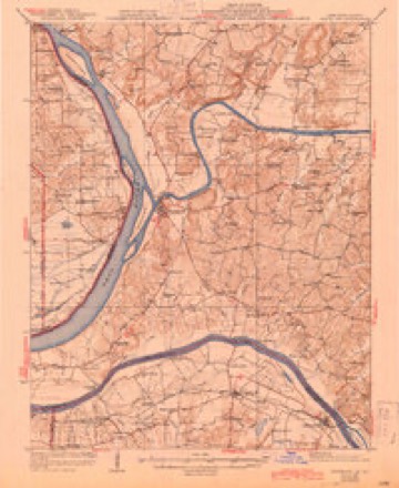
21 topographic sheets cover this place, the earliest surveyed in 1929 and the latest in 1996. It stands in the Smithland census division. It lies in ZIP code area 42081. It lies near Cemetery Hill. The Survey maps it on the Smithland quadrangle. 240 people lived here at the 2020 count. It stands 348 feet above sea level.
Research this city
On record in Smithland
Buildings and businesses the archive holds for this place. Each opens its own page, with the source record it came from.
On the National Register 6 records
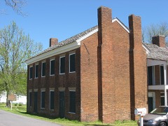 Gower Houselisted 1973
 Livingston County Courthouse and Clerk's Officeslisted 2011
 Mantle Rock Archeological Districtlisted 2004
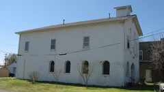 Masonic Hall-Federal Commissary Buildinglisted 1998
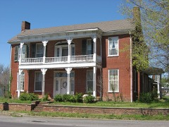 Richard Olive Houselisted 1982
- Fort Starlisted 1998
Population over time
2 figuresSmithland fell from 301 to 240 between 2010 and 2020. These are the recorded population figures Wikidata holds for this place, reached through the Geographic Names Information System number this page is keyed on rather than by name, so they belong to this place and not to another of the same name. Most are census counts, but not all are: an early figure may be a founding or settlement estimate, and an estimate published within five years of a census is left out. The change column is computed, and is left blank where more than 20 years separate a figure from the one before it, because a gap that long is not a change between two counts.
| Year | People | Change |
|---|---|---|
| 2010 | 301 | |
| 2020 | 240 | -61 (-20%) |
Topographic sheets covering this place
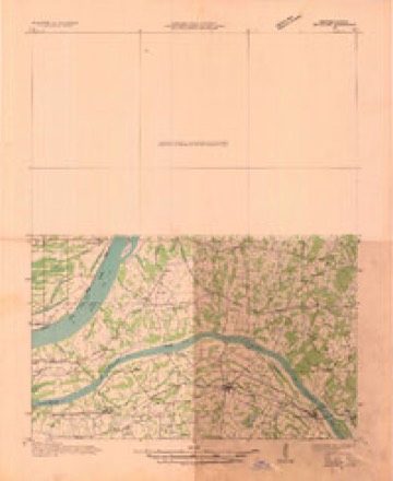
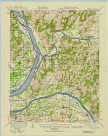
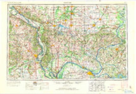
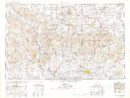
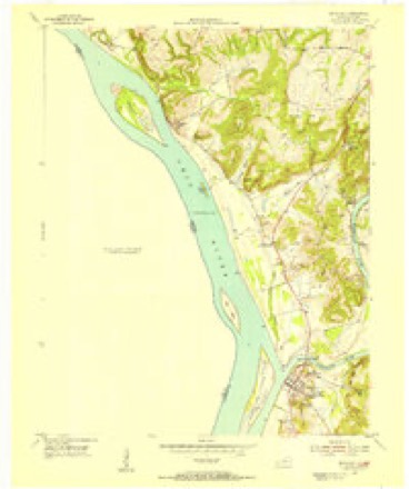
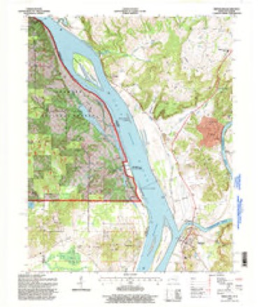
14 surveys from 21 printed sheetsMatched by testing this settlement's coordinate against the published boundary of every sheet in the United States Geological Survey's historical collection. Each opens the scanned sheet at the Survey.
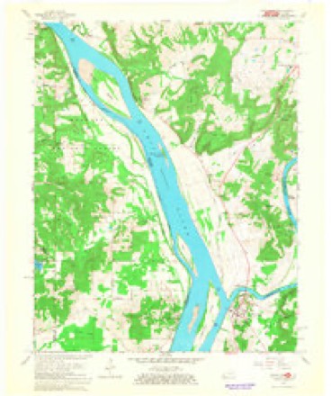
- 1929 USGS Smithland quadrangle1:62500, 3 printings
- 1936 USGS Smithland quadrangle1:48000
- 1942 USGS Smithland quadrangle1:62500
- 1949 USGS Paducah quadrangle1:250000, 2 printings
- 1950 USGS Paducah quadrangle1:250000
- 1954 USGS Paducah quadrangle1:250000, 2 printings
- 1954 USGS Smithland quadrangle1:24000
- 1961 USGS Paducah quadrangle1:250000, 2 printings
- 1964 USGS Paducah quadrangle1:250000, 2 printings
- 1967 USGS Smithland quadrangle1:24000, 2 printings
- 1984 USGS Paducah quadrangle1:100000
- 1986 USGS Paducah quadrangle1:100000
- 1987 USGS Paducah quadrangle1:250000
- 1996 USGS Smithland quadrangle1:24000
Fires near this place
17 since 1999Regional context, not property-specific evidence. The federal wildfire occurrence database lists 17 fires within 5 miles of Smithland between 1999 and 2020, burning about 205 acres in total. None started naturally. 1 was recorded as arson. Distance is straight-line from the map coordinates, so a fire counted here may appear on a neighbouring settlement's page as well.
| Reported cause | Fires |
|---|---|
| Missing data/not specified/undetermined | 9 |
| Recreation and ceremony | 5 |
| Equipment and vehicle use | 1 |
| Railroad operations and maintenance | 1 |
| Arson/incendiarism | 1 |
The most recent of them, most recent first, with the day each was reported and the service that recorded it.
| Date | Cause | Size | Reported by | Name on the report |
|---|---|---|---|---|
| 6 September 2010 | Recreation and ceremony | 12 acres | Kentucky Division of Forestry | SCOTTS CHAPEL RD. |
| 13 September 2008 | Recreation and ceremony | 50 acres | Kentucky Division of Forestry | not named |
| 7 August 2002 | Railroad operations and maintenance | 8.0 acres | Kentucky Division of Forestry | not named |
| 27 August 2007 | Missing data/not specified/undetermined | 2.0 acres | Kentucky Division of Forestry | not named |
| 19 June 2009 | Arson/incendiarism | 70 acres | Shawnee National Forest | POPE COUNTY |
| 22 May 2012 | Missing data/not specified/undetermined | 1.0 acres | Illinois Division of Forestry Resources | DOUGLASS |
| 22 April 2010 | Missing data/not specified/undetermined | 1.0 acres | Illinois Division of Forestry Resources | 1722 |
| 13 April 2011 | Missing data/not specified/undetermined | 1.0 acres | Kentucky Division of Forestry | MCCORMICK CREEK |
Settlements close enough to share some of these fires:
Mines and quarries near this place
4 within 5 milesRegional context, not property-specific evidence. The federal mineral resources record lists 4 workings within 5 miles of Smithland: 2 past producers, 1 prospect, 1 producer. 1 still produces. What was taken out: Stone, Crushed/Broken, Fluorine-Fluorite, Clay. Distance is straight-line from the map coordinates, so a quarry counted here may appear on a neighbouring settlement's page as well.
| Where | Site | Commodity | Status | Recorded |
|---|---|---|---|---|
| Royal Mine | Fluorine-Fluorite | Past Producer | ||
| Valley Divide Clay Bed | Clay | Prospect | ||
| Smithland Quarry | Stone, Crushed/Broken | Past Producer | ||
| Smithland Quarry | Stone, Crushed/Broken | Producer |
Storms near this place
56 since 1995Regional context, not property-specific evidence. The National Weather Service names Smithland in 56 storm reports between 1995 and 2025: 15 thunderstorm wind, 14 hail, 14 flood, 6 flash flood. The reports record 2 injuries. Each account below is quoted exactly as the forecast office filed it, from the NOAA Storm Events Database, and each date opens the federal record of that event.
| When | Event | Place named | Harm | What the report says |
|---|---|---|---|---|
| May 2009 | Thunderstorm Wind | Smithland | 1 hurt, $60,000 | A poorly tied-down mobile home was moved several feet. An occupant of the mobile home sustained minor to moderate injuries. Two metal sheds were blown down. A number of trees were either snapped or uprooted. Several telephone poles were blown over. The microburst damage area was about one-half mile in length and width. |
| May 1996 | Thunderstorm Wind | Smithland | 1 hurt, $40,000 | no account filed |
| November 2013 | Tornado (EF2) | Smithland | $400,000 | The tornado moved across the Ohio River from Pope County, Illinois into Livingston County, Kentucky. The tornado passed just south of Smithland. The most intense damage in Livingston County was rated EF-2 with estimated 125 mph peak winds. Several mobile homes were destroyed. Thousands of trees were snapped or uprooted as the tornado passed mainly through forested hilly terrain. The black tornado funnel was videotaped as it moved across parts of the county. The tornado continued east into Lyon County, Kentucky. The total path length of this tornado was 42 miles. The parent supercell tracked from southeast Missouri across the Mississippi River through the Paducah area, then east to the Kentucky Lake area of western Kentucky. |
| June 2019 | Tornado (EF1) | Smithland | $100,000 | This tornado began on the south side of town and peeled the roof back on a church. A mobile home was destroyed. Other homes in the path sustained minor roof damage. Large trees were snapped, and numerous large branches were down. There was also minor damage to a gas station canopy. Peak winds were estimated near 110 mph. |
| March 1997 | Flash Flood | Smithland | $100,000 | no account filed |
| June 2007 | Thunderstorm Wind | Smithland | $35,000 | Numerous trees were blown down along Kentucky Highway 453. One of the trees landed on a house, trapping a person inside. Another tree landed on a car. The highway was closed for over an hour. No injuries were reported. |
| January 2008 | Thunderstorm Wind | Smithland | $20,000 | Numerous trees were down, blocking roadways countywide. A horse trailer was blown over on U.S. Highway 60. |
| May 2010 | Flash Flood | Smithland | $10,000 | Kentucky Highway 866 was closed over the Gum Fork Creek due to possible bridge damage. Kentucky Highway 453 was under eight inches of water near Smithland. |
| June 2000 | Thunderstorm Wind | Smithland | $10,000 | Several trees were down in Burna, and several large tree limbs were down in Smithland. |
| December 2008 | Thunderstorm Wind | Smithland | $9,000 | Several trees were down throughout the county. |
| June 2011 | Thunderstorm Wind | Smithland | $5,000 | Large tree limbs were down. Siding was blown off a house. |
| January 2000 | Thunderstorm Wind | Smithland | $5,000 | About 8 telephone poles were blown over. Shingles and tin roofs were blown off. |
| September 2001 | Hail | Smithland | $4,000 | no account filed |
| April 2015 | Flood | Smithland | $3,000 | Minor flooding occurred along the Ohio River. Low-lying woods and bottomland fields were inundated. A private campground at Birdsville was flooded. |
| December 2015 | Flood | Smithland | $2,000 | Minor flooding occurred along the Ohio River from Smithland upriver past Birdsville. Low-lying bottomland woods and fields were flooded, including parts of a private campground. The flooding continued into early January. |
| May 2010 | Flood | Smithland | $2,000 | Minor flooding occurred on the Ohio River in the Smithland area. Low-lying bottomland fields and woodlands were inundated. A campground in Birdsville was flooded. |
| July 1997 | Thunderstorm Wind | Smithland | $2,000 | A couple of trees were down. |
| May 2017 | Thunderstorm Wind | Smithland | $1,000 | A tree was blown down along the Ohio River riverfront. |
| February 2025 | Flood | Smithland | - | Minor flooding of bottomland and surrounding low-lying areas occurred near Smithland. |
| May 2025 | Hail | Smithland | - | Multiple reports of hail came in from Smithland, with the larger stones measuring from golf ball to tennis ball size. |
| May 2024 | Tornado (EFU) | Smithland | - | There were two separate video recordings of a brief tornado touchdown just east of U.S. Hwy 60 and south of Cutoff Rd. The intensity remains unknown as the touchdown location was not accessible by NWS Storm Surveyors. |
| April 2023 | Thunderstorm Wind | Smithland | - | Thunderstorm outflow winds were estimated to be gusting to 60 mph. The winds were out ahead of the leading edge of rain. |
| February 2022 | Flood | Smithland | - | The Ohio River rose above flood stage and remained there into March. The crest occurred in March. |
| March 2020 | Flood | Smithland | - | Minor flooding occurred on the Ohio River, affecting mainly bottomland woods and fields. However, a few lesser travelled rural roads were affected. |
| January 2016 | Flood | Smithland | - | Minor flooding continued into January along the Ohio River. Low-lying bottomland woods and fields were flooded, including parts of a private campground near Birdsville. |
| November 2015 | Heavy Rain | Smithland | - | A co-operative observer at Smithland Lock and Dam on the Ohio River measured 3.21 inches in the past 48 hours. |
| August 2013 | Thunderstorm Wind | Smithland | - | A wind gust to 60 mph was estimated by law enforcement personnel. |
| March 2012 | Hail | Smithland | - | Quarter size hail was reported just north of Smithland. |
| April 2011 | Hail | Smithland | - | Golf-ball size hail fell on U.S. Highway 60 between Smithland and Ledbetter. This was the same storm that produced large hail in northwest Marshall County. |
| April 2011 | Flood | Smithland | - | Due to flooding of the Ohio River, there was extensive sandbagging, and a temporary levee was constructed around Smithland. Homeowners were evacuated from Smithland and many other low-lying areas from Birdsville to Ledbetter. Temporary shelters were set up for evacuees. Floodwaters entered a gas station on U.S. Highway 60 in Smithland. Several state roads were closed, along with numerous county roads. |
| April 2008 | Flood | Smithland | - | Minor flooding of the Ohio River occurred. At Smithland, the river remained above flood stage from mid March through mid April. The crest in April was 44.93 feet on the 11th. Flood stage at Smithland is 40 feet. Many low-lying areas were flooded, primarily farm fields and woodlands. Highways 133 and 135 were closed near the Ohio River. |
| May 2006 | Thunderstorm Wind | Smithland | - | Several trees were blown down at the intersection of U.S. Highway 60 and Highway 937. |
| May 2006 | Hail | Smithland | - | Quarter-size hail was reported near Smithland. Dime-size hail fell at U.S. Highway 60 and Highway 937, about four miles south of Smithland. |
| January 2004 | Lightning | Smithland | - | A lightning bolt struck a house, blowing a six-foot hole in the wall and starting a fire. The house was extensively damaged. A neighboring house caught fire, but it was not significantly damaged. |
| August 2004 | Heavy Rain | Smithland | - | From 15 to 18 inches of water was over Kentucky Highway 937 between U.S. Highway 60 and Highway 453. |
| October 2004 | Funnel Cloud | Smithland | - | This funnel cloud was associated with a supercell thunderstorm that began over southeast Missouri, then moved east along a warm front. The storm moved fairly close to the Ohio River, passing just north of Paducah before reaching Livingston County. This storm had a history of strong rotation during most of its life. |
| April 2003 | Flash Flood | Smithland | - | Two to three feet of water was reported in the basements of a couple homes. A foot of water was reported at the fire station at Smithland. Six to eight inches of water was over U.S. Highway 60 just west of Smithland. |
| June 2001 | Thunderstorm Wind | Smithland | - | Gusts were estimated between 55 and 60 MPH. |
| May 1997 | Flash Flood | Smithland | - | Slow moving thunderstorms produced rainfall amounts estimated as high as 3 inches in 3 hours from Smithland east across the county. Areas of major flooding affected Highways 60, 70, and 453, but no closures were reported. |
| March 2022 | Flood | Smithland | - | no account filed |
| April 2020 | Flood | Smithland | - | no account filed |
| January 2019 | Flood | Smithland | - | no account filed |
| April 2018 | Flood | Smithland | - | no account filed |
| April 2016 | Hail | Smithland | - | no account filed |
| April 2011 | Hail | Smithland | - | no account filed |
| December 2011 | Flood | Smithland | - | no account filed |
| June 2011 | Hail | Smithland | - | no account filed |
| June 2005 | Hail | Smithland | - | no account filed |
| April 2003 | Hail | Smithland | - | no account filed |
| April 2003 | Hail | Smithland | - | no account filed |
| June 2001 | Hail | Smithland | - | no account filed |
| June 1999 | Hail | Smithland | - | no account filed |
| June 1998 | Flash Flood | Smithland | - | no account filed |
| March 1997 | Flash Flood | Smithland | - | no account filed |
| April 1996 | Thunderstorm Wind | Smithland | - | no account filed |
| June 1995 | Hail | Smithland | - | no account filed |
Nearest settlements
The eight closest, with where each one stands in the county. Distances are straight-line, computed from the Geographic Names Information System coordinates.
| Map | Place | Distance | Sheets |
|---|---|---|---|
| Miller Landing | 3.4 miles | 21 | |
| Heater | 3.9 miles | 19 | |
| Lemen Landing | 4.8 miles | 19 | |
| Vicksburg | 4.9 miles | 19 | |
| Newbern | 5.9 miles | 23 | |
| Moxley Landing | 6.1 miles | 19 | |
| Birdsville | 6.1 miles | 21 | |
| Cooper Landing | 6.5 miles | 23 |
Elsewhere
Matched on this settlement's Geographic Names Information System number rather than its name, so it cannot be a different place of the same name in another state.
| Wikipedia article on Smithland | An encyclopaedic summary. Its text is share-alike, so it is linked here rather than copied. |
| Wikidata item Q3181116 | The structured record the population and elevation above come from. Public domain (CC0). |
Provenance
This settlement is recorded in the Geographic Names Information System as feature 503811. The sheet list is computed by point-in-boundary test against the United States Geological Survey's historical topographic inventory. Both are works of the United States government and carry no copyright under 17 U.S.C. 105.
Wildfire. Short, Karen C. 2022. Spatial wildfire occurrence data for the United States, 1992-2020 [FPA_FOD_20221014]. 6th Edition. Fort Collins, CO: Forest Service Research Data Archive. https://doi.org/10.2737/RDS-2013-0009.6 Collected with United States Government funding and usable without additional permissions or fees.
Mines and quarries. USGS Mineral Resources Data System (MRDS) https://mrdata.usgs.gov/mrds/ A work of the United States government, no copyright under 17 U.S.C. 105.
Storms. NOAA National Centers for Environmental Information, Storm Events Database https://www.ncei.noaa.gov/stormevents/ A work of the United States government, no copyright under 17 U.S.C. 105. Narratives are quoted verbatim from the National Weather Service report and are not edited or summarised.