 Block
Stanton, Kentucky
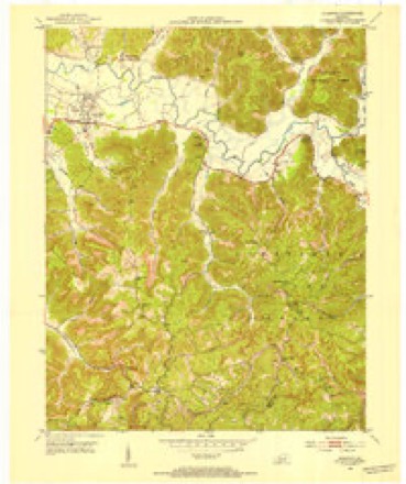
13 topographic sheets cover this place, the earliest surveyed in 1892 and the latest in 1982. It stands in the Stanton census division. It lies in ZIP code area 40380. It stands on Boone Branch. The Survey maps it on the Stanton quadrangle. 3,251 people lived here at the 2020 count. It stands 673 feet above sea level.
On record in Stanton
Buildings and businesses the archive holds for this place. Each opens its own page, with the source record it came from.
Surveyed buildings and structures 1 record
- Powell County Courthouse, Washington & Court Streets, Stantonfederal building survey, 16 photographs
Population over time
2 figuresStanton grew from 2,733 to 3,251 between 2010 and 2020. These are the recorded population figures Wikidata holds for this place, reached through the Geographic Names Information System number this page is keyed on rather than by name, so they belong to this place and not to another of the same name. Most are census counts, but not all are: an early figure may be a founding or settlement estimate, and an estimate published within five years of a census is left out. The change column is computed, and is left blank where more than 20 years separate a figure from the one before it, because a gap that long is not a change between two counts.
| Year | People | Change |
|---|---|---|
| 2010 | 2,733 | |
| 2020 | 3,251 | +518 (+19%) |
Topographic sheets covering this place
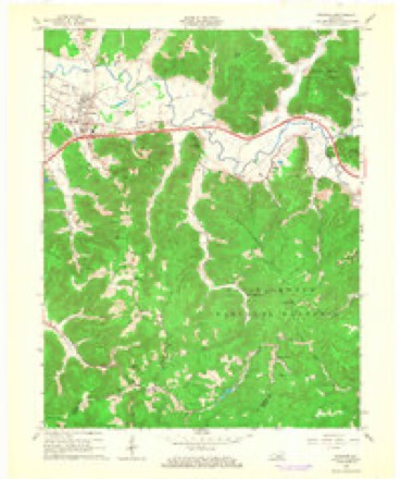
6 surveys from 13 printed sheetsMatched by testing this settlement's coordinate against the published boundary of every sheet in the United States Geological Survey's historical collection. Each opens the scanned sheet at the Survey.
- 1892 USGS Beattyville quadrangle1:125000, 6 printings
- 1952 USGS Stanton quadrangle1:24000
- 1957 USGS Jenkins quadrangle1:250000
- 1960 USGS Jenkins quadrangle1:250000
- 1966 USGS Stanton quadrangle1:24000, 3 printings
- 1982 USGS Irvine quadrangle1:100000

Photographs
1 photograph,Taken for the Office of War Information and the Farm Security Administration, who photographed the country between 1935 and 1944. Works of United States government photographers, with no known restriction on use. Each opens its catalogue record.
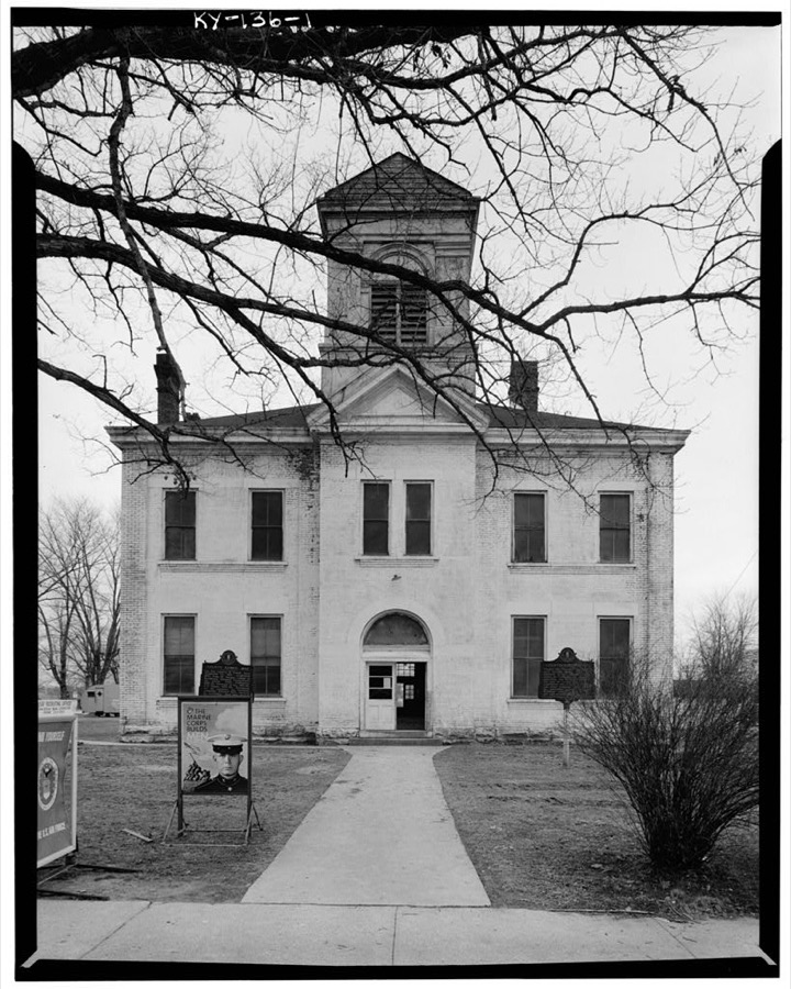
Photographer not recorded. Library of Congress
Fires near this place
76 since 1997Regional context, not property-specific evidence. The federal wildfire occurrence database lists 76 fires within 5 miles of Stanton between 1997 and 2020, burning about 562 acres in total. None started naturally. 12 were recorded as arson. Distance is straight-line from the map coordinates, so a fire counted here may appear on a neighbouring settlement's page as well.
| Reported cause | Fires |
|---|---|
| Debris and open burning | 26 |
| Recreation and ceremony | 20 |
| Missing data/not specified/undetermined | 16 |
| Arson/incendiarism | 12 |
| Railroad operations and maintenance | 1 |
| Misuse of fire by a minor | 1 |
The most recent of them, most recent first, with the day each was reported and the service that recorded it.
| Date | Cause | Size | Reported by | Name on the report |
|---|---|---|---|---|
| 29 September 2008 | Missing data/not specified/undetermined | 2.0 acres | Kentucky Division of Forestry | not named |
| 25 September 2019 | Arson/incendiarism | 1.0 acres | Kentucky Division of Forestry | CHARLIE LANE |
| 18 September 1999 | Recreation and ceremony | 1.0 acres | Kentucky Division of Forestry | not named |
| 14 September 2008 | Recreation and ceremony | 1.0 acres | Kentucky Division of Forestry | not named |
| 17 June 2007 | Recreation and ceremony | 10 acres | Kentucky Division of Forestry | not named |
| 15 June 2015 | Recreation and ceremony | 1.0 acres | Kentucky Division of Forestry | FIFE LICK |
| 21 May 2009 | Recreation and ceremony | 2.0 acres | Kentucky Division of Forestry | not named |
| 18 May 2000 | Debris and open burning | 25 acres | Kentucky Division of Forestry | not named |
Settlements close enough to share some of these fires:
Mines and quarries near this place
2 within 5 milesRegional context, not property-specific evidence. The federal mineral resources record lists 2 workings within 5 miles of Stanton: 2 producers. All of them still produce. What was taken out: Clay, Stone, Crushed/Broken. Distance is straight-line from the map coordinates, so a quarry counted here may appear on a neighbouring settlement's page as well.
| Where | Site | Commodity | Status | Recorded |
|---|---|---|---|---|
| 213 Quarry | Stone, Crushed/Broken | Producer | ||
| Drake 01 | Clay | Producer |
Storms near this place
60 of 98 shownRegional context, not property-specific evidence. The National Weather Service names Stanton in 98 storm reports between 1997 and 2025: 53 thunderstorm wind, 19 hail, 14 flash flood, 7 flood. The reports record 1 injury. Each account below is quoted exactly as the forecast office filed it, from the NOAA Storm Events Database, and each date opens the federal record of that event.
| When | Event | Place named | Harm | What the report says |
|---|---|---|---|---|
| June 1997 | Flash Flood | Stanton | 1 hurt, $3,300,000 | no account filed |
| March 1997 | Tornado (F0) | Stanton | $1,250,000 | no account filed |
| March 1997 | Tornado (F1) | Stanton | $500,000 | no account filed |
| June 2012 | Thunderstorm Wind | Stanton | $80,000 | There was roof damage on a house in Stanton and trees and power lines down county wide. |
| June 2010 | Thunderstorm Wind | Stanton | $50,000 | A roof was blown off of a house. Multiple trees were blown down. Power lines were blown down. |
| March 1997 | Thunderstorm Wind | Stanton | $50,000 | no account filed |
| February 2017 | Lightning | Stanton | $25,000 | A lightning strike caused a fire that destroyed a building on Paint Creek Road near Stanton. |
| June 2012 | Thunderstorm Wind | Stanton | $20,000 | Trees were blown down countywide. |
| July 2021 | Flash Flood | Stanton | $15,000 | Water was flowing over the road in the Brookside Cottages subdivision in Stanton, and made it into the Leasing Office. The force of the water cased the pavement on the road to break apart. |
| August 2024 | Thunderstorm Wind | Stanton | $10,000 | A tree was blown down and onto a structure in Stanton. Exact details, including location in Stanton, were not given. |
| June 2022 | Thunderstorm Wind | Stanton | $10,000 | The roof was blown off of an apartment complex in Stanton. |
| April 2007 | Thunderstorm Wind | Stanton | $7,000 | Seven trees blown down. |
| January 2012 | Thunderstorm Wind | Stanton | $6,000 | Trees were blown down and onto power lines in Stanton. |
| February 2009 | Thunderstorm Wind | Stanton | $3,000 | Large limbs were blown down by thunderstorm wind gusts. |
| August 2009 | Thunderstorm Wind | Stanton | $3,000 | A few trees were blown down at various locations around the county. |
| February 2012 | Thunderstorm Wind | Stanton | $2,000 | Large tree limbs were blown down on Mill Knob. |
| February 2009 | Thunderstorm Wind | Stanton | $2,000 | A county official observed large limbs down along Cane Creek Road. |
| May 1998 | Thunderstorm Wind | Stanton | $2,000 | Power lines were downed. |
| June 2024 | Thunderstorm Wind | Stanton | $1,000 | Dispatch received a report of a tree down against a power pole between Clay City and Stanton, around 2885 Stanton Road. |
| March 2015 | Flood | Stanton | $1,000 | Maple St at the Red River was closed due to flooding. |
| March 2015 | Flood | Stanton | $1,000 | Maple Street was flooded. |
| March 2015 | Flood | Stanton | $1,000 | Paint Creek was out of its banks and causing flooding, but nearby Hwy 615 was not flooded. |
| March 2015 | Flood | Stanton | $1,000 | The Red River left its banks and flooded Hwy 613. |
| June 2015 | Thunderstorm Wind | Stanton | $1,000 | A wind gust estimated at 50 mph was reported near Stanton. Small tree limbs were also blown down in the same area. |
| August 2014 | Flash Flood | Stanton | $1,000 | Two bridges were reported to have been washed out along Jerrica Leigh Lane just to the east of KY Hwy 213. |
| August 2013 | Flash Flood | Stanton | $1,000 | A resident of Willowbend Way in the Brookside Cottages subdivision in Stanton reported that 18-24 inches of water was flowing across the backyard of her residence and that 3 inches of water entered her garage. The water swept away the large trash can in front of her home and carried the full bags of trash to the other end of the subdivision. One other resident of Willowbend Way had water enter her home and an office building in the neighborhood had 2 inches of water inside at one point. |
| August 2013 | Flash Flood | Stanton | $1,000 | Knee deep water was flowing across the intersection of Washington Ave and Railroad Street. The water receded off the road around 335 pm. |
| August 2013 | Flash Flood | Stanton | $1,000 | Both Railroad St and Washington Ave were flooded. |
| July 2013 | Flash Flood | Stanton | $1,000 | Water was reported to have been flowing over portions of both East and West College Avenue and Airport Rd in Stanton. The roads were temporarily impassable. |
| February 2009 | Thunderstorm Wind | Stanton | $1,000 | A couple of large tree limbs were blown down. |
| September 2009 | Thunderstorm Wind | Stanton | $1,000 | Large tree limbs were blown down east of Stanton. |
| June 2008 | Thunderstorm Wind | Stanton | $1,000 | One tree was blown down by thunderstorm wind gusts on Upper Cane Creek Road. |
| April 2008 | Thunderstorm Wind | Stanton | $1,000 | A tree was blown down on Highway 1057. |
| June 2021 | Thunderstorm Wind | Stanton | $100 | An NWS employee reported a large tree snapped due to strong thunderstorm wind gusts along Pompeii Road, near the intersection with Thorpe Ridge Road. |
| September 2016 | Flash Flood | Stanton | $50 | A Kroger employee reported the store parking lot was inundated with water. Nearby ditches and Judy Creek overspilled their banks. Water rose over semi truck wheel wells as approximately three to four feet of water flooded loading dock ramps. |
| May 2025 | Thunderstorm Wind | Stanton | - | Multiple trees were blown down in the vicinity of Stanton. |
| May 2024 | Thunderstorm Wind | Stanton | - | Social media reported trees down blocking KY-213 at the brick plant just north of Stanton. |
| June 2021 | Thunderstorm Wind | Stanton | - | An NWS employee reported that strong thunderstorm wind gusts knocked down a small tree along KY-615, near the intersection with Thorpe Ridge Road. |
| July 2021 | Heavy Rain | Stanton | - | A member of the public reported a storm total precipitation amount of (estimated) 6 inches. |
| July 2021 | Flash Flood | Stanton | - | Powell County dispatch reported that all the primary streets in Stanton now have water over them. |
| December 2021 | Flood | Stanton | - | Maple Street (Pompeii Road) is closed and flooded by water of an unknown depth. |
| December 2019 | Flood | Stanton | - | A spotter observed water from the Red River spilling over onto Kentucky Highway 2026 northwest of Stanton, forcing the closure of the highway. |
| April 2018 | Thunderstorm Wind | Stanton | - | Dispatch reported that two trees were knocked down within the city limits of Stanton. |
| July 2018 | Thunderstorm Wind | Stanton | - | A Skywarn Spotter observed a large tree blown down off of Railroad Street in the Brookside Cottages Subdivision of Stanton. |
| May 2018 | Thunderstorm Wind | Stanton | - | Dispatch reported a large tree limb blown down in Stanton. |
| June 2016 | Thunderstorm Wind | Stanton | - | A trained spotter observed a 30 to 40 foot tree blown down southeast of Stanton. |
| July 2015 | Thunderstorm Wind | Stanton | - | A small tree was blown down. |
| July 2015 | Thunderstorm Wind | Stanton | - | A tree was blown down and onto Lower Hatcher Creek Road. |
| June 2015 | Hail | Stanton | - | Quarter size hail occurred near the UPS hub on Hwy 213 in Stanton. |
| June 2015 | Thunderstorm Wind | Stanton | - | A large tree limb 3 to 4 inches in diameter fell onto Hwy 15 just east of Stanton. |
| December 2013 | Thunderstorm Wind | Stanton | - | Trees were blown down on Furnace and Halls Roads. |
| August 2013 | Flash Flood | Stanton | - | Eighteen inches of water were flowing across Willow Bend Way in the Brookside Cottages subdivision. |
| June 2013 | Thunderstorm Wind | Stanton | - | A tree was blown down on East College Ave. |
| July 2012 | Thunderstorm Wind | Stanton | - | A tree was blown down on East Pendleton St. |
| July 2012 | Thunderstorm Wind | Stanton | - | Power lines were blown down on George Drake Rd.. |
| February 2012 | Hail | Stanton | - | Quarter size hail was reported in Stanton. |
| April 2011 | Hail | Stanton | - | The hail was the size of half dollars. |
| April 2011 | Hail | Stanton | - | The hail was the size of golf balls. |
| April 2011 | Thunderstorm Wind | Stanton | - | Utility poles were snapped off near the middle school. |
| May 2010 | Flood | Stanton | - | A large amount of flooding occurred along Boone Street in Stanton. Yards were flooded almost up to porches in some cases with up to a foot of water in lower lying areas. Many small tree limbs had been blown down. Six inches of storm total rainfall was measured. |
Nearest settlements
The eight closest, with where each one stands in the county. Distances are straight-line, computed from the Geographic Names Information System coordinates.
| Map | Place | Distance | Sheets |
|---|---|---|---|
| North Bend (historical) | 0.5 miles | 13 | |
| Campton Road (historical) | 1.1 miles | 13 | |
| Old Clay City Road (historical) | 1.7 miles | 12 | |
| Hatton Creek (historical) | 1.9 miles | 13 | |
| Pecks Creek (historical) | 2.2 miles | 13 | |
| Rosslyn | 2.5 miles | 13 | |
| Judy (historical) | 2.6 miles | 12 | |
| Morris Creek (historical) | 2.7 miles | 12 |
Elsewhere
Matched on this settlement's Geographic Names Information System number rather than its name, so it cannot be a different place of the same name in another state.
| Wikipedia article on Stanton | An encyclopaedic summary. Its text is share-alike, so it is linked here rather than copied. |
| Wikidata item Q3181333 | The structured record the population and elevation above come from. Public domain (CC0). |
Provenance
This settlement is recorded in the Geographic Names Information System as feature 515661. The sheet list is computed by point-in-boundary test against the United States Geological Survey's historical topographic inventory. Both are works of the United States government and carry no copyright under 17 U.S.C. 105.
Wildfire. Short, Karen C. 2022. Spatial wildfire occurrence data for the United States, 1992-2020 [FPA_FOD_20221014]. 6th Edition. Fort Collins, CO: Forest Service Research Data Archive. https://doi.org/10.2737/RDS-2013-0009.6 Collected with United States Government funding and usable without additional permissions or fees.
Mines and quarries. USGS Mineral Resources Data System (MRDS) https://mrdata.usgs.gov/mrds/ A work of the United States government, no copyright under 17 U.S.C. 105.
Storms. NOAA National Centers for Environmental Information, Storm Events Database https://www.ncei.noaa.gov/stormevents/ A work of the United States government, no copyright under 17 U.S.C. 105. Narratives are quoted verbatim from the National Weather Service report and are not edited or summarised.