 Block
Uniontown, Kentucky
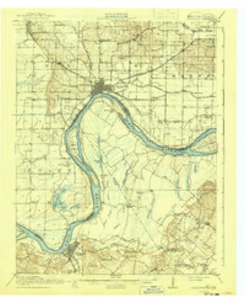
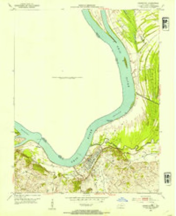
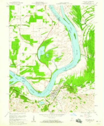
19 topographic sheets cover this place, the earliest surveyed in 1917 and the latest in 1991. It stands in the Uniontown census division. It lies in ZIP code area 42461. It stands on Highland Creek. The Survey maps it on the Uniontown quadrangle. 929 people lived here at the 2020 count. It stands 364 feet above sea level.
Research this city
Population over time
3 figuresUniontown fell from 1,064 to 929 between 2000 and 2020. These are the recorded population figures Wikidata holds for this place, reached through the Geographic Names Information System number this page is keyed on rather than by name, so they belong to this place and not to another of the same name. Most are census counts, but not all are: an early figure may be a founding or settlement estimate, and an estimate published within five years of a census is left out. The change column is computed, and is left blank where more than 20 years separate a figure from the one before it, because a gap that long is not a change between two counts.
| Year | People | Change |
|---|---|---|
| 2000 | 1,064 | |
| 2010 | 1,002 | -62 (-6%) |
| 2020 | 929 | -73 (-7%) |
Topographic sheets covering this place
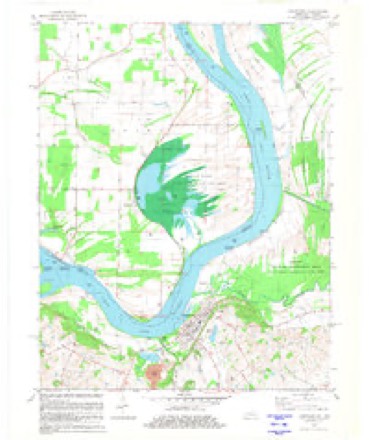
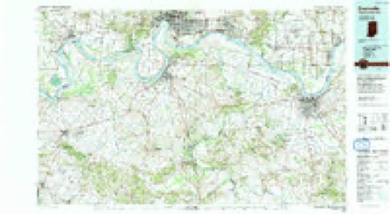
9 surveys from 19 printed sheetsMatched by testing this settlement's coordinate against the published boundary of every sheet in the United States Geological Survey's historical collection. Each opens the scanned sheet at the Survey.
- 1917 USGS Uniontown quadrangle1:62500, 6 printings
- 1952 USGS Uniontown quadrangle1:24000, 2 printings
- 1954 USGS Evansville quadrangle1:250000
- 1957 USGS Evansville quadrangle1:250000, 3 printings
- 1958 USGS Uniontown quadrangle1:24000, 2 printings
- 1961 USGS Evansville quadrangle1:250000, 2 printings
- 1981 USGS Uniontown quadrangle1:24000
- 1986 USGS Evansville quadrangle1:100000
- 1991 USGS Evansville quadrangle1:100000
Mines and quarries near this place
1 within 5 milesRegional context, not property-specific evidence. The federal mineral resources record lists 1 working within 5 miles of Uniontown: 1 unknown. None of them still produces. What was taken out: Clay. Distance is straight-line from the map coordinates, so a quarry counted here may appear on a neighbouring settlement's page as well.
| Where | Site | Commodity | Status | Recorded |
|---|---|---|---|---|
| Uniontown Brick Works | Clay | Unknown |
Storms near this place
60 of 83 shownRegional context, not property-specific evidence. The National Weather Service names Uniontown in 83 storm reports between 1993 and 2025: 64 flood, 8 thunderstorm wind, 7 hail, 3 flash flood. No death or injury is recorded in these reports. Each account below is quoted exactly as the forecast office filed it, from the NOAA Storm Events Database, and each date opens the federal record of that event.
| When | Event | Place named | Harm | What the report says |
|---|---|---|---|---|
| May 2011 | Flood | Uniontown | $1,000,000 | Major flooding continued on the Ohio River from April. At the Uniontown river gage, the flood crest of 56.94 feet on the morning of May 6 was about three feet higher than the 1997 flood. This was still over seven feet lower than the record crest set in 1937. The Ohio River floodgates were installed on Kentucky Highway 923 at Sturgis. This was the first time since the March 1997 flood that such actions were required. Sandbagging was done to protect some houses. Several county roads were closed, as was the main traffic artery through the county, U.S. Highway 60. There were at least 14 state highways and 18 county roads posted as closed in Union County. |
| March 2008 | Flood | Uniontown | $153,000 | Due to flooding, U.S. Highway 60 was closed near the Henderson County line. Nine other less travelled state roads were closed. About a dozen county roads were closed. Two county roads collapsed. |
| May 2011 | Thunderstorm Wind | Uniontown | $20,000 | A wind gust to 60 mph was measured in Uniontown. At Morganfield, a house sustained siding and roofing damage. A glass door was broken. At a nearby business, a metal carport was lifted and blown into a neighboring yard. Trees were blown down on State Route 1508. |
| September 2000 | Thunderstorm Wind | Uniontown | $10,000 | Trees were down in the Uniontown area, blocking roads. A state trooper's car was struck by a falling tree, causing major damage to the vehicle. |
| May 1995 | Thunderstorm Wind | Uniontown | $10,000 | Several trees and large limbs were blown down in Uniontown. |
| May 1995 | Thunderstorm Wind | Uniontown | $5,000 | Several large limbs were blown down in Uniontown. |
| December 2013 | Flood | Uniontown | $1,000 | Minor flooding occurred along the Ohio River. Low-lying fields and woodlands were underwater, along with river access roads. |
| December 2011 | Flood | Uniontown | $1,000 | Minor flooding of low-lying fields occurred along the Ohio River. The road to several farms was flooded. |
| August 1993 | Thunderstorm Wind | Uniontown | $50 | Trees were blown down in Uniontown and Morgantown. Large hail was reported in Morgantown. |
| February 2025 | Flood | Uniontown | - | Minor flooding of bottomland occurred around J.T. Myers Lock and Dam. |
| July 2025 | Flood | Uniontown | - | Flooding was reported during the afternoon on KY-130 south of Uniontown. Rainfall rates in the area peaked at around 1/hr. |
| May 2024 | Flash Flood | Uniontown | - | Floodwaters covered KY-130 between Morganfield and Uniontown. Hourly rainfall of up to around 2 inches was estimated by radar from 1900-2000CST. |
| May 2024 | Hail | Uniontown | - | Hail estimated to 1 inch was reported via, mPING, from the west side of Uniontown as a thunderstorm moved northeastward through Union County. |
| March 2023 | Flood | Uniontown | - | Minor flooding occurred on the Ohio River. There was minor flooding of low-lying woods and fields. The river remained above flood stage into April. |
| March 2023 | Flood | Uniontown | - | Minor flooding occurred on the Ohio River. Low-lying woods and fields near the river were inundated. |
| March 2023 | Flash Flood | Uniontown | - | A few state highways were closed due to high water, including Highways 760, 132, and 138. The westbound lane of U.S. Highway 60 was closed at the 8 mile marker. Some county roads were also affected by high water. |
| February 2022 | Flood | Uniontown | - | Minor flooding occurred on the Ohio River. Low-lying fields and woodlands near the river were underwater, along with a few rural state roads. |
| February 2022 | Flood | Uniontown | - | The Ohio River rose above flood stage and remained there into March. The river crested in March. |
| March 2021 | Flood | Uniontown | - | Minor flooding affected low-lying woods and fields. Some secondary roads in the bottomlands were flooded. |
| March 2020 | Flood | Uniontown | - | Minor flooding occurred on the Ohio River. Low-lying woods and fields were inundated, along with some lightly travelled county roads. |
| May 2020 | Flood | Uniontown | - | Flooding of the Ohio River was minor, consisting of flooded fields, low-lying access roads, and some riverside parkland. Some minor crop damage likely occurred. |
| March 2019 | Flood | Uniontown | - | Minor flooding occurred on the Ohio River. Low-lying woods and farmland near the river were inundated. A few rural roads were flooded. |
| December 2018 | Flood | Uniontown | - | Minor flooding occurred along the Ohio River. Low-lying woods and fields near the river were inundated. A few access roads to farms were underwater. |
| January 2017 | Flood | Uniontown | - | Minor flooding occurred on the Ohio River, affecting mainly bottomland and surrounding low-lying areas. The road to several farms above Uniontown flooded. |
| May 2017 | Flood | Uniontown | - | Minor flooding occurred on the Ohio River. Low-lying woods and fields were inundated, along with a farm road. |
| January 2016 | Flood | Uniontown | - | Minor flooding of the Ohio River continued into January. Low-lying fields and woodlands, as well as some bottomland county roads, were underwater. |
| February 2016 | Flood | Uniontown | - | Minor flooding occurred along the Ohio River. Some fields and woods in the bottomlands were underwater. The river continued rising into early March. |
| March 2016 | Flood | Uniontown | - | Minor flooding continued from February along the Ohio River. Some fields and woods in the bottomlands were underwater. |
| July 2015 | Flood | Uniontown | - | Minor flooding occurred along the Ohio River. The flooding affected mainly bottomland fields and surrounding low lying areas. The road to several farms above Uniontown flooded. |
| March 2015 | Flood | Uniontown | - | Minor flooding occurred on the Ohio River. At the Uniontown river gage, the river crested at 49.40 feet on the 20th. Flood stage is 37 feet. About eight state roads were closed, including Highways 667, 668, 1452, 1637, 871, and 1508. |
| April 2015 | Flood | Uniontown | - | Minor flooding occurred along the Ohio River. Minor flooding affected mainly bottomland fields and low-lying areas. |
| April 2015 | Hail | Uniontown | - | Quarter-size hail fell over parts of northern Union County. |
| December 2015 | Flood | Uniontown | - | The Ohio River rose above flood stage late in the month, but the river did not crest until early January. In December, there was flooding of low-lying fields and woodlands. Some river access roads were underwater. The flooding continued into early January. |
| January 2014 | Flood | Uniontown | - | Minor flooding lingered on the Ohio River through the first few days of 2014. Some low-lying woods and fields along the river were inundated. |
| February 2014 | Flood | Uniontown | - | Minor flooding occurred along the Ohio River. Low-lying woods and fields near the river were underwater. The flooding continued into early March. |
| April 2014 | Flood | Uniontown | - | Minor flooding occurred along the Ohio River. Low-lying fields and woodlands near the river were inundated. |
| March 2014 | Flood | Uniontown | - | Minor flooding occurred along the Ohio River. Low-lying woods and fields near the river were underwater. The flooding continued from late February. |
| February 2013 | Flood | Uniontown | - | Minor flooding occurred along the Ohio River. Low-lying woods and fields, along with some river access roads, were inundated. |
| January 2013 | Flood | Uniontown | - | Minor flooding occurred along the Ohio River near Uniontown. Some low-lying fields and woodlands near the river were underwater. |
| January 2012 | Flood | Uniontown | - | Minor flooding of low-lying fields occurred along the Ohio River. Several farm roads were flooded. The river continued rising into early February. |
| February 2012 | Flood | Uniontown | - | Minor flooding of low-lying fields occurred along the Ohio River. Several farm roads were flooded. The river rose above flood stage in late January and crested in early February. |
| April 2011 | Flood | Uniontown | - | The Ohio River floodgates were installed on Kentucky Highway 923 at Sturgis. This was the first time since the March 1997 flood that such actions were required. Sandbagging was done to protect a house in the Sullivan area. Several county roads were closed, as was the main traffic artery through the county, U.S. Highway 60. There were a total of 14 state highways and 18 county roads posted as closed in Union County. |
| November 2011 | Flood | Uniontown | - | At J.T. Myers Lock and Dam near Uniontown, the Ohio River rose above flood stage on the 30th. Minor flooding of low-lying fields occurred. |
| February 2010 | Flood | Uniontown | - | Minor flooding of the Ohio River inundated some fields and several farm roads. At the J.T. Myers Lock and Dam gage near Uniontown, the river crested at 38.91 feet on the 2nd. Flood stage there is 37 feet. |
| January 2010 | Flood | Uniontown | - | Minor flooding occurred on the Ohio River. At the gage at J.T. Myers Lock and Dam near Uniontown, the river did not crest before the end of the month. Flood stage there is 37 feet. Some low-lying fields near the river were inundated. |
| March 2010 | Flood | Uniontown | - | Minor flooding occurred on the Ohio River at Uniontown. At the J.T. Myers Lock and Dam, where flood stage is 37 feet, the river crested at 38.21 feet on the 22nd. Minor flooding of low-lying fields and a few farm access roads occurred. |
| May 2010 | Flood | Uniontown | - | Minor flooding occurred on the Ohio River around Uniontown. Minor flooding of bottomland fields and woodlands occurred. |
| May 2009 | Flood | Uniontown | - | Minor flooding of the Ohio River occurred. At J.T. Myers Lock and Dam near Uniontown, where flood stage is 37 feet, the river crested at 40.80 feet on the 15th. Agricultural bottomland and low-lying areas were flooded. |
| March 2008 | Flood | Uniontown | - | Minor flooding of the Ohio River occurred. At the J.T. Myers Lock and Dam gage, the river crested at 48.95 feet on March 26. Flood stage there is 37 feet, and moderate flooding begins at 50 feet. Low-lying fields and some county roads near the river were flooded. |
| April 2008 | Flood | Uniontown | - | Minor flooding of the Ohio River occurred. At J.T. Myers Dam near Uniontown, the river remained above flood stage from early March through mid April. The crest in April was 45.3 feet on the 11th. Flood stage at Uniontown is 37 feet. Many low-lying areas were flooded, primarily farm fields and woodlands. |
| April 2008 | Flood | Uniontown | - | Ten state roads were closed due to high water, including Kentucky 130 at the 15 mile marker. U.S. Highway 60 was covered with water at the 22 mile marker but remained open. |
| February 2008 | Flood | Uniontown | - | Minor flooding of the Ohio River occurred. At J.T. Myers Lock and Dam, the river crested at 42.87 feet on the 16th. Flood stage there is 37 feet. Minor flooding of low-lying bottomlands and fields occurred. |
| March 2007 | Flood | Uniontown | - | Minor flooding of fields and woodlands occurred along parts of the northwest Kentucky shore. At J.T. Myers Lock and Dam, where flood stage is 37 feet, the Ohio River crested at 39.10 feet on the 9th. |
| December 2007 | Flood | Uniontown | - | Minor flooding of bottomland woods and fields occurred. At J.T. Myers Lock and Dam, the Ohio River crested at 39.94 feet on the 21st. Flood stage there is 37 feet. |
| April 2007 | Flood | Uniontown | - | Minor flooding of low-lying fields and woods occurred along the Ohio River. At J.T. Myers Lock and Dam, the river crested just an inch or two above the 37-foot flood stage on April 22. |
| January 2007 | Flood | Uniontown | - | At J.T. Myers Lock and Dam, the Ohio River crested at 43.34 feet on the 23rd. Flood stage there is 37 feet. This resulted in minor flooding of bottomland fields and woodlands. Four county roads and three state roads were closed due to backwater. |
| May 2006 | Funnel Cloud | Uniontown | - | The funnel cloud approached Uniontown from the Ohio River. |
| July 2006 | Thunderstorm Wind | Uniontown | - | Large tree limbs were blown down across town. A trained spotter estimated wind gusts to 60 MPH. |
| June 1998 | Thunderstorm Wind | Uniontown | - | A barge operator on the Ohio River reported a gust to 60 MPH. |
| April 1998 | Thunderstorm Wind | Uniontown | - | Trees and power lines were down. |
Nearest settlements
The eight closest, with where each one stands in the county. Distances are straight-line, computed from the Geographic Names Information System coordinates.
| Map | Place | Distance | Sheets |
|---|---|---|---|
| Boxtown | 0.4 miles | 19 | |
| Chapman | 4.2 miles | 14 | |
| Robinsville | 4.2 miles | 17 | |
| Reyburn (historical) | 4.5 miles | 23 | |
| Hitesville | 5.7 miles | 17 | |
| Morganfield | 6.4 miles | 14 | |
| Flournoy | 6.6 miles | 13 | |
| Saint Vincent | 6.8 miles | 13 |
Elsewhere
Matched on this settlement's Geographic Names Information System number rather than its name, so it cannot be a different place of the same name in another state.
| Wikipedia article on Uniontown | An encyclopaedic summary. Its text is share-alike, so it is linked here rather than copied. |
| Wikidata item Q1966511 | The structured record the population and elevation above come from. Public domain (CC0). |
Provenance
This settlement is recorded in the Geographic Names Information System as feature 505827. The sheet list is computed by point-in-boundary test against the United States Geological Survey's historical topographic inventory. Both are works of the United States government and carry no copyright under 17 U.S.C. 105.
Mines and quarries. USGS Mineral Resources Data System (MRDS) https://mrdata.usgs.gov/mrds/ A work of the United States government, no copyright under 17 U.S.C. 105.
Storms. NOAA National Centers for Environmental Information, Storm Events Database https://www.ncei.noaa.gov/stormevents/ A work of the United States government, no copyright under 17 U.S.C. 105. Narratives are quoted verbatim from the National Weather Service report and are not edited or summarised.