 Block
From the record
7 National Register listings published here.
Sources: the National Register database, National Park Service
66 topographic sheets cover 29 settlements here, and 7 properties are on the National Register of Historic Places.
7 National Register listings published here.
Sources: the National Register database, National Park Service
Every property in this county listed on the National Register of Historic Places, with the year it was listed and the federal nomination document.
| Photograph | Property | Type | Listed | Reference |
|---|---|---|---|---|
 | Ardis Furnace | site | 1972 | 72000608 |
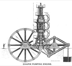 | Chapin Mine Steam Pump Engine | structure | 1981 | 81000305 |
 | Dickinson County Courthouse and Jail | building | 1980 | 80001852 |
 | Immaculate Conception Church | building | 1990 | 90000562 |
 | Iron Mountain Central Historic District | district | 2013 | 13000763 |
| Iron Mountain Veterans Administration (VA) Hospital | district | 2022 | 100007870 | |
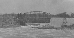 | Upper Twin Falls Bridge | structure | 2012 | 12001028 |
Every wildfire the federal occurrence database records inside this county: 234 of them, burning about 965 acres. 19 started naturally and 30 were recorded as arson. Each settlement page carries the fires within five miles of it.
| Reported cause | Fires |
|---|---|
| Debris and open burning | 63 |
| Missing data/not specified/undetermined | 38 |
| Equipment and vehicle use | 36 |
| Arson/incendiarism | 30 |
| Railroad operations and maintenance | 20 |
| Natural | 19 |
| Misuse of fire by a minor | 12 |
| Recreation and ceremony | 10 |
| Power generation/transmission/distribution | 3 |
| Fireworks | 2 |
| Smoking | 1 |
The five largest, by the area the report gives. One of them was set deliberately.
| Date | Cause | Size | Reported by | Name on the report |
|---|---|---|---|---|
| 5 April 2020 | Railroad operations and maintenance | 103 acres | Michigan Department of Natural Resources | DEJAVU |
| 20 May 1994 | Equipment and vehicle use | 87 acres | Michigan Department of Natural Resources | not named |
| 30 April 2020 | Equipment and vehicle use | 63 acres | Michigan Department of Natural Resources | BREITUNG TOWNSHIP FD 2020-17 - 2020 |
| 27 April 1992 | Arson/incendiarism | 54 acres | Michigan Department of Natural Resources | not named |
| 17 March 2010 | Missing data/not specified/undetermined | 50 acres | Michigan Department of Natural Resources | FLOODWOOD |
| 9 May 1992 | Recreation and ceremony | 45 acres | Michigan Department of Natural Resources | not named |
| 12 May 2019 | Equipment and vehicle use | 24 acres | Michigan Department of Natural Resources | LAKE ANTOINE |
| 23 May 2015 | Debris and open burning | 21 acres | Michigan Department of Natural Resources | AIMONE ROAD |
Every settlement page carries the fires within five miles of it - see the settlement index below.
The NOAA Storm Events Database holds 248 reports for this county, causing no deaths, no injuries and about $8,828,750 in recorded property damage. Each settlement page carries the reports that name it.
| Kind of event | Reports |
|---|---|
| Thunderstorm Wind | 117 |
| Hail | 89 |
| Flash Flood | 13 |
| Heavy Rain | 12 |
| Tornado | 9 |
| Lightning | 3 |
| Flood | 3 |
| Funnel Cloud | 2 |
The most serious of them, by death, then injury, then recorded damage. The accounts are quoted exactly as the forecast office filed them.
| When | Event | Place named | Harm | What the report says |
|---|---|---|---|---|
| September 2002 | Tornado (F1) | Kingsford | $7,000,000 | This tornado developed over northeast Florence County, WI (See Storm Data for Wisconsin, Northeastern, for more information on the beginning portion of this tornado) and crossed the Menominee River just south of the Iron Mountain-Kingsford airport. The storm moved east-northeast into Kingsford and Iron Mountain. As the storm moved into Iron Mountain, the track shifted more to the east and the damage path became more sporadic before the tornado lifted completely on the east side of Iron Mountain. Numerous trees and power lines were knocked down, blocking highway US-2 and disrupting electric power and telephone service. Gas lines were ruptured and several commercial buildings sustained substantial roof damage in Kingsford. |
| July 1999 | Thunderstorm Wind | Countywide | $500,000 | Scattered reports of trees down. Part of the roof on the North Dickinson School was torn off and carried several hundered yards east over the football field. The wood framed, sheet metal-sided bus garage was considered a total loss and a bus inside the garage was slightly damaged. Near Merriman, an all-terrain vehicle was crushed, two houses suffered roof damage, and a shed and a van were seriously damaged by falling trees. A pick-up truck was crushed by a falling tree in Hardwood. |
| June 2000 | Hail | Iron Mtn | $225,000 | no account filed |
| October 2016 | Flash Flood | Norway | $200,000 | The Dickinson County Emergency Manager reported two county roads completely cut in two from flooding, one of which was CR-581. Seven other county roads were partially washed out. The total damage estimate was near $200,000. |
| October 2005 | Lightning | Iron Mtn | $140,000 | One home in the Breitung Township was totally destroyed by a lightning-strike induced fire. Another home on North Evergreen Drive sustained major damage when lightning struck a nearby pine tree. |
| April 2023 | Flood | Vulcan | $100,000 | Flooding along the Michigamme River including secondary roads and property constituted much of the flood impacts in April for Dickinson County. County Road 577 in Vulcan was also closed from the 15th into the 17th due to high water. Governor Whitmer declared a state of emergency for Dickinson County on the 21st to open up state funds to assist in flood recovery efforts. |
| June 1998 | Thunderstorm Wind | Iron Mtn | $100,000 | Thunderstorm downburst winds downed trees up to 12 inches in diameter in Iron Mountain, Kingsford and Vulcan. A 60 mph wind gust downed traffic signals in Norway. Several vehicles damaged. There were a total of 16 house and tree fires started by lightning from this storm. |
| July 2010 | Thunderstorm Wind | (Imt)Iron Mtn Arpt | $75,000 | Numerous trees and power lines were reported down. Damage was also reported to homes and cars from downed trees. Street flooding also occurred. |
| July 2012 | Thunderstorm Wind | Floodwood | $70,000 | The storm survey indicated a four-mile path of straight line wind damage across the Sawyer and Edey Lake area east of Channing. There was evidence of gustnadoes along the main straight line wind core. Straight-line wind speeds were estimated at 60-70 mph with pockets of near 90 mph winds within the gustnado damage. Numerous large trees were uprooted with smaller trees snapped off from the strong winds. Within the area of strongest wind damage several of the large trees fell on houses and vehicles and knocked down power poles and power lines. The 911 call center also reported that numerous witnesses saw a waterspout on Sawyer Lake which moved onshore towards Woodlawn Lane. |
| June 2015 | Thunderstorm Wind | Iron Mtn | $40,000 | There was a report via social media of a tree downed on a house on E Bar D Road off of Quinnesec-Lake Antoine Road. The time of the report was estimated from radar. |
| June 2020 | Thunderstorm Wind | Loretto | $30,000 | There was a public report of a severe thunderstorm at a cottage on Lake Louise. The cottage sustained roof and chimney damage when a 18-inch diameter 50+ foot high spruce tree was uprooted by thunderstorm winds. The storm also sheared off a flagpole and damaged a kayak, paddleboard and heavy patio furniture. |
| September 2014 | Flash Flood | Antoine | $30,000 | More than two inches of heavy rainfall in less than two hours caused flash flooding in the Iron Mountain area into early afternoon on the 4th. The Dickinson County Sheriff reported flooding on US Highway 2 with several sections of the road under 2.5 feet of water causing several cars to stall. Several businesses were also flooded. |
| May 2012 | Lightning | Iron Mtn | $30,000 | A lightning strike from thunderstorms caused a house fire in Iron Mountain on the evening of the 20th. The home sustained damage in numerous areas, but firefighters were able to keep the damage contained to the second floor and attic. The Iron Mountain Police Department, Beacon Ambulance and Wisconsin Electric were also at the scene of the fire to assist. |
| July 2011 | Thunderstorm Wind | (Imt)Iron Mtn Arpt | $30,000 | A 40-foot by 70-foot section of the Fontana Terminal Building at the Ford Airport in Iron Mountain was torn off by winds exceeding 60 mph. Two flights were cancelled due to the damage and the passengers were bused to Escanaba to catch alternate flights. |
| July 1987 | Tornado (F3) | not stated | $25,000 | no account filed |
| September 2014 | Flash Flood | Norway | $20,000 | Nearly two inches of rain in less than two hours caused flash flooding in Norway on the 4th. The Dickinson County emergency manager reported that two city blocks were flooded with at least two streets closed due to washouts across both lanes. Several businesses also reported flooded basements. |
| July 1999 | Flash Flood | Iron Mtn | $20,000 | Heavy rain from thunderstorms partially washed out several secondary roads and sections of highway US-2 in the Iron Mountain area. |
| June 2015 | Thunderstorm Wind | Iron Mtn | $15,000 | There was a report via social media of multiple large trees down around Lake Antoine and Lake Antoine Park and Campgrounds. Trees were reported down on Pine Mountain, Bass Lake, and Lake Antoine Roads. Residents in the area reported seeing a tree down across a house on Lake Antoine Road. The time of the report was estimated from radar. |
| June 2015 | Thunderstorm Wind | Norway | $12,000 | The Norway Fire Chief reported that a tree fell on a vehicle on Saginaw Street causing severe damage to the roof. |
| August 2007 | Thunderstorm Wind | Kingsford | $12,000 | Numerous trees and power lines down along County Road 607 and near Highway M-95 in Breitung Township. A home along County Road 607 sustained damage when a tree fell on it. |
| June 2017 | Thunderstorm Wind | Antoine | $10,000 | There was a delayed report of multiple trees and power lines down closing roads in the Iron Mountain area. Power was out across the area and phone lines were down as well. Ditches were running full from heavy rainfall. |
| July 2013 | Flash Flood | Foster City | $10,000 | Nearly four inches of rain caused minor flash flooding in Foster City on the evening of the 25th. Cunard Road in Foster City was washed out. |
| July 2010 | Tornado (EF0) | Vulcan | $10,000 | The tornado touched down along 7th Avenue in the eastern sections of Norway and then crossed US-2 as it moved east northeastward towards Norway Mountain. The maximum wind speeds were estimated at 70 mph which made it a EF0 tornado. Several trees were knocked down or snapped off from the tornado. Some minor damage also occurred to structures from falling trees and tree limbs. |
| June 2021 | Thunderstorm Wind | Felch | $8,000 | Dispatcher reported multiple downed trees, downed power lines and power outages across Dickinson County. WE Energies outage map indicated outages from the Felch area down to the WI border. |
| September 2019 | Thunderstorm Wind | Floodwood | $8,000 | There was a report of a tree down on a vehicle near the intersection of Woodlawn Lane and Tobin Lane northeast of Channing. |
| June 2017 | Thunderstorm Wind | Antoine | $8,000 | There was a delayed report of multiple large tree limbs down, including a few that fell on and into houses near Bass Lake. Thunderstorm winds also blew a 700-pound trailer approximately ten yards and flipped a portable boat house. |
| June 2021 | Thunderstorm Wind | Iron Mtn | $7,000 | The observer just northeast of Iron Mountain reported multiple trees down from approximately 14 to 16 inches in diameter. Spotter estimated winds at 70 mph. The power was knocked out. |
| June 2018 | Flash Flood | Vulcan | $5,000 | Broadcast media relayed reports of fields flooded in the Vulcan area. Also, two six-inch diameter trees were downed in the area. |
| June 2015 | Thunderstorm Wind | Iron Mtn | $5,000 | The Dickinson County Sheriff reported multiple large trees and power lines down in the Iron Mountain and Breitung Township areas. Some trees were blocking roads. The time of the report was estimated from radar. |
| July 2011 | Thunderstorm Wind | Antoine | $5,000 | Large tree was toppled onto a car. |
| July 2010 | Thunderstorm Wind | Norway | $5,000 | Several large oak trees were uprooted and yard furniture was overturned. Power outages and downed power lines were reported across the area as well. |
| July 2017 | Thunderstorm Wind | Ralph Arpt | $4,000 | The observer from Norway reported trees and power lines down from three miles to six miles north of Ralph. The time of the report was estimated from radar. |
| August 2024 | Thunderstorm Wind | Antoine | $3,000 | Multiple power outages reported in Iron Mountain, Crystal Falls and surrounding area. Reports taken from the utility outage map and time of the outages estimated from radar. |
| May 2021 | Thunderstorm Wind | Antoine | $3,000 | Report via social media of several trees down throughout Iron Mountain. |
| June 2021 | Thunderstorm Wind | Felch Mtn | $3,000 | Report relayed of multiple trees down in the Felch area, with one large, healthy tree blocking a road. |
| July 2021 | Thunderstorm Wind | Granite Bluff | $3,000 | Significant winds and power outages were reported five miles southwest of Randville. Pictures posted online showed plant and some tree damage. Time of the report was estimated from radar. |
| October 2016 | Thunderstorm Wind | Iron Mtn | $3,000 | The Dickinson County Emergency Manager reported numerous trees and tree limbs down from Iron Mountain through Felch Township. |
| June 2015 | Thunderstorm Wind | Granite Bluff | $3,000 | Numerous trees were reported down on Sportsman Road and other roads north of Iron Mountain. Time of the report was based on radar. |
| July 2010 | Tornado (EF0) | Vulcan | $3,000 | The EF0 tornado touched down in a wooded area about one mile northeast of Vulcan. The tornado was on the ground for about one-quarter mile and had a width of less than 100 yards. Numerous trees were uprooted and snapped off from this tornado as its peak winds were estimated at 70 mph. |
| July 2007 | Thunderstorm Wind | Iron Mtn | $3,000 | Large trees down on Pine Mountain Road. |
| June 1981 | Tornado (F2) | not stated | $2,500 | no account filed |
| August 2024 | Thunderstorm Wind | Antoine | $2,000 | A Facebook post and accompanying pictures showed a few large pine trees downed and snapped at Pine Mountain. Time of the damage was estimated from radar. |
| August 2024 | Thunderstorm Wind | Antoine | $2,000 | A Dickinson County official reported phone lines down, including 911 service in Dickinson County. Time of the report was estimated from radar. |
| August 2024 | Thunderstorm Wind | Antoine | $2,000 | A county official in Dickinson County reported a power line down on a house in Iron Mountain. |
| July 2023 | Thunderstorm Wind | Hardwood | $2,000 | Convenience store worker reported trees down along Ride Outs Road. Hail also occurred but size was unknown. Time of the report was estimated from radar. |
| July 2023 | Thunderstorm Wind | Randville | $2,000 | There were several trees reported blown down along Highway M-95 southeast of Randville. |
| July 2023 | Thunderstorm Wind | Randville | $2,000 | A convenience store worker reported trees down near North Dickinson County School. Hail also occurred but size was unknown. Time of the report was estimated by radar. |
| May 2022 | Flash Flood | Iron Mtn | $2,000 | More than three inches of heavy rainfall caused partial flooding of roadways and parking lots in Iron Mountain and also caused standing water on Cemetery Road in Foster City. |
| June 2021 | Thunderstorm Wind | Iron Mtn | $2,000 | Report and picture via Facebook of winds taking off the tops of at least three very tall pine trees in Iron Mountain. |
| August 2020 | Thunderstorm Wind | Channing | $2,000 | Several snapped trees one to one and a half feet in diameter were observed north of Channing. Time of the thunderstorm damage was estimated from radar. |
| October 2018 | Thunderstorm Wind | Norway | $2,000 | Several large hardwood and softwood trees with diameters 8 inches or greater were snapped along Benton Lake Road in Norway Township. |
| June 2017 | Thunderstorm Wind | Norway | $2,000 | There was a delayed report of several large poplar trees down on old Highway 8 south of Norway. |
| July 2010 | Thunderstorm Wind | Norway | $2,000 | Four-inch diameter tree limbs along with other trees reported down just east of Norway. Minor damage to a shed was also reported. |
| July 2007 | Thunderstorm Wind | Iron Mtn | $2,000 | Trees down in East Kingsford. |
| July 2007 | Thunderstorm Wind | Sagola | $2,000 | Numerous trees down along Leeman Road. |
| September 2019 | Thunderstorm Wind | Floodwood | $1,000 | There was a public report on the social media of a local television news outlet of a tree down on M-95 along with numerous other branches down between Channing and Highway US-41. |
| August 2018 | Thunderstorm Wind | Channing | $1,000 | A spotter reported small trees and small branches down along Highway M-95 from just north of Channing through Silver Lake. |
| October 2018 | Thunderstorm Wind | Antoine | $1,000 | A delayed report via social media indicated a tree down across a power line near Iron Mountain from thunderstorm winds. |
| October 2018 | Thunderstorm Wind | Antoine | $1,000 | The 911 Call Center reported power lines down in Iron Mountain from thunderstorm winds. Time of the report was estimated from radar. |
| June 2017 | Thunderstorm Wind | Antoine | $1,000 | There was a delayed report of a large tree branch snapped off a two-foot diameter maple tree in Iron Mountain. A medium-sized apple tree was also uprooted. |
The Survey's mineral resources record lists 64 workings inside this county. 18 still produce and 46 are closed or unrecorded. Each settlement page carries the workings within five miles of it.
| Commodity | Workings |
|---|---|
| Iron | 45 |
| Sand and Gravel, Construction | 12 |
| Stone, Crushed/Broken | 4 |
| Iron, Manganese | 1 |
| Fire Clay (Refractory) | 1 |
| Feldspar | 1 |
The least common of them first, because a county's hundredth gravel pit says nothing its first ten did not.
| Where | Site | Commodity | Status | Recorded |
|---|---|---|---|---|
| Caspian Const Co Mine | Feldspar | Producer | ||
| Groveland Mine | Iron, Manganese | Past Producer | 1891, 1982 | |
| Vulcan Brick Co.Clay Pit | Fire Clay (Refractory) | Past Producer | ||
| Caspian Const Co Quarry | Stone, Crushed/Broken | Producer | ||
| Felch Quarry | Stone, Crushed/Broken | Producer | ||
| Groveland Pit & Mill | Stone, Crushed/Broken | Producer | ||
| Metronite Co.Marble Quarry | Stone, Crushed/Broken | Past Producer | ||
| Caspian Const Co Pit | Sand and Gravel, Construction | Producer | ||
| Caspian Const Co Pit | Sand and Gravel, Construction | Producer | ||
| Fayas Pit & Mill | Sand and Gravel, Construction | Producer | ||
| M-35 Gravel Pit | Sand and Gravel, Construction | Producer | ||
| Miller Sand & Gravel Pit | Sand and Gravel, Construction | Producer | ||
| Moon Lake Pit | Sand and Gravel, Construction | Producer | ||
| Ozzelos Pit & Mill | Sand and Gravel, Construction | Producer | ||
| Rudy Olson Pit | Sand and Gravel, Construction | Producer | ||
| Sand & Gravel Pit | Sand and Gravel, Construction | Producer | ||
| State Pit | Sand and Gravel, Construction | Producer | ||
| State of Michigan Pit | Sand and Gravel, Construction | Producer | ||
| State of Michigan Pit | Sand and Gravel, Construction | Producer | ||
| Antoine Mine | Iron | Past Producer | 1849, 1895, 1925 | |
| Appleton Iron Mine | Iron | Past Producer | ||
| Aragon Mine | Iron | Past Producer | 1849, 1889, 1932 | |
| Bradley Mine | Iron | Past Producer | 1849, 1937, 1959 | |
| Breen Mine | Iron | Past Producer | 1849, 1877, 1907 | |
| Brier Hill Prospect | Iron | Past Producer | 1849, 1882, 1883 | |
| Bryngelson Mine | Iron | Past Producer | ||
| Calumet Mine | Iron | Past Producer | 1849, 1882, 1913 | |
| Chapin Mine | Iron | Past Producer | 1849, 1880, 1934 | |
| Cuff Mine | Iron | Past Producer | 1849, 1899, 1900 | |
| Cundy Mine | Iron | Past Producer | 1849, 1896, 1913 | |
| Deer Hunt Iron Mine | Iron | Past Producer | ||
| Emmett Mine | Iron | Past Producer | 1849, 1878, 1884 | |
| Federal Exploration | Iron | Prospect | ||
| Felch Properties | Iron | Prospect | 1851 | |
| Few Mine | Iron | Past Producer | 1849, 1907, 1909 | |
| Forest Mine | Iron | Past Producer | 1849, 1904 | |
| Globe-Cornell Mine | Iron | Past Producer | 1879, 1880 | |
| Groveland Mine & Plant | Iron | Producer | ||
| Groveland Pellet Plant | Iron | Plant | ||
| Hamilton Fe Mine | Iron | Past Producer | ||
| Hancock Mine | Iron | Prospect | ||
| Indiana Mine | Iron | Past Producer | 1849, 1882, 1920 | |
| Juno Exploration | Iron | Past Producer | ||
| Loretto Mine | Iron | Past Producer | 1849, 1893, 1940 | |
| Ludington Mine | Iron | Past Producer | 1849, 1880, 1894 | |
| Mcclintocks Exploration | Iron | Prospect | ||
| Menominee Iron District (Range) | Iron | Past Producer | 1851, 1877, 1982 | |
| Metropolitan Mine | Iron | Past Producer | 1849, 1882, 1888 | |
| Millie Mine | Iron | Past Producer | 1849, 1881, 1936 | |
| Munro Mine | Iron | Past Producer | 1849, 1903, 1921 | |
| Northwestern Mine | Iron | Past Producer | 1849, 1883, 1903 | |
| Old Ludington Mine | Iron | Past Producer | ||
| Penn Mines | Iron | Past Producer | 1849, 1877 | |
| Pewabic Mine | Iron | Past Producer | 1849, 1880, 1918 | |
| Quinnesec Mine | Iron | Past Producer | 1849, 1878, 1935 | |
| Saginaw Mine | Iron | Past Producer | 1849, 1879, 1909 | |
| Stephenson Mine | Iron | Past Producer | 1849, 1879, 1887 | |
| Sturgeon Prospect | Iron | Prospect | 1849, 1925 | |
| Tom's Iron Shaft | Iron | Past Producer | ||
| Turners Exploration | Iron | Prospect | ||
| Verona | Iron | Past Producer | 1849, 1900, 1904 | |
| Vivian Mine | Iron | Past Producer | 1849, 1902, 1913 | |
| Walpole Mine | Iron | Past Producer | ||
| West Chapin | Iron | Past Producer | 1849, 1922, 1936 |
Named settlements recorded in the Geographic Names Information System, each with the topographic sheets covering it. Villages, hamlets and abandoned places alike. Each is shown with the nearest named watercourse or landform and the survey quadrangle it falls on.
West Branch township · 49831 · On North Branch Ford River · Alfred quadrangle
10 sheets, 1957 to 1986
Iron Mountain city · 49801 · Near Pine Mountain · Iron Mountain quadrangle
11 sheets, 1939 to 1991
Breen township · 49834 · On Quarry Creek · Foster City quadrangle
9 sheets, 1954 to 1986
Breitung Charter Township · 49801 · On Browning Creek · Randville quadrangle
11 sheets, 1939 to 1991
Iron Mountain city · 49801 · Near Millie Hill · Iron Mountain quadrangle
11 sheets, 1939 to 1991
Breitung Charter Township · 49801 · On Browning Creek · Randville quadrangle
11 sheets, 1939 to 1991
Breitung Charter Township · 49876 · On Fumee Creek · Norway quadrangle
11 sheets, 1954 to 1982
Sagola township · 49801 · On Gestner Branch · Randville quadrangle
11 sheets, 1939 to 1991
Breitung Charter Township · 49801 · Near Millie Hill · Iron Mountain quadrangle
11 sheets, 1939 to 1991