 Block
Antoine, Michigan
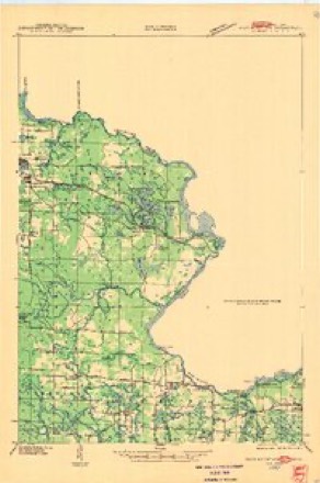
11 topographic sheets cover this place, the earliest surveyed in 1939 and the latest in 1991. It stands in Iron Mountain City. It lies in ZIP code area 49801. It lies near Pine Mountain. The Survey maps it on the Iron Mountain quadrangle.
On record in Antoine
Buildings and businesses the archive holds for this place. Each opens its own page, with the source record it came from.
On the National Register within a mile 3 records
The National Register names another town for these. They stand within one mile of this settlement's coordinate.
 Immaculate Conception Churchlisted 1990 · 0.4 miles away
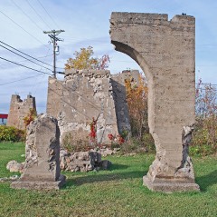 Ardis Furnacelisted 1972 · 0.6 miles away
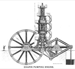 Chapin Mine Steam Pump Enginelisted 1981 · 0.9 miles away
Topographic sheets covering this place
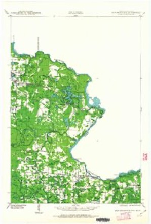
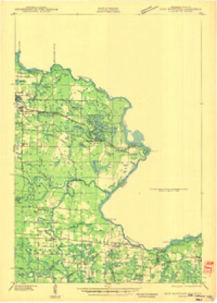
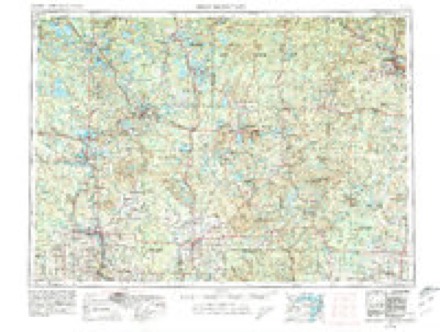
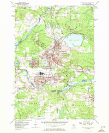
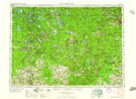
7 surveys from 11 printed sheetsMatched by testing this settlement's coordinate against the published boundary of every sheet in the United States Geological Survey's historical collection. Each opens the scanned sheet at the Survey.
- 1939 USGS Iron Mountain quadrangle1:48000
- 1941 USGS Iron Mountain quadrangle1:48000
- 1947 USGS Iron Mountain quadrangle1:48000
- 1954 USGS Iron Mountain quadrangle1:250000, 2 printings
- 1955 USGS Iron Mountain quadrangle1:24000, 3 printings
- 1959 USGS Iron Mountain quadrangle1:250000, 2 printings
- 1991 USGS Iron Mountain quadrangle1:100000
Fires near this place
136 since 1992Regional context, not property-specific evidence. The federal wildfire occurrence database lists 136 fires within 5 miles of Antoine between 1992 and 2020, burning about 271 acres in total. 6 started naturally. 20 were recorded as arson. Distance is straight-line from the map coordinates, so a fire counted here may appear on a neighbouring settlement's page as well.
| Reported cause | Fires |
|---|---|
| Debris and open burning | 38 |
| Missing data/not specified/undetermined | 32 |
| Arson/incendiarism | 20 |
| Equipment and vehicle use | 13 |
| Power generation/transmission/distribution | 8 |
| Misuse of fire by a minor | 7 |
| Natural | 6 |
| Recreation and ceremony | 5 |
| Smoking | 3 |
| Railroad operations and maintenance | 2 |
| Fireworks | 2 |
The most recent of them, most recent first, with the day each was reported and the service that recorded it.
| Date | Cause | Size | Reported by | Name on the report |
|---|---|---|---|---|
| 21 September 2018 | Natural | 1.0 acres | Michigan Department of Natural Resources | IRON MOUNTAIN FD 0000259 - 2018 |
| 17 September 2009 | Debris and open burning | under an acre | Wisconsin Department of Natural Resources | DYNAMITE FIRE |
| 17 September 2005 | Natural | under an acre | Michigan Department of Natural Resources | not named |
| 9 August 2014 | Missing data/not specified/undetermined | under an acre | Michigan Department of Natural Resources | DICKINSON 0003 |
| 16 August 2020 | Natural | 1.0 acres | Michigan Department of Natural Resources | IRON MOUNTAIN FD 0000174 - 2020 |
| 9 July 2011 | Fireworks | under an acre | Wisconsin Department of Natural Resources | LARSON'S BAY |
| 5 July 2011 | Missing data/not specified/undetermined | under an acre | Wisconsin Department of Natural Resources | DITCH FIRE |
| 4 July 2008 | Missing data/not specified/undetermined | under an acre | Wisconsin Department of Natural Resources | not named |
Settlements close enough to share some of these fires:
Mines and quarries near this place
10 of 39 shownRegional context, not property-specific evidence. The federal mineral resources record lists 39 workings within 5 miles of Antoine: 22 past producers, 9 producers, 6 occurrences, 2 prospects. 9 still produce. What was taken out: Sand and Gravel, Construction, Iron, Stone, Dimension. Distance is straight-line from the map coordinates, so a quarry counted here may appear on a neighbouring settlement's page as well.
| Where | Site | Commodity | Status | Recorded |
|---|---|---|---|---|
| Niagara Greenstone Deposit | Stone, Dimension | Occurrence | ||
| Antoine Mine | Iron | Past Producer | 1849, 1895, 1925 | |
| Bradley Mine | Iron | Past Producer | 1849, 1937, 1959 | |
| Caspian Const Co Pit | Sand and Gravel, Construction | Producer | ||
| Chapin Mine | Iron | Past Producer | 1849, 1880, 1934 | |
| Cuff Mine | Iron | Past Producer | 1849, 1899, 1900 | |
| Cundy Mine | Iron | Past Producer | 1849, 1896, 1913 | |
| Fayas Pit & Mill | Sand and Gravel, Construction | Producer | ||
| Federal Exploration | Iron | Prospect | ||
| Feeder Creek Gravel Pit | Sand and Gravel, Construction | Past Producer |
Storms near this place
24 since 2010Regional context, not property-specific evidence. The National Weather Service names Antoine in 24 storm reports between 2010 and 2025: 15 thunderstorm wind, 6 hail, 2 flash flood, 1 heavy rain. No death or injury is recorded in these reports. Each account below is quoted exactly as the forecast office filed it, from the NOAA Storm Events Database, and each date opens the federal record of that event.
| When | Event | Place named | Harm | What the report says |
|---|---|---|---|---|
| September 2014 | Flash Flood | Antoine | $30,000 | More than two inches of heavy rainfall in less than two hours caused flash flooding in the Iron Mountain area into early afternoon on the 4th. The Dickinson County Sheriff reported flooding on US Highway 2 with several sections of the road under 2.5 feet of water causing several cars to stall. Several businesses were also flooded. |
| June 2017 | Thunderstorm Wind | Antoine | $10,000 | There was a delayed report of multiple trees and power lines down closing roads in the Iron Mountain area. Power was out across the area and phone lines were down as well. Ditches were running full from heavy rainfall. |
| June 2017 | Thunderstorm Wind | Antoine | $8,000 | There was a delayed report of multiple large tree limbs down, including a few that fell on and into houses near Bass Lake. Thunderstorm winds also blew a 700-pound trailer approximately ten yards and flipped a portable boat house. |
| July 2011 | Thunderstorm Wind | Antoine | $5,000 | Large tree was toppled onto a car. |
| August 2024 | Thunderstorm Wind | Antoine | $3,000 | Multiple power outages reported in Iron Mountain, Crystal Falls and surrounding area. Reports taken from the utility outage map and time of the outages estimated from radar. |
| May 2021 | Thunderstorm Wind | Antoine | $3,000 | Report via social media of several trees down throughout Iron Mountain. |
| August 2024 | Thunderstorm Wind | Antoine | $2,000 | A Facebook post and accompanying pictures showed a few large pine trees downed and snapped at Pine Mountain. Time of the damage was estimated from radar. |
| August 2024 | Thunderstorm Wind | Antoine | $2,000 | A Dickinson County official reported phone lines down, including 911 service in Dickinson County. Time of the report was estimated from radar. |
| August 2024 | Thunderstorm Wind | Antoine | $2,000 | A county official in Dickinson County reported a power line down on a house in Iron Mountain. |
| October 2018 | Thunderstorm Wind | Antoine | $1,000 | A delayed report via social media indicated a tree down across a power line near Iron Mountain from thunderstorm winds. |
| October 2018 | Thunderstorm Wind | Antoine | $1,000 | The 911 Call Center reported power lines down in Iron Mountain from thunderstorm winds. Time of the report was estimated from radar. |
| June 2017 | Thunderstorm Wind | Antoine | $1,000 | There was a delayed report of a large tree branch snapped off a two-foot diameter maple tree in Iron Mountain. A medium-sized apple tree was also uprooted. |
| September 2010 | Flash Flood | Antoine | $1,000 | The Dickinson County Sheriff reported Pine Mountain Road in Iron Mountain washed out with water over the road. |
| July 2021 | Thunderstorm Wind | Antoine | - | A trained spotter just west of Iron Mountain measured a thunderstorm wind gust of 58 mph. |
| August 2021 | Thunderstorm Wind | Antoine | - | A thunderstorm moving through Iron Mountain produced a 58 mph wind gust on a handheld anemometer. Pea-sized hail was also reported. |
| July 2020 | Heavy Rain | Antoine | - | The Great Lakes Storm Chasers reported minor street and yard flooding in portions of Iron Mountain on the evening of the 14th due to nearly two inches of rainfall. |
| August 2018 | Thunderstorm Wind | Antoine | - | A spotter reported two to three inch diameter branches broken off of trees near Iron Mountain. Small hail was also reported. |
| April 2017 | Hail | Antoine | - | There was a public report of nickel-sized hail near Moon Lake. |
| April 2017 | Hail | Antoine | - | There was a public report of nickel-sized hail near Bass Lake. |
| April 2017 | Hail | Antoine | - | A public report via MPING of one inch diameter hail near Iron Mountain. The time of the report was estimated from radar. |
| June 2015 | Hail | Antoine | - | Quarter-sized hail was reported on the north side of Iron Mountain. The time of the report was estimated from radar. |
| August 2013 | Hail | Antoine | - | Penny-sized hail was reported near Iron Mountain. |
| July 2011 | Thunderstorm Wind | Antoine | - | Wind gust measured by the Iron Mountain ASOS. |
| July 2025 | Hail | Antoine | - | no account filed |
Nearest settlements
The eight closest, with where each one stands in the county. Distances are straight-line, computed from the Geographic Names Information System coordinates.
| Map | Place | Distance | Sheets |
|---|---|---|---|
| Iron Mountain | 1.2 miles | 11 | |
| White Birch Estates | 2.6 miles | 11 | |
| East Kingsford | 2.9 miles | 11 | |
| Kingsford | 3.0 miles | 11 | |
| Skidmore | 3.2 miles | 11 | |
| Quinnesec | 4.5 miles | 11 | |
| Merriman | 5.5 miles | 11 | |
| Granite Bluff | 7.0 miles | 11 |
Provenance
This settlement is recorded in the Geographic Names Information System as feature 620150. The sheet list is computed by point-in-boundary test against the United States Geological Survey's historical topographic inventory. Both are works of the United States government and carry no copyright under 17 U.S.C. 105.
Wildfire. Short, Karen C. 2022. Spatial wildfire occurrence data for the United States, 1992-2020 [FPA_FOD_20221014]. 6th Edition. Fort Collins, CO: Forest Service Research Data Archive. https://doi.org/10.2737/RDS-2013-0009.6 Collected with United States Government funding and usable without additional permissions or fees.
Mines and quarries. USGS Mineral Resources Data System (MRDS) https://mrdata.usgs.gov/mrds/ A work of the United States government, no copyright under 17 U.S.C. 105.
Storms. NOAA National Centers for Environmental Information, Storm Events Database https://www.ncei.noaa.gov/stormevents/ A work of the United States government, no copyright under 17 U.S.C. 105. Narratives are quoted verbatim from the National Weather Service report and are not edited or summarised.