Block
From the record
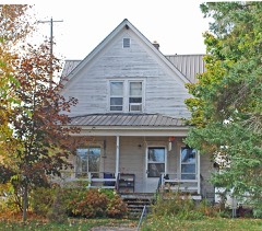
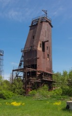
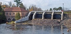
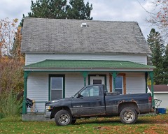
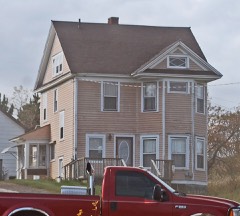
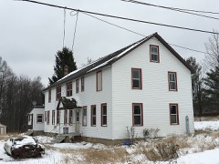
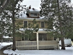
80 National Register listings published here.
Sources: the National Register database, National Park Service
75 topographic sheets cover 45 settlements here, and 80 properties are on the National Register of Historic Places.
80 National Register listings published here.
Sources: the National Register database, National Park Service
Every property in this county listed on the National Register of Historic Places, with the year it was listed and the federal nomination document.
Every wildfire the federal occurrence database records inside this county: 166 of them, burning about 864 acres. 15 started naturally and 6 were recorded as arson. Each settlement page carries the fires within five miles of it.
| Reported cause | Fires |
|---|---|
| Equipment and vehicle use | 29 |
| Missing data/not specified/undetermined | 26 |
| Recreation and ceremony | 25 |
| Debris and open burning | 23 |
| Natural | 15 |
| Railroad operations and maintenance | 14 |
| Power generation/transmission/distribution | 11 |
| Smoking | 6 |
| Arson/incendiarism | 6 |
| Misuse of fire by a minor | 6 |
| Other causes | 4 |
| Fireworks | 1 |
The five largest, by the area the report gives. None of them was recorded as arson.
| Date | Cause | Size | Reported by | Name on the report |
|---|---|---|---|---|
| 12 May 2007 | Railroad operations and maintenance | 134 acres | Michigan Department of Natural Resources | not named |
| 10 April 2010 | Debris and open burning | 129 acres | Michigan Department of Natural Resources | CARNEY DAM FIRE |
| 12 May 2007 | Railroad operations and maintenance | 97 acres | Michigan Department of Natural Resources | not named |
| 6 April 2009 | Recreation and ceremony | 85 acres | Michigan Department of Natural Resources | not named |
| 10 August 2009 | Natural | 85 acres | Michigan Department of Natural Resources | ROCK DAM FIRE |
| 22 April 2007 | Misuse of fire by a minor | 49 acres | Michigan Department of Natural Resources | not named |
| 29 April 2009 | Railroad operations and maintenance | 15 acres | Michigan Department of Natural Resources | OLE-2 (#13) |
| 10 April 1995 | Debris and open burning | 13 acres | Michigan Department of Natural Resources | not named |
Every settlement page carries the fires within five miles of it - see the settlement index below.
The NOAA Storm Events Database holds 173 reports for this county, causing no deaths, 2 injuries and about $9,546,530 in recorded property damage. Each settlement page carries the reports that name it.
| Kind of event | Reports |
|---|---|
| Thunderstorm Wind | 83 |
| Hail | 60 |
| Tornado | 9 |
| Heavy Rain | 9 |
| Flood | 6 |
| Flash Flood | 4 |
| Lightning | 2 |
The most serious of them, by death, then injury, then recorded damage. The accounts are quoted exactly as the forecast office filed them.
| When | Event | Place named | Harm | What the report says |
|---|---|---|---|---|
| August 1978 | Tornado (F1) | not stated | 2 hurt, $25,000 | no account filed |
| June 2000 | Hail | Iron River | $4,100,000 | no account filed |
| April 2023 | Flood | Michigamme Res | $3,100,000 | Secondary roads were impacted by flooding along the Paint River, Iron River and other tributaries across the county. Iron County was included in a state of emergency declaration by Governor Whitmer on 4/21 to aid in flood recovery efforts. |
| July 2020 | Flash Flood | Basswood | $1,000,000 | Spotters reported that following roads were washed out across the county due to flash flooding: Idlewild Road southwest of Bewabic State Park, Hunter Street in Iron River between River Avenue and Highway US-2 and Smoky Lake Road between Homan Lake and Forest Highway 16. Moderate to severe shoulder washouts and downed trees were also reported across the county as rainfall amounts exceeded five inches at some locations. |
| April 2026 | Flood | Crystal Falls Iron C | $379,000 | County emergency management reported that the M-69 bridge was closed on the 21st and advised residents to evacuate if they resided near flooded waters. On the 18th, social media reports showed inundation for low lying areas in the town of Amasa including damage to local parks and residential septic systems. Deer Lake became inaccessible due to road washouts on the 18th. Flooding in Sagola resulted in railroad washouts. Due to the severity of the flooding, a Disaster Declaration Request was approved by the president on June 30th. |
| July 1999 | Flash Flood | Caspian | $225,000 | Two to seven and a half inches of rain fell over southern Iron County between 2200 EST, July 14 and 300 EST July 15. Considerable damage was done to area roads with many secondary roads down to one lane. Several roads were washed out and closed. Seventy-five homes in southern Iron County had flooded basements and some businesses in the low lying area of downtown Iron River were flooded and closed. |
| August 2020 | Thunderstorm Wind | Basswood | $150,000 | The NWS storm survey found widespread extensive tree damage on both sides of Golden Lake in Iron County. At least a hundred healthy softwood and hardwood trees were snapped and uprooted, some causing minor damage to homes in the area. One camper had to be rescued after being trapped by falling trees but was uninjured. Time of the report was estimated from radar. |
| August 2020 | Tornado (EF1) | Crystal Falls Iron C | $100,000 | At least 50 to 100 healthy softwood and hardwood trees were snapped and uprooted on both sides of the road where NWS personnel has access to the path. The tornado, with estimated wind speed of 105 mph, started at Peavy Pond Road and took a path over the northern end of Peavy Pond. Damage could be seen where the tornado moved back onshore and across a small island. |
| October 2016 | Flash Flood | Alpha | $100,000 | Heavy rain caused washouts or partial washouts of several roads in Iron County. The more significant road damage was reportedly in the Alpha area along County Road 424. |
| August 2020 | Tornado (EF0) | Scott Lake | $70,000 | Tornado damage was confirmed by NWS storm survey team with numerous hardwood and softwood trees snapped off or uprooted on its path along and north of the Brule River in Iron County. Time of the damage was estimated from radar. |
| May 1998 | Lightning | Iron River | $50,000 | A resort cabin burned down after it was struck by lightning. |
| April 2010 | Thunderstorm Wind | Iron River | $30,000 | Storms uprooted numerous birch trees and caused some roof damage to houses in the Homer area near Iron River. |
| June 2017 | Flood | Stambaugh City Arpt | $20,000 | The Department of Highways reported Highway M-73 at Baumgartner Road was closed due to a culvert washout. |
| April 2017 | Thunderstorm Wind | Gibson Lake | $20,000 | The Iron County Sheriff reported numerous trees down across the Bates-Amasa Road resulting in its closure. Numerous trees were downed in the Amasa area as well. The time of the report was estimated from radar. |
| August 2020 | Thunderstorm Wind | Crystal Falls Iron C | $15,000 | There were photos received through social media of at least a dozen trees snapped or uprooted near Peavy Pond Road. The time of the report was estimated from radar. |
| April 2010 | Tornado (EF0) | Mineral Hills | $15,000 | The tornado touched down just west of Homer Road between Forbes Road and West Mineral Avenue approximately 1.5 miles northwest of Iron River. The tornado uprooted trees and caused some damage to a few out buildings before lifting back off the ground. |
| August 2010 | Thunderstorm Wind | Iron River | $15,000 | Thunderstorm winds knocked over a large tree onto a house near Iron River on the evening of the 31st. |
| July 2023 | Thunderstorm Wind | Stambaugh City Arpt | $10,000 | There was a public report of over 20 trees blown down throughout Caspian. |
| August 2021 | Thunderstorm Wind | Stambaugh | $10,000 | Delayed report of downed trees and power outages at a cabin on Ice Lake. Time estimated from radar. |
| August 2020 | Thunderstorm Wind | Basswood | $10,000 | There was a photo submitted to local media of numerous trees down near Golden Lake in Iron County. The time of the report was estimated from radar. |
| August 2020 | Thunderstorm Wind | Gibbs | $10,000 | The Iron County Road Commission reported clearing numerous trees fallen on power lines along Gold Mine Road for about four miles northeast of the intersection with Basswood Road. The time of the report was estimated from radar. |
| July 2012 | Flash Flood | Gibbs | $10,000 | The US Forest Service reported several roads washed out in the area around Perch Lake north of Iron River where an estimated three to four inches of rainfall fell. |
| July 2021 | Thunderstorm Wind | Crystal Falls Iron C | $8,000 | There was a report of power lines down and large trees uprooted at Peavy Falls. Time of the report was estimated from radar. |
| June 2017 | Thunderstorm Wind | Stager | $8,000 | The Iron County Sheriff reported a tree down on a house south of Crystal Falls near the Wisconsin state line. |
| June 2022 | Thunderstorm Wind | Mineral Hills | $7,000 | There was a report of a swath of 20 trees knocked down laying on top of each other on someone's property. Power lines were also reported down with the tops of some trees sheared off. This was a delayed report and the time of the event was estimated from radar. |
| August 2020 | Thunderstorm Wind | Crystal Falls Iron C | $5,000 | Photos received through social media indicated at least a dozen trees were snapped or uprooted from thunderstorm winds near Peavy Falls Dam. |
| June 2017 | Thunderstorm Wind | Basswood | $5,000 | The Iron County Sheriff reported multiple trees down near the intersection of Highway US-2 and Forest Highway 16. A large truck was hung up on one of the downed trees. |
| August 1996 | Thunderstorm Wind | Iron River | $5,000 | no account filed |
| August 2022 | Thunderstorm Wind | Crystal Falls Iron C | $4,000 | A public report via Facebook of lost power due to big trees falling down. Power still wasn't restored as of late morning. |
| September 2017 | Thunderstorm Wind | Scott Lake | $3,000 | There were multiple trees downed with widespread tree debris at the George Young Golf Course several miles southeast of Iron River. These reports were a combination of public and broadcast media. |
| July 2016 | Thunderstorm Wind | Beechwood | $3,000 | The Iron County Sheriff reported trees down near Beechwood. |
| July 2008 | Thunderstorm Wind | Elmwood | $3,000 | Numerous eight to ten-inch diameter trees were knocked down. Some 12-inch diameter trees reported down along Highway 16. |
| September 2000 | Thunderstorm Wind | Crystal Falls | $3,000 | Falling tree crushed pick-up truck. |
| June 2022 | Thunderstorm Wind | Stambaugh City Arpt | $2,500 | Two large diameter spruce trees were snapped and uprooted in Caspian. This was a delayed report via social media. There was also a tree reported down over Youngs Avenue which was quickly removed by city officials. |
| June 1981 | Tornado (F2) | not stated | $2,500 | no account filed |
| June 1979 | Tornado (F0) | not stated | $2,500 | no account filed |
| June 2022 | Thunderstorm Wind | Gibbs | $2,000 | There was a public report of tree damage near Camp Gibbs Road. Time of the report was estimated from radar. |
| June 2021 | Hail | Stambaugh City Arpt | $2,000 | One inch diameter hail reported in the Iron River area with large branches and a tree down over a power line. |
| June 2020 | Thunderstorm Wind | Elmwood | $2,000 | The Forest Service reported multiple large poplar and pine trees snapped at the tops along Forest Service highways FS-3320 and FS-3270. These roads were reportedly blocked, stranding a Forest Service truck for three to four hours. The time of the report was estimated from radar. |
| September 2017 | Thunderstorm Wind | Stambaugh City Arpt | $2,000 | There were reports of snapped power poles and several medium to large diameter trees downed. Downed trees blocked Baumgartner road in the Stambaugh Township. |
| July 2016 | Thunderstorm Wind | Iron River | $2,000 | The Iron County Sheriff reported several trees down in the Iron River area. |
| July 2014 | Tornado (EF0) | Michigamme Res | $2,000 | A weak tornado touched down in northeast Iron County and then tracked across into southwest Marquette County. The tornado downed or snapped off numerous trees along its path. |
| July 2007 | Thunderstorm Wind | Crystal Falls | $2,000 | Several one-foot diameter pine trees downed along Camp Five Road one mile south of Highway M-69. The damage path was approximately 0.6 mile in width. |
| June 2017 | Thunderstorm Wind | Gaastra | $1,500 | Several small trees were reported down near Stambaugh. Time of the report was estimated from radar. |
| May 2013 | Thunderstorm Wind | Rogers | $1,000 | A tree was reported down on a power line at the intersection of Sunset Road and Section 16 Road. The tree was on fire. |
| June 2007 | Thunderstorm Wind | Crystal Falls | $1,000 | Large birch tree down across Way Dam Road. Also, a lot of small hail covering the ground. |
| May 2007 | Thunderstorm Wind | Gaastra | $1,000 | A few trees down across roads in the Gaastra area. |
| September 2005 | Thunderstorm Wind | Iron River | $1,000 | Trees down on power line near Smoky Lake. |
| September 2019 | Lightning | Crystal Falls | $500 | There was a public report of a tree struck by lightning just northwest of Crystal Falls. The tree was estimated to be three and a half feet in diameter and split in pieces. Time of the report was estimated via ENTLN lightning data. |
| June 2017 | Thunderstorm Wind | Crystal Falls | $500 | The Gogebic/Iron County Central Police Dispatch reported a tree down in Crystal Falls. |
| May 2013 | Thunderstorm Wind | Crystal Falls | $500 | A tree was reported down at 4th Street and Wisconsin Avenue. |
| August 1958 | Tornado (F1) | not stated | $30 | no account filed |
| June 2025 | Thunderstorm Wind | Amasa | - | WEenergies reported electrical equipment damaged by winds, causing 23 customers to be without power. |
| July 2025 | Thunderstorm Wind | Alpha | - | Trees were uprooted due to thunderstorm winds in Alpha. |
| April 2022 | Flood | Crystal Falls | - | Snowmelt combined with a period of heavy rain resulted in brief period of minor flooding along the Paint River near Crystal Falls on the 26th. |
| May 2022 | Heavy Rain | Crystal Falls Iron C | - | There was a social media report of 2.65 inches of rainfall just west of Peavy Falls on the afternoon and evening of the 12th. Photos posted showed a stream overtopping its banks, and water was also flowing over driveways from backed up culverts. |
| June 2021 | Hail | Iron River | - | One inch diameter hail reported in Iron River via social media. |
| April 2019 | Flood | Crystal Falls | - | Gages Creek overflowed its banks onto private property east of Peavy Pond on April 19th. Minor flooding was also reported on the Paint and Michigamme Rivers from the 23rd into the 26th. |
| September 2018 | Heavy Rain | Crystal Falls Iron C | - | The spotter near Peavy Falls Dam measured 4.65 inches of rain in 24 hours. Most of the rain fell on the morning of the 5th. |
| April 2017 | Hail | Mapleton | - | One inch diameter hail was observed along the Bates Amasa Road. |
The Survey's mineral resources record lists 910 workings inside this county. 16 still produce and 894 are closed or unrecorded. Each settlement page carries the workings within five miles of it.
| Commodity | Workings |
|---|---|
| Iron | 891 |
| Sand and Gravel, Construction | 14 |
| Manganese | 2 |
| Diamond | 2 |
| Aluminum, Iron, Manganese, Phosphorus-Phosphates, Silica, Water, Free | 1 |
| Stone, Dimension | 1 |
The least common of them first, because a county's hundredth gravel pit says nothing its first ten did not.
Named settlements recorded in the Geographic Names Information System, each with the topographic sheets covering it. Villages, hamlets and abandoned places alike. Each is shown with the nearest named watercourse or landform and the survey quadrangle it falls on.
Crystal Falls township · 49920 · On East Fork Premo Creek · Amasa quadrangle
13 sheets, 1899 to 1989
Crystal Falls city · 49920 · On Briar Hill Creek · Crystal Falls quadrangle
12 sheets, 1899 to 1989
Iron River city · 49935 · On Iron Lake Creek · Iron River quadrangle
14 sheets, 1898 to 1999
Crystal Falls township · 49920 · Near Scaddens Island · Fortune Lakes quadrangle
13 sheets, 1899 to 1989
Iron River township · 49935 · On Edna Creek · Gibbs City quadrangle
14 sheets, 1898 to 1999
Iron River city · 49935 · On Holmes Creek · Iron River quadrangle
14 sheets, 1898 to 1999
Iron River city · 49935 · On Iron Lake Creek · Iron River quadrangle
14 sheets, 1898 to 1999
Iron River city · 49935 · On Stanley Creek · Iron River quadrangle
14 sheets, 1898 to 1999
Crystal Falls township · 49920 · On Kelso River · Kelso Junction quadrangle
13 sheets, 1899 to 1989
Mansfield township · 49920 · Near Michigamme Mountain · Kiernan quadrangle
17 sheets, 1899 to 1989
Crystal Falls city · 49920 · On Dunn Creek · Crystal Falls quadrangle
12 sheets, 1899 to 1989
Iron River city · 49935 · On Iron Lake Creek · Iron River quadrangle
14 sheets, 1898 to 1999
Crystal Falls township · 49920 · Crystal Falls quadrangle
12 sheets, 1899 to 1989
Crystal Falls township · 49920 · Fortune Lakes quadrangle
13 sheets, 1899 to 1989
Crystal Falls township · 49920 · On Briar Hill Creek · Crystal Falls quadrangle
12 sheets, 1899 to 1989
Crystal Falls township · 49920 · On Waterworks Creek · Crystal Falls quadrangle
12 sheets, 1899 to 1989
Mastodon township · 49920 · On McGoverns Creek · Florence West quadrangle
9 sheets, 1941 to 1991
Crystal Falls township · 49920 · On Briar Hill Creek · Crystal Falls quadrangle
12 sheets, 1899 to 1989
Crystal Falls city · 49920 · On Blaney Creek · Crystal Falls quadrangle
12 sheets, 1899 to 1989