Block
From the record
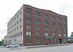
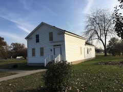
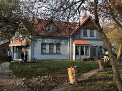
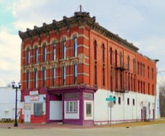
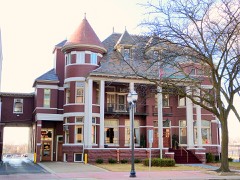
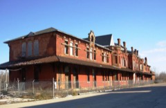
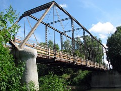
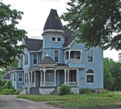
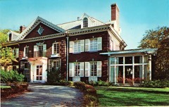
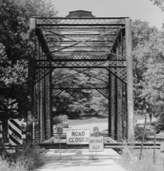
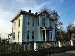
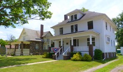
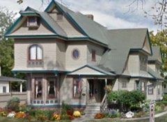
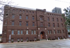
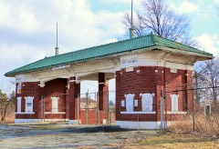
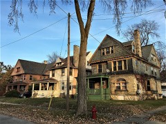
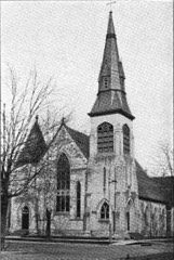
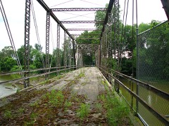
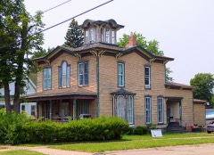
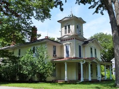
37 National Register listings published here.
Sources: the National Register database, National Park Service
79 topographic sheets cover 53 settlements here, and 37 properties are on the National Register of Historic Places.
37 National Register listings published here.
Sources: the National Register database, National Park Service
Every property in this county listed on the National Register of Historic Places, with the year it was listed and the federal nomination document.
Every wildfire the federal occurrence database records inside this county: 280 of them, burning about 487 acres. 62 started naturally and 2 were recorded as arson. Each settlement page carries the fires within five miles of it.
| Reported cause | Fires |
|---|---|
| Equipment and vehicle use | 103 |
| Missing data/not specified/undetermined | 88 |
| Natural | 62 |
| Recreation and ceremony | 13 |
| Debris and open burning | 8 |
| Smoking | 2 |
| Arson/incendiarism | 2 |
| Power generation/transmission/distribution | 1 |
| Fireworks | 1 |
The five largest, by the area the report gives. None of them was recorded as arson.
| Date | Cause | Size | Reported by | Name on the report |
|---|---|---|---|---|
| 5 February 2020 | Natural | 50 acres | Michigan Department of Natural Resources | CHESANING-BRADY FD 8 - 2020 |
| 15 April 2003 | Debris and open burning | 42 acres | Michigan Department of Natural Resources | not named |
| 13 April 2003 | Smoking | 32 acres | Michigan Department of Natural Resources | not named |
| 14 April 2003 | Equipment and vehicle use | 21 acres | Michigan Department of Natural Resources | not named |
| 22 December 2019 | Equipment and vehicle use | 15 acres | Michigan Department of Natural Resources | ALBEE TOWNSHIP FD 1900075 - 2019 |
| 18 April 2004 | Missing data/not specified/undetermined | 14 acres | Michigan Department of Natural Resources | not named |
| 25 March 2020 | Equipment and vehicle use | 11 acres | Michigan Department of Natural Resources | REESE FIRE RESCUE 030 - 2020 |
| 8 May 1993 | Recreation and ceremony | 10 acres | Huron-Manistee National Forest | not named |
Every settlement page carries the fires within five miles of it - see the settlement index below.
The NOAA Storm Events Database holds 469 reports for this county, causing no deaths, 9 injuries and about $28,729,300 in recorded property damage. Each settlement page carries the reports that name it.
| Kind of event | Reports |
|---|---|
| Thunderstorm Wind | 293 |
| Hail | 123 |
| Tornado | 29 |
| Flood | 10 |
| Flash Flood | 7 |
| Lightning | 7 |
The most serious of them, by death, then injury, then recorded damage. The accounts are quoted exactly as the forecast office filed them.
| When | Event | Place named | Harm | What the report says |
|---|---|---|---|---|
| June 1982 | Tornado (F2) | not stated | 3 hurt, $2,500,000 | no account filed |
| June 2008 | Thunderstorm Wind | Carrollton | 2 hurt, $200,000 | Dozens of trees uprooted and blown down, along with powerlines down.|A few large trees fell onto houses. Downed trees also blocked roads. An entire roof was blown off a commercial building near Stevens and Hamilton roads. In addition, a tree fell onto a car, resulting in two residents suffering minor injuries. |
| June 2015 | Tornado (EF0) | Birch Run | 2 hurt, $50,000 | A tornado touched down just west of Pine Ridge RV Campground in far southeast Saginaw county and tracked generally east along Birch Run Road, lifting near Mcpherson Road in Tuscola County 2 miles south of Millington. Trees were blown down and shingles were observed off houses. The tornado peaked in intensity near Buell and Belsay Roads, with estimated wind speeds up to 115 mph. Major structure damage occurred to one house, with another home suffering damage to roof and wall. Two minor injuries occurred at the campground. The total path length of the tornado ended up being around 11.2 miles, with 2.4 miles occurring in Saginaw County. |
| November 2005 | Thunderstorm Wind | Saginaw | 1 hurt | In the City of Saginaw on Emerson near Jefferson, a large tree, reportedly 6 feet in diameter, fell onto a man, trapping him under the branches. The man was not seriously injured. |
| June 1992 | Thunderstorm Wind | not stated | 1 hurt | no account filed |
| May 2020 | Flood | Fordney | $9,000,000 | The Saginaw River experienced moderate flooding due to the heavy rainfall across the Tri-cities, with the river cresting at 22.32 feet during the evening of May 22nd. In Saginaw County, there were numerous structures that suffered flood damage. A total of 148 buildings suffered major damage, with 13 homes or buildings destroyed, while another 287 buildings were affected or suffered minor damage from a combination of areal flooding and river flooding. |
| June 1996 | Tornado (F3) | Frankenmuth | $5,000,000 | no account filed |
| April 1986 | Tornado (F2) | not stated | $2,500,000 | no account filed |
| April 2013 | Flood | (Mbs)Tri City Apt Sa | $1,300,000 | The Saginaw River at Saginaw crested at 22.42 feet on April 21st at 1045Z. |
| May 2020 | Flood | Fenmore | $1,000,000 | Widespread flooding closed over 100 roads across Bay, Midland, and Saginaw Counties. In Saginaw County, there were numerous structures that suffered flood damage. A total of 148 buildings suffered major damage, with 13 homes or buildings destroyed, while another 287 buildings were affected or suffered minor damage from a combination of areal flooding and river flooding. |
| May 1998 | Thunderstorm Wind | Freeland | $1,000,000 | no account filed |
| June 1996 | Flash Flood | Nrn 1/2 Of Co. | $1,000,000 | no account filed |
| July 1997 | Tornado (F1) | Chesaning | $400,000 | no account filed |
| July 1997 | Tornado (F1) | Chesaning | $400,000 | no account filed |
| May 2019 | Flood | Bridgeport | $300,000 | no account filed |
| May 1998 | Thunderstorm Wind | Bridgeport | $300,000 | no account filed |
| July 1995 | Thunderstorm Wind | Countywide | $300,000 | no account filed |
| June 2014 | Tornado (EF1) | Brant | $250,000 | U.S. National Weather Service meteorologists surveyed a tornado damage path near St. Charles Michigan. The damage was consistent with EF-1 tornado damage. Estimated peak wind values were 90-100 mph. Initial EF-0 damage was observed near the intersections of Marion and Raucholz roads, approximately 6 miles southwest of St. Charles. The Damage consisted of mainly tree limbs. Damage intensity increased to EF-1 along Fordney road between Brant and Fergus roads and continued to the vicinity of Ring and Oakley roads. Several large trees were uprooted and many more were damaged severely, some of which fell on adjacent dwellings. Some minor to moderate structural damage was also observed, consisting mainly of partially lost roofs, blown out garage doors and destruction of out buildings. Additional EF-0 damage was observed across M-52 north of Ring road and continued to near Sharon road on the far south side of St Charles. |
| May 2004 | Tornado (F1) | Shields | $250,000 | A tornado caused damage along Trinklein, Stroebel, Hart, Miller, and Weigel roads in James Township. Damage was also reported along Center Road near Camelot Place Apartments in Saginaw Township.A National Weather Service storm survey determined winds reached up to 90 mph. Numerous trees and power lines were down. |
| June 1982 | Tornado (F1) | not stated | $250,000 | no account filed |
| June 1973 | Tornado (F1) | not stated | $250,000 | no account filed |
| April 1967 | Tornado (F1) | not stated | $250,000 | no account filed |
| July 1997 | Tornado (F1) | Layton Corners | $200,000 | no account filed |
| May 2025 | Tornado (EF0) | St Charles | $150,000 | The tornado touched down in the vicinity of Dempsey Road and Walnut Street, southwest of the Kimberly Oaks Golf Club, where numerous soft and hardwood trees were uprooted. A few stands of pine trees were also sheared off. The tornado |continued to track northeast, crossing the Bad River where tree damage was notable from Walnut Street. The tornado then continued northeast across Coal Miners Park, causing additional tree damage. The tornado ended in the vicinity of the neighborhood |north of the park. There was some minor structural damage observed, but the majority of the damage to homes was sustained where large limbs and/or uprooted trees fell on and into homes. Estimated peak winds of 85 mph. |
| April 2013 | Flood | Merrill | $150,000 | no account filed |
| May 1998 | Thunderstorm Wind | Birch Run | $125,000 | no account filed |
| July 2006 | Lightning | Saginaw | $106,000 | Delayed entry. Two and half months after the incident, a newspaper article reported that lightning had caused severe damage to a Church bell tower. Lightning hit the brick spire of a Church's 76 year old bell tower, sending 300 to 400 pounds of broken rocks flying throughout the surrounding neighborhood. It will cost the Church $106K to repair the tower. |
| April 2026 | Tornado (EF1) | Alicia | $100,000 | The tornado started in a field on northwest side of W Birch Run Rd and|Amman Rd. It first produced EF-0 damage with two rows of pine trees|uprooted, along with removing siding from an outbuilding. The tornado|then continued northeast toward Fergus Rd and Gasper Rd where more pine|trees were uprooted. EF-1 damage occurred on a half mile stretch of|Bishop Rd with the greatest concentration of EF-1 damage near Bishop Rd|and Alicia Rd. Peak winds estimated at 95 mph. This damage included both pine and hardwood trees snapped, two outbuildings and a few empty silos destroyed, along with three homes that sustained roof damage. One home did have the majority of the roof|blown off with the attached garage walls blown out. It continued east producing EF-0 damage to an outbuilding northeast of Alicia Rd and Horning Cut Rd where a door and wall were collapsed before lifting just off on an outbuilding. The tornado then lifted just off to the northeast in a field. |
| April 2026 | Tornado (EF0) | Buena Vista | $100,000 | The tornado touched down just to the northwest of Roedel Rd and S Reimer Rd.|EF-0 damage occurred along the path of the tornado as it moved southeast. Two|barns were damaged and lost the majority of roofing. Some siding on an|adjacent house was also ripped off. Pine trees were uprooted and several|hardwood trees lost large limbs along the path. Peak winds estimated at 80 mph. The tornado lifted of in a field south of Roedel Rd between S Reimer Rd and Maple Rd after causing additional tree damage. |
| June 2008 | Thunderstorm Wind | Saginaw | $100,000 | Trees reported down, along with siding off a house. |
| September 2008 | Flood | Fenmore | $100,000 | no account filed |
| June 2017 | Thunderstorm Wind | Fenmore | $80,000 | Pockets of damage observed roughly along a 12 mile southwest-northeast path. Estimated 100 trees snapped or uprooted, otherwise just lots of minor tree damage. Structural damage to outhouse. A couple old barns collapsed or destroyed. Large uprooted tree landed on deck of a house. One house suffered roof damage. A garage door was caved in, leading to walls of garage buckling. Damage to house awning. |
| May 1998 | Thunderstorm Wind | Merrill | $80,000 | no account filed |
| July 2006 | Thunderstorm Wind | Freeland | $60,000 | A local newspaper reported numerous accounts of trees blown down across Thomas, James, and Saginaw Townships. Several homes were damaged along the Geddes and Thomas road areas. One home sustained significant damage and a destroyed garage. Another Thomas Township home's garage wall bowed out. A fallen tree also destroyed a parked vehicle in James Township. No injuries were reported. Total property damage was roughly estimated at $60K. |
| July 2000 | Thunderstorm Wind | Saginaw | $60,000 | no account filed |
| July 2007 | Thunderstorm Wind | St Charles | $50,000 | A National Weather Service field survey confirmed that 70 to 80 MPH straight line winds blew down numerous large trees. Several homes were damaged from the falling trees. |
| May 2005 | Lightning | Saginaw | $50,000 | Lightning caused a fire at a townhouse unit located on West Cabaret Trail. |
| July 1997 | Tornado (F1) | Burt | $50,000 | no account filed |
| July 1997 | Thunderstorm Wind | Frankenmuth | $50,000 | no account filed |
| February 1997 | Flash Flood | Countywide | $50,000 | no account filed |
| June 2008 | Thunderstorm Wind | Saginaw | $40,000 | Large trees reported down. |
| June 2008 | Thunderstorm Wind | Burt | $30,000 | Trees reported down. |
| June 2005 | Thunderstorm Wind | Oakley | $30,000 | A 50 inch diameter ash tree fall onto a home, puncturing three holes in the roof. |
| July 2014 | Thunderstorm Wind | Fergus | $25,000 | A barn roof was torn off and trees were uprooted. |
| July 2012 | Thunderstorm Wind | Chesaning | $25,000 | Trees and power lines reported down across southwest Saginaw county. |
| June 1976 | Tornado (F1) | not stated | $25,000 | no account filed |
| May 1956 | Tornado (F2) | not stated | $25,000 | no account filed |
| June 1953 | Tornado (F2) | not stated | $25,000 | no account filed |
| May 2013 | Thunderstorm Wind | Chesaning | $20,000 | Multiple trees blown down. Barn Destroyed, along with power poles downed. |
| May 2005 | Lightning | Bridgeport | $15,000 | A lightning strike sparked a basement fire at a home on McGrandy near Airport. The fire was contained to a single room in the basement. |
| October 2001 | Thunderstorm Wind | Bridgeport | $15,000 | A large tree fell onto a garage. |
| July 1999 | Lightning | Frankenmuth | $12,000 | A lightning strike took out a transformer, and blew the chimney off of a home. |
| August 2021 | Thunderstorm Wind | Iva | $10,000 | Trees blown down, as well as some metal roofing blown off a barn. |
| August 2018 | Thunderstorm Wind | St Charles | $10,000 | Numerous trees and power lines reported down across Saginaw County. |
| May 2012 | Thunderstorm Wind | Chesaning | $10,000 | Multiple trees down on roads, causing road closures. |
| August 2011 | Thunderstorm Wind | Burt | $10,000 | Power poles were reported snapped. |
| June 2011 | Thunderstorm Wind | Oakley | $10,000 | Multiple trees down across Saginaw County. |
| June 2008 | Thunderstorm Wind | Freeland | $10,000 | Large tree limbs reported down. |
| June 2007 | Flash Flood | Saginaw | $10,000 | A trained spotter reported water 12 inches deep flowing across Interstate 75. Several cars stalled out. Total damages were estimated at roughly $10K. |
| July 2007 | Thunderstorm Wind | Marion Spgs | $10,000 | Law enforcement reported several large trees down on Harris Road near Meridian Road in Chapin Township. A few homes suffered minor damages. |
The Survey's mineral resources record lists 11 workings inside this county. 5 still produce and 6 are closed or unrecorded. Each settlement page carries the workings within five miles of it.
| Commodity | Workings |
|---|---|
| Fire Clay (Refractory) | 3 |
| Sand and Gravel, Construction | 2 |
| Limestone, General | 2 |
| Clay | 2 |
| Calcium | 1 |
| Graphite | 1 |
The least common of them first, because a county's hundredth gravel pit says nothing its first ten did not.
| Where | Site | Commodity | Status | Recorded |
|---|---|---|---|---|
| Carrollton Lime Kiln Mill | Calcium | Producer | ||
| Wickes Eng'Ng Matls--Saginaw, Mich. | Graphite | Producer | ||
| Saginaw Gravel Pit | Sand and Gravel, Construction | Producer | ||
| Saginaw Mill | Limestone, General | Producer | ||
| Saginaw Rock Prdts--Carrollton Mill | Limestone, General | Past Producer | ||
| Sargent Sand Co. Pit | Sand and Gravel, Construction | Producer | ||
| Shields Pit | Clay | Past Producer | ||
| Stand.Mining Co.Clay Shale Pit | Clay | Prospect | ||
| Albee Clay Sample | Fire Clay (Refractory) | Prospect | ||
| Day's Clay Pit | Fire Clay (Refractory) | Past Producer | ||
| E.Saginaw Clay Sample | Fire Clay (Refractory) | Prospect |
Named settlements recorded in the Geographic Names Information System, each with the topographic sheets covering it. Villages, hamlets and abandoned places alike. Each is shown with the nearest named watercourse or landform and the survey quadrangle it falls on.
Birch Run township · 48415 · On Runnel Drain · Birch Run North quadrangle
16 sheets, 1919 to 1990
Brant township · 48614 · On Little Potato Creek · Saint Charles quadrangle
15 sheets, 1917 to 1985
Carrollton township · 48724 · On Carrollton Bar · Saginaw quadrangle
16 sheets, 1919 to 1990
Bridgeport Charter Township · 48722 · Birch Run North quadrangle
16 sheets, 1919 to 1990
No longer a settlement
Buena Vista Charter Township · 48601 · Near Carrollton Bar · Saginaw quadrangle
16 sheets, 1919 to 1990
St. Charles township · 48655 · On Deer Creek · Chesaning West quadrangle
15 sheets, 1917 to 1985
Buena Vista Charter Township · 48601 · On English Drain · Saginaw NE quadrangle
16 sheets, 1919 to 1990
Taymouth township · 48457 · On Pine Run · Birch Run South quadrangle
14 sheets, 1919 to 1990
Fremont township · 48626 · On Morgan Creek · Saint Charles quadrangle
15 sheets, 1917 to 1985
Brady township · 48649 · On Mickles Creek · Chesaning West quadrangle
15 sheets, 1917 to 1985
Chesaning township · 48649 · On Mickles Creek · Chesaning West quadrangle
15 sheets, 1917 to 1985
St. Charles township · 48655 · On South Fork Bad River · Saint Charles quadrangle
15 sheets, 1917 to 1985
Taymouth township · 48417 · On Pine Run · Birch Run South quadrangle
14 sheets, 1919 to 1990
Birch Run township · 48415 · On Horton Graham Drain · Birch Run North quadrangle
16 sheets, 1919 to 1990
The vanished settlements of Saginaw County: the places named above that are no longer on the map.