 Block
Bay City, Michigan
13 topographic sheets cover this place, the earliest surveyed in 1916 and the latest in 1984. It stands in Bay City City. It lies in ZIP code area 48708. The Survey maps it on the Bay City quadrangle. 32,661 people lived here at the 2020 count. It stands 584 feet above sea level.
Research this city
On record in Bay City
Buildings and businesses the archive holds for this place. Each opens its own page, with the source record it came from.
On the National Register 12 of 16 shown
 Bay City Bascule Bridge
 Bay City Downtown Historic Districtlisted 1985
 Bay City Masonic Templelisted 2016
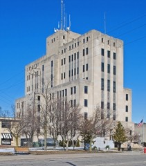 Bay County Buildinglisted 1982
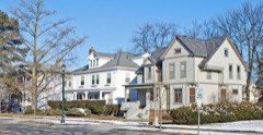 Center Avenue Neighborhood Residential Districtlisted 1982
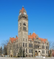 City Halllisted 1975
 James Clements Airport Administration Buildinglisted 1982
 Elm Lawn Cemeterylisted 2006
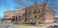 Mercy Hospital and Elizabeth McDowell Bialy Memorial Houselisted 1980
 Midland Street Commercial Districtlisted 1982
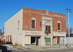 Odd Fellows Valley Lodge No. 189 Buildinglisted 2010
 Pere Marquette Railroad Depot, Bay City Stationlisted 1982
Population over time
4 figuresBay City grew from 1,583 to 32,661 between 1860 and 2020. These are the recorded population figures Wikidata holds for this place, reached through the Geographic Names Information System number this page is keyed on rather than by name, so they belong to this place and not to another of the same name. Most are census counts, but not all are: an early figure may be a founding or settlement estimate, and an estimate published within five years of a census is left out. The change column is computed, and is left blank where more than 20 years separate a figure from the one before it, because a gap that long is not a change between two counts.
| Year | People | Change |
|---|---|---|
| 1860 | 1,583 | |
| 1968 | 50,000 | |
| 2010 | 34,932 | |
| 2020 | 32,661 | -2,271 (-7%) |
Topographic sheets covering this place
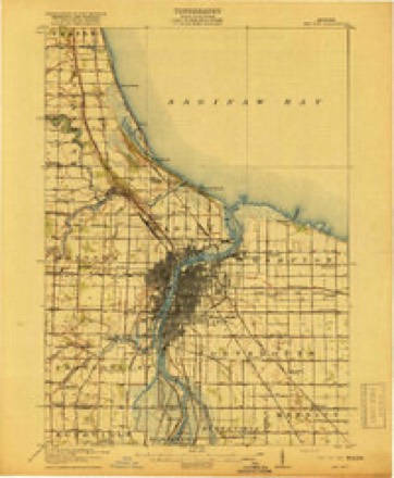
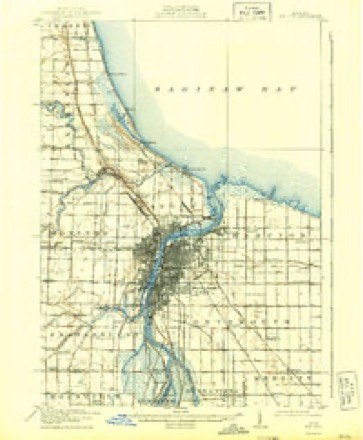
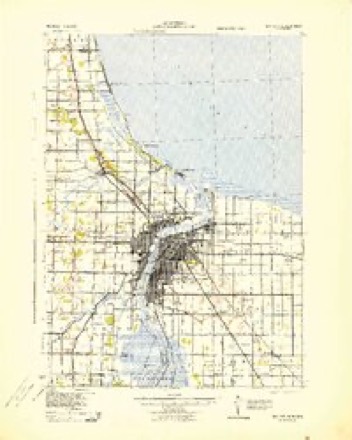
7 surveys from 13 printed sheetsMatched by testing this settlement's coordinate against the published boundary of every sheet in the United States Geological Survey's historical collection. Each opens the scanned sheet at the Survey.
- 1916 USGS Bay City quadrangle1:62500
- 1919 USGS Bay City quadrangle1:62500, 2 printings
- 1943 USGS Bay City quadrangle1:62500
- 1954 USGS Flint quadrangle1:250000, 4 printings
- 1958 USGS Flint quadrangle1:250000, 2 printings
- 1967 USGS Bay City quadrangle1:24000, 2 printings
- 1984 USGS Bay City quadrangle1:100000
Fires near this place
45 since 2018Regional context, not property-specific evidence. The federal wildfire occurrence database lists 45 fires within 5 miles of Bay City between 2018 and 2020, burning about 46 acres in total. 12 started naturally. None was recorded as arson. Distance is straight-line from the map coordinates, so a fire counted here may appear on a neighbouring settlement's page as well.
| Reported cause | Fires |
|---|---|
| Missing data/not specified/undetermined | 17 |
| Equipment and vehicle use | 16 |
| Natural | 12 |
The most recent of them, most recent first, with the day each was reported and the service that recorded it.
| Date | Cause | Size | Reported by | Name on the report |
|---|---|---|---|---|
| 28 September 2018 | Equipment and vehicle use | 1.0 acres | Michigan Department of Natural Resources | BAY CITY FIRE/RESCUE 0003908 - 2018 |
| 18 September 2019 | Equipment and vehicle use | 1.0 acres | Michigan Department of Natural Resources | BAY CITY FIRE/RESCUE 0010824 - 2019 |
| 13 September 2018 | Natural | 1.0 acres | Michigan Department of Natural Resources | MONITOR TOWNSHIP FD 920 - 2018 |
| 31 August 2019 | Equipment and vehicle use | 1.0 acres | Michigan Department of Natural Resources | MONITOR TOWNSHIP FD 792 - 2019 |
| 30 August 2020 | Equipment and vehicle use | 1.0 acres | Michigan Department of Natural Resources | MONITOR TOWNSHIP FD 684 - 2020 |
| 30 August 2020 | Natural | 1.0 acres | Michigan Department of Natural Resources | MONITOR TOWNSHIP FD 688 - 2020 |
| 29 August 2019 | Missing data/not specified/undetermined | 1.0 acres | Michigan Department of Natural Resources | MONITOR TOWNSHIP FD 785 - 2019 |
| 14 August 2019 | Natural | 1.0 acres | Michigan Department of Natural Resources | HAMPTON TOWNSHIP FD 0000769 - 2019 |
Settlements close enough to share some of these fires:
Mines and quarries near this place
5 within 5 milesRegional context, not property-specific evidence. The federal mineral resources record lists 5 workings within 5 miles of Bay City: 3 prospects, 1 past producer, 1 producer. 1 still produces. What was taken out: Clay, Stone. Distance is straight-line from the map coordinates, so a quarry counted here may appear on a neighbouring settlement's page as well.
| Where | Site | Commodity | Status | Recorded |
|---|---|---|---|---|
| Aetna | Stone | Producer | ||
| Central Coal Mine Shale Prospect | Clay | Prospect | ||
| Ed Twinning Clay Pit | Clay | Past Producer | ||
| Mich Coal&Mining Co Shale Prospect | Clay | Prospect | ||
| Winona Coal Co Shale Prospect | Clay | Prospect |
Storms near this place
60 of 72 shownRegional context, not property-specific evidence. The National Weather Service names Bay City in 72 storm reports between 1993 and 2023: 53 thunderstorm wind, 13 hail, 3 lightning, 2 tornado. The reports record 2 injuries. Each account below is quoted exactly as the forecast office filed it, from the NOAA Storm Events Database, and each date opens the federal record of that event.
| When | Event | Place named | Harm | What the report says |
|---|---|---|---|---|
| July 1999 | Hail | Bay City | 2 hurt | no account filed |
| May 1998 | Thunderstorm Wind | Bay City | $1,000,000 | no account filed |
| June 1996 | Thunderstorm Wind | Bay City | $400,000 | no account filed |
| July 1999 | Thunderstorm Wind | Bay City | $90,000 | no account filed |
| October 2001 | Tornado (F1) | Bay City | $60,000 | A tornado touched down 3.5 miles east of the town of Munger. The tornado struck a farmstead on Briggs Road. Property damage from the tornado included, complete destruction of a small barn and garage, a grain silo being lifted off its foundation, and minor damage to the siding and front porch of the main house. The tornado then moved northeast into Tuscola County. |
| June 2023 | Thunderstorm Wind | Bay City | $50,000 | Numerous trees and wires reported down through the county. |
| June 2005 | Thunderstorm Wind | Bay City | $40,000 | County police reported trees and power lines down all over Bay city. A large tree branch also landed on a car on the south side of the city. Siding was blown off houses across the north side of the city, along with fences blown down. |
| September 2002 | Thunderstorm Wind | Bay City | $25,000 | Law enforcement reported that several large trees were blown down and that several garage doors were blown in due to thunderstorm winds. |
| July 2005 | Thunderstorm Wind | Bay City | $20,000 | A thunderstorm wind gust snapped a tree in half. Four private hangers at James Clements Airport also sustained damage. |
| August 2007 | Thunderstorm Wind | Bay City | $8,000 | Law enforcement reported large tree branches down at Lincoln ave and 5th Street. There were also reports of numerous wires down and a couple of blown transformers across the Bay City area. |
| August 2000 | Thunderstorm Wind | Bay City | $7,000 | A tree was downed in Bay City, and large limbs were downed in Bay City and near Essexville. A spotter estimated 60 mph winds just east of Essexville. |
| July 2003 | Thunderstorm Wind | Bay City | $6,000 | Several large trees were blown down. One tree fell onto the roof of a home. Another tree fell onto a parked Asto van. |
| July 2013 | Thunderstorm Wind | Bay City | $3,000 | Very large tree branches blown down, damaging a home. |
| September 2010 | Thunderstorm Wind | Bay City | $3,000 | Several trees fell down onto power lines. |
| October 2006 | Lightning | Bay City | $3,000 | Lightning struck a home. Firefighters reported smoke in the roofline area of the house. Property damage was roughly estimated at $3K. |
| May 2007 | Thunderstorm Wind | Bay City | $2,000 | Law enforcement reported wires down. |
| June 2003 | Thunderstorm Wind | Bay City | $1,000 | Thunderstorm winds blew several trees down and knocked a porch wall down. |
| July 1997 | Thunderstorm Wind | Bay City | $1,000 | no account filed |
| July 2022 | Thunderstorm Wind | Bay City | - | Central dispatch reported 20 to 30 trees blown down across Bay City. |
| August 2021 | Thunderstorm Wind | Bay City | - | Multiple trees and wires reported down in Bay City. |
| August 2021 | Thunderstorm Wind | Bay City | - | Trees were reported down. |
| July 2020 | Thunderstorm Wind | Bay City | - | Numerous trees and power lines reported down. |
| June 2020 | Thunderstorm Wind | Bay City | - | Several reports of trees down. |
| October 2017 | Thunderstorm Wind | Bay City | - | A tree was reported blown down. |
| August 2015 | Thunderstorm Wind | Bay City | - | Trees and powerlines reported down. |
| November 2015 | Thunderstorm Wind | Bay City | - | Numerous trees and power lines reported blown down. |
| July 2013 | Thunderstorm Wind | Bay City | - | A spotter estimated a 60 mph thunderstorm wind gust. |
| July 2013 | Thunderstorm Wind | Bay City | - | Numerous six inch diamter tree limbs reported down. |
| July 2013 | Thunderstorm Wind | Bay City | - | Several small trees blow down. |
| June 2011 | Thunderstorm Wind | Bay City | - | Large tree limbs and wires were reported down. |
| July 2011 | Thunderstorm Wind | Bay City | - | A tree was reported down. |
| June 2011 | Thunderstorm Wind | Bay City | - | Large tree limbs were reported blown down. |
| June 2008 | Thunderstorm Wind | Bay City | - | Trees reported down at Marquette and Truman Parkway. |
| May 2007 | Thunderstorm Wind | Bay City | - | A state park official reported a large tree down. |
| June 2007 | Thunderstorm Wind | Bay City | - | Road Commission reported a tree down on a road. |
| August 2007 | Thunderstorm Wind | Bay City | - | Law enforcement reported a tree down across the westbound lane of Wheeler Road at 3 Mile Road. |
| August 2007 | Thunderstorm Wind | Bay City | - | Law enforcement reported a tree and wire down on the road at the intersection of Douglas Drive and Boy Scout Road. |
| August 2007 | Thunderstorm Wind | Bay City | - | Law enforcement reported a tree down. |
| August 2007 | Thunderstorm Wind | Bay City | - | Law enforcement reported a tree down. |
| July 2006 | Thunderstorm Wind | Bay City | - | Central dispatch reported trees blown down in Bay City. |
| June 2005 | Lightning | Bay City | - | Lightning struck substation on 26th Street. |
| June 2005 | Lightning | Bay City | - | One home suffered some damage from lightning on Stark Road off South Euclid Avenue. |
| June 2005 | Thunderstorm Wind | Bay City | - | Trees were reported blown down. |
| July 2005 | Thunderstorm Wind | Bay City | - | Siding was blown off a building, as well as trees reported down. |
| June 2004 | Thunderstorm Wind | Bay City | - | A trained weather spotter reported large tree limbs down. |
| August 2004 | Thunderstorm Wind | Bay City | - | Local law enforcement reported trees and power lines blown down. |
| June 2003 | Thunderstorm Wind | Bay City | - | Law enforcement reported a large tree blown down. |
| August 2003 | Tornado (F0) | Bay City | - | A cold air funnel briefly touched down on 25th street. The tornado moved a garage 2 feet and destroyed 2 sheds. |
| April 2002 | Thunderstorm Wind | Bay City | - | A trained weather spotter reported an estimated wind gust to 60 MPH at the intersection of I-75 and M84. |
| July 2001 | Dust Devil | Bay City | - | Path Length was 1/4 mile. It tossed lawn chairs and downed tents. |
| September 2001 | Thunderstorm Wind | Bay City | - | Several trees and power lines blown down. |
| August 2001 | Thunderstorm Wind | Bay City | - | Several large limbs blown down. |
| July 1994 | Thunderstorm Wind | Bay City | - | A few trees, large limbs, and power lines were downed by thunderstorm wind gusts in Bay City. Lightning struck two male golfers at the Twin Oaks Golf Course about nine miles southwest of Bay City. One of the men suffered severe burns on his right leg. In addition, a small child was hit by lightning in Bay City. At least one home caught fire as a result of a lightning strike. |
| June 1994 | Thunderstorm Wind | Bay City | - | Strong thunderstorm wind gusts snapped off tree limbs which brought down power lines in Bay City. |
| August 1993 | Thunderstorm Wind | Bay City | - | A few large trees were blown down by gusty thunderstorm winds. A large oak tree was blown down, and strong thunderstorm winds took down all the power lines in the 900 block of South Ottillia St. |
| April 2020 | Hail | Bay City | - | no account filed |
| July 2016 | Hail | Bay City | - | no account filed |
| July 2016 | Hail | Bay City | - | no account filed |
| May 2012 | Hail | Bay City | - | no account filed |
| June 2011 | Hail | Bay City | - | no account filed |
Nearest settlements
The eight closest, with where each one stands in the county. Distances are straight-line, computed from the Geographic Names Information System coordinates.
| Map | Place | Distance | Sheets |
|---|---|---|---|
| West Bay City | 0.5 miles | 13 | |
| Bangor (historical) | 2.5 miles | 14 | |
| Essexville | 2.9 miles | 14 | |
| Aplin Beach | 4.0 miles | 13 | |
| Donahue Beach | 4.3 miles | 14 | |
| Lagoon Beach | 4.6 miles | 14 | |
| Kawkawlin | 4.9 miles | 14 | |
| Tobico Beach | 5.8 miles | 14 |
Elsewhere
Matched on this settlement's Geographic Names Information System number rather than its name, so it cannot be a different place of the same name in another state.
| Wikipedia article on Bay City | An encyclopaedic summary. Its text is share-alike, so it is linked here rather than copied. |
| Wikidata item Q746820 | The structured record the population and elevation above come from. Public domain (CC0). |
Provenance
This settlement is recorded in the Geographic Names Information System as feature 620777. The sheet list is computed by point-in-boundary test against the United States Geological Survey's historical topographic inventory. Both are works of the United States government and carry no copyright under 17 U.S.C. 105.
Wildfire. Short, Karen C. 2022. Spatial wildfire occurrence data for the United States, 1992-2020 [FPA_FOD_20221014]. 6th Edition. Fort Collins, CO: Forest Service Research Data Archive. https://doi.org/10.2737/RDS-2013-0009.6 Collected with United States Government funding and usable without additional permissions or fees.
Mines and quarries. USGS Mineral Resources Data System (MRDS) https://mrdata.usgs.gov/mrds/ A work of the United States government, no copyright under 17 U.S.C. 105.
Storms. NOAA National Centers for Environmental Information, Storm Events Database https://www.ncei.noaa.gov/stormevents/ A work of the United States government, no copyright under 17 U.S.C. 105. Narratives are quoted verbatim from the National Weather Service report and are not edited or summarised.