 Block
Niles, Michigan
16 topographic sheets cover this place, the earliest surveyed in 1927 and the latest in 1983. It stands in Niles City. It lies in ZIP code area 49120. It stands on Dowagiac River. The Survey maps it on the Niles West quadrangle. 11,988 people lived here at the 2020 count. It stands 686 feet above sea level.
Research this city
On record in Niles
Buildings and businesses the archive holds for this place. Each opens its own page, with the source record it came from.
On the National Register 7 records
 Henry A. Chapin Houselisted 1981
 Ring Lardner Houselisted 1972
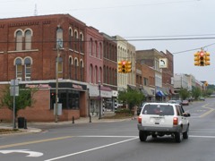 Niles Downtown Historic Districtlisted 2007
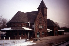 Niles Railroad Depotlisted 1979
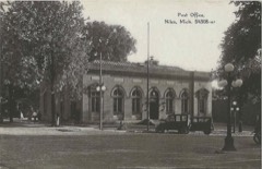 Old US Post Officelisted 1985
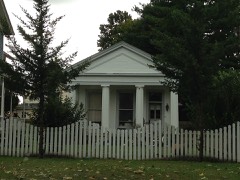 Paine Banklisted 1973
- Ferry Street Historic Districtlisted 2025
Population over time
3 figuresNiles fell from 12,204 to 11,988 between 2000 and 2020. These are the recorded population figures Wikidata holds for this place, reached through the Geographic Names Information System number this page is keyed on rather than by name, so they belong to this place and not to another of the same name. Most are census counts, but not all are: an early figure may be a founding or settlement estimate, and an estimate published within five years of a census is left out. The change column is computed, and is left blank where more than 20 years separate a figure from the one before it, because a gap that long is not a change between two counts.
| Year | People | Change |
|---|---|---|
| 2000 | 12,204 | |
| 2010 | 11,600 | -604 (-5%) |
| 2020 | 11,988 | +388 (+3%) |
Topographic sheets covering this place
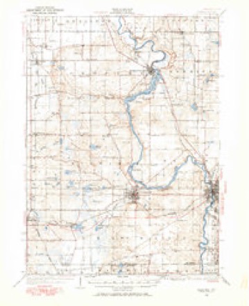
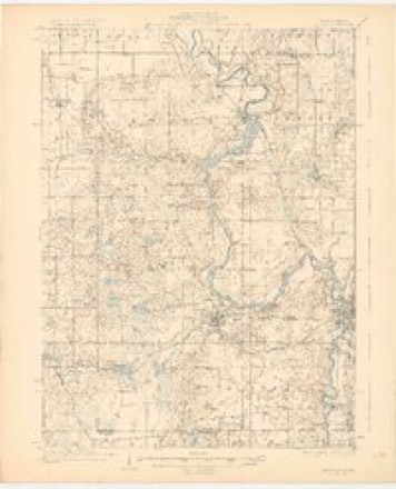
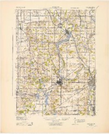
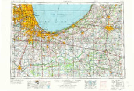
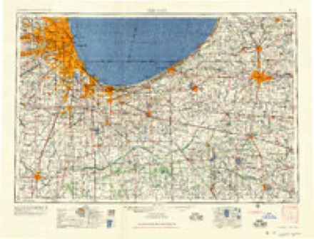
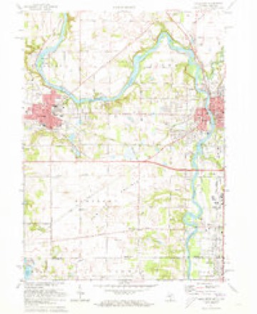
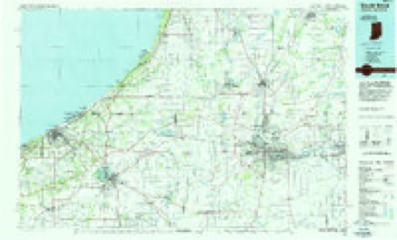
7 surveys from 16 printed sheetsMatched by testing this settlement's coordinate against the published boundary of every sheet in the United States Geological Survey's historical collection. Each opens the scanned sheet at the Survey.
- 1927 USGS Niles quadrangle1:62500
- 1930 USGS Niles quadrangle1:62500, 4 printings
- 1943 USGS Niles quadrangle1:62500
- 1953 USGS Chicago quadrangle1:250000, 5 printings
- 1957 USGS Chicago quadrangle1:250000
- 1971 USGS Niles West quadrangle1:24000, 2 printings
- 1983 USGS South Bend quadrangle1:100000, 2 printings
Fires near this place
24 since 2018Regional context, not property-specific evidence. The federal wildfire occurrence database lists 24 fires within 5 miles of Niles between 2018 and 2020, burning about 26 acres in total. None started naturally. None was recorded as arson. Distance is straight-line from the map coordinates, so a fire counted here may appear on a neighbouring settlement's page as well.
| Reported cause | Fires |
|---|---|
| Missing data/not specified/undetermined | 14 |
| Equipment and vehicle use | 10 |
The most recent of them, most recent first, with the day each was reported and the service that recorded it.
| Date | Cause | Size | Reported by | Name on the report |
|---|---|---|---|---|
| 5 September 2019 | Equipment and vehicle use | 1.0 acres | Michigan Department of Natural Resources | NILES TOWNSHIP FD 2019309 - 2019 |
| 27 September 2020 | Equipment and vehicle use | 1.0 acres | Michigan Department of Natural Resources | BUCHANAN TOWNSHIP FD 68 - 2020 |
| 31 August 2019 | Missing data/not specified/undetermined | 1.0 acres | Michigan Department of Natural Resources | HOWARD TOWNSHIP VFD 2019278 - 2019 |
| 27 July 2019 | Missing data/not specified/undetermined | 1.0 acres | Michigan Department of Natural Resources | HOWARD TOWNSHIP VFD 2019238 - 2019 |
| 22 May 2018 | Missing data/not specified/undetermined | 1.0 acres | Michigan Department of Natural Resources | HOWARD TOWNSHIP VFD 2018131 - 2018 |
| 17 May 2018 | Equipment and vehicle use | 1.0 acres | Michigan Department of Natural Resources | NILES TOWNSHIP FD 2018156 - 2018 |
| 13 May 2020 | Missing data/not specified/undetermined | 1.0 acres | Michigan Department of Natural Resources | BERTRAND TOWNSHIP FD 2020027 - 2020 |
| 1 May 2018 | Equipment and vehicle use | 1.0 acres | Michigan Department of Natural Resources | NILES TOWNSHIP FD 2018132 - 2018 |
Settlements close enough to share some of these fires:
Mines and quarries near this place
2 within 5 milesRegional context, not property-specific evidence. The federal mineral resources record lists 2 workings within 5 miles of Niles: 1 producer, 1 past producer. 1 still produces. What was taken out: Sand and Gravel, Construction. Distance is straight-line from the map coordinates, so a quarry counted here may appear on a neighbouring settlement's page as well.
| Where | Site | Commodity | Status | Recorded |
|---|---|---|---|---|
| Kiell Pit & Mill | Sand and Gravel, Construction | Past Producer | ||
| Three S Pit & Mill | Sand and Gravel, Construction | Producer |
Storms near this place
33 since 1997Regional context, not property-specific evidence. The National Weather Service names Niles in 33 storm reports between 1997 and 2023: 23 thunderstorm wind, 4 hail, 3 tornado, 2 flash flood. No death or injury is recorded in these reports. Each account below is quoted exactly as the forecast office filed it, from the NOAA Storm Events Database, and each date opens the federal record of that event.
| When | Event | Place named | Harm | What the report says |
|---|---|---|---|---|
| August 1998 | Tornado (F1) | Niles | $1,100,000 | EXTENSIVE DAMAGE TO TREES ACROSS THE CITY WHICH BLOCKED 15 SEPARATE STREETS AT ONE TIME. 60 HOMES DAMAGED SUSTAINED MINOR TO SEVERE STRUCTURAL DAMAGE. MANY VEHICLES WERE DAMAGED OR DESTROYED BY FALLEN TREES AND LIMBS. SEVERAL POWER POLES AND LINES TAKEN OUT. THE FRENCH PAPER COMPANY LOST ROOFS ON THREE DIFFERENT BUILDINGS AS DID THE D&D TIRE COMPANY WHICH HAD ITS WAREHOUSE ROOF RIPPED OFF. DEMOND GROCERY STORE LOST 20K DOLLARS WORTH OF PERISHABLE FOOD ITEMS DUE TO THE EXTENDED EXTENSIVE POWER OUTAGE THAT AFFECTED 41,500 PEOPLE AT ONE POINT. ONE MAN LOST 21 LARGE TREES IN HIS YARD ALONE. THE MICHIGAN STATE GOVERNOR DECLARED THE CITY OF NILES A DISASTER AREA. AN OFF DUTY MICHIGAN STATE POLICE OFFICER TRAGICALLY LOST HIS LIFE WHEN HE WAS ELECTROCUTED BY A DOWNED POWER LINE. |
| October 2001 | Tornado (F1) | Niles | $750,000 | no account filed |
| July 1997 | Thunderstorm Wind | Niles | $50,000 | Numerous trees were downed in the Niles area during the severe thunderstorm which produced estimated 70 mph winds across much of southeastern Berrien County. Falling trees downed power, phone, and cable lines. Minor damage was reported at several residences, including reports of patio furniture being swept away and a trampoline destroyed. Nearly 2 3/4 inches of rain fell in one hour at a Niles residence, with minor street flooding reported in the storm's aftermath. |
| June 2005 | Lightning | Niles | $40,000 | Residents reported hearing a loud boom and a flash of light from their electrical meter box. A fire rapidly started as a result, destroying at least half the house. The damage to the house was estimated as a total determination of the damage was not available. No one was injured. |
| July 2007 | Flash Flood | Niles | $25,000 | A report of 3.61 inches of rain was received in the Niles area, with several roads having signs of partial damage from flowing water over them. Damage is estimated at $25,000. |
| November 1998 | Thunderstorm Wind | Niles | $25,000 | SEVERAL TREES...TREE LIMBS...POWER LINES AND POWER POLES WERE EITHER SNAPPED OR BLOWN DOWN IN TOWN. |
| April 2008 | Thunderstorm Wind | Niles | $10,000 | A local newspaper reported that a tree fell onto a car. No specifics on the car or the amount of damage was given. Damage is estimated at $10,000. |
| March 2023 | Flash Flood | Niles | $5,000 | Both lanes of traffic were flooded on Michigan Route 139 in Niles at Lincoln Ave. |
| July 1997 | Thunderstorm Wind | Niles | $2,500 | Niles Police Department reported trees downed in Niles. |
| June 2021 | Thunderstorm Wind | Niles | - | WSBT relayed via Twitter a picture of a few broken tree branches. |
| June 2021 | Thunderstorm Wind | Niles | - | A couple of large tree limbs down. Time estimated from radar. |
| October 2021 | Thunderstorm Wind | Niles | - | Emergency management officials reported a three foot diameter tree was blown down. |
| August 2020 | Thunderstorm Wind | Niles | - | Local media reported through social media of several large, healthy branches down with one rotten tree severely damaged. |
| July 2019 | Thunderstorm Wind | Niles | - | Local media reported multiple trees down in the area. |
| July 2019 | Thunderstorm Wind | Niles | - | Local media reported a tree was blown down in the road. |
| February 2017 | Tornado (EF1) | Niles | - | A NWS damage survey indicated a tornado touched down in downtown Niles, near the Eastside Elementary School. Extensive tree damage along|with minor to significant structural damage to homes occurred in |about a 5 block area of Niles Michigan. Many large trees were downed onto houses and vehicles. A city of Niles public works maintenance building also suffered damage. |
| June 2016 | Hail | Niles | - | Broadcast media shared pictures from viewers of at least one inch diameter inch hail. |
| October 2012 | Thunderstorm Wind | Niles | - | Local fire officials reported a tree was blown down near Geiger and Walton Roads, west of Old US 31. |
| June 2010 | Thunderstorm Wind | Niles | - | Nine power poles snapped. |
| July 2010 | Thunderstorm Wind | Niles | - | Law enforcement officials reported large tree limbs down as well as a few trees in the Niles and Bertrand area. |
| October 2007 | Thunderstorm Wind | Niles | - | Two trees were blown down in the town of Niles. |
| May 2004 | Thunderstorm Wind | Niles | - | Law enforcement reported trees and power lines down in Niles. |
| May 2004 | Thunderstorm Wind | Niles | - | Amateur radio reported trees down in Niles. |
| May 2004 | Thunderstorm Wind | Niles | - | Emergency management reported trees down in Bertrand. |
| August 2004 | Thunderstorm Wind | Niles | - | Law enforcement reported trees down in Niles. |
| July 2003 | Thunderstorm Wind | Niles | - | Law enforcement trees and power lines down in Niles. |
| July 2003 | Thunderstorm Wind | Niles | - | Law enforcement reported trees down in Niles. |
| May 2000 | Thunderstorm Wind | Niles | - | Power pole and street light down. |
| May 2000 | Thunderstorm Wind | Niles | - | Trees down at Library and at Hannah Rd. and Morris Dr. |
| June 2000 | Thunderstorm Wind | Niles | - | Minor wind damage to the roofs of 4 buildings. |
| October 2007 | Hail | Niles | - | no account filed |
| October 2007 | Hail | Niles | - | no account filed |
| August 2003 | Hail | Niles | - | no account filed |
Nearest settlements
The eight closest, with where each one stands in the county. Distances are straight-line, computed from the Geographic Names Information System coordinates.
| Map | Place | Distance | Sheets |
|---|---|---|---|
| North Niles | 1.8 miles | 14 | |
| Bertrand | 3.8 miles | 16 | |
| Fairland | 5.0 miles | 16 | |
| Buchanan | 5.7 miles | 16 | |
| Bakertown | 7.4 miles | 15 | |
| Pennellwood | 7.9 miles | 16 | |
| River Spring Estates | 8.6 miles | 16 | |
| Berrien Center | 8.8 miles | 16 |
Elsewhere
Matched on this settlement's Geographic Names Information System number rather than its name, so it cannot be a different place of the same name in another state.
| Wikipedia article on Niles | An encyclopaedic summary. Its text is share-alike, so it is linked here rather than copied. |
| Wikidata item Q2442951 | The structured record the population and elevation above come from. Public domain (CC0). |
Provenance
This settlement is recorded in the Geographic Names Information System as feature 633412. The sheet list is computed by point-in-boundary test against the United States Geological Survey's historical topographic inventory. Both are works of the United States government and carry no copyright under 17 U.S.C. 105.
Wildfire. Short, Karen C. 2022. Spatial wildfire occurrence data for the United States, 1992-2020 [FPA_FOD_20221014]. 6th Edition. Fort Collins, CO: Forest Service Research Data Archive. https://doi.org/10.2737/RDS-2013-0009.6 Collected with United States Government funding and usable without additional permissions or fees.
Mines and quarries. USGS Mineral Resources Data System (MRDS) https://mrdata.usgs.gov/mrds/ A work of the United States government, no copyright under 17 U.S.C. 105.
Storms. NOAA National Centers for Environmental Information, Storm Events Database https://www.ncei.noaa.gov/stormevents/ A work of the United States government, no copyright under 17 U.S.C. 105. Narratives are quoted verbatim from the National Weather Service report and are not edited or summarised.