 Block
Wayland, Michigan
9 topographic sheets cover this place, the earliest surveyed in 1958 and the latest in 1984. It stands in Wayland City. It lies in ZIP code area 49348. The Survey maps it on the Wayland quadrangle. 4,435 people lived here at the 2020 count. It stands 771 feet above sea level.
On record in Wayland
Buildings and businesses the archive holds for this place. Each opens its own page, with the source record it came from.
On the National Register 1 record
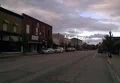 Wayland Downtown Historic Districtlisted 2021
Population over time
2 figuresWayland grew from 4,079 to 4,435 between 2010 and 2020. These are the recorded population figures Wikidata holds for this place, reached through the Geographic Names Information System number this page is keyed on rather than by name, so they belong to this place and not to another of the same name. Most are census counts, but not all are: an early figure may be a founding or settlement estimate, and an estimate published within five years of a census is left out. The change column is computed, and is left blank where more than 20 years separate a figure from the one before it, because a gap that long is not a change between two counts.
| Year | People | Change |
|---|---|---|
| 2010 | 4,079 | |
| 2020 | 4,435 | +356 (+9%) |
Topographic sheets covering this place
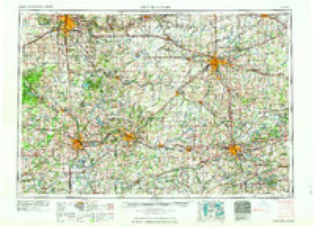
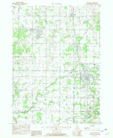
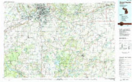
6 surveys from 9 printed sheetsMatched by testing this settlement's coordinate against the published boundary of every sheet in the United States Geological Survey's historical collection. Each opens the scanned sheet at the Survey.
- 1958 USGS Grand Rapids quadrangle1:250000, 2 printings
- 1959 USGS Wayland quadrangle1:62500, 2 printings
- 1961 USGS Grand Rapids quadrangle1:250000
- 1962 USGS Grand Rapids quadrangle1:250000, 2 printings
- 1982 USGS Wayland quadrangle1:24000
- 1984 USGS Grand Rapids quadrangle1:100000
In the county-history sources
2,780 words on this townshipHistory of Allegan and Barry Counties Michigan 1880, published 1880 names this settlement in its chapter on Wayland Township. These are the passages that mention it, exactly as the scans read.
This is an incorporated village of some 700 inhabitants, situated in the northwest corner of the township of Wayland. It is a station on the Grand Rapids and Indiana Railroad, distant twenty-seven miles north of Kalamazoo, twenty-one miles south from Grand Rapids, twenty miles northeast of Allegan, the county-seat, one hundred and seventy-two miles from pics and one hundred and sixtyeight from Chicago.
Passage source: History of Allegan and Barry Counties Michigan 1880, published 1880.
The Lake-Shore and Michigan Southern Railroad was first completed, and, as its road-bed at Hilliard's Station was but four miles distant west from Wayland, there were many here who did not believe the Grand Rapids and Indiana Railroad Company would run their line through that village. Consequently, an exodus (though a small one) took place. The latter road, however, was completed in the summer of 1870, since which time not many important changes have occurred, except: at the station where are situated William E. White's grist-mill, a saw-mill, and a large unoccupied building erected for the purpose of manufacturing chairs. In the village proper the most recent acquisition is a commodious brick school building, which was completed in 1879 at a cost of $4500, including site, etc.
Passage source: History of Allegan and Barry Counties Michigan 1880, published 1880.
At the fall meeting of the Allegan County board of supervisors, held in the year 1868, the village of Wayland was duly incorporated, and section 6 and the west half of section 5 designated as its limits. By this act inspectors of election were appointed, and the electors directed to assemble on the first Monday in December, 1868, for holding their first charter election.
Passage source: History of Allegan and Barry Counties Michigan 1880, published 1880.
Machine-read from a century-old scan, so expect the errors a machine makes: misspelled names, dropped words, stray characters.
Read the whole chapter on Wayland Township - it names this place 8 more 8 times.
Fires near this place
14 since 1996Regional context, not property-specific evidence. The federal wildfire occurrence database lists 14 fires within 5 miles of Wayland between 1996 and 2020, burning about 41 acres in total. 2 started naturally. None was recorded as arson. Distance is straight-line from the map coordinates, so a fire counted here may appear on a neighbouring settlement's page as well.
| Reported cause | Fires |
|---|---|
| Equipment and vehicle use | 5 |
| Missing data/not specified/undetermined | 3 |
| Natural | 2 |
| Recreation and ceremony | 2 |
| Misuse of fire by a minor | 1 |
| Debris and open burning | 1 |
The most recent of them, most recent first, with the day each was reported and the service that recorded it.
| Date | Cause | Size | Reported by | Name on the report |
|---|---|---|---|---|
| 1 September 2019 | Natural | 1.0 acres | Michigan Department of Natural Resources | LEIGHTON TOWNSHIP FD 0000103 - 2019 |
| 8 June 2020 | Missing data/not specified/undetermined | 1.0 acres | Michigan Department of Natural Resources | DORR TOWNSHIP FD 0000070 - 2020 |
| 11 June 2018 | Equipment and vehicle use | 1.0 acres | Michigan Department of Natural Resources | WAYLAND FD 0000109 - 2018 |
| 9 April 2019 | Equipment and vehicle use | 1.0 acres | Michigan Department of Natural Resources | LEIGHTON TOWNSHIP FD 0000041 - 2019 |
| 18 April 2004 | Misuse of fire by a minor | 6.8 acres | Michigan Department of Natural Resources | not named |
| 9 March 2020 | Equipment and vehicle use | 1.0 acres | Michigan Department of Natural Resources | WAYLAND FD 0000042 - 2020 |
| 26 March 2018 | Recreation and ceremony | 1.0 acres | Michigan Department of Natural Resources | LEIGHTON TOWNSHIP FD 0000037 - 2018 |
| 23 March 1996 | Debris and open burning | 22 acres | Michigan Department of Natural Resources | not named |
Settlements close enough to share some of these fires:
Storms near this place
22 since 1994Regional context, not property-specific evidence. The National Weather Service names Wayland in 22 storm reports between 1994 and 2023: 13 thunderstorm wind, 8 hail, 1 flash flood. No death or injury is recorded in these reports. Each account below is quoted exactly as the forecast office filed it, from the NOAA Storm Events Database, and each date opens the federal record of that event.
| When | Event | Place named | Harm | What the report says |
|---|---|---|---|---|
| April 2023 | Hail | Wayland | $500,000 | Hail up to nearly two inches in diameter was reported. Car windshields were cracked and the hail did considerable damage to roofs and siding of homes. |
| July 2019 | Thunderstorm Wind | Wayland | $50,000 | Several trees were blown down. |
| December 2007 | Thunderstorm Wind | Wayland | $50,000 | Numerous power lines were blown down along with 6 inch tree limbs. |
| May 2004 | Thunderstorm Wind | Wayland | $50,000 | Several trees and power lines were blown down in Wayland. |
| July 2006 | Thunderstorm Wind | Wayland | $40,000 | Trees and power lines were blown down in Wayland and Allegan. |
| July 2005 | Thunderstorm Wind | Wayland | $40,000 | no account filed |
| July 2003 | Thunderstorm Wind | Wayland | $25,000 | Numerous sixteen inch diameter trees were blown down north of Wayland. |
| June 1997 | Thunderstorm Wind | Wayland | $25,000 | The Wayland Police Department reported numerous trees and power lines downed across the area. Some people were trapped in vehicles under felled power lines. |
| June 2000 | Hail | Wayland | $20,000 | no account filed |
| July 2005 | Thunderstorm Wind | Wayland | $10,000 | Several trees were blown down two miles north northeast of Wayland. |
| July 2004 | Thunderstorm Wind | Wayland | $10,000 | Numerous power lines were blown down in Wayland. |
| April 2008 | Hail | Wayland | $10,000 | no account filed |
| June 2005 | Thunderstorm Wind | Wayland | $5,000 | Road commission officials reported a couple of trees were blown down three miles north of Wayland. |
| September 2003 | Hail | Wayland | $5,000 | An isolated severe thunderstorm produced three quarters inch diameter hail in Wayland. |
| July 1997 | Thunderstorm Wind | Wayland | $5,000 | Trees and power lines were downed in Wayland. |
| September 1997 | Thunderstorm Wind | Wayland | $2,500 | Local media reported large tree limbs were downed in Wayland Township. |
| June 2002 | Hail | Wayland | $2,000 | Three quarters inch hail was reported by trained spotters 3 miles west of Wayland. |
| May 2012 | Hail | Wayland | - | The public reported one inch hail five miles south of Wayland. |
| May 2012 | Hail | Wayland | - | One inch hail was reported in Wayland. |
| May 2000 | Flash Flood | Wayland | - | no account filed |
| April 1997 | Thunderstorm Wind | Wayland | - | no account filed |
| September 1994 | Hail | Wayland | - | no account filed |
Nearest settlements
The eight closest, with where each one stands in the county. Distances are straight-line, computed from the Geographic Names Information System coordinates.
| Map | Place | Distance | Sheets |
|---|---|---|---|
| Bradley | 3.0 miles | 9 | |
| Corning | 4.2 miles | 9 | |
| Hilliards | 4.4 miles | 9 | |
| Moline | 4.6 miles | 9 | |
| Hopkinsburg | 4.9 miles | 9 | |
| Dorr | 5.4 miles | 9 | |
| Green Lake | 5.4 miles | 9 | |
| Shelbyville | 5.5 miles | 9 |
Elsewhere
Matched on this settlement's Geographic Names Information System number rather than its name, so it cannot be a different place of the same name in another state.
| Wikipedia article on Wayland | An encyclopaedic summary. Its text is share-alike, so it is linked here rather than copied. |
| Wikidata item Q2507527 | The structured record the population and elevation above come from. Public domain (CC0). |
Provenance
This settlement is recorded in the Geographic Names Information System as feature 1615899. The sheet list is computed by point-in-boundary test against the United States Geological Survey's historical topographic inventory. Both are works of the United States government and carry no copyright under 17 U.S.C. 105.
Wildfire. Short, Karen C. 2022. Spatial wildfire occurrence data for the United States, 1992-2020 [FPA_FOD_20221014]. 6th Edition. Fort Collins, CO: Forest Service Research Data Archive. https://doi.org/10.2737/RDS-2013-0009.6 Collected with United States Government funding and usable without additional permissions or fees.
Storms. NOAA National Centers for Environmental Information, Storm Events Database https://www.ncei.noaa.gov/stormevents/ A work of the United States government, no copyright under 17 U.S.C. 105. Narratives are quoted verbatim from the National Weather Service report and are not edited or summarised.