 Block
From the record
15 National Register listings published here, 1 of them a National Historic Landmark.
Sources: the National Register database, National Park Service
71 topographic sheets cover 29 settlements here, and 15 properties are on the National Register of Historic Places.
15 National Register listings published here, 1 of them a National Historic Landmark.
Sources: the National Register database, National Park Service
Every property in this county listed on the National Register of Historic Places, with the year it was listed and the federal nomination document.
| Photograph | Property | Type | Listed | Reference |
|---|---|---|---|---|
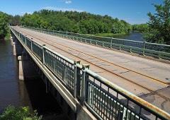 | Bridge No. 4969 | structure | 2015 | 14001175 |
 | Burton-Rosenmeier House | building | 1986 | 86000328 |
 | Church of Our Savio-Episcopal | building | 1980 | 80002090 |
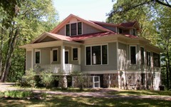 | Charles A. Lindbergh House and Park | building | 1970 | 70000303 |
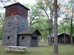 | Charles A. Lindbergh State Park WPA/Rustic Style Historic Resources | district | 1989 | 89001655 |
 | Little Falls Carnegie Library | building | 1980 | 80002091 |
 | Little Falls Commercial Historic District | district | 1994 | 94000740 |
 | Morrison County Courthouse | building | 1978 | 78001552 |
 | Northern Pacific Railway Depot | building | 1985 | 85001987 |
 | Our Lady of the Angels Academy | building | 2005 | 05001474 |
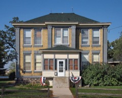 | Pine Tree Lumber Company Office Building | building | 1985 | 85001991 |
 | St. Joseph's Church-Catholic | building | 1985 | 85001998 |
 | Warren, William, Two Rivers House Site and McDougall, Peter, Farmstead | building | 1974 | 74001031 |
 | Weyerhaeuser, Charles A., and Musser, Richard Drew, Houses | building | 1985 | 85001990 |
 | Almond A. White House | building | 1986 | 86000330 |
Every wildfire the federal occurrence database records inside this county: 1,843 of them, burning about 43,280 acres. 9 started naturally and 780 were recorded as arson. Each settlement page carries the fires within five miles of it.
| Reported cause | Fires |
|---|---|
| Arson/incendiarism | 780 |
| Debris and open burning | 600 |
| Equipment and vehicle use | 213 |
| Missing data/not specified/undetermined | 107 |
| Railroad operations and maintenance | 42 |
| Recreation and ceremony | 41 |
| Smoking | 31 |
| Power generation/transmission/distribution | 13 |
| Natural | 9 |
| Fireworks | 3 |
| Other causes | 3 |
| Misuse of fire by a minor | 1 |
The five largest, by the area the report gives. 6 of them were set deliberately.
| Date | Cause | Size | Reported by | Name on the report |
|---|---|---|---|---|
| 5 April 1992 | Debris and open burning | 1,737 acres | Minnesota Department of Natural Resources | not named |
| 23 March 2003 | Arson/incendiarism | 1,250 acres | Minnesota Department of Natural Resources | HOG PILE |
| 5 April 1992 | Arson/incendiarism | 830 acres | Minnesota Department of Natural Resources | not named |
| 19 March 1998 | Arson/incendiarism | 750 acres | Crane Meadows National Wildlife Refuge | WEST SKUNK |
| 5 April 2004 | Debris and open burning | 710 acres | Minnesota Department of Natural Resources | WEST FIRE |
| 18 April 1993 | Arson/incendiarism | 680 acres | Minnesota Department of Natural Resources | not named |
| 6 April 2006 | Arson/incendiarism | 663 acres | Minnesota Department of Natural Resources | not named |
| 22 April 1993 | Arson/incendiarism | 640 acres | Minnesota Department of Natural Resources | not named |
Every settlement page carries the fires within five miles of it - see the settlement index below.
The NOAA Storm Events Database holds 376 reports for this county, causing 1 death, 26 injuries and about $11,063,000 in recorded property damage. Each settlement page carries the reports that name it.
| Kind of event | Reports |
|---|---|
| Hail | 170 |
| Thunderstorm Wind | 145 |
| Tornado | 30 |
| Flash Flood | 11 |
| Funnel Cloud | 8 |
| Heavy Rain | 8 |
| Flood | 3 |
| Lightning | 1 |
The most serious of them, by death, then injury, then recorded damage. The accounts are quoted exactly as the forecast office filed them.
| When | Event | Place named | Harm | What the report says |
|---|---|---|---|---|
| September 1997 | Tornado (F3) | Lastrup | 1 killed, 1 hurt, $1,700,000 | Several buildings destroyed and numerous other buildings damaged. Hundreds of trees down. A number of cattle killed in barn collapse. One man injured when the tornado engulfed his car and threw it into a nearby woods. A second man critically injured when his garage collapsed. He died several weeks later.Total path length of tornado from 1 NE of Lastrup to Onamia was 17 miles. |
| July 2001 | Lightning | Camp Ripley | 25 hurt | One U. S. Marine Reservist was critically injured, but survived and was released the next afernoon. Twenty four others were treated and released within hours of the strike. |
| April 2001 | Flash Flood | Countywide | $2,000,000 | no account filed |
| June 2022 | Flash Flood | Randall | $1,530,000 | Nearly 30 homes were evacuated in the town of Randall due to flood waters spilling over the banks of the Little Elk River. Numerous roads and bridges were also damaged. The heaviest rainfall occurred before 4 am, but flood waters developed during the morning. Damage totals were provided by Morrison County Emergency Management. |
| April 2001 | Flash Flood | Countywide | $1,500,000 | no account filed |
| September 2016 | Tornado (EF1) | Darling | $1,000,000 | A NWS storm survey concluded that an EF1 tornado with estimated winds of 90 mph, damaged several buildings and uprooted trees in Camp Ripley. One concrete block apartment style living quarters had its roof completely removed, and another one had its roof partially removed. Another high-roof garage building was mostly destroyed, with debris landing in an array of solar panels, which sustained significant damage. One car was lofted and deposited about 50 feet away. The tornado started just southeast of Randall and moved east, damaging a resort and a number of lake homes on the northwest side of Green Prairie Fish Lake. It then turned northeast and hit Camp Ripley. The core of the tornado tracked just north of the KRYM AWOS at the Camp Ripley airfield, which measured a peak gust of 56 knots. Specific wind measurements (in knots) were 14016G24 at 0333Z, 19034G56 at 0334Z, 24048G56 at 0335Z, 28048G56 at 0336Z, 33036G56 at 0337Z, and 30018G56 at 0338Z. The tornado intensified shortly thereafter, taking the roof off the buildings, lofting a car, and bending six metal light poles in half. |
| May 2022 | Tornado (EF1) | Cushing | $750,000 | Hundreds of trees were uprooted or snapped as the tornado moved along the east side of Lake Alexander. Many trees came down on vehicles, sheds, and cabins. Maximum winds were estimated at 90 mph. |
| May 2022 | Thunderstorm Wind | Pierz | $500,000 | The Pierz city garage on the north end of town was severely damaged due to severe straight-line winds. |
| August 2010 | Thunderstorm Wind | Royalton | $250,000 | Significant straight-line wind damage occurred from near Royalton, east along and near East Nature Road for roughly 13 miles. Damage included a chicken barn roof blown off, shingles off a home, and several large trees uprooted. |
| July 2010 | Tornado (EF0) | Little Rock | $250,000 | Several dozen trees were downed, two sheds and a barn were damaged, and minor damage occurred to a house. |
| August 1978 | Tornado (F1) | not stated | $250,000 | no account filed |
| July 1966 | Tornado (F1) | not stated | $250,000 | no account filed |
| August 2007 | Thunderstorm Wind | Harding | $200,000 | Numerous tees down. Four mobile homes on the northwest side of Pierz were deemed uninhabitable after being pounded by the strong wind and large hail. An adjacent chicken barn was also destroyed. |
| June 2001 | Tornado (F2) | Flensburg | $200,000 | One home lost its roof. Several sheds and outbuildings blown down. Two additional homes sustained minor damage. |
| April 2023 | Flood | Hillman | $149,000 | A combination of record setting seasonal snowfall, high snow water equivalent values, and rapid snow melt led to low lying areas, ditches, and ravines across the county to flood for a prolonged period of time. Road infrastructure such as bridges, gravel roads, and culverts experience varied degrees of damage caused by rapid runoff. Morrison County Emergency Management reported $149,300 in damages to roads and bridges. |
| May 2022 | Thunderstorm Wind | Darling | $100,000 | Scattered wind damage was noted from social media pictures in the township of Darling. This is northwest of Little Falls and posted significant barn damage, with several uprooted trees along a 50 to 60 foot path. |
| May 2022 | Thunderstorm Wind | Little Falls | $75,000 | Significant wind damage occurred to city-owned property of the Little Falls Golf Course. There were 53 trees lost to the storm, along with several large branches. There were also several buildings damage to the local Little Falls Community School District. Dozens of trees were also broken or uprooted in the southeast part of town. A damage survey by the NWS was performed and it appeared to have been downburst damage. |
| August 2020 | Tornado (EF0) | Camp Ripley Jct | $50,000 | An NWS survey found damage consistent with an EF-0 tornado in northern Morrison County about 7 miles northeast of Little Falls. The tornado traveled northeast for almost 6 miles snapping large tree branches, uprooting trees, and causing damage to a few outbuildings. |
| July 2019 | Hail | Cushing | $50,000 | There were numerous reports of large hail, up to baseball size, that occurred across parts of Morrison County. Hail was reported near Cushing, then east-southeast to Randall, Camp Ripley area, and north of Freedhem. The same line of storms moved southeast to near Hillman, but no additional reports of hail was observed. However, the emergency managers did have reports of trees and power lines down across central Morrison County. |
| August 2021 | Thunderstorm Wind | Upsala | $25,000 | Several large trees and power lines were blown down near Upsala. |
| September 2019 | Thunderstorm Wind | Pierz | $25,000 | A roof was blown off a building south of Pierz. |
| March 1981 | Tornado (F2) | not stated | $25,000 | no account filed |
| June 1981 | Tornado (F1) | not stated | $25,000 | no account filed |
| July 1967 | Tornado (F0) | not stated | $25,000 | no account filed |
| August 1965 | Tornado (F0) | not stated | $25,000 | no account filed |
| July 1965 | Tornado (F1) | not stated | $25,000 | no account filed |
| June 1961 | Tornado (F2) | not stated | $25,000 | no account filed |
| June 2001 | Flash Flood | Little Falls | $20,000 | Little Elk River in Randall overflowed. Skunk River in Pierz overflowed and undermined Park Road bridge. Many highways and basements flooded. |
| July 2010 | Thunderstorm Wind | Pierz | $10,000 | Several trees and power lines were blown down near Pierz, Minnesota. |
| June 2001 | Thunderstorm Wind | Buckman | $10,000 | Numerous trees uprooted. Garage flattened. Granary unroofed. |
| May 2022 | Thunderstorm Wind | Pierz | $5,000 | Large tree branches blew down near Pierz and caused power outages as the branches landed on power lines. |
| June 1994 | Thunderstorm Wind | Motley | $5,000 | A garage was destroyed causing 3,000 dollars damage. |
| September 2021 | Thunderstorm Wind | Ramey | $4,000 | A large tree fell on a power line. |
| July 1954 | Tornado (F1) | not stated | $2,500 | no account filed |
| August 2014 | Hail | Hillman | $1,000 | Large hail damaged a residence north the intersection of County Road 34 and 33 in Morrison County. |
| June 2001 | Thunderstorm Wind | Lastrup | $1,000 | Trees toppled onto garage door, and knocking down TV antenna. |
| May 2016 | Hail | Royalton | $500 | An automobile windshield was broken due to the hail stones. |
| May 2025 | Thunderstorm Wind | Pierz | - | Multiple power lines were reported down near the intersection of 143rd St and 280th Ave, southeast of Pierz. |
| July 2025 | Thunderstorm Wind | Darling | - | Large branch snapped off a willow tree in Darling Township. |
| August 2024 | Thunderstorm Wind | Little Falls | - | Trees down in the Little Falls with a measured wind gust of 65 mph. |
| August 2024 | Tornado (EF1) | Genola | - | The tornado hit several farms before moving into Lastrup and dissipating. It ripped most of the roof off of two barns west and northwest of Pierz, then continued northeast to Lastrup, where it knocked down or broke large limbs of dozens of trees and tore off half of the roof of an outbuilding. Drone video from the Sheriff's Office showed a convergent damage pattern in Lastrup, and the damage survey showed a convergent pattern at several locations before the tornado hit Lastrup. |
| August 2024 | Thunderstorm Wind | Royalton | - | Boat lift bent as well as 12 oak trees down on the property. |
| August 2024 | Thunderstorm Wind | Pierz | - | Multiple trees up to two feet in diameter were toppled throughout the Pierz Trailer Park. |
| August 2024 | Thunderstorm Wind | Harding | - | Damage to barn and outbuildings. |
| July 2024 | Funnel Cloud | Hillman | - | Funnel cloud photos were provided for an area southwest of Lake Mille Lacs. Time and location were estimated based on radar. |
| June 2024 | Thunderstorm Wind | Upsala | - | Several trees were toppled onto power lines. |
| June 2024 | Thunderstorm Wind | Little Falls | - | A few trees were down, including one on a power line. |
| June 2024 | Thunderstorm Wind | Randall | - | A few trees were down, including one on a power line. |
| June 2024 | Thunderstorm Wind | Upsala | - | A tree was downed along the road. |
| June 2024 | Thunderstorm Wind | Cushing | - | Reports of trees down on Dove Rd and Bear Rd. Time estimated via radar. |
| June 2024 | Thunderstorm Wind | Little Falls | - | Tree down on the 700 block of 6th St NE. Time estimated via radar. |
| July 2023 | Thunderstorm Wind | Cushing | - | Delayed report of multiple trees down with damage to roofs on southeast side of Lake Alexander. |
| October 2022 | Hail | Pierz | - | One storm in eastern Morrison County had a report of 3/4 inch hail as relayed via mPing. |
| May 2022 | Tornado (EF0) | Cushing | - | This tornado broke or uprooted hundreds of trees and partially took the roof off two outbuildings in Cushing. Maximum winds were estimated at 70 mph. |
| May 2022 | Thunderstorm Wind | Pierz | - | Several trees were also reported down in Pierz. |
| June 2022 | Heavy Rain | Little Falls | - | Storm total from overnight thunderstorms 4.00 inches. |
| September 2021 | Funnel Cloud | Hillman | - | A funnel cloud was observed from the spotters northeast location along County Road 47. |
| September 2021 | Hail | Freedhem | - | There was a social media picture of the 2 diameter hail. |
| June 2020 | Flash Flood | Lastrup | - | Torrential rainfall with measured amounts of over 9 inches occurred in the city of Little Falls, causing numerous roads, city and county, to close. The extent of the closed roads occurred several miles west and east of the city of Little Falls along Highway 27. The city of Little Falls had many roads and culverts washed out, with some structures receiving water. |
| August 2020 | Tornado (EF0) | Bowlus | - | An NWS survey indicated that an EF-0 tornado tracked over mostly fields and open land, but it did hit some trees, downing large tree branches. Downburst wind damage was noted adjacent to the tornado. |
The Survey's mineral resources record lists 13 workings inside this county. 10 still produce and 3 are closed or unrecorded. Each settlement page carries the workings within five miles of it.
| Commodity | Workings |
|---|---|
| Sand and Gravel, Construction | 10 |
| Iron | 2 |
| Titanium, Water, Free, Aluminum, Iron, Silica | 1 |
The least common of them first, because a county's hundredth gravel pit says nothing its first ten did not.
| Where | Site | Commodity | Status | Recorded |
|---|---|---|---|---|
| Mississippi River Area Clays | Titanium, Water, Free, Aluminum, Iron, Silica | Occurrence | ||
| Gorman Mine | Iron | Past Producer | 1951 | |
| Gorman Mine | Iron | Past Producer | ||
| Banach Pit | Sand and Gravel, Construction | Producer | ||
| Banach Pit | Sand and Gravel, Construction | Producer | ||
| Darling Pit | Sand and Gravel, Construction | Producer | ||
| East Zetah Pit | Sand and Gravel, Construction | Producer | ||
| Eilers Pit | Sand and Gravel, Construction | Producer | ||
| Loven Pit | Sand and Gravel, Construction | Producer | ||
| Marshek Pit | Sand and Gravel, Construction | Producer | ||
| Morrison County Pit | Sand and Gravel, Construction | Producer | ||
| Schling Pit West | Sand and Gravel, Construction | Producer | ||
| Upsala Pit | Sand and Gravel, Construction | Producer |
Named settlements recorded in the Geographic Names Information System, each with the topographic sheets covering it. Villages, hamlets and abandoned places alike. Each is shown with the nearest named watercourse or landform and the survey quadrangle it falls on.
Little Falls city · 56345 · Near Roscoe Island · Belle Prairie quadrangle
13 sheets, 1948 to 1986
Ripley township · 56345 · Near Island Fortythree · Belle Prairie quadrangle
13 sheets, 1948 to 1986
Scandia Valley township · 56443 · Near Towers Island · Lincoln quadrangle
12 sheets, 1948 to 1986
Little Falls city · 56345 · Near Mill Island · Little Falls East quadrangle
12 sheets, 1948 to 1986
Little Falls city · 56345 · Near Mill Island · Little Falls East quadrangle
12 sheets, 1948 to 1986
Two Rivers township · 56314 · On Hazel Creek · Royalton quadrangle
11 sheets, 1948 to 1986
Randall city · 56475 · On South Branch Little Elk River · Randall West quadrangle
12 sheets, 1948 to 1986
Little Falls township · 56373 · On Buckman Creek · Pierz Lake quadrangle
10 sheets, 1948 to 1986