 Block
From the record
18 National Register listings published here.
Sources: the National Register database, National Park Service
60 topographic sheets cover 28 settlements here, and 18 properties are on the National Register of Historic Places.
18 National Register listings published here.
Sources: the National Register database, National Park Service
Every property in this county listed on the National Register of Historic Places, with the year it was listed and the federal nomination document.
| Photograph | Property | Type | Listed | Reference |
|---|---|---|---|---|
 | Abraham Bisson House | building | 1980 | 80002164 |
 | Church of St. Wenceslaus-Catholic | building | 1982 | 82003035 |
 | Julius A. Coller House | building | 1980 | 80002168 |
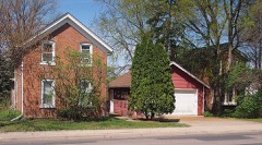 | Early Shakopee Houses | building | 1980 | 80002169 |
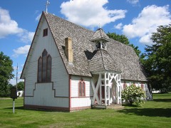 | Episcopal Church of the Transfiguration | building | 1980 | 80002159 |
 | Foss and Wells House | building | 1980 | 80002161 |
 | Holmes Street Bridge | structure | 2010 | 10000414 |
 | Hooper-Bowler-Hillstrom House | building | 1980 | 80002160 |
 | Jordan Brewery Ruins | building | 1980 | 80002162 |
 | Jordan Historic District | district | 1980 | 80002163 |
 | Wencl Kajer Farmstead | building | 1980 | 80002166 |
 | Mudbaden Sulphur Springs Company | building | 1980 | 80002165 |
 | New Market Hotel and Store | building | 1980 | 80002167 |
| Herman Schroeder House and Livery | building | 2023 | 100008547 | |
 | Shakopee Historic District | district | 1972 | 72000682 |
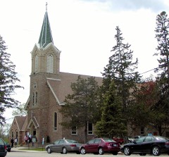 | St. Mary's Church of the Purification-Catholic | building | 1980 | 80002173 |
 | Strunk-Nyssen House | building | 1980 | 80002174 |
Every wildfire the federal occurrence database records inside this county: 77 of them, burning about 571 acres. None started naturally and 18 were recorded as arson. Each settlement page carries the fires within five miles of it.
| Reported cause | Fires |
|---|---|
| Recreation and ceremony | 46 |
| Arson/incendiarism | 18 |
| Missing data/not specified/undetermined | 4 |
| Debris and open burning | 4 |
| Smoking | 3 |
| Equipment and vehicle use | 1 |
| Power generation/transmission/distribution | 1 |
The five largest, by the area the report gives. One of them was set deliberately.
| Date | Cause | Size | Reported by | Name on the report |
|---|---|---|---|---|
| 5 April 2000 | Missing data/not specified/undetermined | 180 acres | Minnesota Valley National Wildlife Refuge | RICE LAKE |
| 15 April 2009 | Debris and open burning | 144 acres | Minnesota Department of Natural Resources | not named |
| 22 March 2007 | Debris and open burning | 100 acres | Minnesota Department of Natural Resources | not named |
| 2 April 2003 | Recreation and ceremony | 70 acres | Minnesota Valley National Wildlife Refuge | RICE LAKE |
| 6 April 2000 | Missing data/not specified/undetermined | 27 acres | Minnesota Valley National Wildlife Refuge | FISHER LK |
| 20 May 2009 | Recreation and ceremony | 10 acres | Minnesota Valley National Wildlife Refuge | BELLE PLAIN |
| 2 April 2000 | Arson/incendiarism | 10 acres | Minnesota Department of Natural Resources | not named |
| 27 April 2013 | Equipment and vehicle use | 8.0 acres | Minnesota Valley National Wildlife Refuge | WAGON WHEEL |
Every settlement page carries the fires within five miles of it - see the settlement index below.
The NOAA Storm Events Database holds 495 reports for this county, causing no deaths, 1 injury and about $211,012,000 in recorded property damage. Each settlement page carries the reports that name it.
| Kind of event | Reports |
|---|---|
| Hail | 232 |
| Thunderstorm Wind | 188 |
| Heavy Rain | 24 |
| Tornado | 20 |
| Flash Flood | 16 |
| Flood | 9 |
| Lightning | 4 |
| Funnel Cloud | 2 |
The most serious of them, by death, then injury, then recorded damage. The accounts are quoted exactly as the forecast office filed them.
| When | Event | Place named | Harm | What the report says |
|---|---|---|---|---|
| March 1996 | Lightning | Prior Lake | 1 hurt | no account filed |
| May 1998 | Thunderstorm Wind | Savage | $170,000,000 | Large hail propelled by strong winds resulted in widespread roof and house damage. Windows at public works blown out. Roof damage to library and schools. Damage estimate for entire county. |
| May 1998 | Thunderstorm Wind | Prior Lake | $17,600,000 | 2500 trees lost. 100 boats, lifts and docks damaged. 28 homes sustained major damage. Damage estimate for entire county. |
| August 2006 | Hail | New Prague | $10,000,000 | Vehicles, homes and businesses damaged. Damage total includes all storm reports from August 24 in Scott County. |
| June 2014 | Flood | Blakeley | $9,000,000 | Several sources in Scott County compiled a summary of flood related damages and locations for the flood of June 2014. There were multiple reports of road closures due to high water and debris. Sporadic power outages reported throughout the county due to the water and electrical equipment being underwater. Mudslides and flood waters cut off all access to the town of Blakeley. This included train tracks that impacted Union Pacific and Canadian Pacific rail operations. Highways 6, 41 and 101 were all closed from flood waters of the Minnesota River. The town of Louisville, north of Jordan and west of Prior Lake, had two homes surrounded by flood waters during the height of the flood. Highway 169 was the only access from Scott County during the height of the flooding. In addition, no wake zones were posted on area lakes due to high levels and several parks were closed. Due to high levels on Prior Lake, County Road 21 was closed near the downtown area. In addition, numerous homes along the lake started to sandbag due to rising lake levels. In Shakopee, three rides were shut down at Valleyfair because of floodwaters that spilled into the park and across its parking lots. |
| March 2007 | Flood | Jordan | $900,000 | High water from an ice jam along the Minnesota River undermined a railroad bridge over a slough near Gifford Lake, northeast of Jordan. Five boxcars fell when the bridge collapsed. |
| September 2005 | Lightning | Prior Lake | $604,000 | Three homes were struck by lightning and were damaged by the resulting fire. The first home on Highview Court suffered damage when lightning struck the outside gas meter. An outer wall caught fire and damage was estimated at $4,000. The second house on Prairie Hills Lane was engulfed in flames and has extensive roof and garage damage totaling $500,000. The third home on Century Lane suffered $100,000 in fire damage to interior walls after two bolts struck the building. |
| July 2013 | Flash Flood | Shakopee | $500,000 | Several local officials, trained spotters and the general public observed flash flooding across northern and eastern Scott County due to 3, to locally 8.3 inches of rain that fell between 4 AM CST to 9 AM CST. During the height of the storm, several low lying areas in Prior Lake, Savage, Shakopee, and Elko New Market became inundated with flood waters.||Specific flooded or impassable roads from local law enforcement officials during the height of the storm include; ||South Brunswick Avenue in Savage.|Vierling Drive East & Heather Street in Shakopee.|Flooded home on Harvest Lane in Shakopee.|Several feet of water over Valley View Road in Shakopee.|Twelve inches of flowing water on Dakotah Parkway, near Little Six Casino in the Shakopee Mdewakanton Sioux Community.|Northwood Road West and Spring Lake Road Southwest in Prior Lake.|Valley View near Independence Dr in Shakopee.|High water on Credit River Blvd near Natchez. |High water on Connelly Parkway and Connelly Place in Savage.|Home was flooded on Quentin Avenue South in Savage.|Water over the roadway on Xerxes and 260 Street East in New Market Township.|Water over the roadway on 160th Street Southeast and Fish Point Road Southeast in Prior Lake.|Around the Elko New Market area, Xerxes Avenue was impassable 2 miles south of County Road 2. |
| June 2001 | Hail | Prior Lake | $500,000 | Wind driven hail damaged houses and vehicles. |
| March 2010 | Flood | Shakopee | $400,000 | The Highway 101 bridge from Shakopee to Chanhassen was closed due to flood waters along the Minnesota River. Monetary costs were based on FEMA, State, and Local assistance which includes the following categories; emergency protective measures, road systems and bridges, utilities, and parks. |
| September 2021 | Tornado (EF0) | Prior Lake | $250,000 | An EFO tornado touched down near Highway 13 and Connelly Parkway and moved east for 2.1 miles. There was sporadic damage along this path with maximum winds of 85 mph. Most of the damage was due to trees falling on houses and vehicles. The worst damage occurred near the intersection of Connelly Parkway and Dakota Avenue South where roof damage occurred at the Savage Public Works and Light. The city of Savage transformer station also had damage near this intersection, and most of the street lights and signs were damage. |
| June 2012 | Tornado (EF0) | Blakeley | $250,000 | An EF-0 tornado continued from Le Sueur County, into Scott County and moved northeast for approximately 1.7 miles before dissipating 4.5 miles south-southeast of Belle Plaine. The tornado had a maximum width of 50 yards. A farm near Henderson sustained heavy damage, with a 60,000 bushel grain bin destroyed and at least one other damaged, plus a workshop roof was blown off, with rafters and support beams cracked in a storage shed. |
| May 1977 | Tornado (F2) | not stated | $250,000 | no account filed |
| August 2002 | Flash Flood | Countywide | $200,000 | Four to six inches of rain fell within three hours. Ditches overflowed in Jordan, streets from Belle Plaine to Shakopee flooded with two to three feet of water, and numerous basements were filled with several feet of water. One clogged storm drain in Belle Plaine resulted in water flowing into the basement of a bank. Mudslides were reported from new residential developments in Jordan and Belle Plaine. |
| July 2019 | Tornado (EF0) | St Benedict | $150,000 | A NWS Storm Survey indicated a tornado touchdown southeast of Belle Plaine, and tracked a quarter of a mile to the northeast. It damaged a farm and uprooted several large trees. Maximum winds were estimated at 80 mph. |
| July 2015 | Thunderstorm Wind | Marystown | $100,000 | A severe squall line produced significant tree damage across Scott County from near Marystown, east-southeast toward Prior Lake and Credit River. Numerous trees were uprooted or toppled in sporadic areas. There were also several private weather stations that measured wind gusts of 45 to 55 mph from Shakopee to Prior Lake. There was also a measured wind gust of 58 mph in Belle Plaine, and 56 mph wind gust west of New Prague. |
| June 2010 | Flash Flood | Blakeley | $50,000 | Several retaining walls collapsed due to excessive rainfall amounts, and caused mud flows and logs to flow onto city streets. |
| August 2002 | Thunderstorm Wind | New Prague | $50,000 | Roof blown off house. Numerous trees down, including some on cars and houses. |
| June 2001 | Tornado (F1) | New Market | $50,000 | Sheds, outbuildings and a barn down. This was the fifth and last tornado from this particular mesocyclone that produced its first tornado in Swift County 9 N Kerkhoven at 1427. |
| August 2002 | Thunderstorm Wind | New Prague | $40,000 | Three roofs off houses. Numerous trees down. |
| July 2011 | Thunderstorm Wind | Jordan | $35,000 | A large tree fell on a mobile home in the west part of Jordan, Minnesota. |
| July 2016 | Thunderstorm Wind | Belle Plaine | $25,000 | Wind damage occurred throughout the county, but the worst areas were from New Prague to Elko-New Market. This area had multiple reports of trees down, many large, and some affecting power lines. There were a few recorded wind gusts of 55 to 65 mph across the southern part of Scott County. |
| July 2010 | Thunderstorm Wind | Credit River | $25,000 | A National Weather Service Storm Survey and the local emergency manager concluded that straight-line winds caused considerable damage to a sub-division southeast of Credit River Township. Numerous trees were uprooted or blown down along with a camper that rolled over. |
| May 2022 | Thunderstorm Wind | Shakopee | $10,000 | A severe wind gust was measured at the local police office. In addition, the cover of an air handler located on the top of the Scott County Government Center blew off the building. A light pole also blew over at the corner of 4th Ave & Atwood Street in Shakopee. |
| July 2019 | Thunderstorm Wind | Jordan | $5,000 | A large tree branch broke off and landed on a vehicle. There was considerable damage to the car. |
| June 2012 | Thunderstorm Wind | Jordan | $5,000 | Roof damage occurred to a home southwest of Jordan, along with numerous trees blown down. |
| July 2011 | Thunderstorm Wind | Prior Lake | $5,000 | Several power lines and a street lamp were damaged between 154th and 150th Streets, along Allen Street, or County Road 27, east of Prior Lake. |
| June 2001 | Thunderstorm Wind | New Prague | $5,000 | Numerous trees uprooted on east side of Cedar Lake, and a few boats and pontoons were flipped. |
| May 2012 | Thunderstorm Wind | St Benedict | $2,000 | A 71 mph wind gust was measured by the Minnesota Department of Transportation wind sensor near New Prague. In addition, a farm to the northeast of this sensor had several large tree limbs, up to 10 inches in diameter, snapped off approximately 15 feet above the base of the tree. Plus, a metal shed roof was partially blown off and thrown into a neighbor's yard. |
| August 2021 | Thunderstorm Wind | Shakopee | $1,000 | A few large trees were blown down in Shakopee, most of them rotted. The top wind speed recorded around Shakopee was 41 mph at the Jackson Township Mesonet site, located on Zumbro Ave., just south of Shakopee at about 1 PM CST. Another spotter recorded a wind gust of 52 mph at her home in Savage. |
| July 2025 | Thunderstorm Wind | Belle Plaine | - | Report of downed maple tree in backyard near the Belle Plaine High School. |
| July 2025 | Thunderstorm Wind | Belle Plaine | - | Large tree snapped in Belle Plaine. |
| July 2025 | Thunderstorm Wind | Credit River | - | Measured at CR27 and Longview two miles southwest of Credit River. |
| July 2025 | Thunderstorm Wind | Jordan | - | Report of large tree down on structure in the city of Jordan. |
| July 2025 | Thunderstorm Wind | St Benedict | - | Measured by Scott County mesonet near St. Benedict. |
| July 2025 | Thunderstorm Wind | Prior Lake | - | Tree down across Cassandra St in Prior Lake. |
| July 2025 | Thunderstorm Wind | Prior Lake | - | Large tree down 2 miles west of Prior Lake in the Spring Lake Estates neighborhood. |
| July 2025 | Thunderstorm Wind | Shakopee | - | Measured by Scott County mesonet in Shakopee. |
| August 2025 | Funnel Cloud | Belle Plaine | - | There were several reports of a funnel cloud near Belle Plaine. |
| August 2024 | Thunderstorm Wind | Savage | - | Measured by a trained spotter at the Savage Community Park. |
| August 2024 | Thunderstorm Wind | Prior Lake | - | Large tree branches were down. |
| July 2024 | Thunderstorm Wind | Shakopee | - | Measured from personal weather observing station. |
| June 2024 | Heavy Rain | Belle Plaine | - | Nearly 3 to 4 inches of rain fell in southern Scott county. |
| May 2021 | Tornado (EF0) | Blakeley | - | A brief touchdown was reported east-northeast of Henderson as it crossed Highway 19, moving from Le Sueur County into Scott County. It blew a trampoline and damaged a play set on the Le Sueur County side before moving north and damaging some trees in a grove in Scott County per a NWS damage survey. |
| September 2021 | Thunderstorm Wind | Shakopee | - | There was a downed tree and a bent light post in Shakopee, west of St. Francis Hospital. |
| September 2021 | Thunderstorm Wind | Savage | - | A weather sensor had a wind gust of 58 mph near the intersection of Highway 13 and County Road 42. Several small tree limbs also blew down in the area. |
| September 2021 | Thunderstorm Wind | Elko New Market | - | A private weather station measured a wind gust of 50 knots. |
| September 2021 | Thunderstorm Wind | Lydia | - | A private weather station measured a wind gust of 50 knots near Lydia. |
| September 2021 | Thunderstorm Wind | Lydia | - | A private weather sensor measured a wind gust of 50 knots southwest of Prior Lake. |
| December 2021 | Thunderstorm Wind | Elko New Market | - | A local mesonet weather station measured a wind gust of 59 knots. |
| December 2021 | Thunderstorm Wind | Lydia | - | A large tree was blown down near Fish Lake. |
| August 2021 | Heavy Rain | Shakopee | - | A measured rainfall amount of 1.63 inches occurred with this storm. |
| August 2021 | Heavy Rain | Jordan | - | A measured rainfall amount of 2.82 inches occurred with this storm. |
| August 2021 | Thunderstorm Wind | Shakopee | - | A 55 knot wind gust was measured by a local storm spotter in Shakopee by a handheld wind sensor. |
| August 2020 | Hail | Lydia | - | There were two reports of large hail in Scott County, the largest was in Spring Lake Township where a 1.75-inch diameter hailstone was measured. Radar indicated that the largest and most widespread area of hail fell south and east of Prior Lake, toward the Scott, Dakota County line. |
| July 2020 | Hail | Blakeley | - | A local trained spotter reported dime to occasional quarter size hail in the town of Belle Plaine. Radar indicated that the strongest part of the storm occurred southwest of Belle Plaine which likely had hail stones much larger. There were also strong winds that caused some large branches to be blown down, and it also moved outdoor furniture. |
| July 2020 | Thunderstorm Wind | Jordan | - | A large tree was blown down in Jordan. Minor damage was reported. |
| July 2020 | Thunderstorm Wind | Shakopee | - | A tree fell onto a road in Shakopee. Minor damage was reported. |
| March 2019 | Flood | Belle Plaine | - | As temperatures started to rise, a recent heavy rainfall event on the 12th and 13th, the snowpack ripened and began melting. This caused the Sand Creek in Jordan to develop an ice jam from the rapid melt. This also led to the evacuation of some residents in the Valley Green Mobile Home Park, in Jordan along this creek. About 1,000 people were affected by the evacuation which caused water to flow over the bank and onto the property. In addition, the Minnesota River along the western and northern county line had numerous road closures due to flood waters. |
| June 2019 | Thunderstorm Wind | Belle Plaine | - | Several power lines were blown down on Iago Blvd southeast of Belle Plaine. |
The Survey's mineral resources record lists 12 workings inside this county. 11 still produce and 1 is closed or unrecorded. Each settlement page carries the workings within five miles of it.
| Commodity | Workings |
|---|---|
| Stone, Crushed/Broken | 6 |
| Sand and Gravel, Construction | 4 |
| Silica | 1 |
| Halite | 1 |
The least common of them first, because a county's hundredth gravel pit says nothing its first ten did not.
| Where | Site | Commodity | Status | Recorded |
|---|---|---|---|---|
| Cargill Salt Plant | Halite | Producer | ||
| Minnesota Quartz Co. | Silica | Past Producer | Sandstone | |
| Belle Plaine Pit | Sand and Gravel, Construction | Producer | ||
| Eggum Pit | Sand and Gravel, Construction | Producer | ||
| Prior Lake Pit and Mill | Sand and Gravel, Construction | Producer | ||
| Sheperd Pit and Mill | Sand and Gravel, Construction | Producer | ||
| Bryan Rock Prod Inc | Stone, Crushed/Broken | Producer | ||
| Highway Quarry & Mill | Stone, Crushed/Broken | Producer | ||
| Jordan Quartz Pit & Mill | Stone, Crushed/Broken | Producer | ||
| Malkerson Quarry | Stone, Crushed/Broken | Producer | ||
| Shiely Savage Quarry | Stone, Crushed/Broken | Producer | ||
| W G Pearson Limestone Quarry | Stone, Crushed/Broken | Producer |
Named settlements recorded in the Geographic Names Information System, each with the topographic sheets covering it. Villages, hamlets and abandoned places alike. Each is shown with the nearest named watercourse or landform and the survey quadrangle it falls on.
Belle Plaine city · 56011 · On Robert Creek · Belle Plaine South quadrangle
11 sheets, 1953 to 1985
Blakeley township · 56011 · On Big Possum Creek · Belle Plaine South quadrangle
11 sheets, 1953 to 1985
Prior Lake city · 55372 · Near Martinson Island · Prior Lake quadrangle
12 sheets, 1953 to 1985
Louisville township · 55379 · On Picha Creek · Jordan East quadrangle
12 sheets, 1953 to 1985
Prior Lake city · 55372 · Near Reeds Island · Prior Lake quadrangle
12 sheets, 1953 to 1985
Prior Lake city · 55372 · Near Twin Isle · Prior Lake quadrangle
12 sheets, 1953 to 1985
Belle Plaine city · 56011 · On Robert Creek · Belle Plaine North quadrangle
11 sheets, 1953 to 1985