 Block
Beaver, Minnesota
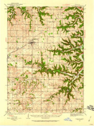
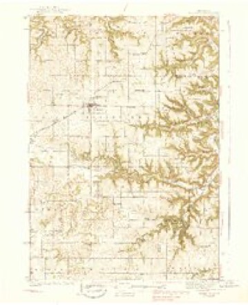
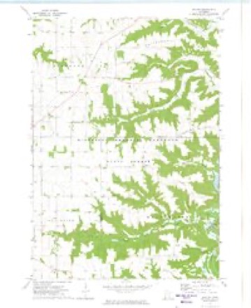
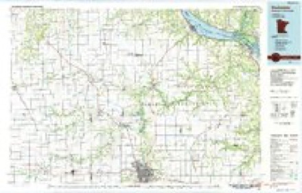
14 topographic sheets cover this place, the earliest surveyed in 1934 and the latest in 1989. It stands in Whitewater Township. It lies in ZIP code area 55910. It lies near Jacobs Hill. The Survey maps it on the Beaver quadrangle.
Topographic sheets covering this place
9 surveys from 14 printed sheetsMatched by testing this settlement's coordinate against the published boundary of every sheet in the United States Geological Survey's historical collection. Each opens the scanned sheet at the Survey.
- 1934 USGS Plainview quadrangle1:62500
- 1938 USGS Plainview quadrangle1:62500, 2 printings
- 1953 USGS Saint Paul quadrangle1:250000, 3 printings
- 1953 USGS St. Paul quadrangle1:250000
- 1959 USGS Saint Paul quadrangle1:250000
- 1959 USGS St. Paul quadrangle1:250000
- 1972 USGS Beaver quadrangle1:24000, 2 printings
- 1985 USGS Rochester quadrangle1:100000
- 1989 USGS Rochester quadrangle1:100000, 2 printings




In the county-history sources
1,072 words on this townshipHistory of Winona County, published 1883 names this settlement in its chapter on Whitewater Township. These are the passages that mention it, exactly as the scans read.
The su]-face is generally very much broken. On the western part, however, nearly the entire length of the township skirts on Greenwood prairie, in Wabasha county. The township lies in T. 108 N. and R. 10 W. It is bounded on the north and west by Wabasha county, on the east by Mt. Yernon township, and on the south by Elba township. Whitewater lies in the extreme northwestern corner of Winona county. There are two principal valleys - Whitewater valley and Beaver creek valley. Whitewater valley is six miles long, and runs directly north and south through the township. It is traversed by Whitewater river, which enters the township on Sec. 35 and leaves it on Sec. 1. This river attains an average width of forty feet and a depth of three feet. Beaver valley runs almost east and west ; it is four miles long and traversed by Beaver creek. This creek rises in Sec. 19, flows east, and empties into Whitewater river at the village of Beaver on Sec. 15. Timber is abundant along the valleys, and trout plentiful in the streams. There have been two village settlements in the township, viz : Whitewater Falls, now gone to decay, and Beaver. The early history of these is in general the early history of the township.
Passage source: History of Winona County, published 1883.
Beaver village is situated on Sec. 15, at the junction of Beaver creek with Whitewater river. Beavers were numerous in these streams at an early day. A large dam was built by these animals in the creek near the village ; from this came the names Beaver creek and Beaver village. The village was laid out in 1856, and covers an area of forty acres. The first house in this locality, and, indeed, the first in Whitewater township, was put up by Stephen Covey in 1854 ; the iirst store was built in 1856 by Wm. Dooley ; it was a log structure, 14x20 feet, and devoted to general merchandise. Among the early residents were John Knowles, H. B. Knowles, Dr. Sheldon Brooks and J. W. Hayes.
Passage source: History of Winona County, published 1883.
The lirst blacksmith shop was built by Carl Pope in 1856 ; first death was that of Stephen Covey, who died in 1857, and was buried on his farm, S.E. ^ Sec. 15 ; first birth was that of Cora Knowles, born February 16, 1856 ; first marriage was that of Laura Covey to John Cheney in 1856. A private school was kept in the house of Carl Pope in 1857 ; it was taught by Sarah Pope, and had an attendance of perhaps twenty -five pupils. A sawmill was built on Beaver creek, on Sec. 16, in 1856, by Carleton and Gardner Malindy ; it was a very crude affair at first : a hollow log was pressed into service and used as a flume ; in 1857 it was converted into a gristmill with one run of burrs ; F. E. Becker is the present owner. The mill has been much improved; it is now two stories in height, is 40x100 feet in dimensions, has two run of burrs, patent rolling machinery and a capacity of fifty barrels per day ; the water-power is excellent at this point. An hotel was built in Beaver in 1865 by David Jecobis ; it was a structure half frame and half log. Beaver contains a population of 125 persons. Two stores, kept by G. G. Knowles and Samuel Detamore respectively ; two blacksmith shops, owned by R. Young and S. Card ; one wagon shop run by Peter Neiheisel, and a feedmill owned by Adam Winters. This mill grinds corn, oats, etc., into feed for stock. In the fall it is converted into a sorghummill ; great quantities of amber cane are consumed and converted into sorghum molasses. Sherman Card keeps the one hotel in Beaver ; it does a small business, as travel has fallen off almost entirely. One school in Beaver, district 45, has an attendance of forty pupils.
Passage source: History of Winona County, published 1883.
Machine-read from a century-old scan, so expect the errors a machine makes: misspelled names, dropped words, stray characters.
Read the whole chapter on Whitewater Township - it names this place 2 more 2 times.
Fires near this place
38 since 1992Regional context, not property-specific evidence. The federal wildfire occurrence database lists 38 fires within 5 miles of Beaver between 1992 and 2020, burning about 122 acres in total. None started naturally. 7 were recorded as arson. Distance is straight-line from the map coordinates, so a fire counted here may appear on a neighbouring settlement's page as well.
| Reported cause | Fires |
|---|---|
| Missing data/not specified/undetermined | 8 |
| Equipment and vehicle use | 7 |
| Arson/incendiarism | 7 |
| Smoking | 7 |
| Recreation and ceremony | 6 |
| Debris and open burning | 3 |
The most recent of them, most recent first, with the day each was reported and the service that recorded it.
| Date | Cause | Size | Reported by | Name on the report |
|---|---|---|---|---|
| 2 August 2012 | Recreation and ceremony | 15 acres | Minnesota Department of Natural Resources | not named |
| 29 July 1993 | Missing data/not specified/undetermined | 5.0 acres | Minnesota Department of Natural Resources | not named |
| 28 July 2004 | Missing data/not specified/undetermined | 5.0 acres | Minnesota Department of Natural Resources | not named |
| 4 June 1992 | Recreation and ceremony | under an acre | Minnesota Department of Natural Resources | not named |
| 16 June 2003 | Missing data/not specified/undetermined | 1.0 acres | Minnesota Department of Natural Resources | not named |
| 13 June 1992 | Missing data/not specified/undetermined | under an acre | Minnesota Department of Natural Resources | not named |
| 7 May 2018 | Debris and open burning | under an acre | Minnesota Department of Natural Resources | not named |
| 6 May 2004 | Equipment and vehicle use | under an acre | Minnesota Department of Natural Resources | not named |
Settlements close enough to share some of these fires:
Mines and quarries near this place
2 within 5 milesRegional context, not property-specific evidence. The federal mineral resources record lists 2 workings within 5 miles of Beaver: 1 producer, 1 occurrence. 1 still produces. What was taken out: Stone, Crushed/Broken, Clay. Distance is straight-line from the map coordinates, so a quarry counted here may appear on a neighbouring settlement's page as well.
| Where | Site | Commodity | Status | Recorded |
|---|---|---|---|---|
| Dodge County Clay Deposit | Clay | Occurrence | ||
| Kieffer Quarry | Stone, Crushed/Broken | Producer |
Storms near this place
3 since 2000Regional context, not property-specific evidence. The National Weather Service names Beaver in 3 storm reports between 2000 and 2023: 2 hail, 1 flood. No death or injury is recorded in these reports. Each account below is quoted exactly as the forecast office filed it, from the NOAA Storm Events Database, and each date opens the federal record of that event.
| When | Event | Place named | Harm | What the report says |
|---|---|---|---|---|
| April 2023 | Flood | Beaver | - | A strong spring storm at the end of March provided over 1.5 of rainfall in parts of southeastern Minnesota, falling on frozen ground. The resultant rapid runoff resulted in sites along the Whitewater River in Winona and Olmsted counties to quickly rise above flood stage on April 1st. Minor flooding was recorded at Beaver where a crest of 700.17 ft above sea level was recorded, 1.17 ft over flood stage. |
| June 2020 | Hail | Beaver | - | no account filed |
| May 2000 | Hail | Beaver | - | no account filed |
Nearest settlements
The eight closest, with where each one stands in the county. Distances are straight-line, computed from the Geographic Names Information System coordinates.
| Map | Place | Distance | Sheets |
|---|---|---|---|
| Elba | 4.5 miles | 14 | |
| Oakridge | 5.4 miles | 14 | |
| Crystal Spring | 5.6 miles | 14 | |
| Altura | 6.8 miles | 14 | |
| Minneiska | 8.0 miles | 14 | |
| Bethany | 10.4 miles | 14 | |
| Whitman | 10.9 miles | 14 | |
| Rollingstone | 11.1 miles | 14 |
Provenance
This settlement is recorded in the Geographic Names Information System as feature 654592. The sheet list is computed by point-in-boundary test against the United States Geological Survey's historical topographic inventory. Both are works of the United States government and carry no copyright under 17 U.S.C. 105.
Wildfire. Short, Karen C. 2022. Spatial wildfire occurrence data for the United States, 1992-2020 [FPA_FOD_20221014]. 6th Edition. Fort Collins, CO: Forest Service Research Data Archive. https://doi.org/10.2737/RDS-2013-0009.6 Collected with United States Government funding and usable without additional permissions or fees.
Mines and quarries. USGS Mineral Resources Data System (MRDS) https://mrdata.usgs.gov/mrds/ A work of the United States government, no copyright under 17 U.S.C. 105.
Storms. NOAA National Centers for Environmental Information, Storm Events Database https://www.ncei.noaa.gov/stormevents/ A work of the United States government, no copyright under 17 U.S.C. 105. Narratives are quoted verbatim from the National Weather Service report and are not edited or summarised.