BlockBefore

Winona County, Minnesota

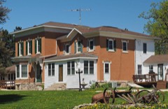
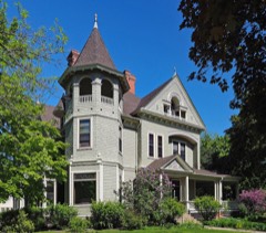
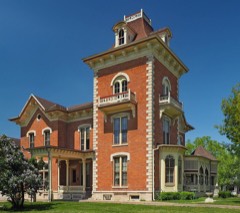
85 topographic sheets cover 36 settlements here, and 50 properties are on the National Register of Historic Places.

Research this county

From the record

50 National Register listings published here · the county-history sources tell 1 story and name 2 people · people the book names include Business. Amount 1882. Increase (Winona City, 1883) · St. Charles Towttship (St. Charles City, 1883) (machine-read).

Sources: the county history on the Internet Archive · the National Register database, National Park Service

Minnesota within the United States
Winona County within Minnesota

What the record shows

  • 473 topographic sheet readings cover the county's settlements.
  • 50 properties here are on the National Register of Historic Places: 42 buildings, 5 districts, 2 structures and 1 site.
  • 13 of the 50 listings were added during the 1970s.
  • The Geographic Names Information System records 36 populated places in this county; 36 are covered by at least one topographic sheet.
  • 2 public-domain county histories, 1883 and 1884, supply 64,224 words of narrative reproduced here.

What happened here

1 accounts

Among them: Flood. These passages come from the identified county-history source books. Each inset names its own source and opens the exact section it comes from.

From History of Winona County, published 1883 - Rollingstone Township

Flood

In February, 1876, Minnesota City was visited with a disastrous flood. The Rolling Stone drains a large extent of surface and at the village has a narrow exit. The ground was frozen hard and a heavy rain had filled the water-holes and covered the country with a sheet of ice. The snow then covered this to the depth of a foot when a warm heavy rain fell for twenty-four hours, and as the ground could not absorb any water, it raised higher than has ever been known.

Read the rest of this passage

Places on the National Register

50

Every property in this county listed on the National Register of Historic Places, with the year it was listed and the federal nomination document.

Photograph PropertyType ListedReference
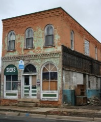
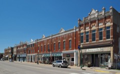
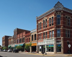
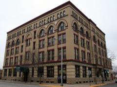
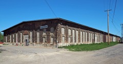
Anger's Blockbuilding197878001571
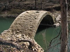
Bridge No. L1409structure199090000978
Willard Bunnell Housebuilding197373000998
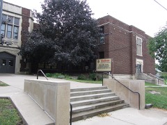
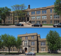
Central Grade Schoolbuilding201212000071
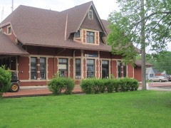
Chicago, Milwaukee and St. Paul Railway Stationbuilding201313000327
Choate Deparment Storebuilding197676001079
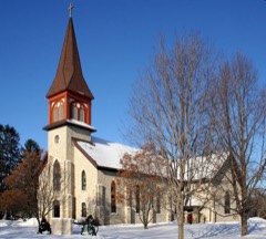
Church of St. Stanislaus-Catholicbuilding198484000251
Church of the Holy Trinity-Catholicbuilding198484001721
East Second Street Commercial Historic Districtdistrict199190002198
Benjamin Ellsworth Housebuilding198484001718
First Congregational Churchbuilding2021100006440
Dr. J. W. S. Gallagher Housebuilding198484000245
Grain and Lumber Exchange Buildingbuilding197777000774
William Hemmelberg Housebuilding198686002916
Abner F. Hodgins Housebuilding198484000248
Huff-Lamberton Housebuilding197676001080
Jefferson Schoolbuilding201212000072
Kirch/Latch Buildingbuilding197575001036
Laird, Norton Company Buildingbuilding201414000392
Lake Park Bandshellstructure2023100009129
Madison Schoolbuilding201212000073
Nicholas Marnach Housebuilding197878003406
Merchants National Bankbuilding197474001045
Model School Building and College Hall of the Winona Normal Schoolbuilding201313000884
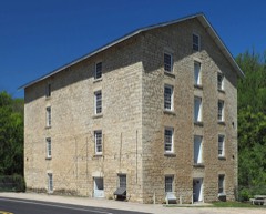
Pickwick Millbuilding197070000314
Rollingstone Village Hallbuilding2021100006357
Schlitz Hotelbuilding198282003087
St. Charles City Bakerybuilding198484001723
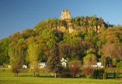
Sugar Loafsite199090001164
Sugar Loaf Brewerybuilding197878001572
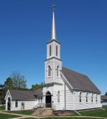
Trinity Episcopal Churchbuilding198484001726
Trinity Episcopal Churchbuilding198484001727
Washington-Kosciusko Schoolbuilding201212000074
J. R. Watkins Medical Company Complexbuilding200484003940
Paul Watkins Housebuilding198484000255
Whitewater Avenue Commercial Historic Districtdistrict198484001736
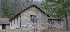
Whitewater State Park CCC/WPA/Rustic Style Historic Resourcesdistrict198989001661
Windom Park Residential Historic Districtdistrict2021100007069
Winona Athletic Clubbuilding2020100005359
Winona City Hallbuilding199999000806
Winona Commercial Historic Districtdistrict202098001220
Winona County Courthousebuilding197070000313
Winona Free Public Librarybuilding197777000775
Winona High School and Winona Junior High Schoolbuilding200403001350
Winona Hotelbuilding198383000947
Winona Masonic Templebuilding199898000152
Winona Savings Bank Buildingbuilding197777000776
Winona and St. Peter Engine Housebuilding198484001730
Winona and St. Peter Railroad Freight Housebuilding198484001733

Wildfire, 1992 to 2020

248 fires

Every wildfire the federal occurrence database records inside this county: 248 of them, burning about 677 acres. 4 started naturally and 18 were recorded as arson. Each settlement page carries the fires within five miles of it.

Reported cause Fires
Debris and open burning84
Equipment and vehicle use38
Smoking35
Railroad operations and maintenance27
Missing data/not specified/undetermined26
Arson/incendiarism18
Recreation and ceremony13
Natural4
Misuse of fire by a minor2
Power generation/transmission/distribution1

The five largest, by the area the report gives. None of them was recorded as arson.

DateCause SizeReported by Name on the report
6 April 1995Debris and open burning60 acresMinnesota Department of Natural Resourcesnot named
24 April 2003Missing data/not specified/undetermined54 acresMinnesota Department of Natural Resourcesnot named
18 December 2004Debris and open burning35 acresMinnesota Department of Natural Resourcesnot named
29 April 2018Missing data/not specified/undetermined27 acresMinnesota Department of Natural Resourcesnot named
28 April 1995Debris and open burning25 acresMinnesota Department of Natural Resourcesnot named
23 April 1996Debris and open burning20 acresMinnesota Department of Natural Resourcesnot named
28 October 2001Debris and open burning20 acresMinnesota Department of Natural Resourcesnot named
11 April 1996Equipment and vehicle use20 acresMinnesota Department of Natural Resourcesnot named

Every settlement page carries the fires within five miles of it - see the settlement index below.

Storms, 1953 to 2026

60 of 572 shown

The NOAA Storm Events Database holds 572 reports for this county, causing 5 deaths, 8 injuries and about $63,301,600 in recorded property damage. Each settlement page carries the reports that name it.

Kind of event Reports
Hail224
Thunderstorm Wind188
Flood64
Flash Flood31
Tornado24
Heavy Rain22
Funnel Cloud10
Lightning9

The most serious of them, by death, then injury, then recorded damage. The accounts are quoted exactly as the forecast office filed them.

WhenEvent Place namedHarm What the report says
August 2007Flash FloodLewiston5 killed, $300,000Five fatalities were reported from people driving into flood waters. Two fatalities occurred near Witoka when a couple's vehicle fell into a chasm along County Road 17 that had opened when flood waters washed out the road. Near Stockton, two fatalities occurred when a couple's vehicle was swept away by flood waters from Garvin Brook. Near the Enterprise rest area on Interstate 90, a man was killed when his vehicle was washed away by flood waters along Rush Creek.
May 1953Tornado (F4)not stated5 hurt, $2,500,000no account filed
July 1999Tornado (F2)Lewiston2 hurt, $2,000,000no account filed
July 2010HailNodine1 hurtA motorcycle passenger was hit on the head by hail on Interstate 90 near Nodine. The passenger was taken by ambulance to a hospital.
August 2007Flash FloodStockton$22,000,000Flash flooding hit all the creeks and drainage areas hard that begin near the Interstate 90 area in Winona County. Garvin Brook and other creeks that flow into Stockton became terrain-changing flowages that washed out numerous roads, created massive mudslides, took out bridges, damaged railroad tracks, and washed away some homes.||Most homes in Stockton had severe water damage as flood waters roared through town.||Erosion problems were also noted south of Interstate 90 in the Hart area. Many roads, including Highway 43, were closed for several days.
August 2007Flash FloodWinona$12,000,000All drainage areas leading into communities in eastern Winona County experienced tremendous flash flooding. State Highway 43 was washed out just south of Winona. In addition, more than 300 residents were evacuated from their homes in Goodview due to high water. In Minnesota City a railroad bridge was ripped apart by Garvin Brook and a highway bridge through town suffered major damage on each end. Railroad tracks were warped or pushed clear out of position. Major erosion was seen.
August 2007Flash FloodLewiston$6,000,000Flash flooding and mudslides were common from the Elba area through Whitewater State Park and into the Lewiston area. Numerous mudslides occurred with many roads closed. Debris slid down hills and blocked drainage areas making flooding worse in many areas. A car was stuck in high water on County Highway 29 at some point.||Highway 74 in Whitewater State Park completely washed out. About 500 campers were evacuated that evening, but about a dozen campers were stranded at a primitive campsite overnight. They were rescued the following morning. The state park lost 3 bridges and there was extreme damage to campgrounds, rest rooms, a group dining hall, and the septic and water systems totaling at least one million dollars. The flood system installed at the park did activate that evening.||Many area creeks and trout streams were heavily damaged.
June 2021HailGoodview$3,000,000Baseball sized hail fell in Goodview.
May 1965Tornado (F3)not stated$2,500,000no account filed
June 2020HailWinona$1,800,000Hail ranging in size from 1.25 to 2 inches in diameter moved across the city of Winona causing extensive roof damage to houses and buildings.
August 2007FloodWinona$1,500,000Law enforcement officials reported some roads and bridges washed out or still under water. Whitewater State Park remained closed. In Goodview, extensive damage occurred to homes and apartments due to flood waters. All or portions of highways still closed included Highway 76 from Interstate 90 to Highway 16.
September 2010FloodTroy$1,360,000Flooding occurred along rivers, creeks, and streams as well as in low-lying areas, with the worst impacts seen in the northern parts of the county. Numerous roads were closed and some were damaged by flood waters. A portion of County Road 74 southwest of Elba was closed due to high water. The Whitewater River saw major flooding, which did some damage to portions of the Whitewater State Park, which was evacuated. Five homes incurred minor damage. At mid-morning on the 23rd, the majority of the rain had fallen with 5.52 inches measured at a location 5 miles north of St. Charles and 4.20 inches in Winona.
June 2020HailHomer$900,000Hail ranging in size from 1.25 to 2 inches in diameter fell from the south side of Winona to near Pickwick.
June 2021HailGoodview$800,000Golf ball sized hail fell in Goodview.
June 1998Thunderstorm WindWinona$400,000no account filed
June 1998Thunderstorm WindWinona Muni Arpt$300,000no account filed
July 2023HailBethany$250,000Public reported tea cup sized hail between Altura and Lewiston that shattered a trailer house window and damaged cars.
July 2023HailAltura$250,000Public reported hen egg to tea cup sized hail near Altura resulted in damage to houses and cars.
June 2008Flash FloodLamoille$250,000Flash flooding led to mudslides and damage to sections of County Road 9 along Cedar Creek. Pleasant Valley Creek also had a flash flood. Water flowed into nearby fields as well.
June 1998Thunderstorm WindLewiston$250,000no account filed
May 1982Tornado (F2)not stated$250,000no account filed
June 1980Tornado (F2)not stated$250,000no account filed
September 2019Tornado (EF1)Winona$175,000A short-lived tornado moved through Woodlawn Cemetery in Winona. The tornado caused extensive damage to trees and gravestones. The roof of a shed was also damaged.
July 2023HailRollingstone$150,000Public reported tennis ball hail caused holes in siding of a house near Minnesota City.
July 2023HailAltura$150,000Public reported hen egg to tea cup sized hail near Altura. News reported damage to corn crops, house roofs, and cars.
May 2022Flash FloodWinona Muni Arpt$150,000Runoff from heavy rains caused mud slides and washouts to occur in the area around Homer with the debris covering several roads. Some cars were submerged in the flood waters. A state of emergency was declared and the Governor of Minnesota authorized emergency assistance to help with the recovery.
August 1998Flash FloodStockton$150,000no account filed
May 2024Tornado (EF1)Utica$120,000A fast moving and long track tornado began in St. Charles and produced EF-0 to EF-1 damage to farmsteads and trees in central Winona County. It then moved into Rollingstone, Minnesota were it damaged a few structures and caused widespread tree damage. The tornado continued northeast and crossed the Mississippi River into Buffalo County, Wisconsin where it dissipated.
June 2017Flash FloodStockton$108,000Runoff from heavy rain pushed Garvin Creek out of its banks around Stockton. Debris caught in the flood waters clogged culverts where the creek passes under County Road 23 causing enough dirt to be eroded that a portion of the road collapsed.
December 2021Tornado (EF1)Homer$100,000An EF1 tornado formed on a ridge top southwest of Homer, moved northeast across Homer before moving out over the Mississippi River and into Trempealeau County, Wisconsin. The main damage occurred on the ridge top to trees and outbuildings. By the time the tornado reached Homer, it was weakening and damage was mainly limited to trees.
December 2021Tornado (EF0)Wyattville$95,000This short-lived EF0 tornado moved over rural areas southeast of Lewiston. Farm outbuildings, a garage and trees were damaged by the tornado.
June 2010Thunderstorm WindGoodview$95,000Thunderstorm winds damaged at least a dozen mobile homes in the Hidden Valley mobile home park. One home was destroyed when a large tree was uprooted and fell on the home. No injuries occurred as the family decided to stay the night with friends. In addition, the roof of a cattle slaughtering plant was damaged in the Bethany area.
July 2024FloodWinona$85,000Significant rainfall throughout June pushed the Mississippi River at Winona into flood stage in June and continued into July. The river stage crested during the afternoon on July 2nd in moderate flood stage at 16.14 ft.
July 2024HailGoodview$85,000The public reported 2 inch diameter hail in Goodview.
July 2024HailRollingstone$78,000Local officials reported 2 inch diameter hail near Rollingstone.
August 1998Thunderstorm WindWinona$75,000no account filed
June 2010Thunderstorm WindSt Charles$65,000The Winona County emergency manager reported railroad crossing guard rails and trees blown down.
August 2020HailRidgeway$60,000Two inch diameter hail was reported near Ridgeway.
August 2007FloodElba$60,000The Middle Fork of the Whitewater River at Whitewater State Park reached a record crest of 19.24 feet. Flood stage is 13.5 feet. The rapid rise of flood waters forced the evacuation of campers throughout the park.
July 2023HailAltura$55,000Public reported hen egg to tea cup sized hail near Altura that broke through a roof of a greenhouse.
August 1998Thunderstorm WindWinona$55,000no account filed
July 2023HailWilson$50,000Public reported tennis ball sized hail near Winona.
July 2023HailWitoka$50,000Public reported hen egg sized hail in Wilson.
December 2021Thunderstorm WindHart$50,000A path of wind damage occurred west of Hart where the roof was removed from a farm outbuilding, a metal pole shed was destroyed and siding removed from a house.
December 2021Thunderstorm WindThe Arches$50,000A house southeast of Lewiston sustained significant wind damage.
December 2021Thunderstorm WindThe Arches$50,000Two open air farm outbuildings were destroyed east of Lewiston.
June 2020HailHomer$50,000Hail ranging in size from 1.75 to 2 inches in diameter was reported south of Homer.
June 2010Thunderstorm WindSt Charles$50,000The Winona County emergency manager reported a large grain bin blown over along with power lines down.
June 2008FloodWinona$50,000Street flooding was reported in Winona.
July 2008Thunderstorm WindUtica$50,000Thunderstorm wind gusts produced damage to a farm near Utica. Thunderstorm wind gusts also knocked down several elm trees, a 50 foot steel windmill, and blew a metal roof off of a tractor shed.
May 1998Thunderstorm WindWinona$50,000no account filed
July 1997Flash FloodLewiston$50,000no account filed
July 2023HailThe Arches$40,000Public reported tennis ball hail fell between Stockton and Lewiston.
May 2013Thunderstorm WindSt Charles$40,000Damage to buildings occurred from about 2 miles north of St. Charles to 4 miles north of St. Charles. Large trees were blown down along with a pole barn and corn cribs. Six foot long sections of tin were ripped off other buildings and some one inch hail also fell.
May 1998Thunderstorm WindHart$40,000no account filed
August 1998Thunderstorm WindWinona$40,000no account filed
August 1997Flash FloodWinona$40,000no account filed
August 1997Thunderstorm WindGoodview$40,000no account filed
April 2022Thunderstorm WindLewiston$30,000At the high school in Lewiston, metal bleachers were ripped off the main seating area, smaller metal bleachers were blown across the track and part of the track was ripped up.
December 2021Thunderstorm WindStockton$30,000Farm outbuildings sustained wind damage near Stockton.

Mines and quarries

22 recorded

The Survey's mineral resources record lists 22 workings inside this county. All of them still produce. Each settlement page carries the workings within five miles of it.

Commodity Workings
Stone, Crushed/Broken18
Sand and Gravel, Construction3
Limestone, Dimension1

The least common of them first, because a county's hundredth gravel pit says nothing its first ten did not.

Where SiteCommodity StatusRecorded
Biesanz Winona QuarryLimestone, DimensionProducer
Biesanz Sand & Gravel PitSand and Gravel, ConstructionProducer
Winona Aggregate Pit & PlantSand and Gravel, ConstructionProducer
Winona S & G PitSand and Gravel, ConstructionProducer
Bailey QuarryStone, Crushed/BrokenProducer
Bronk Quarry and MillStone, Crushed/BrokenProducer
Buckbee QuarryStone, Crushed/BrokenProducer
Dresbach QuarryStone, Crushed/BrokenProducer
Enterprise Quarry & MillStone, Crushed/BrokenProducer
Frickson QuarryStone, Crushed/BrokenProducer
Hector Constr QuarryStone, Crushed/BrokenProducer
Kieffer QuarryStone, Crushed/BrokenProducer
Kohner QuarryStone, Crushed/BrokenProducer
Kreidermacher QuarryStone, Crushed/BrokenProducer
Mathy QuarryStone, Crushed/BrokenProducer
Quarve and Anderson QuarryStone, Crushed/BrokenProducer
Roverud Quarry and MillStone, Crushed/BrokenProducer
Silo QuarryStone, Crushed/BrokenProducer
Winona Quarry and MillStone, Crushed/BrokenProducer
Woodward QuarryStone, Crushed/BrokenProducer
Wyattville QuarryStone, Crushed/BrokenProducer
Yeadke QuarryStone, Crushed/BrokenProducer

The townships, in 1883

64,224 words

History of Winona County devotes a chapter to each township: its boundaries and streams, who settled it and when, the mills, the schools and the churches. All 15 are reproduced here in full. Each row shows the township's own shape and where it lies in the county, drawn from the Census Bureau's boundary. Which settlements belong to which township is computed from that same boundary, not taken from the book.

Shape and position in the county TownshipSettlements in it LengthSections
Dakota CityDakota1,868 words7
Dresbach TownshipDresbach1,741 words1
Elba TownshipCrystal Spring, Elba1,101 words1
Fremont TownshipFremont949 words1
Hart TownshipHart868 words1
Homer TownshipHomer, Pickwick3,708 words2
Mount Vernon TownshipOakridge826 words2
Richmond TownshipDonehower, Lamoille867 words1
Rollingstone TownshipRollingstone, Whitman2,095 words2
Saratoga TownshipClyde, Saratoga, Troy2,247 words0
St. Charles CitySaint Charles10,138 words14
Utica CityUtica2,913 words2
Whitewater TownshipBeaver1,072 words4
Winona CityMorningside Terrace, Sugarloaf, Winona29,591 words13
Wiscoy TownshipWitoka4,240 words2

The county's history books

303,006 words

One book written about this county, cut here where the book itself is cut, at its printed chapters: 39 chapters in all. Every chapter is public domain, machine-read from the scan and reproduced complete. A chapter already given under one of the county's towns is not repeated in this list.

History of Winona County (1883)

ChapterLength
Aboriginal History7,693 words
Chapter 4: Troubles with the Indians3,287 words
Chapter 518,268 words in 2 parts
Chapter 9: Gf.ographical3,267 words
Chapter 10: Rait.roads4,724 words
Chapter 11: Navigation4,681 words
Chapter 14: General Hi8t0ry of Winona County - Its Pearly Settlement, Pioneers, Etc2,087 words
Chapter 15: Treaties with the Indians2,921 words
Chapter with an unread heading (no. 9 of those read)4,620 words
Early Land Titles5,086 words
Chapter with an unread heading (no. 11 of those read)8,625 words
Chapter 21: The Association Crystallized2,719 words
Chapter 22: Emigrants Coming3,763 words
Chapter with an unread heading (no. 14 of those read)3,451 words
Chapter 24: First Settlements at Winona City4,562 words
Chapter 25: Incidents of the Early Times4,466 words
Chapter 26: The Association at Rolling Stone6,219 words
Chapter with an unread heading (no. 18 of those read)4,642 words
Chapter 28: Respectability5,048 words
Chapter 29: Looking Around3,950 words
Chapter 30: Reflections13,958 words
Chapter 31 (1 of 2 so headed)1,997 words
Chapter with an unread heading (no. 23 of those read)8,648 words
Chatfield Settled and Winona County Organized1,753 words
Chapter 309,347 words
Chapter 31 (2 of 2 so headed)1,940 words
Chapter 40: Winona Public Schools6,519 words
Chapter 41: History of Winona City4,257 words
Roads2,634 words
Societies5,686 words
Chapter with an unread heading (no. 31 of those read)8,387 words
Business Incorporatons5,128 words
Chapter with an unread heading (no. 33 of those read)12,188 words
Biographical sketches (1 of 4 so headed)17,655 words in 2 parts
Biographical sketches (2 of 4 so headed)21,294 words in 2 parts
Biographical sketches (3 of 4 so headed)34,730 words in 3 parts
Biographical sketches (4 of 4 so headed)21,922 words in 2 parts
Chapter 61: Military Record6,362 words
Miscellaneous14,522 words

The people it describes

2 named

Everyone History of Winona County stops to write about, with the section that describes them. Among them are the men who founded the place and governed the Territory. Each name opens the passage itself, in the words of 1883.

Every populated place in the county

36

Named settlements recorded in the Geographic Names Information System, each with the topographic sheets covering it. Villages, hamlets and abandoned places alike. Each is shown with the nearest named watercourse or landform and the survey quadrangle it falls on.

Provenance

  • Topographic sheets. USGS Historical Topographic Map Collection, county index, measured from the bulk metadata.
  • Fire insurance maps. Library of Congress Sanborn collection, faceted to this county.
  • Photographs. Each place queried individually against the Library of Congress Prints and Photographs search.
  • Wildfire. Short, Karen C. 2022. Spatial wildfire occurrence data for the United States, 1992-2020 [FPA_FOD_20221014]. 6th Edition. Fort Collins, CO: Forest Service Research Data Archive. https://doi.org/10.2737/RDS-2013-0009.6 Collected with United States Government funding and usable without additional permissions or fees.
  • Mines and quarries. USGS Mineral Resources Data System (MRDS) https://mrdata.usgs.gov/mrds/ A work of the United States government, no copyright under 17 U.S.C. 105.
  • Storms. NOAA National Centers for Environmental Information, Storm Events Database https://www.ncei.noaa.gov/stormevents/ A work of the United States government, no copyright under 17 U.S.C. 105. Narratives are quoted verbatim from the National Weather Service report and are not edited or summarised.