 Block
Elba, Minnesota
14 topographic sheets cover this place, the earliest surveyed in 1934 and the latest in 1989. It stands in Elba Township. It lies in ZIP code area 55910. It stands on Middle Fork Whitewater River. The Survey maps it on the Elba quadrangle. 129 people lived here at the 2020 count. It stands 738 feet above sea level.
On record in Elba
Buildings and businesses the archive holds for this place. Each opens its own page, with the source record it came from.
On the National Register 3 records
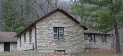 Whitewater State Park CCC/WPA/Rustic Style Historic Resourceslisted 1989
- William Hemmelberg Houselisted 1986
- Nicholas Marnach Houselisted 1978
Population over time
2 figuresElba fell from 152 to 129 between 2010 and 2020. These are the recorded population figures Wikidata holds for this place, reached through the Geographic Names Information System number this page is keyed on rather than by name, so they belong to this place and not to another of the same name. Most are census counts, but not all are: an early figure may be a founding or settlement estimate, and an estimate published within five years of a census is left out. The change column is computed, and is left blank where more than 20 years separate a figure from the one before it, because a gap that long is not a change between two counts.
| Year | People | Change |
|---|---|---|
| 2010 | 152 | |
| 2020 | 129 | -23 (-15%) |
Topographic sheets covering this place
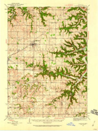
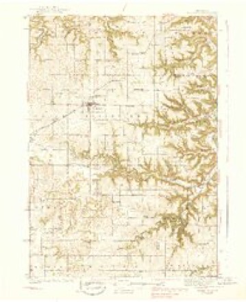
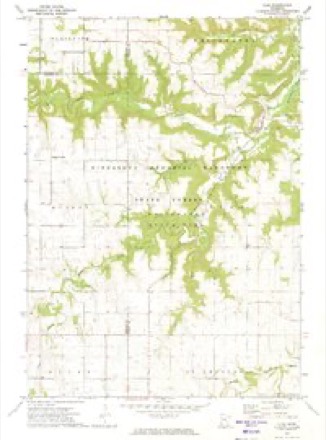
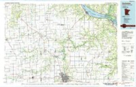
9 surveys from 14 printed sheetsMatched by testing this settlement's coordinate against the published boundary of every sheet in the United States Geological Survey's historical collection. Each opens the scanned sheet at the Survey.
- 1934 USGS Plainview quadrangle1:62500
- 1938 USGS Plainview quadrangle1:62500, 2 printings
- 1953 USGS Saint Paul quadrangle1:250000, 3 printings
- 1953 USGS St. Paul quadrangle1:250000
- 1959 USGS Saint Paul quadrangle1:250000
- 1959 USGS St. Paul quadrangle1:250000
- 1972 USGS Elba quadrangle1:24000, 2 printings
- 1985 USGS Rochester quadrangle1:100000
- 1989 USGS Rochester quadrangle1:100000, 2 printings




In the county-history sources
1,101 words on this townshipHistory of Winona County, published 1883 names this settlement in its chapter on Elba Township. These are the passages that mention it, exactly as the scans read.
Elba is situated in T. 107 N., R. 10 W. Its boundaries are, on the north Whitewater township, on the east Norton, on the south St. Charles, and on the west Olmsted county. The surface is very much broken, and is covered by three deep valle_ys, which in turn are traversed by three prominent streams. There are three branches of the Whitewater river, the north branch, the east branch and the middle branch. These unite at the village of Elba, on Sec. 10, and form one principal stream, which flows north and leaves the township on Sec. 2. Whitewater river is formed by numerous springs arising from the bluffs, and furnishes excellent water-power for a number of mills along its course. The streams abound in speckled trout, and the country is much visited all through the summer months by Ashing parties in quest of sport. The bluffs along the valley are from 350 to 400 feet in height, and form some of the most beautiful scenes in that section of the country.
Passage source: History of Winona County, published 1883.
There are two churches, the German Catholic at Elba village, and the United Brethren on Sec. 21. The latter was built in 1876. It is 30x40 feet, with a spire forty feet tall. They have a congregation of perhaps seventy-five members, composed mostly of Germans. The first minister was Rev. Reiswick, the present one is Rev. J. Gutensohn. Attached to the church is a cemetery and two acres of land.
Passage source: History of Winona County, published 1883.
Elba village is situated on Sees. 9 and 10, at the iuncti(m of the three branches of the Whitewater. Although it has never been recorded as a village plat, there has been a settlement there since 1 856. The first house was put up by C. South wick. Among the early residents were D. R. Holbrook, Israel Messenger, Manoa Turner, D. J. W, Ireland, David Duryee, John Penson and A. D. Nichols. The first postoffice was established in 1857, with H. D. Bailey as postmaster. D. S. Loy kept the first store in 1862 ; John BoUen soon started another store. The first blacksmith shop was kept by Mr. Medcalf. The first school was a log house, built 1858.
Passage source: History of Winona County, published 1883.
Machine-read from a century-old scan, so expect the errors a machine makes: misspelled names, dropped words, stray characters.
Read the whole chapter on Elba Township - it names this place 2 more 2 times.
Fires near this place
29 since 1992Regional context, not property-specific evidence. The federal wildfire occurrence database lists 29 fires within 5 miles of Elba between 1992 and 2020, burning about 66 acres in total. None started naturally. 4 were recorded as arson. Distance is straight-line from the map coordinates, so a fire counted here may appear on a neighbouring settlement's page as well.
| Reported cause | Fires |
|---|---|
| Equipment and vehicle use | 7 |
| Debris and open burning | 6 |
| Missing data/not specified/undetermined | 5 |
| Smoking | 5 |
| Arson/incendiarism | 4 |
| Recreation and ceremony | 2 |
The most recent of them, most recent first, with the day each was reported and the service that recorded it.
| Date | Cause | Size | Reported by | Name on the report |
|---|---|---|---|---|
| 13 June 1992 | Missing data/not specified/undetermined | under an acre | Minnesota Department of Natural Resources | not named |
| 7 May 2018 | Debris and open burning | under an acre | Minnesota Department of Natural Resources | not named |
| 6 May 2004 | Equipment and vehicle use | under an acre | Minnesota Department of Natural Resources | not named |
| 3 April 2016 | Debris and open burning | 4.0 acres | Minnesota Department of Natural Resources | not named |
| 3 April 1996 | Equipment and vehicle use | under an acre | Minnesota Department of Natural Resources | not named |
| 27 April 1995 | Debris and open burning | under an acre | Minnesota Department of Natural Resources | not named |
| 26 April 2018 | Debris and open burning | 1.0 acres | Minnesota Department of Natural Resources | not named |
| 21 April 1998 | Smoking | 3.0 acres | Minnesota Department of Natural Resources | not named |
Settlements close enough to share some of these fires:
Mines and quarries near this place
1 within 5 milesRegional context, not property-specific evidence. The federal mineral resources record lists 1 working within 5 miles of Elba: 1 producer. All of them still produce. What was taken out: Stone, Crushed/Broken. Distance is straight-line from the map coordinates, so a quarry counted here may appear on a neighbouring settlement's page as well.
| Where | Site | Commodity | Status | Recorded |
|---|---|---|---|---|
| Kieffer Quarry | Stone, Crushed/Broken | Producer |
Storms near this place
9 since 2005Regional context, not property-specific evidence. The National Weather Service names Elba in 9 storm reports between 2005 and 2024: 3 hail, 2 flood, 2 thunderstorm wind, 2 flash flood. No death or injury is recorded in these reports. Each account below is quoted exactly as the forecast office filed it, from the NOAA Storm Events Database, and each date opens the federal record of that event.
| When | Event | Place named | Harm | What the report says |
|---|---|---|---|---|
| August 2007 | Flood | Elba | $60,000 | The Middle Fork of the Whitewater River at Whitewater State Park reached a record crest of 19.24 feet. Flood stage is 13.5 feet. The rapid rise of flood waters forced the evacuation of campers throughout the park. |
| June 2017 | Flash Flood | Elba | $25,000 | Runoff from heavy rain caused flood waters to flow down a dry run along County Highway 37 between Elba and Altura. The flood waters caused the road bank to erode in several places. |
| July 2016 | Flash Flood | Elba | $10,000 | Locally heavy rains produced flash flooding in the Whitewater State Park. This flooding washed out some trail bridges and flooded campsites. |
| August 2014 | Thunderstorm Wind | Elba | $10,000 | Trees were blown down at a campground near Elba. The high winds also damaged a picnic shelter, destroyed a storage shed and one of the fallen trees went through the roof of a trailer. |
| June 2012 | Flood | Elba | $5,000 | Around 2.5 inches of rain fell in an hour and a half across Whitewater State Park. This sent Trout Run Creek out of its banks producing a debris jamb against a low walking bridge and washed out part of a gravel road. |
| August 2012 | Thunderstorm Wind | Elba | $5,000 | A fifteen inch diameter tree was snapped thirty feet above the ground near Whitewater State Park and other trees in the area were pushed over. Corn was flattened with some snapped on the top portion of the stalks. |
| July 2024 | Hail | Elba | - | The public reported quarter sized hail 2 miles east of Elba. The report was relayed via mPING. |
| May 2018 | Hail | Elba | - | Quarter sized hail fell in the Whitewater State Park. |
| June 2005 | Hail | Elba | - | no account filed |
Nearest settlements
The eight closest, with where each one stands in the county. Distances are straight-line, computed from the Geographic Names Information System coordinates.
| Map | Place | Distance | Sheets |
|---|---|---|---|
| Crystal Spring | 2.0 miles | 14 | |
| Altura | 4.4 miles | 14 | |
| Beaver | 4.5 miles | 14 | |
| Oakridge | 5.7 miles | 14 | |
| Bethany | 7.2 miles | 14 | |
| Utica | 8.5 miles | 10 | |
| Saint Charles | 8.6 miles | 9 | |
| Lewiston | 10.7 miles | 10 |
Elsewhere
Matched on this settlement's Geographic Names Information System number rather than its name, so it cannot be a different place of the same name in another state.
| Wikipedia article on Elba | An encyclopaedic summary. Its text is share-alike, so it is linked here rather than copied. |
| Wikidata item Q2231582 | The structured record the population and elevation above come from. Public domain (CC0). |
Provenance
This settlement is recorded in the Geographic Names Information System as feature 643223. The sheet list is computed by point-in-boundary test against the United States Geological Survey's historical topographic inventory. Both are works of the United States government and carry no copyright under 17 U.S.C. 105.
Wildfire. Short, Karen C. 2022. Spatial wildfire occurrence data for the United States, 1992-2020 [FPA_FOD_20221014]. 6th Edition. Fort Collins, CO: Forest Service Research Data Archive. https://doi.org/10.2737/RDS-2013-0009.6 Collected with United States Government funding and usable without additional permissions or fees.
Mines and quarries. USGS Mineral Resources Data System (MRDS) https://mrdata.usgs.gov/mrds/ A work of the United States government, no copyright under 17 U.S.C. 105.
Storms. NOAA National Centers for Environmental Information, Storm Events Database https://www.ncei.noaa.gov/stormevents/ A work of the United States government, no copyright under 17 U.S.C. 105. Narratives are quoted verbatim from the National Weather Service report and are not edited or summarised.