 Block
Benson, Minnesota
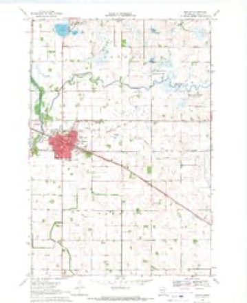
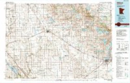
8 topographic sheets cover this place, the earliest surveyed in 1953 and the latest in 1986. It stands in Benson City. It lies in ZIP code area 56215. It stands on East Branch Chippewa River. The Survey maps it on the Benson quadrangle. 3,480 people lived here at the 2020 count. It stands 1,047 feet above sea level.
Research this city
On record in Benson
Buildings and businesses the archive holds for this place. Each opens its own page, with the source record it came from.
On the National Register 4 records
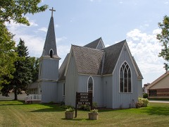 Christ Church-Episcopallisted 1985
 Church of St. Francis Xavier-Catholiclisted 1985
 Swift County Courthouselisted 1977
- Christian F. Uytendale Farmsteadlisted 1985
Population over time
2 figuresBenson grew from 3,240 to 3,480 between 2010 and 2020. These are the recorded population figures Wikidata holds for this place, reached through the Geographic Names Information System number this page is keyed on rather than by name, so they belong to this place and not to another of the same name. Most are census counts, but not all are: an early figure may be a founding or settlement estimate, and an estimate published within five years of a census is left out. The change column is computed, and is left blank where more than 20 years separate a figure from the one before it, because a gap that long is not a change between two counts.
| Year | People | Change |
|---|---|---|
| 2010 | 3,240 | |
| 2020 | 3,480 | +240 (+7%) |
Topographic sheets covering this place
5 surveys from 8 printed sheetsMatched by testing this settlement's coordinate against the published boundary of every sheet in the United States Geological Survey's historical collection. Each opens the scanned sheet at the Survey.
- 1953 USGS Saint Cloud quadrangle1:250000, 3 printings
- 1957 USGS Saint Cloud quadrangle1:250000
- 1958 USGS Saint Cloud quadrangle1:250000
- 1968 USGS Benson quadrangle1:24000
- 1986 USGS Willmar quadrangle1:100000, 2 printings
Fires near this place
2 since 1992Regional context, not property-specific evidence. The federal wildfire occurrence database lists 2 fires within 5 miles of Benson between 1992 and 2006, burning about 86 acres in total. None started naturally. None was recorded as arson. Distance is straight-line from the map coordinates, so a fire counted here may appear on a neighbouring settlement's page as well.
| Reported cause | Fires |
|---|---|
| Debris and open burning | 1 |
| Equipment and vehicle use | 1 |
The most recent of them, most recent first, with the day each was reported and the service that recorded it.
| Date | Cause | Size | Reported by | Name on the report |
|---|---|---|---|---|
| 2 May 1992 | Debris and open burning | 1.0 acres | Minnesota Agency | not named |
| 14 October 2006 | Equipment and vehicle use | 85 acres | Minnesota Department of Natural Resources | not named |
Settlements close enough to share some of these fires:
Storms near this place
49 since 1994Regional context, not property-specific evidence. The National Weather Service names Benson in 49 storm reports between 1994 and 2025: 21 hail, 16 thunderstorm wind, 6 tornado, 4 funnel cloud. The reports record 7 injuries. Each account below is quoted exactly as the forecast office filed it, from the NOAA Storm Events Database, and each date opens the federal record of that event.
| When | Event | Place named | Harm | What the report says |
|---|---|---|---|---|
| June 2001 | Tornado (F2) | Benson | 7 hurt, $10,000,000 | After several brief tornadoes around Danvers, a much larger tornado struck the east side of Benson and travelled southeast along Highway 212. 71 structures were damaged, including 4 homes and 7 businesses that had to be demolished. The tornado lifted off in DeGraff, but not before damaging one last grain bin, taking the roof off a grain elevator, and knocking several sheds down in DeGraff. Seven people were injured when they fled a van just as the tornado was hitting the vehicle on the eastern edge of Benson. One boy was critically injured but survived and was discharged from the hospital two weeks later. Damage listed encompasses damages from all tornadoes and wind events in Swift County. |
| July 1997 | Thunderstorm Wind | Benson | $500,000 | Three 50,000 bushel grain bins blown onto highway. Wall collapse at ethanol plant. Damage estimate for entire county. |
| May 2022 | Thunderstorm Wind | Benson | $50,000 | Several trees were blown down and a steel building was damaged near the intersection of 40th Street and Highway 29 south of Benson. Dozens of downed trees were scattered across Benson. |
| August 2020 | Thunderstorm Wind | Benson | $5,000 | Several large trees and power lines/poles were blown down around Benson, Minnesota. |
| June 2014 | Tornado (EF0) | Benson | $5,000 | A brief tornado touched down just to the northeast of Benson. It took the roof off a shed and hit a grove of trees but caused no other damage. It drew water upward from a slough and then soon thereafter dropped all the water and debris when the tornado dissipated. The tornado was recorded on photos and video. |
| May 2025 | Tornado (EF1) | Benson | - | A tornado developed approximately 3 miles to the SSE of Benson. Visible debris was reported by trained spotters and law enforcement. The tornado caused damage to some farm outbuildings before lifting just north of the intersection of US-12 and 10th St NE. Multiple damage photos and the detailed track were provided, so a virtual storm survey was conducted on this tornado. Its maximum wind was estimated at 95 mph. |
| May 2022 | Thunderstorm Wind | Benson | - | Several large trees were blown across Highway 9 near Benson. |
| July 2018 | Funnel Cloud | Benson | - | The local police department reported funnel clouds west of Benson. |
| July 2017 | Hail | Benson | - | A swath of large hail occurred north, and through the city of Benson. The largest hail stone was golf ball size. |
| June 2016 | Funnel Cloud | Benson | - | Several fire department personnel, trained as spotters, witnessed a funnel cloud just southeast of Benson. |
| July 2016 | Hail | Benson | - | In addition to the hail, strong winds around 50 mph occurred. |
| September 2014 | Thunderstorm Wind | Benson | - | A 10 inch wide apple tree was uprooted. There were also several other reporting sites that had wind gusts over 50 mph. |
| June 2014 | Funnel Cloud | Benson | - | Two separate funnel clouds and one tornado developed west and southwest of Benson at the same time. Eyewitness accounts suggest that of the three vortices, only one touched down (see separate entries for the tornado and other funnel cloud). |
| June 2013 | Thunderstorm Wind | Benson | - | Scattered trees and power lines were blown down around Benson. |
| March 2009 | Flood | Benson | - | An ice jam and debris was up against the railroad bridge over Chippewa River in the northwest side of Benson. Water was over a few township roads south and southwest of Benson. |
| July 2008 | Thunderstorm Wind | Benson | - | One hundred thousand square foot building under contruction destroyed. |
| September 2007 | Thunderstorm Wind | Benson | - | Two trees down in town. One blocking a street. |
| May 2005 | Funnel Cloud | Benson | - | A funnel cloud was reported by a Sheriff's deputy 4 miles north of the Chippewa/Swift County line south of Benson. |
| May 2005 | Thunderstorm Wind | Benson | - | Several trees were downed. |
| May 2005 | Tornado (F0) | Benson | - | Two Sheriff's deputies saw a tornado pick up debris near Highway 29. |
| June 2005 | Hail | Benson | - | Law enforcement officials reported nickel sized hail at the intersection of Highway 29 and County Road 6. |
| June 2005 | Thunderstorm Wind | Benson | - | A tree and several branches were downed. |
| June 2005 | Hail | Benson | - | Dime sized hail was reported south and west of Benson. |
| June 2005 | Thunderstorm Wind | Benson | - | Trees and power lines were downed near Benson. |
| July 1998 | Thunderstorm Wind | Benson | - | Trees blown down. Estimated windspeed. |
| August 1998 | Flood | Benson | - | 3 to 4 inches of rain in less than 2 hours caused street and basement flooding. |
| June 1998 | Tornado (F0) | Benson | - | Crossed open fields. |
| July 1997 | Thunderstorm Wind | Benson | - | Numerous trees blown down. Portion of roof ripped off Livestock Exchange. |
| May 2022 | Thunderstorm Wind | Benson | - | no account filed |
| June 2018 | Thunderstorm Wind | Benson | - | no account filed |
| June 2016 | Hail | Benson | - | no account filed |
| July 2016 | Hail | Benson | - | no account filed |
| May 2011 | Hail | Benson | - | no account filed |
| May 2011 | Hail | Benson | - | no account filed |
| September 2006 | Hail | Benson | - | no account filed |
| April 2005 | Hail | Benson | - | no account filed |
| May 2005 | Hail | Benson | - | no account filed |
| June 2005 | Hail | Benson | - | no account filed |
| May 2004 | Hail | Benson | - | no account filed |
| August 2001 | Hail | Benson | - | no account filed |
| June 1999 | Hail | Benson | - | no account filed |
| June 1999 | Hail | Benson | - | no account filed |
| May 1996 | Hail | Benson | - | no account filed |
| October 1996 | Hail | Benson | - | no account filed |
| October 1996 | Hail | Benson | - | no account filed |
| October 1996 | Tornado (F1) | Benson | - | no account filed |
| August 1995 | Thunderstorm Wind | Benson | - | no account filed |
| May 1994 | Hail | Benson | - | no account filed |
| July 1994 | Hail | Benson | - | no account filed |
Nearest settlements
The eight closest, with where each one stands in the county. Distances are straight-line, computed from the Geographic Names Information System coordinates.
Elsewhere
Matched on this settlement's Geographic Names Information System number rather than its name, so it cannot be a different place of the same name in another state.
| Wikipedia article on Benson | An encyclopaedic summary. Its text is share-alike, so it is linked here rather than copied. |
| Wikidata item Q1913224 | The structured record the population and elevation above come from. Public domain (CC0). |
Provenance
This settlement is recorded in the Geographic Names Information System as feature 639933. The sheet list is computed by point-in-boundary test against the United States Geological Survey's historical topographic inventory. Both are works of the United States government and carry no copyright under 17 U.S.C. 105.
Wildfire. Short, Karen C. 2022. Spatial wildfire occurrence data for the United States, 1992-2020 [FPA_FOD_20221014]. 6th Edition. Fort Collins, CO: Forest Service Research Data Archive. https://doi.org/10.2737/RDS-2013-0009.6 Collected with United States Government funding and usable without additional permissions or fees.
Storms. NOAA National Centers for Environmental Information, Storm Events Database https://www.ncei.noaa.gov/stormevents/ A work of the United States government, no copyright under 17 U.S.C. 105. Narratives are quoted verbatim from the National Weather Service report and are not edited or summarised.